Lower Caramy Gorge and St. Probace chapel
From the cool gorge to a promising rock ledge
hike
average
2 h 45 min
far
yes
no
mountain
Introduction
The Gorges du Caramy form a natural jewel between Mazaugues and Tourves. The upper part around Sauts du Cabri is difficult to hike, but the lower part is very accessible. On nice days there are many people here, in summer shuttles are organized to relieve the access road.
The way back over the rocky plateau with the Saint-Probace chapel is a great contrast to the humid and shady valley. Once at the top, the 360-degree panorama is definitely worth it.
Optionally, it is possible to continue on a fishing path along the creek up to the Sauts du Cabri in the upper part of the gorge.
The facts
8,8 km total distance
2 h 45 min walk time
250 m total elevation
orientation easy on the way there and back, less at the bottom of the gorge
mark 80% of the total distance
35% forest roads
30% easy trails
25% hard-to-recognize trails
10% exposed trails
dangers water level after thunderstorms, steep descent
children yes
useful picnic stuff
required hiking boots, hiking equipment and water
GPS coordinates (WGS84) of start and end point 43.390425,5.931906
downloads ![]()
![]()
No reproduction is permitted without the written consent of the author. (id5764)
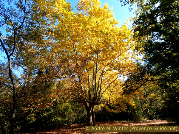
Big plane tree in the lower Caramy Canyon in autumn
Public transport
The village of Tourves is located along the axis of several important lines by Zou! (only french), including lines express busses 92 an 93 from Brignoles and bus 849 from Toulon. The start of the hike is three kilometers south of the bus stop in Tourves, see also the map on this page. Between mid-June and mid-September, a chargeable shuttle bus runs between the stadium and the entrance to the gorge, see below.
Access by car
Tourves is on the old National Road 7 between Aix-en-Provence and Saint-Raphaël, more precisely between Saint-Maximin-la-Sainte-Baume and Brignoles. We leave the DN7 road east of the village. 300 meters after passing under the old railway line, turn left onto the narrow Avenue Charles Gaou. Arrived below the town centre, we keep to the left without turning at right angles. We pass two parking spaces before we cross under the railway and the expressway. We then follow the signs for Gorges du Caramy along the Chemin du Moulin and Chemin des Grès.
Attention, from 15 June to 15 September the road is closed from the entrance to the sports fields south of the village and we have to park 1,5 km before the entrance to the gorge. A shuttle bus departs here at 9am, 9.45am, 10.30am, 11.15am, 12pm and 12.15pm during the summer. The return journey is always fixed with the outward journey and takes place six hours after the outward journey (as of 2021). This is more than enough time for this trek, but the time window is quite restrictive. Of course, you can also walk the distance in half an hour. There is not much traffic as the road is closed in summer.
Useful parking spaces
In summer, the parking lot is near the sports field, south of the village. From 16 September to 14 June, you can access the last car park at the entrance of the gorge and near the Pont de Cassède bridge.
Hints
Weekends should be avoided during the summer season as the lower part of the gorge is very busy. We recommend autumn, the colors are fantastic and if you start in the early afternoon, the sun shines down the entire length of the gorge.
The part beyond the marked section is very narrow and when the water level is high it may not be possible to cross it with dry feet. There are also some rocks and orientation is not always easy.
The whole region is a zone with a high risk of forest fires. In summer, but also in other seasons when it is very dry or by strong winds, access to the forest areas can be regulated. As a result, the roads may be closed to traffic and/or the trails prohibited to hikers. Current information: Map of access to the forests of the Var (also english). The map shows the colours green, yellow, orange and red which correspond to levels of danger.
The sections
- Pont de Cassède bridge - lower Gorges Basses
- lower Gorges Basses - St. Probace chapel
- St. Probace chapel - Pont de Cassède bridge
Section 1: Pont de Cassède - Gorges Basses
➙ 2,9 km ... 45 min ➚ 25 m ➘ 0 m ↝ easy
50% forest roads, few marks
25% easy trails, few marks
20% hard-to-recognize trails, faulty marks
The clues
- Start at the parking lot, 275 m
- Pont de Cassède bridge
- Mas Rimbert ruins, 285 m
- Rocky area in the canyon floor, 300 m
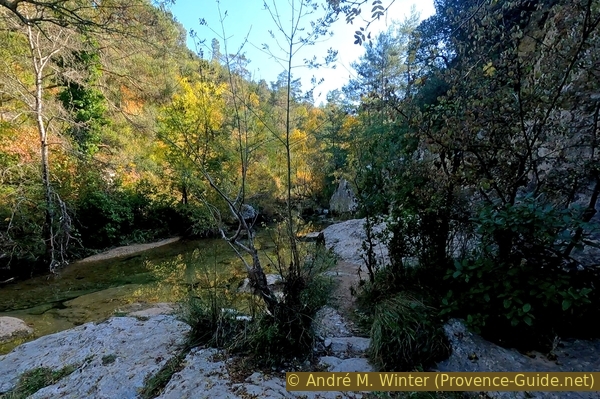
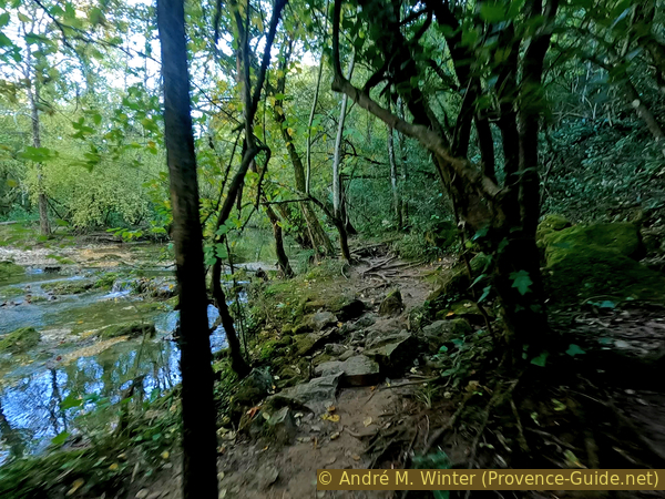
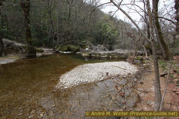
In this section we go into the valley on a very wide path with picnic tables. Gradually, however, this becomes a narrower fishing path that leads over some rocks. This change is impressive. The further one advances, the fewer people are camped on the banks.
The path from the parking lot cannot be missed. Immediately we see an old bridge without parapet on the left. There is a good view of the Caramy stream. The bridge is part of the medieval road to Toulon. It is also possible to walk along the other side of the Caramy, but you will have to go through the water later to return to the left bank with the main path. There is no other bridge upstream.
No reproduction is permitted without the written consent of the author. (id5762)
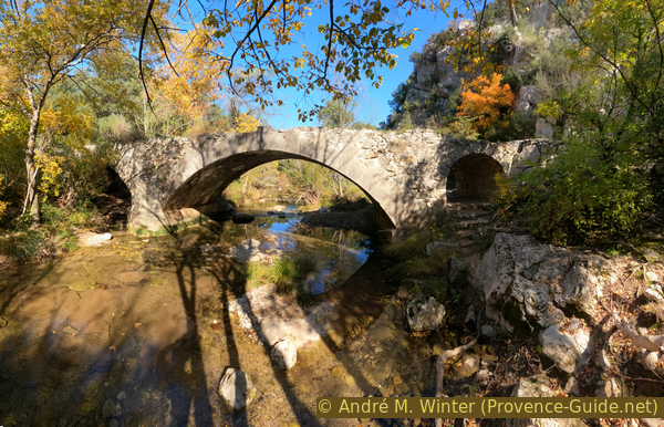
Pont de Cassède
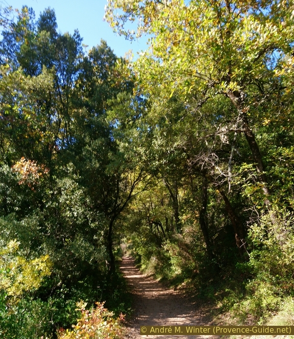
The main path, marked in yellow, is very wide, here we find some picnic tables
Large plane trees testify to the human use of this valley as a dwelling and quarrying site.
No reproduction is permitted without the written consent of the author. (id5765)
The wide left bank path along the Caramy
Countless paths lead down to the water, but there is no continuous path along the shore. At every turn of the meander there is a new view of the river and one could watch the calmly flowing water forever. However, we want to go further back into the valley.
No reproduction is permitted without the written consent of the author. (id5763)
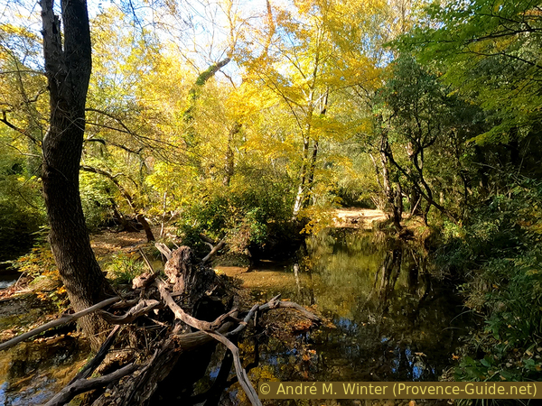
Lower Caramy gorge in autumn
Further ahead, the forest road becomes narrower and rockier. It ends at the Mas Rimbert.
The big house looks like an inn with a terrace under large and shady plane trees. It is quite conceivable that the Gueules Roges (bauxite miners) stopped here when they returned to Tourves after work.
No reproduction is permitted without the written consent of the author. (id5766)
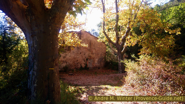
Mas Rimbert ruins
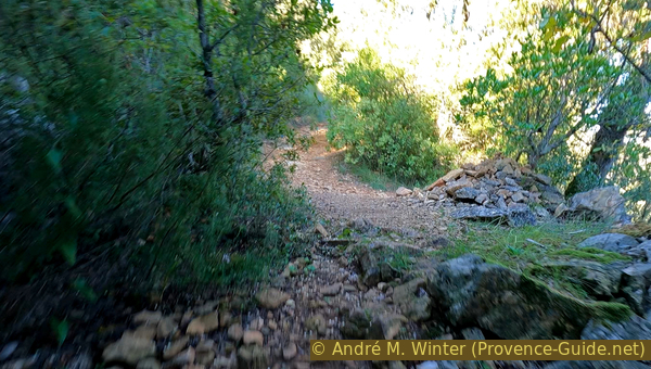
The path leads to the right behind the ruins, it is now narrower, but is still flat and pleasant to walk on. Ten minutes later the path is no longer passable for traffic, but still wide enough to walk on.
Another five minutes later we come to a signpost pointing right to Tourves. However, we keep to the left and stay close to the water.
No reproduction is permitted without the written consent of the author. (id5768)
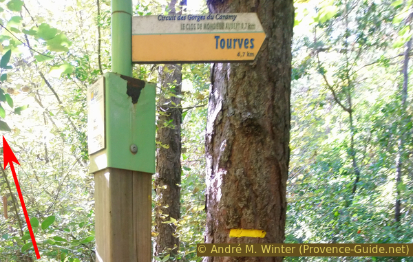
Signpost and end of marking
There are no official markings from now on, but a few orange dots will help you find the route. The path is more irregular, but also more challenging.
No reproduction is permitted without the written consent of the author. (id5769)
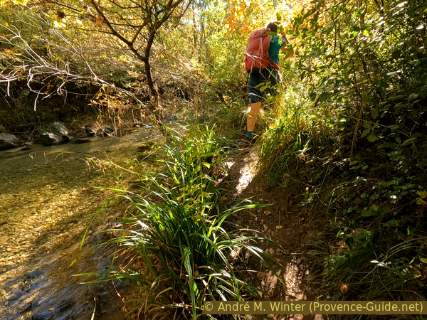
Fishermen's path along the Caramy river
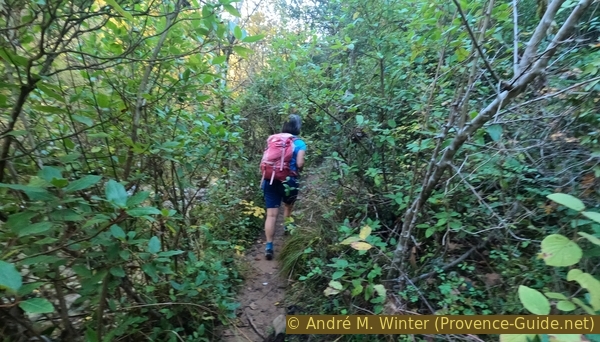
On this part of the trail, following the course of the stream, we gradually turn left and south.
No reproduction is permitted without the written consent of the author. (id5770)
Path under Clos de Monsieur Aubert
After ten minutes you reach the old canals that drained the water from Caramy.
There is also a small water gauge here.
No reproduction is permitted without the written consent of the author. (id5771)
Old aqueduct in the Caramy Gorge
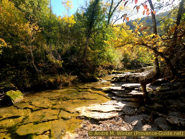
Shortly thereafter, our bank becomes rocky, but the layers of limestone are quite horizontal and we can still make headway directly at the water's edge without much difficulty.
No reproduction is permitted without the written consent of the author. (id5772)
Rocky section on the Caramy
The rock wall approaches from the right but a small strip remains generally dry to walk through.
No reproduction is permitted without the written consent of the author. (id5773)
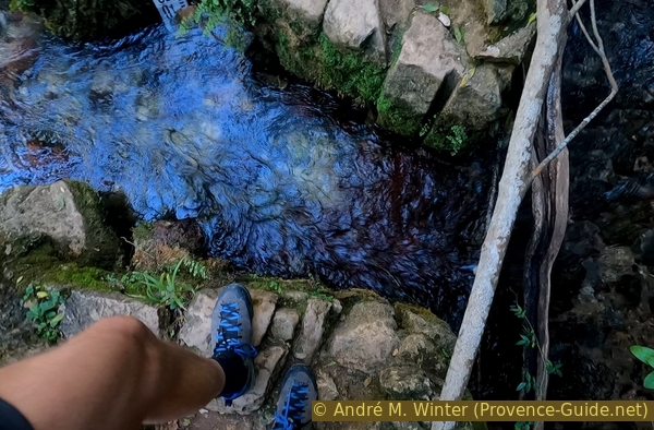
Narrow section along the rock wall
On this part we stay on the rocks very close to the water.
No reproduction is permitted without the written consent of the author. (id5774)
Limestone plates in the river bed
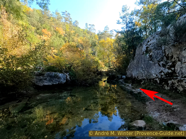
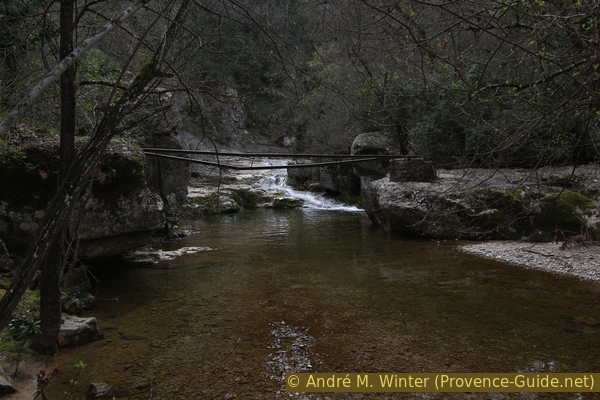
Further ahead we come to a series of small waterfalls with a drop of less than a meter. Here our attention is drawn to the rocks on the right. A few meters before the first waterfall you can easily climb to the upper limestone step. This strip of rock rises to the right, it is our natural route out of the gorge.
No reproduction is permitted without the written consent of the author. (id5775)
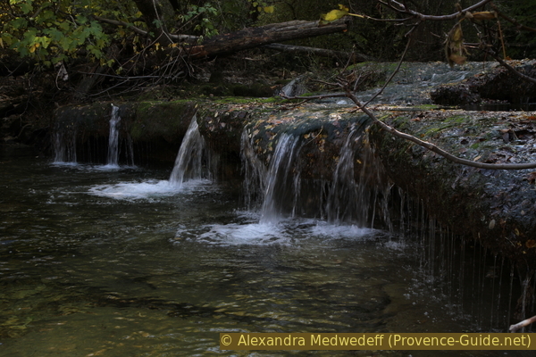
Small waterfalls at Caramy creek
If we get past this quench pot, we've gone too far and we'll have to go back to the falls in order to find the path uphill.
The alternative described below offers further exploration of the Caramy Gorge upstream..
No reproduction is permitted without the written consent of the author. (id5776)
Dry resurgence in the Gorges du Caramy
Section 2: Gorges Basses - Chapelle St. Probace
➙ 3,5 km ... 1 h ➚ 215 m ➘ 5 m ↝ average
10% exposed trails, without marks
55% easy trails, few marks
35% forest roads, few marks
The clues
- Rocky area in the canyon floor, 300 m
- Reaching the marked trail, 330 m
- Clos de Monsieur Aubert crossroads, 410 m
- Forest road to the plateau, 475 m
- St. Probace chapel, 510 m
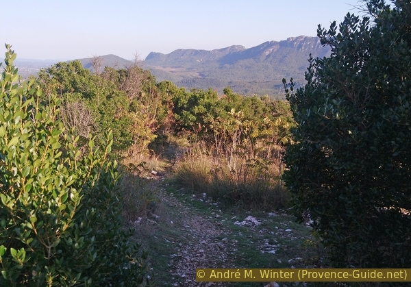
After a shady climb out of the gorge, we climb up in a dry valley and turn to get to the plateau with a great panorama that leads us to the chapel.
Section 1 ends at the small waterfalls. Here we scramble up a gently sloping ledge on the right, which leads us out of the gorge in a gradual ascent. Sometimes you have to balance on the edge of the rocks to avoid trees and bushes.
No reproduction is permitted without the written consent of the author. (id5777)
Up along a rocky ledge
After five minutes we meet the path marked in yellow that we had previously left.
The path turns left another five minutes later. We are now in a dry valley.
No reproduction is permitted without the written consent of the author. (id5778)
Again on the marked main path
A large cairn marks a crossing where we turn left.
No reproduction is permitted without the written consent of the author. (id5780)
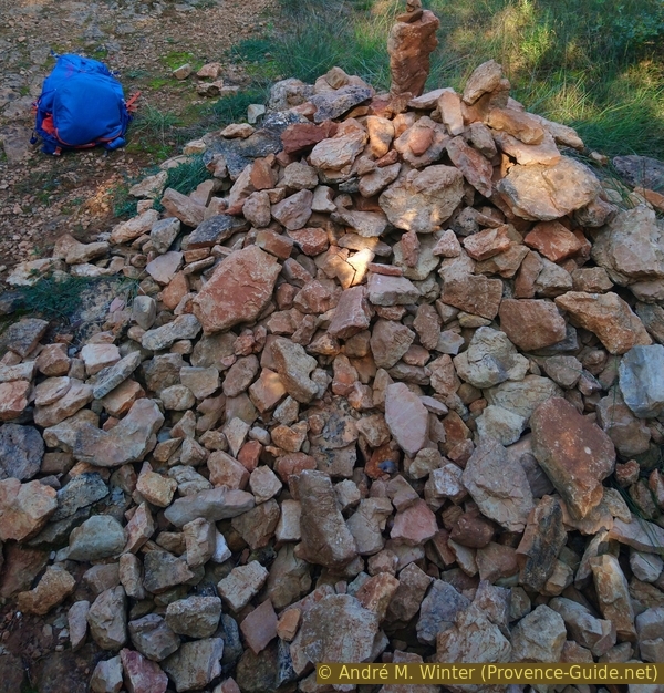
Keep left at this cairn
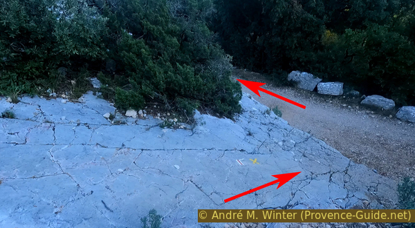
Five minutes after the cairn, the path turns sharp right at the signpost for Clos de Monsieur Aubert, we follow up to Tourves.
We first climb onto a wooded plateau without too many landmarks. Five minutes after the signpost, keep right at the fork, a little further the path becomes quite flat again. Ten minutes later we are walking straight across a crossroads.
No reproduction is permitted without the written consent of the author. (id5781)
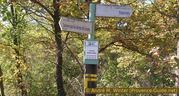
Sign-post at Clos de Monsieur Aubert
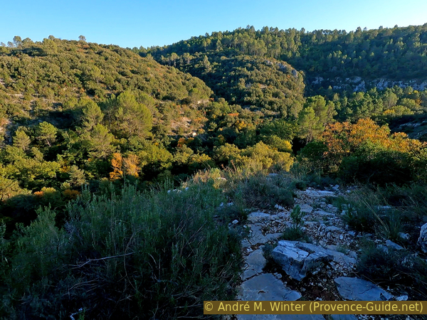
The leisurely ascent ends further ahead and it now goes up steeper between rocks on a stony forest path.
On reaching a bumpy forest road, turn right, it takes us to the highest point of the wide ridge.
No reproduction is permitted without the written consent of the author. (id5782)
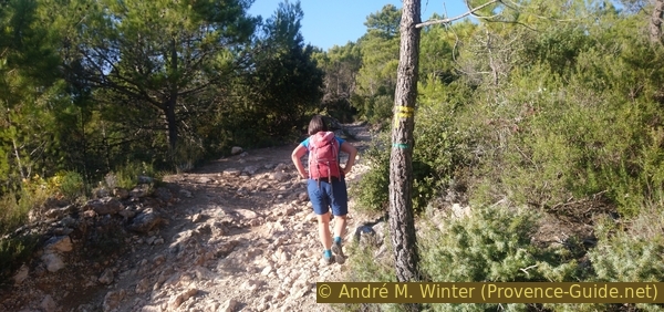
On the forest road to St. Probace chapel
The Chapelle Saint-Probace is east of the plateau. The path leads in a straight line.
No reproduction is permitted without the written consent of the author. (id5783)
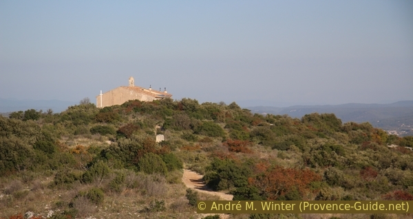
Straight ahead to St. Probace chapel
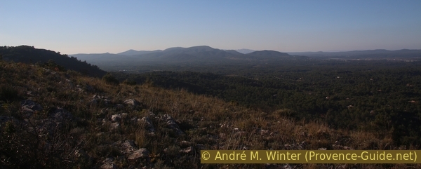
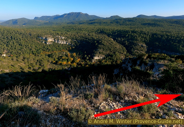
Once on the crest we have a panorama of almost 360 degrees.
The view goes left to right from the Sainte-Baume ridge to the Mont Olympe and Mont Aurélien mountains, with the Montagne Sainte-Victoire looming behind. You can't see the place, but the Saint-Maximin basilica clearly stands out. To the north is Tourves with the ruins of its castle and obelisk. Further to the right the Petit Bessillon and Gros Bessillon mountains.
No reproduction is permitted without the written consent of the author. (id5785)
Mont Olympe and Mont Aurélien
In the south, the Massif de la Loube stands out between vast wooded hills in the municipality of Roquebrussanne. Brignoles remains hidden behind the chapel.
No reproduction is permitted without the written consent of the author. (id5784)
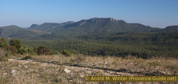
Massif de la Loube south-east
It is often windy on the broad and rocky ridge, there are only a few trees.
On the south side of the chapel is a house with a surprising vegetable garden at this height and with the blatant lack of water. North of the chapel is a panorama panel explaining the north panorama, but the counterpart for the south is missing. We also look in vain for a bench.
If you started straight from the village of Tourves, or don't want to risk waiting or missing the shuttle back to the village, you can go down from the chapel on the marked path to the left and ignore the following section 3. This path, marked in red and white, leads directly to Tourves. Arrived between the houses in the south of the village, we keep right on the Chemin Notre Dame and ignore the dead end signs. At house number 115 we take the footpath downhill to the right. Below left and under the DN7 road to the village or right to the parking lot at the stadium.
No reproduction is permitted without the written consent of the author. (id5779)
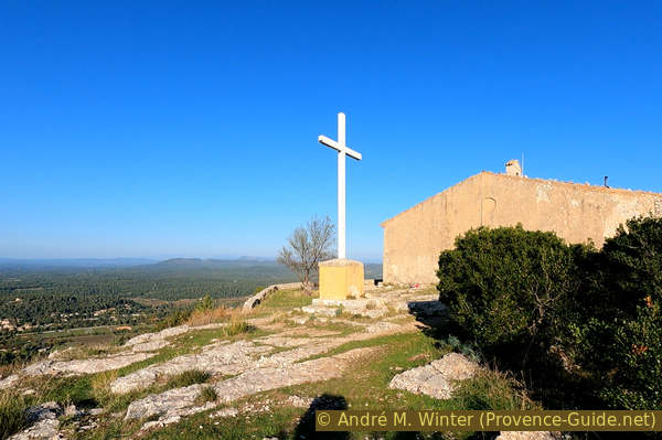
The cross in front of St. Probace chapel
Section 3: Chapelle St. Probace - Pont de Cassède
➙ 1 km ... 25 min ➚ 0 m ➘ 235 m ↝ average
70% exposed trails, few marks
30% forest roads, few marks
The clues
- St. Probace chapel, 510 m
- Parking lot at the exit of the gorge, 275 m
The way back to the starting point is quite direct on limestone slabs inclined in the direction of descent. We will appreciate the grip of good mountaineering boots on the rock.
We pass the chapel on the left, behind it we keep very slightly to the right and to the east.
No reproduction is permitted without the written consent of the author. (id5786)
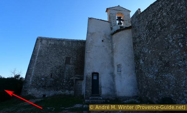
St. Probace chapel north side
The path leads between scattered bushes and only at the rocky edge do we come across a red and white marking of the long-distance hiking trails GR51 (Menton-Marseille) and GR99 (Trigance-Toulon).
No reproduction is permitted without the written consent of the author. (id5787)
Path behind the St. Probace chapel
We are now following the edge of this sloping limestone plateau, but you don't really notice the abyss to our left yet.
No reproduction is permitted without the written consent of the author. (id5788)
Massif de la Loube and car park at the starting point below
One is more concerned with finding the best way between gravel-covered rock slabs and thorny bushes. In any case, the descent is dizzying and fast, we descend the 230 meters in altitude in a quarter of an hour.
No reproduction is permitted without the written consent of the author. (id5789)
Descent over rock slabs
We return to the easy path in the gorge, finally over particularly steep limestone slabs.
Turn left and we are back at the starting point in a few minutes.
No reproduction is permitted without the written consent of the author. (id5790)
Descent to the path in the Caramy Valley
Appendix: Gorges du Caramy - Sauts du Cabri
➙ 1,4 km ... 30 min ➚ 20 m ➘ 0 m ↝ difficult
100% hard-to-recognize trails, without marks
The clues
- Rocky area in the canyon floor, 300 m
- Destroyed bridge under the bauxite mine, 320 m
- Mine access, rock overhang and waterfall, 330 m
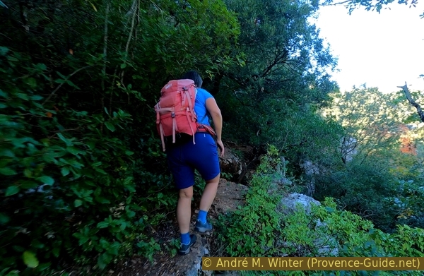
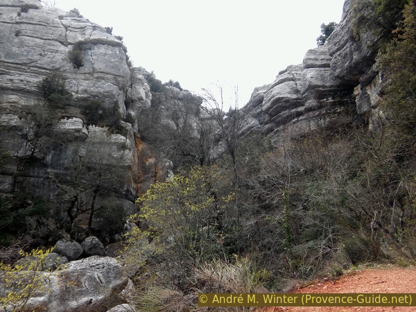
Beyond the first large rocky section in the gorge, the fisherman's path continues in the same style and without official markings. This path takes you to the Sauts du Cabri waterfalls, in the narrowest part of the canyon.
We constantly stay on the same bank near the water, ignoring any paths that lead up to the right.
The path is not always easy as in the photo, there are also passages where you have to climb the rock to avoid having to go through the water.
No reproduction is permitted without the written consent of the author. (id5791)
The jungle in the Caramy Gorge
After about 30 minutes we arrive under slightly taller trees.
The following three photos were taken in April 2018, the vegetation here is bare in winter. The first of these photos shows the Caramy Creek from the far bank and downstream. On the one hand, this is the easiest transition (but not necessary), but this is also the point where you have to climb up to the right to reach the narrow part of the gorge.
No reproduction is permitted without the written consent of the author. (id5793)
The calmer Caramy River under the Sauts du Cabri
A little further ahead we see the remains of a bridge built with rails from the bauxite quarries. This is the last moment for us to look for a path that leads up to the right, but there is a little better way before that.
No reproduction is permitted without the written consent of the author. (id5794)
Ruined bridge near the bauxite mines
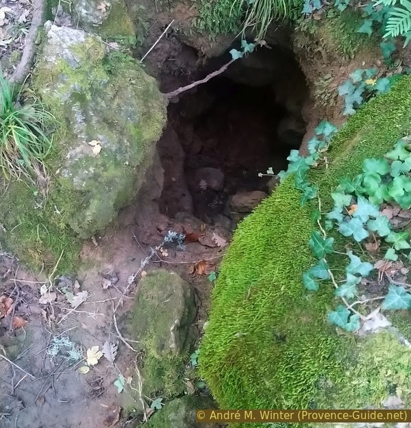
The ground here consists of red earth, this is spoil from the bauxite mines. We climb up to the rock face and pass a mine entrance. We then already see in the direction of the narrowest part of the gorge.
We continue along this path until we reach under a large rock overhang, at the base of which the Caramy stream reappears under the rocks that hide it in the narrow part upstream. You can also go further up, see section 2 of Sauts du Cabri tour in the opposite direction.
No reproduction is permitted without the written consent of the author. (id5792)
The nearer Caramy Canyon at Sauts du Cabri
Sources and additional information
It is better to use a good topographical hiking map: this tour is on the IGN "Signes, Tourves, Massif de la Sainte-Baume" map, scale 1:25000, 3345OT.
If you don't want to bother with a paper map, you can also use mapping apps on your cell phone. On the one hand, it is the Cartes IGN app from the official map service. However, it requires access to the data network and this is sometimes difficult in canyons or remote locations.
Alternatively, you can use apps that store data directly on the device. They're generally not free, but they don't cost much. We mainly use OSMAnd, here it is possible to add contour lines, relief shading, markings and others. To store this data on your phone you need a lot of space.
Of course, one needs access to satellites for the GPS signal with any app. In some canyons this is not the case. Therefore, do not rely on the position shown, but read the map on your phone as you would read it on paper. Most apps are available for Android and iPhone. The applications usually allow us to record the route travelled and also view the GPS files offered for each of our hikes.
This page has been seen 2476 times since 20 March 2024.