Canyon Sauts du Cabri
Through the waterfall in the Caramy gorge
scramble
average
1 h 30 min
no
yes
no
mountain
Introduction
The Caramy is a creek in the limestone area behind the coast. Not far from the source, the water has formed a small canyon, but it has all the characteristics and qualities of the large canyons further north. At the narrow point is the Sauts du Cabri waterfall, made up of a multitude of small waterfalls more or less covered by the fallen boulders. Our route leads directly through the labyrinth of rocks and water. When the valley opens up and the stream calms down, we ford and climb back up to the plateau. Here a newly created section of the GR99 awaits us through a wild karst area. The route is short, the differences in altitude are small, but the tour is classified as very demanding.
The facts
4 km total distance
1 h 30 min walk time
90 m total elevation
orientation difficult in the narrow canyon area
mark 50% of the total distance
45% forest roads
20% exposed trails
15% moderate trails
10% Trails with scramble passages
5% in the riverbed
dangers flooding, falling rocks
children from 12 years with appropriate experience
useful picnic stuff
required hiking boots, hiking equipment and water
GPS coordinates (WGS84) of start and end point 43.364972,5.913322
downloads ![]()
![]()
Public transport
You cannot get to the starting point by public transport. Although there are several access roads, fast access is not possible. Brignoles is the next city with taxis, it is 18 kilometres east.
Access by car
The loop is located in an area that is neither populated nor cultivated, south between Saint-Maximin-la-Sainte-Baume and Brignoles (starting point GPS 43.364972, 5.913322).
Coming from Saint-Maximin, take the D4 to Mazaugues. Cross the Canal de Provence and stay straight on at the next crossing. Later, the road leads over two distinctive hairpin bends, which are followed by further tight curves. You reach the plateau and the road becomes straighter. Now look out for a monument on the left. 400 meters further on the road we come to an area with a large number of branching forest roads. Here is the starting point. If you see a transformer on the right, you've gone 50 meters too far.
From Brignoles, follow the signs for Tourves and then Mazaugues. You drive over two distinctive hairpin bends and follow the descriptions above from Saint-Maximin.
From Mazaugues, follow the signs for Saint-Maximin. If you see a photovoltaic field on the right, you are 500 meters before the starting point. If you drive past a transformer on the left, you are there in 50 meters.
Useful parking spaces
There is space for parking everywhere along the road. You can also drive 500 meters over a bumpy and washed-out dirt road in the direction of the gorge. You cross a concrete bridge in a dilapidated condition and shortly thereafter there is a large open space to stop.
No reproduction is permitted without the written consent of the author. (id4282)
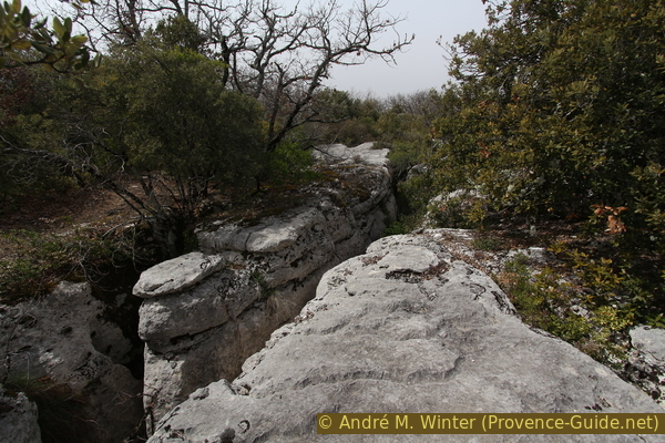
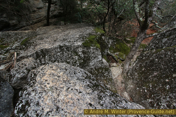
Deep cracks in the karst of the Caïre de Sarrasin plateau
No reproduction is permitted without the written consent of the author. (id8387)
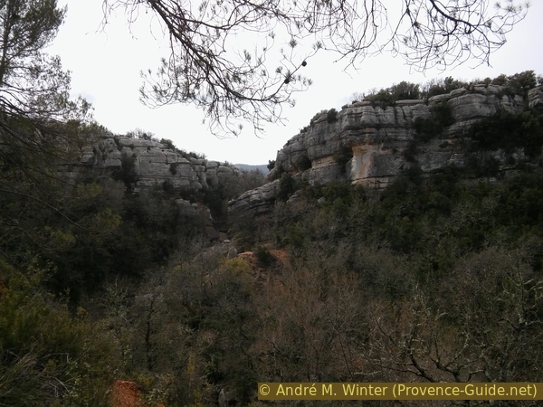
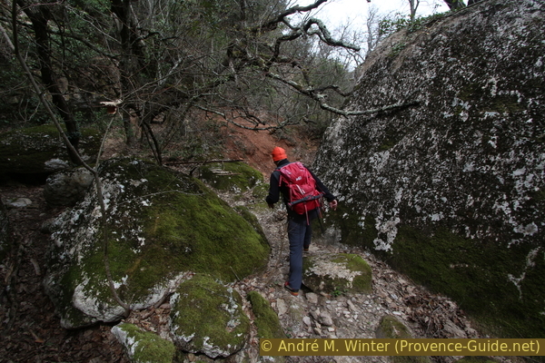
View back into the narrow section of the Caramy Gorge
Hints
The tour should be avoided on rainy and thundery days. Even after long rains there is too much water in the gorge. Don't jump downhill in places where you can't go back. Orientation is difficult and you always have to be able to find your way back. Floods and rockfalls can change the situation on site or make passages impossible. Do not go through the gorge alone, very few people pass by here. Be particularly careful with all openings in the ground, also on the marked path on the plateau (section 3). As a shelter you can only use the natural rocky outcrops after the key points.
GPS reception is very poor in the gorge and impossible in some sections. The devices display incorrect or interrupted tracks. Around the bottleneck you have to follow the instructions in the text, if you follow the GPS signal, you would walk on the wrong bank!
There are no sources of drinking water in the course of the trek. The creek flows through a former mining area and therefore does not offer safe drinking water.
The whole region is a zone with a high risk of forest fires. In summer, but also in other seasons when it is very dry or by strong winds, access to the forest areas can be regulated. As a result, the roads may be closed to traffic and/or the trails prohibited to hikers. Current information: Map of access to the forests of the Var (also english). The map shows the colours green, yellow, orange and red which correspond to levels of danger.
The sections
- Follow the bumpy forest road and switch to the stream bed. The difficulties begin at the end of this section
- Through the boulders and over the waterfall, ford the stream and back up to the plateau
- Follow the long-distance hiking trail GR99 through the karst zone and back to the starting point
Section 1: D64 - Barrage de la mine
➙ 1 km ... 20 min ➚ 0 m ➘ 20 m ↝ challenging
55% forest roads, without marks
20% moderate trails, without marks
25% Trails with scramble passages, without marks
The clues
- D64, 360 m
- Bridge, 360 m
- Caramy river bed, 350 m
- Old dam, 340 m
A simple beginning of the tour, but already at the end of this section it gets complicated.
Danger! The recommendations above apply from the end of this section!
pont = bridge
vers = to
The starting point is explained under access by car. There is a forest road here that runs basically straight east, but in this flat area there are many forks and previous drivers have sometimes sought parallel paths. You have to stubbornly continue in this direction, because in the end only this forest road leads over the only bridge that we have to cross. The old reinforced concrete construction is badly battered, the steel of the reinforcement is already sticking out.
This whole access area, the bridge, the structures in the gorge and further east all date back to a large bauxite mine that was active here until 1985. Around 10 shafts went up to 300 meters deep into the ground. Large sterile areas are old and levelled overburden mounds. The former prospect was located between Mazaugues to the south and Tourves to the north.
No reproduction is permitted without the written consent of the author. (id4280)
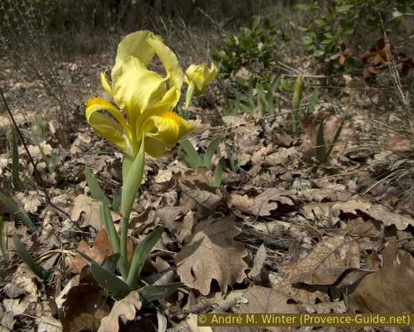
Crimean iris blooms here in the karst
pont = bridge
vers D64 = to road D64
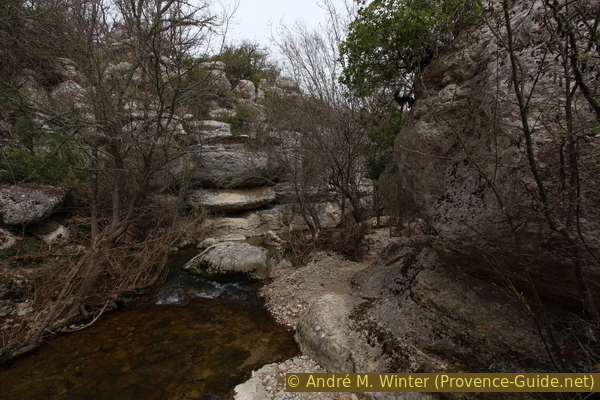
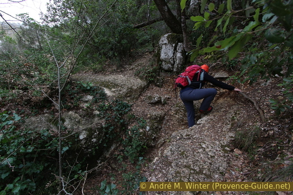
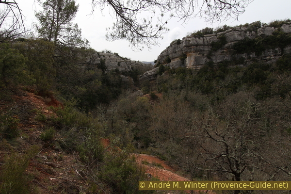
The small river under the bridge is the Caramy, responsible for the gorge further downstream. About 15 meters after the bridge, a path branches off to the left to the north, which we take to get into the gorge. It quickly becomes a narrow path that continues along a cliff edge. The step is not particularly high, as we go on we see another path on the lower level, we have to go down there, looking for a descent between the rocks. Continue here in the same direction.
No reproduction is permitted without the written consent of the author. (id4256)
Path at the cliff edge downstream of the dilapidated bridge
In between you can see the stream through the oak branches covered with lichen. But our path leads us away from the creek bed and we look left for a cairn that marks the descent to the water (photo).
No reproduction is permitted without the written consent of the author. (id4257)
Cairn and descending into the river bed
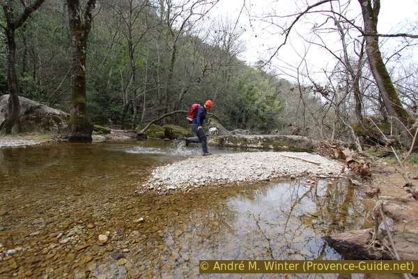
Once at the bottom, we go downstream on the same bank. We're not changing shores for the time being. You walk over rocks and gravel surfaces, the path is quite easy to see.
Attention: if you can't get through here without wading deep through the water, you should turn back, because the narrow passage further down could be flooded and impassable. In this case you can still enjoy a large part of the tour by returning to the cairn and keeping to the left. This leads to the forest road at the end of section 3 and the long-distance trail GR99, which you can walk back and forth.
No reproduction is permitted without the written consent of the author. (id4258)
In the river bed of the Caramy, before the waterfalls
As you advance, the gorge slowly narrows. Several large boulders seem to block the way. You often have to go around them on the right, i.e. between the boulder and the rock face of the gorge. Sometimes the path also climbs, but after the bottleneck it comes back to the original level.
No reproduction is permitted without the written consent of the author. (id4259)
Path between rocks above the falls
Nevertheless, the path ascends slowly, the stream ripples further down, now more and more often completely covered with large rocks. You hike on a slope shoulder about 15 meters above water. Through trees we soon recognize an old dam in the creek bed.
No reproduction is permitted without the written consent of the author. (id4260)
First view of the old dam at Caramy
We have to go down there, but first we continue crossing the slope. Sometimes you also have to cross washed-out rock gullies, but branches and roots offer good handholds.
No reproduction is permitted without the written consent of the author. (id4261)
You can get over this section of the path with the help of the roots
barrage = dam
sous surplomb = under overhang
remontée en amont = upstream
pont en ruine = broken bridge
corniche = rock edge
Our path arrives in a steep and wooded rocky area, here it seems to disappear. The dam is at the bottom left. When we are exactly at its height, we go a little further on the rocky ground. Here you can see old steps carved into the rock that lead diagonally down! They are badly worn, but help us to get down to the dam.
This dam channelled water into a penstock, which was used to generate electricity for the bauxite mine below.
You can proceed over the top of the wall, the wall is still in good condition. From the middle we can see that we are still at the top of the drop where the Sauts du Carbi tumble down. The descent starts here.
No reproduction is permitted without the written consent of the author. (id4262)
Descending worn steps to the dam in the Caramy river bed
The white rock next to the tree trunk is the crest of the dam, which we want to reach.
Section 2: Sauts du Cabri
➙ 1 km ... 30 min ➚ 70 m ➘ 20 m ↝ very challenging
25% Trails with scramble passages, without marks
10% moderate trails, without marks
30% in the riverbed, without marks
35% moderate trails, without marks
The clues
- Old dam, 340 m
- Rock overhang, the waterfall and the mine, 330 m
- Caramy ford, 320 m
- Ascent to the karst plateau, 390 m
We walk on the right bank through the tangle of boulders, later cross dry to the other side into a large semi-cave. Further down we cross the creek again and climb to the plateau in the east. In 2018 there were pink markers in the difficult spots, but these are neither officially nor consistently attached.
Attention: never jump from one rock to another without having a way back. The text and pictures accurately describe the easiest route, but floods and rockfalls can change or worsen the situation.
Saut means jump and Cabri, Provençal, means goat. So it is not a big waterfall but many small goat jumps.
We return to the point where we came onto the crest of the dam. On this side, remains of brick steps lead down to a flat rock by the water.
The following meters always run on the right bank and as close as possible to the rock wall. Some passages may be clogged with driftwood, you will have to climb over them or even clear your way.
The photo shows the approximate route above and below the dam. It was taken at the dam.
No reproduction is permitted without the written consent of the author. (id4263)
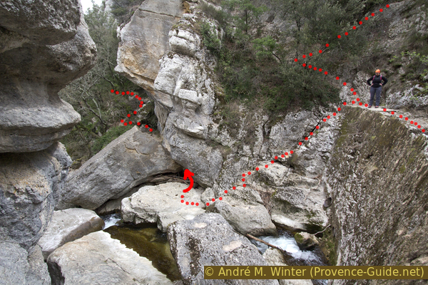
Route above and below the dam in the river bed
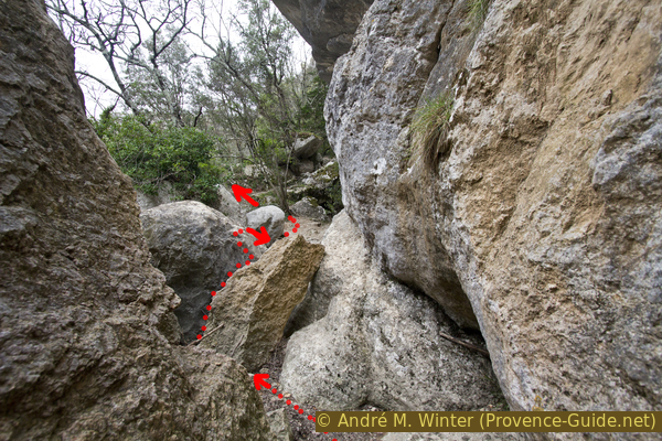
A first bottleneck has to be passed, under certain circumstances you have to take off your backpack and twist yourself accordingly in order to get through.
The picture shows the detail of the upper one where the arrow is centred. You can see a diagonal opening above the driftwood, we have to go through this!
No reproduction is permitted without the written consent of the author. (id4264)
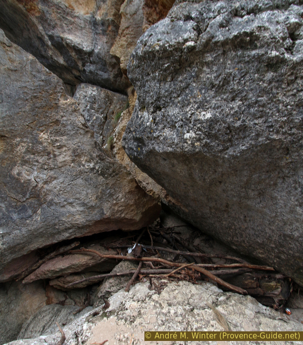
Narrow passage below the dam
Immediately after that, another difficult spot awaits us, although we can spot an easier path just behind it.
A newer and jagged rock has fallen and is lying uncomfortably in a hollow. You can't go right behind the rock and you have to go around it to the left. So we have to climb on the rounder rocks behind.
The photo shows the recommended route.
No reproduction is permitted without the written consent of the author. (id4265)
Route on a rock below the dam
Behind the rounder rock we have to go about two meters more difficult than right into the hole. This is possible if you use the rocks opposite to help you. At the bottom of the trough is driftwood, which should be tested for load-bearing capacity before loading it with your entire body weight. Then immediately up the vis-à-vis side.
No reproduction is permitted without the written consent of the author. (id4266)
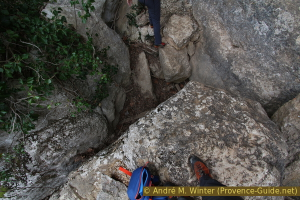
View from rounder rocks downstream
Back in easier surroundings, we advance into the widening gorge. So we leave the right rock wall for the first time.
We first aim for the reddish spoil heap at the back, but after the last trees we keep more to the left.
No reproduction is permitted without the written consent of the author. (id4267)
From the boulders out into the valley floor
We come to an open area with sandy bottom, but in front of us there are boulders again, these are large blocks with a relatively flat surface. On these rocks we will cross the creek flowing below, but we will not see it here. We maintain a strict north heading when traversing.
No reproduction is permitted without the written consent of the author. (id4268)
Looking back through the narrow passages between the rocks
We cross the creek by climbing the rocks.
You descend in the crevice with the tree on the right in the picture.
No reproduction is permitted without the written consent of the author. (id4269)
Over flat rocks to the left bank
We jump from rock to rock. Vis-à-vis we meet again rounder rocks, which are overgrown with moss. In front we see a reddish slope of earth, it is overburden in front of a mine entrance, which we will pass later.
No reproduction is permitted without the written consent of the author. (id4270)
Exit to the left bank of the Caramy
Under the trees, however, we keep to the left and go under the rock overhang. At the top left we look back to our descent route and also to the weir.
No reproduction is permitted without the written consent of the author. (id4271)
Looking back to the old dam
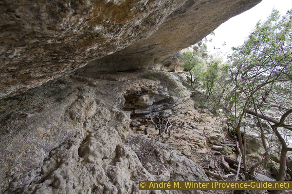
On the right we can go up under the ledge for about 50 meters. One passes a shallow cave entrance. However, this wide and naturally covered path ends in the rock face wall no possibility of getting off.
No reproduction is permitted without the written consent of the author. (id4272)
Overhang in the left bank cliff of Caramy
One finds graffiti of early 20th century miners under the overhang.
No reproduction is permitted without the written consent of the author. (id8381)
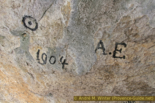
Initials and year of passage in 1904 of a bauxite mine worker
For the further course we go from the rock overhang out of the valley to the red spoil heap (a part of the rail of the mine railway lies around here).
No reproduction is permitted without the written consent of the author. (id8382)
Way towards the mine slope
There is an entrance to the mine in the rock wall. The door is missing and you can get in, but we recommend staying outside.
No reproduction is permitted without the written consent of the author. (id8383)
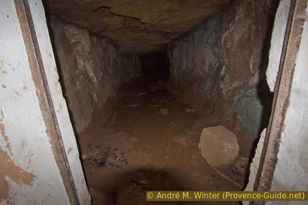
Access to an old bauxite mine in the Caramy canyon
From the top, on the flattened hill, there is a good view of the gorge, which is much wider here.
No reproduction is permitted without the written consent of the author. (id8384)
Right ledge of the Caramy Gorge downstream from the Sauts du Cabri
At the other end of the wall we take the path leading down. It leads us directly to the water and here we have to find a suitable transition. The old bridge, consisting only of two bent old rails, can no longer be used, a little further downstream there are supposedly grippy rocks (the unofficial marking leads here), but they are quite slippery. Further down, the stream widens and leads over gravel banks. Here we got through dry in the spring with high mountain boots.
No reproduction is permitted without the written consent of the author. (id4273)
Cross the Caramy stream without taking off shoes
You then come back to the broken bridge. It must have been destroyed by the floods.
No reproduction is permitted without the written consent of the author. (id8385)
Rails of the destroyed bridge over the Caramy River
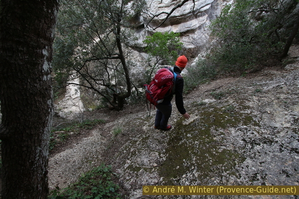
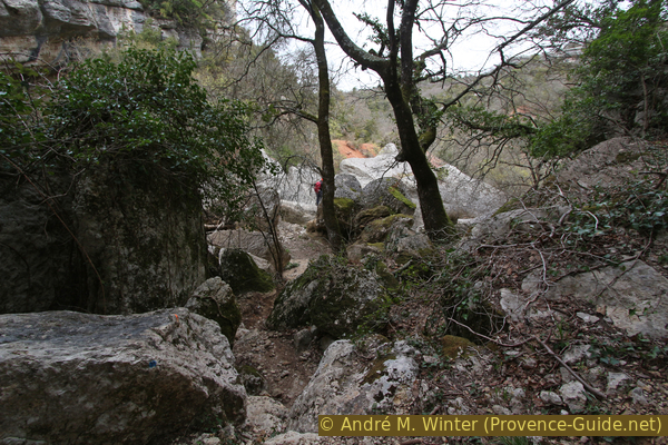
Now you can climb a little up the stream, but soon you come up against rocks. The Caramy leads here over smooth rock slabs.
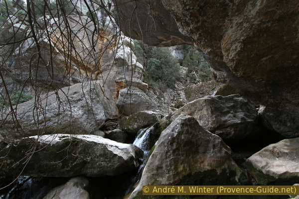
No reproduction is permitted without the written consent of the author. (id4274)
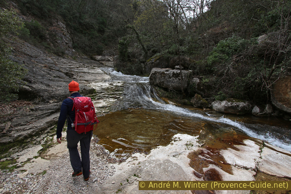
Caramy with its goat jumps
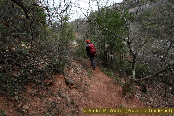
The former bridge also marks our way to the plateau. It's the old way from the mine. It has not been maintained for a long time and is strewn with stones of various sizes. It is quite difficult to walk, and this is the only significant climb on the whole tour.
No reproduction is permitted without the written consent of the author. (id8386)
Path climbing onto the plateau on the right bank
However, various open spots offer a good view of the gorge and also back to sections that we had crossed.
No reproduction is permitted without the written consent of the author. (id4275)
View from the serpentines to the bottleneck of the gorge
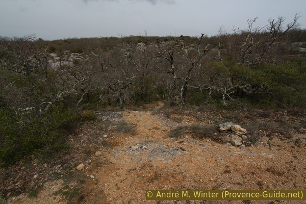
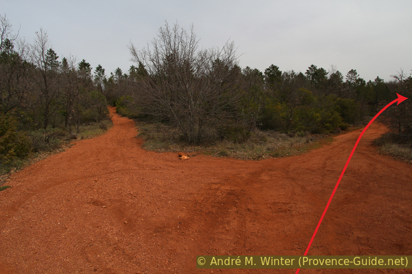
At the plateau we come to a dirt road with deep red earth and take the fork to the right.
No reproduction is permitted without the written consent of the author. (id4276)
Forest road curve at Plateau Caïre de Sarrasin
Section 3: Karst de la Caïre de Sarrasin Ouest
➙ 2 km ... 40 min ➚ 20 m ➘ 50 m ↝ average
40% exposed trails, with marks
60% forest roads, few marks
The clues
- Plateau, 390 m
- Karst area and viewpoints
- Forest road, 375 m
- Road D64, 360m
Crossing a large and heavily karstified area on the new course of the GR99 long-distance hiking trail.
corniche = cliff edge
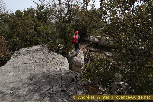
Less than 20 meters further there is a first signpost pointing to the new route of the GR99 since 2018. We now follow the white and red markings. But one must remain vigilant throughout: the markings are small and sparingly applied, the path is not well trodden and it is unclear if it ever will be. Above all, however, we cross heavily rugged karst with deep holes and wide crevasses. Because of the vegetation, these openings are usually seen quite late. But this also provides the appeal of this section.
We climb one last up: in the crevice in the picture (marking on the right).
No reproduction is permitted without the written consent of the author. (id4277)
Ascent of the GR99 trail in the Caïre de Sarrasin karst area
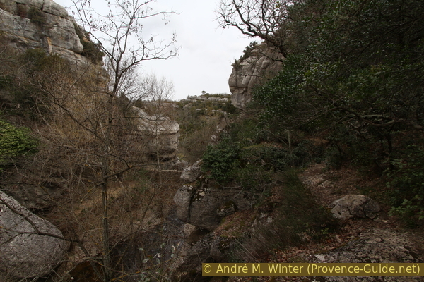
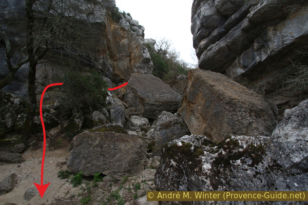
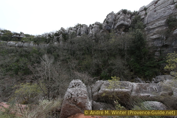
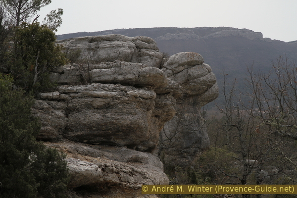
At the top you can go to the ridge and here you have the best view over the gorge. On the left is the Sauts du Cabri constriction (in the middle of the picture).
No reproduction is permitted without the written consent of the author. (id4278)
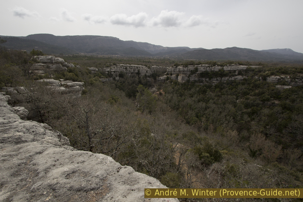
View from the edge of the cliff into the widening of the gorge
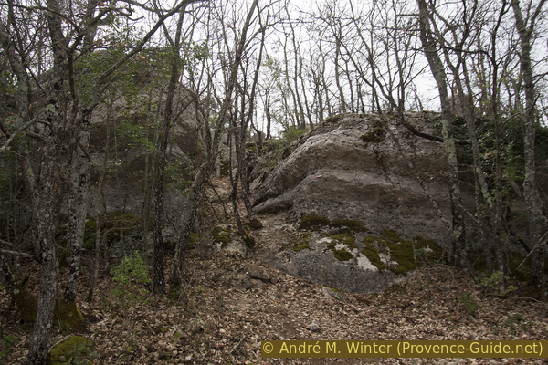
You can walk along the edge for some time, but soon the terrain becomes quite chaotic and overgrown. The officially marked path turns left in front of a prominent rock formation (photo).
No reproduction is permitted without the written consent of the author. (id4279)
Rock formations at the edge of the gorge
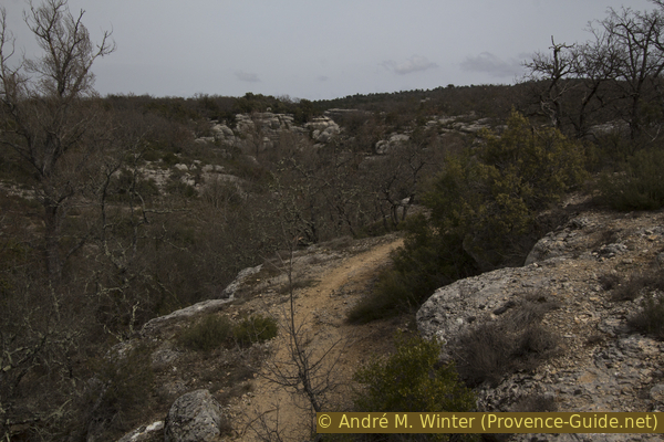
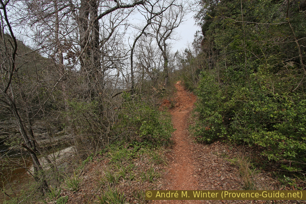
At about 100 meters we are now on an old forest road. But soon the GR99 turns right again (signpost). This is where the really karstified section begins. You first go over large and flat sections where only boxwood grows. Real trees only grew in and out of the crevices.
No reproduction is permitted without the written consent of the author. (id4281)
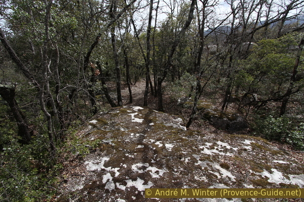
The GR99 trail on the Caïre de Sarrasin karst plateau
The path doesn't seem to follow any natural conditions, only in the aerial photo you can see that you bypass the largest crevasses. Nevertheless, you can get quite close to some deep cracks.
Smaller crevices are crossed directly on the way. One may be tempted to examine some of these karst forms more closely, in some crevasses one can simply descend. But first you should get your bearings. If you can't find your way, you're not completely lost, because the next forest road is less than 150 meters to the east. However, the terrain is extremely rugged and overgrown, a wild crossing here corresponds to a real expedition.
We land on a forest road, on which we return to the starting point on the right. 100 meters further there is a junction. On the right you come to the path from the approach to the gorge and the old concrete bridge. From there it is 500 meters to the main road D64.
When you have parked your car after the concrete bridge, go left and then right at the water cistern that follows.
No reproduction is permitted without the written consent of the author. (id4283)
Jump over a crevice on the GR99 trail
Sources and additional information
It is better to use a good topographical hiking map: this tour is on the IGN "Signes/Tourves/Massif de la Sainte-Baume" map, scale 1:25000, 3345OT.
If you don't want to bother with a paper map, you can also use mapping apps on your cell phone. On the one hand, it is the Cartes IGN app from the official map service. However, it requires access to the data network and this is sometimes difficult in canyons or remote locations.
Alternatively, you can use apps that store data directly on the device. They're generally not free, but they don't cost much. We mainly use OSMAnd, here it is possible to add contour lines, relief shading, markings and others. To store this data on your phone you need a lot of space.
Of course, one needs access to satellites for the GPS signal with any app. In some canyons this is not the case. Therefore, do not rely on the position shown, but read the map on your phone as you would read it on paper. Most apps are available for Android and iPhone. The applications usually allow us to record the route travelled and also view the GPS files offered for each of our hikes.
This page has been seen 2118 times since 20 March 2024.
No reproduction is permitted without the written consent of the author. (id2919)
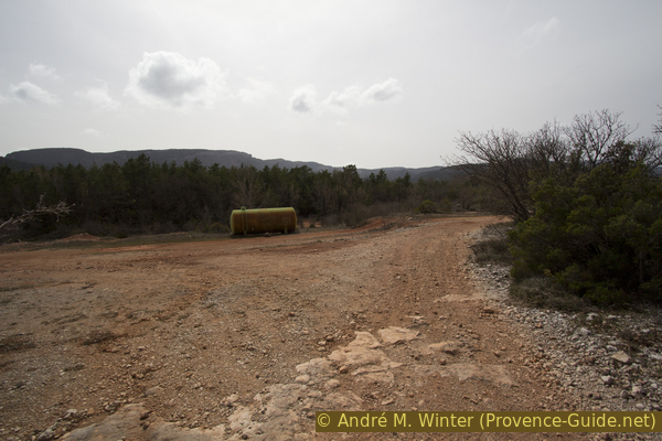
Water tank on the western part of the Caïre de Sarrasin karst plateau