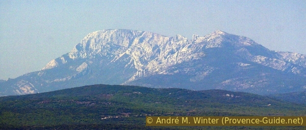
Lonesome mountain Gross Bessillon
From the monastery of St. Joseph, over Jas du Bessillon to the summit
hike
difficult
4 h
no
yes
no
mountain
Introduction
Warning: The forest fire that started on 21 July 2026, north of Pontevès has completely burned the Gros Bessillon ridge. It is impossible and pointless to attempt this hike until the end of 2027, and we strongly advise following the instructions on site. Not only are there risks of falling rocks and falling charred trees, but the vegetation will also need to regenerate, and it is essential not to trample it, especially on the western path towards the ridge.
In the tranquil region of Provence Verte there are vast and almost entirely wild areas. Here, due to the lack of roads, the ascents are often very long. The Gros Bessillon is a mountain that can be seen from many other points, but the summit is not easily reached. There is a road leading up to it, but it is not for nature lovers. Driving is also prohibited here. The Gros Bessillon is a limestone ridge stretching east-west, nearly 5 km long at the base and about 3 km at the top.
In this wilderness there are also living cultural traces, the monastery of Saint Joseph lies in the south-east at the foot of the Gros Bessillon. Below is our starting point in the municipality of Cotignac. There is only a forest road all around, a path on the ridge and a few, mostly overgrown, climbs in between. Our suggestion is to walk the mountain in its entire length. So we first go west at the southern foot, climb there to the summit and stay mostly on the ridge for the descent. The monastery is planned here at the beginning of the tour, but you can also stop by there at the end.
The facts
12,7 km total distance
4 h walk time
530 m total elevation
orientation easy except in the rock area
mark 5% of the total distance
70% forest roads
15% easy trails
10% hard-surfaced quiet side streets
5% moderate trails
<5% difficult trails
<5% Trails with scramble passages
dangers climbing areas, possibly wind
children no
useful picnic stuff
required hiking boots, hiking equipment and water
GPS coordinates (WGS84) of start and end point 43.534129,6.125122
downloads ![]()
![]()
No reproduction is permitted without the written consent of the author. (id4124)
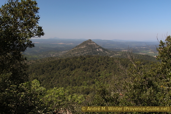
Mount Petit Bessillon to the west
The two Bessillons form a small mountain range.
Public transport
There is no viable public transport for this hike. Only school transport is available. It ist useful to complain about at the tourist offices of the region.
Access by car
The start is at the car park in the south-east of Gros Bessillon. Turn off the D13 road between Cotignac and Barjols. Coming from Cotignac it is the second street on the left after a right-angled bend. Coming from Barjols or Les Quatre Chemins, take the road marked Monastère St-Joseph on the right.
Useful parking spaces
There is a very large and shady car park right at the starting point of the hike.
Hints
You will almost always be alone on this mountain. It takes courage to tackle the five kilometers of gravel track. Only very early in the morning can you avoid the scorching heat on this southern slope foot. There is only a source of drinking water at the monastery at the very beginning or at the very end of the tour.
There are no usable markers throughout the course. You have to be able to find little used paths in the forest and there are two places where you have to put your hand on the rock.
The whole region is a zone with a high risk of forest fires. In summer, but also in other seasons when it is very dry or by strong winds, access to the forest areas can be regulated. As a result, the roads may be closed to traffic and/or the trails prohibited to hikers. Current information: Map of access to the forests of the Var (also english). The map shows the colours green, yellow, orange and red which correspond to levels of danger. The affected area is: Haut Var (3).
No reproduction is permitted without the written consent of the author. (id4111)
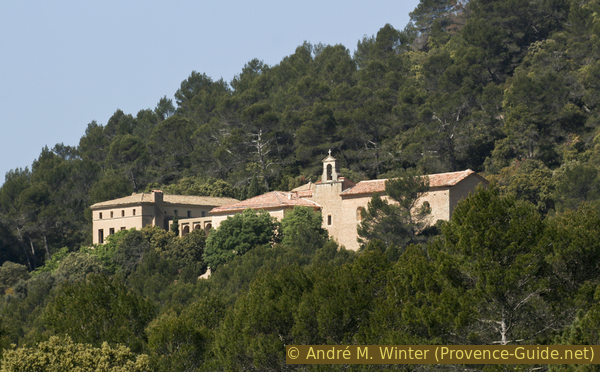
Monastery of Saint-Joseph du Bessillon
The sections
- Up to the monastery of St. Joseph and the Chemin de Ceinture
- At the foot of the Gros Bessillon on the Chemin de Ceinture heading west
- From the saddle at Jas du Bessillon over rock passages to the summit
- All the way along the Gros Bessillon ridge to the Resistance Monument
- Via the valley of Valaurie back to the car park
Section 1: Monastère St. Joseph - Chemin de Ceinture
➙ 1 km ... 15 min ➚ 70 m ➘ 15 m ↝ easy
80% forest roads, few marks
20% easy trails, without marks
The clues
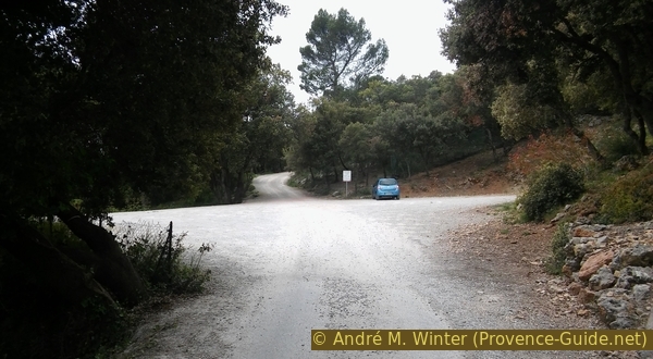
- Lower parking lot of the monastery of St. Joseph, 380 m
- Monastery of St. Joseph, 440 m
- Chemin de Ceinture, 415 m
Hameau = settlement
The parking lot is a large open space under trees in the forest. You usually get here via the Chemin St. Joseph. Continue in the same direction to climb up to the monastery in a few minutes. There is a wide path that runs parallel to the road on the right and that we can mostly follow. You can see the way down by the big green water tank. After 10 minutes you are at the top.
No reproduction is permitted without the written consent of the author. (id4177)
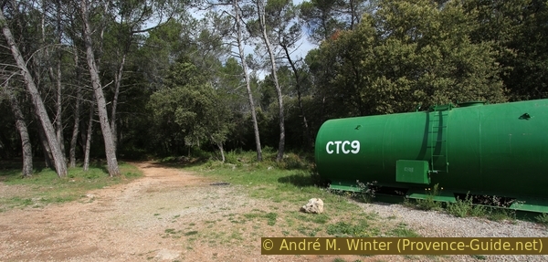
Water tank and footpath to the monastery of St. Joseph
If you want to skip the monastery or stop by there at the end of the tour, take the forest road to the left of the asphalt road. This is already the ring road (Chemin de Ceinture). The road codes start with N, here we are on the N88.
No reproduction is permitted without the written consent of the author. (id4112)
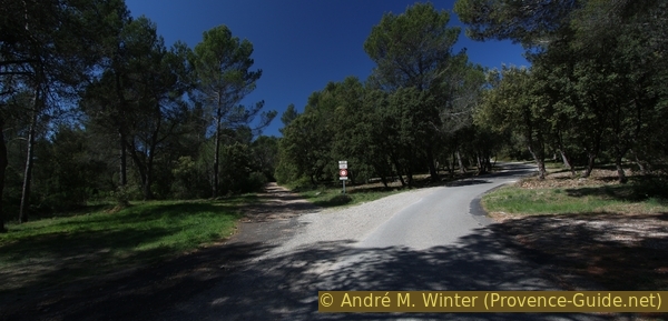
Path Chemin de Ceinture (forest road N88) left
col = pass
After the path to the monastery made a right turn, there is the possibility to climb up to the left to the road and cut off a hairpin bend of the same. As you continue, stay on the road and you will soon reach the last parking lot. The opening hours of the church are also written here. Do not enter on other times because many religious offices take place in the church.
Do not go up the driveway on the right, but straight ahead after the parking lot and flat ahead.
No reproduction is permitted without the written consent of the author. (id4178)
Last car park before St. Joseph monastery
The road is no longer asphalted and branches out. We first go up to the church on the right.
It is built directly on the source that started the cult here. In 1660 the shepherd Gaspard Ricard discovered it here shortly before dying of thirst. A chapel was built in the same year, but soon became too small and in 1663 gave way to the current new and larger one. After the sale during the revolution, religious offices were held again in 1840. Nuns have been on duty here since 1975. The facade appears to be plastered with clay, otherwise it has no special features apart from the large door. Inside it is very dark and unadorned.
No reproduction is permitted without the written consent of the author. (id4180)
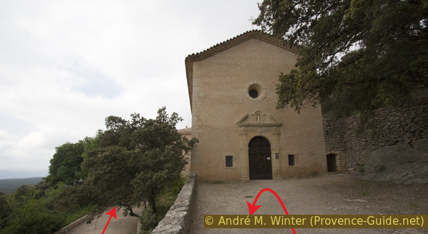
Monastery church of St. Joseph
After the church we turn around and go right to the lower level. The path leads us under the bell gable. Below is the grotto with the Saint Joseph source. It is completely taken up by the masonry of the church. Through a grid you can see a pool of water in what is probably a natural cavity. To the right in front of it is a tap where you can take this drinking water.
No reproduction is permitted without the written consent of the author. (id4181)
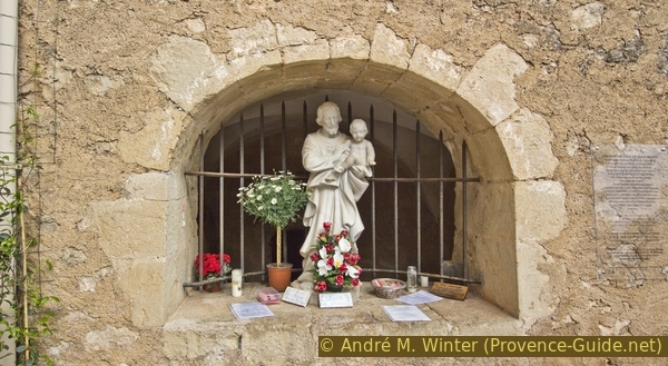
Source St. Joseph
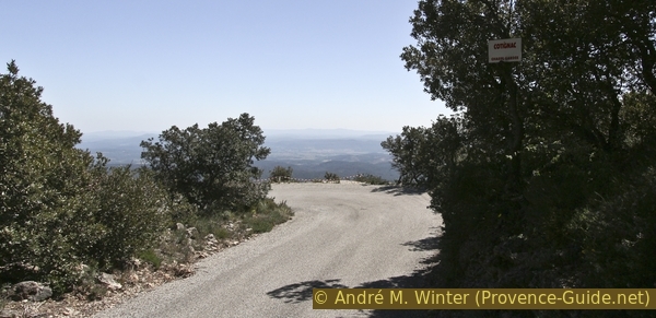
When approaching the spring, the attentive hiker must have noticed the small path down. About 40 mm before the spring, this old path, which is still paved in places, branches off. It passes an abandoned courtyard with blue doors and shutters and takes us to the forest road, the Chemin de Ceinture (N88), which also started at the parking lot below.
No reproduction is permitted without the written consent of the author. (id4182)
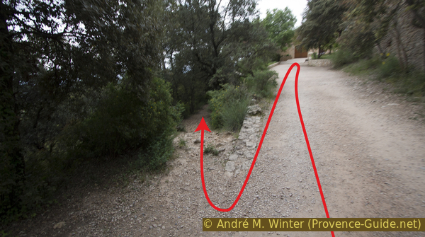
Path downhill from the monastery to the Chemin de Ceinture
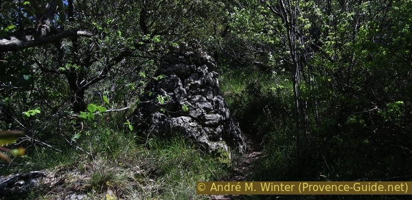
Those who only want to go to the monastery at the end, keep an eye out for the rock needle and the cairn in the picture on the descent. There is a more detailed description at the end of the tour.
No reproduction is permitted without the written consent of the author. (id4114)
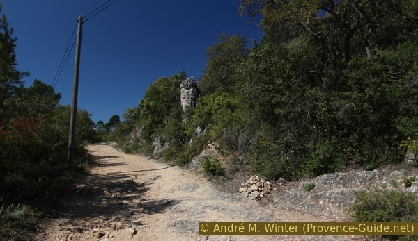
Rock needle and cairn on the forest road N88
Section 2: Chemin de Ceinture - Col du Jas du Bessillon
➙ 5,8 km ... 1 h 10 min ➚ 175 m ➘ 20 m ↝ easy
100% forest roads, without marks
The clues
- Chemin de Ceinture, 415 m
- Saddle at Jas du Bessillon, 565 m
Along the southern slopes of Gros Bessillon.
This section could be summarized succinctly as follows: follow the forest road for one hour and 15 minutes. In fact, the trail isn't all that charming. You walk mostly without shade to the west, so it is recommended to start early when the weather is nice, even in the off-season. We are on the south side here and are walking over pure white limestone gravel.
No reproduction is permitted without the written consent of the author. (id4118)
Chemin de Ceinture to the south of the Gros Bessillon
But this little ordeal allows us to later go back up over the ridge. From below we can already spot some interesting sections. Some signs point to overgrown paths in the valleys, we remember one of them: through the Vallon de Valaurie we come down from the mountain at the end.
No reproduction is permitted without the written consent of the author. (id4117)
Valley Gorge de Cinq Heures
At first you think the forest road runs flat on the slope from one valley to the other. However, it climbs continuously 150 metres up to the saddle, which you don't even notice. To make the ascent prettier, spring is recommended, when the calcareous garrigue is in full bloom.
No reproduction is permitted without the written consent of the author. (id4116)
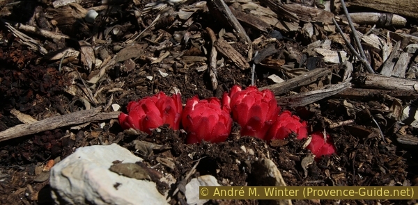
Parasitic Cytinus hypocistis
There are no prominent branches. Only at a water tank, after about 40 minutes walking time, we have to stay on the N88, this gravel road is on the right and wider than the others branching off.
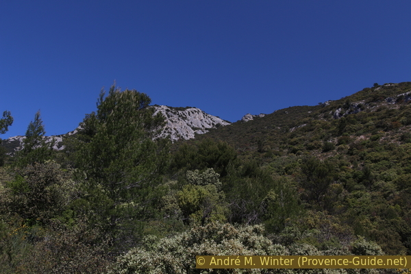
If you look at the ridge, you can now see antennas and a lookout tower to the west, which we will pass later. Our road slowly turns towards the saddle between the Gros Bessillon to the east and the Petit Bessillon to the west. The road now climbs steeper, but flattens out again at the saddle.
On the left is a ruin, the Jas du Bessillon farm. There is also a wayside shrine on the saddle, which, like everything else here, is dedicated to St. Joseph. Old weathered arrows point to battlefields between resistance fighters and the German Nazis in 1944 in this forest.
No reproduction is permitted without the written consent of the author. (id4119)
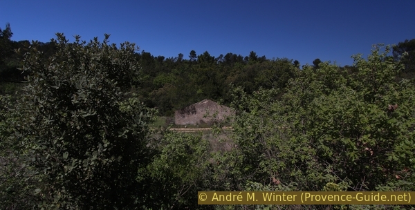
Hut Jas du Bessillon south just below the saddle
Section 3: Col du Jas du Bessillon - Gros Bessillon
➙ 0,8 km ... 45 min ➚ 245 m ➘ 0 m ↝ average
45% easy trails, without marks
25% moderate trails, without marks
10% Trails with scramble passages, without marks
20% easy trails, without marks
The clues
- Saddle at Jas du Bessillon, 565 m
- Rocks west of the summit, 760 m
- Gros Bessillon summit, 810 m
Progressively steeper fast ascent and two passages in the rocks.
Warning ,this section includes a few metres of climbing that also require good orientation. With GPS you won't be precise enough to find the passages, you should follow the instructions below. There is no simpler variant than the one presented here.
No reproduction is permitted without the written consent of the author. (id4120)
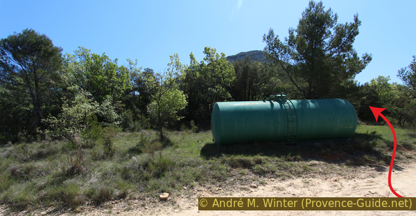
Water tank at the Col du Jas du Bessillon saddle
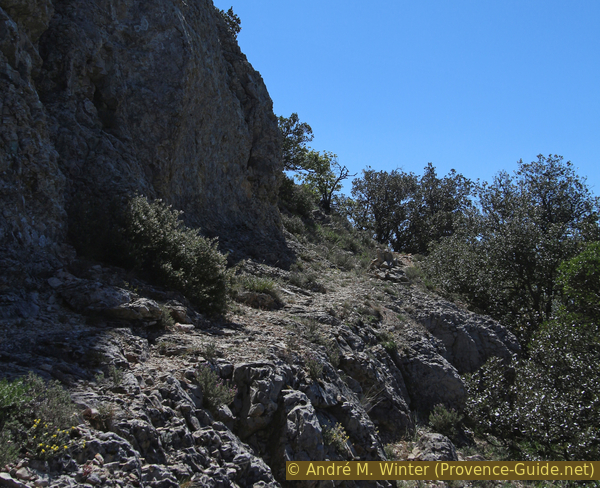
There is a crossroads at the saddle, but we are primarily interested in the water tank as a point of reference. 20 metres before, directly in the crossing area, a path leads up to the right. It points directly to the outcrop of rock to the west of the summit, which cannot yet be seen from here. This path will lead us up the ridge. There are trail numbers on signs, but they don't help us in any way with the ascent. At first we simply climb in the direction of fall.
No reproduction is permitted without the written consent of the author. (id4121)
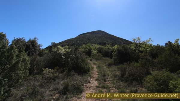
Way from the west on the Gros Bessillon
col = saddle
très raide = very steep
bande rocheuse = rock ledge
rocher = rock
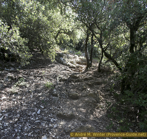
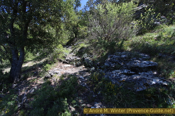
After about 200 metres the path narrows and soon there is a cairn where we turn right and get into a forest of small gnarled oaks. We are now in a first short, more or less traversal section, the rest of the ascent is steeper.
No reproduction is permitted without the written consent of the author. (id4122)
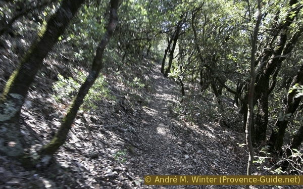
First less steep path section to the right
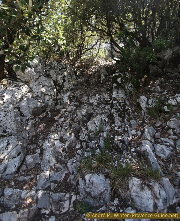
Less than 50 metres later, the path turns left again and climbs, continuing under the low trees over dirt terrain with few clues. After a strenuous climb of around 100 metres, the path leads flat out again to the right. We are now at the foot of the rock face through which we are looking for a climb further south. Flatter out means, of course, that you will still go up.
No reproduction is permitted without the written consent of the author. (id4123)
Very steep ascent under holm oaks
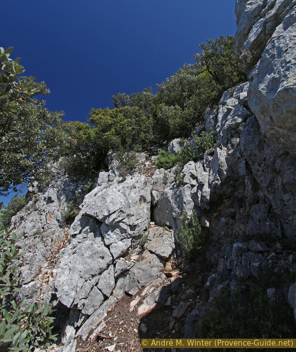
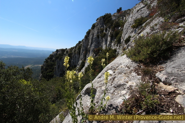
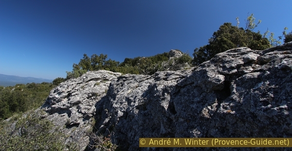
Progressively it becomes rockier and the forest lighter. We come across a sloping gravel surface and then a rock ledge that leads us further uphill without climbing vertically yet.
No reproduction is permitted without the written consent of the author. (id4125)
Path on a ledge
After the ledge there is another gravel area that leads us to a rock wall that is now vertical and impassable in front of us. Now you have to look for a passage through the rock up on the left, you can recognize the spot on the worn rock. This is the first climbing point, we aim for the bushes a few meters above. There you come to a small and narrow platform, which consists of finely crumbled limestone gravel.
No reproduction is permitted without the written consent of the author. (id4126)
First easy climb below the summit
Continuing in the only viable direction, we quickly come to another vertical rocky outcrop, oak trunks also prevent us from continuing. As before, you look back a little in search of a passage, you can also see here on the ground that this is a place that is sometimes walked on. Climbing we come to a rock step, which is again overgrown with bushes.
We come out onto a ledge again, but here we have to walk a few meters before we find a flatter and more open spot further to the right. We have now arrived at the western summit plateau of Gros Bessillon.
No reproduction is permitted without the written consent of the author. (id4127)
Second climbing point below the summit
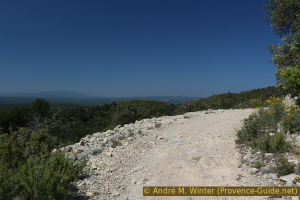
Throughout the climb we had a good view of the Petit Bessillon to the west, the village of Pontèves and a few scattered farms. Depending on the weather conditions, you can see as far as the Montagne Sainte-Victoire. Other mountains can also be recognized by their distinctive shape.
No reproduction is permitted without the written consent of the author. (id4128)
Montagne Sainte Victoire seen from Gros Bessillon
We have yet to climb to the top of our mountain. A path between bushes leads along the edge to a hill, before we see the summit.
No reproduction is permitted without the written consent of the author. (id4129)
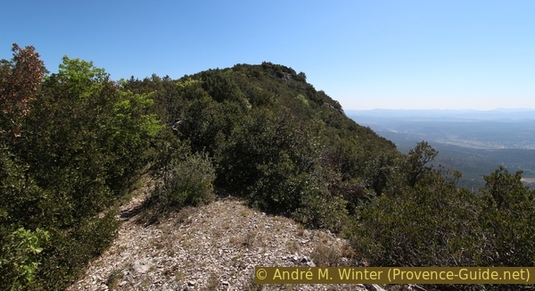
On the summit plateau with a view towards Gros Bessillon
Further ahead we see the buildings in the summit area. We aim for the watch tower.
No reproduction is permitted without the written consent of the author. (id4130)
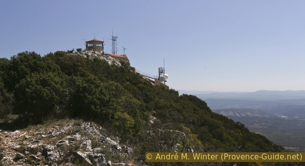
Fire lookout tower at Gros Bessillon
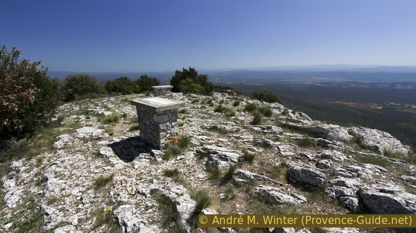
The facilities at the top are fenced, but at the bottom there is a first viewpoint with two panoramic panels explaining the view to the north and west of the Gros Bessillon. Here we are at the highest point of the tour, it is a good place to take a break.
No reproduction is permitted without the written consent of the author. (id4131)
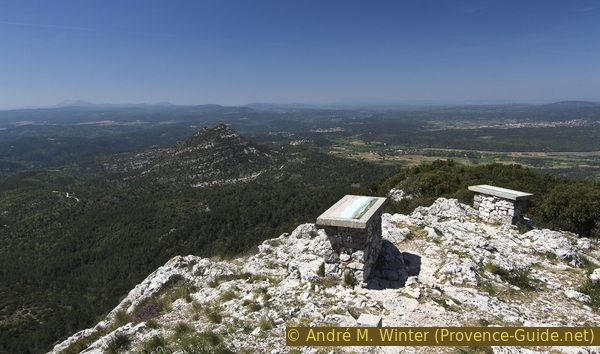
Two panorama boards to the west of the summit
Section 4: Gros Bessillon - Monument de la Résistance
➙ 2,5 km ... 1 h 10 min ➚ 45 m ➘ 275 m ↝ average
5% easy trails, without marks
<5% hard-surfaced quiet side streets, without marks
20% easy trails, without marks
10% hard-surfaced quiet side streets, without marks
<5% easy trails, without marks
10% hard-surfaced quiet side streets, without marks
5% difficult trails, cairns
25% hard-surfaced quiet side streets, without marks
20% easy trails, cairns
<5% hard-surfaced quiet side streets, without marks
The clues
- Gros Bessillon summit, 810 m
- Saddle above the Gorge de Cinq Heures, 740 m
- Roche Trouée, 745 m
- Monument of the Résistance, 595 m
We walk along the ridge line, partly on the ridge road (driving ban). Be careful with strong winds!
table d'orientation = panorama table
ouest = west
est = east
tour de guet = watch tower
route de crête = ridge road
We circle the fenced area on the left (north). There we come to the paved road. There is a ban on driving here, but in low season the barrier down in the valley is often open, so you could see vehicles. Especially cyclists will be found here because the road has now been newly asphalted. The note is located here because we have to walk short cuts on this road again and again.
No reproduction is permitted without the written consent of the author. (id4132)
Two more panorama boards to the east of the summit
Now we follow the road for about 100 metres and before the first curve we take an unmarked path on the right that leads us out to the cliff edge and continues along it. We pass behind (i.e. north of) another antenna and reach the edge. So we quickly come to two more panorama boards, which explain the southern view of the Gros Bessillon.
Our route continues along the cliff edge. The terrain is easy and not really dangerous. Only with north wind (Mistral) great care is required here.
No reproduction is permitted without the written consent of the author. (id4133)
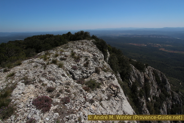
Path on the ridge west of the Gorge de Cinq Heures
Slowly but surely our path now leads downhill in a saddle, where we will meet the road again. Here we can also look into extraordinarily smooth and vertical cliffs on the southern flank.
No reproduction is permitted without the written consent of the author. (id4134)
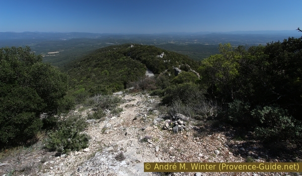
The ridge path leads down to the road
We are here above the Gorge de Cinq Heures (Five O'clock Gorge), which we crossed below and was much less impressive there. In the rock cliff you can see established climbing routes, paths that lead down serve mainly as access to these climbing possibilities. The path through the valley is extremely overgrown.
To the east of the valley you have a better view of the gorge from a rock.
No reproduction is permitted without the written consent of the author. (id4135)
Flowering Phlomis lychnite above the Gorge de Cinq Heures
For the next few minutes we stay on the road up to the first hairpin bend, where hikers can descend straight ahead. In front of us the terrain becomes more chaotic, the southern flank now consists of individual rocks and towers in the forest. Before we can have a closer look at this area, we have to stay on the asphalt road for about 250 metres.
No reproduction is permitted without the written consent of the author. (id4136)
Go straight ahead in this curve
vallon = small valley
route de crête = ridge road
The road passes at the top of another cut, the Vallon de Picoin. You can go to some rocks via a small area south of the road. This pays off especially in the east of the small area, because here you can climb up to a natural rock arch. There is a marked approach (see below), but also the adventure route: you climb directly from the square into the bushes (left) and rocks (right). You stay roughly parallel to the road below.
No reproduction is permitted without the written consent of the author. (id4137)
Path from the saddle at Vallon de Picoun to the rock gate
It goes over a rock and then, bending down, you come to what is probably a natural terrace with small, crooked trees.
We aim for the rock to the left of the centre of the picture, the natural arch is in front of it.
No reproduction is permitted without the written consent of the author. (id4138)
Rock on the path to the Roche Trouée natural arch
In a flatter section, but still under small trees, is a strikingly large cairn. Here we turn right, going uphill, we come directly to La Roche Trouée natural arch.
No reproduction is permitted without the written consent of the author. (id4139)
Old cairn on the path to the natural arch
In one niche there is a cross, in another a candle can burn. It is not easy to see the gate from the other side, nor do we see back well from neighbouring rocks.
Now back to the large cairn, but then straight ahead down to the road.
No reproduction is permitted without the written consent of the author. (id4140)
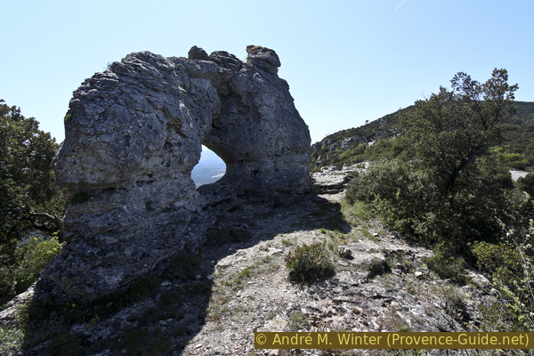
Roche Trouée in the crest of the Gros Bessillon
The ascent is also signposted at the bottom of the road, it is recommended for those who did not want to walk through the garrigue before. A small sign shows the spot for the short climb.
No reproduction is permitted without the written consent of the author. (id4141)
Access from the road to Roche Trouée
vallon = small valley
route de crête = ridge road
col = saddle
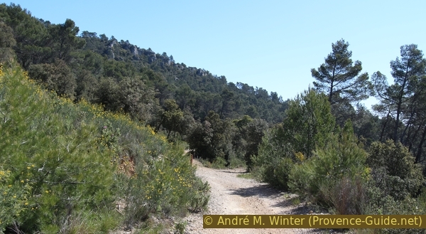
Now we stay on the road for about 650 metres because the ridge here is very rugged and overgrown. On the left, looking through the branches, you can see the village of Fox-Amphoux. The road makes a few gentle curves and is then straight. If there is a right turn in front of us, we look for a cairn on the right side of the road. A relatively large holm oak casts its shadow here on the road and on the beginning of a path that climbs a few meters and then turns left and continues eastwards down the ridge, which is not very pronounced here.
No reproduction is permitted without the written consent of the author. (id4142)
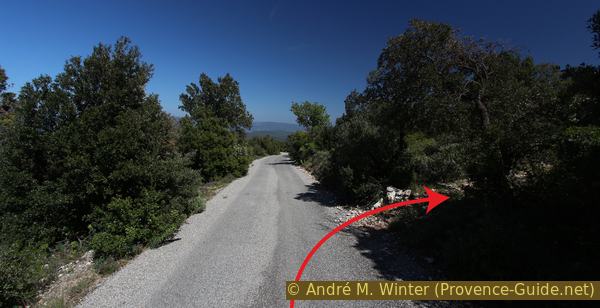
Road and the cairn for the new beginning of the path
We go down under oak trees and come back to the road. We are now crossing it for the first time. Opposite we dive back into the forest and shortly afterwards the second road crossing follows.
No reproduction is permitted without the written consent of the author. (id4143)
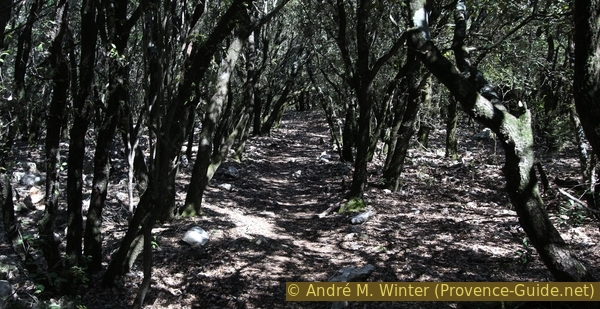
Ridge path in the holm oak forest
The following section is short and we hit the road a third time. This time we don't go straight ahead, the path would lead far to the north-east of the mountain range. So we turn right and stay on the road.
No reproduction is permitted without the written consent of the author. (id4144)
The path shortens the last bend in the road
This brings us to another open area to the right of the road, here is a memorial to the fallen resistance fighters who were tracked down and executed by the German Nazis further down on July 27, 1944. They were young men from the region.
The remote mountain range of the two Bessillons was a retreat for the French resistance (Résistance). Many volunteer fighters died here and memorials mark these sad spots. A central monument was erected on the edge of the D560 road west of Rognette in the north of Gros Bessillon.
No reproduction is permitted without the written consent of the author. (id4145)
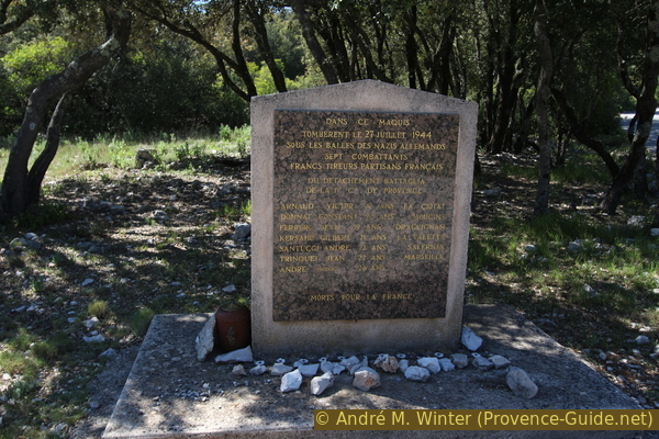
Memorial to the fighting at Gros Bessillon on 27 July 1944
Section 5: Vallon de Valaurie - Parking
➙ 2,5 km ... 40 min ➚ 0 m ➘ 215 m ↝ easy
20% moderate trails, without marks
80% forest roads, without marks
The clues
- Monument de la Résistance, 595 m
- Parking lot under the monastery of St. Joseph, 380 m
Descent through a side valley and over the forest road from the starting way back to the parking lot.
Next to the memorial is a sign pointing left to the location of the battle. It is also our way downhill from the plateau, since the entire eastern area is flat and extremely overgrown. The 150 metres marked go steeply downhill. Here you will find another stele, with the same names as above.
No reproduction is permitted without the written consent of the author. (id4146)
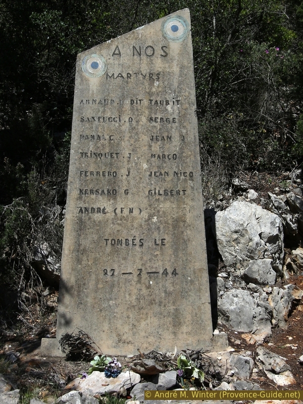
Stele at the battlefield
col = saddle
aiguille rocheuse = rock needle
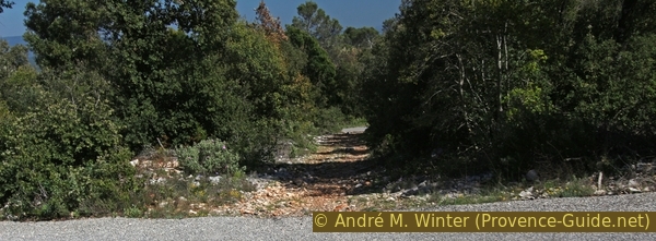
Below the second monument, the path continues steeply downhill. The forest gets denser again below and the path stays mostly in the valley of the dry valley. This brings us back to the Chemin de Ceinture forest road, where we turn left and return to the starting point.
No reproduction is permitted without the written consent of the author. (id4115)
Chemin de Ceinture south of the Gros Bessillon
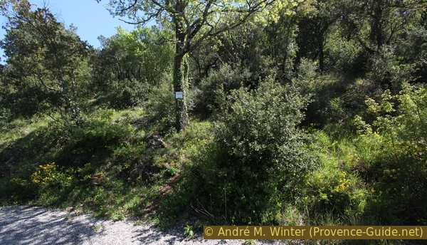
If you only want to go to the monastery at the end, look for a conspicuous rock needle and a cairn on the left on the way downhill. Here you can climb up an old path to the monastery of Saint Joseph du Bessillon. If you pass a rusted trailer, you have missed the junction to the monastery by about 100 metres.
No reproduction is permitted without the written consent of the author. (id4113)
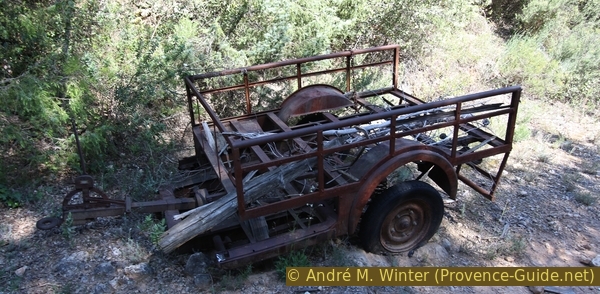
Rusty old trailer
From the monastery you first go down the road and at the first opportunity take a path on the right, which crosses the road below and continues parallel through the forest to the starting point.
No reproduction is permitted without the written consent of the author. (id4179)
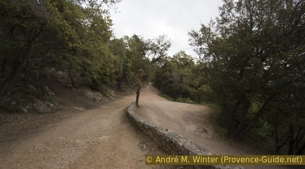
Road down from the monastery
Sources and additional information
It is better to use a good topographic hiking map: This tour is on the IGN "Aups/Salernes" map, scale 1:25000, 3443ET.
If you don't want to bother with a paper map, you can also use mapping apps on your cell phone. On the one hand, it is the Cartes IGN app from the official map service. However, it requires access to the data network and this is sometimes difficult in canyons or remote locations.
Alternatively, you can use apps that store data directly on the device. They're generally not free, but they don't cost much. We mainly use OSMAnd, here it is possible to add contour lines, relief shading, markings and others. To store this data on your phone you need a lot of space.
Of course, one needs access to satellites for the GPS signal with any app. In some canyons this is not the case. Therefore, do not rely on the position shown, but read the map on your phone as you would read it on paper. Most apps are available for Android and iPhone. The applications usually allow us to record the route travelled and also view the GPS files offered for each of our hikes.
This page has been seen 3757 times since 20 March 2024.