Over the ridge of Petit Bessillon
A small mountain with all the advantages of a big one
hike
average
2 h
near
yes
no
mountain
Introduction
Seen from the north, Petit Bessillon resembles a volcano with its two peaks. Unlike other hills around, it's a real small mountain: there are no dirt roads to the top, the only two accesses are seriously steep, the ridge is rugged and secured with some irons like via ferrata. In addition, the view is great, all the mountain massifs of the Var are visible.
There are only two paths that lead up, which allows us to make a nice circular walk. We prefer to take the steeper path to the top first. The departure time should be chosen carefully, as you can walk in the shade there. It is possible to end the tour at the castle of Pontevès, a ruin that is freely open to visitors.
The facts
4,8 km total distance
2 h walk time
300 m total elevation
orientation easy
mark 85% of the total distance
50% dirt roads
25% easy trails
10% hard-surfaced city alleys
10% hard-surfaced quiet side streets
10% moderate trails
<5% via ferrata
dangers heat in summer
children with the appropriate walking experience and sufficient supervision
useful picnic stuff
required hiking boots, hiking equipment and water
GPS coordinates (WGS84) of start and end point 43.553402,6.031403
downloads ![]()
![]()
No reproduction is permitted without the written consent of the author. (id3771)
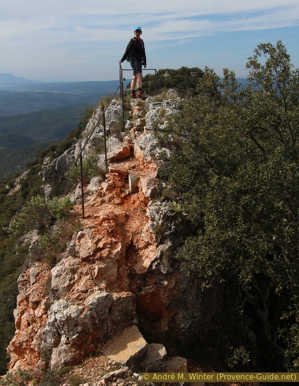
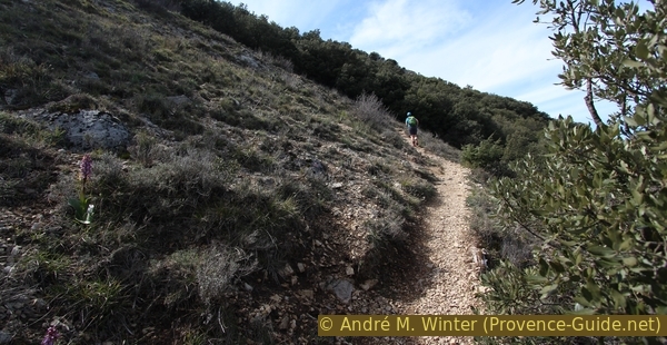
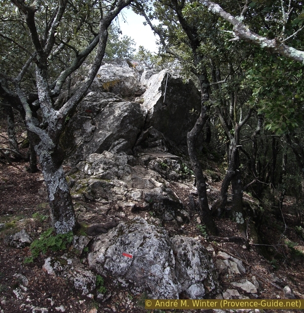
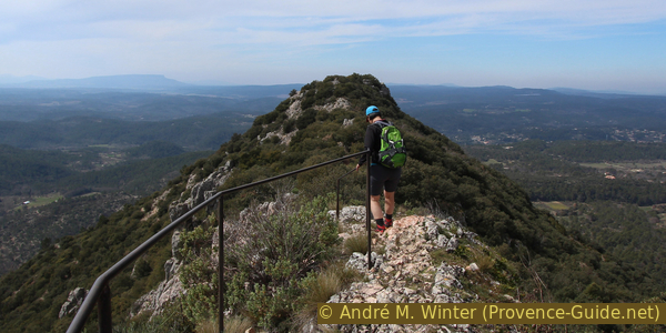
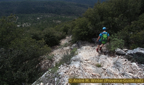
Path on the rocky ridge of Petit Bessillon
Public transport
It is not possible to reach Pontevès and the start of the hike by public transport. Only school transport is available. It is useful to complain about at the tourist offices of the region.
Access by car
Pontevès is a small village north of Brignoles and close to Barjols. You have to cross Barjols to the north and then turn towards Aups. A little later follows the D60 road, which leads directly to Pontevès. The Place des Martyres du Bessillon, located right in the centre, is the starting point of this tour.
Useful parking spaces
There is a central car park near the village school in Pontevès. Coming from Barjols, take the first street on the right before the centre and then turn right again. The parking lot is shaded under plane trees. A toilet is available in an old tower.
Another car park is on the first right when coming from Barjols. This is called Chemin du Tavernes.
To get to the starting point on foot: go up the main street and continue up towards the church, located on the Place des Martyres du Bessillon.
Hints
The difficult sections of this tour are short, well insured, but still exposed. From this point of view, the Petit Bessillon has nothing to do with the surrounding hills. Access via the western peak is easier, the exposed parts are between the two peaks.
There are no huts or shelters and no water in the course of the tour. Due to the location, you should avoid climbing during thunderstorms or storms (Mistral).
The whole region is a zone with a high risk of forest fires. In summer, but also in other seasons when it is very dry or by strong winds, access to the forest areas can be regulated. As a result, the roads may be closed to traffic and/or the trails prohibited to hikers. Current information: Map of access to the forests of the Var (also english). The map shows the colours green, yellow, orange and red which correspond to levels of danger. The affected area is: Haut Var (3).
The sections
- Pontevès - water tank at the track namend Piste du Jas: out of the village.
- Water tank - east summit: very steep ascent.
- East summit - west summit: the interesting ridge.
- West summit - Pontevès: gentler descent and back.
Bars and inns only in the towns of Pontevès and Barjols. A grocery store can be found in the main square of Pontevès.
No reproduction is permitted without the written consent of the author. (id3752)
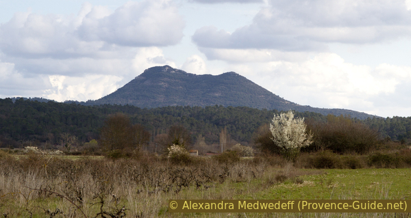
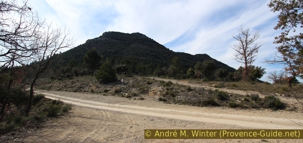
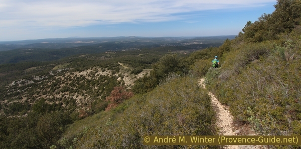
Petit Bessillon seen from Tavernes
Section 1: Pontevès - Citerne Piste du Jas
➙ 1,5 km ... 20 min ➚ 100 m ➘ 5 m ↝ easy
25% hard-surfaced quiet side streets, faulty marks
75% dirt roads, few marks
The clues
- Pontevès, 395 m
- Water tank at the track named Piste du Jas, 485 m
We leave the village on a track that takes us to the north face of Petit Bessillon.
château = fortress
The tour begins on the central square in Pontevès with a bar, library and grocer. In the centre there are no signposts for hikers which direction to take. On the square you can see the church to the east and a narrow street that rises diagonally opposite: this one we take, it is the Chemin du Bessillon.
No reproduction is permitted without the written consent of the author. (id3753)
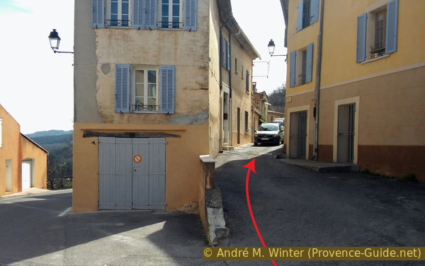
On the right the Chemin du Bessillon seen from the church square
The tour to the Petit Bessillon described here is marked in red, and you can also make out some markings along the access road. We hike without branching and climb very slightly, always in an easterly direction. The asphalt soon gives way to a dusty dirt road with limestone gravel.
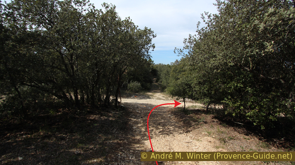
After a quarter of an hour you come to a curious parallel forest road, the markings point to the right-hand one, but both sections soon come together again.
No reproduction is permitted without the written consent of the author. (id3754)
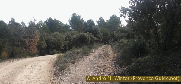
Parallel running forest roads
Arriving at the water tank, the interesting things begin: on the one hand, an olive grove on the left hand side, on the other hand, the access path to the east summit of Petit Bessillon branches off to the right just behind the water tank.
No reproduction is permitted without the written consent of the author. (id3755)
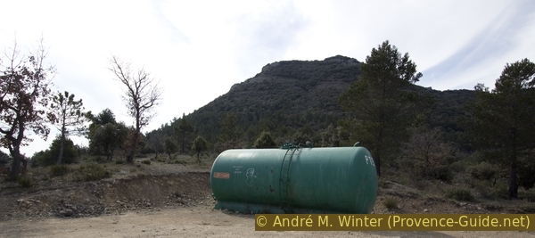
PTS 04 water tank on the Piste du Jas forest road
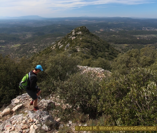
The Petit Bessillon has two peaks, the eastern one, which we are now targeting, is the higher and the larger of the two. "Targeting" is the correct term, as the marked path simply climbs vertically in the direction of the fall. It starts gently but ends very steeply. This section in particular is the reason why we decided to walk the tour clockwise, descending here is even less pleasant.
No reproduction is permitted without the written consent of the author. (id3756)
North slope of the Petit Bessillon summit
Section 2: Citerne - Sommet Est
➙ 0,5 km ... 30 min ➚ 160 m ➘ 0 m ↝ easy
50% easy trails, with marks
50% moderate trails, with marks
The clues
- Water tank at Piste du Jas, 485 m
- Petit Bessillon north side of the east summit, 665 m
Vertical climb without curves, the path becomes very steep very quickly.
At first the path is still wide.
We pass a stele that commemorates the planting of an olive tree in 2004. But you have to search well to find the little tree.
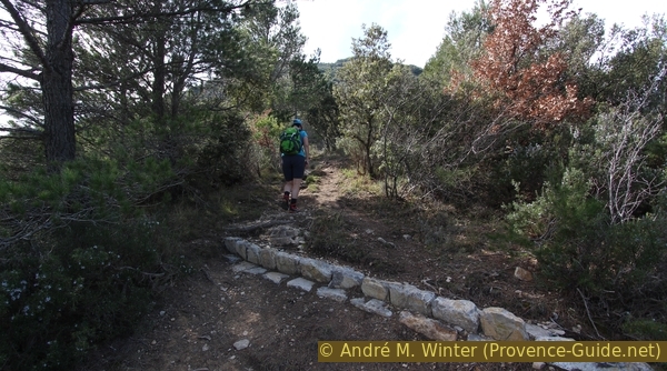
The path was rearranged around 2015, the stable drainage channels were built so that the water does not rut the path. Hewn stone stairs help with the ascent, but the 180 meters of altitude remain tough. At least you're in the shade here if you set off early enough.
No reproduction is permitted without the written consent of the author. (id3758)
Rainwater drainage channel north of the Petit Bessillon
If we stop to catch our breath, we already have a foretaste of the panorama that awaits us at the top, and the Verdon mountains can also be seen on the horizon.
No reproduction is permitted without the written consent of the author. (id3757)
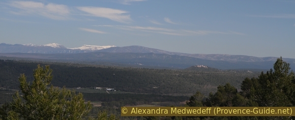
Mountains to the north-east: Chiran, Mourre de Chanier and Grand Margès
lacet = hairpin
citerne = water tank
table d'orientation = panoramic table
sommet principal = main summit
crête = ridge
At the moment when you think you have to go on all fours because the terrain is becoming more and more vertical, the path makes walking a little easier, leading to a single bend to the right. The last 30 meters are again vertical.
No reproduction is permitted without the written consent of the author. (id3759)
The single bend on the way up the Petit Bessillon
By the time the path becomes flat we are already on a natural platform near the east summit of Petit Bessillon. The actual summit is wooded, but two panoramic tables have been set up for hikers. We are now close to the northern panorama. Here the view extends from the Luberon over the Verdon to the Esterel.
No reproduction is permitted without the written consent of the author. (id3760)
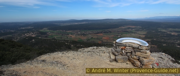
Panoramic table at the Petit Bessillon, view to the north
Only the Gros Bessillon obstructs the free view to the east. And you can see very well from here that the other approaches are no less rough.
No reproduction is permitted without the written consent of the author. (id3761)
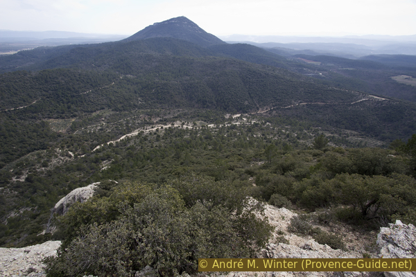
Mount Gros Bessillon to the east
You can also see the starting point from here.
No reproduction is permitted without the written consent of the author. (id3762)
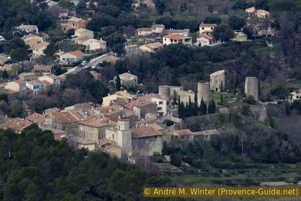
The old center of Pontevès and the castle ruins
Section 3: Sommet Est - Sommet Ouest
➙ 0,5 km ... 25 min ➚ 10 m ➘ 85 m ↝ easy
65% easy trails, with marks
20% via ferrata, with marks
15% moderate trails, without marks
The clues
- East summit Petit Bessillon north, 665 m
- East summit Petit Bessillon south, 665 m
- Cleft in the Petit Bessillon ridge, 630 m
- Western summit of Petit Bessillon, 640 m
We pass the rugged ridge that is exposed on both sides.
The path now dives between small oaks and passes a first rocky stretch with insurances that hell passing this section. But the job is not very difficult.
No reproduction is permitted without the written consent of the author. (id3763)
Rocks to pass to get to the southern part of the Petit Bessillon
When you come out of the forest again after a few minutes, there is also a panoramic view here, this time with a southern view. Here the view extends from the Gros Bessillon to the Massif des Maures over the Cuers ridge, la Montagne de la Loube, the Massif de Sainte-Baume and the Sainte-Victoire! Yes, you absolutely have to choose a day with good visibility for this tour if you really want to enjoy it.
No reproduction is permitted without the written consent of the author. (id3764)
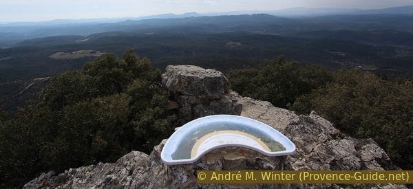
Panoramic table of the Petit Bessillon facing south
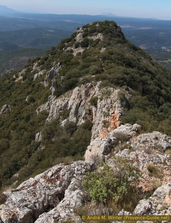
From this point, looking west, one can clearly see the further course of the tour: there is a little forest, a ruin and, further away, the western peak, which is 30 metres lower than the eastern one. In the photo these are the rocks on the left which appear to be in the side of the wooded hill.
No reproduction is permitted without the written consent of the author. (id3765)
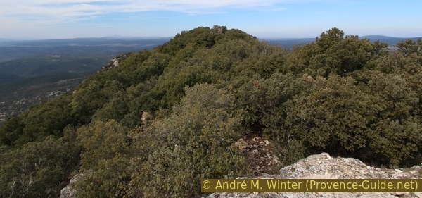
View over the ridge to the west
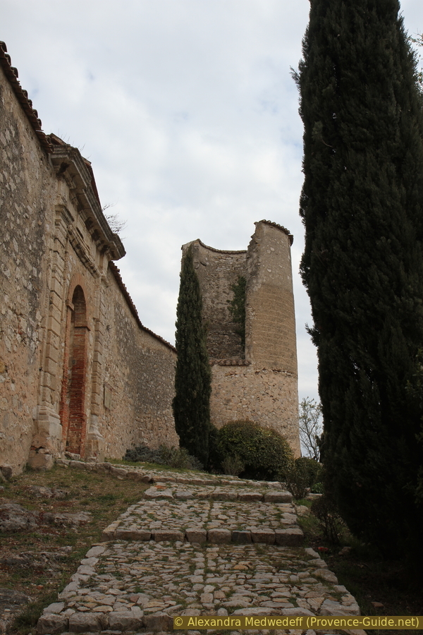
We quickly come to the remaining walls of a watchtower built by the squires of Pontevès.
The tower was built with great care.
No reproduction is permitted without the written consent of the author. (id3766)
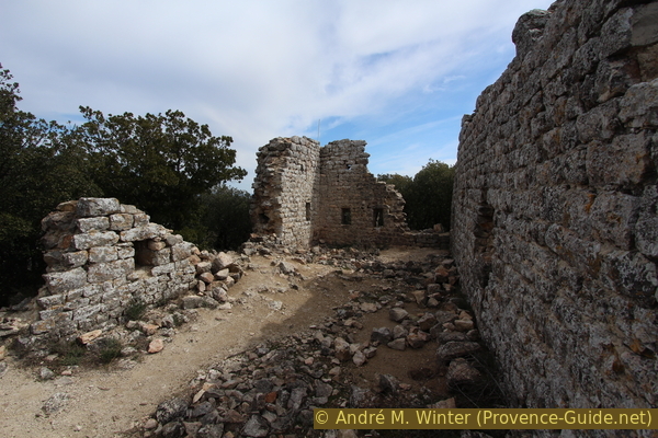
Ruins of the watchtower of Pontevès
As we continue west, the second peak of Petit Bessillon comes fully into view. This is an even more prominent cone than the eastern peak. You go from one peak to the other directly on the crest, which is more exposed than it appears from here.
No reproduction is permitted without the written consent of the author. (id3767)
On the ridge of Petit Bessillon
First you have to descend into the hollow between the two peaks. The ridge is quite wide at first, but it quickly becomes rocky. Here, too, some iron bars help to overcome the steep passage.
No reproduction is permitted without the written consent of the author. (id3768)
Short climb on the Petit Bessillon ridge
After a flat and easy stretch, the view opens onto the heart of the Petit Bessillon ridge. It is a craggy ledge that ends in a vertical cliff to the south and a forest that hides the vertical cliff to the north. A handrail helps in the tightest and most exposed spots. The passage is not problematic, but it is not recommended for people who have a head for heights.
No reproduction is permitted without the written consent of the author. (id3769)
Rocky stretch on the Petit Bessillon crest
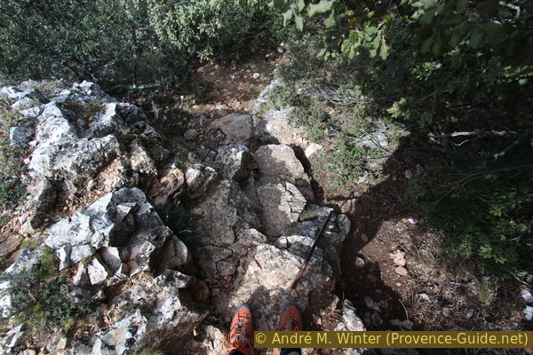
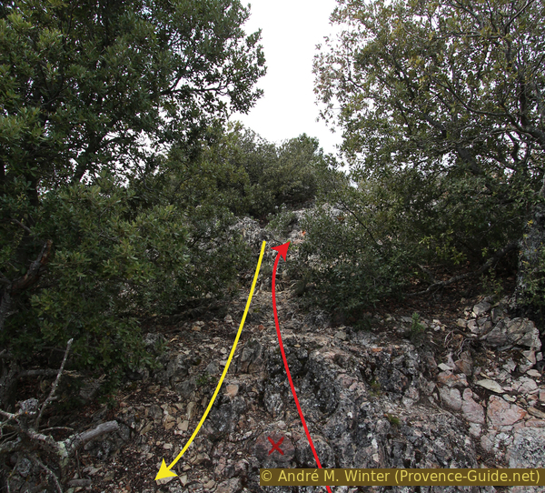
First you have to descend into the cleft of the ridge, the steepest part is secured by a large steel chain. This descent is not difficult, but it is advisable to go through it one at a time to avoid getting your fingers caught in the chain if two people pull on it at the same time.
No reproduction is permitted without the written consent of the author. (id3770)
Descent into the cleft of the Petit Bessillon ridge
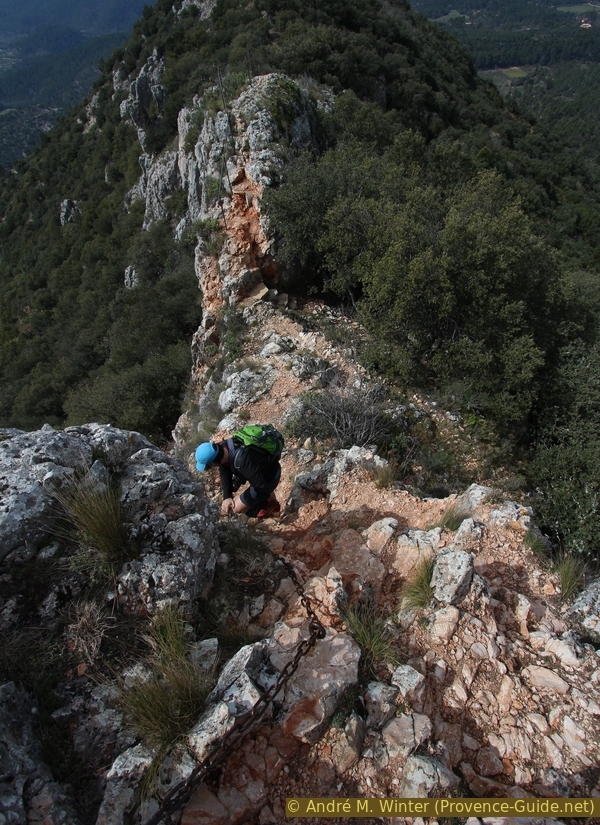
Climbing up from the crevasse is almost like stairs. Here the ridge becomes even narrower, but the handrail accompanies the path. You really have to be careful where you put your feet and only pay attention to the path, not the panorama.
No reproduction is permitted without the written consent of the author. (id3772)
Railings on the rocky ridge of Petit Bessillon
Finally we descend one last rocky step before finding ourselves on the flat saddle east of the western summit. The marked trail runs to the left and past the western peak. A path, however, allows us to go up where we can see Pontevès in its entirety.
No reproduction is permitted without the written consent of the author. (id3773)
Path to the western summit of Petit Bessillon
The western peak is different: it is formed by a natural plateau with steep edges, which is also why the official trail circles around it.
No reproduction is permitted without the written consent of the author. (id3774)
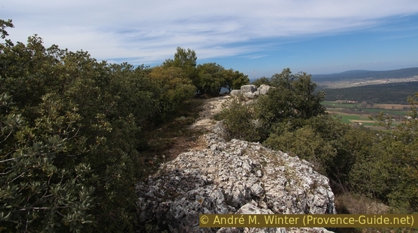
West summit of Petit Bessillon
Section 4: Sommet Ouest - Pontevès
➙ 2,3 km ... 45 min ➚ 30 m ➘ 210 m ↝ easy
5% moderate trails, without marks
25% easy trails, with marks
50% dirt roads, few marks
25% hard-surfaced city alleys, without marks
The clues
- Petit Bessillon West Summit, 640 m
- Carrefour les Piés, 430 m
- Shrine in Rue des Puits, 375 m
- Castle ruins in Pontevès, 405 m
- Church square in Pontevès, 395 m
The descent is along the southern flank of the western summit of Petit Bessillon. After a somewhat arduous passage, the incline becomes a little gentler to then we go back to the village.
No reproduction is permitted without the written consent of the author. (id3777)
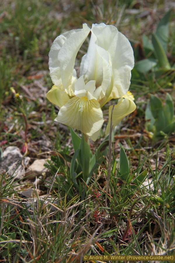
Crimean iris blooms here in March
To descend from the mountain, you have to go back to the marked trail. This now reels off all previously accumulated altitude metres. First you go southeast of the second peak, the path is steep but in good condition.
No reproduction is permitted without the written consent of the author. (id3775)
Descent from the Petit Bessillon to the west
Very quickly our path passes the southern flank, becomes less steep, to end on a ridge west of the summit.
No reproduction is permitted without the written consent of the author. (id3776)
Path south-west under the Petit Bessillon
We descend further on an earthy ridge on a straight slope to a forest road junction. Here we turn right and continue descending into the valley where olive trees are planted.
No reproduction is permitted without the written consent of the author. (id3778)
Junction west of the Petit Bessillon
chateau = castle
Generally speaking, from now on you always keep in the same direction north. This track becomes flat, you pass a wayside shrine, come out on an asphalt road and end with an ascent back to the village centre of Pontevès, now on the rue des Puits. At the top you return to the central square on the right, on the left the path leads to the parking lot at the school.
No reproduction is permitted without the written consent of the author. (id3779)
Rue des Puits in Pontevès
We go up the narrow lane on the right.
To get to the castle, we continue straight ahead, opposite rue des Puits, so we ascent in the old village. At the highest point is the entrance to the ruins.
Sources and additional information
It is better to use a good topographical hiking map: this tour is on the IGN "Aups-Salernes" map, scale 1:25000, 3443OT.
If you don't want to bother with a paper map, you can also use mapping apps on your cell phone. On the one hand, it is the Cartes IGN app from the official map service. However, it requires access to the data network and this is sometimes difficult in canyons or remote locations.
Alternatively, you can use apps that store data directly on the device. They're generally not free, but they don't cost much. We mainly use OSMAnd, here it is possible to add contour lines, relief shading, markings and others. To store this data on your phone you need a lot of space.
Of course, one needs access to satellites for the GPS signal with any app. In some canyons this is not the case. Therefore, do not rely on the position shown, but read the map on your phone as you would read it on paper. Most apps are available for Android and iPhone. The applications usually allow us to record the route travelled and also view the GPS files offered for each of our hikes.
This page has been seen 2212 times since 20 March 2024.
No reproduction is permitted without the written consent of the author. (id2921)
Access to the ruins of Pontevès Castle