Panorama from Croix des Pins and Caves of Aups
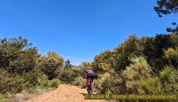
The Montagne des Espiguières is not for the faint mountain biker.
MTB tour
difficult
3 h 30 min
yes
yes
no
8 % of the distance
Introduction
Aups is a stopover town between the Côte and the Verdon. Yet it's also a place worth discovering. The mountain bike tour described here isn't particularly long, and the elevation gain isn't daunting. However, there are long stretches on tracks covered with large, very uneven limestone scree. Sometimes they're also too steep to climb. So, it's often impossible to go fast. But we're rewarded with a superb view of the village of Aups, the Gros Bessillon and Petit Bessillon mountains, the Sainte-Baume, and even the Montagne Sainte-Victoire (these links point to hiking trails). During the descent, we explore several caves, some of which have been used by humans, like the Sainte-Magdeleine Chapel.
We ascend from the west and north and descend from the west and south.
The facts
13,9 km total distance
3 h 30 min movement time.
460 m total elevation
orientation average
mark 65% of the total distance
40% rutted forest roads
20% forest roads
20% hard-surfaced city alleys
5% moderate trails
5% hard-surfaced quiet side streets
5% passages too steep and to carry
5% very steep passages
<5% trail through a cave
<5% dirt roads
<5% easy trails
dangers Wind, fall on rough forest roads
children no
useful picnic stuff, puncture repair kit
required Hardtail mountain bike and water
GPS coordinates (WGS84) of start and end point 43.62720801218102,6.224157980312031
downloads ![]()
![]()
Public transport
Aups is only connected by bus to Draguignan, and Draguignan has direct connections to the Saint-Raphaël train station. Check the timetables and connections on Zou! (only french).
Access by car
Aups is located southwest of the Verdon Gorge and the Canjuers military camp. Whether coming from the Durance Valley (A51) or the A8 motorway, it always takes about fifty minutes on small country roads to reach the small town of Aups, the capital of the Haut-Var region.
Useful parking spaces
The starting point is on Place Frédéric Mistral, south of the church and the old town centre. There is a parking lot here, but it is often full and parking is prohibited on market days. It is recommended to turn at the large building housing the Maison de la Truffe (Truffle House) towards south and the gymnasium. There are three large parking lots there. These are also directly on the return route.
No reproduction is permitted without the written consent of the author. (id7742)
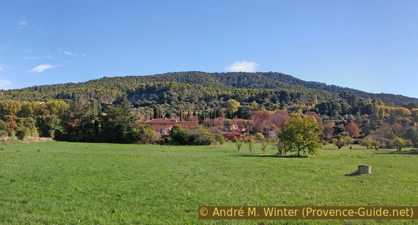
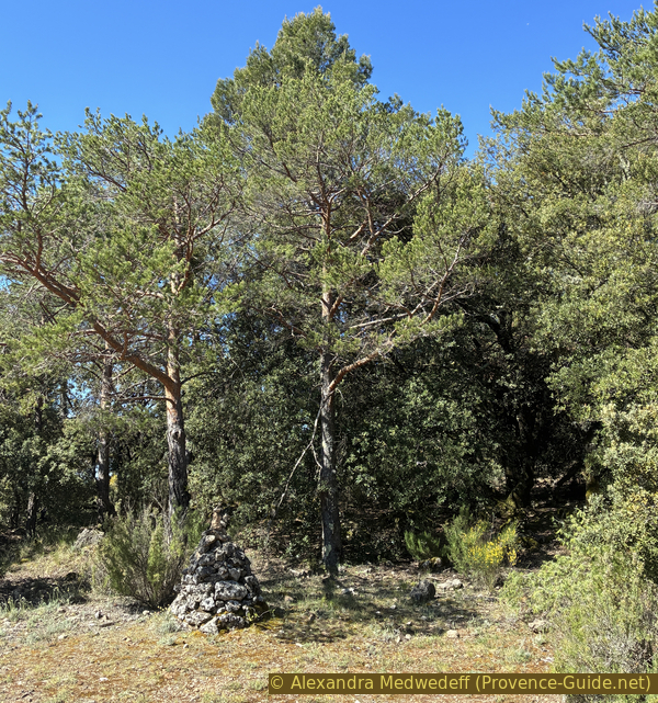
Montagne des Espiguières seen from Les Prés d'Aups
Under the cliffs on the left are the caves. The cross is located on what appears from here to be the highest point of the mountain, so slightly to the right of the center of the photo.
No reproduction is permitted without the written consent of the author. (id8947)
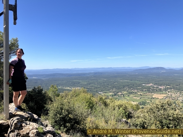
Alex at Croix des Pins
Hints
As mentioned in the introduction, the condition of the trails is the main challenge of this tour. The forest roads are covered with stones of varying sizes, sometimes in large quantities. Steep sections that could normally be climbed are there difficult to push because you slip. This will also give your arms a good workout.
A shorter tour with the same destinations is available as hike under Aups Caves and the cross Croix des Pins.
The whole region is a zone with a high risk of forest fires. In summer, but also in other seasons when it is very dry or by strong winds, access to the forest areas can be regulated. As a result, the roads may be closed to traffic and/or the trails prohibited to hikers. Current information: Map of access to the forests of the Var (also english). The map shows the colours green, yellow, orange and red which correspond to levels of danger. The affected area is: le Haut Var (3).
The sections
- The Chemin des Devenseaux climbs west of the Montagne des Espiguières.
- We follow the mountain's northern foot via the Grande Colle, a long, ascending valley.
- The final climb begins at the Col du Bresc pass and leads to the Croix des Pins.
- We then follow the ridge westward and descend to the Chapelle Sainte-Trinité.
- Exploration of the Grottes d'Aups and return to the starting point.
Section 1: Chemin des Devenseaux
➙ 2,6 km ... 35 min ➚ 125 m ➘ 15 m ↝ easy
↙ Colours of the sections like MTB rating but without the duration.
80% hard-surfaced city alleys, few marks
20% forest roads, few marks
The clues
- Église d'Aups, 495 m
- Chemin de la Croix des Pins, 620 m
- Tank AUP09, l'Estré, 605 m
We have a long approach along a small paved road with a fairly consistent incline. It's shady here in the morning.
Behind the large triangular square of plane trees at the foot of the old center of Aups is this fountain, and to the right, the Collegiate Church of Saint Pancrace.
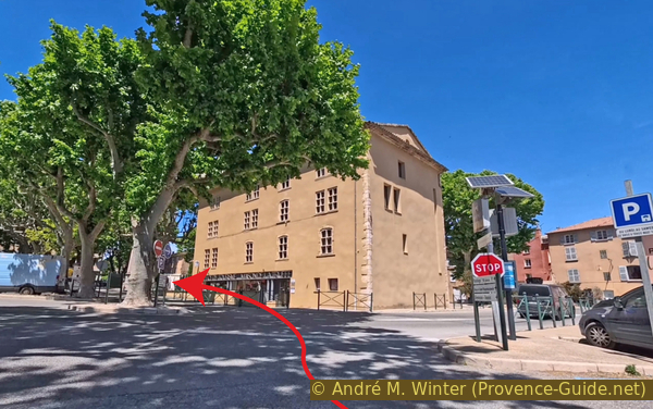
To avoid the crowds on the main street and the one-way street, we turn right just behind the church.
During the establishment of the Napoleonic dictatorship, the insurgents of Aups took refuge in the church on December 10, 1851. They were all killed, arrested, deported, or imprisoned. On December 9, 1905, the law separating church and state was finally promulgated. It was at this time that the people of Aups placed the motto of the French Republic above the church portal (Liberté, Égalité, Fraternité), also in part as a reminder of 1851.
No reproduction is permitted without the written consent of the author. (id1699)
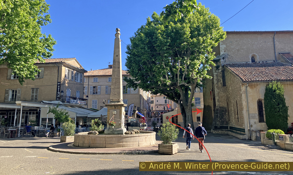
The church square in Aups
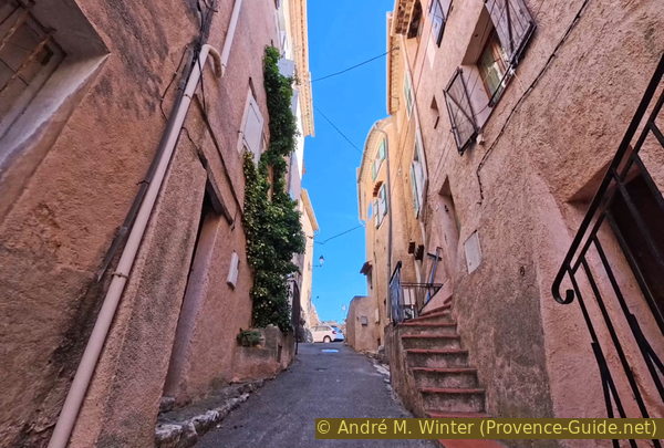
Just after turning behind the church, take the first alley on the left. A sign indicates a width restriction of 1.5 meters, so you won't encounter many cars here.
No reproduction is permitted without the written consent of the author. (id2665)
Turn onto Rue de l'Hôpital Vieux
This alley climbs steeply. You'll be warmed up by the top!
At the very top, turn left to reach a gate in the medieval walls.
The name Porte des Aires comes from the public threshing floors where grain was treaded. Located on higher ground and exposed to the wind, it was easier to separate the grains from the dust and husks.
No reproduction is permitted without the written consent of the author. (id2156)
Struggling climb
Exit through this gate onto a roundabout where you turn left. Be careful, there is often a lot of traffic here.
Alternatively, you can drive on the sidewalk to the left and cross at the pedestrian crossing to avoid going around the roundabout.
No reproduction is permitted without the written consent of the author. (id2225)
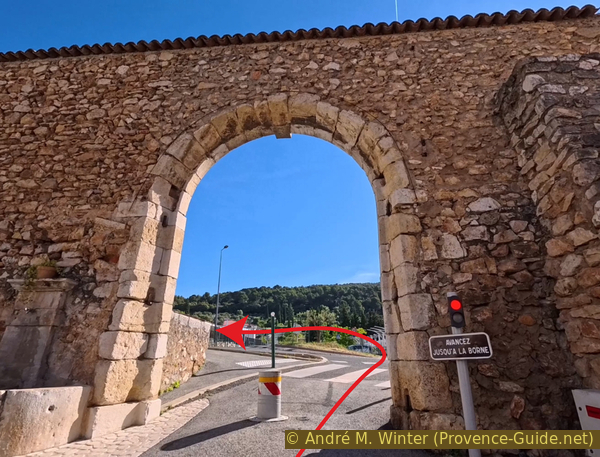
Exit through the Porte des Aires north of the town of Aups
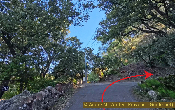
We don't linger long on this northern ring road around Aups. We take the first right. We're now on the Chemin des Devensaux.
There are several ways to spell it: it's also found as Devenseaux or Devencaux. It's a local variant of the word Défens, which historically referred to a pasture or wood reserved for the lord, and therefore forbidden to the common people.
No reproduction is permitted without the written consent of the author. (id3060)
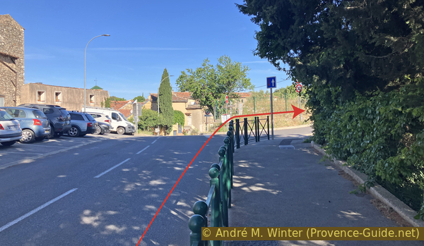
Turn onto Chemin des Devenseaux
This road accompanies us to the end of this first section.
It's initially quite freshly paved up to the ruins of the Sainte-Anne Chapel.
No reproduction is permitted without the written consent of the author. (id6238)
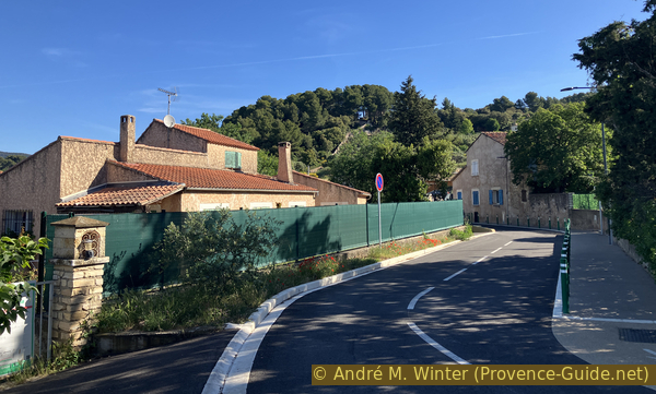
Chemin des Devenseaux
Beyond that point, the tarmac is older but in good condition. However, the constant incline soon becomes noticeable.
We pass this single hairpin bend.
No reproduction is permitted without the written consent of the author. (id895)
Hairpin bend on Chemin des Devenseaux
This road manages to maintain its gradient in a very rocky environment.
No reproduction is permitted without the written consent of the author. (id957)
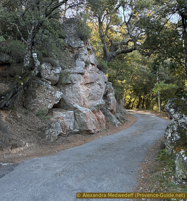
The Chemin des Devenseaux passes between rocks
Further up, we reach a more uniform area planted mainly with olive trees.
This doesn't mean the slope changes, however.
No reproduction is permitted without the written consent of the author. (id1198)
The Chemin des Devenseaux leaves the town
We pass a few isolated houses. They offer views of the Bessillons and Sainte-Baume mountains.
No reproduction is permitted without the written consent of the author. (id1702)
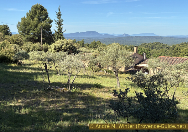
An isolated house on Chemin des Devenseaux
At this intersection, the asphalt turns into a dirt track in good condition.
No reproduction is permitted without the written consent of the author. (id1145)
End of the asphalt on Chemin des Devenseaux
We continue straight ahead, and after a few meters, there's a slight descent leading to the junction at L'Estré with the AUP09 water tank.
No reproduction is permitted without the written consent of the author. (id1212)
Continuation of Chemin des Devenseaux
During this descent, we can even take the time to admire the well-maintained olive groves.
No reproduction is permitted without the written consent of the author. (id1358)

Olive groves north of Aups
Section 2: Piste de la Grande Colle
➙ 3,6 km ... 35 min ➚ 145 m ➘ 0 m ↝ easy
↙ Colours of the sections like MTB rating but without the duration.
100% rutted forest roads, few marks
The clues
- Water reservoir AUP09, l'Estré, 605 m
- Junction direct ascent, 620 n
- Pass Col du Bresc, 750 m
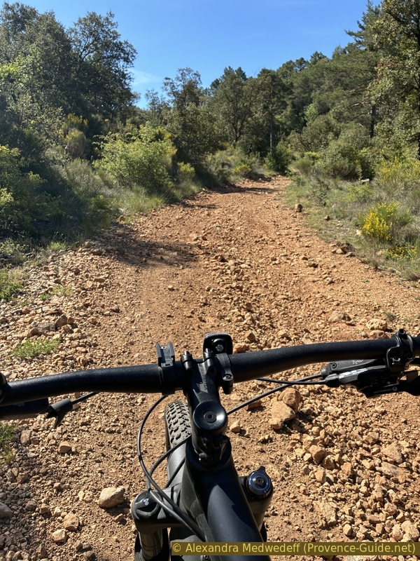
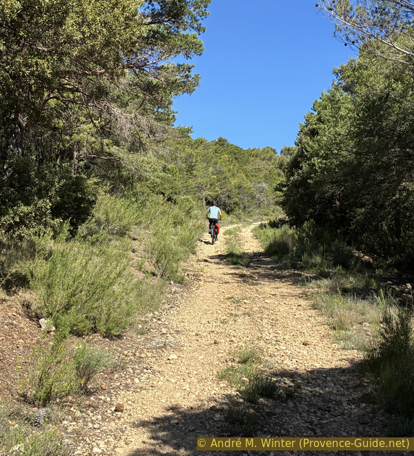
This is where things get serious. The gradient isn't as steep as before, but it's still fairly consistent uphill. The condition of the track, however, is much worse. It's through bumpy, there's hardly a smooth section.
We turn right at the water tank AUP09 and stay on the main path for over three kilometres and 145 meters of elevation gain ahead.
We're so busy pedalling and searching for the smoothest path that we don't realize we're passing several bends in a slightly narrower valley.
No reproduction is permitted without the written consent of the author. (id1497)
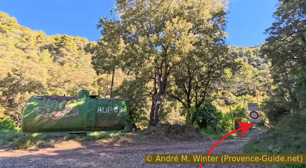
AUP09 tank and trail K62 Grande Colle
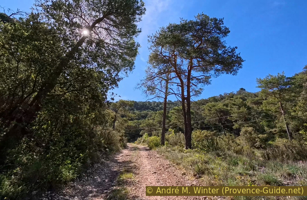
The valley becomes straighter. It runs west-south-west, and in the mornings during spring and autumn, we're already well into the sun. The gradient and the condition of the track remain the same, and this is when it becomes difficult.
No reproduction is permitted without the written consent of the author. (id1241)
Trail K62 Grande Colle
We pass several junctions that we have to ignore. This one is the only one to the right and to the south. This would be the direct route to Croix des Pins, but this track in the Ravine is too steep. So we wisely stay on our Grande Colle track.
No reproduction is permitted without the written consent of the author. (id1352)
Fork in the Grande Colle trail at point 668
Numbered water tanks mark our path. Continue straight ahead here.
No reproduction is permitted without the written consent of the author. (id1418)

AUP19 tank in the Grande Colle valley
Ignore all left turns and ride straight ahead.
No reproduction is permitted without the written consent of the author. (id1169)
Fork to the east of the AUP19 cistern in the Grande Colle Valley
In spring, at least there are flowers here. Otherwise, this section is typical: a constant climb with varying bad gravel surfaces.
No reproduction is permitted without the written consent of the author. (id1059)
A bit of shade in the Grande Colle Valley near point 689
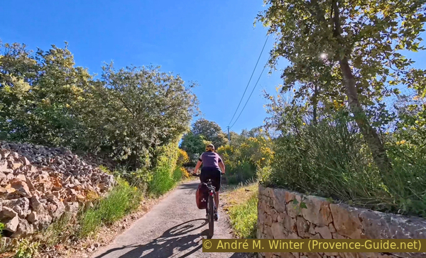
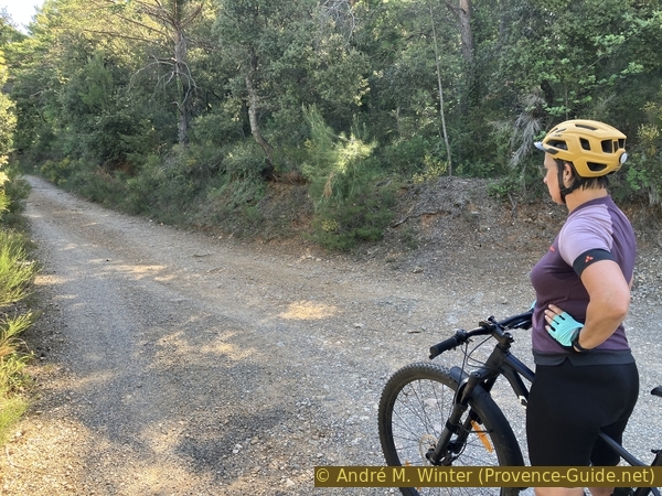
There are also many sections with very bumpy surfaces. Naturally, this slows you down considerably on the climbs.
No reproduction is permitted without the written consent of the author. (id1367)
Alex on the rough track in the Grande Colle Valley
This trail is marked with small black enduro mountain bike markers (very difficult) on the climbs but not on the descents. However, it's clear that it's rarely, if ever, used, as there are no visible tracks.
No reproduction is permitted without the written consent of the author. (id1560)
The track continues to climb in the Grande Colle Valley
We also ignore these left turns and always stay to the right.
No reproduction is permitted without the written consent of the author. (id1211)
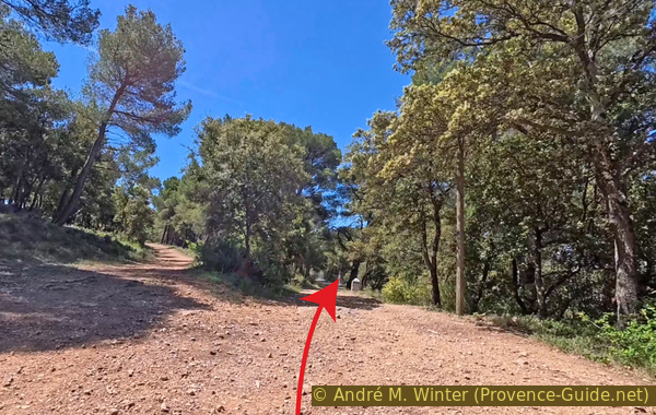
Trail junction north of the Col du Bresc
This AUP18 water tank is located almost at the Col du Bresc pass. We gradually turn right here to finally begin climbing the ridge of the Montagne des Espiguières. We take the right fork at the next junction and thus continue uphill.
No reproduction is permitted without the written consent of the author. (id1066)
AUP18 cistern with the turning track
Section 3: Col du Bresc - Croix des Pins
➙ 2,3 km ... 45 min ➚ 125 m ➘ 60 m ↝ easy
↙ Colours of the sections like MTB rating but without the duration.
10% rutted forest roads, few marks
20% passages too steep and to carry, few marks
↖ obligation to push/carry the bike
20% rutted forest roads, few marks
35% forest roads, few marks
10% moderate trails, with marks
↖ leave the bike and explore on foot
The clues
- Pass Col du Bresc, 750 m
- Highest point, 875 m
- Croix des Pins, 815 m
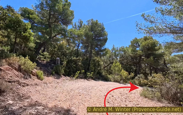
The final climb is a steep incline over loose gravel, requiring some pushing at times. Then it's almost flat at the top. To reach the Croix des Pins, we'll have to leave our bikes because the limestone terrain is too rugged, even though the path is relatively flat overall.
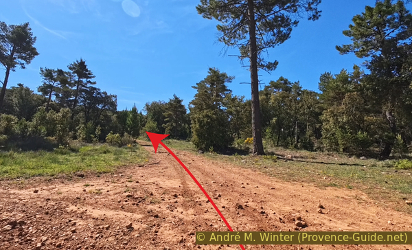
So we turn right here at the small cairn. The junction isn't any better marked.
No reproduction is permitted without the written consent of the author. (id1620)
Turn at the Col du Bresc
A little further on is this large, old cairn on the left. A path also descends to the left here, later joining the track towards Aups. This is where the old paths used to run, the forest tracks reveal the pass further down.
We continue straight ahead, however.
No reproduction is permitted without the written consent of the author. (id1754)
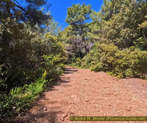
Large cairn at the Col du Bresc
We pass this barrier, and it still looks fairly easy.
No reproduction is permitted without the written consent of the author. (id1320)
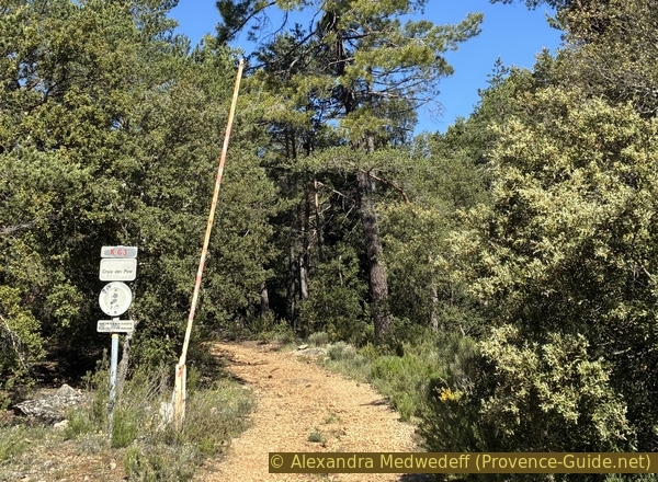
Track K63 La Croix des Pins
But things quickly get difficult. The gradient exceeds 13%, and the track is covered with a layer of loose gravel that doesn't withstand the force of our rear wheels. So we push.
No reproduction is permitted without the written consent of the author. (id1135)
Track K63 La Croix des Pins is very steep climbing from the Col du Bresc
Here the path splits. The left-hand path leads to the mountain's highest point, but the slope is even steeper and the view is no better than at the cross later on. So we stay on the right-hand path.
No reproduction is permitted without the written consent of the author. (id1039)
Division of the track
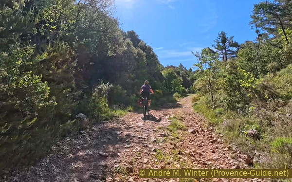
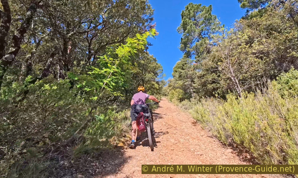
At times, the gravel is smaller and more stable, allowing us to climb back up and pedal. It's still a bit of a slog, though.
No reproduction is permitted without the written consent of the author. (id1508)
André climbs the Track K63 La Croix des Pins on his mountain bike
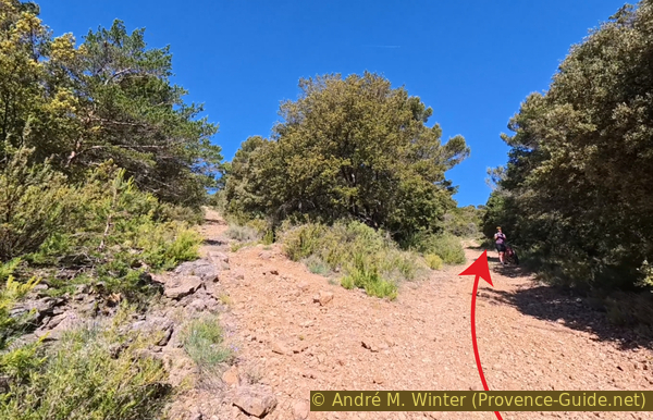
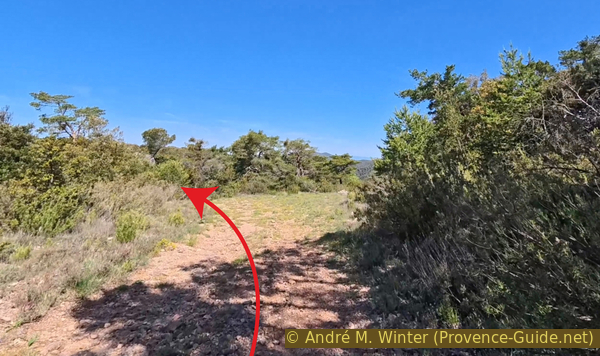
When the left-hand path rejoins our route, we're on the mountain plateau. It even descends again, so we can let our mountain bikes roll freely.
Many species of maquis grow in this area: savory, thyme, rosemary and lavender.
We pass this junction, which corresponds to the direct climb to the cross seen before form La Grande Colle valley. So we stay here on the left.
No reproduction is permitted without the written consent of the author. (id1074)
Junction on the Croix des Pins track
Shortly after, we reach the AUP17 cistern and a sign clearly indicating the path to the cross.
Take the left-hand path here.
No reproduction is permitted without the written consent of the author. (id1194)
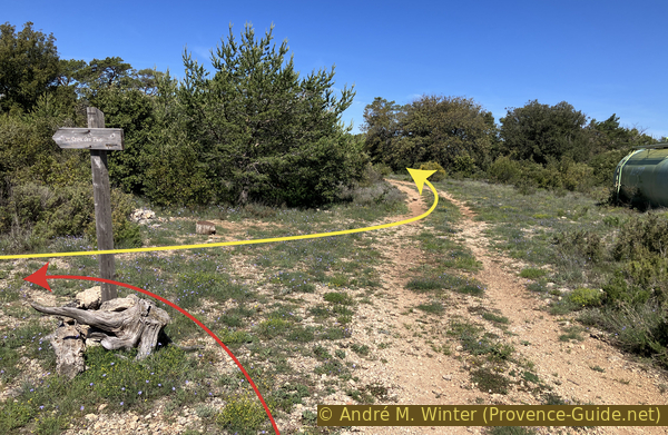
Junction towards Croix des Pins and the AUP17 cistern
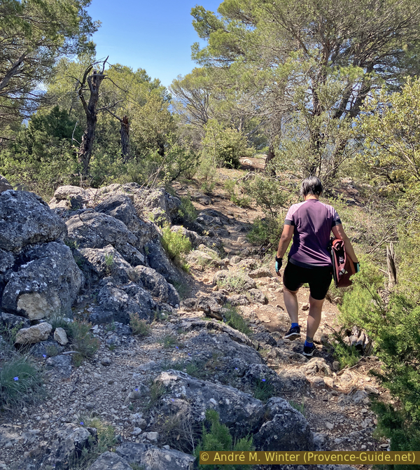
The trail crosses natural limestone terrain, and we haven't found a way to ride here. So we leave the mountain bikes at the side of the path quite early and continue on foot.
We take our panniers because we'll have lunch at the cross.
No reproduction is permitted without the written consent of the author. (id1505)
Very rough path towards Croix des Pins
There we are, the first goal of the day is achieved.
In the center of the cross is a flat, oval mirror. We don't know if it reflects some special ray of light at a particular time of year. At the ends of the crossbar are LED lights powered by small solar panels, so the cross can be seen at night from the plain and from Aups at night.
No reproduction is permitted without the written consent of the author. (id1322)
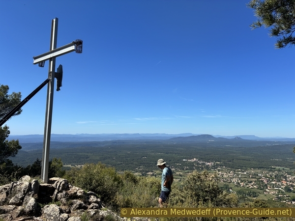
André at Croix des Pins
Descending further past the cross, the view opens up to a panoramic 180 degrees to the south.
The two prominent green mountains in the center are the Gros Bessillon and the Petit Bessillon. Just behind them rise the Sainte-Baume and Mont Aurélien. Further still, in the distance, could be the Chaîne de l'Étoile mountain range. The distinctive dome to the right is none other than Sainte-Victoire, seen from the east. To the left, more diffuse, lies the Massif des Maures.
No reproduction is permitted without the written consent of the author. (id1628)
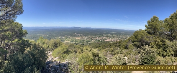
The town of Aups below the Montagne des Espiguières
Section 4: Descente par les Devensaux
➙ 3,1 km ... 40 min ➚ 20 m ➘ 270 m ↝ average
↙ Colours of the sections like MTB rating but without the duration.
10% moderate trails, leave the bike and explore on foot
40% forest roads, without marks
15% very steep passages, without marks
30% rutted forest roads, without marks
10% hard-surfaced quiet side streets, without marks
The clues
- Croix des Pins, 815 m
- Water tank AUP17, 835 m
- Chemin de la Croix des Pins, 645 m
- Chapelle de la Trinité, 560 m
As soon as we return from the cross to the track, it goes all downhill until the end of the loop. But don't be fooled, the descent is faster than the climb, so the gradient here exceeds 14%, still on the same track of loose limestone rubble. Honestly, we pushed through a few downhill sections here.
We return from Croix des Pins to the track with the AUP17 water tank and turn left.
As long as we stay on the ridge, the downhill slope is gentle. The track's condition varies, but it's mostly very rough.
No reproduction is permitted without the written consent of the author. (id8946)
The track on the Montagne des Espiguières
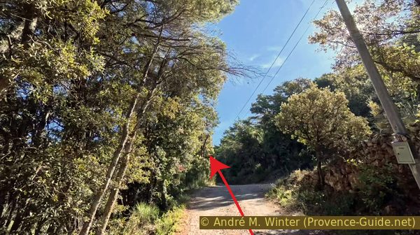
About 900 meters past the AUP17 water tank, the steep descent begins.
The photo shows the point where it starts to get steeper.
No reproduction is permitted without the written consent of the author. (id1379)
Steep descent of the trail to the west
Along the track are sorb trees. They are only truly noticeable in autumn when their golden fruits adorn the trees. The fruits are edible and quite sweet here in the Haut-Var region. The tree itself is becoming increasingly rare because its hard wood is highly prized.
No reproduction is permitted without the written consent of the author. (id7701)
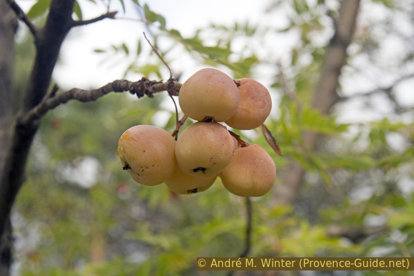
Fruits on sorb tree
We have about one kilometre to cover on a track in this condition, with gradients reaching 14%. There are sections where the limestone debris causes the front wheel to slip sidewise by about 20 centimetres, which is very dangerous. It's best to get off your bike then.
No reproduction is permitted without the written consent of the author. (id1133)
Steep and chaotic descent of the trail to the west
When you encounter this concrete the track, it means the gradient is getting steeper. The concrete provides good grip, but it's a real workout for your arms!
At the bottom, we turn left.
No reproduction is permitted without the written consent of the author. (id1072)
Concrete section on the trail above point 643 and the AUP08 cistern
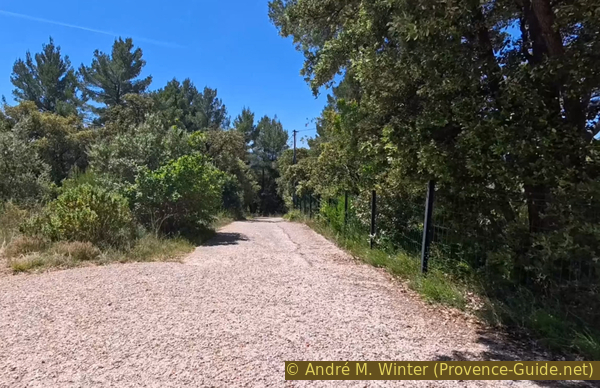
We find ourselves back on a dirt road that is a little gentler around the AUP08 tank.
No reproduction is permitted without the written consent of the author. (id1952)
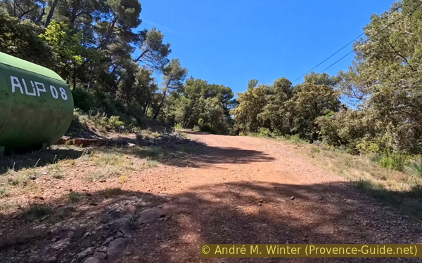
AUP08 cistern and the gentler trail
At this intersection, we keep right, continuing downhill.
For a while now, our descent has been marked by large stone markers. They delineate a section of the southwest slope of the Montagne des Espiguières. Does anyone know their significance?
No reproduction is permitted without the written consent of the author. (id1371)
Fork below the AUP08 cistern
A little further down, three switchbacks lead to a wider bend. Here, the road is in the worst condition, with large, loose debris piled up on the track.
No reproduction is permitted without the written consent of the author. (id1535)
First hairpin bend
The bends aren't the most difficult part, it's the straight sections between the switchbacks that are particularly bumpy.
No reproduction is permitted without the written consent of the author. (id1510)
Concrete section of the trail between the hairpin bends
Near the first house, we reach a concrete section. It slopes gently, however, and further on, there's asphalt. We pass a bigger water reservoir and continue downhill.
No reproduction is permitted without the written consent of the author. (id1766)
Concrete section of the trail
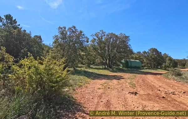
We arrive at this large crossroads, which is a turnaround area. Hidden in the bushes directly ahead is an old chapel!
No reproduction is permitted without the written consent of the author. (id1767)
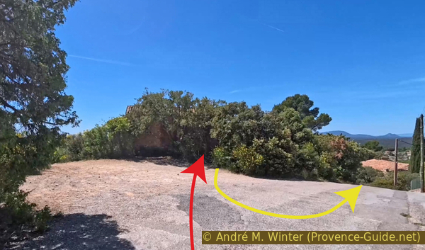
Crossing above the Chapelle Sainte-Trinité
It's a small 11th-century chapel about which little is known. A milestone was used as a building block in the base of one of the walls. A doorway was cut into the side when the building was converted into a barn.
No reproduction is permitted without the written consent of the author. (id1868)
La Chapelle Sainte-Trinité
We ride around the chapel along the road to its right and take the first path on the left.
No reproduction is permitted without the written consent of the author. (id1209)
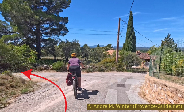
Road to the west below the Chapelle Sainte-Trinité
Section 5: Les Grottes d'Aups
➙ 2,2 km ... 1 h ➚ 45 m ➘ 115 m ↝ difficult
↙ Colours of the sections like MTB rating but without the duration.
5% forest roads, few marks
10% trail through a cave, without marks
↖ leave the bike and explore on foot
<5% forest roads, few marks
20% hard-surfaced quiet side streets, without marks
5% moderate trails, without marks
5% trail through a cave, without marks
↖ leave the bike and explore on foot
15% moderate trails, few marks
10% hard-surfaced city alleys, without marks
15% dirt roads, without marks
5% easy trails, without marks
10% hard-surfaced city alleys, without marks
The clues
- Chapelle de la Trinité, 560 m
- Cave Grotte des Fées, 560 m
- Troglodytic cave near Saint-Marc, 595 m
- Chapelle Sainte-Magdeleine, 560 m
- Carraire 1, 485 m
- Aups church, 495 m
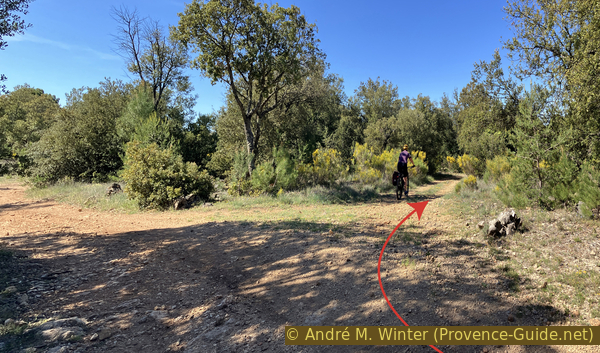
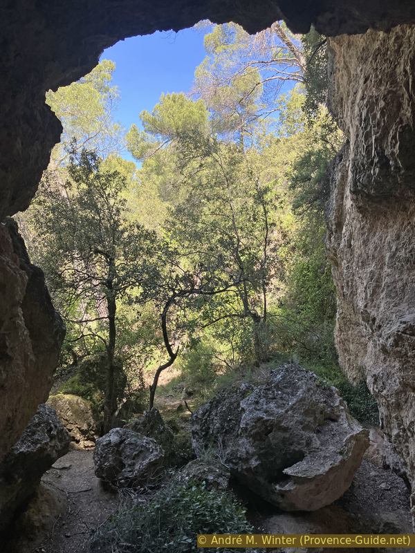
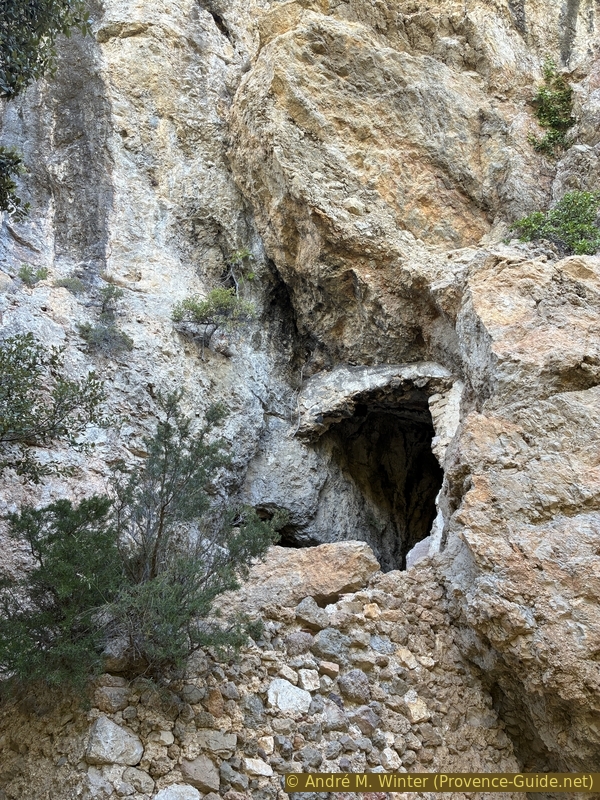
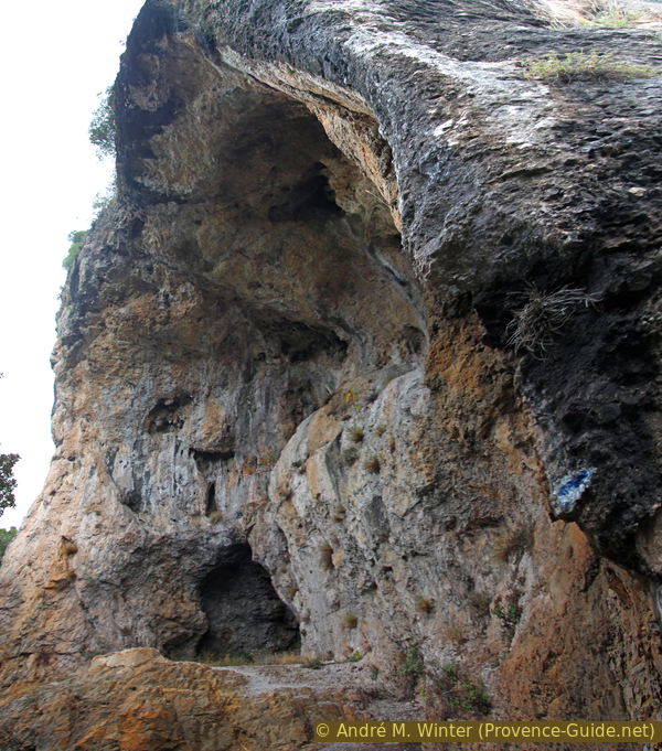
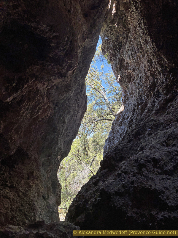
Here we are in the section with nine caves to visit. They are all located along the same cliff, visible from Aups. A path runs alongside them, it's easily passable by mountain bike, but of course, we'll stop more or less every 20 meters to explore another cave. Yes, the rides here aren't just about sport, there's always an exploratory and historical aspect as well.
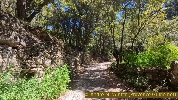
So, we turned left under the Sainte Trinité Chapel. We find ourselves on an easy forest track. It brings us straight to the most important caves in the cliffs above Aups.
We park our mountain bikes under the trees because we were now going to pass through four caves in a row.
No reproduction is permitted without the written consent of the author. (id1383)
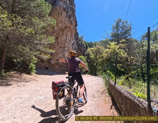
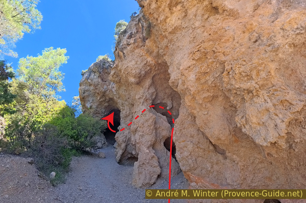
Arriving below the Grotte des Fées
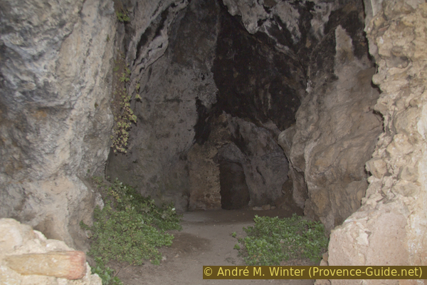
These caverns aren't particularly long, but the composition of the rock makes that there are several openings in the same cave.
Thus, one can enter the small opening #1 and emerge fairly quickly into the access arch of the larger cave #2.
No reproduction is permitted without the written consent of the author. (id2262)
Below the Grotte des Fées
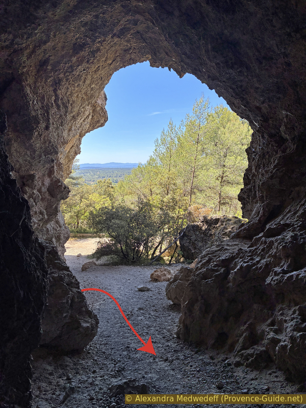
This opening is about twenty meters high and is initially easily accessible on a gravel floor. But very soon, one must climb over rocks.
Advancing in a fairly straight line, one arrives at a slope composed of rock debris fallen from the ceiling. Ahead, below, lies a vast, dark chamber. Descent is possible with a good flashlight, but it's a dead end. However, one can feel a draft, so there must be another opening. We'll find it soon!
No trace of human occupation is visible in these caves. But it's highly likely they were occupied during the protohistoric period. The Aven de Plérimond, south of Aups, houses an Iron Age ossuary. Its use is attested until the 4th century CE.
No reproduction is permitted without the written consent of the author. (id2199)
View back from the large opening of the Grotte des Fées
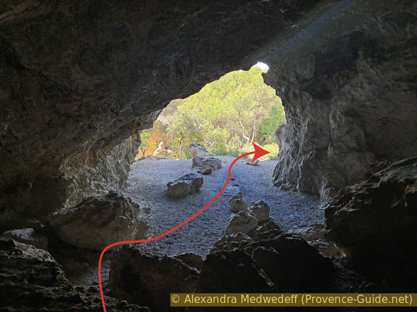
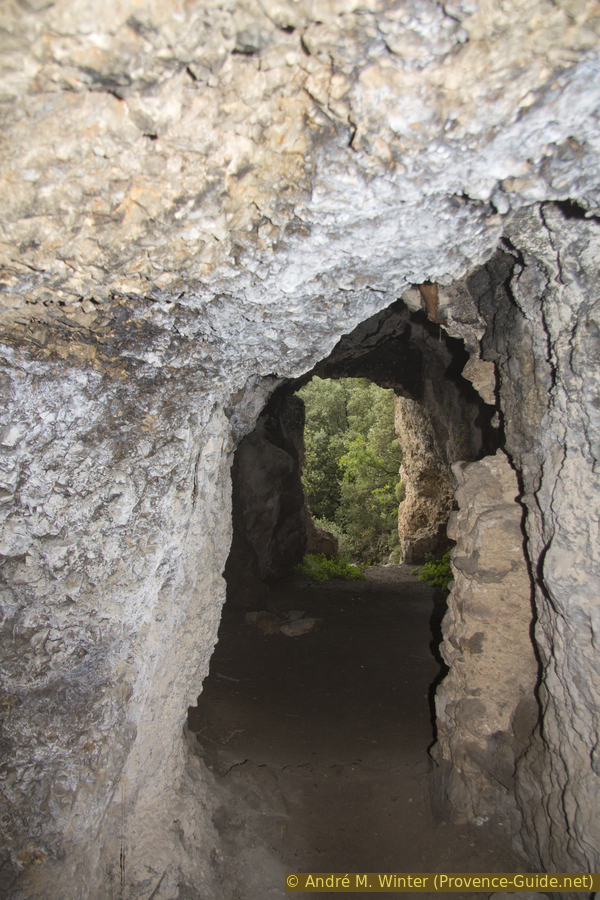
Heading left of the debris embankment, we see a light. We continue along it and emerge through another large natural portal. In front of this cave, number 3, is a sort of terrace.
No reproduction is permitted without the written consent of the author. (id2034)
Descent through the small opening of the Grotte des Fées
We exit by turning right, thus moving further away from the mountain bikes parked below.
No reproduction is permitted without the written consent of the author. (id2670)
View back through the small opening of the Grotte des Fées
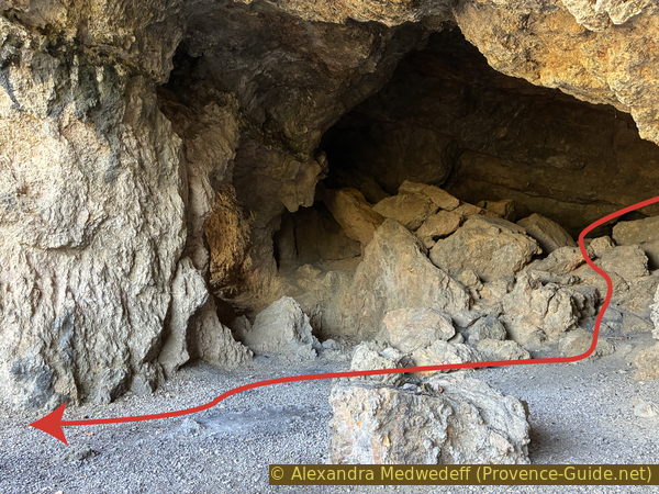
We reach another large portal, under which we can proceed straight into cave number 4. This is a dead end for us.
No reproduction is permitted without the written consent of the author. (id4647)
View out of the cave above the small opening of the Grotte des Fées
On the left is a kind of shaft, and we feel a draft. Looking ahead, not down, we see an opening with a faint glimmer. This is the passage to the large hall we saw at the back of cave number 2.
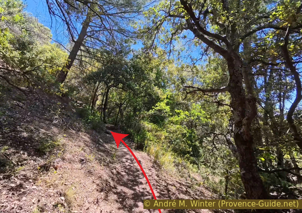
We then return to the bikes. We can take one of the paths through the forest without having to follow the base of the cliff. After that, we take our bikes again and drive on the now smaller path downhill.
No reproduction is permitted without the written consent of the author. (id5710)
Passage from the cave above the small opening to the large chamber in the large opening of the Grotte des Fées
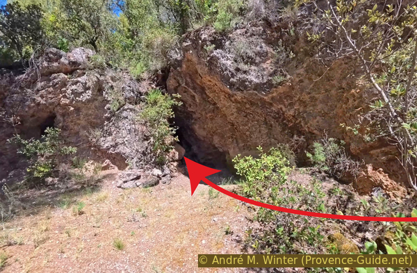
Not even 40 meters further on, we reach a fork in the path. We can go left uphill here. It's a concrete path that winds between the rocks. The climb is very steep, yet it's only a 35-meter elevation gain. We arrive at a gate leading up to an isolated house. The Saint-Marc Chapel is located there, but it remains inaccessible to us.
No reproduction is permitted without the written consent of the author. (id2282)
Steep climb towards Saint-Marc
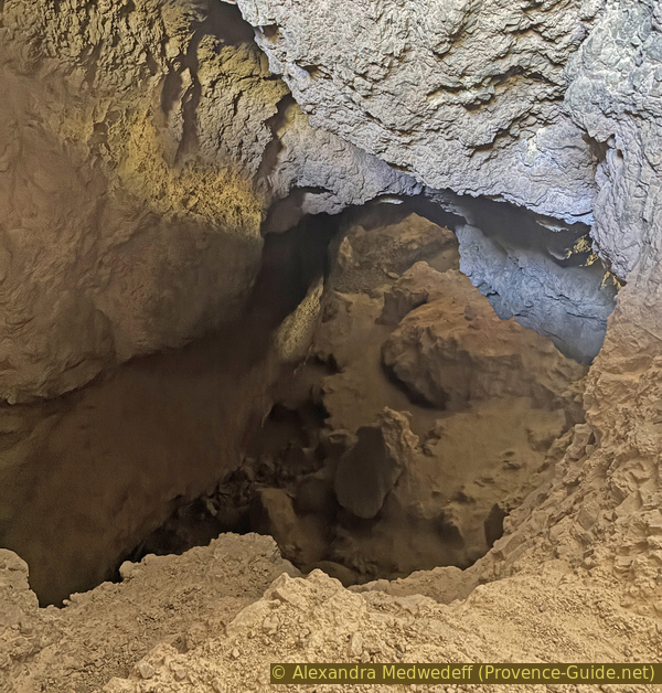
On feet and turning left, we see a dry-stone wall. We follow it, and in the cliff face to the left, there's another opening. We quickly reach an iron gate, which is open. It's a dark, narrow passage about fifteen meters long that once served as a cellar. We then return to the path that runs alongside the main caves and continue downhill to the left.
No reproduction is permitted without the written consent of the author. (id2633)
Access to the troglodytic cave of St. Marc
About forty meters further along the main path, you come to a cave-like chamber fitted with a staircase supported by a 4-meter-high wall.
No reproduction is permitted without the written consent of the author. (id2695)
Access to the ruined troglodytic cavity below the Grotte des Fées
The chamber is about twenty meters long. Besides the wall at the entrance, there is a second dividing wall. This could be the Chapelle St. Philipp, which is mentioned in some sources.
No reproduction is permitted without the written consent of the author. (id2531)
Cavity of the ruined troglodytic site
The straight shape is only noticeable when you are at the back and looking towards the single opening, the one through which we entered.
No reproduction is permitted without the written consent of the author. (id2660)
View back towards the entrance of the cavity of the ruined troglodytic site
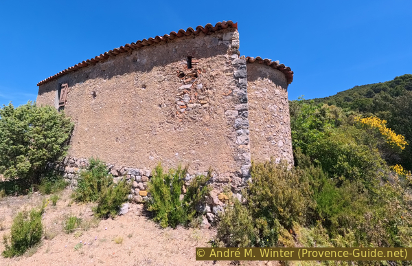
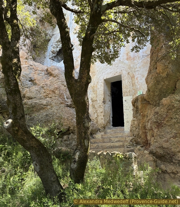
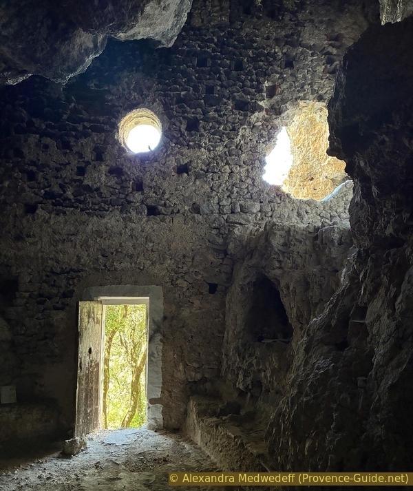
A little further down, we arrive at the cave with the most significant features. This is the Chapelle Sainte Magdeleine.
The cave has a large opening closed off by a wall over 10 meters high.
The niche above the entrance once housed a statue of St. Mary Magdalene.
No reproduction is permitted without the written consent of the author. (id2946)
La Chapelle Sainte-Magdeleine
Besides the door, the wall has two other openings, including an oculus. The interior is large, but the cavern may have been divided into several levels.
At the base of the cave's natural walls is a stone bench containing a fairly large holy water font.
No reproduction is permitted without the written consent of the author. (id2266)
Wall closing the cave of the Chapelle Sainte-Magdeleine
The cave appears to have been converted into a chapel around 1635 by the villagers. It became a hermitage in 1666. Mary Magdalene is associated with caves. Another, much better-known cave with the same name is located on the northern slope of the Sainte-Baume (hiking trail).
At the back are the remains of an altar from the early 20th century.
No reproduction is permitted without the written consent of the author. (id2239)
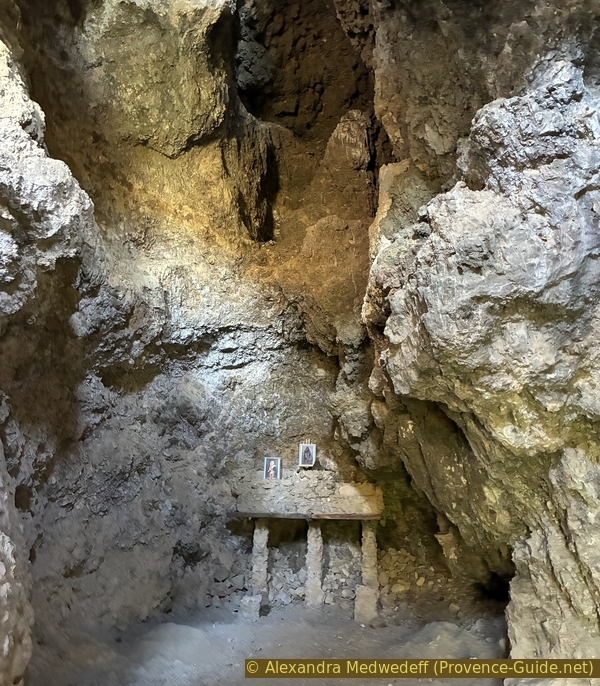
Altar in the Chapelle Sainte-Magdeleine
Not far below, there is another cavern slightly higher up.
Steps carved into the rock and a terrace are visible. There was undoubtedly an oratory here.
No reproduction is permitted without the written consent of the author. (id2571)
Small cave with terrace below the Chapelle Sainte-Magdeleine
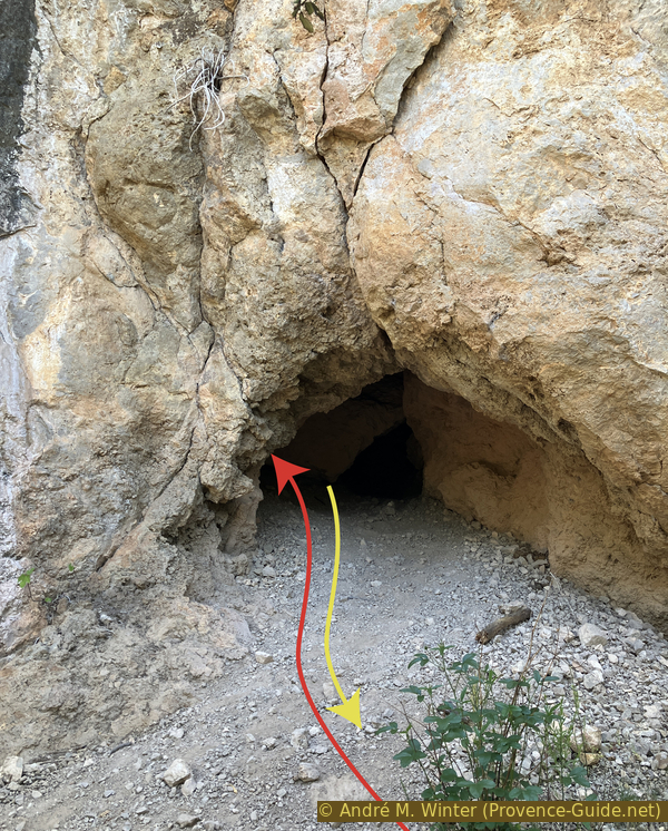
We arrive at the last of the caves, which is worth a short visit. It is untouched by medieval structures. The entrance is small, you have to stoop a bit, but you arrive in a narrow, but high, chamber.
No reproduction is permitted without the written consent of the author. (id2233)
Another cave below the Chapelle Sainte-Magdeleine
Further ahead to the left are the other openings of this cave. It would require a considerable climb to exit that way. These same openings can be seen from the outside. Exiting through the lower opening and keeping to the right while following the cliff edge, you quickly reach this crevice with several notches.
No reproduction is permitted without the written consent of the author. (id2549)
High opening of The other cave below the Chapelle Sainte-Magdeleine
Just below the last cave is this fork in the path. You could continue straight ahead, but there are some high steps to climb. So, take the left fork.
No reproduction is permitted without the written consent of the author. (id7708)

Fork below the Chapelle Sainte-Magdeleine
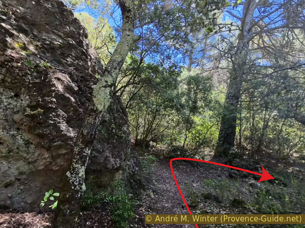
Continue immediately after, also turning left.
The path is narrow, and you have to feel your way around a bit to follow an old dry-stone wall a little further on.
No reproduction is permitted without the written consent of the author. (id2572)
Fork below the caves
The path reaches a fork where we bear right.
No reproduction is permitted without the written consent of the author. (id2519)
Hairpin bend below the caves
So we return to the main path along the wall topped with a wire fence. This descent can be overgrown. The ground is made of uneven limestone, so we have to drive slowly.
Nevertheless, we soon reach a narrow road which we follow downhill.
No reproduction is permitted without the written consent of the author. (id7799)
Straight descent to the Montée des Moulins
This road takes us between two houses. Just before the bottleneck, you can plunge your hands and head into some cool water on the left.
No reproduction is permitted without the written consent of the author. (id7753)
Passage between the first houses of the Montée des Moulins
This canal used to supply water to the mills further down. It's possible that this stream dries up in the summer.
No reproduction is permitted without the written consent of the author. (id4626)
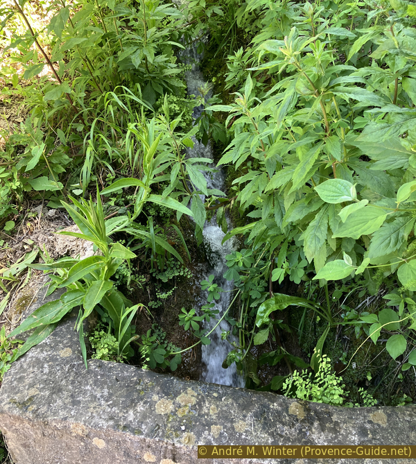
Fresh water before the first houses of the Montée des Moulins
We continue downhill in a straight line and descend the last few meters of the hard-won elevation gain at the beginning of the tour.
We cross Avenue Charles Boyer (D77), being careful of cars which have the right of way here. Opposite, we continue onto the unpaved road. It's called Carraire No. 1.
No reproduction is permitted without the written consent of the author. (id5616)
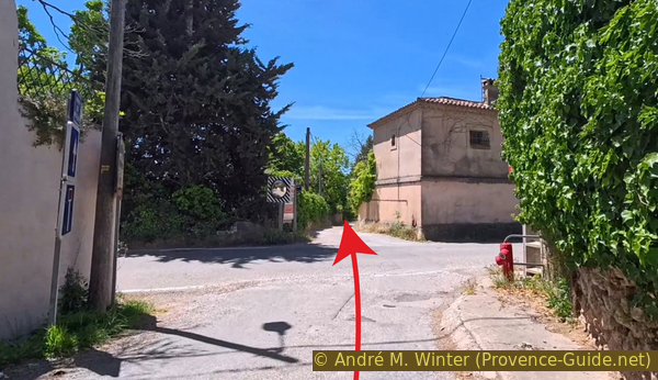
Crossing the D77 road
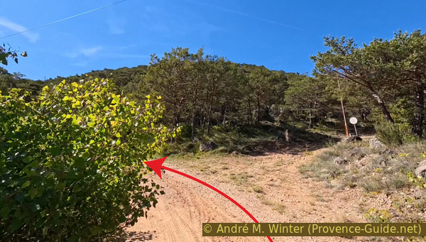
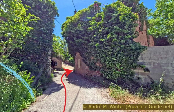
This path becomes increasingly narrow. Finally, we think we've arrived in someone's garden. But you have to turn right before the large hedge.
We are now at the lowest point of the tour, at 485 meters above sea level.
No reproduction is permitted without the written consent of the author. (id5651)
Turn just before the large hedge
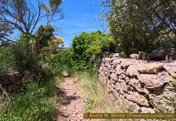
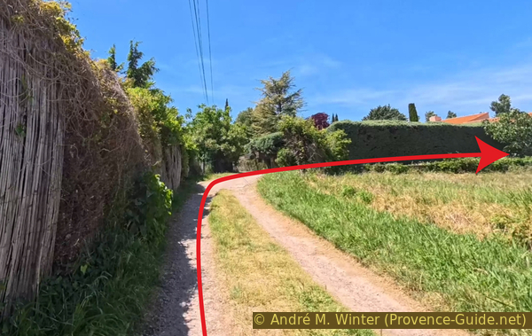
We continue straight ahead beyond the path. We pass several parking lots, a gymnasium, and tennis courts. Further on, we arrive at the Maison de la Truffe, and a little to the left, we reach the square in front of the church where we started this tour.
No reproduction is permitted without the written consent of the author. (id7694)
Arrival at the truffle house and the centre of Aups
Sources and additional information
It is better to use a good topographic hiking map: this tour is on the IGN map "Aups, Salernes", scale 1:25000, 3443OT.
If you don't want to bother with a paper map, you can also use mapping apps on your cell phone. On the one hand, it is the Cartes IGN app from the official map service. However, it requires access to the data network and this is sometimes difficult in canyons or remote locations.
Alternatively, you can use apps that store data directly on the device. They're generally not free, but they don't cost much. We mainly use OSMAnd, here it is possible to add contour lines, relief shading, markings and others. To store this data on your phone you need a lot of space.
Of course, one needs access to satellites for the GPS signal with any app. In some canyons this is not the case. Therefore, do not rely on the position shown, but read the map on your phone as you would read it on paper. Most apps are available for Android and iPhone. The applications usually allow us to record the route travelled and also view the GPS files offered for each of our hikes.
This page has been seen 151 times since 20 March 2024.
No reproduction is permitted without the written consent of the author. (id1462)
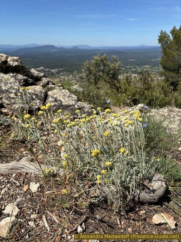
Mediterranean strawflower on the Espiguières Mountain