From the middle of the Esterel massif on two peaks on the coast
Pass Belle Barbe to le Pic d'Aurelle, Pic du Cap Roux and around St. Pilon.
hike
average
5 h
no
yes
shelter
mountain
Introduction
The Massif de l'Esterel is an iconic mountain range between Saint-Raphaël and Cannes. It's impossible to just drive past it when holidaying on the French Riviera. Its red porphyry rocks contrast beautifully with the blue of the sea and sky. Despite its small size, the massif is crossed by a multitude of little-known small roads, forest roads and paths that allow to climb many peaks that offer a fantastic view. Choosing a representative hike for a day is therefore difficult.
Due to its proximity to big cities, the Massif is also stormed by the locals on public holidays. The roads inside the massif no longer allow crossing the massif as in the past, but there is still too much car traffic. This tour tries to avoid the roads as much as possible. In winter, some access roads are closed for safety reasons. However, car access to the Col de Belle Barbe remains normally possible, this is also the starting point of our tour. So we have a little shade on our first ascent. We leave the higher peaks behind and climb two peaks with views of the coast and the deep blue sea: the Pic d'Aurelle and the Pic du Cap Roux. These mountains are easy to climb, they got their name Pic (which means pinnacle), because of their massive appearance seen from the coast line.
The facts
16,1 km total distance
5 h walk time
790 m total elevation
orientation average
mark 45% of the total distance
55% easy trails
20% moderate trails
15% forest roads
5% hard-surfaced quiet side streets
5% stairs
<5% hard-to-recognize trails
dangers none
children no
useful picnic stuff
required trekking shoes, hiking gear and water
GPS coordinates (WGS84) of start and end point 43.456612,6.868782
downloads ![]()
![]()
No reproduction is permitted without the written consent of the author. (id3919)
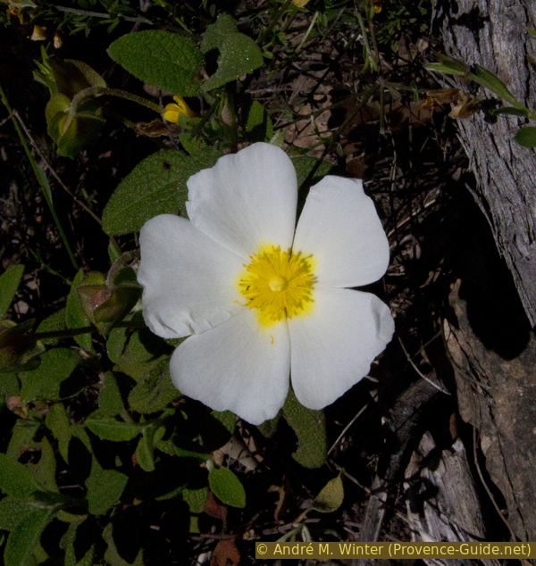
Flowering sage-leaved rock-rose
Public transport
There is no public transport to get to the starting point of the tour. It is however possible to hike the Esterel Massif by taking the reginal train and stop at Agay (south) or Le Trayas (north-east).
Access by car
The Col de Belle Barbe is located behind the Rastel d'Agay rock formation. From the Rade d'Agay bay, take the D100 road towards the A8 motorway. At the end of the inhabited area, take the first flat road on the right, there is an arrow pointing towards the Massif de l'Esterel. Cross a bridge and a quarry to go up the old paved road in a north-easterly direction without crossing the watercourse again. The road turns left and ends on the flat Col de Belle Barbe, which is our starting point.
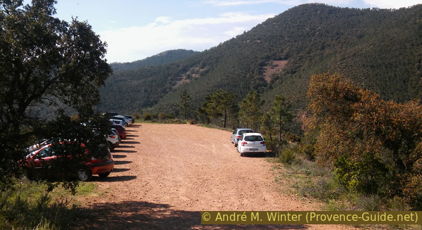
Useful parking spaces
At the top of the pass turn right or a little further along the road. There are other car parks in the mountain massif. Please avoid accessing them in order to preserve ths nice natural landscape!
Hints
This is a long tour through the Massif de l'Esterel. Access and return to and from the peaks include flat and very quiet sections. Several sections are poorly marked or not marked at all, and one spot is overgrown with bushes. There is no drinking water in the course apart from the spring under the Cave of St. Honoré.
It can get very hot inside the massif, so it is recommended to do the tour in winter or in spring. Maquis also blooms in April.
The whole region is a zone with a high risk of forest fires. In summer, but also in other seasons when it is very dry or by strong winds, access to the forest areas can be regulated. As a result, the roads may be closed to traffic and/or the trails prohibited to hikers. Current information: Map of access to the forests of the Var (also english). The map shows the colours green, yellow, orange and red which correspond to levels of danger.
The sections
- Up in direction of Pic d'Aurelle.
- Change to the soummit of the Pic du Cap Roux
- Around the rocks of St. Pilon and to the Grotte de St. Honoré
- Through the Ravin des Lentisques back to the starting point
Section 1: Col de Belle Barbe - Pic d'Aurelle
➙ 5,1 km ... 1 h 35 min ➚ 320 m ➘ 55 m ↝ average
25% forest roads, with marks
20% moderate trails, without marks
55% easy trails, without marks
<5% moderate trails, without marks
The clues
- Col de Belle Barbe, 45 m
- Ford, 20 m
- Saddle Baisse Orientale, 265 m
- Saddle Baisse des Sangliers, 250 m
- Pic d'Aurelle, 323 m
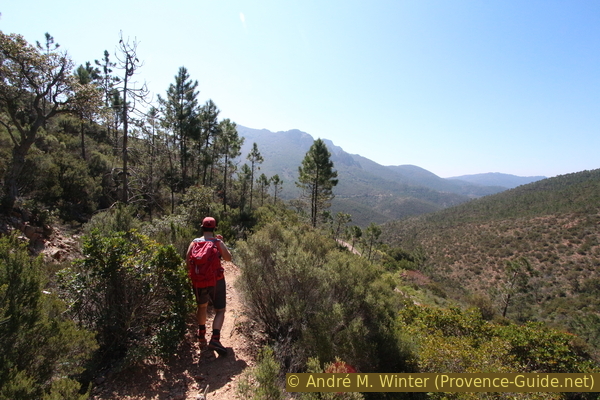
Now on foot we go on a forest road at the bottom of the Ravin du Grenouillet and thus at some height under the Pic de l'Escale to advance to the Pic d'Aurelle by the sea.
col = saddle
baisse = saddle
ravin = ravine
gué = ford
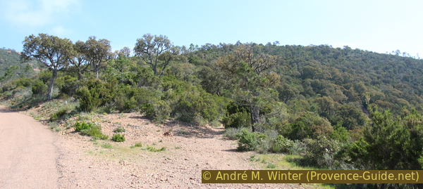
We see a flat forest road with barriers leading towards a cluster of rocky peaks far east. We will climb some of them and walk around others. This forest road leads us imperceptibly down to a concrete ford over the Grenouillet watercourse and to the junction at the exit of the Ravin du Mal Invernet.
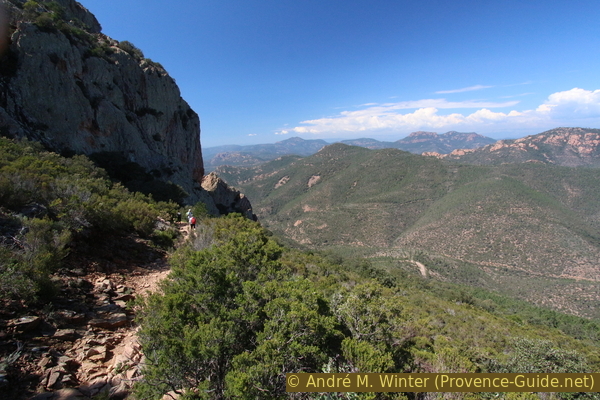
No reproduction is permitted without the written consent of the author. (id3905)
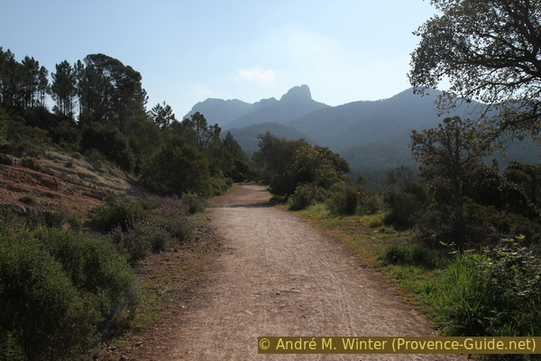
Forest road in the Ravin du Grenouillet valley
Behind the mountains to reach on this tour.
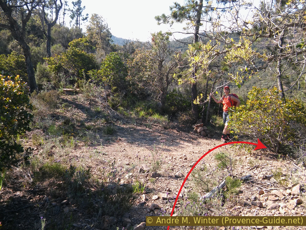
Just 50 meters after this ford, our path branches off to the right, despite a mark in the shape of an X. Be careful, not even 40 meters further on this path, another one goes up to the left at a steep angle (backwards) and this without any notice!
No reproduction is permitted without the written consent of the author. (id3906)
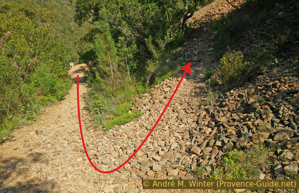
Turn-off to the Baisse Orientale saddle
There we go up the same incline under the Rocher du Gravier, initially crossing a scree slope (Gravier means gravel).
No reproduction is permitted without the written consent of the author. (id3907)
Ascent on scree heaps
As the path approaches a rock wall, it turns right in a second hairpin bend. A little later the ascent becomes less steep and then almost flat at the Baisse Orientale saddle.
No reproduction is permitted without the written consent of the author. (id3908)
Mont Vinaigre in the background
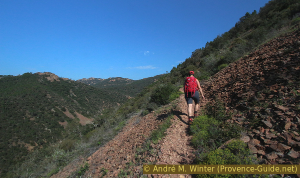
At all the crossroads we keep to the right and from now on we continue towards the east, going south under the Pic de l'Escale, all without gaining or losing height.
No reproduction is permitted without the written consent of the author. (id3909)
Path from the Baisse Orientale saddle to the Baisse des Sangliers saddle
baisse = saddle
col = saddle
This is how we get to a paved road at the Baisse des Sangliers saddle. Many paths and roads cross here. Basically you have to keep the same direction and cross the road to find opposite a small cairn and a path that is flat at first and then climbs.
No reproduction is permitted without the written consent of the author. (id3910)
Access to the path from the Baisse des Sangliers saddle to the Pic d'Aurelle
This unmarked trail (a green X-shaped marker) leads south of the Sommet des Lentisques into a saddle where it joins another trail to continue east. We go north past another small rise, then over some rocks to find ourselves at the end of the rocky ridge of the Pic d'Aurelle. Caution: the front of the ridge is steep on all sides!
No reproduction is permitted without the written consent of the author. (id3911)
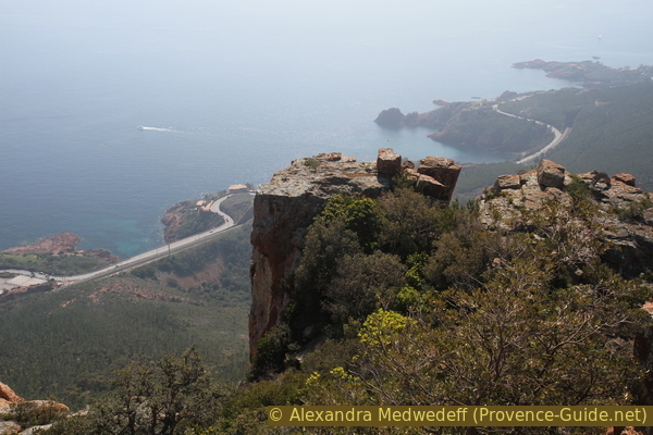
Rocks at the top of the Pic d'Aurelle
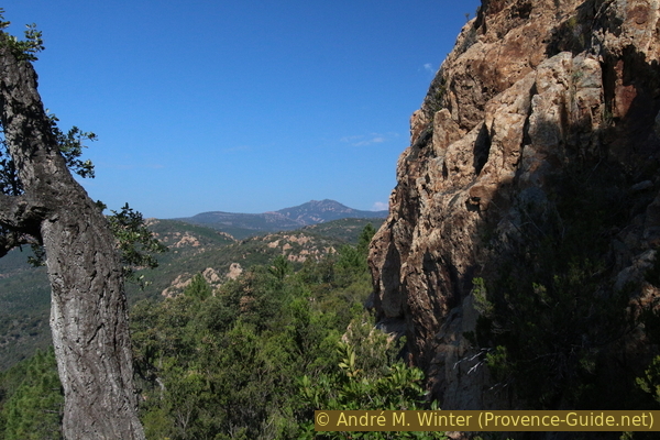
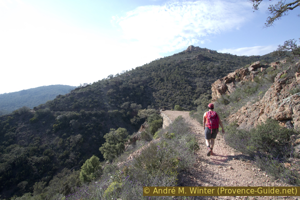
The view opens entirely to the north-east on the Esterel coast and beyond, in good weather, to the Cap d'Antibes. Looking south, the Pic du Cap Roux rises in front of us, our next stage with a not insignificant climb.
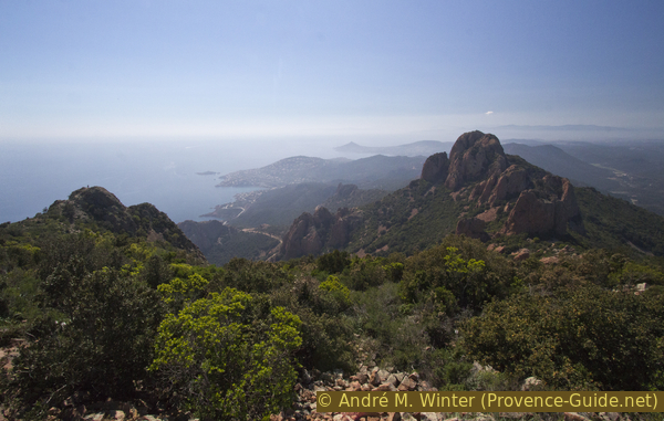
No reproduction is permitted without the written consent of the author. (id3912)
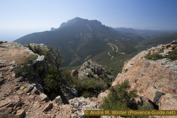
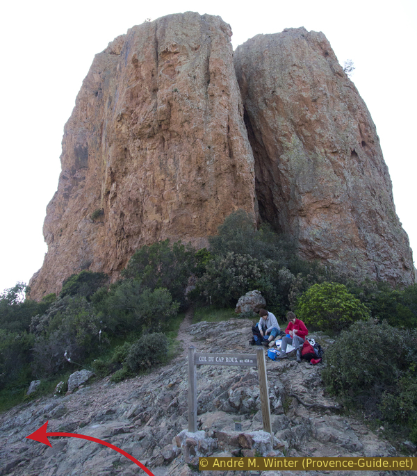
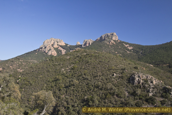
Pic du Cap Roux mountain seen from the north
Section 2: Pic d'Aurelle - Pic du Cap Roux
➙ 3,5 km ... 1 h 10 min ➚ 295 m ➘ 165 m ↝ average
<5% moderate trails, without marks
25% easy trails, without marks
15% easy trails, faulty marks
15% hard-surfaced quiet side streets, without marks
45% moderate trails, faulty marks
The clues
- Pic d'Aurelle, 323 m
- Saddle Baisse des Sangliers, 250 m
- Saddle Col de l'Évêque, 160 m
- Pic du Cap Roux, 453 m
Steep climb to the highest point of this tour.
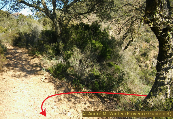
We return to the Baisse des Sangliers saddle by the same route. There is a way to walk across the flat Sommet des Lentisques, but it doesn't shorten the path. At the Baisse des Sangliers saddle, we meet the paved road again and turn left. After a few metres, turn left again to find a path parallel to the road, which at the same time leads down to the Col de l'Évêque pass. A cairn and several colourful markings indicate where we should leave the road.
No reproduction is permitted without the written consent of the author. (id3913)
On the way from the Baisse des Sangliers saddle to the Col de l'Évêque
The path leads back to the asphalt and here we follow the road to the saddle with the parking lots on both sides. On the left, our path leads up without any indication (2020). It begins easily in the shade of the pine trees.
No reproduction is permitted without the written consent of the author. (id3914)
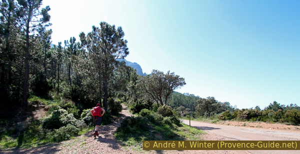
Beginning of the path to the Pic du Cap Roux from the north
We circle rocks to find a flat junction above. Here we continue uphill, we pass a block heap and the path becomes steeper.
No reproduction is permitted without the written consent of the author. (id3915)
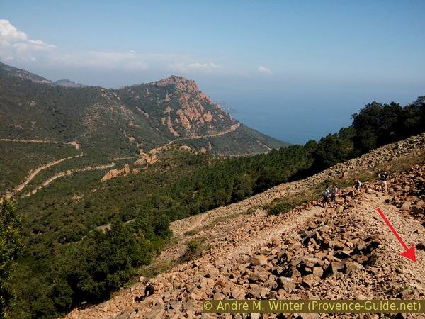
Hairpin bends on the way from the Col de l'Évêque to the Pic du Cap Roux
Pic d'Aurelle in the background.
As we approach the cliff that forms the north-west ridge of the Pic du Cap Roux, the path turns east in a hairpin bend under the summit. This flank is easily walkable, so we make a detour to the east side to finally climb to the south to the orientation table of this high peak that towers over the sea.
No reproduction is permitted without the written consent of the author. (id3916)
Rocky ridge north-west of the Pic du Cap Roux
The summit plateau is large and is ideal for a break.
No reproduction is permitted without the written consent of the author. (id3917)
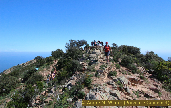
Summit of the Pic du Cap Roux
Section 3: Pic du Cap Roux - Grotte de St. Honoré
➙ 2,9 km ... 1 h ➚ 120 m ➘ 280 m ↝ average
85% easy trails, faulty marks
10% stairs, without marks
5% moderate trails, without marks
The clues
- Pic du Cap Roux, 453 m
- Saddle Col du Cap Roux, 360 m
- Saddle Col du St. Pilon, 280 m
- Spring Sainte Baume, 175 m
- Cave de St. Honoré, 295 m
On a panoramic path around the St. Pilon.
No reproduction is permitted without the written consent of the author. (id3918)
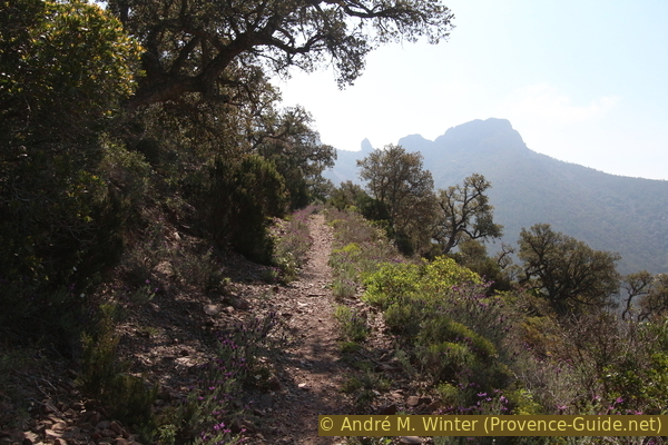
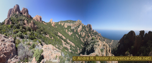
Southeast ridge of the Pic du Cap Roux and the St. Pilon
We return from the summit to the crossroads in the south and there we take the path to the right and west. The way down leads evenly. When we get to the rocks with the cavities that we can only see clearly from below, the path turns south and quickly leads us to the Col du Cap Roux.
No reproduction is permitted without the written consent of the author. (id3920)
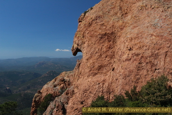
Rock wall with a hook
At the saddle we find ourselves at the foot of a double pinnacle that we could already see from the Col de Belle Barbe. We go down on the left and after the first bend we stay at the same level to be able to circum-walk the Pilon and Saint Pilon to the south.
No reproduction is permitted without the written consent of the author. (id3921)
Dome of rock at the Col du Cap Roux saddle
You should also look back from time to time, the red mountain ridges stand out beautifully against the blue sea.
No reproduction is permitted without the written consent of the author. (id3922)
Saint Pilon, Pilon, Pic du Cap Roux
At the Col du Saint Pilon we take the path on the right and descend steadily west until we are north of St. Pilon. After a passage over scree, we come to an increasingly dense forest.
No reproduction is permitted without the written consent of the author. (id3923)
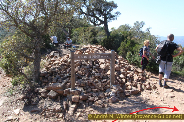
Saddle Col du Saint-Pilon, 281 metres
GR = long-distance hiking trail
At the end of the path we go down into a valley with large trees, which probably could only reach their size because they have a good water source. And there is also the Fontaine de Sainte Baume spring waiting for us!
No reproduction is permitted without the written consent of the author. (id3924)
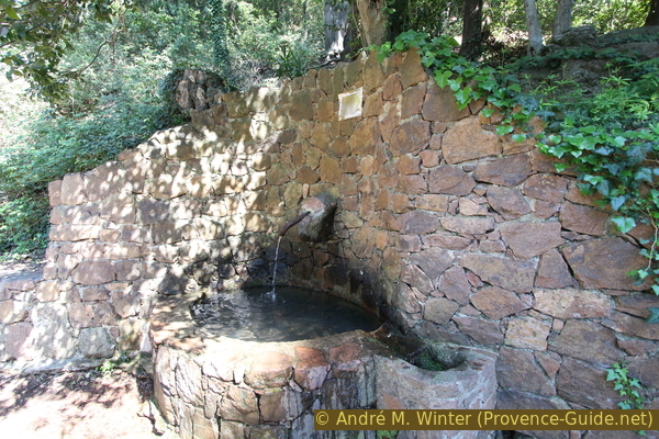
Source de la Sainte-Baume in the Esterel Massif
Stairs to the left of the spring lead into the forest. This is the entrance to the cave of the hermitage of St. Honorat. In ten minutes you go up to the ruins and the cave that became a chapel. This detour and the last climb are really worth it!
You go up in a kind of cirque under the Pic du Cap Roux. When you get to the foot of the cliff, the path, well stabilised, continues underneath it to the right. There are ropes to hold on to, but these are only necessary when it's freezing here in winter.
No reproduction is permitted without the written consent of the author. (id3925)
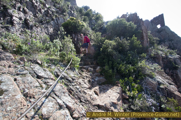
Secured trail to the gate at the St. Honorat chapel
Over a few steps we pass the remains of a fortified gate that protected the hermitage.
No reproduction is permitted without the written consent of the author. (id3926)
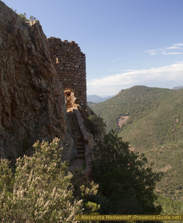
North side of the fortifications in front of the St. Honorat chapel
On the other side, large stone stairs lead down. At its foot is the cave on the left, which was converted into a chapel and is full of dusty votive tablets.
No reproduction is permitted without the written consent of the author. (id3927)
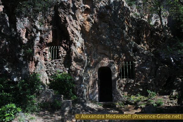
Grotto Ste. Baume of the hermitage of St. Honorat
Section 4: Grotte de St. Honoré - Col de Belle Barbe
➙ 4,7 km ... 1 h 20 min ➚ 50 m ➘ 290 m ↝ difficult
5% moderate trails, without marks
5% stairs, without marks
5% forest roads, without marks
5% hard-surfaced quiet side streets, without marks
5% moderate trails, few cairns
10% hard-to-recognize trails, without marks
45% easy trails, without marks
25% forest roads, with marks
The clues
- Cave de St. Honoré, 295 m
- Source Sainte Baume, 175 m
- Parking lot, 165 m
- Ravin des Lentisques, 65 m
- Ford, 20 m
- Saddle Col de Belle Barbe, 45 m
We return to the starting point via the Ravin des Lentisque, the first stretch involves an overgrown path and orientation is rather difficult on the slopes of the valley. This section is long and the now tired legs make it seem even longer.
No reproduction is permitted without the written consent of the author. (id3928)
Large terrace under the St. Honorat chapel
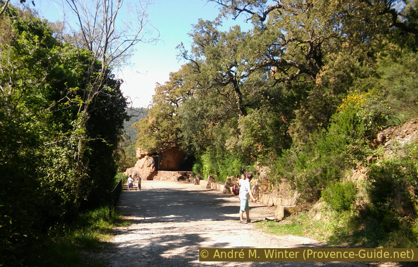
From the chapel we return to the source and from there north across a large terrace. Then 200 m down the road to a car park on the left on the outside of a bend.
We go down this parking lot and perceive the wide ridge on which we are. Roughly speaking, we have to look for an old path that follows the course of the ridge, but where the forest becomes more and more dense. A path leads down to the left of the end of the parking lot. Don't stay to the left here for too long, but make your way to the right on the ridge before passing under the trees. You come across a straight and slightly sloping course towards the west.
No reproduction is permitted without the written consent of the author. (id3929)
Parking at the ridge between the ditches Ste. Baume and Lentisques
We come to a saddle with a cairn and turn sharp right to descend into the Ravin des Lentisque. The path descends steadily and keeps the direction constant, but it becomes less and less easy to spot. One should stay on course even if young pines and other bushes have to be avoided.
As one slowly nears the bottom of the valley, what appears to be a trail seems to descend more steeply. However, it is a small landslide covered with vegetation. Here you have to continue in the same direction as before, maybe even climb a bit to find the direction again. The path ultimately leads to the river bed, which is often dry here. We cross it and look for a path that leads up opposite side.
No reproduction is permitted without the written consent of the author. (id3930)
Saddle in the crest
After a few minutes we find ourselves on a wide path. It is the GR653A long-distance trail that runs here along the northern flank of the Ravin des Lentisques. Logically, we turn left in the direction down the valley.
No reproduction is permitted without the written consent of the author. (id3931)
Carin on the GR635A long-distance trail in the Ravin des Lentisques
View back up. Right the path out of the ditch.
This is an old forest road that will take us back to the concrete ford at the end of the Ravin du Grenouillet, where we passed at the beginning of the tour. The path leads downhill, but has a few slight counter ascents.
No reproduction is permitted without the written consent of the author. (id3933)
The GR653A long-distance trail in the Ravin des Lentisques
col = saddle
baisse = saddle
ravin = ravine
gué = ford
From the ford back to the car park at the Col de Belle Barbe on the same route as the approach.
No reproduction is permitted without the written consent of the author. (id3932)
Pic du Cap Roux, Pilon and Saint Pilon
View back.
Sources and additional information
It is better to use a good topographical hiking map: this tour is on the IGN map "Fréjus/Saint-Raphaël/Corniche de l'Estérel", scale 1:25000, 3544ET.
If you don't want to bother with a paper map, you can also use mapping apps on your cell phone. On the one hand, it is the Cartes IGN app from the official map service. However, it requires access to the data network and this is sometimes difficult in canyons or remote locations.
Alternatively, you can use apps that store data directly on the device. They're generally not free, but they don't cost much. We mainly use OSMAnd, here it is possible to add contour lines, relief shading, markings and others. To store this data on your phone you need a lot of space.
Of course, one needs access to satellites for the GPS signal with any app. In some canyons this is not the case. Therefore, do not rely on the position shown, but read the map on your phone as you would read it on paper. Most apps are available for Android and iPhone. The applications usually allow us to record the route travelled and also view the GPS files offered for each of our hikes.
This page has been seen 3354 times since 20 March 2024.