Paracol chapels and Le Cuit viewpoint
Several chapels but an extensive tour
hike
average
4 h 45 min
no
yes
no
mountain
Introduction
The little-noticed village of Le Val hides little treasures in its mountains: many chapels and wayside shrines can be found along old paths. It is hardly possible to combine all of them in one tour in one day. But when you add a lookout peak and a long ridge for the way back, you can put together a varied hike.
We are north of Brignoles, in the valley of the La Ribeirotte creek, which later flows into the Argens river. We are here in the lime (Sainte-Baume is to the west and the Verdon to the north), the hills and valleys are extremely dry. In this barren area we do a rather long circuit.
The facts
13,5 km total distance
4 h 45 min walk time
640 m total elevation
orientation average
mark 15% of the total distance
45% easy trails
45% forest roads
5% hard-surfaced city alleys
<5% hard-surfaced quiet side streets
dangers sun, lack of water
children no
useful picnic stuff
required hiking boots, hiking equipment and water
GPS coordinates (WGS84) of start and end point 43.441145,6.070369
downloads ![]()
![]()
Public transport
The village of Le Val is only supplied with student transports, which are not timed to reconcile with hiking. It ist useful to complain about at the tourist offices of the region. More public transport may also help the local population.
Access by car
Le Val is north of the Brignoles motorway exit. After the tollbooth, at the following two roundabouts, turn left towards Le Val. Now go up the ridge north of Brignoles. At the saddle there is another chapel north of the road: Notre-Dame de Pitié. She is known for her naïve adornments with shells. After the saddle, a long hairpin bend descends to the roundabout at the Correns wine cooperative. Here turn left (Other Directions) and then follow the indications to Carcès. After making half a circle around the village, we turn right (Cimetière). At the following crossroads, turn right again and there is a large car park along this lane.
Useful parking spaces
The car park extends along the entire length of Avenue des Droits de l'Homme. We continue on foot to the west, so it makes sense to drive as far ahead as possible. Attention, the parking places at the end on the right are reserved for teachers of the school.
You are not allowed to park along the access road to the retirement home at the beginning of the loop.
No reproduction is permitted without the written consent of the author. (id4656)
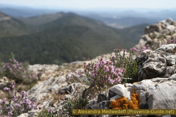
Flowering thyme on Le Cuit mountain
No reproduction is permitted without the written consent of the author. (id4657)
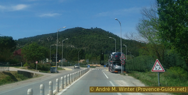
Le Paracol hill
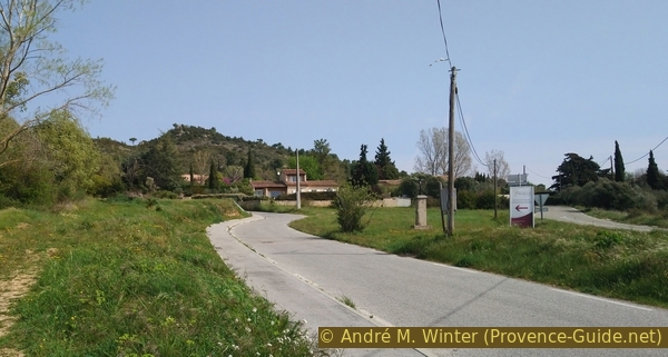
View from the Le Val ring road.
Hints
Between the chapels and the mountain Le Cuit there is a long dry stretch with several counter climbs that make up a good part of the total difference in altitude.
There is only a sparsely scattered forest along the hiking trails. You can always pause in the shade, but you walk mostly in the sun, the forest is just too thin.
The whole region is a zone with a high risk of forest fires. In summer, but also in other seasons when it is very dry or by strong winds, access to the forest areas can be regulated. As a result, the roads may be closed to traffic and/or the trails prohibited to hikers. Current information: Map of access to the forests of the Var (also english). The map shows the colours green, yellow, orange and red which correspond to levels of danger. The affected area is: Haut Var (3).
The sections
- Le Val - St. Jacques chapel - St. Blaise chapel - Notre-Dame de Paracol - dry valley north of Les Meyans and Vaou de Flâme - Le Cuit: towards the west.
- Le Cuit - Les Sambles crest - St. Cyriaque chapel - St. Jacques chapel - Le Val: back east.
Section 1: Le Val - Paracol - Le Cuit
➙ 6,6 km ... 2 h 20 min ➚ 460 m ➘ 175 m ↝ average
<5% hard-surfaced city alleys, without marks
5% easy trails, without marks
5% hard-surfaced city alleys, without marks
5% forest roads, without marks
15% easy trails, few marks
10% forest roads, without marks
5% forest roads, without marks
5% easy trails, without marks
35% forest roads, without marks
15% easy trails, few marks
The clues
- Le Val, 245 m
- St. Jacques chapel, 270 m
- N-D de Paracol, 480 m
- north of Les Meyans hill, 390 m
- Vallon de Buffe vallay, 370 m
- north of Vaou de Flâme hill, 405 m
- west of Vaou de Flâme hill, 360 m
- saddle north of Le Cuit, 470 m
- Le Cuit, 540 m
Three chapels are reached quickly, but the summit is further away.
maison de Retraite = retirement home
We leave the parking lot of the Avenue des Droits de l'Homme to the west and come straight into an underpass. At the exit we turn right onto a gravel path (stay to the right of the fence). So we go aside the main road. It leads us to a crossroads, here we go straight on in the same direction and stay on the left side of the road.
At the next crossing we take the left road uphill (Chemin de Paracol).
No reproduction is permitted without the written consent of the author. (id4679)
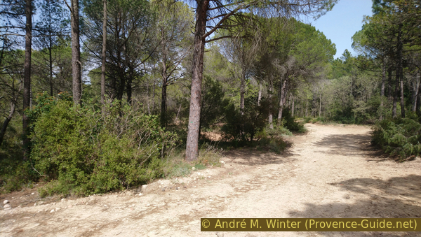
Chemin de Paracol
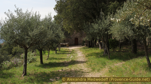
This side street gets progressively steeper and there is no flat part until the first peak Paracol. We pass the entrance to a retirement home and shortly after that the first chapel is on the left.
The St. Jacques chapel was renovated in 2012. It was built in the 19th century on the remains of another place of worship. Although it bears the name of the district of St. Jacques, it is dedicated to John the Baptist (St. Jean Baptiste).
No reproduction is permitted without the written consent of the author. (id4680)
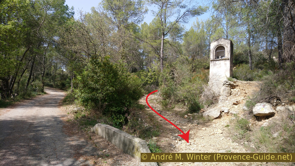
Crossroads at Saint-Jacques chapel
At the chapel we turn left and come to a forest road. It points precisely to the summit with the Notre-Dame de Paracol chapel. So it goes up into the forest. At the junctions, we always go straight ahead to the west.
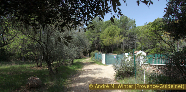
On the right is a green fence and a green gate. In 2019 geese were housed in the enclosure.
No reproduction is permitted without the written consent of the author. (id4681)
End of the Paracol forest road
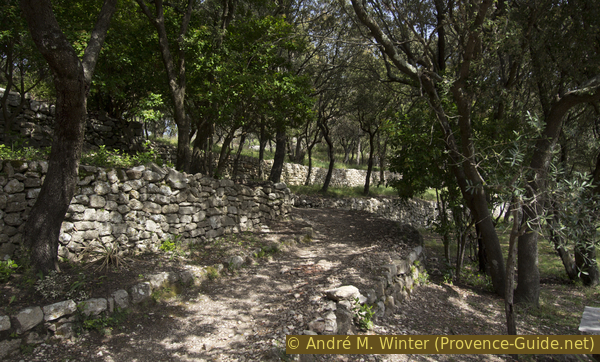
The forest road becomes a narrower path that is no longer passable for traffic. Initially, the path is surrounded by stone walls.
No reproduction is permitted without the written consent of the author. (id4682)
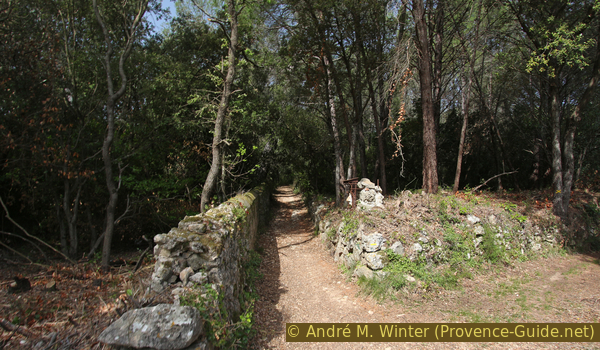
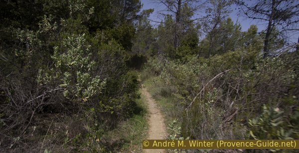
Beginning of the trail to Notre Dame de Paracol chapel
Now it's really going uphill! The sun is already strong here in the morning.
No reproduction is permitted without the written consent of the author. (id4683)
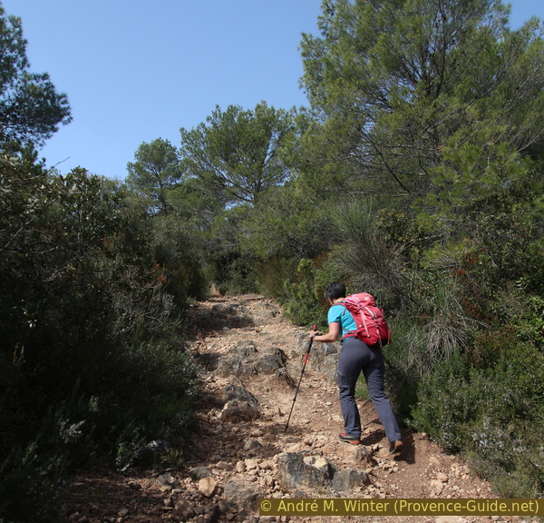
The steep path to the Paracol hill
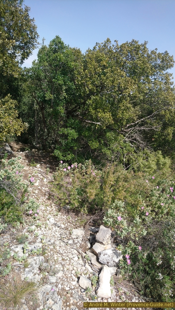
The path continues straight west to a first wayside shrine. In the official map and also in other documents, the chapel of St. Blaise is incorrectly noted here. But this follows a little further up. From now on the path makes short turns.
No reproduction is permitted without the written consent of the author. (id4684)
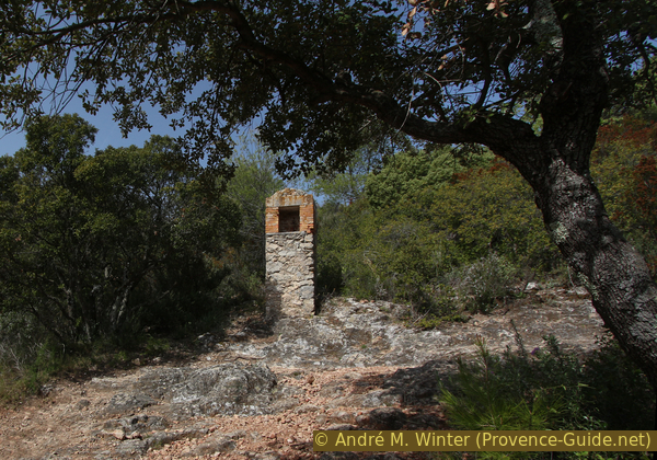
First shrine and first turn
croix monumentale = big cross
oratoire = shrine
After the third wayside shrine we reach an artificial level with olive trees and oaks. We are in front of the St. Blaise Chapel, the oldest of this circuit.
The chapel was originally dedicated to the Apostle John (Saint Jean l'Évangéliste). Later Blasius of Sebaste (bishop in Armenia) was worshipped here. This saint was made popular in Provence by the returning Crusaders.
No reproduction is permitted without the written consent of the author. (id4685)
Terrace in front of the Hermitage of St. Blaise
You can walk around the building on both sides. At the top you can see a natural crevice in the rock that serves as a storeroom and below you can see what used to be the hermitage's vegetable garden.
A first place of worship seems to have been built here as early as the 6th century, because during the migration of peoples the inhabitants sought protection here in the mountains. The chapel was rebuilt around the year 1000. When the inhabitants returned to the valley, a hermitage was set up: in 1547 the right transept was extended for this purpose. With the entrances relocated several times and other modifications, the original form is no longer recognizable today.
No reproduction is permitted without the written consent of the author. (id4769)
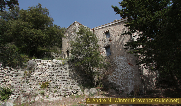
St. Blaise chapel and hermitage
In a few steps we get from here to the summit with another very old chapel.
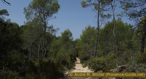
We walk up the wide path under oak trees and between former cultural terraces (restanques). When we come to a forest road, we keep to the left and continue uphill.
No reproduction is permitted without the written consent of the author. (id4687)
Ascent to Notre Dame de Paracol chapel
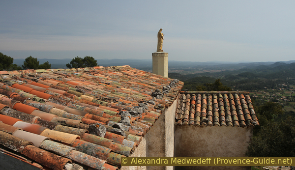
Soon we see a huge iron cross. From the top you have a good all-round view. Only the gilded Madonna from 1893 disturbs the panorama.
No reproduction is permitted without the written consent of the author. (id4688)
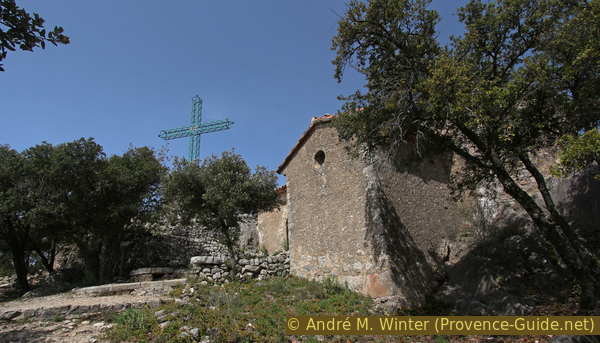
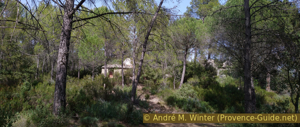
Cross and ND de Paracol chapel
The chapel does not appear to be old, but dates from the 11th century. A pilgrimage takes place up here in September. In the chapel there were many votive offerings (Ex-Voto), today they are in the Sacred Museum of Le Val (musée d'art sacral du Val).
No reproduction is permitted without the written consent of the author. (id4655)
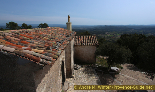
Notre-Dame de Paracol chapel and the gilded Madona
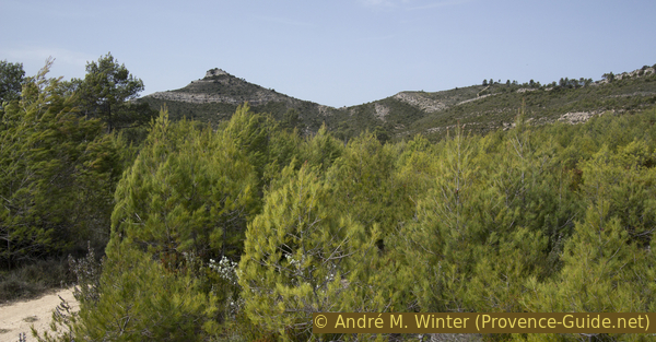
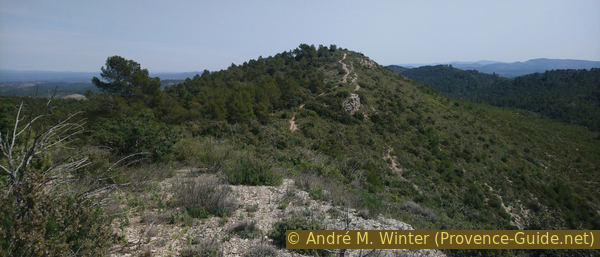
You can also see west from the cross. In this direction, a peak with horizontal calcareous bands at the base is noticeable behind. This mountain is the highest point of the tour and our next destination. However, we have to go down into the valley and advance a good four kilometres.
No reproduction is permitted without the written consent of the author. (id4689)
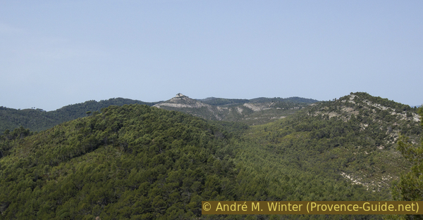
View of Le Cuit mountain
We can leave the chapel to the west, so you come to a path that quickly turns to the right and thus leads back to the saddle with the forest road. Now we go left on the bumpy road. It runs along the ridge north of Paracol.
When the forest road changes to the east side (right) of the ridge, there is a memorial stone on the right in the curve. The text in Provençal commemorates an event on 14 May 1972.
No reproduction is permitted without the written consent of the author. (id4690)
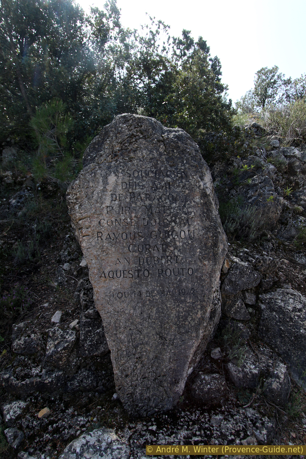
Plaque in Provençal language
The forest road runs further ahead directly on the ridge. 100 meters before a right-hand bend, a bumpy path also leads downhill to the left. This one also has the better direction to get further west. Sturdy mountaineering boots certainly make sense here. We go 100 meters downhill here.
No reproduction is permitted without the written consent of the author. (id4752)
Steep path in the Vallon des Flammes valley
If you stay on the upper forest road, you will come to a forest road crossing to the north. So you can skip the Le Cuit summit entirely. At the crossroads below, go straight on and follow the path to the Chapel of St. Cyriaque.
The stony path makes a right turn and immediately another turn to the left. In the straight section that follows, we leave a forest road on the right, but then look for a way to the right in the following left-hand bend. This narrow path leads progressively back to the forest road which we previously skipped. But that way we could at least walk a few minutes away from the boring forest road.
No reproduction is permitted without the written consent of the author. (id4753)
Path north of Les Meyans hill
On the dirt road we keep the same direction. It runs straight, but it is not flat, there are permanent counter climbs. One even thinks that one goes more uphill, but in fact we lose altitude.
During the 30 minutes on this forest road we can only admire the ridge on the right. Part of the way back will take place on it.
No reproduction is permitted without the written consent of the author. (id4754)
Forest road north of Les Meyans
Step by step we approach Le Cuit mountain, sometimes you can see the summit through the trees.
No reproduction is permitted without the written consent of the author. (id4755)
Closer to Le Cuit mountain
col = saddle
When we think we have to turn off to get up the mountain, the forest road turns to the left. We also have to turn left, because on the right there is only a dead end which ends in the thicket.
No reproduction is permitted without the written consent of the author. (id4756)
Cul-de-sac in the north-west of Vaou de Flâme
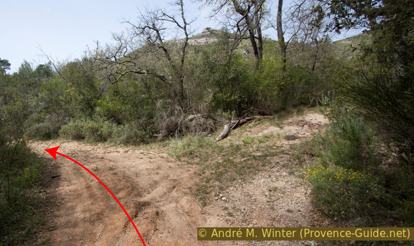
The forest road takes us south and apparently past the mountain, but after 200 meters we see a junction with a blue and yellow marking. Here we go straight uphill to the right. Later it gets even steeper.
No reproduction is permitted without the written consent of the author. (id4757)
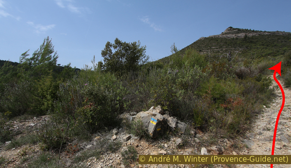
Marking on the way to Le Cuit mountain
We reach a saddle, now there are still 70 vertical meters left to the summit.
No reproduction is permitted without the written consent of the author. (id4758)
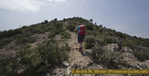
The last metres before the Le Cuit summit
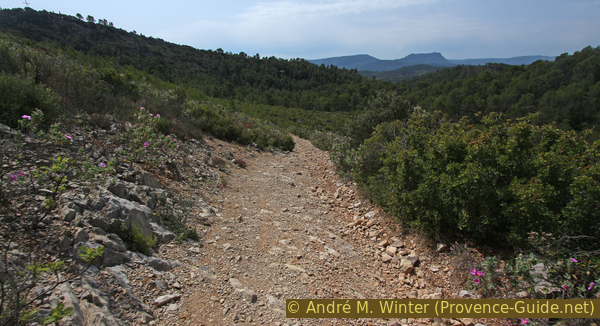
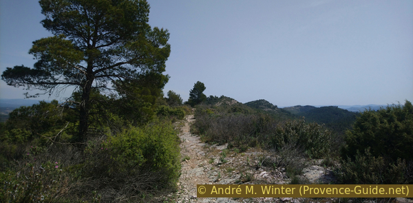
In the 360° panorama there is the Montagne Sainte-Victoire in the west, the Petit Bessillon and the Gros Bessillon in the north and when the weather is optimal, the main ridge of the Alps appears in the north-east.
To the east looking back is Paracol Hill, which is the wooded twin peaks. Below you can see the forest road on which we went west. To the left of it the banded ridge with our way back at the top.
No reproduction is permitted without the written consent of the author. (id4759)
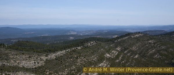
Ridge to the east of Le Cuit
Section 2: Le Cuit - Chapelle St. Cyriaque - Le Val
➙ 6,9 km ... 2 h 20 min ➚ 175 m ➘ 460 m ↝ average
5% easy trails, few marks
40% easy trails, without marks
35% forest roads, without marks
5% easy trails, without marks
5% hard-surfaced quiet side streets, without marks
5% hard-surfaced city alleys, without marks
5% easy trails, without marks
<5% hard-surfaced city alleys, without marks
The clues
- Le Cuit, 540 m
- Saddle north of Le Cuit, 470 m
- Nameless hill, 500 m
- Ridge Les Sambles
- Descent north at the end of the ridge path, 475 m
- Forest roads in the hilly landscape of Les Sambles
- St. Cyriaque chapel, 370 m
- St. Jacques chapel, 270 m
- Le Val, 245 m
The way back starts from the long ridge and ends with a last chapel on its hill.
We get back in the saddle and climb the nameless peak opposite.
No reproduction is permitted without the written consent of the author. (id4760)
View from the saddle north of Le Cuit mountain
Petit and Gros Bessillon in the background.
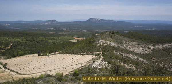
At this summit we turn right to walk back east along the ridge. It is an old forest road that has been reclaimed by the vegetation. Just like in the valley before, the ridge is also a roller coaster. However, you remain constantly below 500 meters above sea level.
No reproduction is permitted without the written consent of the author. (id4761)
East ridge of Le Cuit
It makes sense to count the ascents and descents, so we can narrow down the area where we have to leave the ridge. We pass two depressions and two elevations.
No reproduction is permitted without the written consent of the author. (id4762)
Hills in the ridge to the east of Le Cuit
The second elevation is very long. However, 150 meters after the highest point you have to look out for a cairn blocking the way at the crest.
And indeed, at the crest the path soon ends in bushes and between rocks. At cairn, a path leads north into the forest on the left. Here it goes quickly and in a large hairpin bend downhill.
No reproduction is permitted without the written consent of the author. (id4763)
The trail leaves the ridge to the north
We come to a forest road, where we keep to the right. At the next crossing we turn right again.
No reproduction is permitted without the written consent of the author. (id4765)
We reach a forest road
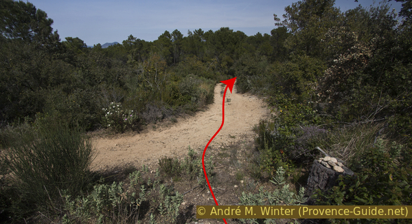
Now it goes over a kilometre not quite flat through a typical Provençal forest. Here are pines, oaks and tree heather. After a kilometre we see a stone hut in the forest on the left and a little later we pass a field with olive trees.
At the following crossroads we turn left.
The dirt road has many branches into the forest here, but they lead nowhere. We always stay on the widest forest road, even if it's not exactly straight. Walk north-east for roughly 120 meters, then turn right and continue south-east.
No reproduction is permitted without the written consent of the author. (id4766)
Stone hut in the forest
maison de Retraite = retirement home
And we come to another crossroads, here we go straight and the forest road slowly rises. This is the last elevation on this tour. After a few minutes we are in front of the of St. Cyriaque chapel.
No reproduction is permitted without the written consent of the author. (id4767)
Forest road and fork to the north-east
The country chapel was probably built in the 16th century. Cyriaque was a deacon who was tortured and executed in Rome in 303. He is the patron saint of the village of Le Val.
The jagged rock carries not only the chapel but also a large cross that can be seen from the village.
For the descent we go south past the chapel to the east. After two hairpin bends, the path leads down across the slope. With two more hairpin bends, it leads to a wayside shrine and an old, narrow asphalt road.
No reproduction is permitted without the written consent of the author. (id4768)
Way down from St. Cyriaque
We turn left here and continue downhill. After a few minutes we pass the St. Jacques chapel and are back on the familiar path to the starting point.
No reproduction is permitted without the written consent of the author. (id4686)
Looking back towards St. Cyriaque hill
Sources and additional information
It is better to use a good topographical hiking map: this tour is on the IGN "Brignoles, Le Luc, Lac De Carcès" map, scale 1:25000, 3444OT.
If you don't want to bother with a paper map, you can also use mapping apps on your cell phone. On the one hand, it is the Cartes IGN app from the official map service. However, it requires access to the data network and this is sometimes difficult in canyons or remote locations.
Alternatively, you can use apps that store data directly on the device. They're generally not free, but they don't cost much. We mainly use OSMAnd, here it is possible to add contour lines, relief shading, markings and others. To store this data on your phone you need a lot of space.
Of course, one needs access to satellites for the GPS signal with any app. In some canyons this is not the case. Therefore, do not rely on the position shown, but read the map on your phone as you would read it on paper. Most apps are available for Android and iPhone. The applications usually allow us to record the route travelled and also view the GPS files offered for each of our hikes.
This page has been seen 1999 times since 20 March 2024.
No reproduction is permitted without the written consent of the author. (id4770)
Notre-Dame de Paracol chapel and the gilded Madona