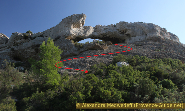
The natural arch Terreveine at Cap Canaille
A difficult tour with a magnificent view
scramble
difficult
2 h
no
yes
no
mountain
Introduction
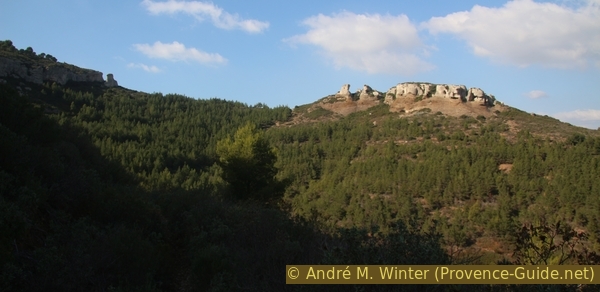
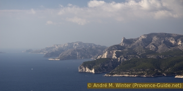
Cap Canaille is a large layer of limestone that encloses a layer of conglomerate called puddingstone (poudingue). You can see this rock more clearly at Bec de l'Aigle in La Ciotat. Limestone and poudingue are eroded over time in very different ways. At the connecting zones, arches and crags are formed that are comparable with the forms in American national parks.
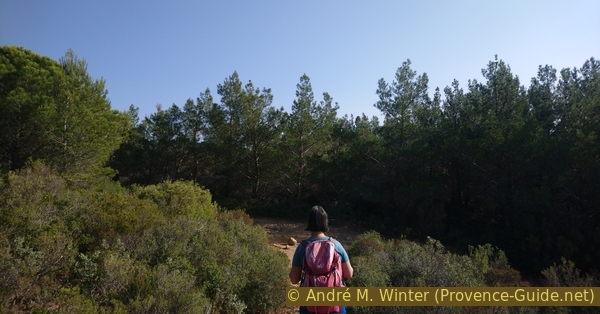
This hike takes us under a natural arch and along old gorge slopes. Most of these remarkable forms are unnamed. The path is partly very overgrown, the first two sections are unmarked.
The facts
3,7 km total distance
2 h walk time
200 m total elevation
orientation difficult in the first section
mark 30% of the total distance
70% easy trails
15% hard-surfaced country road
10% moderate trails
5% difficult trails
<5% cross country
dangers heat in summer, little shade
children yes
useful picnic stuff
required trekking shoes, long pants, hiking gear and water
GPS coordinates (WGS84) of start and end point 43.180364478067,5.57235591552
downloads ![]()
![]()
Public transport
There is no direct way to get there by public transport. You may reach the area with adding some hike time. With the regional train TER PACA (only french) which runs between Marseille and Toulon to the station La Ciotat. Then take line 10, 60, 70 or 200 from CiotaBus (only french) to the end of line at Louis Pecout final station.
Look for a forest track that leaves from the bus turnaround area. This track passes on the ridge and you arrive at a large area with a water tank. Continue in a straight line, then follow the bends of the forest track. We arrive on the Cap Canaille crest road, we turn right and continue to climb. In the middle of the straight line that follows, a bushy path goes to the right, initially down a little, then keeping the height. We thus come to the beginning of the tour described here. 150 meters of altitude difference, 2 kilometers of distance and 45 minutes for one direction, a little less downhill. See the red line on the map on this page.
Access by car
La Ciotat is located between Marseille and Toulon. The motorway exit coincides with the toll station. We first follow the arrows to La Ciotat Center, then the signs towards Route des Crêtes. We drive up until it becomes flatter and there are no-way signs on the left at an intersection. This is the road to the military watchtower (Sémaphore).
From Cassis, take the Route des Crêtes to the junction for the semaphore.
Useful parking spaces
Ideally we park in the small parking lot near the crossing. A little further in the direction of Cassis there is another larger car park. If you park here, cross the road and take a path in the forest parallel to the road to get to the starting point.
Hints
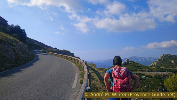
Given the exposed location and heavy traffic on the Route des Crêtes, it is better to come here off-season and during the week.
The first section leads on a very narrow path through thorny thickets, here consisting of kermes oaks. Unlike other shrubs, the branches are very stiff and will cut into the skin of the lower legs or the fabric of hiking pants. As an exception, we recommend long jeans here!
The whole region is a zone with a high risk of forest fires. In summer, but also in other seasons when it is very dry or by strong winds, access to the forest areas can be regulated. As a result, the roads may be closed to traffic and/or the trails prohibited to hikers. Current information: Map of access to forests and exposed areas in Bouches-du-Rhône (only french). The map shows the colours green, yellow, orange and red which correspond to levels of danger.
No reproduction is permitted without the written consent of the author. (id5996)
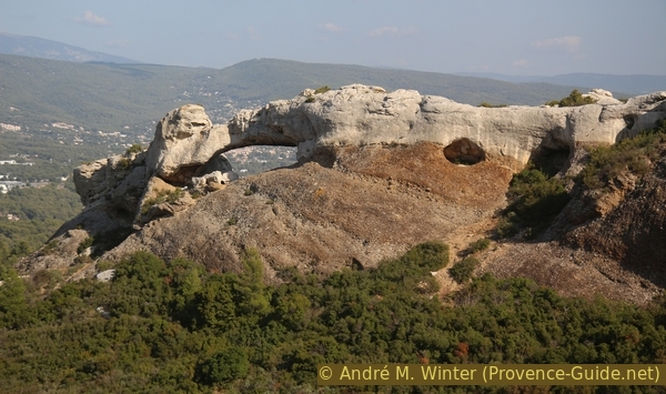
East under the arch
The sections
- Route des Crêtes - Terrevaine - natural arch near Dent du Chat
- Natural arch - Belvédère Cap Canaille
- Belvédère - Highest point of the Cape and back
Section 1: Route des Crêtes - Arc
➙ 1,1 km ... 50 min ➚ 20 m ➘ 125 m ↝ challenging
30% hard-surfaced country road, without marks
30% moderate trails, without marks
20% difficult trails, old marks
5% cross country, without marks
15% easy trails, without marks
The clues
- Start at 330 m on the Route des Crêtes
- Descend to 310 m into the bend north of the ridge line
- Path on the Terrevaine limestone plateau
- Descent under the ridge
- Pass under the natural arch
- Saddle south Dent du Chat, 225 m
After the short stretch of road, a narrow path begins, overgrown and without many landmarks up to the rock arch. This is the most difficult part of the tour.
We leave the car park on Route des Crêtes at the crossroads to the semaphore. The first hundred meters are downhill to the hairpin bend under the main ridge. This is one of two short stretches of road along this loop.
In the following hairpin bend, we continue straight ahead in the direction of the ridge and ignore the wide path on the left.
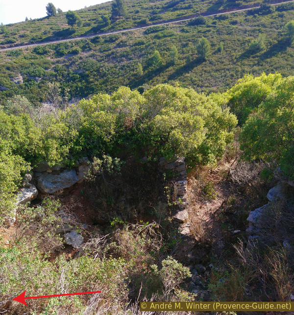
Attention, just before the edge there is a hole in the ground, you can see down to the valley floor!
No reproduction is permitted without the written consent of the author. (id5981)
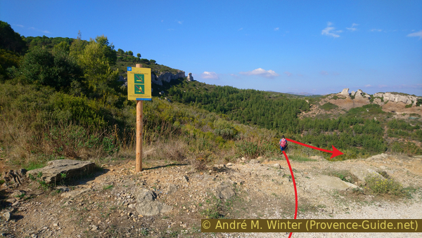
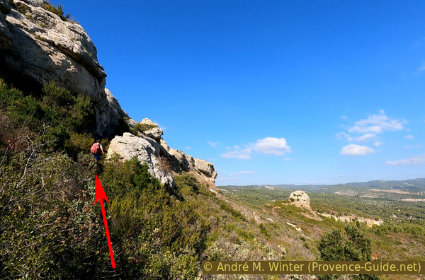
Trail start at the hairpin turn
Then we step back a little from the ledge and take the path that descends parallel to the ledge.
No reproduction is permitted without the written consent of the author. (id5987)
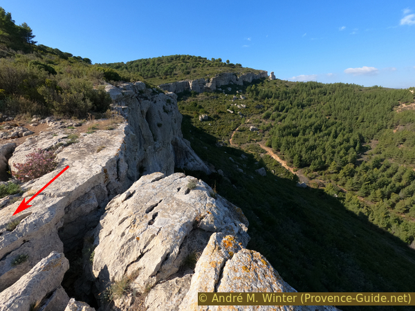
View back on the ridge
Down in the valley the path of section 2.
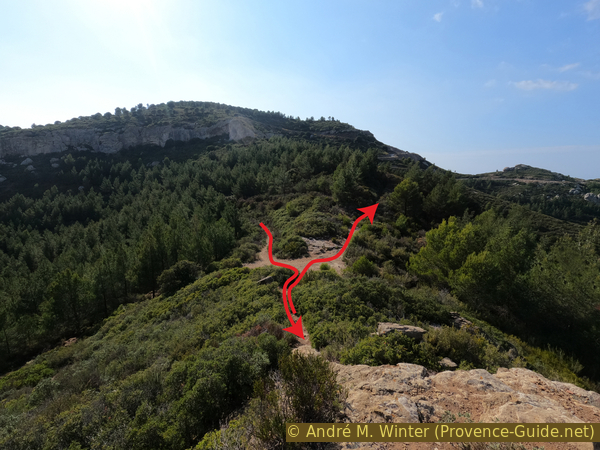
After a flat and rocky area, where the cliff and the path curve slightly to the left, the path becomes less wide but remains recognizable.
Turn right at the next fork.
No reproduction is permitted without the written consent of the author. (id5988)
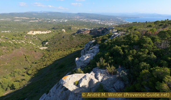
Cliff edge and Dent du Chat rock far behind
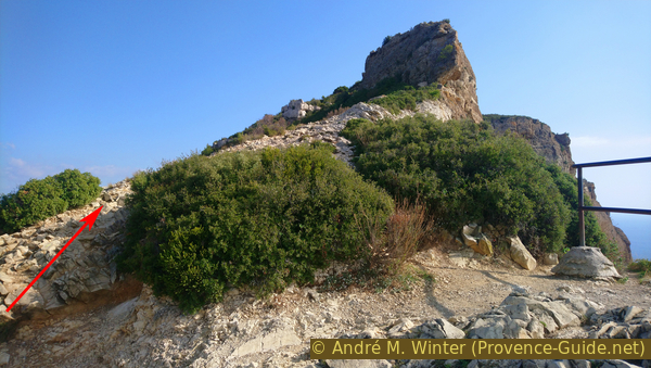
Now it is a matter of following the instructions exactly or observing the GPS track. This is also where the part heavily overgrown with kermes oaks begins, which does not forgive losing the path. This area is not called Terrevaine (useless earth) for nothing.
No reproduction is permitted without the written consent of the author. (id5989)
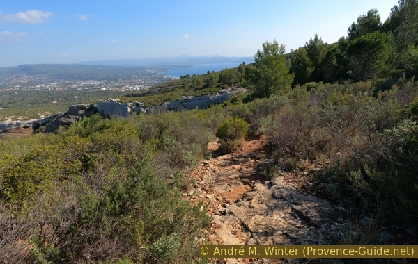
The still large path on the limestone plateau
After the fork we go straight for about 20 meters before turning a little to the right and descending another 15 meters. At the latest when you see an old red marker on a rock, you have to turn almost 180 degrees to the left and north to pass over an old water basin.
Under no circumstances should you descend further south, come to a rocky area with no vegetation or descend to the shooting range in an old quarry.
No reproduction is permitted without the written consent of the author. (id5990)
Cross over this basin
Shortly after the basin turn right and then go down about thirty meters. This takes us through a gap in the east side of the ledge. You can still see some blue markings.
No reproduction is permitted without the written consent of the author. (id5991)
Descend between rocks
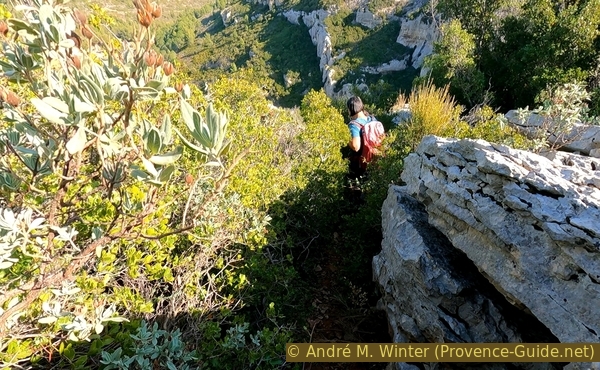
The path descends a little further and then follows the foot of the ridge at different distances. You have to find your way between the taller bushes.
No reproduction is permitted without the written consent of the author. (id5992)
Under the ridge-line forward
Further ahead we come to a round rock that has detached from the wall. We pass to the left of the cliff and come so close to the limestone cliff face.
No reproduction is permitted without the written consent of the author. (id5993)
Pass between the rock wall and the isolated rock
Then we come to the rock of puddingstone (poudingue) and continue between rock and vegetation.
Above we see different cave entrances. A shimmer of light comes in from above through an opening.
No reproduction is permitted without the written consent of the author. (id5994)
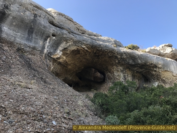
Cave before the natural arch
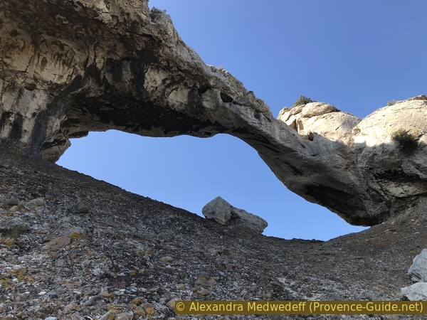
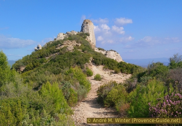
After another section in the bushes we reach the reddish puddingstone (poudingue) under the natural arch. It's time to climb to the top and leave the prickly plants behind. It's steep, but the rock is grippy.
So let's go right under the arch!
No reproduction is permitted without the written consent of the author. (id5995)
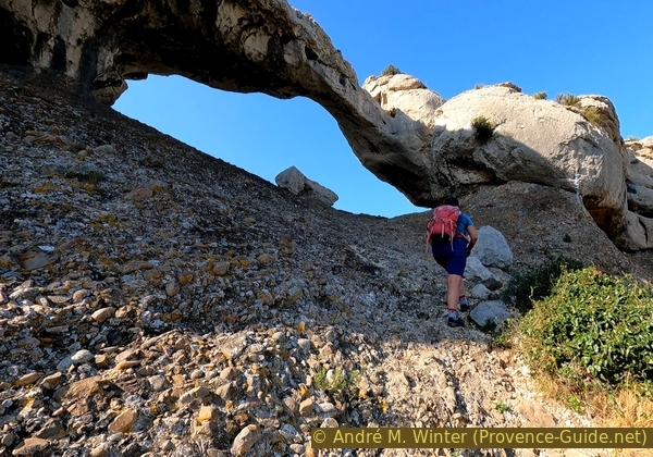
Going up east under the natural arch
On the other side there is a narrow path on the right and we can see a few steps.
No reproduction is permitted without the written consent of the author. (id5997)
Descend west under the arch
You can go out the hairpin bends or descend in the direct line.
No reproduction is permitted without the written consent of the author. (id5998)
West under the arch
A little further down is a wider path. We take it to the right and towards the isolated rock called Dent du Chat (the cat's tooth). We can easily climb a first rock step. It is also possible to reach the summit by rock climbing, but the main route is difficult to pass due to unruly bushes.
No reproduction is permitted without the written consent of the author. (id5999)
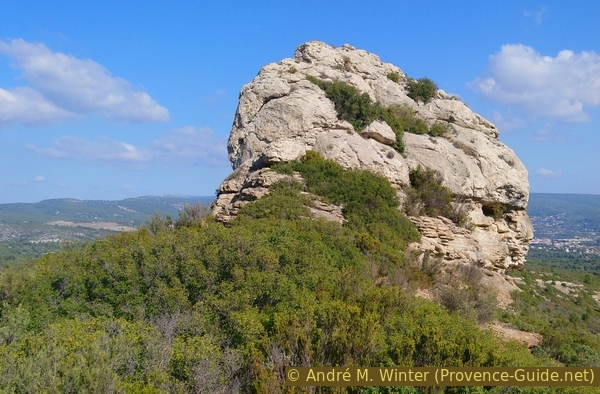
Dent du Chat rock
Section 2: Arc - Falaises Soubreyanes
➙ 1,5 km ... 40 min ➚ 125 m ➘ 5 m ↝ easy
85% easy trails, without marks
15% hard-surfaced country road, without marks
The clues
- Saddle south of Dent du Chat, 225 m
- valley floor, 250 m
- Saddle in the southwest of Bau Rous, 310 m
- Falaises Soubreyanes belvédère, 350 m
We pass various caves in the cliff face and climb to the crest of the Falaises Soubreyanes.
After a break under the Dent du Chat rock, we return to the natural arch and continue along the wide path to the west and to the right of the rock wall. This path runs under the edge of the cliff and is therefore parallel to the approach that led us before ontop.
Passing by, one sees other caves that could form arches.
As the path approaches the rock, one can climb up to a small cave with a natural window overlooking the valley.
No reproduction is permitted without the written consent of the author. (id6000)
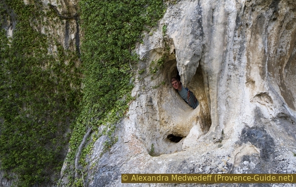
Cave with a window
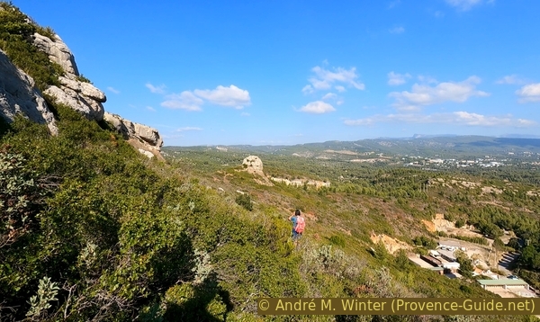
Afterwards we have several opportunities to look back at this impressive limestone rock.
No reproduction is permitted without the written consent of the author. (id6001)
View back to the arch
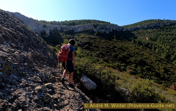
The path bends to the right with the rock wall, then it moves away from it a little. One might think to see passages in the rock, but nothing is passable here. We continue on the flat path to the west, which finally leads down the valley. In a wide ditch it then goes up about 30 metres in altitude. It is possible to take a slightly less steep path on the left halfway up.
No reproduction is permitted without the written consent of the author. (id6002)
Bau Rous crest
After that, the path becomes more pleasant again and takes us to the pass south-west of the Bau Rous rocks, the same limestone range that we saw further back at the beginning of the tour. It is possible to traverse the maze of limestone pinnacles back and forth along a winding and narrow path.
We see the rock arch from the pass very clearly one last time.
No reproduction is permitted without the written consent of the author. (id6003)
Bau Rous crest as seen from the pass
On the normal loop we return to the pass and turn right to get to a hairpin bend on the Route des Crêtes coming from Cassis.
No reproduction is permitted without the written consent of the author. (id6004)
View to the pass under Bau Rou ridge
We go up along this road. For the most part you can walk on a small path to the right of the crash barrier.
No reproduction is permitted without the written consent of the author. (id6011)
Path along the road
Once at the top, we reach one of the most famous natural viewpoints at Cap Canaille. It's just above the bend in the road. From here we can see the Calanques of Marseille including the Calanque d'En-Vau, Calanque de Morgiou and Calanque de Sormiou as well as all the islands. However, Cassis and La Ciotat remain hidden.
No reproduction is permitted without the written consent of the author. (id6005)
Calanques de Marseille to the west
Section 3: Cap Canaille
➙ 1,1 km ... 30 min ➚ 55 m ➘ 70 m ↝ easy
80% easy trails, with marks
20% easy trails, without marks
The clues
- Falaises Soubreyanes belvédère, 350 m
- Highest point of Cap Canaille, 395 m
- Route des Crêtes, 330 m
The return to the starting point climbs to the highest point of the cape and takes place on a marked path between Cassis and La Ciotat.
From the belvedere, we climb steeply again. The path is now marked in yellow, it meanders between bushes and rocks along the edge of the Falaises Soubreyanes. We approach the highest point of Cap Canaille as the path becomes flat.
No reproduction is permitted without the written consent of the author. (id6006)
Way up after the viewpoint
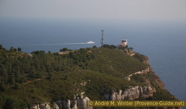
We then have a very good view of the semaphore Bec de l'Aigle. So this military installation is not on the highest point of the cape, it faces La Ciotat and Cap Sicié.
No reproduction is permitted without the written consent of the author. (id6008)
Military semaphore at Cap Canaille
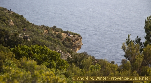
After starting the descent, it is possible to continue descending to the right towards the cliff edge, some places are overhanging here. The view of the Calanques is even better here than from the Belvedere on the side of the road. However, we continue along the marked path without taking the first large forest road on the left.
No reproduction is permitted without the written consent of the author. (id6007)
Overhang on Falaises Soubreyanes
400 meters after the highest point you come to a fork with a forest path that branches off to the left. It is now time for us to leave the cliff edge and return to the starting point.
When the path meets the road, we have the following options: turn left on a path parallel to the road to reach the higher parking lot on the road to Cassis, turn right to return to the junction towards the semaphore.
No reproduction is permitted without the written consent of the author. (id6009)
Forest road left to the starting point
Sources and additional information
It is better to have a good topographic hiking map: this tour is on the IGN map "Aubagne, la Ciotat, Massif de la Sainte-Baume", scale 1:25000, 3245ET.
If you don't want to bother with a paper map, you can also use mapping apps on your cell phone. On the one hand, it is the Cartes IGN app from the official map service. However, it requires access to the data network and this is sometimes difficult in canyons or remote locations.
Alternatively, you can use apps that store data directly on the device. They're generally not free, but they don't cost much. We mainly use OSMAnd, here it is possible to add contour lines, relief shading, markings and others. To store this data on your phone you need a lot of space.
Of course, one needs access to satellites for the GPS signal with any app. In some canyons this is not the case. Therefore, do not rely on the position shown, but read the map on your phone as you would read it on paper. Most apps are available for Android and iPhone. The applications usually allow us to record the route travelled and also view the GPS files offered for each of our hikes.
This page has been seen 3118 times since 20 March 2024.
No reproduction is permitted without the written consent of the author. (id6010)
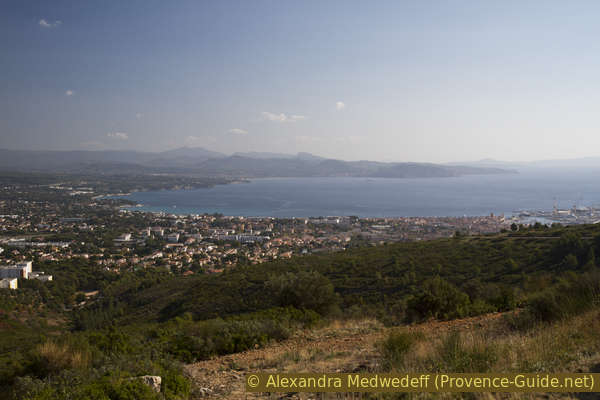
Bay of La Ciotat