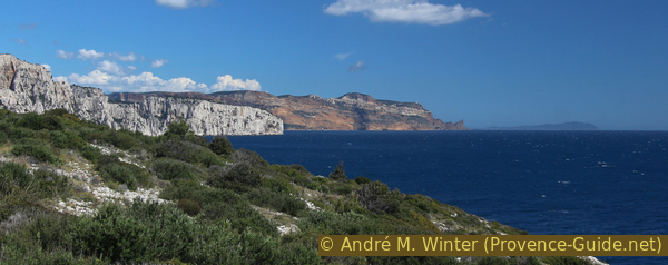
Calanques Sormiou and Morgiou and two large semi-caves off the ridge
The two largest calanques that frame Cap Morgiou, starting from Les Baumettes
scramble
average
6 h 45 min
yes
yes
built-up area
mountain
Introduction
The Calanques of Marseille are a top destination for all lovers of nature, of the sea and of sporty hikes. They attract both the residents of Marseille and tourists who come from very far. The bare white limestone that juts out into the dark blue sea, the high and vertical cliffs, the length of the possible tours and the easy accessibility make up the whole success of this national park. There is a multitude of access points and an almost unlimited number of routes. This is perhaps the most difficult question: where to get in, which way to go?
The tour presented here leads to the two largest calanques of this stretch of coast: Sormiou and Morgiou. In between, we go to the long Cap Morgiou and just below its ridge we descend to two caves worth seeing. They are not noted on the classic maps and are nevertheless highlights of this round.
The facts
12,7 km total distance
6 h 45 min walk time
800 m total elevation
orientation easy on marked paths, difficult off the beaten track
mark 80% of the total distance
35% easy trails
20% moderate trails
10% hard-surfaced quiet side streets
10% cross country
5% exposed trails
5% dirt roads
5% hard-surfaced city alleys
5% forest roads
<5% Trails with scramble passages
<5% hard-to-recognize trails
<5% on beach
dangers airy sections, rock passages
children if they are persistent
useful picnic stuff, swimwear
required hiking boots, hiking gear, sun protection and plenty of water
GPS coordinates (WGS84) of start and end point 43.226278,5.416302
downloads ![]()
![]()
Public transport
The number 22 bus runs from the Rond Point du Prado metro station to the Les Baumettes terminus in about 30 minutes and this at least 25 times a day. This terminus is the starting point of the tour. Information at RTM (only french).
From the bus stop, we go right along Chemin de Morgiou street until we reach a parking lot.
Access by car
The district of Les Baumettes is located in the south of the city of Marseille. During the weekday mornings and late afternoon traffic is really bothersome.
- Coming from Aubagne on the A50 highway, first follow the direction to Mazargues. When exiting the roundabout, take the left lane and the subsequent toll tunnel. In the tunnel, get in the left lane towards Mazargues.
- Coming from the North and Marignane, take the A55 highway to Marseille. Stay on the motorway towards Aubagne and take the toll tunnel under the port. When you definitely come out of the tunnel section, you will pass a tollbooth and then turn right towards Mazargues.
In both cases, we come to Boulevard Michelet, this wide street already points in the good direction (south). It is also the D559 road, which continues to Cassis. At the roundabout with the obelisk, we keep to the right and follow the signs to Les Baumettes. At the end of the alley, we turn left. If we are in line at a church, we drive around it to the right. From here, you just follow this road.
When the road gets wider and straighter again, we see a long wall on the left, behind which a large prison is hidden. After that, there are often free parking spaces on both sides that can be used if everything further back is full.
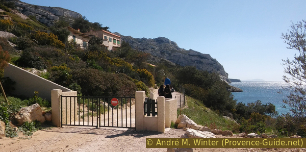
Our street, the Chemin de Morgiou, separates into a left and a right lane, we have to stay on the right first. At the latest at the second intersection, however, we change to the other lane and turn right again and drive out of town. The road rises briefly and so you come to the barrier in front of the road to Morgiou (no driving), on the right is the entrance to the parking lot with a bumpy ground.
No reproduction is permitted without the written consent of the author. (id4326)
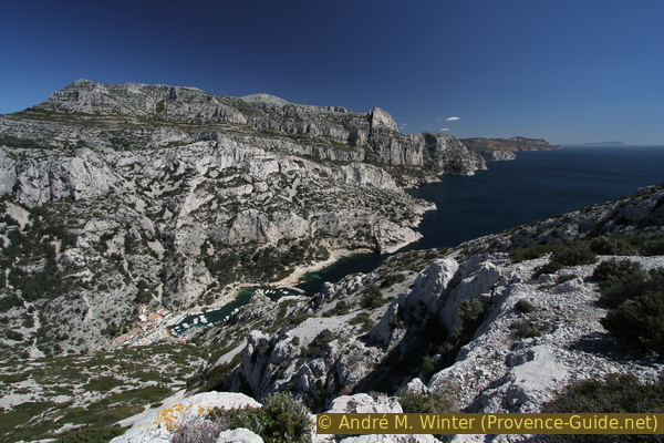
Calanque de Morgiou seen from the ridge
Useful parking spaces
As described above, there are almost always free parking spaces after the jail. If you arrive in time, you can aim for the upper and last parking lot. If you arrive late on weekends, it is better to stay just after the prison.
Hints
In the Calanques, almost all paths are long, most of them have a lot of altitude difference and the way back usually leads uphill. In addition, there is the merciless sun and there are no watercourses or springs. Therefore, most of the hikes here are quite demanding. Even marked trails can be steep and extremely exposed. The detours to the caves presented here are difficult. Sun protection, lots of water and high mountain boots are mandatory.
Bars in Sormiou and Morgiou are open during the summer months and the rest of the year when the weather is nice, otherwise there are no catering options.
Shade is scarce. You can only swim on the small beaches of Sormiou and Morgiou, everywhere else the path leads high above the sea and the cliffs usually fall vertically down to the water.
The whole region is a zone with a high risk of forest fires. In summer, but also in other seasons when it is very dry or by strong winds, access to the forest areas can be regulated. As a result, the roads may be closed to traffic and/or the trails prohibited to hikers. Current information: Map of access to forests and exposed areas in Bouches-du-Rhône (only french). The map shows the colours green, yellow, orange and red which correspond to levels of danger.
The sections
- Via Col des Baumettes saddle and on the normal route to Plage de Sormiou beach
- Ascent from the Calanque de Sormiou to the Carrefour on the ridge of Morgiou.
- Detour to the Grotte de l'Os cave
- Go out the ridge of Morgiou to the Col du Renard saddle
- Detour to the Grotte du Figuier and on to the Fortin de Morgiou ramparts
- Loop at Cap Morgiou and back to the Col du Renard saddle
- Descent from the Col du Renard to Morgiou, detour to the beach and return through the valley to the Col de Morgiou saddle and on to Les Baumettes
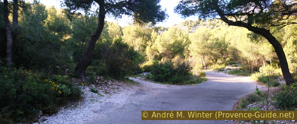
No reproduction is permitted without the written consent of the author. (id4284)
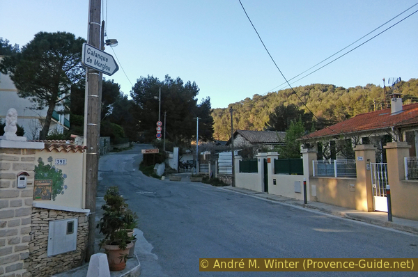
Chemin de Morgiou and access to the last possible car park
Section 1: Les Baumettes - Sormiou
➙ 2,3 km ... 1 h ➚ 80 m ➘ 175 m ↝ average
15% hard-surfaced city alleys, without marks
10% forest roads, with marks
10% easy trails, with marks
10% forest roads, with marks
40% moderate trails, with marks
10% dirt roads, without marks
5% on beach, without marks
The clues
- Les Baumettes, 95 m
- Col des Baumettes saddle, 170 m
- Sormiou beach, 0 m
After a short climb, you descend from the Col des Baumettes saddle to the sea. The entire section is marked in red (single dash). This is today's normal route into this bay.
col = saddle
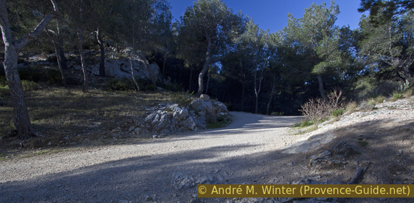
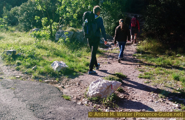
Whether by car or on foot, we have to come to the upper parking lot. On the right behind the barrier (photo) we definitely leave the city.
No reproduction is permitted without the written consent of the author. (id4285)
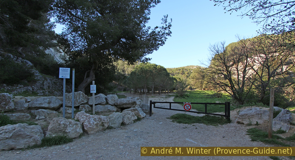
Barriers in front of Pré des Évadés meadow
We come to a somewhat unnatural meadow with a pine forest in the middle (Pré des Évadés). In the background, there is a monument and ruins in the forest. However, we keep to the left. The forest road becomes a path, leads even further to the left and up over rocks and slabs.
No reproduction is permitted without the written consent of the author. (id4286)
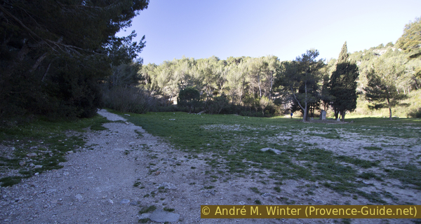
Pré des Évadés, the monument and our trail
When it starts to flatten out again, we continue to take the path on the left, but without going all the way down to the road on the far left. This takes you back to a forest road, turn right here and after a few minutes, you are at the Col des Baumettes saddle.
No reproduction is permitted without the written consent of the author. (id4287)
Forest road under the Col des Baumettes saddle
The forest road turns right at the pass, but we continue straight ahead. You come out of the forest and see the sea for the first time over the ridge of Sormiou. Several paths branch off here, we do not change direction and follow the red marks.
No reproduction is permitted without the written consent of the author. (id4288)
Access to the start of the trail down to Sormiou
col = saddle
plage = beach
Carrefour = junction
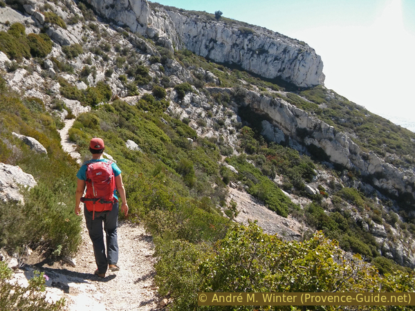
The path leads slowly downhill at first, you walk on white limestone gravel. If you start early enough, you still have shade here.
We come to rocks and a ridge where you can see the Calanque de Sormiou in its entirety for the first time. Here at the latest we come back into the sun and the path becomes steeper.
No reproduction is permitted without the written consent of the author. (id4289)
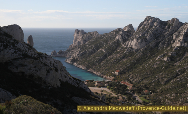
First look at the Calanque de Sormiou
Behind us is Le Pouce (the thumb), a pinnacle in the ridge south of the Col des Baumettes saddle.
No reproduction is permitted without the written consent of the author. (id4290)
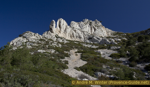
Le Pouce (the thumb)
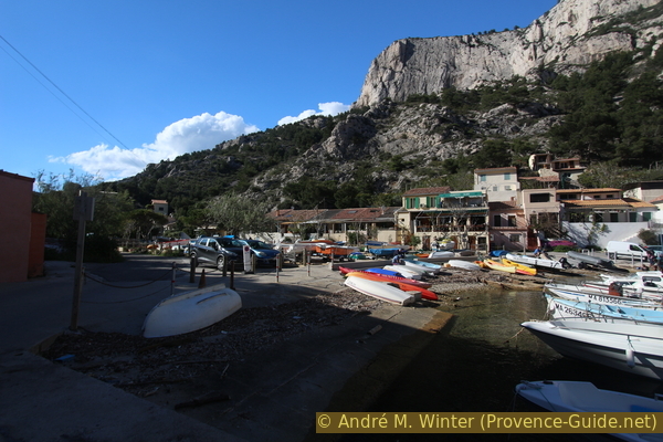
We are then quickly down in a small fishing village. We cross the large square and can descend on the right to the beach with the small boat ramp.
Section 2: Sormiou - Le Carrefour
➙ 1,6 km ... 1 h 25 min ➚ 230 m ➘ 0 m ↝ easy
5% on beach, without marks
25% dirt roads, few marks
70% moderate trails, with marks
The clues
- Plage de Sormiou beach, 0 m
- Le Carrefour, 230 m
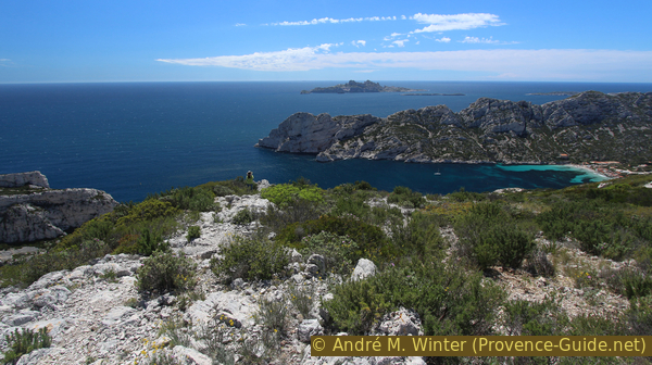
We climb the Crête de Morgiou ridge to the north. From this path are several viewpoints of the Crête de Sormiou ridge, the cape and the island of l'Île de Riou further out in the sea.
You can also continue on the south side of the bay to Cap Redon and the Crête de Sormiou ridge. But you change the hike: Calanque de Sormiou.
From the beach we climb back up to the large square and look for the gravel road on the right. After a gate, it leads flat to the port of Sormiou and to historic fishermen's huts.
No reproduction is permitted without the written consent of the author. (id4316)
Access to Sormiou port
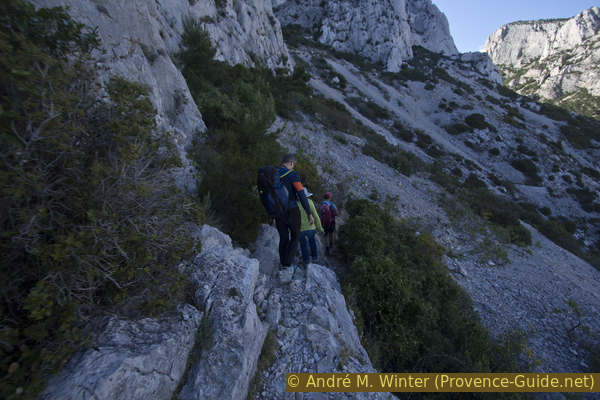
At the port we continue south-east along the red marker. The path first leads between houses and then under individual huts. Shortly thereafter, the path climbs to the left along a ridge that is not particularly pronounced here. You should turn around often, the ridge of Sormiou is progressively fully visible.
No reproduction is permitted without the written consent of the author. (id4318)
Look back to Sormiou
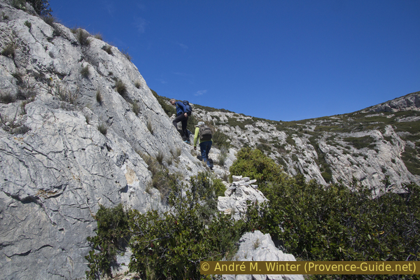
It's consistently uphill. When you come in a rocky section, it gets even steeper. You walk over irregular rock and then continue to the left of the now rocky ridge. The path now leads over sloping rock slabs. They are not slippery, but walking on them is uncomfortable and it is certainly a difficult passage for the inexperienced.
No reproduction is permitted without the written consent of the author. (id4320)
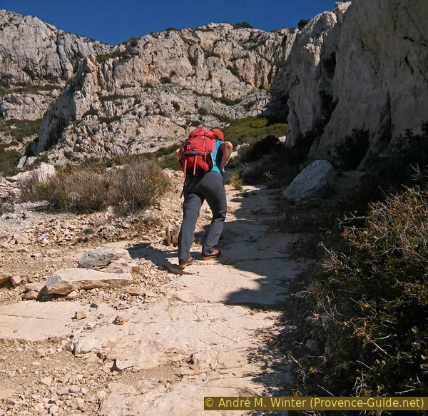
Passage over inclined plates
After this steep passage, we have to climb over a small section. A red marker indicates the ideal spot for crossing.
No reproduction is permitted without the written consent of the author. (id4321)
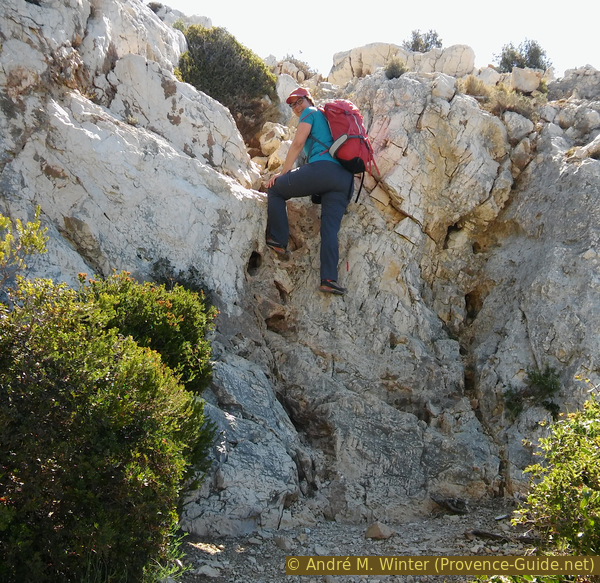
Climbing point on the way up to the ridge
After that, the previously arduous climb turns into a comfortable walk. You hike to the east without gaining any significant metres in altitude.
From this stretch of the path, you can admire the Sormiou ridge better, behind which you can now also see the Île de Riou island.
No reproduction is permitted without the written consent of the author. (id4322)
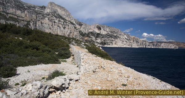
Path under the ridge of Morgiou
Slowly but surely, the rock face on the left is getting closer and closer.
No reproduction is permitted without the written consent of the author. (id4324)
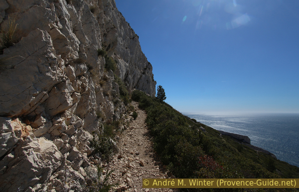
Panoramic path under the ridge
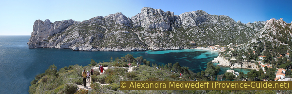
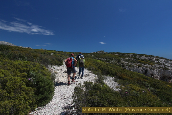
After the narrower section, the path climbs again and enters a wide saddle on the ridge of Morgiou called Le Carrefour (the crossroads). Behind us the view is still fantastic.
No reproduction is permitted without the written consent of the author. (id4325)
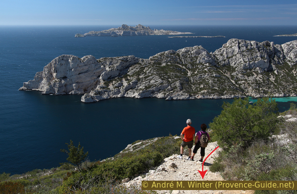
Hikers admire the Sormiou ridge
We come to a wider path, which leads along the ridge that is flat here. On the left it goes back to Les Baumettes (red and blue markings), in front you could go straight down to Morgiou (red) and on the right it goes along the ridge to Cap Morgiou (blue).
We're planning to go to Cap Morgiou, but before that we suggest a detour that's really worth it!
Section 3: Le Carrefour - Grotte de l'Os
➙ 0,4 km ... 30 min ➚ 60 m ➘ 60 m ↝ difficult
25% hard-to-recognize trails, cairns
50% Trails with scramble passages, cairns
25% hard-to-recognize trails, cairns
The clues
- Le Carrefour junction, 230 m
- Grotte de l'Os cave, 170 m
- Le Carrefour junction, 230 m
Descend to a semi-cave with a view of the Sormiou cape. Back in the saddle the same way.
Attention, the descent to the cave includes exposed rock sections that must also be walked on the way back. You will also put your hand on the rock during the descent and help children and less experienced people. The path is barely visible, but marked with many cairns. There is no other way of marking.
The whole tour is long and you can skip this detour. In this case, follow the blue trail to the right and continue along section 4. This saves you 30 minutes, but you miss a sight!
col = saddle
crête = ridge
passages rocheux = rock section
rocher blanc = white rock
At Le Carrefour junction is a very large cairn. Continue in the direction of the cape, that is, coming from Sormiou, turning right. Only about 15 meters away from the cairn, however, we turn right onto a narrower path and we aim for a white rock that protrudes from the flat vegetation.
No reproduction is permitted without the written consent of the author. (id4447)
The white rock on the right, which is to be targeted on the way to the cave
We pass the rock on the left and continue on a ledge that is relatively bare of vegetation.
No reproduction is permitted without the written consent of the author. (id4448)
Access to the cave over the rock strip
A little further ahead, it goes slightly downhill, but we keep the direction. However, when it gets steeper, we look to the left for a descending path. It is marked with small cairns.
No reproduction is permitted without the written consent of the author. (id4449)
On the edge of the plateau south of Le Carrefour
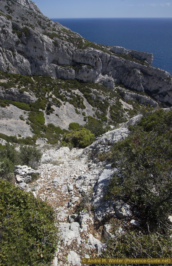
Now the descent is steeper. The path turns right again and leads us down south over gravel.
No reproduction is permitted without the written consent of the author. (id4450)
Descending path to the cave
You get to firmer rock and here you have to climb down a first step. After that, you tend to keep to the right and continue to climb down. A similar section follows and shortly after that, you soon come to the cave.
No reproduction is permitted without the written consent of the author. (id4451)
First rock step to climb down
The second section of rock is more interspersed with gravel.
No reproduction is permitted without the written consent of the author. (id4452)
Second steep descent to the cave
We can now easily proceed further south on a rocky edge, even if we have to bend some bushes to the side. Then you stand on a boulder in front of which it goes vertically down several meters. However, we are soon arrived, if you bend slightly and look to the right, you can see part of the cave! We still have to descend to the lower level on the right. A step carved into the rock helps.
It just goes into the cave, next to the small gate there is a big opening to the south.
No reproduction is permitted without the written consent of the author. (id4455)
Last descent before the cave
The semi-cave Grotte de l'Os is not very deep, it is probably a washout of a primeval river. However, the size and the pillar separating the two openings make this cave unique.
No reproduction is permitted without the written consent of the author. (id4453)
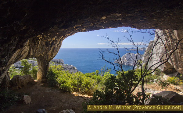
View from the Grotte de l'Os cave
The many cairns, fireplaces (forbidden) and climbing hooks prove that we are not the first here. But that doesn't make the place any less worth seeing. You're far from the main path, you're sheltered (from sun, wind, rain) and you have a good view of Cape Sormiou. Even if we have only completed a quarter of the entire tour, you will stay here for a break.
No reproduction is permitted without the written consent of the author. (id4454)
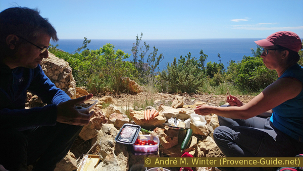
Rich snack in the Grotte de l'Os
Satisfied, we climb back up the same path to the Le Carrefour crossroads and turn right there.
No reproduction is permitted without the written consent of the author. (id4456)
Rocky section above the cave
Section 4: Sentier des Crêtes de Morgiou
➙ 1,8 km ... 45 min ➚ 35 m ➘ 180 m ↝ easy
80% easy trails, with marks
20% moderate trails, with marks
The clues
- Le Carrefour junction, 230 m
- Cancéou ridge, 220 m
- Col du Renard saddle, 85 m
On the path of the ridge of Morgiou, here easy, we advance to the cape. The main path is marked in blue.
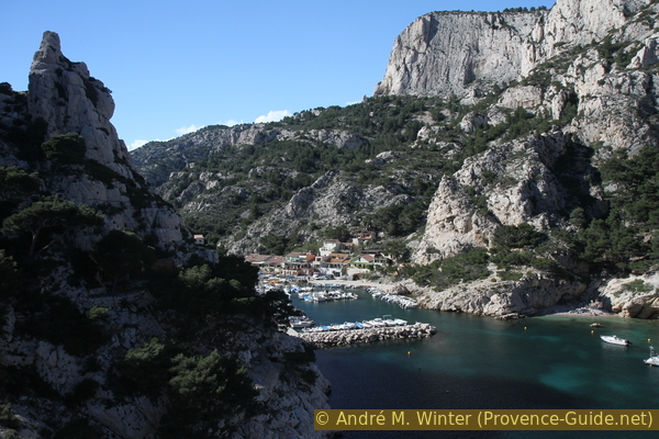
Back on the ridge, we turn right towards Cap Morgiou. It's flat at first, bypassing some rocky sections. Gradually we have various views of the much narrower Calanque de Morgiou at the bottom left.
No reproduction is permitted without the written consent of the author. (id4457)
Way east of Le Carrefour
After a while you can also see up to Cap Canaille between Cassis and La Ciotat. You can also see the Cap Sicié between Sanary and Toulon in the foreground.
No reproduction is permitted without the written consent of the author. (id4458)
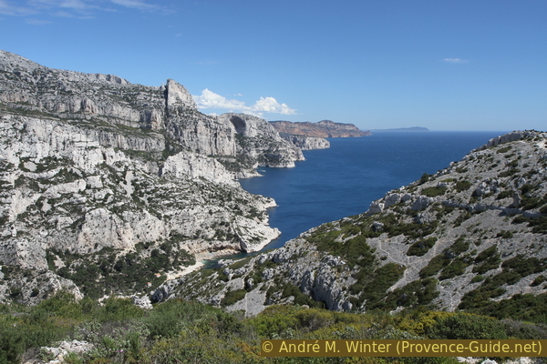
Calanque de Morgiou, Cap Canaille and Cap Sicié
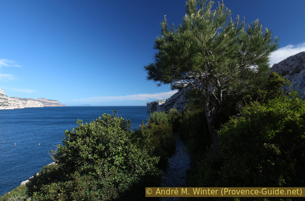
We bypass a rocky area to the north. In the following section we pass a pine tree that survived the 2009 fire.
No reproduction is permitted without the written consent of the author. (id4327)
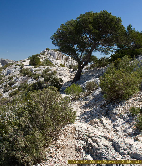
Pine on the Morgiou ridge
Up to the Falaise du Renard, we remain over 200 meters above sea level. This area can be recognized by a transverse crest. In 2019, there was a wooden cross on the south side. You can go there for a better view.
From here, we also see the front Cap Morgiou in its entirety.
No reproduction is permitted without the written consent of the author. (id4459)
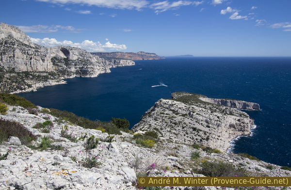
Calanque and Cap Morgiou
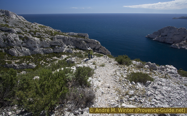
This is also where the steeper descent to the Col du Renard saddle begins. We quickly lose 120 meters in altitude.
The path leads over brittle rock and gravel. It's also badly marked here.
No reproduction is permitted without the written consent of the author. (id4460)
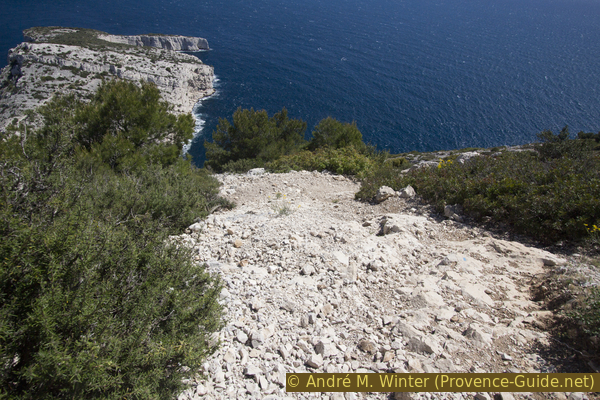
Descent to the Col du Renard saddle
There are some rocky sections, but they are pleasant compared to the chaotic gravel areas.
No reproduction is permitted without the written consent of the author. (id4461)
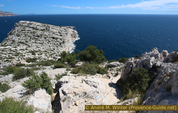
Rocky passage above the Col du Renard saddle
Section 5: Col du Renard - Grotte du Figuier
➙ 0,4 km ... 45 min ➚ 65 m ➘ 60 m ↝ challenging
25% cross country, without marks
20% Trails with scramble passages, without marks
25% cross country, without marks
30% easy trails, with marks
The clues
- Col du Renard saddle, 85 m
- Rock edge, 40 m
- Grotte du Figuier cave, 55 m
- Rock edge, 40 m
- Fortin de Morgiou ramparts, 90 m
Now another detour to another cave is possible. The access is more difficult to find, more complicated from a technical point of view and more exposed than in the other cave.
There is also a junction at the saddle. On the left is our way back, here you can skip the cave and the whole cape, save 1h30 and continue on section 7. Skipping just the cave and continuing on the main trail to the cape will save you 40 minutes. Continue with section 6.
col = saddle
crête = crest
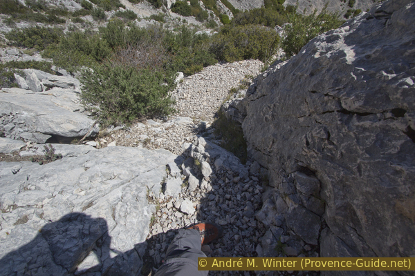
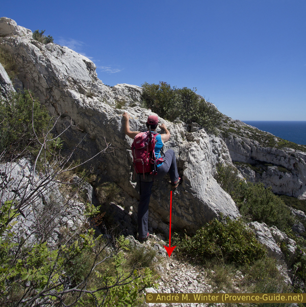
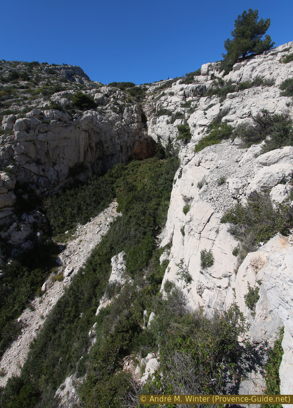
We go from the saddle first towards Cape. About 15 meters after the crossing, we turn right. The path is barely visible and there are no other visual clues. We descend and turn to the ledge on the right. The terrain is rough, there are deep crevices between the boulders, hidden by the sparse vegetation.
We look for a rock on the edge that looks like pincers (photo) and in front of it, we look for a way over the rock edge.
No reproduction is permitted without the written consent of the author. (id4463)
Descent to the Grotte du Figuier
Below left the striking rock.
The narrow gap lies between two rocks and leads to a path that leads to the cave in the valley slope and rises again at the end.
No reproduction is permitted without the written consent of the author. (id4464)
Over the ledge to get to the cave
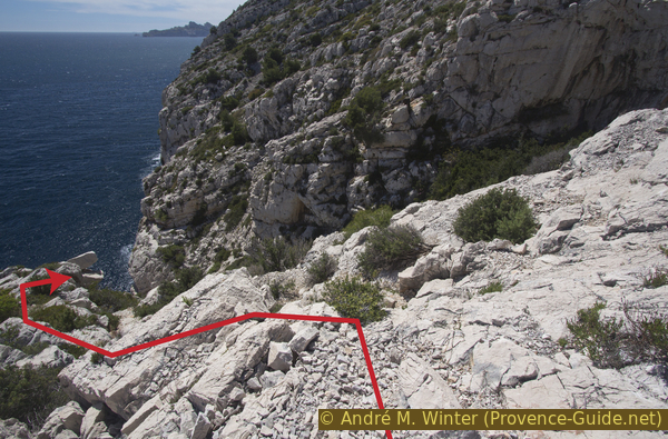
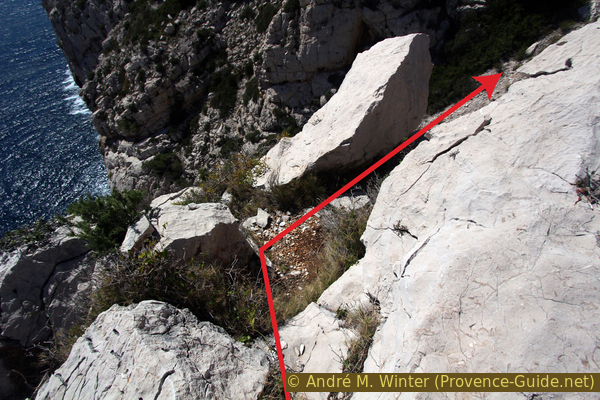
When descending over the edge, you can already see the cave in front above. You can also see the lower edge of the rock, over which you can advance. You should stay as high as possible, mostly between the rock face on the right and the bushes on the left. In the photo, the route is a vertical line in the center of the image. In any case, do not descend into the valley floor!
No reproduction is permitted without the written consent of the author. (id4465)
Valley under the cave
This cave is smaller than the previous one, the sea view is limited by the canyon. Even fewer hikers come here.
The pass Col du Renard is directly above the half-cave, on the picture you can see a hiker at the top.
No reproduction is permitted without the written consent of the author. (id4466)
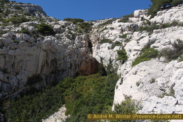
Semi-cave Grotte du Figuier
From the cave we first go back the same way over the cliff edge. We don't have to go back up to the Col du Renard saddle as we continue, we can proceed slightly uphill to the right up to the path marked in blue.
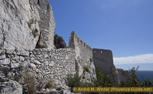
Shortly afterwards we are at the foot of the Fortin de Morgiou ramparts. Through the only former opening we reach the front area of the cape.
No reproduction is permitted without the written consent of the author. (id4467)
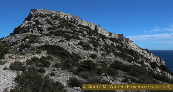
Wall of Fortin de Morgiou
Section 6: Fortin, Cap Morgiou
➙ 2,1 km ... 45 min ➚ 75 m ➘ 80 m ↝ average
30% easy trails, few marks
40% cross country, without marks
35% easy trails, few marks
The clues
- Fortin de Morgiou wall, 90 m
- Cap Morgiou, 20 m
- Col du Renard saddle, 85 m
After the wall, the cape is noticeably flat. The Napoleonic fortifications were destroyed by the English. The ruins now shelter vegetation and the cape is greener than the rest of the whole ridge.
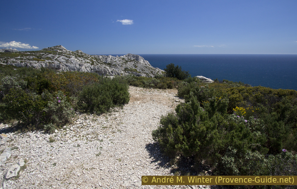
The path is clear and marked in blue between Col du Renard and Calanque de la Triperie.
After crossing the fortress wall, our path leads over the gently sloping plateau of the cape. Here are the easiest sections of the whole tour. Few people come here, although you can only see the two Calanques Sormiou and Morgiou in full from the very front!
No reproduction is permitted without the written consent of the author. (id4468)
Passing the Fortin de Morgiou wall
fortin = fortress wall
grande = big
petite = small
batterie = gun emplacement
vigie = lookout
The main path takes us to the edge of the Calanque de la Triperie. It is a huge and flooded rock basin with vertically sloping walls. It is impossible to get to the water here. Under the western cape of the bay (Pointe de la Voile, right) are the famous Grottes Cosquer caves.
No reproduction is permitted without the written consent of the author. (id4469)
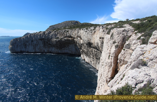
Calanque de la Triperie and Pointe de la Voile cape
The southern cape of the bay is the real Cap de Morgiou. You can get there by crossing a pine grove. This part of the cape is really flat but ends immediately at a vertical drop.
No reproduction is permitted without the written consent of the author. (id4470)
Cap Morgiou
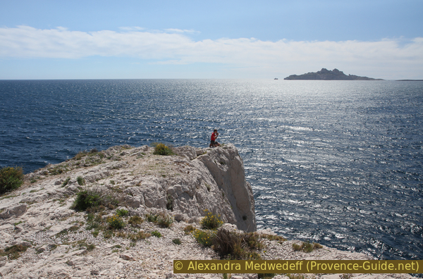
You don't have to go further, you can see very well the Calanque de Sormiou, all the offshore islands and even the Île Maire island, which is also visible from Marseille.
No reproduction is permitted without the written consent of the author. (id4471)
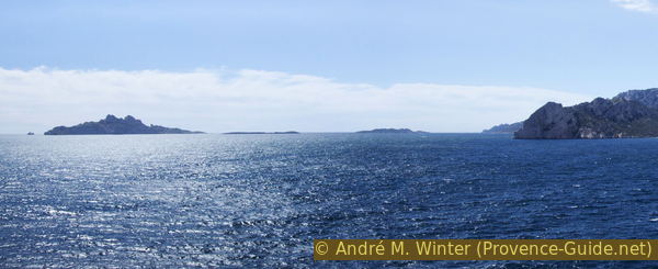
Islands of Riou, Calseraigne, Jarre, Maire and Bec de Sormiou
From the cape, you can see along the cliffs of the Calanques from Marseille to the Castelvieil peninsula (the Calanque d'En Vau is hidden behind it), over the redder Cap Canaille, to the islands of Embiez and Cap Sicié.
No reproduction is permitted without the written consent of the author. (id4472)
Panoramic view from Cap Morgiou
From the southern tip of Cap Morgiou, a path leads along the southeast ridge. Attention, some former fortifications are in their desolate condition right on the cliffs. It is better to avoid them by staying inland. From the Grande Batterie, you can go northeast to the Petite Batterie and further north to the remains of the lookout (Vigie).
No reproduction is permitted without the written consent of the author. (id4473)
Remains of the large gun emplacement at Cap Morgiou
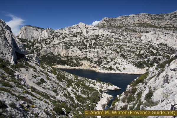
When we get to the nort-hwest of the cape area, we stumble across a paved area. This is where the military lookout stood and from here you can see the Calanque de Morgiou in full.
No reproduction is permitted without the written consent of the author. (id4474)
Calanque de Morgiou
Via a narrow path that leads to the left and west, we come back to the marked main path. Then we climb comfortably back to the ramparts and go back to the Col du Renard saddle.
Section 7: Col du Renard - Morgiou - Les Baumettes
➙ 4,2 km ... 1 h 35 min ➚ 250 m ➘ 240 m ↝ average
20% exposed trails, few marks
5% hard-surfaced quiet side streets, few marks
5% moderate trails, few marks
15% hard-surfaced quiet side streets, few marks
20% easy trails, few marks
15% hard-surfaced quiet side streets, few marks
20% easy trails, few marks
5% hard-surfaced city alleys, without marks
The clues
- Col du Renard saddle, 85 m
- Morgiou, 0 m
- Col de Morgiou saddle, 200 m
- Les Baumettes, 95 m
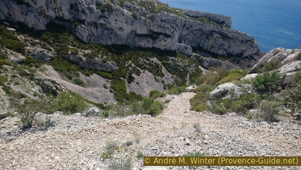
The longest part of this tour is the way back and it should not be underestimated. The descent from the Col du Renard saddle to Morgiou is marked in black and has difficult passages, especially because the legs are already tired. The ascent to the Col de Morgiou saddle, marked in red, is partly on a paved road. The tour is long and you will be out here in the late afternoon, so at least you have shade during the climb. If the sun is still too high, you can wait out the evening in the only bar on the port or on the small beach.
col = sadle
crête = crest
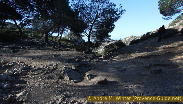
From the saddle, a path marked in black leads to the port of Morgiou, this color also stands for the level of difficulty. It goes steeply downhill, partly on slippery gravel.
No reproduction is permitted without the written consent of the author. (id4462)
Valley north of the Col du Renard saddle
Basically, we walk along the south side of the Calanque de Morgiou. In some rock sections, you also have to use your hands.
No reproduction is permitted without the written consent of the author. (id4475)
Way on the Corniche du Renard
Here, too, it is always worth looking back.
No reproduction is permitted without the written consent of the author. (id4476)
Looking back to Cap Morgiou
col = saddle
plage = beach
cabanes en bois = wooden cabins
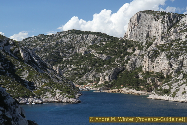
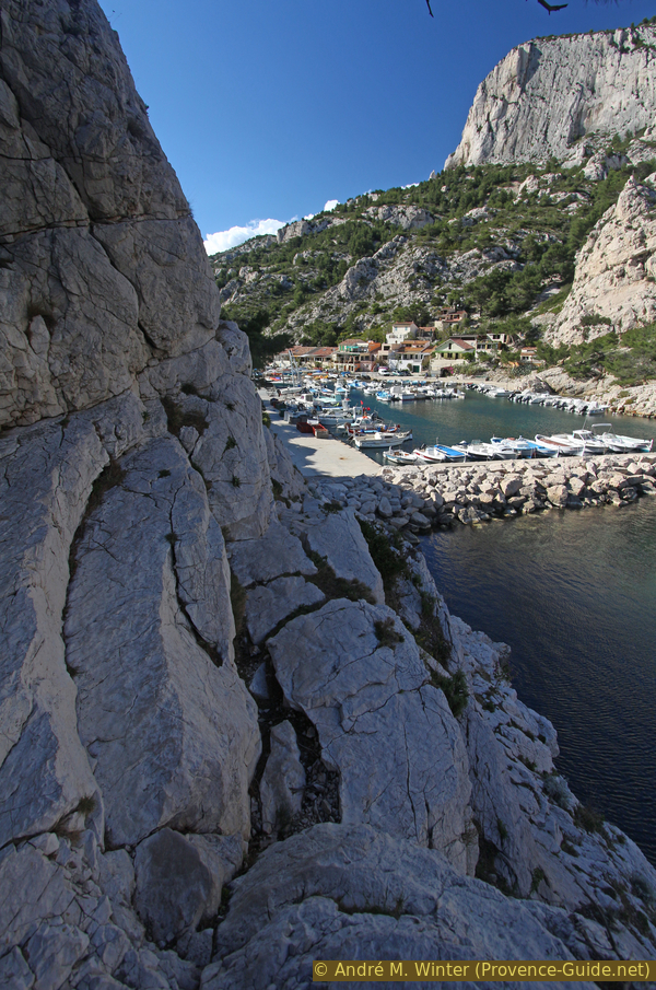
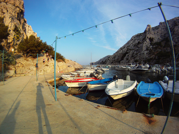
The port of Morgiou gets closer with every step.
The Aiguille du Sorbet pinnacle (photo) forces the way into the cliff towards the sea, at the top of which there will be one last rocky passage.
No reproduction is permitted without the written consent of the author. (id4477)
Aiguille du Sorbet and Port de Morgiou
After another section of rock, we pass under two wooden huts. We have to go clearly underneath it, even if you think the path ends in the middle of the rock. Only at the bottom, you can see the only possible passage. This is how you get to the port.
No reproduction is permitted without the written consent of the author. (id4478)
Last stretch of rock before the port of Morgiou
In the harbour we are back in civilization. There are two options here, which can also be combined:
Option bar: from the port you go straight towards the row of houses. The Nautic Bar can be recognized in the picture by the green shutters.
No reproduction is permitted without the written consent of the author. (id4479)
Village and port of Morgiou
Option beach: circum-walk the port, descend to the concrete platform and from there by steps along a path marked red in a few minutes to a small beach.
Way from the port to the small beach
A rock ledge and further steps lead to a small beach with coarse gravel.
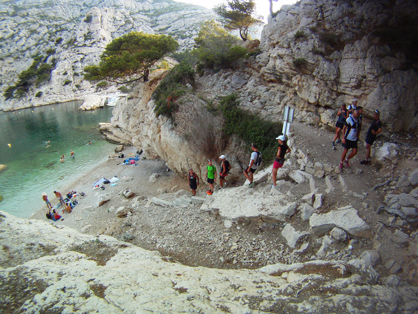
The small beach of Morgiou
After the breaks, the way back is definitely to be started.
The greatest difficulties, but also the greatest sections are behind us. In a last effort we have to overcome the last saddle. It goes up 200 meters and partly on asphalt.
No reproduction is permitted without the written consent of the author. (id4480)
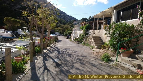
View from the village towards the saddle
We go inland on the road. Five minutes after a fork in the road, which meets again after 50 meters, look for a red marking on the right. Here you can climb on a path parallel to the road.
No reproduction is permitted without the written consent of the author. (id4481)
Beginning of the path north of the road
col = saddle
This trail is quite steep at first, becoming flatter and more pleasant in the second half.
The last rays of sun lie over the Calanque de Morgiou.
No reproduction is permitted without the written consent of the author. (id4482)

Looking back into the Calanque de Morgiou
Our path leads us back to the asphalt road, there is no alternative here. It is also quite steep here, so it is all the better if there is already shade here.
After about 10 minutes, there is another path for us. This time it is to be found on the left. We cut off a bend in the road and cross the road further up. Then it's a little steeper up to the Col de Morgiou saddle.
No reproduction is permitted without the written consent of the author. (id4483)
Second start of path on the left
A forest road, which is also a firebreak, runs over the pass. We cross this ridge and first go down opposite. The path is simply marked in red. This is the historical access to the Calanque de Morgiou, the rock is partially smoothed.
Further down the valley narrows a little.
No reproduction is permitted without the written consent of the author. (id4485)
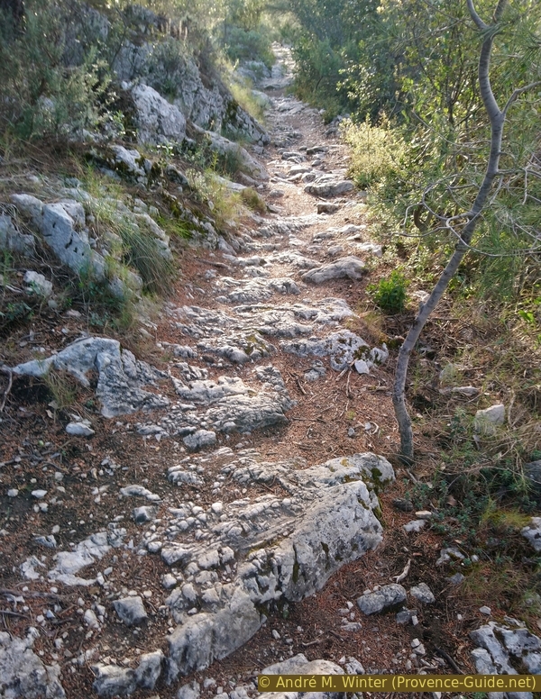
Old path from the saddle to Les Baumettes
In the lower part, the valley widens again and we come back to Les Baumettes via a dead end. In front we cross the street Chemin de Morgiou. On the left you can return to the upper parking lot, on the right you can go to the bus terminus or the parking facilities near the prison.
Sources and additional information
It is better to use a good topographic hiking map: This tour is on the IGN map "Les Calanques, Parc National", scale 1:15000, 82011.
If you don't want to bother with a paper map, you can also use mapping apps on your cell phone. On the one hand, it is the Cartes IGN app from the official map service. However, it requires access to the data network and this is sometimes difficult in canyons or remote locations.
Alternatively, you can use apps that store data directly on the device. They're generally not free, but they don't cost much. We mainly use OSMAnd, here it is possible to add contour lines, relief shading, markings and others. To store this data on your phone you need a lot of space.
Of course, one needs access to satellites for the GPS signal with any app. In some canyons this is not the case. Therefore, do not rely on the position shown, but read the map on your phone as you would read it on paper. Most apps are available for Android and iPhone. The applications usually allow us to record the route travelled and also view the GPS files offered for each of our hikes.
This page has been seen 3391 times since 20 March 2024.