The Parc du Mugel, Figuerolles and Notre-Dame de la Garde
Wondrous rock mounds in a public park
walk
easy
3 h
yes
forth/back
built-up area
walk
Introduction
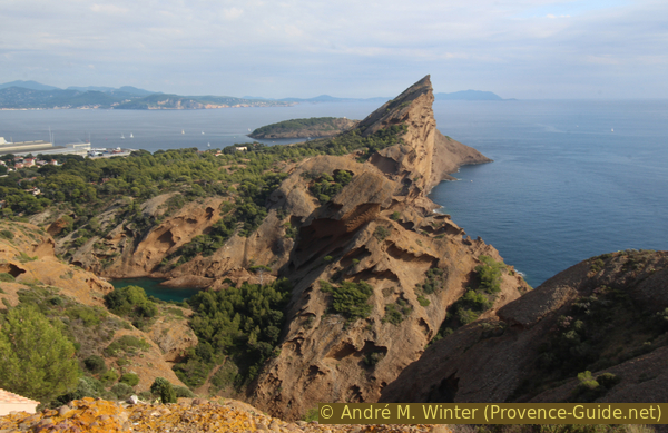
La Ciotat is a town on the eastern foothills of Cap Canaille. The city has a rich industrial and maritime past. The classic shipyards have been closed, but all the cranes are still standing because luxury ships are now being serviced on the site.
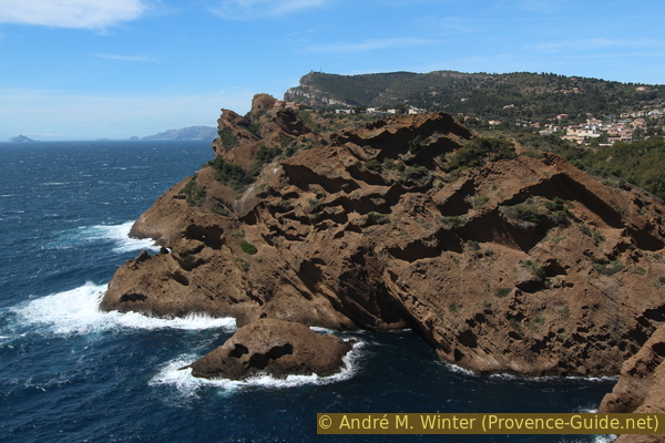
The natural setting is exceptional: the eastern part of Cap Canaille plunges into the sea in the form of conglomerate rocks called poudingue (puddingstone). This rock, formed by erosion, forms very particular mounds, locally called Secs.
Between Les Secs and the city lies the Parc du Mugel, a former agricultural estate that was long ago converted into a botanical park by various wealthy owners. Since 1982, the entire park belongs to the city and department of Bouches du Rhône.
This very special coast extends further north. We then explore it. First we have a view of the Anse de Gaméou, then the descent to the beach of the Anse de Figuerolles. Finally we climb to the Chapel of Notre-Dame de la Garde. All these points after the Parc du Mugel are unfortunately linked by road sections.
The facts
7,5 km total distance
3 h walk time
300 m total elevation
orientation easy
mark 70% of the total distance
45% hard-surfaced quiet side streets
15% moderate trails
15% parks
10% hard-surfaced paths
5% hard-to-recognize trails
5% easy trails
5% stairs
<5% hard-surfaced country road
<5% forest roads
dangers unsecured sections
children yes
useful picnic stuff, swimwear
required trekking shoes and water
GPS coordinates (WGS84) of start and end point 43.167661,5.605668
downloads ![]()
![]()
Public transport
With the regional train TER PACA (only french) which runs between Marseille and Toulon to the station La Ciotat. Then take line 10 or 40 from CiotaBus (only french) to the bus station (Gare Routière). From here, take line 30 to the Le Mugel stop. Tickets at the counter and from the machines at the bus station or on the bus.
Access by car
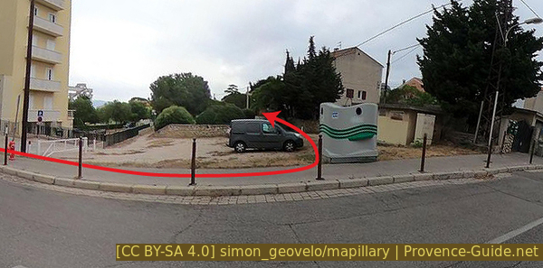
La Ciotat is located between Marseille and Toulon. The motorway exit coincides with the toll station. We first follow the arrows to La Ciotat Centre, then the signs towards Vieux Port. This bypasses the village centre. Attention, immediately after turning left once, you must turn right towards Calanque du Mugel (Boulangerie Daniel at the crossroads). It goes further down along the former shipyard site before we drive up to the right. At the next intersection, the parking lot is on the right.
Useful parking spaces
Le Mugel car park is chargeable and limited to normal cars due to a very narrow access chicane. If you cannot pass the chicane, you have to go back and turn left onto Avenue du Capitaine Marchand. Either park here at the beginning or drive towards Calanque de Figuerolles, where there is less space but also fewer chicanes. There is also a charge for parking.
The car park indicated at the entrance to the Chapelle Notre-Dame de la Garde is tiny, so don't expect to find space there except in the off season.
No reproduction is permitted without the written consent of the author. (id5982)
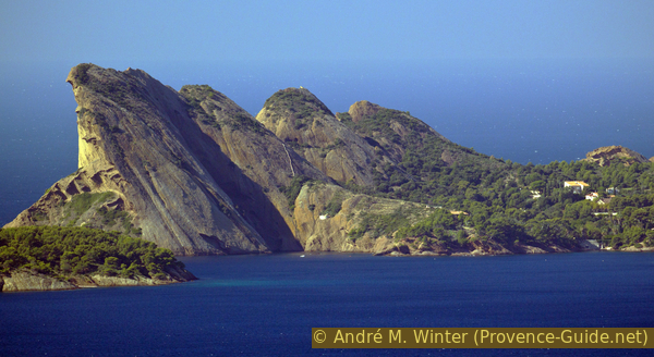
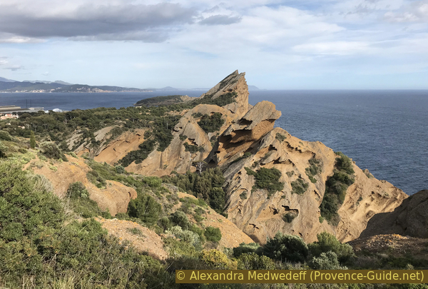
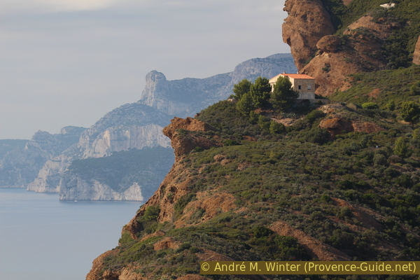
Bec de l'Aigle as seen from St.-Cyr
Hints
The park is open from April to September from 8am to 8pm and from October to March from 9am to 6pm. Warning: the park is closed during strong winds and this happens quite often in autumn and winter. The park is completely fenced in, leaving it in the direction of Anse de Figuerolles is not possible. The massive hill that forms the cape reaches a height of 155 meters.
Access to the viewpoint on the Anse de Gaméou is without signs or security. It is a part of the coast that has remained wild.
Due to erosion, it is no longer possible to pass over the rocks between Figuerolles and the Chapelle Notre-Dame de la Garde. For this reason, we have to make a diversion via the roads.
The markets in La Ciotat take place mainly on weekends.
The whole region is a zone with a high risk of forest fires. In summer, but also in other seasons when it is very dry or by strong winds, access to the forest areas can be regulated. As a result, the roads may be closed to traffic and/or the trails prohibited to hikers. Current information: Map of access to forests and exposed areas in Bouches-du-Rhône (only french). The map shows the colours green, yellow, orange and red which correspond to levels of danger.
The sections
- Park entrance - Anse du Sec bay - Terrasse de Mugel
- Terrasse de Mugel - la Bastide - park exit
- View on Anse de Gaméo bay and walk down to Anse de Figuerolles
- Notre-Dame de la Garde chapel and the viewpoint above
The descent to the Parc du Mugel
Section 1: Anse du Sec - Terrasse de Mugel
➙ 1,4 km ... 35 min ➚ 115 m ➘ 55 m ↝ easy
30% hard-surfaced quiet side streets, with marks
10% forest roads, few marks
20% easy trails, few marks
25% hard-to-recognize trails, without marks
20% parks, few marks
The clues
- Anses du Mugel bays
- Villa Nege Froume
- Belvédère de l'Anse du Sec
- Impluvium
- Belvédère du Mugel
Discovery of the park overlooking the main curiosities.
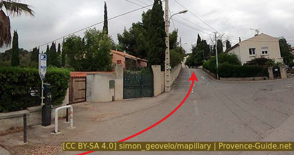
We start from the parking lot or the bus stop by walking up the lane with the one-way sign and then we turn left.
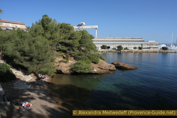
The road leads straight down to the Calanque du Grand Mugel. Here is a restaurant with a terrace on the beach.
No reproduction is permitted without the written consent of the author. (id5983)
Anse du Grand Mugel and Trois Secs
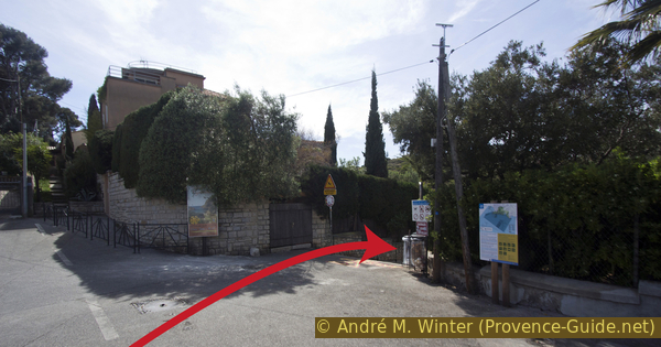
We stay on the road that runs along a kind of dike at the back of the beach to reach a rocky headland where the only public access gate to Mugel Park is. The opening hours can be found above on this page.
The park, with an area of about 16 hectares, is located on the Bec de l'Aigle rock. This consists of a pink colored rock called poudingue and gives the park its original and colourful character.
No reproduction is permitted without the written consent of the author. (id5986)
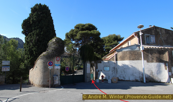
Parc du Mugel entrance
We stay on the sea road inside the park and pass Anse du Petit Mugel bay. This street goes up and ends under the Villa Nege Froume.
It is possible to descend to the left on a path towards Pointe de Nege Froume, but it is a dead end and the surface is quite loose.
So we climbed up to the terrace of the villa. It was the home of the last private owner of the site. The mansion is boarded up and appears to have found no public function.
No reproduction is permitted without the written consent of the author. (id5807)
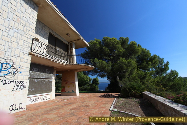
Villa du Nege Froume
We continue the path by the sea to the viewpoint on Anse du Sec bay.
No reproduction is permitted without the written consent of the author. (id5809)
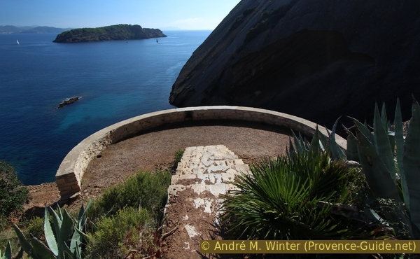
Belvédère du Sec
From here we have a good view of the Île Verte (green island). Like the Parc du Mugel, this island was also fortified by the Nazi German occupiers during World War II. Log house remains are visible from the viewing platform.
No reproduction is permitted without the written consent of the author. (id5980)
Anse du Sec and Île Verte
We go back from the Belvedere, but we take the first path on the left. It leads to a pool of water. Several other historical water reservoirs are scattered throughout the park, which also collected water for the gardens.
Here we turn left again and go straight towards the rock with the recognizable V-shaped impluvium. Poudingue, a hard and impermeable rock, allows water to be collected here.
Since the 19th century, the complex gardens have needed more and more water, so all rainwater was forced to be stored. Partially, the path installations were also used to collect the water.
No reproduction is permitted without the written consent of the author. (id5984)
Under the impluvium
It is possible to advance to the Impluvium funnel. You have to squeeze your way through the bushes to get there.
Today the impluvium still catches rainwater, but it is no longer collected and drained. For this reason, denser vegetation is found at the foot of the impluvium.
No reproduction is permitted without the written consent of the author. (id5810)
Impluvium funnel at Bec de l'Aigle
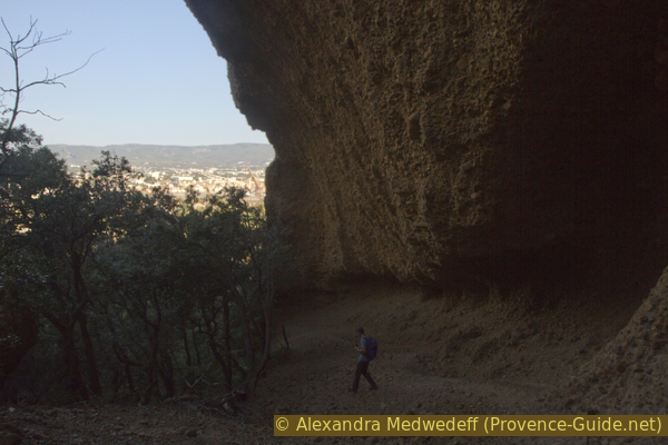
After this excursion into the bushes we return to the water reservoir and turn left tree times.
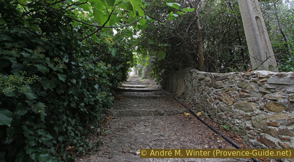
The path is better laid out again as you climb up to the Terrasse du Mugel. This is the steepest climb on this small tour, and this is also where most of the visitors to the park come up.
No reproduction is permitted without the written consent of the author. (id5812)
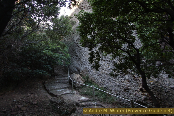
Path in Parc du Mugel towards the viewpoint
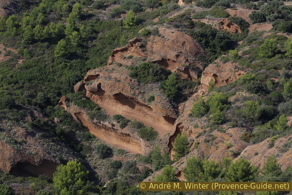
This valley between the 2nd and 3rd Sec is very dark and a little cool. The rock face gets closer and closer as you climb.
No reproduction is permitted without the written consent of the author. (id5811)
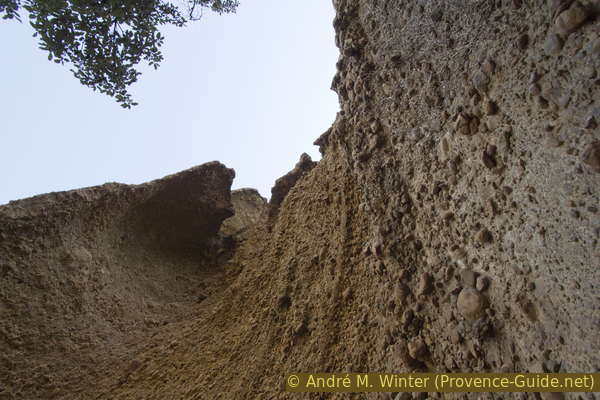
Tafoni-type erosion in the puddingstone at the Bec de l'Aigle
If you turn around, you can see the shipyards of La Ciotat.
No reproduction is permitted without the written consent of the author. (id5976)
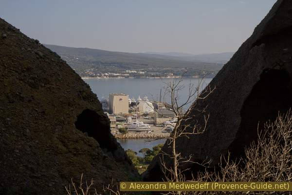
La Ciotat shipyard in retrospect from the way to the viewing platform
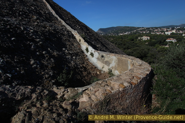
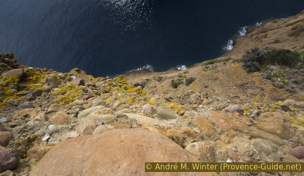
The paved path ends on a small platform in the sun. Here you can see the vertical part of the rock where erosion by salt and moisture is eroding the rock.
Without this sea-side erosion, the Secs would be rounded to the south as they are on the north side.
No reproduction is permitted without the written consent of the author. (id5813)
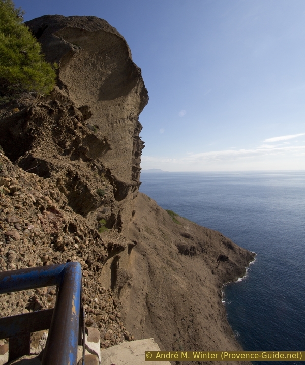
Seaside erosion at Bec de l'Aigle
Section 2: Bastide du Mugel
➙ 1,1 km ... 35 min ➚ 15 m ➘ 75 m ↝ easy
65% parks, few marks
35% hard-surfaced quiet side streets, with marks
The clues
- La Bastide
- Garden in the Parc du Mugel
Return via the park gardens. It has only one entrance through which we must exit. It is not possible to walk along this coast except by returning to the roads of the district.
The Belvedere is of course a dead end, the only way down is through the dark valley.
It is possible to leave the path to the right and go along a trail under the cliff overhanging here. The floor is lined with decomposing conglomerate. Further down you have to climb over a few bushes to get back on the path.
No reproduction is permitted without the written consent of the author. (id5985)
Overhanging conglomerate wall at the north side of the viewing terrace
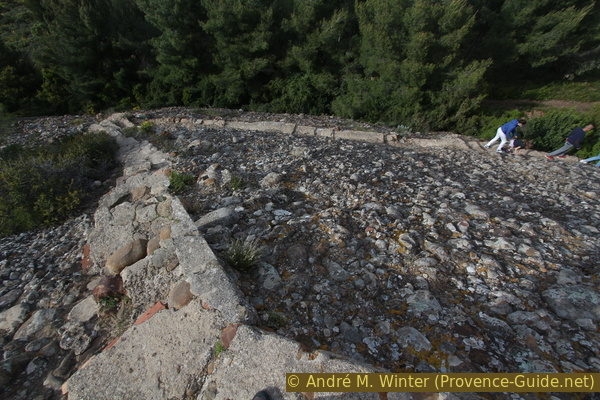
Arriving at the junction where we came from the impluvium, we now turn left. We pass a small stone house before climbing slightly towards the terrace of La Bastide.
No reproduction is permitted without the written consent of the author. (id5978)
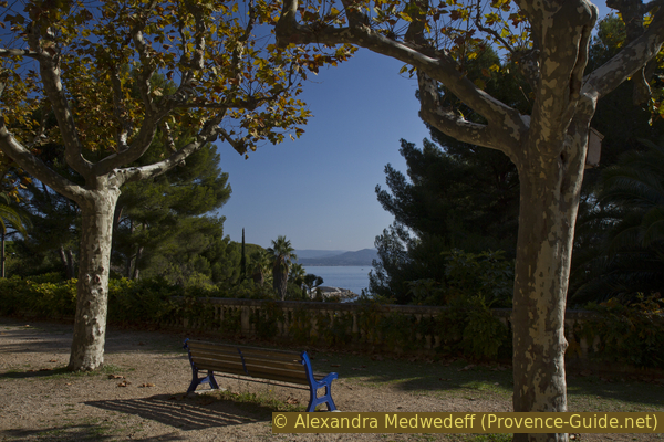
Bench in Parc du Mugel
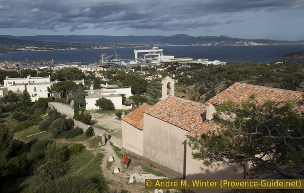
The building exudes an atmosphere of the beginning of the 20th century. Today, an association for the protection of the environment has its headquarters here.
No reproduction is permitted without the written consent of the author. (id5977)
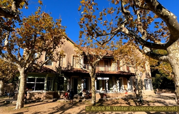
La Bastide of Parc du Mugel in autumn
Below the bastide is the landscaped part of the park's garden. You can descend to the right or left of the terrace. Various paths run through this overgrown baroque garden.
No reproduction is permitted without the written consent of the author. (id5806)
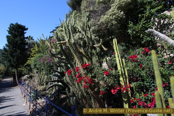
Cacti in Parc du Mugel
We recommend descending into the valley, which ends below in the form of Anse du Petit Mugel. In the forest environment, we can also see some other old installations used to tend the gardens. Bamboo grows in a hollow with very thin rods.
No reproduction is permitted without the written consent of the author. (id5795)
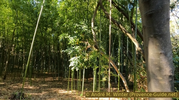
Bamboo in Parc Mugel
As soon as we have arrived back at the Anse du Petit Mugel, we can start the way back via the Anse du Grand Mugel, which we already know.
Continue straight ahead without turning towards the car park to continue on section 3 below.
No reproduction is permitted without the written consent of the author. (id5979)
Anse du Petit Mugel
Section 3: Anse Gaméou & Figuerolles
➙ 1,9 km ... 45 min ➚ 70 m ➘ 55 m ↝ average
30% hard-surfaced quiet side streets, few marks
40% moderate trails, without marks
10% hard-surfaced country road, few marks
5% stairs, few marks
10% moderate trails, without marks
5% stairs, few marks
The clues
- Avenue du Mugel and Avenue des Myrtilles
- Walk up the slope
- Unknown viewpoint over Anse de Gaméou
A bit of road and a quick climb on a wild path.
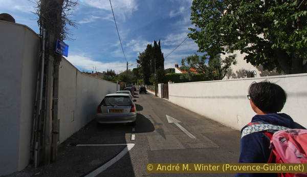
Coming up from the beaches under the park, we continue straight on into the Avenue du Mugel. We walk slightly uphill on this road.
No reproduction is permitted without the written consent of the author. (id6697)
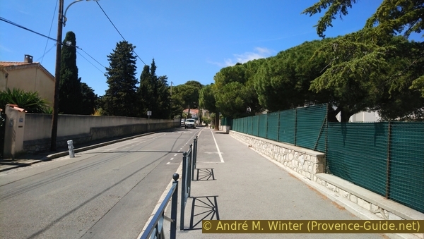
Avenue du Mugel
Here we pass the primary school.
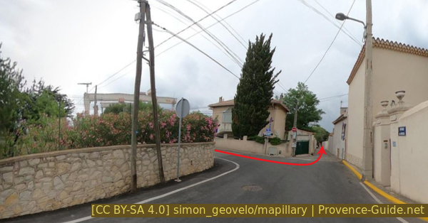
We turn left at the first road without a barrier, it is the Avenue des Myrtilles. It goes slightly downhill and makes slight turns.
No reproduction is permitted without the written consent of the author. (id6716)
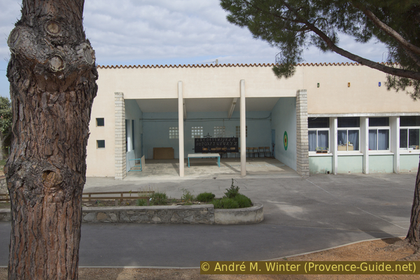
Alphabet board in La Garde primary school
At the next intersection, we continue straight on.
No reproduction is permitted without the written consent of the author. (id6698)
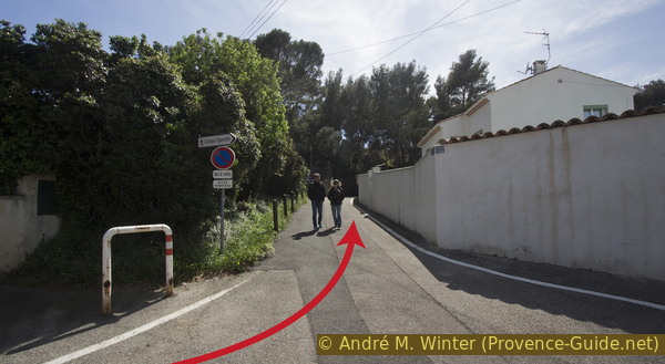
Cul-de-sac extending the Avenue des Myrtilles
It is a cul de sac that ends with an access to a last house, but on the left is a passage closed by a chain. We go through it and climb up on an unmarked path.
No reproduction is permitted without the written consent of the author. (id6699)
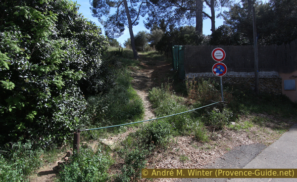
Access to the cliff above the Anse du Gaméou cove
After a short climb, we see the Trois Secs from a new angle.
No reproduction is permitted without the written consent of the author. (id6700)
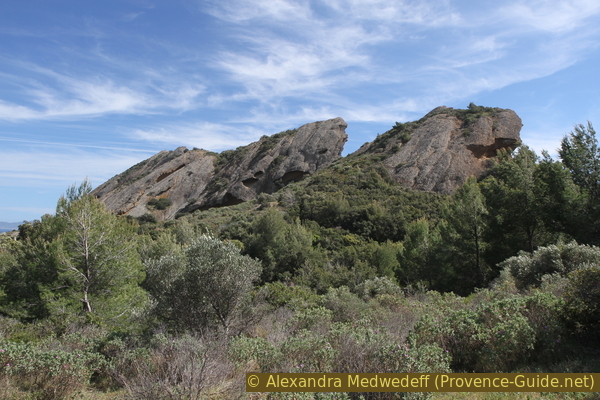
Trois Secs
At the highest point there are several paths leading off in different directions, but those all end at fences. You can anyhow go slightly downhill, turn left a little and reach the edge of the cliff. On the left is an impressive overhang.
No reproduction is permitted without the written consent of the author. (id6701)
Overhang under the third hill Sec
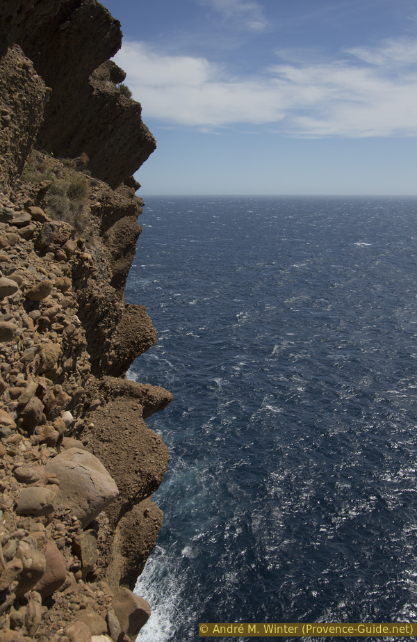
The puddingstone, which looks so patched up, forms a wall over 100 metres high here. The pebbles, which seem to fall away at any moment, are nevertheless held in place by the wall.
No reproduction is permitted without the written consent of the author. (id6702)
Detail of the eroded vertical wall of the Secs puddingstone
The vertical view is possible by lying down on the ground, but beware of gales. Even without vertigo, your head is bound to spin.
No reproduction is permitted without the written consent of the author. (id6703)
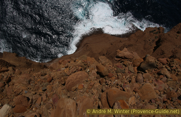
Vertical view towards the sea
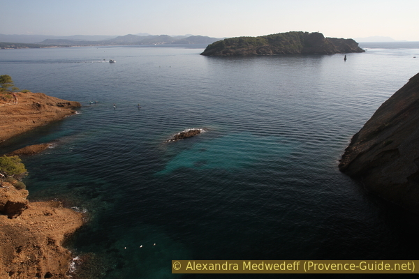
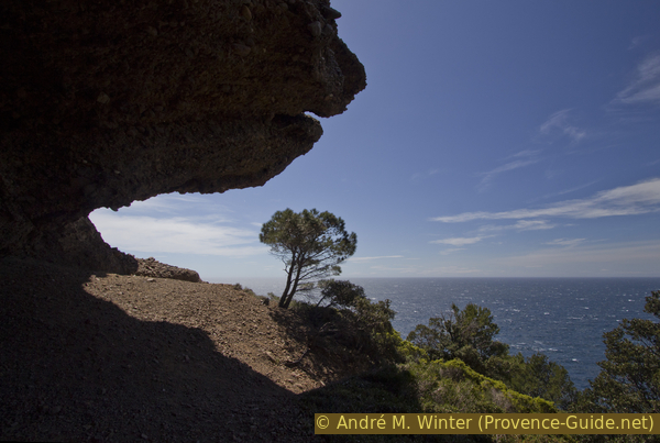
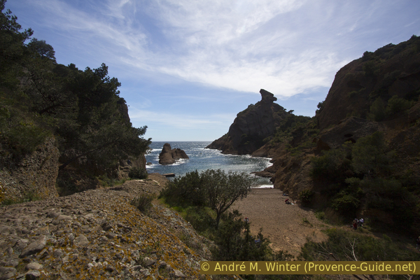
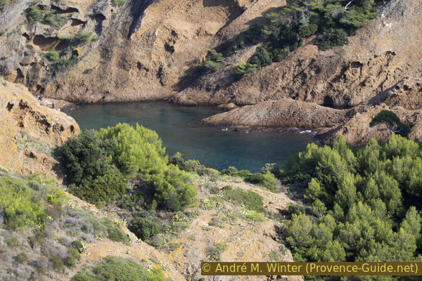
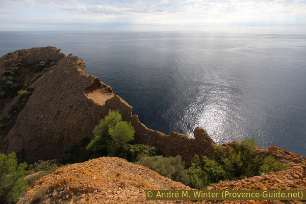
A small path leads to the right. There is a good view of the Anse de Gaméou cove with the Trou du Diable (devil's hole) on the right.
The Anse de Figuerolles is the bay just behind. Further on, you can see Notre Dame de la Garde Chapel and the Cap Canaille semaphore.
No reproduction is permitted without the written consent of the author. (id6704)
Anse du Gaméou cove
It is not possible to go north without ending up on private land or at the abyss. We return along the same path at the last intersection and turn immediately left into Avenue des Falaises.
No reproduction is permitted without the written consent of the author. (id6705)
Avenue des Falaises
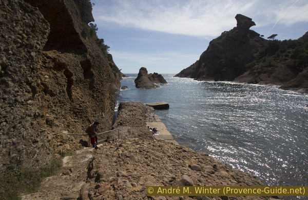
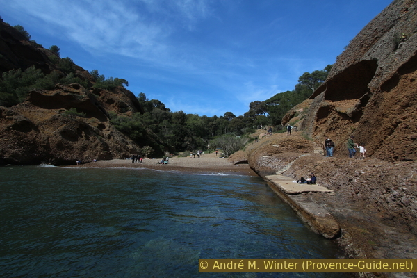
After about 50 metres, we can already descend to the Anse de Figuerolles. A concrete ramp and stairs lead down to the site, which is well loved by the locals.
No reproduction is permitted without the written consent of the author. (id6706)
Access to the stair of the Anse de Figuerolles cove
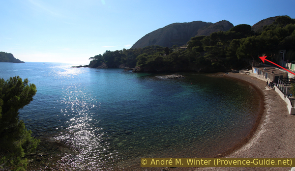
Figuerolles is a small cove in the same rock type as the Parc du Mugel. The blue and turquoise water is easy to approach here.
Its name refers to the cultivation of fig trees in Provençal.
No reproduction is permitted without the written consent of the author. (id6707)
Anse de Figuerolles cove
The beach is of course formed of pebbles from the erosion of the puddingstone. This erosion also forms the emblematic rock, Rocher du Capucin (monk's rock), also called Tête de Chien (dog's head).
You can walk along a rocky strip to a sort of landing stage on the left of the cove.
No reproduction is permitted without the written consent of the author. (id6708)
Path of the Anse de Figuerolles quayside
As before, one would be tempted to go through the rocks towards the Chapel of Notre Dame de la Garde. This was possible by climbing for a long time behind the huts at the bottom of the beach. However, due to landslides and the danger of falling rocks, this passage is now officially barricaded and forbidden.
All we have to do is go back to the car park at the top of the cove.
No reproduction is permitted without the written consent of the author. (id6709)
View back to Figuerolles beach
Section 4: Chapelle Notre-Dame de la Garde
➙ 3,1 km ... 1 h ➚ 100 m ➘ 115 m ↝ easy
25% hard-surfaced quiet side streets, few marks
10% hard-surfaced paths, few marks
10% moderate trails, without marks
10% hard-surfaced paths, few marks
25% hard-surfaced quiet side streets, without marks
5% parks, without marks
15% hard-surfaced quiet side streets, few marks
The clues
- Go down all of Avenue de Figuerolles
- Walk up Chemin de Notre Dame de la Garde and its Way of the Cross
- Climb to the viewpoint above the chapel
- Come back to the starting point
A little walk to the best view.
No reproduction is permitted without the written consent of the author. (id6714)
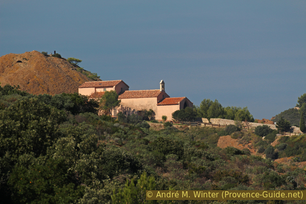
Chapelle Notre-Dame-de-la-Garde as seen from Parc du Mugel
Coming up from the Calanque de Figuerolles, we turn left and now proceed in a straight line along the Avenue de Figuerolles.
Avenue de Figuerolles
The road widens and we take the first road on the left. This is the Chemin de Notre Dame de la Garde, a sign also indicates this direction.
It's a bit of a tough climb along a narrow road with no real walkway for us pedestrians. It takes about ten minutes to climb thirty metres.
After some slight bends and when a pedestrian walkway starts on the right, we spot the sign for the chapel on the left. Here we descend to this access to a housing estate.
Crossing Ave. de Figuerolles and Chemin de Notre Dame de la Garde
At the next crossroads, continue straight ahead on a narrower path that is not suitable for vehicles. This is the old way of the cross that goes up to the chapel. There are another 40 metres of ascent to climb here. At the beginning, there is some shade.
No reproduction is permitted without the written consent of the author. (id6717)
Way up to N.-D. de la Garde
Further up the path widens to form the chapel forecourt. To the left are holiday homes of dubious style.
No reproduction is permitted without the written consent of the author. (id6718)
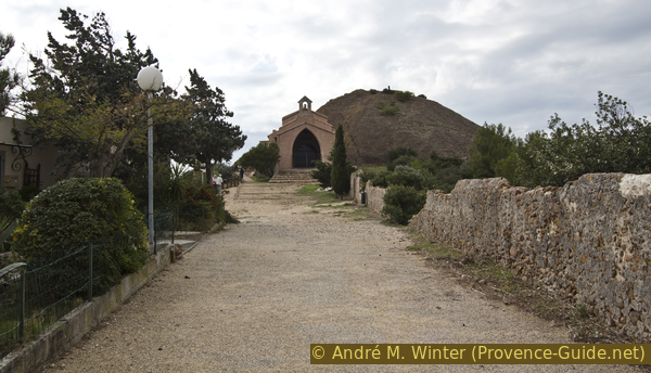
Arrival in front of the Notre Dame de la Garde chapel
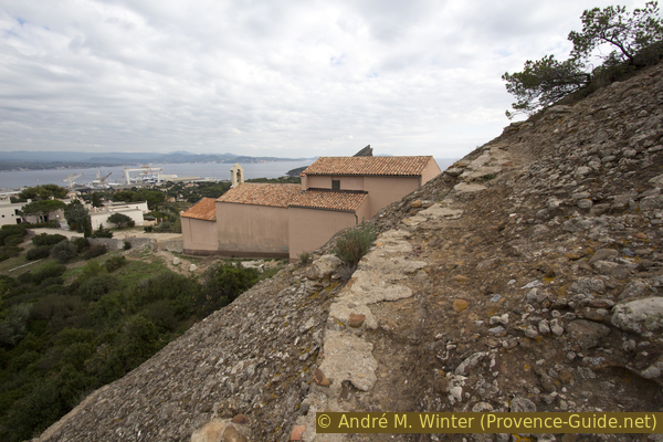
The Chapel of Our Lady de la Garde is usually closed, but it has a large porch.
The site also offers a good view, which is why a first lookout was installed here in 1543 to ensure maritime surveillance against pirates. Later on, this lookout was moved higher up, where the present semaphore is located.
This chapel was built in the 17th century by the brotherhood of the Pénitents Bleus. It is dedicated to the people of the sea. Since the 19th century, it has been filled with ex-voto and models of ships.
No reproduction is permitted without the written consent of the author. (id6719)
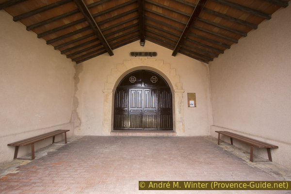
Porch of the Notre Dame de la Garde chapel
As we can't see much of the inside of the chapel, we explore the outside. We start first by the left.
No reproduction is permitted without the written consent of the author. (id6710)
Secs de la Ciotat
As we move forward here, we can see at first very well back towards the Anse de Figuerolles. You can also see that the passage here is not impossible. But it is at the bottom left that things get tougher.
No reproduction is permitted without the written consent of the author. (id6725)
View deep in the Anse de Figuerolles
Straight ahead is a curious rock with a hole in it. It is possible to walk forward and look through it. But beware, the abyss is just behind. The rocks are not slippery, however.
We then return to the square in front of the chapel because it is not possible to go around it on the sea side.
No reproduction is permitted without the written consent of the author. (id6720)
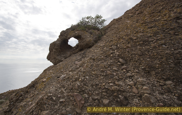
Natural hole in the puddingstone
On the left is a passage in the wall. It allows you to climb the mound to the north of the chapel.
No reproduction is permitted without the written consent of the author. (id6722)
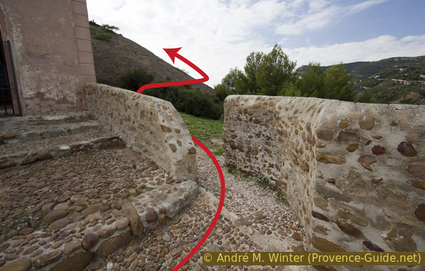
Passage right of the chapel
This is where the lookout was located and this is also where the Nazi Germans maintained a battery. These remains make it easy to reach the summit on a narrow path.
No reproduction is permitted without the written consent of the author. (id6723)
Way up behind the chapel
The view of the Bec de l'Aigle is ideal. The land mass on the left is the Green Island that we saw from the coast under the Parc du Mugel.
No reproduction is permitted without the written consent of the author. (id6724)
Bec de l'Aigle as seen from the hill behind the chapel
You can also see very well on the shipyard cranes.
No reproduction is permitted without the written consent of the author. (id6711)
La Ciotat and Chapelle Notre-Dame de la Garde
In good weather, it is useful to climb here with a good lens.
No reproduction is permitted without the written consent of the author. (id6726)
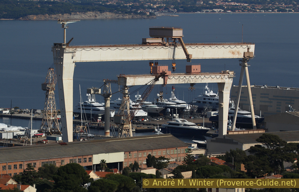
La Ciotat Krupp 650 ton gantry crane
To the north stands the military semaphore on the Tête de l'Aigle. The 16th century lookout was relocated there in 1794.
Here we can study the geology. The puddingstone is found under the limestone layers of the Cap Canaille (white and yellowish), so it is older and this also explains its solidity.
No reproduction is permitted without the written consent of the author. (id6730)
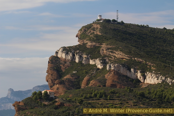
Geology under the Semaphore of the Soubeyranes Cliffs
Below the semaphore is a secluded, cliffside house. It was renovated in 2015.
In the background, you can see the limestone finger called the Grande Candelle in the Calanques of Marseille.
No reproduction is permitted without the written consent of the author. (id6731)
Exposed house near Saint Frétouse
Puddingstone is also eroded inland as long as there is moisture approaching from the sea.
No reproduction is permitted without the written consent of the author. (id6732)
Poudingue and tafoni
The mound is preceded by a point that juts out into the void above the cliff. It's wide enough to go on, but of course there is no safety here.
No reproduction is permitted without the written consent of the author. (id6728)
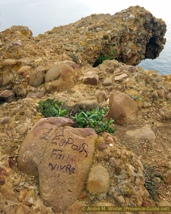
L'espoir fait vivre (hope makes us living)
It's a great place to recharge your batteries.
No reproduction is permitted without the written consent of the author. (id6733)
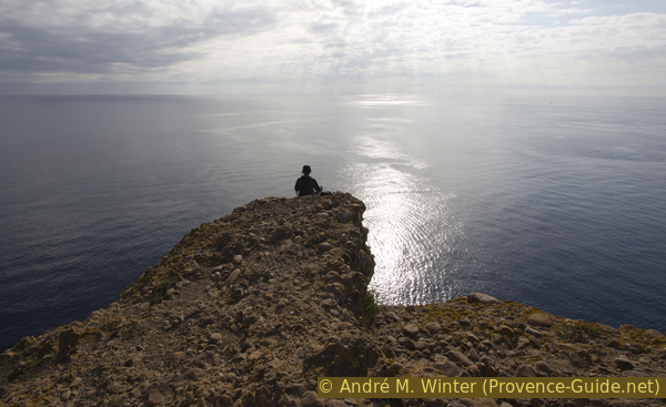
Young man and the sea on the hill behind N.D. de la Garde
But one should not be afraid of the void because the verticality is overwhelming.
No reproduction is permitted without the written consent of the author. (id6727)
Vertical view from the hill behind the chapel
Tourist boats and fishermen pass by.
No reproduction is permitted without the written consent of the author. (id6729)
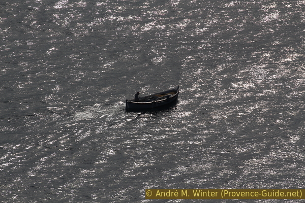
Fishing boat in the sea
The lights are best here out of season. The photo is from October 2015.
No reproduction is permitted without the written consent of the author. (id6721)
Eroded puddingstone
This is the highest point of the tour, so all we have to do is climb down from the rock, back up to the Chemin de Notre Dame de La Garde and down to the crossing.
No reproduction is permitted without the written consent of the author. (id6713)
Path north of the mound
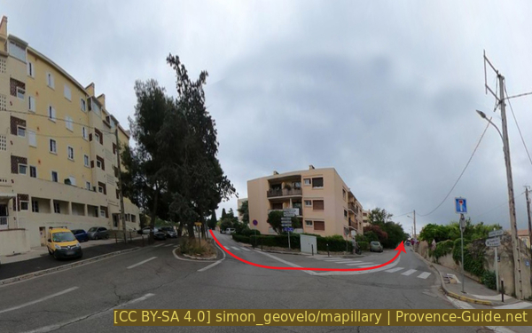
At the intersection with Avenue de Figuerolles, turn right and take the side with the pedestrian walkway. After the large building there is an open square which serves as a car park. Turn left to pass by the transformer. This cuts through a somewhat neglected park. At the end of the park, turn right and you come across the intersection between Avenue des Myrtilles and Avenue du Mugel that we already know.
Turn and walk through the park
We go down this road to return to the starting point.
Looking over the houses, you can see the Trois Secs on the right.
No reproduction is permitted without the written consent of the author. (id6715)
Trois Secs
Sources and additional information
It is better to have a good topographic hiking map: this tour is on the IGN map "Aubagne, la Ciotat, Massif de la Sainte-Baume", scale 1:25000, 3245ET.
If you don't want to bother with a paper map, you can also use mapping apps on your cell phone. On the one hand, it is the Cartes IGN app from the official map service. However, it requires access to the data network and this is sometimes difficult in canyons or remote locations.
Alternatively, you can use apps that store data directly on the device. They're generally not free, but they don't cost much. We mainly use OSMAnd, here it is possible to add contour lines, relief shading, markings and others. To store this data on your phone you need a lot of space.
Of course, one needs access to satellites for the GPS signal with any app. In some canyons this is not the case. Therefore, do not rely on the position shown, but read the map on your phone as you would read it on paper. Most apps are available for Android and iPhone. The applications usually allow us to record the route travelled and also view the GPS files offered for each of our hikes.
This page has been seen 4781 times since 20 March 2024.