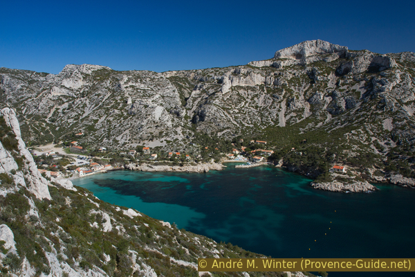
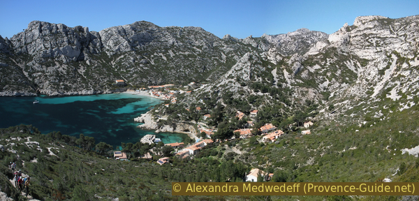
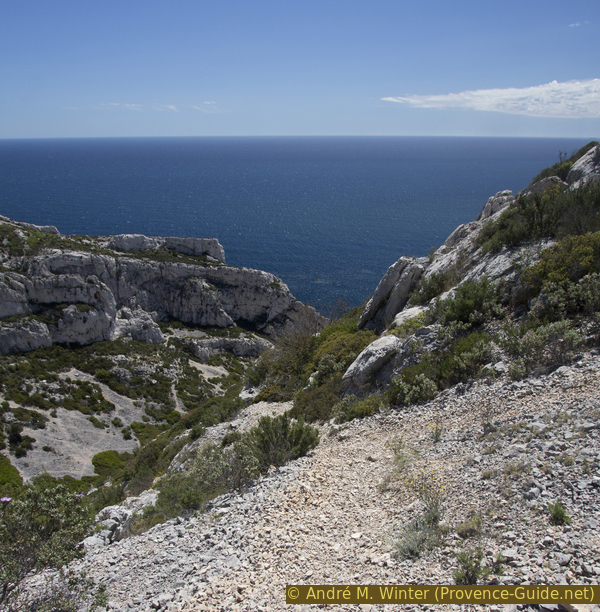
Calanque de Sormiou and the ridge of the same name
Forward to Cap Redon, view from the Luï d'Aï saddle and the cave under the Morgiou ridge
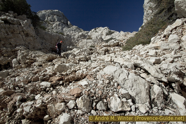
scramble
average
5 h
yes
yes
built-up area
mountain
Introduction
The Calanques of Marseille cover a large area and offer a unique natural spectacle. This national park attracts all lovers of nature, of the sea and of sportive hikes. It is the green lung of the city of Marseille, but travellers from many countries also find their way here. The bare white limestone that protrudes into the dark blue sea, the high and vertical rock walls, the length of the possible tours and the easy accessibility make up the whole success of this natural jewel.
The tour presented here covers the Calanque de Sormiou. We climb up a historic path and go under the Cape of Sormiou, the Cap Redon. We then climb the ridge and the Col du Luï d'Aï pass. So we see the steep south side of the ridge and the islands in front of it. Finally up the other ridge and to the Grotte de l'Os cave.
The facts
8,9 km total distance
5 h walk time
590 m total elevation
orientation average on marked trails, difficult off the beaten track
mark 75% of the total distance
40% moderate trails
25% easy trails
10% dirt roads
5% hard-to-recognize trails
5% hard-surfaced city alleys
5% forest roads
5% Trails with scramble passages
5% on beach
<5% exposed trails
dangers exposed sections, easy climbing
children if they are persistent
useful picnic stuff, swimwear
required hiking boots, hiking gear, sun protection and plenty of water
GPS coordinates (WGS84) of start and end point 43.226332,5.416505
downloads ![]()
![]()
Public transport
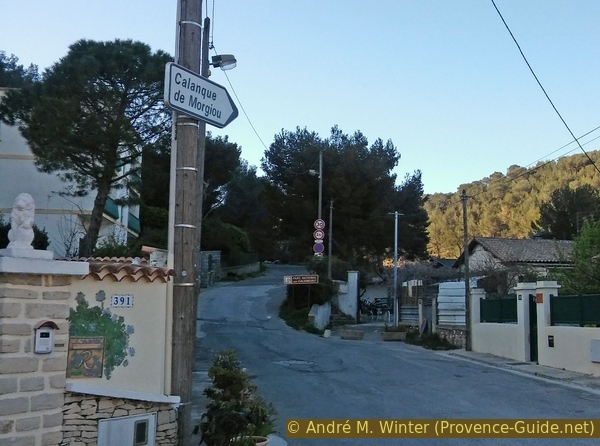
The number 22 bus runs from the Rond Point du Prado metro station to the Les Baumettes terminus in about 30 minutes and this at least 25 times a day. This terminus is the starting point of the tour. Information at RTM (only french).
From the bus stop we go right along Chemin de Morgiou street until we reach a parking lot.
Access by car
The district of Les Baumettes is located in the south of the city of Marseille. During the weekday mornings and late afternoon traffic is really bothersome.
- Coming from Aubagne on the A50 motorway, first follow the direction to Mazargues. When exiting the roundabout, take the left lane and the subsequent toll tunnel. In the tunnel, get in the left lane towards Mazargues.
- Coming from the North and Marignane, take the A55 motorway to Marseille. Stay on the motorway towards Aubagne and take the toll tunnel under the port. When you definitely come out of the tunnel section, you will pass a tollbooth and then turn right towards Mazargues.
In both cases, we come to Boulevard Michelet, this wide street already points in the good direction (south). It is also the D559 road, which continues to Cassis. At the roundabout with the obelisk, we keep to the right and follow the signs to Les Baumettes. At the end of the alley we turn left. If we are in line at a church, we drive around it to the right. From here you just follow this road.
When the street gets wider and straighter again, we see a long wall on the left, behind which a large prison is hidden. After that, there are often free parking spaces on both sides that can be used if everything further back is full.
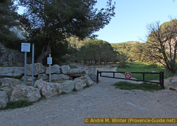
Our street, the Chemin de Morgiou, separates into a left and a right lane, we have to stay on the right first. At the latest at the second intersection, however, we change to the other lane and turn right again and drive out of town. The road rises briefly and so you come to the barrier in front of the road to Morgiou (no driving), on the right is the entrance to the parking lot with a bumpy ground.
No reproduction is permitted without the written consent of the author. (id4313)
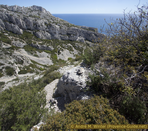
Calanque de Sormiou and Mount Baou Rond
Useful parking spaces
As described above, there are almost always free parking possibilities after the jail. If you arrive in time, you can aim for the upper and last parking lot. If you arrive late on weekends, it is better to stay just after the prison.
Hints
In the Calanques, almost all paths are long, most of them have a lot of altitude difference and the way back usually leads uphill. In addition, there is the merciless sun and there are no watercourses or springs. Therefore, most of the hikes here are quite challenging. Even marked trails can be steep and extremely exposed. Access to the cape, the approach to the ridge and the cave are difficult. Sun protection, lots of water and high mountain boots are mandatory.
A bar is open in Sormiou during the summer months and the rest of the year when the weather is nice, otherwise there are no catering options.
Shade is scarce. You can only swim at the small beach of Sormiou, everywhere else the path leads high above the sea and the rock walls usually fall vertically down to the water.
The whole region is a zone with a high risk of forest fires. In summer, but also in other seasons when it is very dry or by strong winds, access to the forest areas can be regulated. As a result, the roads may be closed to traffic and/or the trails prohibited to hikers. Current information: Map of access to forests and exposed areas in Bouches-du-Rhône (also english). The map shows the colours green, yellow, orange and red which correspond to levels of danger. The affected area is: Calanques.
The sections
- Via the saddle and the path Chemin des Escourtines to Sormiou beach
- Under the Sormiou ridge forward to Cap Redon
- Climb to Col du Luï d'Aï pass and back to Sormiou beach
- Ascent from Calanque de Sormiou to Le Carrefour on the ridge of Morgiou
- Detour to the Grotte de l'Os cave
- Back over the ridge and the pass of Morgiou
No reproduction is permitted without the written consent of the author. (id2880)
Chemin de Morgiou and access to the last car park
Section 1: Baumettes - Sormiou
➙ 2,6 km ... 50 min ➚ 100 m ➘ 190 m ↝ average
15% hard-surfaced city alleys, without marks
10% forest roads, with marks
10% moderate trails, with marks
5% easy trails, faulty marks
10% easy trails, few marks
30% moderate trails, without marks
15% dirt roads, few marks
5% on beach, without marks
The clues
- Les Baumettes, 95 m
- Col des Escourtines saddle, 180 m
- Port de Sormiou, 7 m
- Plage de Sormiou beach, 0 m
After a short climb to the Col des Escourtines saddle, we descend through a gorge to the sea. There is no continuous marking on this section.
col = saddle
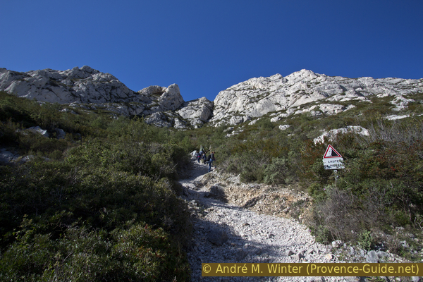
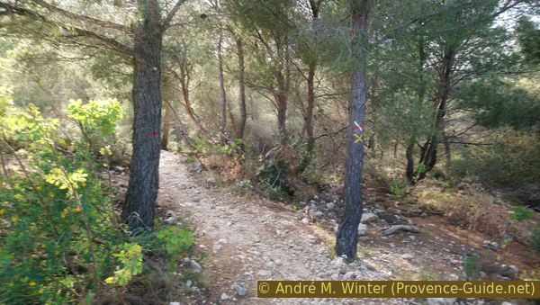
Whether by car or on foot, we have to come to the upper parking lot. On the right behind the barrier (photo) we definitely leave the city.
We come to a somewhat unnatural meadow with a pine forest in the middle (Pré des Évadés). In the background there is a monument and ruins in the forest. However, we keep to the left. The forest road becomes a path, leads even further to the left and up over rocks and slabs.
No reproduction is permitted without the written consent of the author. (id2881)
Barriers in front of the Pré des Évadés meadow
When it starts to flatten out again, we continue to take the path on the left, but without descending onto the road on the far left below. Basically, we stick to the direction to the south. This is how you get to the bend in a forest road. On the right you can see the paved road from Morgiou, but we continue straight on south. This path is now marked with three light blue dots. It is a shortcut to the Col des Escourtines saddle, avoiding the detour via the Col des Baumettes saddle.
Attention, the Col des Escourtines saddle is in fact the one that is 183 meters high, as indicated on the IGN map Les Calanques 1:15000. The position in the IGN map 1:25000 and on Open Street Map is wrong (too far east and at the 213 meter high point, here we pass the way back). The name of the saddle means abbreviation, it is in fact the fastest way from Les Baumettes to Sormiou.
So we climb to the Col des Escourtines saddle, the path becoming progressively steeper. In the saddle, we cross a well-trodden path of the calanques, on a rock you can see a large number of colourful markers, which, however, do not write our further path. It is also not marked in the further course.
No reproduction is permitted without the written consent of the author. (id4336)
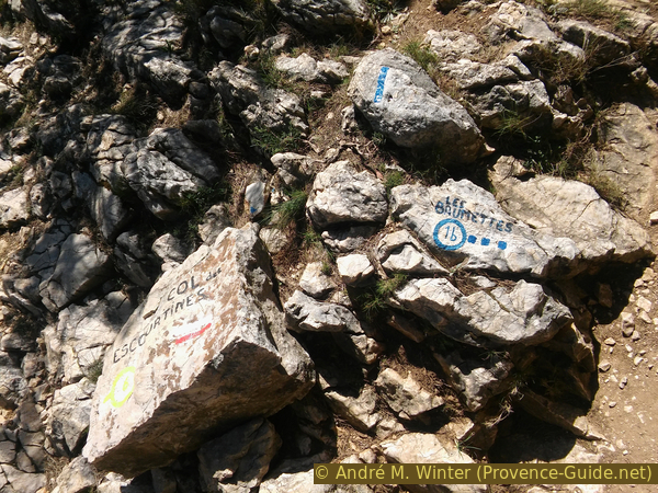
Colorful markings on the Col des Escourtines saddle
We cross the saddle straight away. Opposite, we come to some pine trees and after that we turn and to the right. Less than 10 meters further on we turn left again. This descent under the saddle is a bit confusing and you have to scramble over rocks.
The picture is taken from a higher point than the saddle.
No reproduction is permitted without the written consent of the author. (id4335)
View of the Col des Escourtines saddle
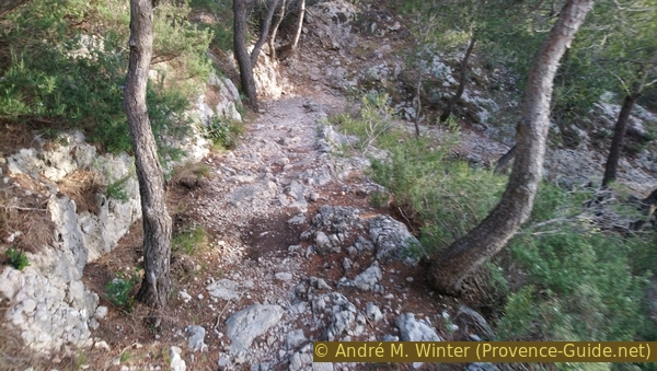
The path is clearly visible after the key point under the saddle. It climbs steadily downhill over a long arch in the upper valley basin. So you don't go down in the fall line, we first traverse above the gorge section. This leads to another trail that descends from the path under the Baou Rond from the ridge of Morgiou.
At this junction we turn right and down. The path now runs in the valley and passes through some bottlenecks. Some areas are steeper and a bit slippery.
The picture shows the first constriction under the wide basin from a higher point of view. Our path from the Col des Escourtines saddle is not visible here (it is below the edge of the picture). On the other hand, you can see the course in the valley floor on the left.
No reproduction is permitted without the written consent of the author. (id4334)
Vallon des Escourtines, Sormiou and the cape
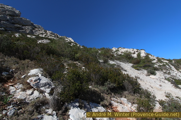
View from above on the ridge between Baou Rond and Col des Escourtines.
col = saddle
plage = beach
Progressively, it becomes less steep and the gravel slopes become a bit greener. Further down, the path turns into a gravel road and this leads through rows of fisherman's huts.
The red arrow shows our way to Sormiou. The yellow one indicates the route on section 4.
No reproduction is permitted without the written consent of the author. (id4317)
Sormiou fishermen's huts
Looking back, the Aiguille de Sormiou in the background on the right.
At the port, we turn right and follow the road into the bay. After the gate, we come to a large square, from there you can reach the small beach with the boat ramp via stairs.
No reproduction is permitted without the written consent of the author. (id4291)
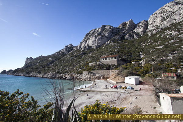
Beach and ridge of Sormiou behind
Section 2: Sormiou - Cap Redon
➙ 1 km ... 40 min ➚ 95 m ➘ 60 m ↝ difficult
<5% on beach, without marks
10% hard-to-recognize trails, few marks
75% moderate trails, few marks
10% Trails with scramble passages, without marks
The clues
- Plage de Sormiou beach, 0 m
- Path under the Crête de Sormiou ridge, 60 m
- Cap Redon, 30 m
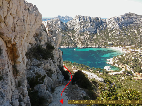
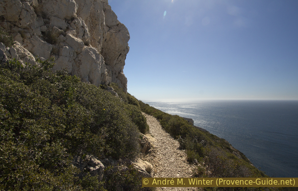
We advance in the calanque and under the southern ridge to Cap Redon, visible from the Sormiou beach. At the cape you can make a small round.
On the slope in the south of the calanque there is a single house a little higher above the beach (picture above). Just to the right of this, a ditch rises vertically. This is also our bumpy way up.
No reproduction is permitted without the written consent of the author. (id4292)
Steep climb after Sormiou beach
The trail is discreetly marked in black.
Climb up to about 30 meters above the mentioned building and up to about 30 meters above sea level, here the path turns left. Don't go any further uphill, the terrain becomes confusing and there is a risk of falling rocks. So we go left and now much more comfortably in the direction of the cape.
No reproduction is permitted without the written consent of the author. (id4293)
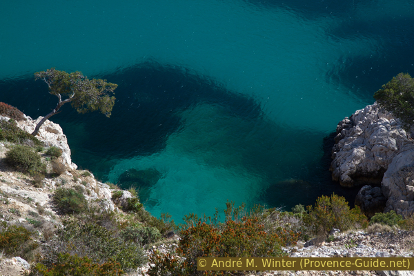
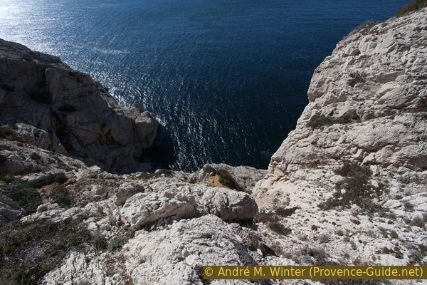
Deep view into the crystal clear waters of the Calanque de Sormiou
Very quickly you have great views back to Sormiou. The path slowly climbs to about 60 meters above sea level.
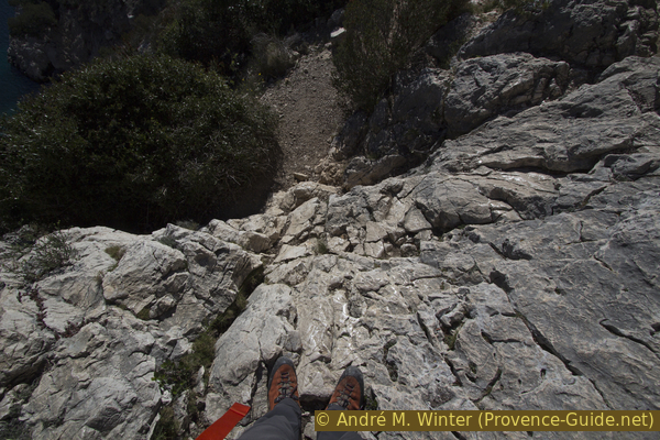
Even the marked path is not always easy. Some rock passages have been sanded smooth, also because there are access routes to climbing routes.
We leave this path neither down nor up.
No reproduction is permitted without the written consent of the author. (id4294)
Smooth rocks along the way at Cap Sormiou
col = pass
Washed-out channels with slippery gravel often have to be crossed. Most of the time it is easier to get through on higher routes.
No reproduction is permitted without the written consent of the author. (id4295)
Way to Cap Redon
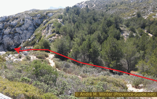
After several ditches, the path gets narrower and after a while we see Cap Redon in front of us on the lower left. The true cape, Bec de Sormiou, is the pointed mass to the right of centre.
Our path is clear, we descend directly into the saddle on the right of the second peak of Cap Redon.
No reproduction is permitted without the written consent of the author. (id4296)
Descent to Cap Redon
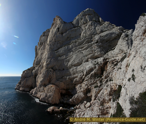
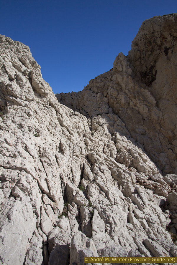
When we are in this saddle, the path suddenly stops. However, one can descend into the cirque directly in front of us without changing the direction of the march. It goes steeply downhill over white limestone with reddish deposits.
No reproduction is permitted without the written consent of the author. (id4298)
Southeast side of Cap Redon
Looking back on this descent.
No reproduction is permitted without the written consent of the author. (id4299)
Descent in the southeast slope of Cap Redon
Here you are often in the slipstream and can enjoy a good view of Bec de Sormiou.
No reproduction is permitted without the written consent of the author. (id4297)
Bec de Sormiou
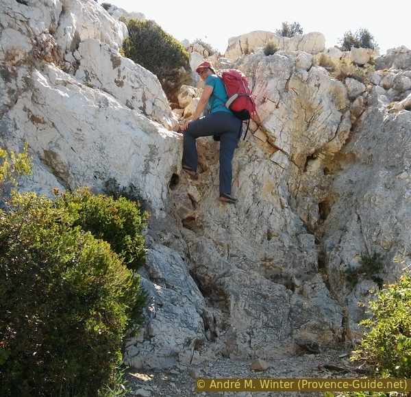
To circum-hike the cape, you have to descend a little to climb up again on the left in an even steeper rocky gully. You have to put your hands on the edge at the top. We come to a small saddle between the two peaks of the cape.
No reproduction is permitted without the written consent of the author. (id4300)
Rock gully to the saddle near the north hill of Cap Redon
For a better view we climb the crest on the right.
No reproduction is permitted without the written consent of the author. (id4302)
North hill at Cap Redon
The Calanque de Sormiou can be fully admired from up here.
No reproduction is permitted without the written consent of the author. (id4301)
Looking back into the Calanque de Sormiou
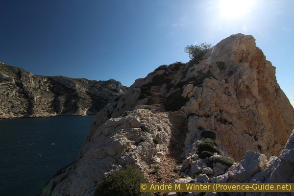
To get back to the marked trail, we don't have to go back down the rock. A small path leads between bushes on the north side of the cape in the saddle with the end of the main path.
No reproduction is permitted without the written consent of the author. (id4303)
View from the saddle in front of Cap Redon
Section 3: Cap Redon - Col du Luï d'Aï - Sormiou
➙ 1 km ... 40 min ➚ 70 m ➘ 100 m ↝ difficult
15% moderate trails, few marks
5% hard-to-recognize trails, without marks
5% exposed trails, without marks
20% hard-to-recognize trails, few cairns
40% moderate trails, few marks
10% hard-to-recognize trails, few marks
5% on beach, without marks
The clues
- Cap Redon, 30 m
- Col du Luï d'Aï pass, 100 m
- Plage de Sormiou beach, 0 m
Ascent to the Sormiou ridge via overgrown paths.
col = pass
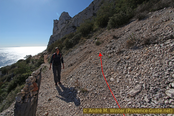
We take again the path by which we came to the cape. It goes up to an altitude of about 55 metres. On this way we pass under the massive main ridge. We cross above two scree fields. After the second field of rubble, the path flattens out, leads between small bushes and here we are in front of a barely visible junction.
The photo shows the said spot, but the bushes prevent direct ascent. So we continue on the normal route for a short while.
No reproduction is permitted without the written consent of the author. (id4304)
Approximate direction of the route up the Sormiou ridge
You come to another gravel area and here a narrow path climbs south, you can see it better when you look back. Higher up, it quickly turns right again, west and towards the Col du Luï d'Aï pass as in the previous picture.
No reproduction is permitted without the written consent of the author. (id4305)
Main path on the left and barely visible ascent on the right
View back.
Further up, the path is less overgrown, but it goes continuously steeply up into a slight hollow in the ridge (left of the middle of the picture).
No reproduction is permitted without the written consent of the author. (id4307)
Ascent to the Col du Luï d'Aï saddle from the north-east
Already on the ascent, the perspective widens. To the front you can see the inside of the Calanque, to the back you can look back down to Cap Redon.
No reproduction is permitted without the written consent of the author. (id4306)
View from the path under the Col de Luï d'Aï saddle
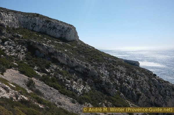
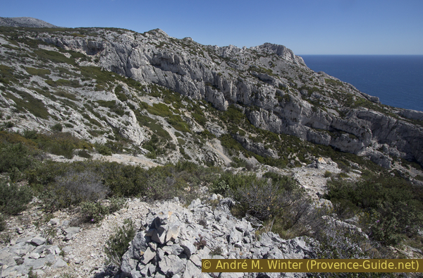
We keep walking in the same direction and thus come to an easily accessible section in the Sormiou ridge.
No reproduction is permitted without the written consent of the author. (id4310)
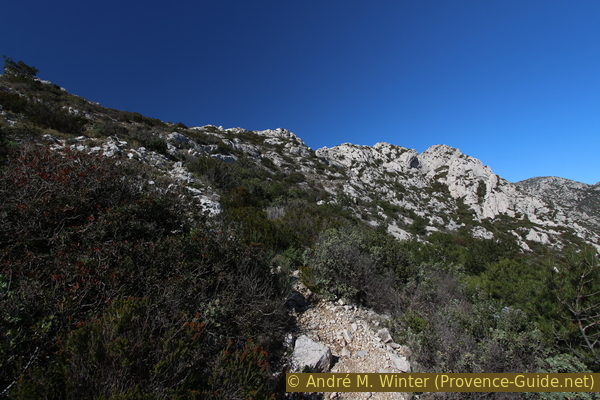
Main ridge of Sormiou looking north-west
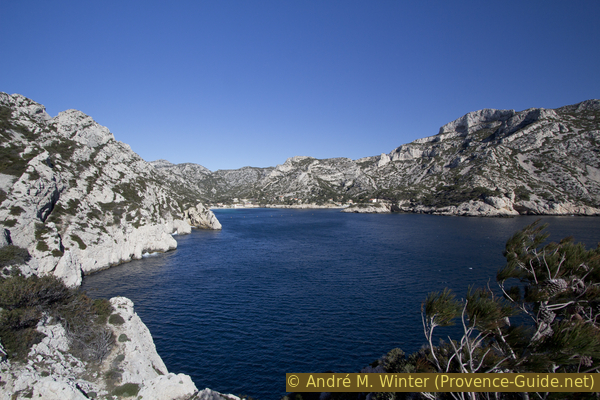
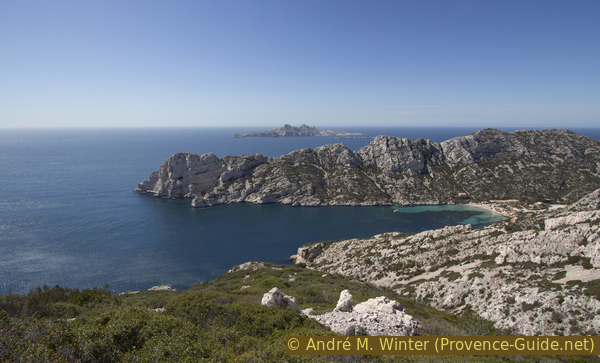
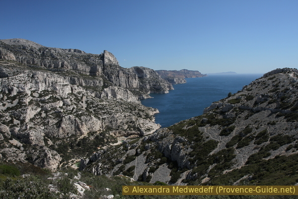
On the south side of the Col du Luï d'Aï pass there is a cove with high and vertical walls.
No reproduction is permitted without the written consent of the author. (id4311)
Rock wall under the Col du Luï d'Aï saddle
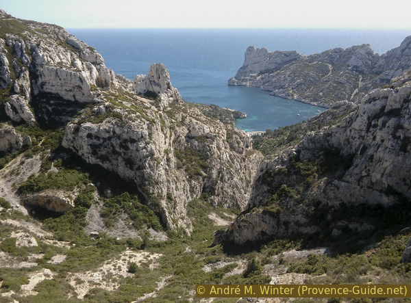
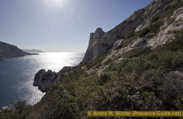
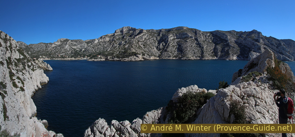
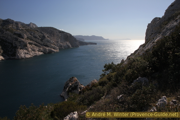
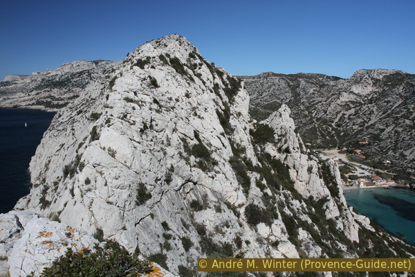
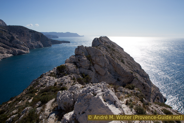
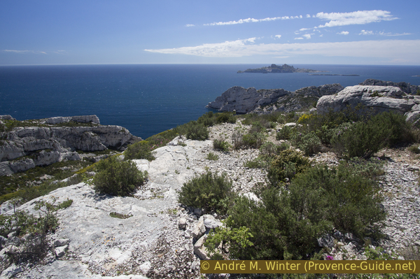
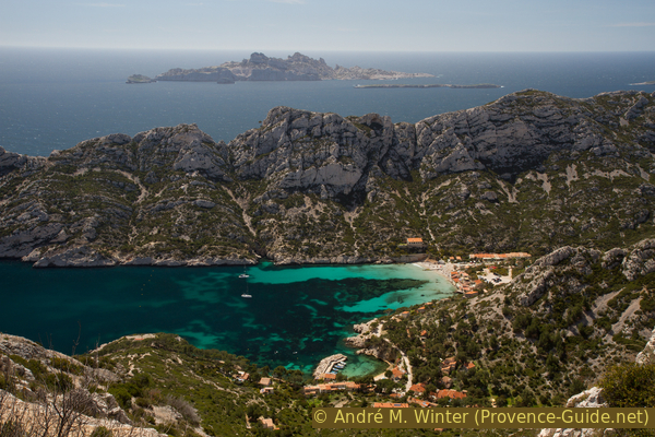
White limestone islands shine in the south. On the right the southern rock wall of the Sormiou ridge.
No reproduction is permitted without the written consent of the author. (id4309)
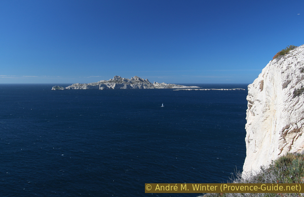
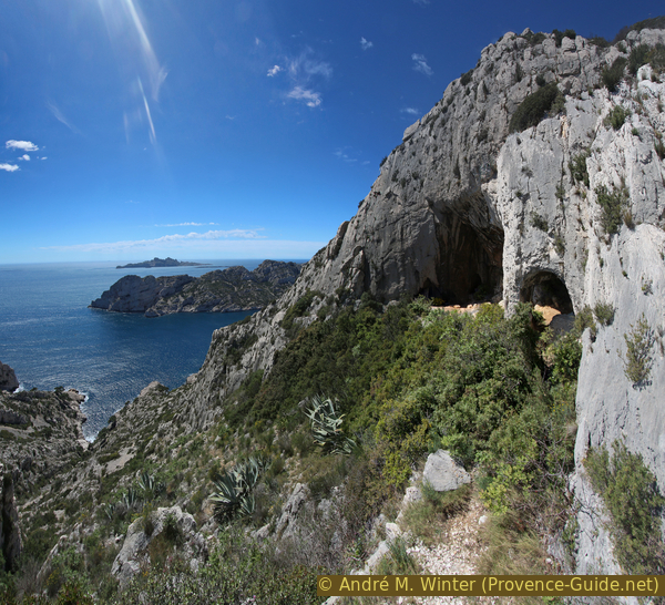
Île du Riou, Île Calseraigne and Falaise de Luï d'Aï
You can also see the islands of Île de Jarre and Île de Jarron, the stretch of coast near Marseilleveyre, the Plan des Cailles area and part of the Île Maire island. Further out to sea is the lighthouse on the island of Île du Planier. If it is not too hot, climbers can be seen in the foreground on the right in the Paroi du Conglué cliff under the main Sormiou ridge.
No reproduction is permitted without the written consent of the author. (id4312)
Plan des Cailles and the island of Île Maire behind
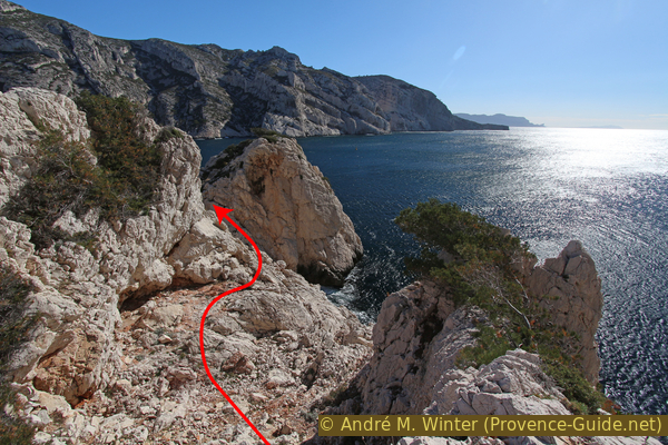
The Col du Luï d'Aï pass is therefore the starting point of several climbing routes in the cliffs south of the ridge. For intrepid mountaineers there are two options to advance further towards the cape. We would like to emphasize that We have not yet been able to climb these two variants ourselves!
Those with a head for heights can balance directly over the ridge to the south-east. You access a wider section at the crest, but then end up at the steeply sloping southern rock wall of the cape.
Another possibility is to advance below. Slightly to the left of the saddle, you descend to the south to get about 15 meters lower on a rock ledge. Then you get almost to the cape via Tiragne. One section is equipped with a steel cable, other sections are very airy and unsecured. However, you can always secure everything with climbing ropes. At the end, you come to about 30 meters above the cape. Come back in the saddle the same way.
No reproduction is permitted without the written consent of the author. (id4308)
Ridge of Sormiou
The path in the southern slope is visible at the bottom right.
In order to get back from the pass to the northern main path, we first descend a few meters north along the same path. But quite quickly we look out for a path down to the left. The slope is criss-crossed with gravel gullies and steep paths. Basically, you have to keep going down steeply to the left.
The photo shows the spot where you get back on the main path. This shows the bad condition of the slope. The Col du Luï d'Aï pass is in the centre of the picture above.
No reproduction is permitted without the written consent of the author. (id4314)
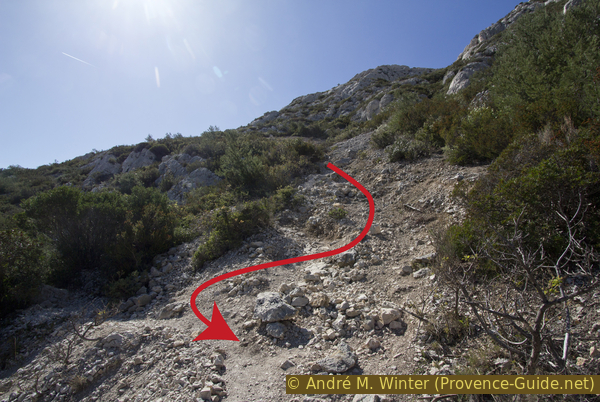
The slope for us to descend
col = saddle
plage = beach
When we are back on the easy path we turn left and back to Sormiou beach. Below you can see the crystal clear water of the calanque and you can see the following climb in the opposite ridge (photo).
No reproduction is permitted without the written consent of the author. (id4315)
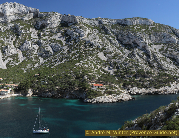
Ridge of Morgiou vis-à-vis
Section 4: Sormiou - Le Carrefour
➙ 1,6 km ... 1 h 25 min ➚ 230 m ➘ 0 m ↝ easy
5% on beach, without marks
25% dirt roads, few marks
70% moderate trails, with marks
The clues
- Plage de Sormiou beach, 0 m
- Junction Le Carrefour, 230 m
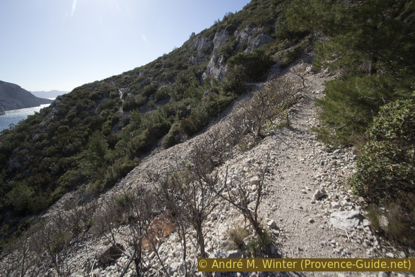
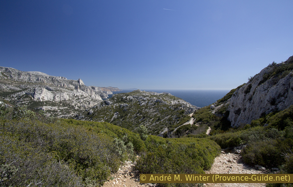
We climb the ridge of Morgiou to the north. There are several viewpoints back to Sormiou from this trail.
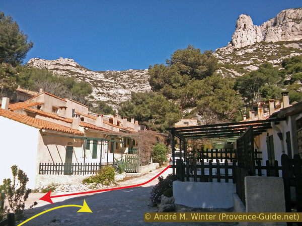
We go from the beach back to the large square and turn right on the gravel road to the port of Sormiou.
Here we follow the red marking further to the east. The path first leads between houses and then under individual huts. Shortly thereafter, the path climbs to the left along a ridge that is not particularly pronounced here. Here you should turn around often, the crest of Sormiou is progressively fully visible.
No reproduction is permitted without the written consent of the author. (id4319)
Looking back to the Port of Sormiou
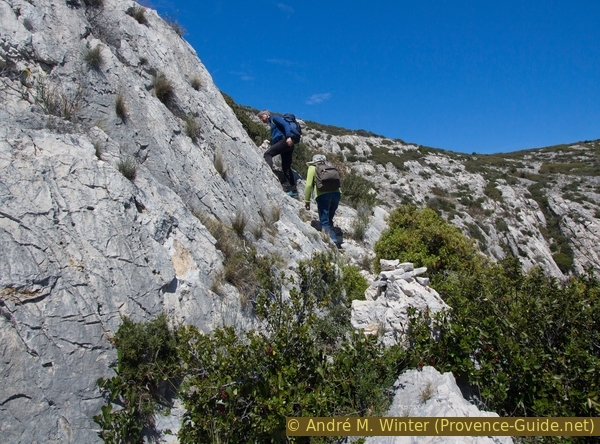
It's consistently uphill. When you come in a rocky section, it gets even steeper. You walk over irregular rock and then continue to the left of the now rocky ridge. The path now leads over sloping rock slabs. They are not slippery, but walking on them is uncomfortable.
No reproduction is permitted without the written consent of the author. (id2882)
Looking back at the sloping slabs under the Morgiou ridge
After this steep passage, we have to climb over a small section. A red marker indicates the ideal spot for crossing.
No reproduction is permitted without the written consent of the author. (id2883)
Climbing point on the path to the Morgiou ridge
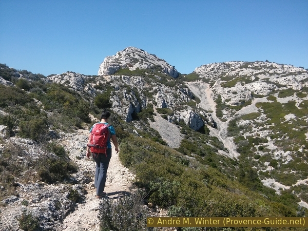
After that, the previously arduous climb turns into a comfortable walk. You hike to the east without gaining any significant meters in altitude.
No reproduction is permitted without the written consent of the author. (id2884)
South slope of the Morgiou ridge
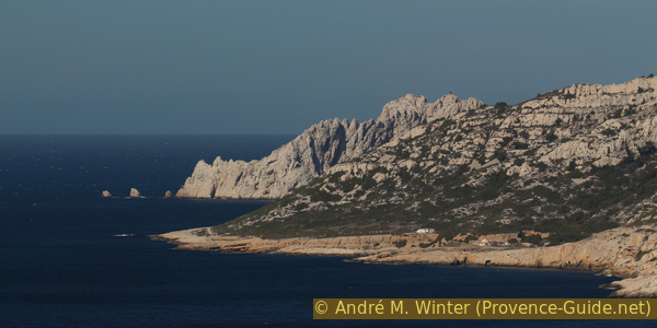
From this stretch of the path, you can admire the Sormiou ridge better, behind which you can now also see the Île de Riou island.
No reproduction is permitted without the written consent of the author. (id2885)
Île de Riou island and Calanque de Sormiou
Slowly but surely, the rock wall on the left is getting closer and closer.
No reproduction is permitted without the written consent of the author. (id2886)
Panoramic path under Le Carrefour
After the narrower section, the path climbs again and enters a wide saddle on the ridge of Morgiou called Le Carrefour (the junction).
We arrive on a wider path, which leads along the ridge that is flat here. On the left, it would go back to Les Baumettes (red and blue markings), in front you could go straight down to Morgiou (red) and on the right it goes along the ridge to Cap Morgiou (blue).
Before we return to Les Baumettes, We suggest a detour that is really worth it!
No reproduction is permitted without the written consent of the author. (id2887)
Calanque de Morgiou and view to Cap Sicié
Section 5: Le Carrefour - Grotte de l'Os
➙ 0,4 km ... 30 min ➚ 60 m ➘ 60 m ↝ difficult
25% hard-to-recognize trails, cairns
50% Trails with scramble passages, cairns
25% hard-to-recognize trails, cairns
The clues
- Le Carrefour junction, 230 m
- Grotte de l'Os, cave 170 m
- Le Carrefour junction, 230 m
Descend to a semi-cave with a view of the Sormiou cape. Back in the saddle the same way.
Attention, the descent to the cave includes exposed rock sections that must also be walked on the way back. You will also put your hand on the rock during the descent and help children and less experienced people. The path is barely visible, but marked with many cairns. There is no other way of marking.
The whole tour is long and you can skip this detour. In this case, follow the trail to the left and continue along section 6. This saves you 30 minutes, but you miss a sight!
col = saddle
crête = ridge
passages rocheux = rock passages
rocher blanc = white rock
At Le Carrefour junction is a very large cairn. Continue in the direction of the cape, that is, coming from Sormiou, on the right. Only about 15 meters away from the cairn, however, we turn right again onto a narrower path and we aim for a white rock that protrudes from the flat vegetation.
No reproduction is permitted without the written consent of the author. (id2888)

White rock to aim on the way to the cave
We pass the rock on the left and continue on a ledge that is relatively bare of vegetation.
No reproduction is permitted without the written consent of the author. (id2889)
Access to the cave on this rock strip
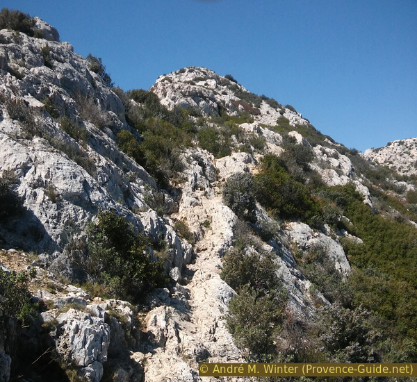
A little further ahead, it goes slightly downhill, but we keep the direction. However, when it gets steeper, we look to the left for a descending path. It is marked with small cairns.
No reproduction is permitted without the written consent of the author. (id2890)
Cairn and path downhill at the edge of the plateau
Now the descent is steeper. The path turns right again and leads us down south over gravel.
No reproduction is permitted without the written consent of the author. (id2891)
Descending path to the cave
You get to firmer rock and here you have to climb down a first step. After that, you tend to keep to the right and continue to climb down. A similar section follows. You soon come to the cave.
No reproduction is permitted without the written consent of the author. (id2892)
First rock step to climb down
The second section of rock is more interspersed with gravel.
No reproduction is permitted without the written consent of the author. (id2893)
Second steeper section to the cave
We can now easily proceed further south on a rocky edge, even if we have to bend some bushes to the side. Then you stand on a boulder in front of which it goes vertically down several meters. However, we are there, if you bend slightly and look to the right, you can see a part of the cave! We still have to descend to the lower level on the right. A step carved into the rock helps.
It leads into the cave, next to the small gate is a big opening to the south.
No reproduction is permitted without the written consent of the author. (id2894)
The Grotte de l'Os cave seen from the approach path
The semi-cave Grotte de l'Os is not very deep, it is probably a washout of a primeval river. However, the size and the pillar separating the two openings make this cave unique.
The many cairns, fireplaces (forbidden) and climbing hooks prove that we are not the first here. But that doesn't make the place any less worth seeing. You're far from the main path, you're sheltered (from sun, wind, rain) and you have a good view of Cap Sormiou. You may linger here for a break.
No reproduction is permitted without the written consent of the author. (id2895)
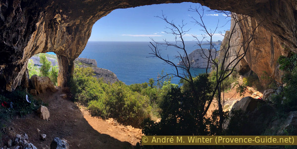
View from the Grotte de l'Os cave
Satisfied, we climb back up the same path to the Le Carrefour crossroads.
No reproduction is permitted without the written consent of the author. (id2896)
Rocky section above the cave
Section 6: Carrefour - Col de Morgiou - Baumettes
➙ 2,3 km ... 50 min ➚ 35 m ➘ 175 m ↝ easy
45% easy trails, with marks
10% forest roads, few marks
35% easy trails, few marks
5% hard-surfaced city alleys, without marks
The clues
- Le Carrefour junction, 230 m
- Under Baou Rond, 260 m
- Col de Morgiou saddle, 200 m
- Les Baumettes, 90 m
Our way back leads along marked paths, but most of them are on sections that are little used.
After coming back from the Grotte de l'Os cave, we go back to the large cairn and from there we continue along the wide ridge towards Marseille, with Cap Morgiou at our back. The trail is fairly flat at first, but later it climbs in stages to a saddle north of Baou Rond. We stay at the ridge or slightly north of it.
No reproduction is permitted without the written consent of the author. (id4328)
The way to the saddle under the Baou Rond
In places, the path leads over smooth rock.
No reproduction is permitted without the written consent of the author. (id4329)
Rocky sections below Baou Rond
As long as we stay south-east of the Baou Rond, we look back at the Calanque de Sormiou when we are at the ridge.
No reproduction is permitted without the written consent of the author. (id4330)
Calanque de Sormiou, Crête de Sormiou and Île de Riou
The way to the saddle is the last serious climb, it is also the highest point of the tour. From the pass, you can see Cap Canaille one last time.
No reproduction is permitted without the written consent of the author. (id4331)
Grande Candelle, Cap Canaille and the broad ridge of Morgiou
In the other direction we long for the Côte Bleue, the bay and the city of Marseille.
No reproduction is permitted without the written consent of the author. (id4332)
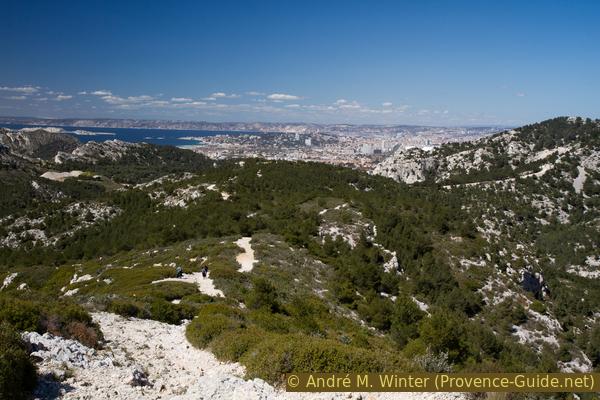
View on Marseille
col = saddle
Five minutes after the saddle we come to a fork in the trail where most people go down to the left. But we stay straight on the path, first it is flat and later slightly sloping. We aim for the Col de Morgiou saddle along a yellow marker.
No reproduction is permitted without the written consent of the author. (id4333)
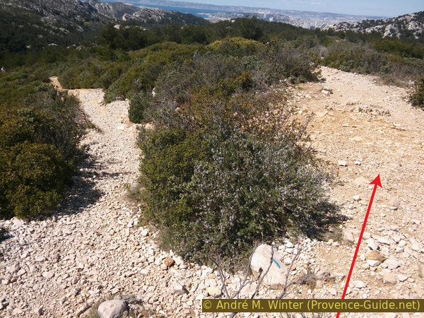
The path to Col de Morgiou is on the right
We go straight ahead and follow the ridge. After a hill we go down to a saddle where the Morgiou road crosses. Straight ahead there too, we are now on a forest road and continue on the ridge line.
When the forest road curves to the left, we look for a narrower path to the right. It leads slightly downhill and shortens the road a bit.
When we come back to the forest road, we are at the Col de Morgiou saddle. In front we see that the old way of Morgiou crosses. On a stone are many marks and an arrow to Les Baumettes.
Our way back to the starting point is marked in red.
No reproduction is permitted without the written consent of the author. (id4484)
Beginning of the path from Col de Morgiou saddle to Les Baumettes
It is the old footpath to Morgiou, you can see the worn passages in the rock. Further down the valley narrows.
No reproduction is permitted without the written consent of the author. (id2897)
Old path from the saddle to Les Baumettes
At the end the valley widens again and we come back to the city via a dead end. In front it crosses the street Chemin de Morgiou. On the left you return to the last parking lot, on the right you come to the terminus of the bus line or to the parking facilities at the prison.
Sources and additional information
It is better to use a good topographic hiking map: This tour is on the IGN map "Les Calanques, Parc National", scale 1:15000, 82011.
If you don't want to bother with a paper map, you can also use mapping apps on your cell phone. On the one hand, it is the Cartes IGN app from the official map service. However, it requires access to the data network and this is sometimes difficult in canyons or remote locations.
Alternatively, you can use apps that store data directly on the device. They're generally not free, but they don't cost much. We mainly use OSMAnd, here it is possible to add contour lines, relief shading, markings and others. To store this data on your phone you need a lot of space.
Of course, one needs access to satellites for the GPS signal with any app. In some canyons this is not the case. Therefore, do not rely on the position shown, but read the map on your phone as you would read it on paper. Most apps are available for Android and iPhone. The applications usually allow us to record the route travelled and also view the GPS files offered for each of our hikes.
This page has been seen 3534 times since 20 March 2024.