Chemins de Bellevue and the Montaigu dovecote
Panoramic tour and isolated site
walk
easy
1 h 15 min
no
yes
no
walk
Introduction
In the eastern part of the Luberon there are hills that are not very high but some of which offer unexpected distant views. This is the case with the Hills of Bellevue and Montaigu north of Manosque. Access is quite quick and very easy paths offer views in all directions of the Luberon, Sainte-Baume, Montagne de Lure, Verdon, Sainte-Victoire and other massifs further to the south . This round is well known to the locals and you are rarely alone there.
However, you can deviate downwards to the Montaigu dovecote. Unlike the ruin next door, it is still in pretty good condition. The location far from everything is very surprising. Few people pass here.
The facts
2,9 km total distance
1 h 15 min walk time
80 m total elevation
orientation easy
mark 80% of the total distance
45% hard-surfaced paths
30% forest roads
25% easy trails
dangers ruins
children yes
useful picnic stuff, binoculars
required trekking boots, hiking equipment and water
GPS coordinates (WGS84) of start and end point 43.869212,5.792092
Public transport
There is no direct access by public transport. One way to approach the starting point is from the Manosque SNCF station with the Trans'Agglo (only french) line 114 to the Rochette terminus. Leave the car park and turn left uphill towards the crematorium. At the last parking lot, continue on Montée de St. Martin les Eaux. This forest track takes us up to the Col de la Mort d'Imbert saddle. Here turn right onto the narrow asphalt road and continue until the first hairpin bend. Continue straight ahead then always take the path on the right. We arrive directly at the starting point of the tour. On the tour described, do not go down towards Montaigu straight away, but go around the big eight and then walk back towards Montaigu and go down towards La Gaude. Continue along the road on Chemin de Sainte-Roustagne and Boulevard des Cougourdelles to take bus line 111 at the terminus named Chasseurs. In total at least 3 hours.
Access by car
From all directions except the Luberon and Vaucluse, you must first reach Manosque and cross the town, it gets jammed at all hours. Take first towards the center, then towards Volx. At the large roundabout with a millstone in the center, head towards the La Villette car park, then towards La Rochette, then towards Dauphin. We gradually leave the city and bends begin. We turn right at the Col de la Mort d'Imbert saddle.
From Vaucluse and Luberon drive through Apt and Céreste towards Forcalquier. Ten minutes after the junctions towards Reillane and Villemus, we turn right towards Dauphin. We cross the scattered village and climb into the hills. We pass gas storage installations in salt mines and finally arrive at the Col de la Mort d'Imbert saddle where we turn left.
For both directions it is then identical. This road is very narrow and has diagonal water channels that you cannot well see, but which shake strongly. After a second bend, we are on the crest and when the road becomes flat, the asphalt stops. However, we continue until the barrier. At the end, the bumpy road goes down a bit.
Useful parking spaces
The end of the road is the parking lot. Only places reserved for disabled are covered with tarmac.
No reproduction is permitted without the written consent of the author. (id7274)
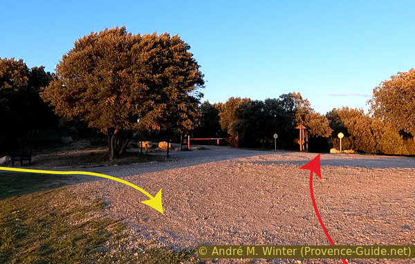
The end of the road in Bellevue
No reproduction is permitted without the written consent of the author. (id7276)
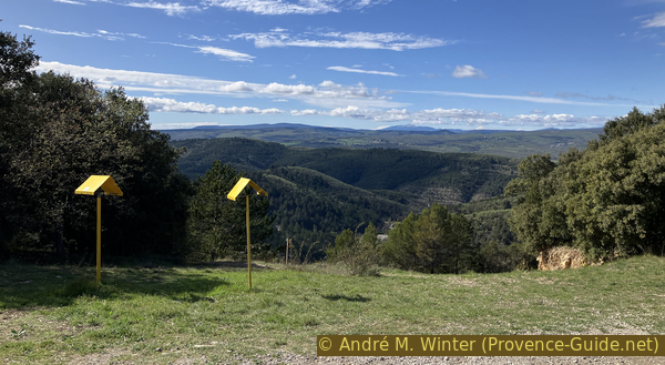
View from the car park towards Mont Ventoux
Hints
There is no source of drinking water along the route, so bring enough to drink. There are few markers, but orientation remains easy.
On a nice day, there can be a lot of people here for sunset.
The entire tour is also doable as it is by mountain bike. Only the steep portion between the crossing above Montaigu and the asphalt strip must potentially be pushed.
The walk on the big eight can be done in a non-motorized wheelchair because it has almost no difference in altitude.
Going up to the Col de la Mort d'Imbert saddle and on this tour, we find ourselves in the alert zone of the Géométhane and Géosel companies. Beneath the hills between Manosque and Dauphin are large deposits of rock salt which is washed with water and transported to the Istres region to be stored for industrial use in the Étangs de Lavalduc and Engrenier. We also offer a mountain bike tour near these The lakes around St. Blaise. In the cavities created by the outwash, gas from the Port of Fos-sur-Mer is stored. It is this gas storage that brings us all these warnings. When you took the road between Dauphin and the Col de la Mort d'Imbert, you pass a multitude of wells and pipes. Yes, Fos-sur-Mer and Dauphin sites are more than 125 kilometres apart. What are we not doing for industrial progress?
The yellow circle marks our tour area on the site concerned.
The whole region is a zone with a high risk of forest fires. In summer, but also in other seasons when it is very dry or by strong winds, access to the forest areas can be regulated. As a result, the roads may be closed to traffic and/or the trails prohibited to hikers. Current information: Access map to the forests of Alpes de Haute Provence (only french). The map shows the colours green, yellow, orange and red which correspond to levels of danger.
The sections
- Bellvue south round and descet towards the Montaigu dovecote.
- Bellvue north round and views towards Luberon.
No reproduction is permitted without the written consent of the author. (id7275)
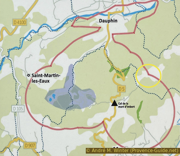
Warning in the gas storage area between Manosque and Dauphin
Section 1: Bellevue Sud - Montaigu
➙ 1 km ... 25 min ➚ 0 m ➘ 65 m ↝ with marks
35% hard-surfaced paths, few marks
10% forest roads, faulty marks
15% easy trails, faulty marks
10% forest roads, few marks
30% easy trails, few marks
The clues
- Bellevue car park, 682 m
- Montaigu, 617 m
The site is more suitable for a visit in the evening because there are more views to clearly see to the east. We go around the big eight counterclockwise, with an excursion to the east and downwards.
We take on the asphalt path to the right of the barrier. There is no point in following the forest track or trying to reach the summits of the two bypassed hills, you can't see anything because of the dense forest.
On a scree devoid of vegetation, we have the first good view. Benches mark some of these spots, but not all benches have good views.
No reproduction is permitted without the written consent of the author. (id7277)
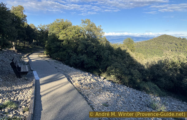
Bench in the southeastern part of Bellevue Eight
We look straight towards the east and this takes our gaze over the Durance valley to the southern part of the Plateau de Valensole, therefore in the Verdon country. The hills in the foreground are part of the small Pélissier massif on which we are located.
No reproduction is permitted without the written consent of the author. (id7278)
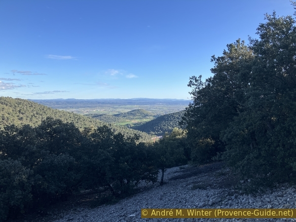
View from the south-eastern part of the Bellevue round
Looking further south, we see the ruin of the Tour d'Or. It is a vestige of a castle built a few years before the year 1000. At that time, Manosque protected itself there from Arab incursions.
Just behind rises the limestone cliff of the Massif de la Sainte-Baume.
No reproduction is permitted without the written consent of the author. (id7279)
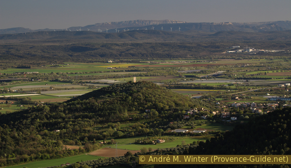
The Mont d'Or tower and the Sainte-Baume massif
With binoculars or telelenses on cameras, you can also see very well at the Cadarache research centre. The site is known in the media for the ITER experimental reactor, but historically and globally, Cadarache is a place of energy research. Classic atomic reactors (with their radioactive waste for millennia) and military nuclear engines were developed there. This is certainly cutting-edge research, but not necessarily always the best for humanity.
No reproduction is permitted without the written consent of the author. (id7280)
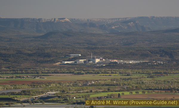
Cadarache CEA center seen from Bellevue
We continue along the asphalt path. In a few moments, we arrive at the central intersection of the big eight. There are benches and sculptures there. But it's still too early to take a break. We keep to the right and go downhill. So we leave the big eight for a forest track.
No reproduction is permitted without the written consent of the author. (id7281)
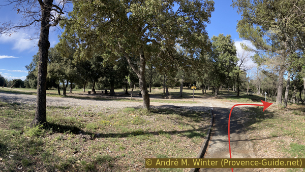
The round of Bellevue arriving at the intersection
We turn right at the first opportunity to shorten the descent.
No reproduction is permitted without the written consent of the author. (id7282)
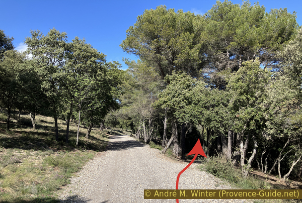
Shortcut under the forest track
We arrive below another intersection where we keep to the right again. We are again on a downhill forest track.
No reproduction is permitted without the written consent of the author. (id7283)
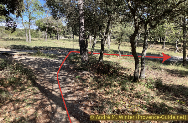
Crossing to the east under the Bellevue round
The game then repeats: descent on a path under the forest track. A signpost here indicates Gaule, a hamlet on the heights of Manosque.
No reproduction is permitted without the written consent of the author. (id7284)
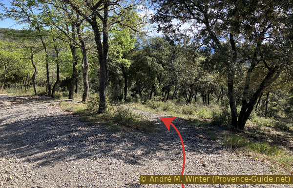
Path to Gaude under the forest track
This path is a little steeper than the others, but also more natural. The forest becomes denser and we cross a valley.
No reproduction is permitted without the written consent of the author. (id7285)
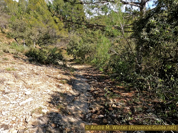
In the direct descent towards the Montaigu dovecote
We arrive in front of a large tower in the middle of the forest in a few moments. We recognize by an opening the niches of a dovecote.
No reproduction is permitted without the written consent of the author. (id7286)
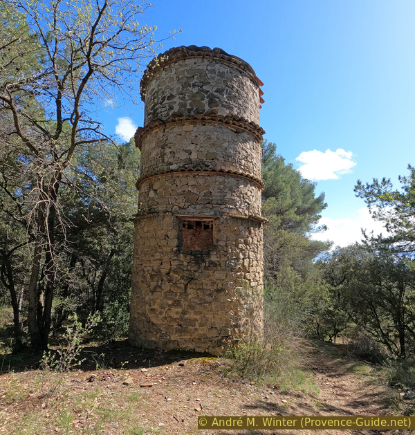
Arrival in front of the Montaigu dovecote
There are more openings on the south side.
No reproduction is permitted without the written consent of the author. (id7287)
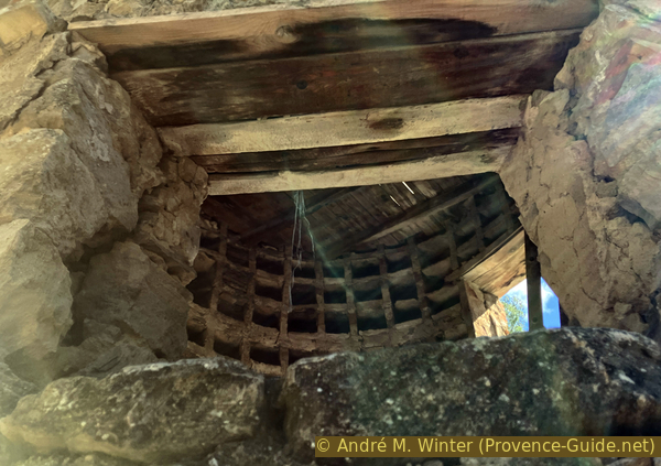
View of the niches through an opening in the Montaigu dovecote
Raising pigeons served two purposes: firstly and mainly for food, it was a delicacy for a long time, but it disappeared from our plates since the 1950s.
At the same time it was also a breeding of messenger pigeons. Pigeons are not particularly intelligent, but they have a good sense of direction. We cannot therefore tell them to fly to a specific point. It will only return to his dovecote. In wars, pigeons were therefore used much more in the direction from the battlefield towards a dovecote in the rear than in the other direction.
Unlike other dovecotes in Provence, this one does not seem to have been decorated with colorful tiles. The tower appears to have a recent roof. The wooden lintels are however very thin, this is not a good sign for the duration over time.
No reproduction is permitted without the written consent of the author. (id7288)
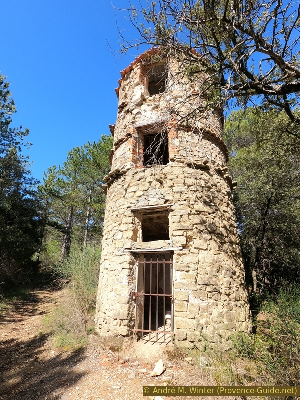
The Montaigu dovecote
In April 2024, the lower gate was open, but the ladder to climb to the first floor was missing. There was, however, a ladder on the first floor. The site seems to have been inhabited by vagabonds, the niches were used for storage.
No reproduction is permitted without the written consent of the author. (id7289)
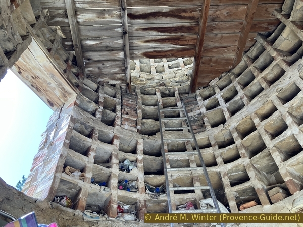
Niches on the first floor of the Montaigu dovecote
It seems that Montaigu was a place of retreat for the population of Manosque around the year 1000, just like the hill of Tour d'Or. The site appears to have been inhabited until the 16th century. However, neither the dovecote nor the ruin further down can date from this time. The ruin does not look like a farm, it is rather a 19th century functional building and this period better corresponds to the state of construction and conservation of the dovecote.
No reproduction is permitted without the written consent of the author. (id7290)
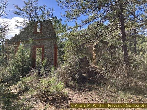
Ruins under the Montaigu dovecote
Section 2: Montaigu - Bellevue Nord
➙ 1,9 km ... 50 min ➚ 75 m ➘ 10 m ↝ with marks
10% easy trails, without marks
20% forest roads, faulty marks
5% easy trails, without marks
50% hard-surfaced paths, few marks
15% forest roads, without marks
The clues
- Montaigu, 617 m
- View point, 690 m
- Bellevue car park, 682 m
Return and the missing parts of the Bellevue big eight.
We go back up from the ruin towards the dovecote and take the outward route again.
This time we chose the uphill path (visible in the photo) which we may not have seen on the way down.
No reproduction is permitted without the written consent of the author. (id7291)
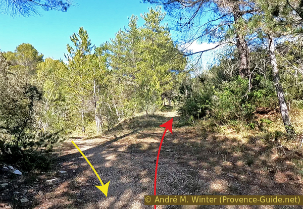
The two paths above the Montaigu dovecote
We end up on the same forest track from before. We take left to return towards the hills of Bellevue.
No reproduction is permitted without the written consent of the author. (id7292)
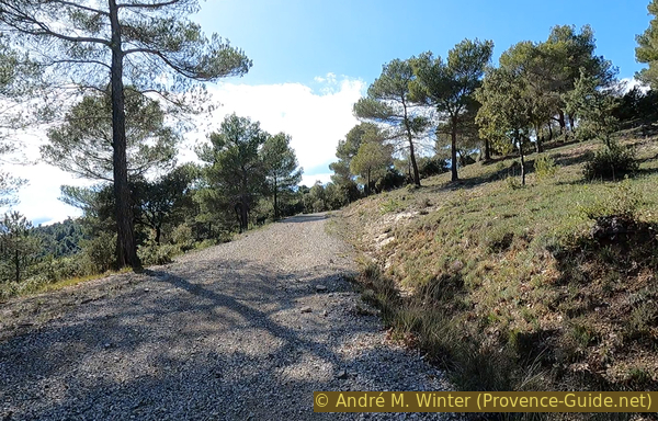
The forest track above the Montaigu dovecote
At the crossroads below the big eight, we stay on the forest track and begin the turn to the left. However, we take the direct uphill path on the right. It takes us back to the asphalt strip and near another bench with a view.
No reproduction is permitted without the written consent of the author. (id7293)
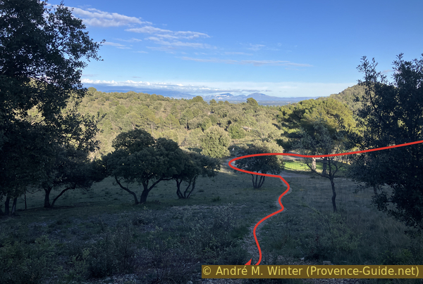
Direct ascent to the Bellevue round
Several large mountains can be seen to the east. The perspective is unusual. You can see straight into the exit from the Gorges du Verdon at Galetas. The large mountain on the right is Margès on the south bank, the others on the left are on the north bank of the Verdon.
No reproduction is permitted without the written consent of the author. (id7294)
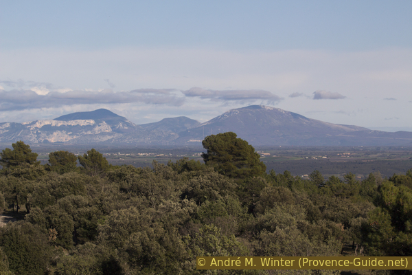
Montdenier and Margès
We continue our tour of the north hill of Bellevue counterclockwise. Another bench shows us a point of view. However, you have to step down the path a little to get a better view.
No reproduction is permitted without the written consent of the author. (id7295)
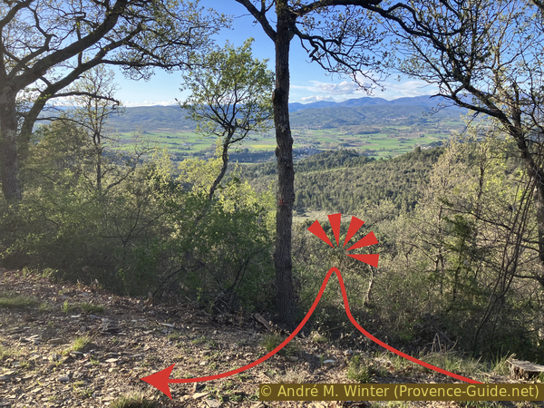
Blocked view towards Montagne de Lure in the northern part of Bellevue
We see a large virgin wooded area apparently devoid of roads and buildings. The site is not totally wild, but still very solitary. This is the Montagne de Lure.
No reproduction is permitted without the written consent of the author. (id7296)
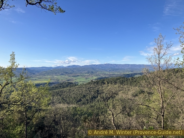
View from the northern part of Bellevue towards Montagne de Lure
The ridge of the Montagne de Lure is a barrier like Mont Ventoux further to the west. Its 1825 metres summit is beaten by winds and devoid of vegetation. A road crosses the Pas de la Graille saddle to the east of the summit at 1600 metres and it is often closed for a long time in spring due to persistent snowfields.
No reproduction is permitted without the written consent of the author. (id7297)
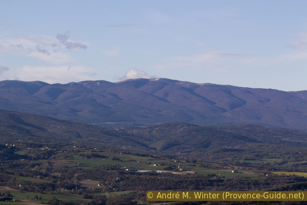
The Montagne de Lure seen from Bellevue
We head back to Bellevue. Returning towards the intersection of the big eight, we pass a bench with no view but good evening sun.
No reproduction is permitted without the written consent of the author. (id7298)
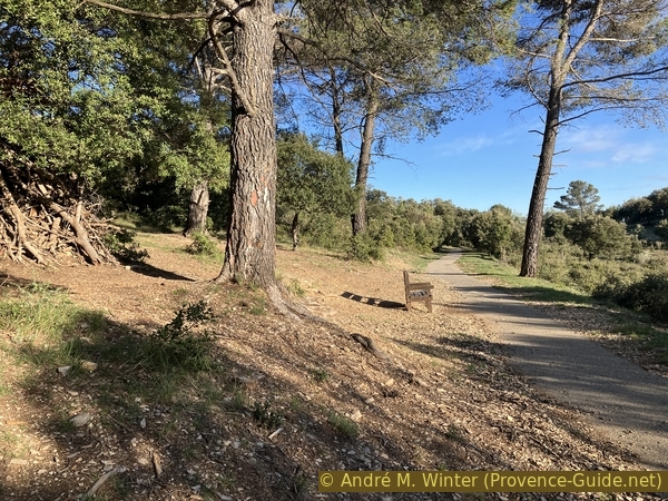
Bench without view before the intersection of Bellevue round
From the intersection, this time we take the last of the branches on the right. We pass a somewhat curious installation of horns imitating those of mammoths.
No reproduction is permitted without the written consent of the author. (id7299)
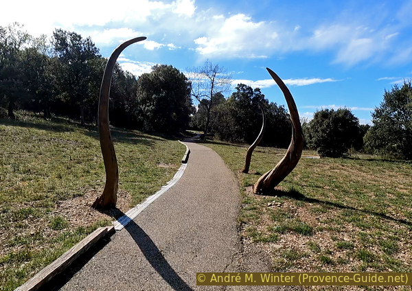
Work of art at the intersection of Bellevue round
A little further away is another installation resembling an ear or a funnel. The nearby bench and those that follow do not offer a view.
No reproduction is permitted without the written consent of the author. (id7300)
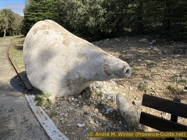
Work of art in the southwest part of Bellevue round
To look west, it is best to return to the starting point. You can climb to the highest point of the road. There is another bench and the view is ideal towards the west, therefore over the entire Luberon Massif to the east of which we are.
No reproduction is permitted without the written consent of the author. (id7301)
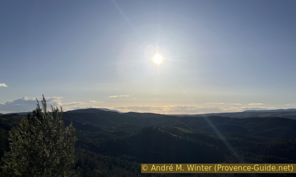
The sun sets over the Luberon
As mentioned above, it can be quite crowded here on nice days, especially on weekends.
On the right still is Mont Ventoux.
No reproduction is permitted without the written consent of the author. (id7302)
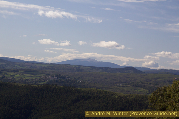
Mont Ventoux seen from the Bellevue car park
Sources and additional information
It is better to use a good topographic hiking map: this tour is on the IGN map "Manosque, Forcalquier", scale 1:25000, 3342OT.
If you don't want to bother with a paper map, you can also use mapping apps on your cell phone. On the one hand, it is the Cartes IGN app from the official map service. However, it requires access to the data network and this is sometimes difficult in canyons or remote locations.
Alternatively, you can use apps that store data directly on the device. They're generally not free, but they don't cost much. We mainly use OSMAnd, here it is possible to add contour lines, relief shading, markings and others. To store this data on your phone you need a lot of space.
Of course, one needs access to satellites for the GPS signal with any app. In some canyons this is not the case. Therefore, do not rely on the position shown, but read the map on your phone as you would read it on paper. Most apps are available for Android and iPhone. The applications usually allow us to record the route travelled and also view the GPS files offered for each of our hikes.
This page has been seen 1202 times since 20 March 2024.
No reproduction is permitted without the written consent of the author. (id7303)
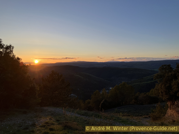
Bellevue Sunset