Road over Mont Ventoux
Natural and industrial site
1 h
view point
Description
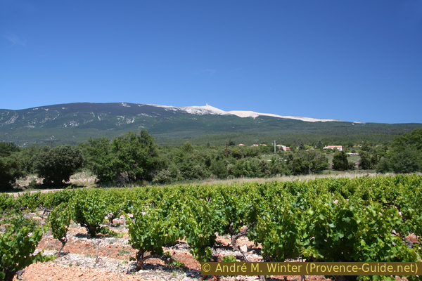
Mont Ventoux is an iconic mountain that can be seen from almost anywhere in western Provence. On the one hand, the mountain is further west into the Rhône Valley than its neighbors, on the other hand it is over 800 meters higher. This situation particularly exposes the summit area to the Mistral wind, which sweeps regularly from north to south. This makes the hilltop a particularly inhospitable spot: it is literally a bare heap of rubble made of chunks of limestone that were formed by frost blasting. The upper 200 meters are completely devoid of vegetation. But this desert landscape also has its charm.
If you can see Mont Ventoux from anywhere, it is also an ideal mountain for panorama viewing. For this reason, on a clear and dry day, one will head up here. Such ideal conditions can be expected especially when the Mistral blows in autumn and spring. In winter, the road in the upper area is often closed due to snowdrifts. But you have to reckon with extreme weather conditions in every season: heat, storm, cold, rapid changes in the weather, etc. The Mont Ventoux is always a change of scenery to the peaceful and comfortable existence in the Provençal plain further down.
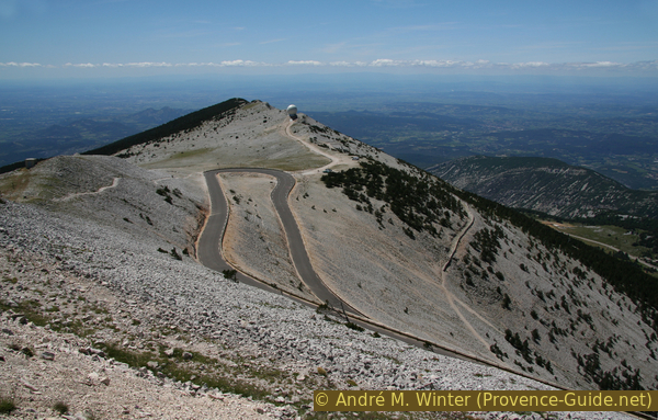
The top of the summit always appears white: in winter there is snow and in the rest of the year the white limestone shines. You can also conquer the mountain on foot or by bike, but that is really tedious and very boring for long stretches. There are many nice and pleasant walks to do in the area. Although we try to present sites and hikes that can also be undertaken without a car, we make an exception here. The road is there, let's use it.
No reproduction is permitted without the written consent of the author. (id2830)
South face of Mont Ventoux
Access by public transport
There is a shuttle bus that goes almost to the summit, but only during the winter holidays in February to reach the small Mont Serein ski area north of the summit. It stops in Carpentras, Caromb and Malaucène before climbing the mountain. You have to reserve the ride a few days in advance, more information here: Navette du Ventoux (only french). Scandinavian winter conditions can be lovely, just ask how heavily snowed up the summit area is.
Access by car
There are three approaches to the summit: from Malaucène, Bédoin and Sault further east. The usual circuit runs along the D974 road between Malaucène, the summit and Bédoin.
We are in the Rhône Valley at Orange. Coming from Marseille, leave the A7 motorway at Avignon Nord and follow the signs to Carpentras and Malaucène. Coming from the north, exit at Bollène, pass through Suze, Tulette and Vaison-la-Romaine to reach Malaucène.
In the afternoon and evening, from Malaucène, you drive up directly on the D974. In the morning it is better to go to Bédoin and there, at the roundabout north of the town centre, tackle the ascent via the south of the mountain.
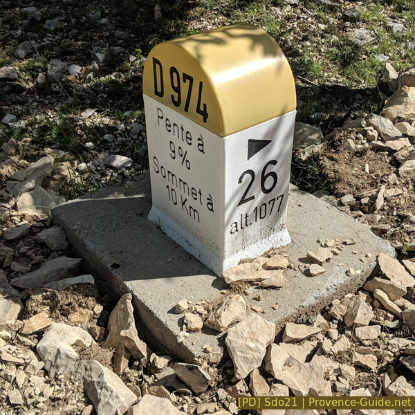
Milestone indicating incline and remaining distance
Starting at Malaucène, you pass the 12th-century Notre-Dame-du-Groseau chapel. Continuing on, you drive for a long time in the forests on the north side of the west ridge of Mont Ventoux. Only below the summit do you switch up the ridge and thus also see to the south.
No reproduction is permitted without the written consent of the author. (id2831)
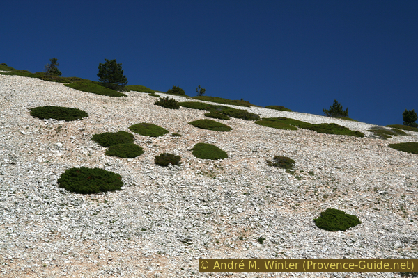
Islands of vegetation in the limestone rubble
The approach from the south and via Bédoin leads through several altitude levels: below in the plain, the cultivation of vines and cherries predominates. Higher up you enter a Mediterranean forest that becomes progressively denser. In the area of Chalet Reynard, the forest thins out again and quickly disappears completely. Only flat-growing plants remain on small islands between bare stones.
Several picnic areas have been set up along the road.
No reproduction is permitted without the written consent of the author. (id2833)
West ridge of Mont Ventoux
No reproduction is permitted without the written consent of the author. (id2834)
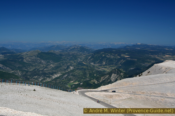
Looking east from Mont Ventoux
No reproduction is permitted without the written consent of the author. (id2835)
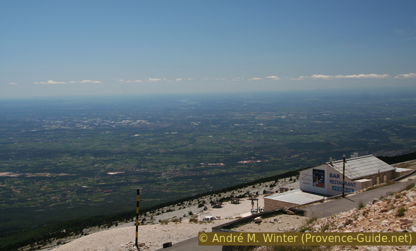
Southwest view from Mont Ventoux
No reproduction is permitted without the written consent of the author. (id2836)
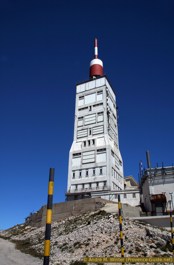
Tower at the top
No reproduction is permitted without the written consent of the author. (id2832)
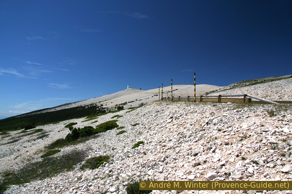
Bare peak of Mont Ventoux