The lakes around St. Blaise by mountain bike
Cycle below sea level and explore traces of ancient Greek presence
MTB tour
difficult
2 h 45 min
no
yes
no
21 % of the distance
Introduction
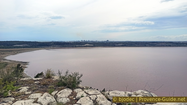
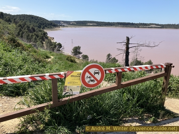
The lakes between Istres and Fos-sur-Mer are natural limestone basins which historically contain fresh water. However, for a long time, man has manipulated the circulation of water between lakes and the sea. Two lakes are specially transformed because of a salinity level of over 300 grams of salt per litre. For comparison, sea water contains 35 grams, the Dead Sea 275 grams. We would therefore easily float on the lakes of Lavalduc and Engrenier. However, it is an industrial brine soiled by hydrocarbons, it is better not to get wet with this water. It comes from natural gas silos in the Manosque region.
Étang de Lavaluc holds another record: on its edge, we find ourselves on the lowest point in France with -10 metres below sea level. On its edge salt is deposited and these structures are constantly transforming. It is therefore useful to come back often. We approach it by bike from the southeast. The eastern shore is sandy, sometimes muddy and requires climbing over some rocks. It is better to leave the bicycles at the pump station. This detour on foot is definitely worth it, you see formations that you won't find anywhere else.
Because of the railway line, it is not easy or useful to try to go around the Étang de Lavalduc. On the other hand, we go around the Étang du Pourra further east. It is almost dry and it is one of the only lakes in an almost natural state. It is a protected natural area.
Along the way, it is possible to visit the ancient Greek archaeological site of St. Blaise. You have to leave the bike at the entrance, but it creates a nice break from the saddle. Because of these two optional parts on foot, we recommend bringing a bike lock.
The facts
14,4 km total distance
2 h 45 min movement time. incl. 1 h 20 min leave the bike and explore on foot
150 m total elevation
orientation average
mark 45% of the total distance
20% moderate trails
20% easy trails
15% forest roads
15% rutted forest roads
10% on beach
5% dirt roads
5% hard-surfaced roads without motorized traffic
5% hard-surfaced quiet side streets
dangers exposed sections, slippery mud after rain
children yes, but it's long
useful picnic stuff, bicycle lock
required Hardtail mountain bike and water
GPS coordinates (WGS84) of start and end point 43.443057567591964,4.984860677642131
downloads ![]()
![]()
Public transport
The easiest access by bike is via the Rassuen train tation in Istres on the Côte Bleue line between Marseille and Miramas. About ten correspondences stop here. Exit the station on the side of the larger station building then turn right. We arrive at an intersection which we cross, the signs for motorists indicate St. Blaise. At the next roundabout turn right, then continue in this direction to arrive at the St. Blaise car park. We then begin the tour in section 3. 4 kmometres more for one direction, train information can be found under TER PACA (only french), look for Gare de Rassuen.
Access by car
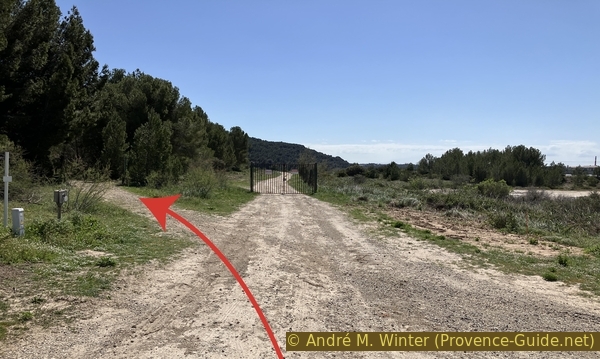
Access is from Arles on the N568 road towards Marseille and from Marseille towards Arles on the A55 motorway and the N568 road. Leave the main road at the St. Mitre exit and follow this direction at the next roundabout coming from Marseille, two roundabouts coming from Arles. At the next roundabout, we take the third exit towards the Forêt de Castillon. Follow this sign at the roundabout and at the next intersection. 60 metres further, we turn left and enter through a gate. This one is open between 8 a.m. and 8 p.m., so you must leave this area in time.
Outside of these hours, it is better to reach the St. Blaise car park and start the tour at section 3. Leave the N568 north towards Istres. Then follow the signs towards St. Blaise. Departure from the car park.
Useful parking spaces
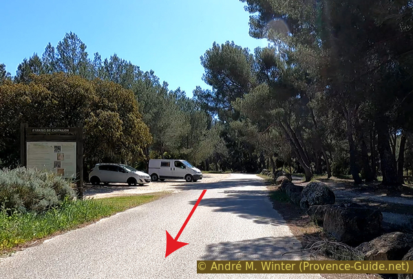
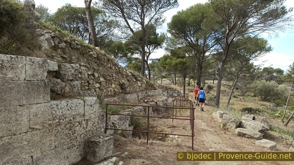
The Domaine de Castillon is a large public park with a single road open to motorized traffic which runs from south to north to the forest house. Park ahead in the designated parking lots. Those a little before the barrier offer more shade.
No reproduction is permitted without the written consent of the author. (id7154)
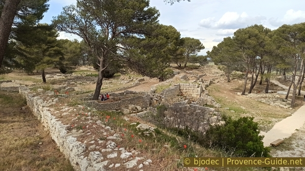
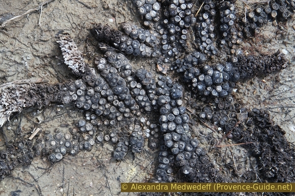
Étang du Pourra
No reproduction is permitted without the written consent of the author. (id7136)
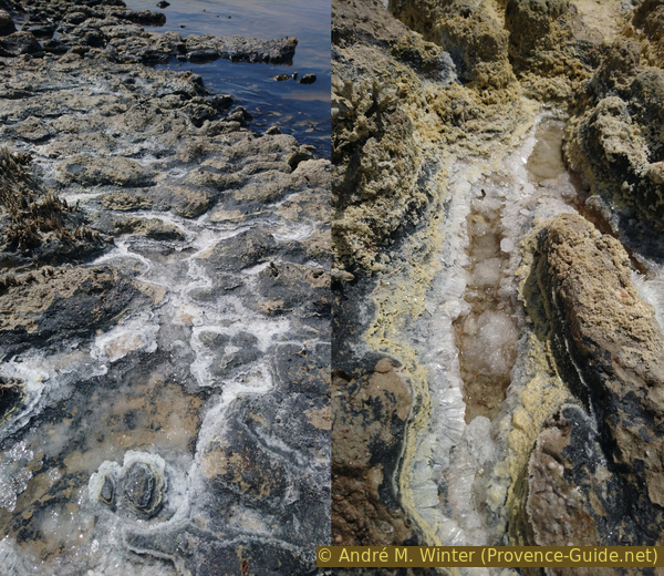
Pink brine water and crystallized salt from Étang de Lavalduc
No reproduction is permitted without the written consent of the author. (id7082)
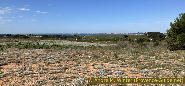
Domaine de Castillon car park
Hints
There is no source of drinking water along the route, so bring enough to drink. The winds can blow unpleasantly strong in all seasons. We pass through the zone of the August 2020 forest fire, the landscape may seem desolate, but it is also more open than before. A large part of the forest trails to be taken are devoid of markers and indications.
No section uses dedicated cycle or mountain bike paths. We ride on paths and forest roads where pedestrians always have priority.
All the water surfaces in the region are called étang (pond) even though they are all lakes (initially with freshwater) if we consider them geographically and historically. The term pond comes from the centuries when attempts were made to dry them out to gain salt. We keep here mainly the french name étang or simply lake.
The whole region is a zone with a high risk of forest fires. In summer, but also in other seasons when it is very dry or by strong winds, access to the forest areas can be regulated. As a result, the roads may be closed to traffic and/or the trails prohibited to hikers. Current information: Map of access to forests and exposed areas in Bouches-du-Rhône (also english). The map shows the colours green, yellow, orange and red which correspond to levels of danger. The affected area is: Castillon.
In the Castillon Forest, the period of severe control of forest fires and the possiblilty of access bans extends from June 1st to September 30.
The sections
- Tour of the Étang du Pourra counterclockwise.
- Return to the plateau between the lakes.
- Optional visit to the archaeological site of St. Blaise on foot.
- Descent to the shore of the Étang de Lavalduc.
- Trip along the edge of the Étang de Lavalduc on foot.
- Return to the Castillon forest house.
Section 1: Étang du Pourra
➙ 5,1 km ... 25 min ➚ 5 m ➘ 68 m ↝ average
↙ Colours of the sections like MTB rating but without the duration.
5% hard-surfaced quiet side streets, few marks
10% hard-surfaced roads without motorized traffic, few marks
↖ small gravel
25% moderate trails, faulty marks
↖ potentially muddy passages
20% dirt roads, few marks
30% rutted forest roads, faulty marks
↖ potentially muddy passages
5% easy trails, without marks
5% moderate trails, without marks
↖ potentially muddy passages
The clues
- Maison forestière de Castillon, 50 m
- Tour of the Étang du Pourra, 0 m
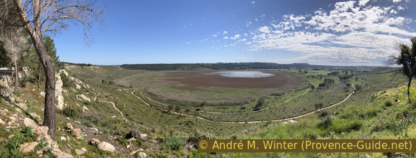
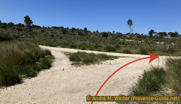
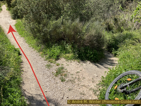
We more or less dive the 50 metres towards the Étang du Pourra to go around it counterclockwise.
We leave the parking lot in the direction in which we came there, therefore towards the north and in a straight line. We pass a large flat area, the forest house and after the barrier, there is no more car traffic. A first point of view is offered over the Étang du Pourra on the right.
No reproduction is permitted without the written consent of the author. (id7081)
Étang du Pourra
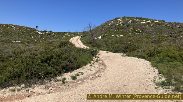
Shortly after, we turn right and begin the descent on an old asphalt road. It has large transversal channels to drain rainwater. In front of these bumps masses of loose gravel accumulate which can cause people to fall badly.
On this portion there are signs that explain the management of the lake's water and the wildlife that has found refuge there. The first sign is found shortly after the start of the descent. It explains the historical attempts to drain the lake and the current management to maintain a humid balance in the center that gradually dries outwards.
No reproduction is permitted without the written consent of the author. (id7080)
Downhill track towards the Étang du Pourra
Shortly before reaching the bottom there is another sign on the left. It has the shape of a panoramic table, but above all it explains the fauna and flora present in this very special humid, salty and hot environment.
No reproduction is permitted without the written consent of the author. (id7079)
Downhill track towards the Étang du Pourra
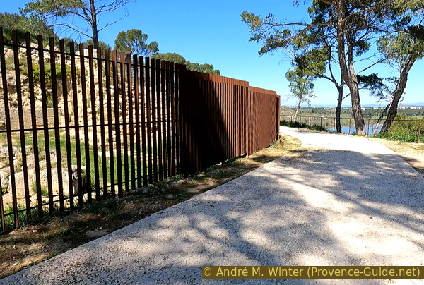
Access to the Étang du Pourra wetland is prohibited to protect this sensitive area. We therefore do not continue straight, we turn right at the first opportunity to follow a fence of ganivelles.
No reproduction is permitted without the written consent of the author. (id7078)
Junction above the Étang du Pourra
Ganivelles are fences formed by the vertical assembly of split chestnut stakes that are often found on the sandy shores of France. They also help helding back flying sand to keep it in place.
No reproduction is permitted without the written consent of the author. (id7077)
Path around the Étang du Pourra
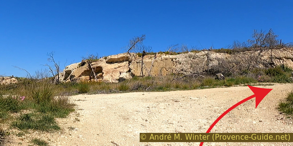
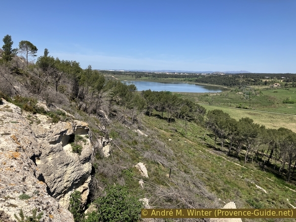
From below we now see the rocky edge of the Forêt de Castillon plateau. All the lakes in the region are in depressions in a large limestone strata. The edges are often steep.
No reproduction is permitted without the written consent of the author. (id7076)
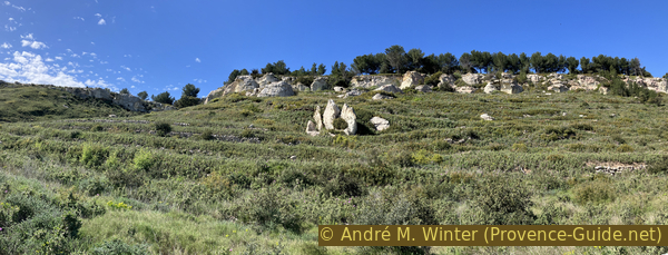
Cliff west of Étang du Pourra
We stay on the path, even if the path then moves away from the fence. This entire area was wooded and was ravaged in 2000 and 2020 by fires. We must let the vegetation regain a foothold. Depending on the previous rains, it can be quite chaotic here.
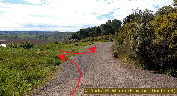
The path makes a wide loop to bring us to the southern part of the lake. After a fork where we continue straight, we arrive near a few trees that have resisted the fires, here the route is erased by the fallen trees left in place. We bypass this area to the north in 2024 because the mud on the main track is too difficult to ride on. We turn roughly right to turn left 200 metres further and take a straight line towards the east and find a straight an still bumpy road.
No reproduction is permitted without the written consent of the author. (id7075)
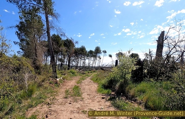
The desolate landscape of the 2020 fire
We pass a horse stable which is in the protected area.
No reproduction is permitted without the written consent of the author. (id7074)
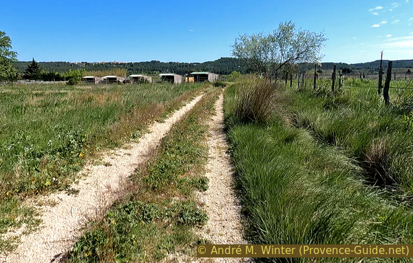
Farm south of Étang du Pourra
Beyond, the forest track becomes a little better as cars pass here.
No reproduction is permitted without the written consent of the author. (id7073)
Path southeast of Étang du Pourra
A kilometre further, this road begins to climb, it's time to spot a blue marker which tells us to turn left. The crossing is also marked by a pile of stones.
No reproduction is permitted without the written consent of the author. (id7092)
Bifurcation to the south-east of Étang du Pourra
Our new forest trail is in worse condition. It is often split to the left or right because of water holes after the rains.
No reproduction is permitted without the written consent of the author. (id7091)
Split path to the east of Étang du Pourra
By taking the right ones, you pass through a remnant of forest which escaped the last forest fires.
No reproduction is permitted without the written consent of the author. (id7090)
Small forest east of Étang du Pourra
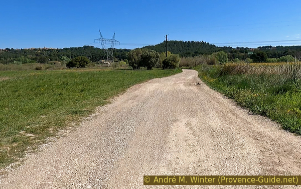
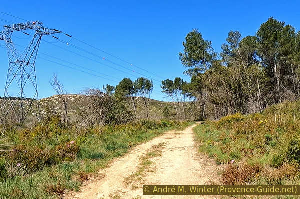
We have been driving alongside a high-voltage line for some time and finally we are driving directly under it. Now is the time to spot a wall on the left and a rusty metal rod on the right. Shortly after, a simple path deviates to the left.
No reproduction is permitted without the written consent of the author. (id7089)
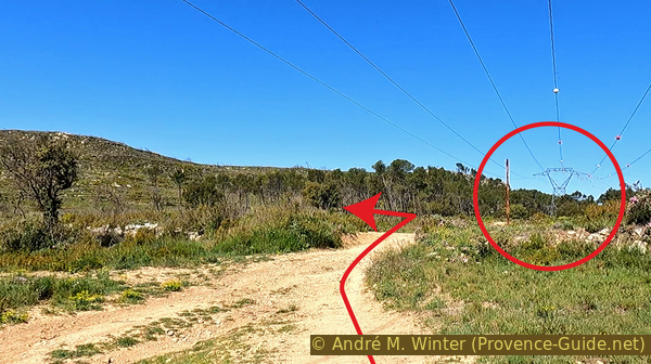
Power line and pole northeast of Étang du Pourra
We therefore turn left to follow the path which goes around the Étang du Pourra, now on the north side.
No reproduction is permitted without the written consent of the author. (id7088)
Path north of Étang du Pourra
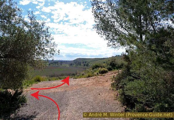
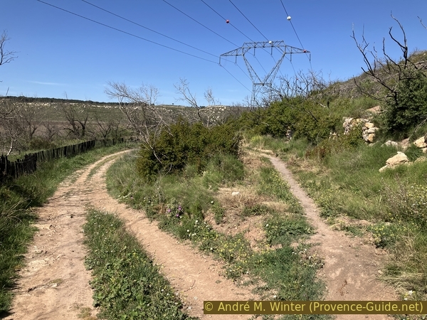
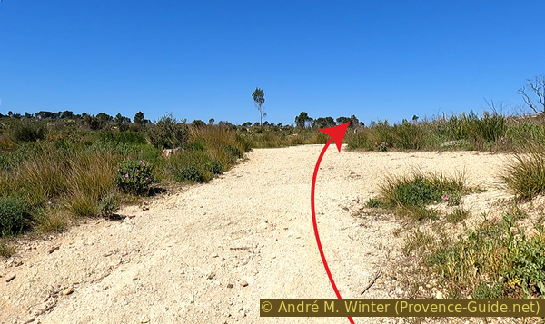
We come out on another forest track where we ride left for another 300 metres. We also start the ascent here.
At the next intersection, we keep right to enter the Vaupiane valley.
No reproduction is permitted without the written consent of the author. (id7087)
Bifurcation northwest of Étang du Pourra
Section 2: Le plateau
➙ 2 km ... 35 min ➚ 66 m ➘ 5 m ↝ difficult
↙ Colours of the sections like MTB rating but without the duration.
25% rutted forest roads, without marks
75% forest roads, without marks
The clues
- Up through the Vaupiane valley, 5 m
- Northwards over the plateau, 57 m
- St. Blaise archeological site, 50 m
After an almost complete tour of the Étang du Pourra, we climb back painfully towards the plateau and pass several viewpoints.
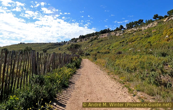
Here we bicycle back up the 50 metres of elevation on a fairly constant slope. There is no shade, we will inevitably sweat. In places, this road is heavily washed out by rainwater.
In the valley to the left, we see dry stone walls running across the bottom of the valley. These are so called restanques that serve as dikes. On the one hand, this created flatter terraces for cultivation, but these walls retained and still retain rainwater and the soil it carries.
Subsequently, we are in a region completely ravaged by forest fires. There is an irregular network of forest trails that all look the same. The following directions and photos therefore explain each crossing and each bifurcation.
At the first fork in the middle of the climb, we continue straight ahead. We then have the view in the photo. So this is the second remaining uphill section.
When the forest is lacking, erosion attacks the soil directly. Here, water flows along the road, not at the bottom of the valley, which is further to the left. This cut can eventually tear away the entire slope, even though it is not extremely steep.
No reproduction is permitted without the written consent of the author. (id7086)
Climb into the Vaupiane valley
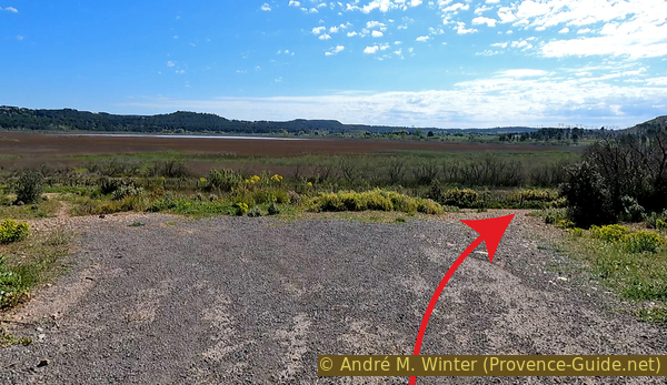
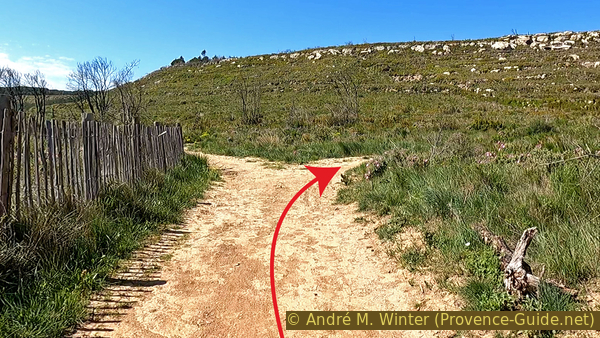
When we almost arrive on the plateau there follows a crossroads where we try to keep the north direction, even if we deviate to the left.
No reproduction is permitted without the written consent of the author. (id7085)
Crossing at the top of the Vaupiane valley
Immediately after, turn right to keep heading north.
No reproduction is permitted without the written consent of the author. (id7084)
Junction at the top of the Vaupiane valley
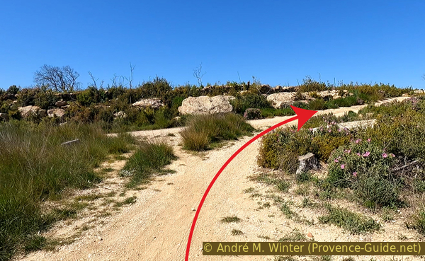
Shortly after, there is another crossroads in front of cliffs. Here on the right to go around them. A yellow and red marker on a tree stump also points in that direction.
No reproduction is permitted without the written consent of the author. (id7083)
Junction under the rocks of Mourre Encaud
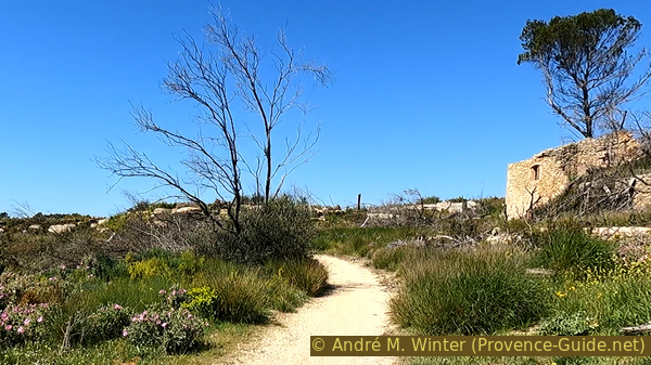
At the next fork on the right. We see on the left a ruin which we will pass later. The path is now narrower.
No reproduction is permitted without the written consent of the author. (id7152)
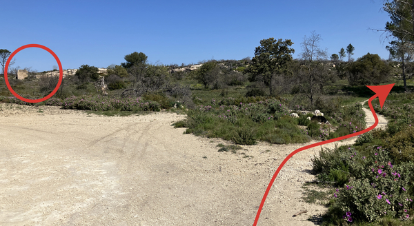
Junction at the rocks of Mourre Encaud
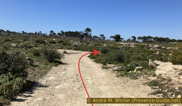
The path leads us straight towards a group of small trees. Just behind is a natural viewpoint.
No reproduction is permitted without the written consent of the author. (id7100)
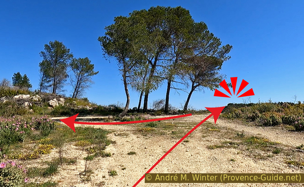
Trees before the Mourre Encaud viewpoint
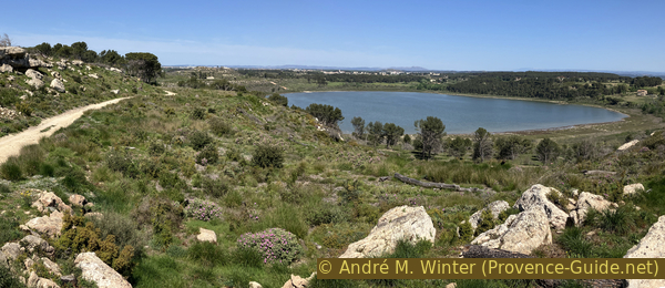
There remain charred wooden beams.
We are at the edge of the plateau and we see the Étang de Citis, it is an almost fresh water lake just as protected and managed as the Étang du Pourra.
No reproduction is permitted without the written consent of the author. (id7099)
View of Étang de Citis
We leave from the viewpoint towards the group of trees and we take the track on the right. It leads us directly to the foot of the ruined house.
No reproduction is permitted without the written consent of the author. (id7098)
Arrival under the ruin of Mourre Encaud
Observing it in more detail, we see that it is built directly on the rocky edge as if one wanted to stay under the ridge without encroaching on the meager arable land.
No reproduction is permitted without the written consent of the author. (id7097)
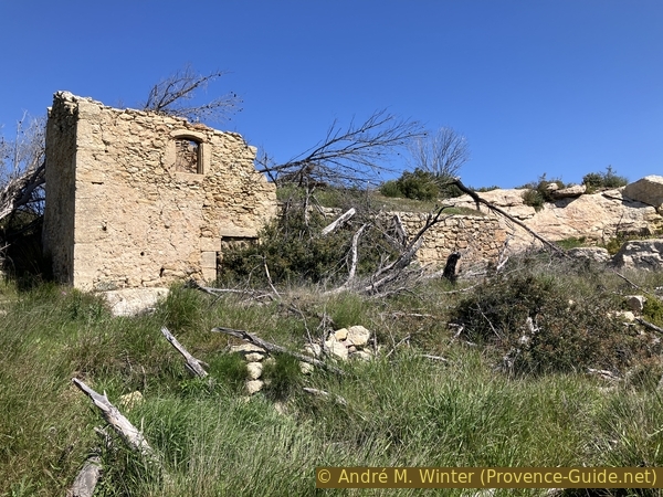
The ruin of Mourre Encaud
You can walk up to the left of the house and go around it to see the interior through the missing roof. This view also shows us the further way.
No reproduction is permitted without the written consent of the author. (id7096)
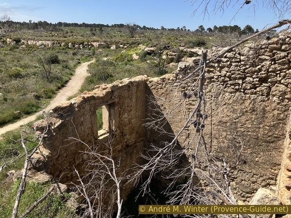
The ruin of Mourre Encaud and the further the path
At the next two junctions, you keep to the right. Here we pass the highest point of the tour just under 60 metres above sea level.
No reproduction is permitted without the written consent of the author. (id7095)
Bifurcation north of the ruin of Mourre Encaud
So also right at the second intersection.
There is no point in trying to advance directly from here to the archaeological site. After the 2020 fire, the fence was moved and we can no longer approach the rock tombs from this side.
No reproduction is permitted without the written consent of the author. (id7094)
Bifurcation north of the ruin of Mourre Encaud
We stay at the height for a few more moments to pass a rocky bar. You can go up there directly from the forest track. Here we have a better view of the Étang de Citis. It was tried to dry it up just like the Étang du Pourra. For this, tunnels were dug to connect it to the Étang de Berre and the Étang de Lavalduc. It was also transformed into a saline and it also sometimes dried up naturally. But today the level is maintained with a certain variability.
The photo also shows our path. It's finally going downhill.
No reproduction is permitted without the written consent of the author. (id7093)
Descent towards St. Blaise and Étang de Citis
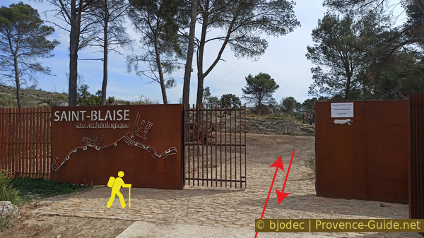
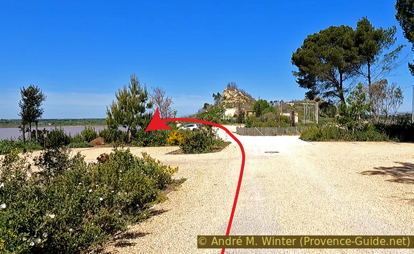
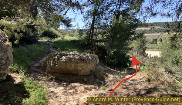
We thus arrive at a barrier. Behind is the concrete path which goes up to the left to access the archaeological site (red arrow) which is described in the following section.
You can pass this tour by going down to the right towards the St. Blaise chapel, the reception house and to the lower parking lot (on the right, yellow arrow), you then go directly to section 4.
No reproduction is permitted without the written consent of the author. (id7110)
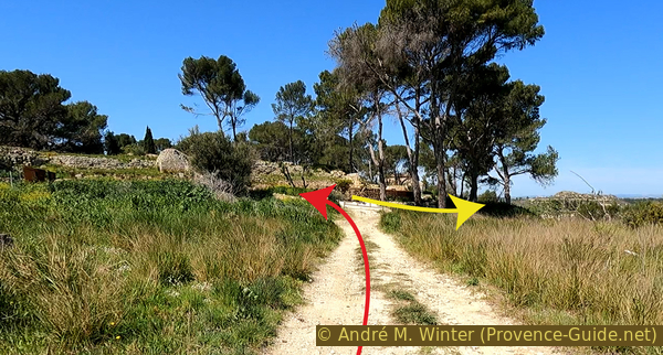
Arrival at the archaeological site of St. Blaise
Section 3: St. Blaise
➙ 1,3 km ... 40 min ➚ 15 m ➘ 25 m ↝ average
100% easy trails, faulty marks
↖ leave the bike and explore on foot
The clues
- St. Blaise archéological site, 50 m
- St. Blaise Chapel, 50 m
- St. Blaise park house, 30 m
- St. Blaise parking lot, 25 m
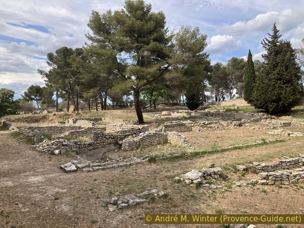
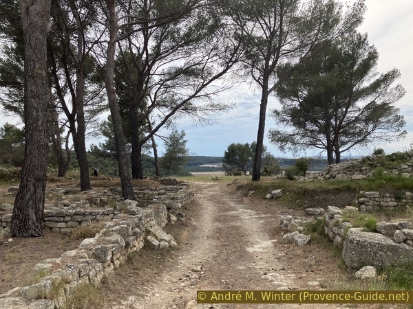
This is the cultural part of the tour, it is worth the detour. We dive into an era ranging from the Middle Ages to the sixth century BCE. The site is briefly described in this section. You can pass it by driving down from the entrance of the site towards the car park and resuming the tour in section 4.
Arriving from the top, we first access the main site and then pass to the reception pavilion. Both have the same changing opening hours, usually both are closed on Mondays.
The archaeological excavations are constantly changing. So the outer fence was massively extended beyond the Bergerie Graille, which made us take a detour in the last section. The forest fires destroyed some of the signs, but also revealed buried traces. The fire also makes the view a little clearer. In 2023, during our visit to the site, the information was very deficient and some signs were visibly placed in the wrong places. At the reception pavillon there is a map of the site, but it does not really help with the historical understanding of the place. However, there are also guided tours on Sundays except July and August.
No reproduction is permitted without the written consent of the author. The permission of use was kindly given to Provence-Guide.net on 5 May 2024. (id7109)
Access to the archaeological site of St. Blaise in early 2023
Capital without a known name of the coastal tribe of Avatiques, who populated the region between the Rhône and Marseille, the oppidum of Saint-Blaise undoubtedly derived its wealth from the salt of the lakes, which it exploited and negotiated with its Greek neighbors and native ones. At the beginning of the 6th century BCE, the founding of Marseille by the Phocaeans gave new impetus to Saint-Blaise. It is above all a Celtic town, a Gallic oppidum which, for nearly five centuries, lived to the rhythm of its relations with the Greek city. Sometimes economic partners, sometimes competitors, even enemies, the two cities follow a parallel evolution.
A first wall was built by the Gauls in the so-called archaic period. A long decline followed.
No reproduction is permitted without the written consent of the author. (id7108)
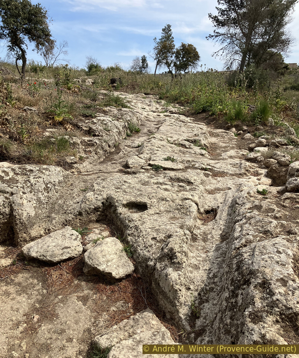
Wheel tracks in the rock area
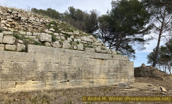
In the 2nd century BCE, the Greeks arrived in the region and gave new economic impulses. The Gauls adopted the building style of the Greeks of Marseille. The more regular wall is the result.
Adopting a broken line layout more than 400 metres long, the Greek rampart forms the monumental covering of the previous native walls. Protected by a front wall, it includes three towers and three projections which frame eleven parapet walks, two to three metres wide. It is pierced by a main carriage gate in the lower town and two posterns in the upper town.
No reproduction is permitted without the written consent of the author. (id7107)
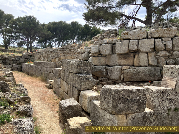
Curtain wall of the Greek rampart in the lower town
The installations are clearly defensive. Although there were significant exchanges between the Gallic site of St. Blaise and the Greek colonies of Marseille, these were also periods of acute rivalry with conflicts between all these ethnic groups.
No reproduction is permitted without the written consent of the author. The permission of use was kindly given to Provence-Guide.net on 5 May 2024. (id7106)
Gate of the lower town of the Saint Blaise site
At the end of the 2nd century BCE, here as elsewhere, the Gallic sites were definitively destroyed by Roman troops, called in as reinforcements by Greek Marseille.
No reproduction is permitted without the written consent of the author. (id7105)
The lower town of the St. Blaise site
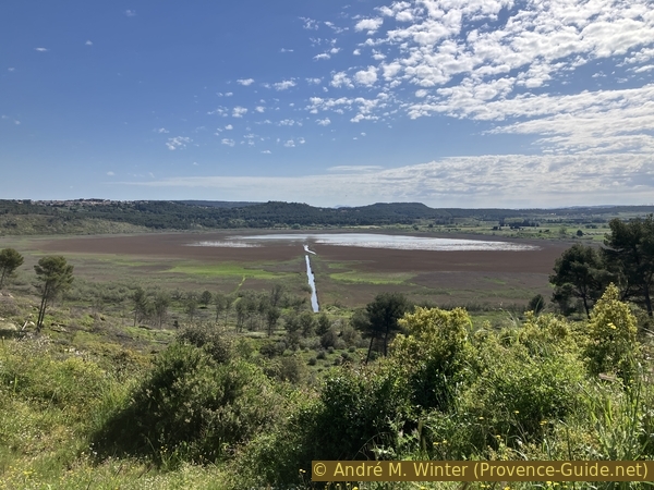
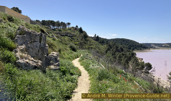
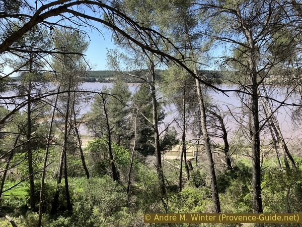
From the so-called lower town, you go up to the left on a wooded plateau until you reach the edge of the cliff which overlooks the Étang de Lavalduc. We see it in full here the first time, it will accompany us in the following sections.
No reproduction is permitted without the written consent of the author. The permission of use was kindly given to Provence-Guide.net on 5 May 2024. (id7104)
Southern part of Lake Lavalduc seen from the plateau of the upper town of the St. Blaise site
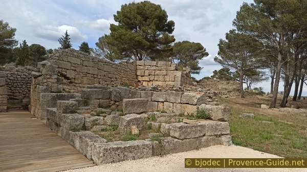
This plateau is also the site of the upper town of St. Blaise. It dates from the so-called Hellenistic period, therefore from the 2nd century BCE. The upper part is completely razed, further down, there remains a street between the bases of houses.
No reproduction is permitted without the written consent of the author. (id7102)
Street in the southern part of the upper town of the St. Blaise site
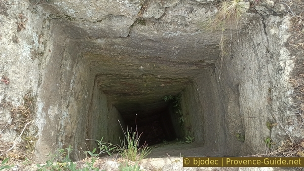
Between these house bases is this well with a rectangular section.
This well is quite deep and probably leads down to the level of the ponds, which were lakes at the time.
No reproduction is permitted without the written consent of the author. The permission of use was kindly given to Provence-Guide.net on 5 May 2024. (id7103)
Rectangular well in the southern part of the upper town
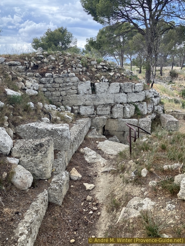
The southern salient is marked by four types of defenses. On the one hand there is the steep cliff, the better worked stones represent the Greek fortifications, further in the center are the earlier Gallic fortifications and even further in the center the late antique fortification.
No reproduction is permitted without the written consent of the author. (id7101)
Hellenistic wall of the southern salient of the oppidum of Saint-Blaise
From the top of the southern salient we can see tombs dug into the rock further away. You can get there by going down the embankment.
This photo is from 2023, so it is taken after the 2020 fire.
No reproduction is permitted without the written consent of the author. The permission of use was kindly given to Provence-Guide.net on 5 May 2024. (id7121)
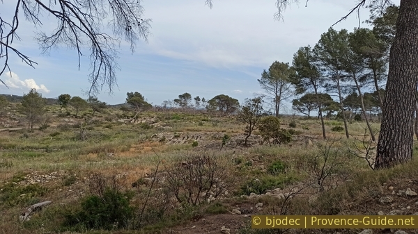
View towards the rupestral necropolis of the oppidum of Saint-Blaise
It is to the south and east of the ramparts that we find the greatest concentration of tombs. Sometimes arranged in small family groups, they were dug out of the rock and covered with flat stones. By their characteristics and by some objects unearthed, these burials belong to the Visigothic period (4th to 5th century CE).
These are the same graves as above, the photo dates from 2019, therefore before the fire of 2020.
No reproduction is permitted without the written consent of the author. (id7120)
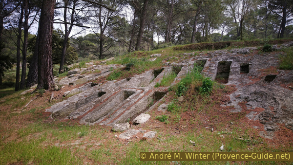
Paleochristian tombs near the Graille sheepfold
After the tombs, we return to the oppidum.
The defensive wall is better preserved in the eastern part.
No reproduction is permitted without the written consent of the author. The permission of use was kindly given to Provence-Guide.net on 5 May 2024. (id7119)
Large-scale reinforcements of the Greek rampart from the 2nd century BCE
We also pass tower bases whose function has not yet been elucidated.
No reproduction is permitted without the written consent of the author. (id7118)
Base of a tower in the reinforcements of the Greek wall from the 2nd century BCE
Now coming from above, we have a more extensive view of the old lower town.
No reproduction is permitted without the written consent of the author. The permission of use was kindly given to Provence-Guide.net on 5 May 2024. (id7117)
View of the lower town from the St. Blaise site
We exit through the lower gate of the site and we can get back on the mountain bike for a short while.
No reproduction is permitted without the written consent of the author. (id7131)
Fence under the archaeological site of St. Blaise
After centuries of abandonment, the site of Saint-Blaise was reoccupied and fortified again at the beginning of the 5th century CE. As elsewhere in Provence, the end of Antiquity marks the regrouping of communities formerly dispersed in numerous small habitats.
Between the end of the 9th century and the 11th century, a second church was erected with the remains of a previous building and burials were organized around the apse. We can see the bases of this church in front of the current chapel.
No reproduction is permitted without the written consent of the author. (id7115)
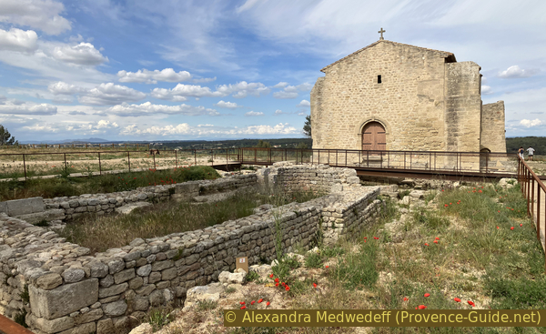
St. Blaise Chapel and the walls of the previous building
Between the 9th and 12th centuries, texts reveal the name Ugium for the site. The main activity was still based on salt, always extracted from lakes.
In the 12th century the current chapel was finally built and the surrounding cemetery moved with it. It is the religious center of the Castelveyre castrum which was located between the church and the parking lot below.
No reproduction is permitted without the written consent of the author. (id7116)
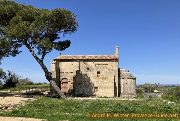
The Chapel of St. Blaise
We leave the chapel behind us and continue the descent along the concrete path. We once again have a good view over the Étang de Lavalduc.
We thus arrive at the site's reception pavilion.
Opening hours are identical to those of the open-air site above.
No reproduction is permitted without the written consent of the author. The permission of use was kindly given to Provence-Guide.net on 5 May 2024. (id7113)
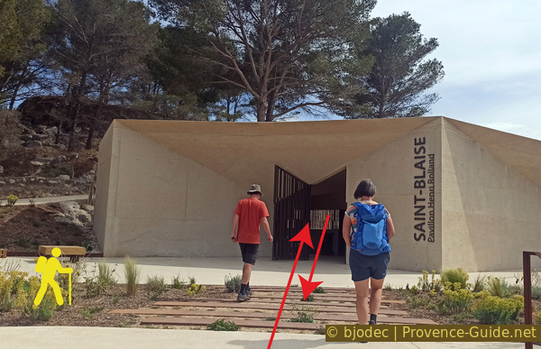
The Henri Rolland Pavilion at the St. Blaise site
There are maps, signs and information beyond the archaeological surveys of the site. One thus focus on the Ségobriges, Celtic-Ligurian people living in the region before the arrival of the Greeks. One knows them mainly through the stories of these same Greek settlers and the legends created around the founding of Marseille.
No reproduction is permitted without the written consent of the author. (id7112)
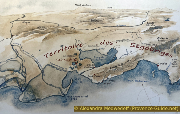
Map of the Ségobriges territory
A three-dimensional plan gives a realistic view of the lakes around St. Blaise. We clearly recognize the depressions of the bodies of water and the crests of the surrounding limestone plateau.
The view is with the south at the top.
We leave the pavilion towards the parking lot and we can get back on our bikes.
No reproduction is permitted without the written consent of the author. (id7111)
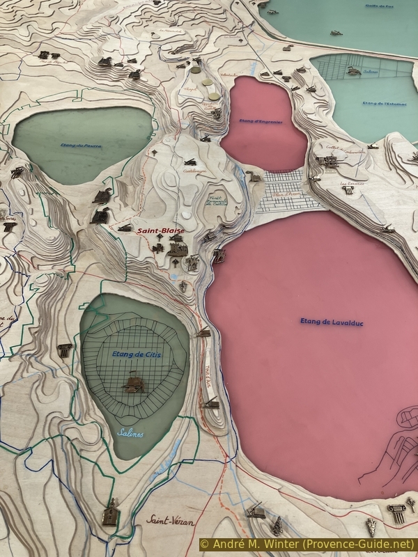
Map of ponds around St. Blaise
Section 4: St. Blaise - Étang de Lavalduc
➙ 1,9 km ... 15 min ➚ 0 m ➘ 38 m ↝ average
↙ Colours of the sections like MTB rating but without the duration.
25% hard-surfaced quiet side streets, without marks
75% moderate trails, without marks
The clues
- St. Blaise car park, 25 m
- Canal de Martigues, 20 m
- Étang de Lavalduc shore, -10 m
The descent takes place in several stages between the flat paths accompanying the two historic canals of Martigues.
We pass the parking lot newly built in 2022 and then turn left.
No reproduction is permitted without the written consent of the author. (id7130)
The Saint-Blaise car park
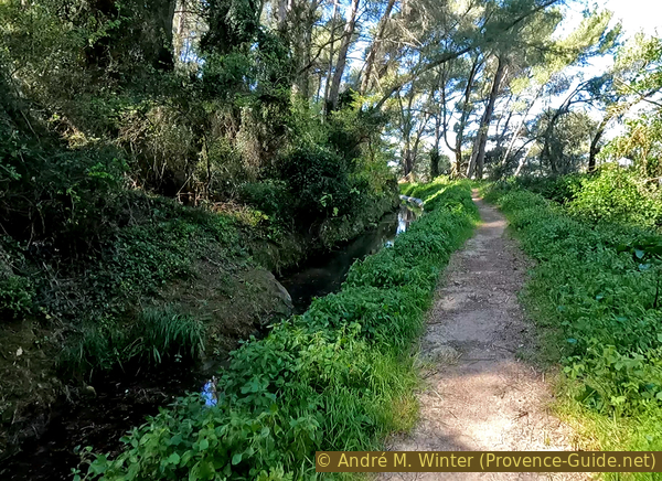
At this barrier a section begins again for our mountain bikes. It is arranged along paths accompanying two canals, most of them open, which supplied water to the city of Martigues. These canals are almost horizontal, the notable descents take place between the various levels down to the shore of the Étang de Lavalduc.
No reproduction is permitted without the written consent of the author. (id7129)
Descent under the archaeological site of Saint-Blaise
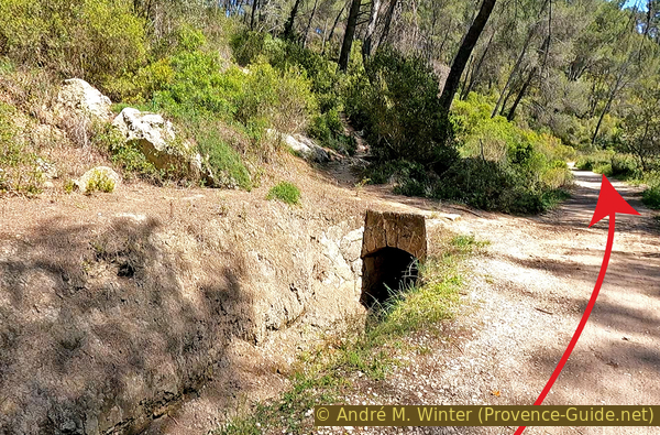
It starts with a passage where the canal is buried or filled. We pass under the cliff of the upper town of the oppidum from where we previously looked down.
Little by little, the canal appears on the left of the path. It is a ditch with greener vegetation than elsewhere.
The straight downhill paths to the right are reserved for experienced hikers because the bush that follows further down is extremely dense. On the shore follow rocks where you would have to carry the bike.
No reproduction is permitted without the written consent of the author. (id7128)
The path under the archaeological site of Saint-Blaise
We pass a few trees that survived the devastating fire of 2020 and the vegetation gradually becomes denser.
We arrive at a footbridge over the canal on the left and a short plant tunnel over our path.
No reproduction is permitted without the written consent of the author. (id7127)
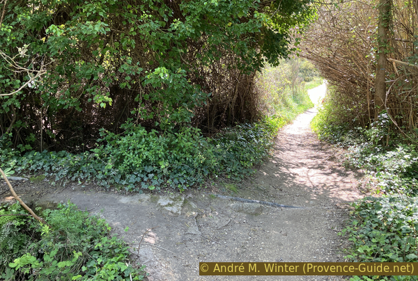
Walkway and plant tunnel
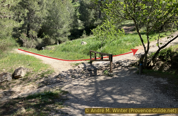
Just after there is a fork.
We turn right downhill to reach the canal further down. The slope is gentle.
No reproduction is permitted without the written consent of the author. (id7126)
Branching off after the plant tunnel
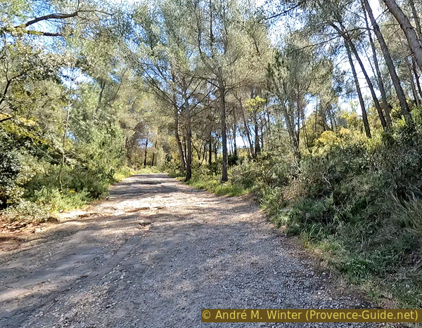
This canal is later filled with water at least in winter and spring. Here also persists the forest which covered the entire site before 2020.
In 2024, trees have fallen across the trail and the mountain bike has to be carried over them.
We continue straight ahead at the following intersections.
No reproduction is permitted without the written consent of the author. (id7125)
The Martigues canal with water
Following this path, we arrive at a second junction where we also recommend continuing straight ahead.
The descent and passage to the shore of the lake are doable by mountain bike, but the terrain is very changeable. The steep descent can get messy and when the level of the lake is high, you have to pass through the rocks on the shore.
No reproduction is permitted without the written consent of the author. (id7124)
Junction where to continue by bike
Continuing, we have a view of the southern part of the lake where we soon will arrive.
No reproduction is permitted without the written consent of the author. (id7123)
Étang de Lavalduc
A third bifurcation is marked by a rock in the middle of the canal accompanying path. We have now passed the Étang de Lavalduc, it is the final moment to descend. It is a washed out path but with a moderate gradient.
No reproduction is permitted without the written consent of the author. (id7122)
Junction to go down by bike
We arrive at the bottom in front of a sodium bisulphite filtering station. As stated above, the Étang de Lavalduc and the Étang d'Engrenier further to the south are natural water reservoirs used for industrial purposes.
No reproduction is permitted without the written consent of the author. (id7144)
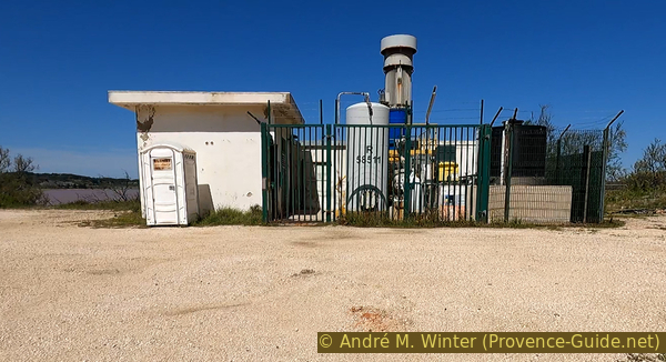
Sodium bisulfite unloading station
Section 5: L'Étang de Lavalduc
➙ 1,7 km ... 40 min ➚ 10 m ➘ 10 m ↝ average
100% on beach, without marks
↖ leave the bike and explore on foot
The clues
- Étang de Lavalduc shore walk, -10 m
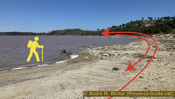
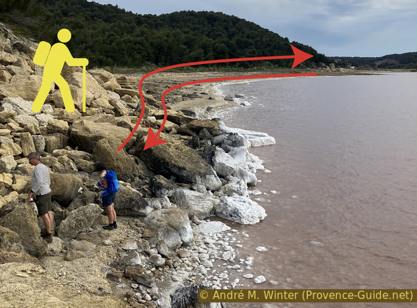
A trip back and forth of around 800 metres in a lunar and saline landscape. We can push the expedition as far as we want. It is best to leave the bikes at the pump station as the sand and mud can be soft. Further on there are also rocks to climb over.
Although the beginning of the trip along the shore looks doable by mountain bike, we see ahead that rocks follow. This is particularly the case when the water level is higher. There are many little details to discover, so walking is recommended here. The bikes can be padlocked to the pumping station fence.
We therefore continue to the right of the pumping station.
No reproduction is permitted without the written consent of the author. (id7143)
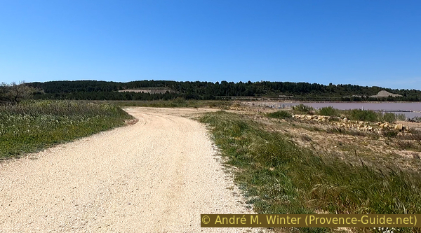
Southeast shore of Étang de Lavalduc
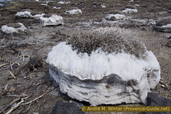
We have been to the Étang de Lavalduc three times. In 2019 before the fire, in 2023 and in 2024. The salt deposits at the edge of the lake were different each time. It depends on the water level, the speed of change of this level and also the amount of rain that falls in winter.
No reproduction is permitted without the written consent of the author. (id7142)
Track south of Étang de Lavalduc
The salt is of natural origin, but it comes from far away. It is rock salt from cavities under the hills north of Manosque. The rock salt is washed there with water and this water is transported here to the lakes of Lavalduc and Engrenier. Evaporation concentrates the brine even more to reach 97%.
No reproduction is permitted without the written consent of the author. (id7141)
Salt around a clump of dead plant
Unfortunately, this is not natural and healthy salt water. On the one hand, transport from Manosque takes place in pipes also used to transport various gases and petroleum products. This brine is used in the Fos-sur-Mer industry for various purposes. We saw a sodium bisulfite extract station. All these operations are carried out without any respect for nature because one assumes that these basins are waterproof, which has not been scientifically proven. On March 12, 2007, during an accident, several hundred litres of fuel oil were spilled into the lakes of Engrenier and of Lavalduc.
Swimming is strongly discouraged for all the reasons cited above. Although it would be nice to float even more easily than in the Dead Sea.
No reproduction is permitted without the written consent of the author. (id7138)
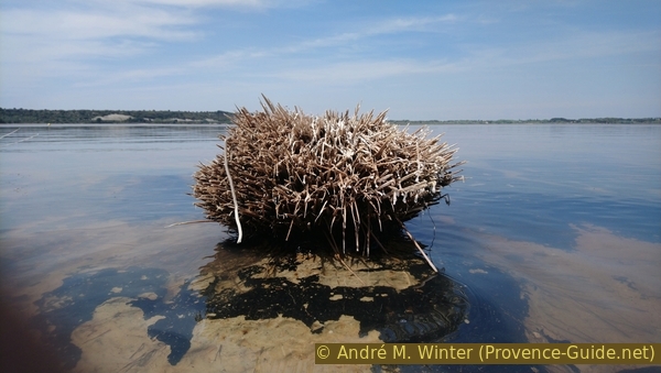
Clump of dead plant on the shore of Étang de Lavalduc
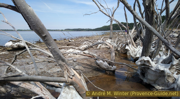
Of course, the remaining vegetation also varies from year to year.
Some plants leave strange marks.
No reproduction is permitted without the written consent of the author. (id7140)
Roots of dead aquatic plants resembling octopus arms
When it's not the plants that fascinate, it's the salt concretions and other minerals. The yellow color here, however, is pollen and not sulfur.
The soil here is made of hard mud.
No reproduction is permitted without the written consent of the author. (id7139)
Salt crystals and polen deposits
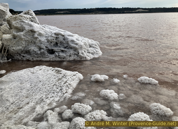
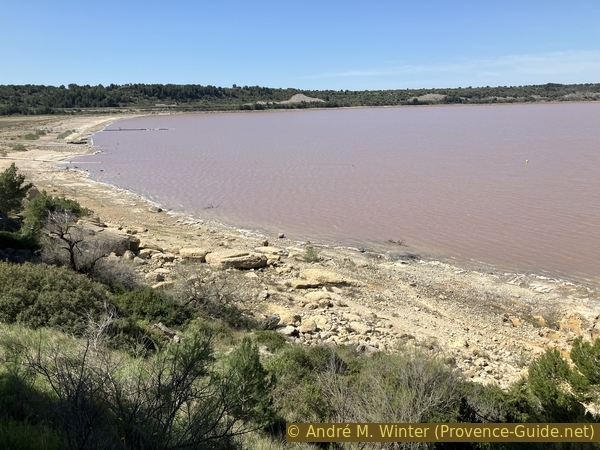
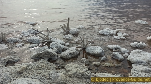
The iridescent blue-pink color comes from a red algae called Rhodophytes.
The place is considered to have the highest evaporation in France.
No reproduction is permitted without the written consent of the author. The permission of use was kindly given to Provence-Guide.net on 5 May 2024. (id7137)
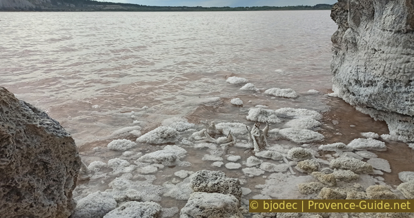
Pink brine water and crystallized salt from Étang de Lavalduc
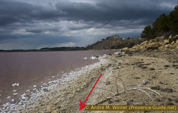
Arriving near yellowish rocks which are debris that fell from the cliff higher up, you can either cross them and continue to find another beach or retrace your steps back.
No reproduction is permitted without the written consent of the author. (id7135)
Salt and pink water from Étang de Lavalduc
We sometimes see large blocks of salt attached to much higher rocks on the shore. This clearly proves the variability of the water level which is here almost purely artificial.
No reproduction is permitted without the written consent of the author. (id7134)
Large blocks of salt on the edge of Étang de Lavalduc
We finally return to the pumping station to take back the bikes which we avoided contact with the salt by leaving them behind us.
Let's remember that we are here 10 metres below sea level and on the lowest point in France!
No reproduction is permitted without the written consent of the author. (id7133)
Pink brine water and crystallized salt on the shore of Étang de Lavalduc
Section 6: Étang de Lavalduc - Foret de Castillon
➙ 2,4 km ... 15 min ➚ 61 m ➘ 0 m ↝ average
↙ Colours of the sections like MTB rating but without the duration.
35% forest roads, without marks
45% easy trails, without marks
20% hard-surfaced roads without motorized traffic, old marks
The clues
- Étang de Lavalduc shore, -10 m
- Canal de Martigues, 18 m
- Maison forestière de Castillon, 50 m
We ride back towards the Martigues canal and when we have got used to this easy route without any difference in altitude, we have to turn and go back up severely towards the starting point.
We therefore take the bikes again and we stay for a while longer around eight metres below sea level. We have to cross the very flat isthmus of Plan d'Aren which separates the Étang de Lavalduc from the Étang d'Engrenier further south. To do this, we take the wide white track on the right and turn with this track towards the south.
No reproduction is permitted without the written consent of the author. (id7132)
Trail south of Étang de Lavalduc
The Étang d'Engrenier is similar to that of Lavalduc, but it is not as easy to approach and its shore is less varied because its level is more stable.
Our track comes up against a closed fence and it is time for us to rideto the left and upwards.
No reproduction is permitted without the written consent of the author. (id7150)
Track and gate south of Étang de Lavalduc
We first follow this fence to arrive at another closed gate, but we continue to the left. We then have this view. A rutted track straight up or a bushy path on the right. Both go up to the Martigues canal which we had left before descending towards the Étang de Lavalduc.
At the top, we take to right and follow the canal path again.
No reproduction is permitted without the written consent of the author. (id7149)
Straight on by bike and at the intersection on the right
You can only see Étang d'Grenier through the trees. It is as pink as the Étang de Lavalduc and it fulfills the same function of storing salt coming via pipelines from the salt deposits of Manosque. It is just as chemically polluted as the Étang de Lavalduc with which it communicates by a tunnel.
Its natural water level is nine metres below sea level. On March 22, 1984, the salinity reached 380 grams per liter, a maximum saturation killing all living organisms.
No reproduction is permitted without the written consent of the author. (id7148)
Étang d'Engrenier
We stay for quite a long time on this easy path along the canal. It is also very regular and does not make sharp turns.
In a wooded area there is another small bridge over the canal. We could return here to St. Blaise by following blue markings.
No reproduction is permitted without the written consent of the author. (id7147)
Path via footbridge to go back to St. Blaise
When the path begins to bend to the right and when you are getting used to this easy route, you pass a ravine and a gate on the left (the photo is taken in reverse). It's time to turn left and go up a wide asphalt road.
No reproduction is permitted without the written consent of the author. (id7146)
Bifurcation from the channel upwards
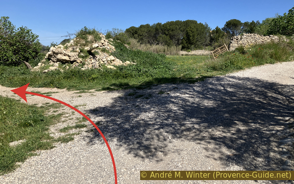
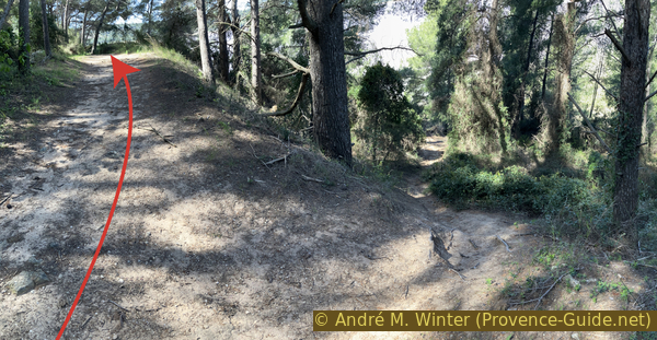
This climb is painful. The asphalt is uneven. There are two bends and then another gate follows, but in less than five minutes of climbing we arrive on the plateau of the Castillon forest house and we are therefore directly at the starting point.
No reproduction is permitted without the written consent of the author. (id7145)
Go up back to the Castillon forest house
Sources and additional information
It is better to use a good topographic hiking map: this tour is on the IGN map "Étang de Berre, Istres, Marignene, Martigues", scale 1:25000, 3144OT.
If you don't want to bother with a paper map, you can also use mapping apps on your cell phone. On the one hand, it is the Cartes IGN app from the official map service. However, it requires access to the data network and this is sometimes difficult in canyons or remote locations.
Alternatively, you can use apps that store data directly on the device. They're generally not free, but they don't cost much. We mainly use OSMAnd, here it is possible to add contour lines, relief shading, markings and others. To store this data on your phone you need a lot of space.
Of course, one needs access to satellites for the GPS signal with any app. In some canyons this is not the case. Therefore, do not rely on the position shown, but read the map on your phone as you would read it on paper. Most apps are available for Android and iPhone. The applications usually allow us to record the route travelled and also view the GPS files offered for each of our hikes.
This page has been seen 1849 times since 20 March 2024.
No reproduction is permitted without the written consent of the author. The permission of use was kindly given to Provence-Guide.net on 7 May 2024. (id7153)
Salt deposited on the shores of Lake Lavalduc
No reproduction is permitted without the written consent of the author. (id7151)
View of the Gulf of Fos-sur-Mer