Gorges de la Nesque and Rocher du Cire by mountain bike
The difficult part first in the canyon and back on the easy road
MTB tour
difficult
2 h 30 min
no
yes
no
6 % of the distance
Introduction
The Gorges de la Nesque form the large canyon under Mont Ventoux. Less known than the Verdon, it is however more easily accessible. We explore it here by mountain bike. Of course, it is impossible to ride at the bottom of the gorge. Although the bed is most often dry, the gours and the steps at the bottom force us to take one of the rare paths on the southern slope. It is opposite the slope with the gorge road between Villes-sur-Auzon and Monieux.
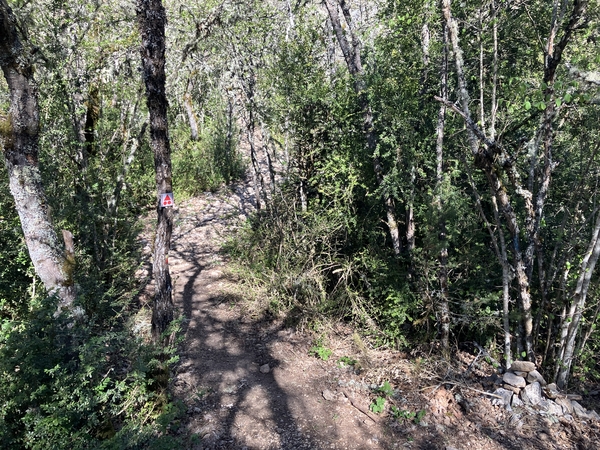
The route followed on the way out is marked as a red mountain bike tour, therefore it is difficult. This is a portion of a grand tour of Mont Ventoux which is no longer documented. The route described here totals 12 points on the scale for MTB-labeling and it has several portions that are definitely not rideable. Most often it is due to the large stones that cover the path. So it's a very sporty ride. The reward is a unique view of Rocher du Cire and at the end the road south of the gorge which is downhill for almost the entire eight kilometres.
The facts
16,7 km total distance
2 h 30 min movement time.
390 m total elevation
orientation easy
mark 90% of the total distance
50% hard-surfaced quiet side streets
25% moderate trails
15% forest roads
5% easy trails
<5% cross country
dangers Floods along the river
children mo
useful picnic stuff
required Hardtail mountain bike, helmet and water
GPS coordinates (WGS84) of start and end point 44.056946,5.35798
downloads ![]()
![]()
Public transport
Monieux is the starting point. It is not reachable by public transport. The closest and reachable town is Sault further to the north. See Zou! (only french) for the rare connections. The approach by bike described below is 7 kilometres long and mostly downhill.
Leave the town of Sault and head first towards Monieux, Carpentras and west on the south under the town. Pass the fuel station and take the left 50 metres further. 400 metres further, turn right and drive straight over the next intersection. Follow this Route de la Saulce in a straight line just like on the later Route du Grand Vallat. Turn left when arriving at a T-junction. Keep hard to the right 350 metres further. On the larger road further take a left following the signs towards the Plan d'eau, do the same under the village. We thus arrive at the northwest of the lake. Continue straight ahead, pass the refreshment bar. The road turns left, the access to the Gorges de la Nesque is immediately on the right.
Access by car
Monieux is located between the Mont Ventoux and the Luberon. All approach roads are long but beautiful.
Coming from the south, aim for Cavaillon, then Gordes or Apt, then up towards Lioux and continue on the D943 road. Take further towards Monieux on the left and shortly towards the Plan d'eau de Monieux on the right. We drive down the D96 in bends. Arriving in the plain, take the first left towards the Plan d'eau.
Coming from the west and the rest of Vaucluse, reach and bypass Carpentras, then follow the directions towards Mazan and Villes-sur-Auzon. Leaving the last village, turn right towards Monieux and the Gorges de la Nesque. We then follow the north bank with several viewpoints into the canyon and on the south slope which we will travel by mountain bike. After the gorge, the road passes under the village of Monieux. Take the road which goes down to the right to cross the bridge over the Nesque river. We are on the D96 road towards Méthamis. It follows a fairly straight line further on. Here take the first and only road on the right. It leads towards the lake.
From the Durance Valley, drive up the Jabron Valley towards Séderon. Take on the Col de la Pigière pass towards Revest du Bion, then towards Sault. Here, follow the signs towards Carpentras and Monieux. Before this village, take the road downhill towards Méthamis to cross the bridge over the Nesque. It follows a fairly straight line further on. Here take the first and only road on the right which also leads towards Plan d'eau.
Useful parking spaces
In any case, we arrive to the east of Lac de Monieux. Leave the vehicle directly at the first crossing of the road which goes around the lake.
No reproduction is permitted without the written consent of the author. (id7494)
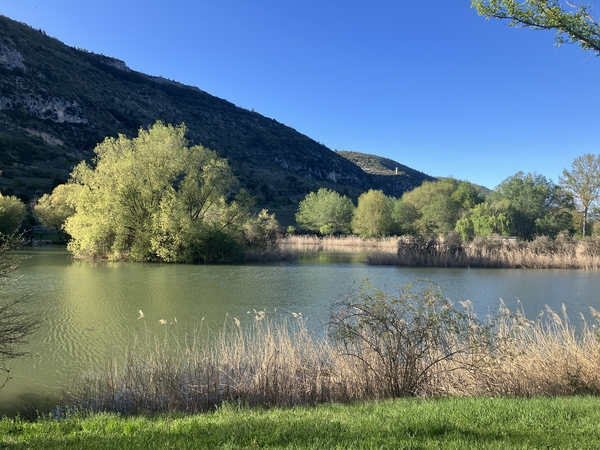
Lake Monieux on an April evening
No reproduction is permitted without the written consent of the author. (id7611)
With the mountain bike at the Nesque
Hints
It is inevitable to push the bike several times and the majority of the time is uphill over large rubble. You don't have to carry the bike though. The rolling parts in the gorge are logically located on the flat portions, on the forest tracks and on roads at the end of the tour.
The access to the site under the Rocher du Cire takes the Domaine de Cassoulen track. These are private lands, but access is authorized, also when the gate is closed. However, you must stay on the track in a straight line without going down to the right. If there are recent electric fences, herds of sheep may be guarded by dogs. See Information at Notes on shepherd dogs on how to behave in these cases.
The French word for gorge or canyon (gorges) is always in the plural.
The whole region is a zone with a high risk of forest fires. In summer, but also in other seasons when it is very dry or by strong winds, access to the forest areas can be regulated. As a result, the roads may be closed to traffic and/or the trails prohibited to hikers. Current information: Map for access to the forests of the Vaucluse department (only french). The map shows the colours green, yellow, orange and red which correspond to levels of danger.
The sections
- Upper Gorges de la Nesque and La Peissonnière viewpoint
- The southern slope of the gorge and the Saume Morte viewpoint
- Painful climb to the Hamlet of Sicade
- Advance under the Rocher du Cire cliff
- Ancient cisterns and return by road to Monieux
Section 1: Hautes Gorges de la Nesque
➙ 2,1 km ... 25 min ➚ 77 m ➘ 30 m ↝ easy
↙ Colours of the sections like MTB rating but without the duration.
15% hard-surfaced quiet side streets, few marks
25% easy trails, with marks
↖ potentially muddy passages
25% moderate trails, with marks
↖ coarse gravel
<5% moderate trails, with marks
↖ passages too steep and to carry
5% moderate trails, with marks
<5% moderate trails, with marks
↖ passages too steep and to carry
25% moderate trails, with marks
5% easy trails, without marks
<5% moderate trails, without marks
↖ leave the bike and explore on foot
The clues
- Lac de Monieux, 625 m
- Vallon de Peissonnier, 618 m
- Signpost Font de Jean, 688 m
- Plateau de la Peissonnière, 673 m
Easy and peaceful access into the gorge followed by the first difficult climbs. Leaving in the morning, we will be in the shade here for a long time.
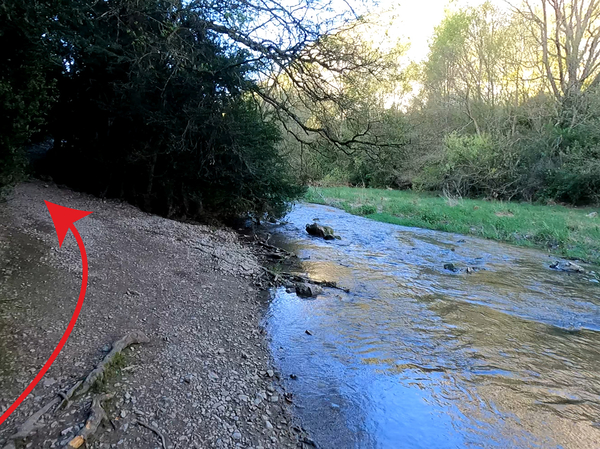
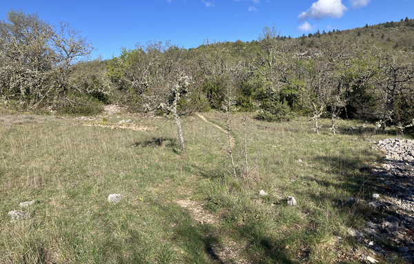
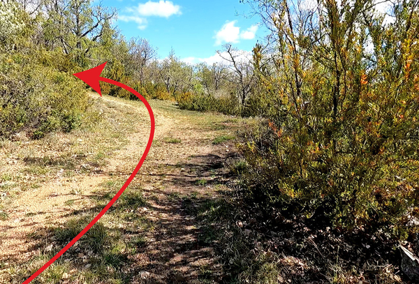
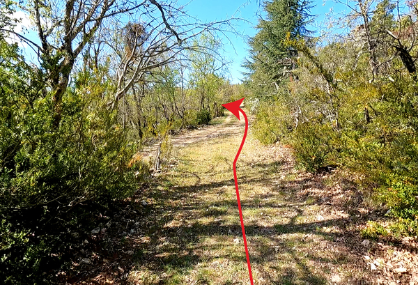
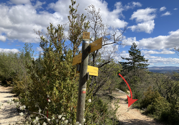
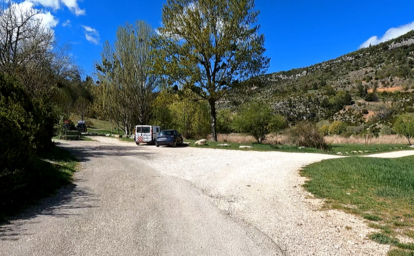
In all cases we reach the south-west part of the lake. The photo shows the access from the east. Here the Nesque river passes from the lake into the gorge.
No reproduction is permitted without the written consent of the author. (id7499)
Access to the Gorges de la Nesque at Lac de Monieux
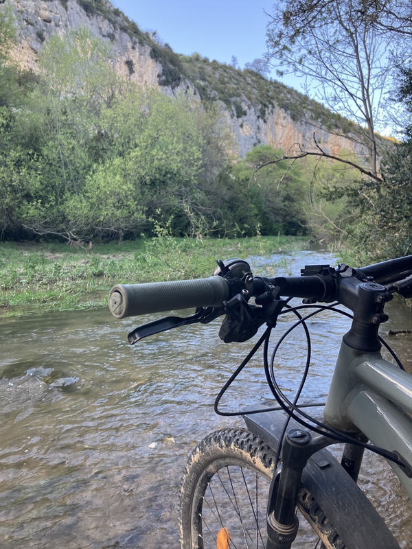
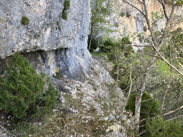
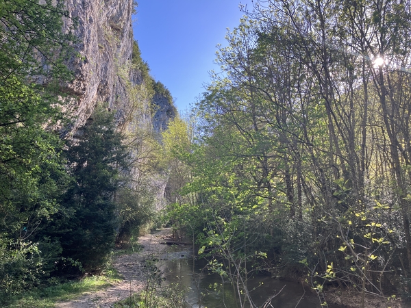
We very quickly arrive at the bank of the Nesque river which flows here peacefully in spring. In stormy weather, we do not pass here and in summer, the downstream part of the lake is generally completely dry. The small gravels here are still pleasant by bike.
The photo is taken in the evening. In the morning there is no sun on the rock cliff here.
No reproduction is permitted without the written consent of the author. (id7503)
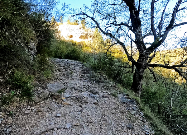
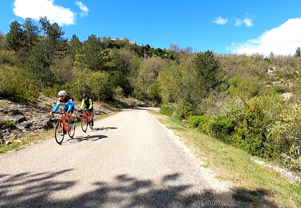
Mountain bike in the Hautes Gorges de la Nesque
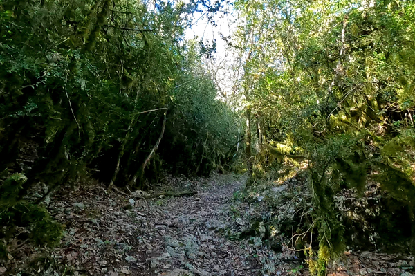
Further on, we keep to the left an a little higher. The path is formed by very well rolling fine gravel. Our track is lined with straight, high hedges, as if they were cut regularly. We ride like in a park in the Renaissance spirit.
No reproduction is permitted without the written consent of the author. (id7504)
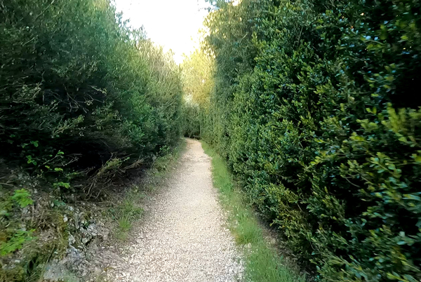
Hedges in the upper Gorges de la Nesque
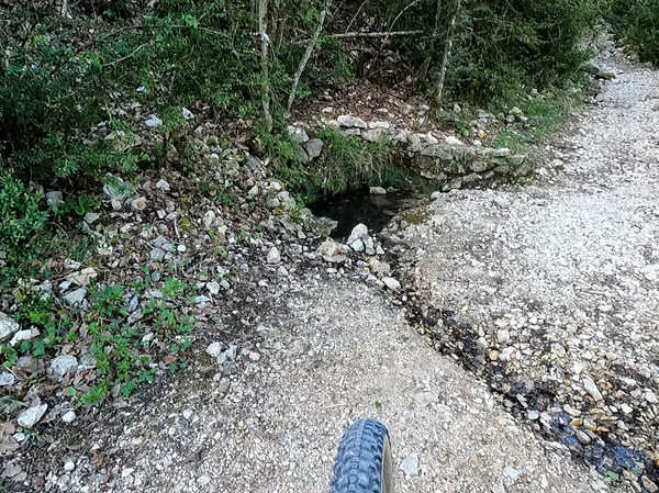
This pleasant path takes us back to the water one last time. The valley here is quite wide and depending on previous floods, the river can also flow elsewhere.
No reproduction is permitted without the written consent of the author. (id7505)
Last access to water from the trail
Shortly after, we cross the Vallon de Peissonnier lateral valley, it is a small opening on the left. This is the lowest point of the tour at 618 metres.
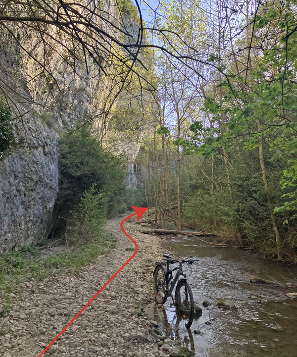
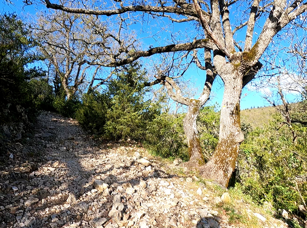
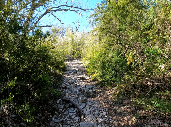
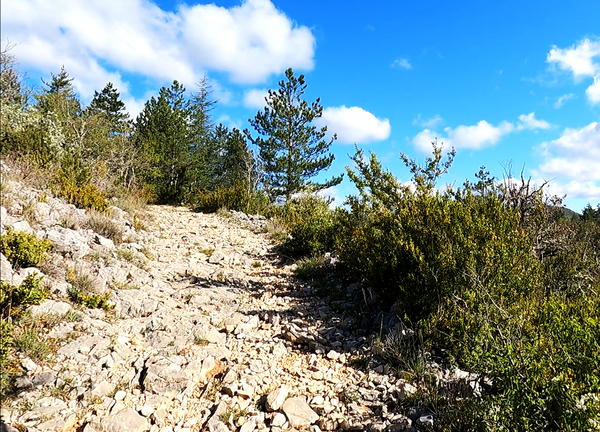
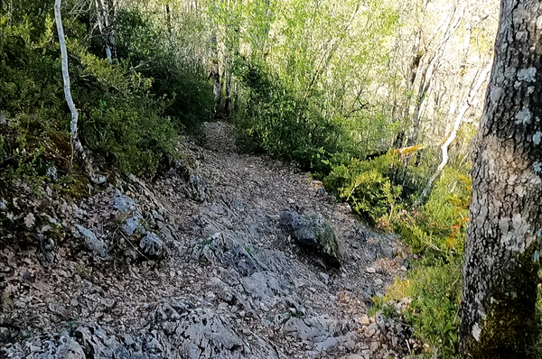
We wouldn't notice it if the path didn't suddenly change. We begin a first climb and it sets the tone for the rest of the tour except forest tracks and roads: a crumbly bedrock covered with coarse rubble. You can ride there provided you avoid large stones and hard rocky strips.
No reproduction is permitted without the written consent of the author. (id7508)
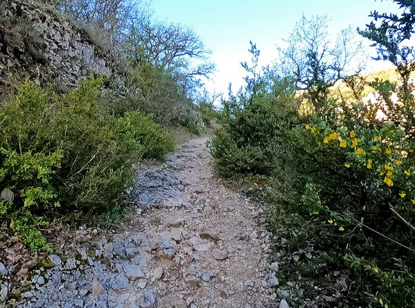
Ascent after the Vallon de Peissonnier
This rubble can be very different depending on the season in forest areas like this. The wild boars turn over the earth and stones and the path can then be covered with several tens of centimetres of rubble that is impossible to cross by bike. In April 2024, we passed because a thin path was drivable.
No reproduction is permitted without the written consent of the author. (id7510)
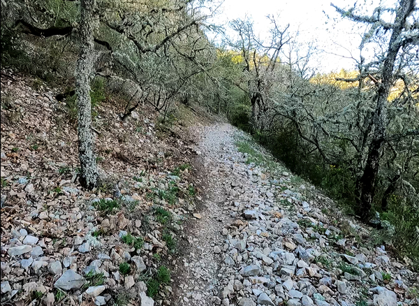
Trees covered in lichens
At times, we come across hard rock. They are often steeper than the rest of the path. You generally have to get off the mountain bike because you can rarely gain momentum and above all you can't see what's coming next.
No reproduction is permitted without the written consent of the author. (id7511)
Uphill over rocky strips
The Font de Jean is a resurgence of a source which springs higher up. The land there higher is agricultural, so this water is not drinkable.
No reproduction is permitted without the written consent of the author. (id7512)
Font de Jean source
Shortly afterwards follows this climb which is rideable only in theory. We don't start again when we lose momentum.
No reproduction is permitted without the written consent of the author. (id7522)
Coarse gravel uphill
Then, the path becomes flat again to pass the Font de Jean signpost. Further on, we begin a fairly pleasant descent to cross another side valley. It is mainly recognized by larger trees.
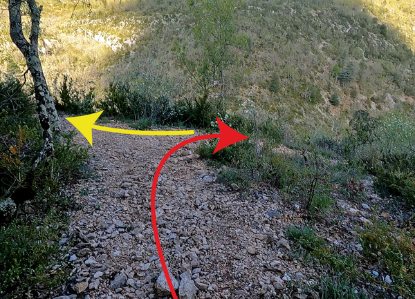
The path first makes a turn to the right, here immediately follow parts of hard rock which necessarily break the previous pace. When the path turns left again, we branch off to the right despite the stones placed on the ground.
No reproduction is permitted without the written consent of the author. (id7534)
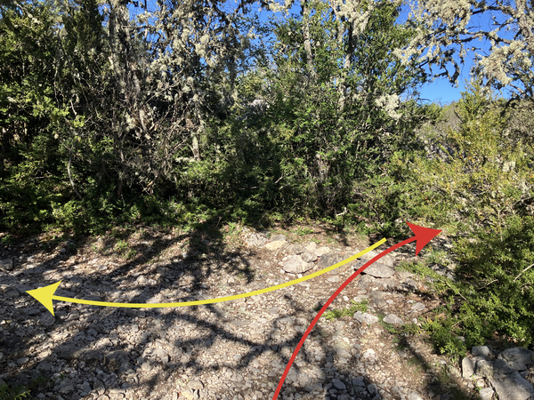
Here on the right over La Peissonnière meadows
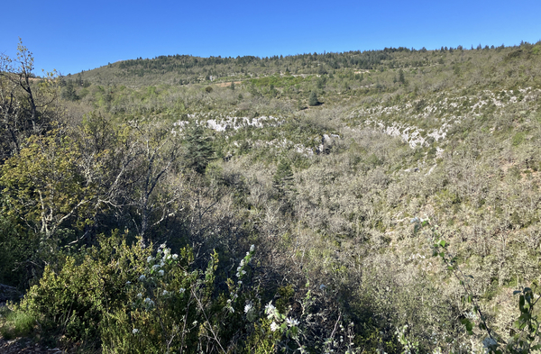
We arrive at a large meadow crossed by a path which we follow. It takes us into another low forest and we arrive in karst terrain not very suitable for bicycle wheels. It is better to get off the mountain bike and continue on foot when you pass a pile of stones which date from the time when the meager fields were cleared of them by hand.
No reproduction is permitted without the written consent of the author. (id7540)
Path on the meadows of La Peissonnière
When the terrain begins to descend, turn right to arrive at a point with a clear view. We then see a large part of the upper Gorges de la Nesque.
Under the cliff on the right lays the St. Michel chapel.
No reproduction is permitted without the written consent of the author. (id7541)
Panorama of La Peissonnière to the north bank of the Nesque
Section 2: Saume Morte
➙ 1,8 km ... 25 min ➚ 85 m ➘ 70 m ↝ easy
↙ Colours of the sections like MTB rating but without the duration.
5% moderate trails, without marks
↖ leave the bike and explore on foot
5% easy trails, without marks
20% moderate trails, faulty marks
40% moderate trails, with marks
15% moderate trails, with marks
↖ coarse gravel
10% moderate trails, with marks
5% moderate trails, with marks
↖ passages too steep and to carry
<5% easy trails, without marks
↖ leave the bike and explore on foot
The clues
- Plateau de la Peissonnière, 673 m
- Hill, 732 m
- Vallat de Peisse valley, 706 m
- Saume Morte valley, 730 m
- View over Vallat de Saume Morte, 690 m
This is a connecting stage towards another viewpoint along the southern slope some 140 metres above the periodic watercourse of La Nesque. There are strenuous parts uphill, large gravel and rocky steps downhill.
We come out of the meadow and continue to the right. Let's remember, just before, we crossed a valley. It goes then logically upwards. We ride at a walking pace, just fast enough not to fall, but to be able to negotiate each quarter turn of the wheel between stones and roots.
Shortly after, the path makes short bends and there are several parallel paths. It's your choice. The variants on the left are more rocky, you can't ride there well, those on the right are more bushy. We end up arriving on a sort of ridge 732 metres high.
The following descent is a little better, but you also pass more difficult areas and there are still dangerous rock steps. The flat parts are almost smooth.
No reproduction is permitted without the written consent of the author. (id7566)
Difficult climb of La Peissonnière
After the ridge, we arrive in a wider area covered with a sparse forest. We pass the Peisse signpost. Here is one of the rare possibilities to cross the Gorges de la Nesque. At the bottom, one also passes the St. Michel Chapel built under an overhanging rock. The descent is possible by mountain bike, but the ascent opposite is very difficult while carrying the bike on your back.
So we continue straight ahead. The easy part is only short-lived, the following descent is painful like the previous steep sections. There are a few rocky parts that require you to put your foot on the ground. The passages are narrow and the side bushes are hard, so you cannot freely choose your trajectory.
No reproduction is permitted without the written consent of the author. (id7571)
Peisse signpost
Shortly before Vallat de Peisse valley, you can ride a little faster because the slope is gentler and the rubble is a little better distributed. We are at 706 metres in this hollow.
The following ascent begins gently, tracing the slope to the right. But higher up, the hard rock reappears, you lose momentum and you end up dismounting and pushing if you don't want to break the bike and your back.
No reproduction is permitted without the written consent of the author. (id7609)
Stony way up after Vallat de Peisse valley
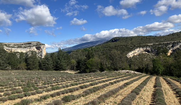
You can get back on the saddle when you arrive above a lavender field. There is a semblance of an agricultural track to follow here, but the driving isn't funny.
This open field, however, allows us to see our goal on the left: the Rocher du Cire. In the center stands Mont Ventoux and to the right are the rock shelters of the left bank of the Nesque river.
A track goes up to the left, but we ride down to the right to follow the field edge. The path here is almost imperceptible, but markers indicate the direction to take. At first it runs well.
No reproduction is permitted without the written consent of the author. (id7572)
Rocher du Cire, the rocks under the Castelleras and lavender fields of Saume Morte
After the field, take the path on the right. A new descent begins between cedars. First gentle, then a little naughtier. You can ride, but you have to lower the saddle if it is still in the high position.
No reproduction is permitted without the written consent of the author. (id7608)
Path west of the lavender fields of Saume Morte
There are also some rocky steps where the wise mountain biker pushes his bicycle. Finally, the slope becomes too steep to ride.
No reproduction is permitted without the written consent of the author. (id7573)
Downhill rocky steps past the lavender fields
When the view opens onto a side valley, we arrive at a fork. The path on the right only leads to a hunting viewpoint, but from further down, the view is even better. Let's leave the MTB at the intersection.
No reproduction is permitted without the written consent of the author. (id7574)
Junction towards the viewpoint to the Rocher du Cire
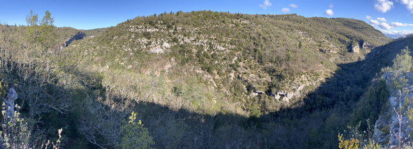
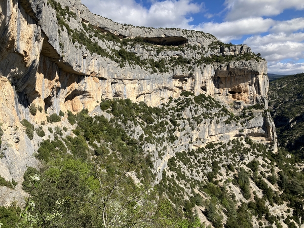
We see for the first time into the deepest part of the Gorges de la Nesque with the Rocher du Cire on the left. We also see longitudinally in this canyon part. You can have the view in the other direction from the D942 Route des Gorges de la Nesque on the left bank, but you are lower there and you cannot see Mont Ventoux at the same time.
No reproduction is permitted without the written consent of the author. (id7575)
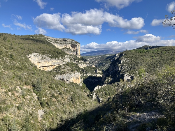
The Rocher du Cire above the Gorges de la Nesque
Looking to the left, we see the valley of Vallat de Saume Morte. We see towards slopes that we will follow later on easier forest tracks.
No reproduction is permitted without the written consent of the author. (id7576)
Vallat de Saume Morte
Let's return to the path and to the mountain bike left at the crossroads.
No reproduction is permitted without the written consent of the author. (id7577)
Return to the main path
Section 3: Hameau de Sicade
➙ 1,2 km ... 25 min ➚ 100 m ➘ 50 m ↝ easy
↙ Colours of the sections like MTB rating but without the duration.
10% moderate trails, with marks
10% moderate trails, with marks
↖ passages too steep and to carry
15% moderate trails, with marks
5% moderate trails, with marks
↖ passages too steep and to carry
10% moderate trails, with marks
20% moderate trails, with marks
↖ passages too steep and to carry
5% moderate trails, with marks
15% moderate trails, with marks
↖ passages too steep and to carry
20% moderate trails, with marks
The clues
- View over Vallat de Saume Morte, 690 m
- Valley Vallat de Saume Morte, 670 m
- Chapel of Sicaude, 745 m
Another connecting stage. Here is the steepest descent and the most difficult ascent.
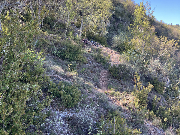
You can get back in the saddle for a few rideable metres, but you quickly arrive at high rocky steps where you have to get off the bike. It is not always easy to climb down next to your bike.
We are here in the steepest part of the tour. This type of passage is repeated several times during this descent. The path remains very narrow and when you can ride, you have to pay attention to the trunks of the trees very close to your path.
No reproduction is permitted without the written consent of the author. (id7610)
Over rocks down into Vallon de Malaval valley
The Vallon de Malaval is another possibility of going down to the right into the canyon. However, we continue straight and we have to push the bike very quickly. The slope is simply too great and the steps are too high.
It goes down again quite quickly, you can get back in the saddle, but it shakes a lot.
No reproduction is permitted without the written consent of the author. (id7578)
Vallon de Malaval
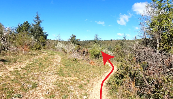
We change here into the Vallat de Saume Morte and we ride up this valley to the left. We are first in a very dark passage. The trees are covered with thick moss.
We finally come again on terrain that is difficult to ride. We come out to a meadow next to which we ride a little better. Two bends follow, but we again come up against very steep and erratic terrain. The rolling sections here are too short to get into the saddle.
So one arrives at old meadows where we can ride again. The route is also a bit downhill here.
No reproduction is permitted without the written consent of the author. (id7579)
In the Vallon de Saume Morte
We arrive again in the dry valley of Vallat de Saume Morte, the path turns right and here the last notorious climb presents itself in all its repulsive splendor. It goes straight up over very uneven rocky terrain. It would also be very demanding going downhill. So you have to push. This is a workout for the arms too.
We follow power and telephone lines. You can try to ride again when you are near these posts and along a fence. However, it takes a lot of good will.
No reproduction is permitted without the written consent of the author. (id7580)
Climb to the Hameau de Sicaude
The lines lead under a hamlet which we cannot enter.
No reproduction is permitted without the written consent of the author. (id7581)
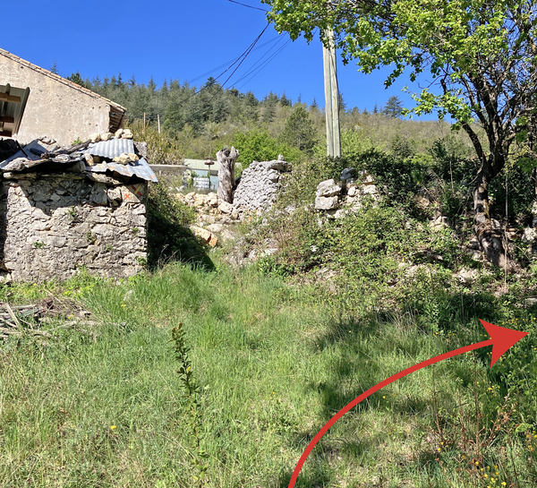
Hamlet of Sicaude
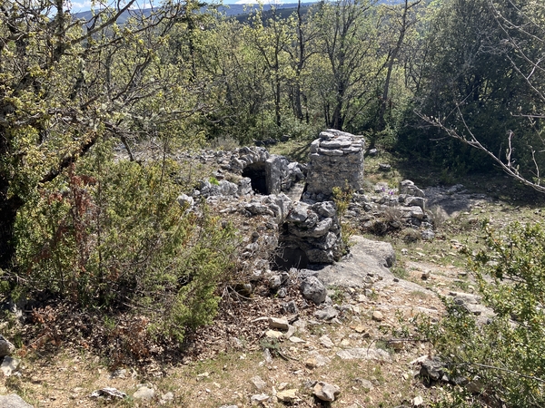
However, we can see the old chapel of the hamlet. Only the main facade is still in fairly good shape because cut stones were used there.
No reproduction is permitted without the written consent of the author. (id7582)
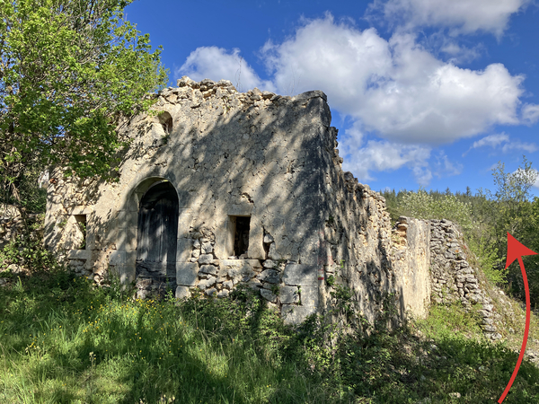
Ruin of the Chapel of Sicaude
Section 4: Rocher du Cire
➙ 1,2 km ... 20 min ➚ 50 m ➘ 10 m ↝ average
↙ Colours of the sections like MTB rating but without the duration.
35% easy trails, with marks
15% forest roads, with marks
35% forest roads, without marks
15% cross country, without marks
↖ leave the bike and explore on foot
The clues
- Chapel of Sicaude, 745 m
- View point under Rocher du Cire, 785 m
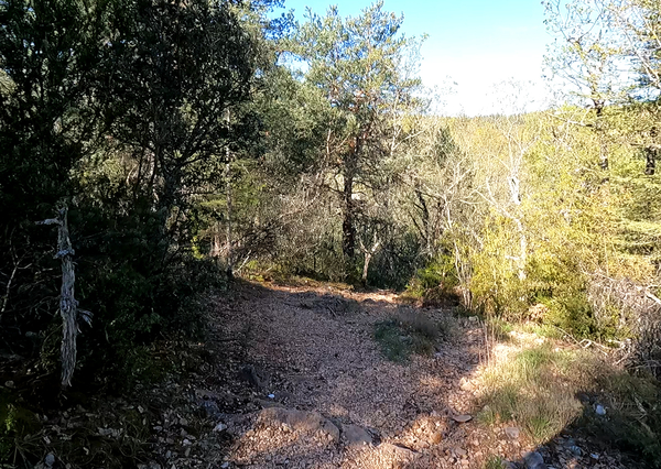
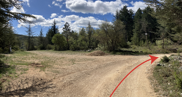
After a few minutes on a rocky path, we arrive on a forest track and we stay there for the next three kilometres. Thereafter, there will only be paved roads. The difficult things are therefore over, but there remains some positive elevation and above all the major viewpoint needs to be reached.
We turn right in front of the chapel. The path is flatter and we would ride quite well if stones were not often found in the middle of the path. Further on, this path goes up enough to make you sweat. We are often here in the sun. The more the slope increases, the more irregular the ground becomes.
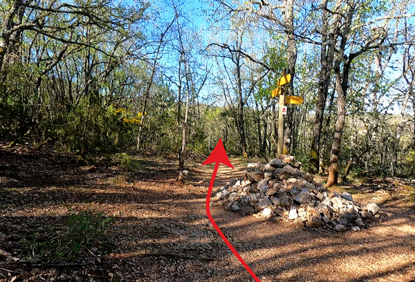
But we arrive quite quickly on a forest track where we turn right. The wheels roll noiselessly on the fine sand, what a change! It continues to climb, but it is much easier on this track which leads in the other direction to the Hameau de Sicaude from above.
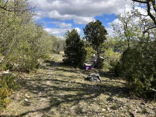
We continue straight on the bend of the following track. A sign indicates the private property of Domaine de Cassoulen (Cassoulin on the IGN map), the access to the viewpoint is however possible. See also the notes under Hints.
No reproduction is permitted without the written consent of the author. (id7583)
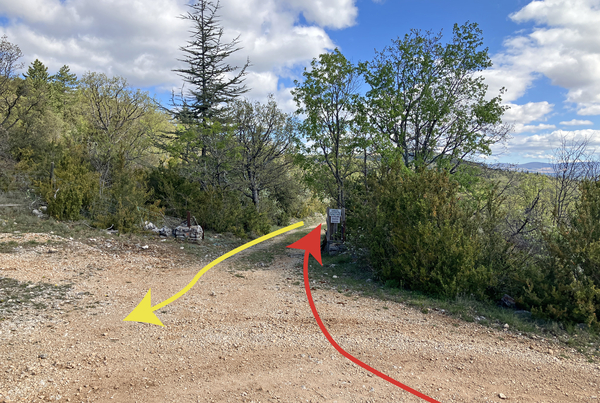
Junction on the Chemin de Sicaude towards the Domaine de Cassoulen
This forest track is initially slightly downhill, then flat. We continue straight on a less used track when the main track goes down to the right. We still ride very well there, we just have to avoid the scattered stones.
No reproduction is permitted without the written consent of the author. (id7584)
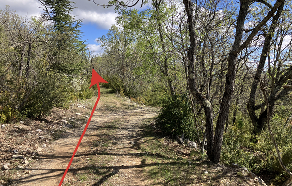
Junction on the Domaine de Cassoulen track
Fifty metres after the last fork, you have to ride upwards about ten metres to the left. It then resumes as pleasantly as before, the climb is now light though.
No reproduction is permitted without the written consent of the author. (id7585)
The track to the viewpoint under the Rocher du Cire goes up to the left
Passing beehives, the track becomes a path and begins to turn slightly to the left. We can already see the cliff of Rocher du Cire through the branches of the bushes.
No reproduction is permitted without the written consent of the author. (id7586)
Bees on the trail towards the viewpoint under the Rocher du Cire
It is better to leave the mountain bike and continue on foot when the trail begins to descend. In a few steps, we will be directly in the middle of the cliff of Rocher du Cire!
No reproduction is permitted without the written consent of the author. (id7587)
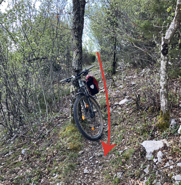
Leave the bike before the viewpoint
We reach a small open space. On the left we advance under the cliff, on the right we descend towards a rock forming a natural belvedere.
No reproduction is permitted without the written consent of the author. (id7588)
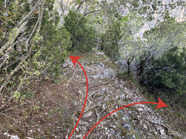
Path towards the cliffs under the Rocher du Cire
Let's start on the left first. There is a single, slightly tricky passage at the beginning which passes above the void, but afterwards, you walk on a very wide ledge in the middle of the cliff of the Rocher du Cire. You can move forward for about twenty metres.
No reproduction is permitted without the written consent of the author. (id7589)
Delicate passage under the Rocher du Cire
This perspective is truly unique. The cliff does not seem so impressive from the road on the other side, nor from its summit.
No reproduction is permitted without the written consent of the author. (id7590)
View under the Rocher du Cire
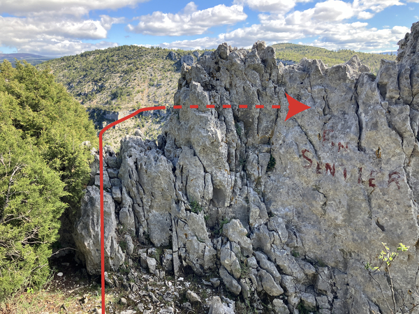
Let's return to the small square and walk down towards the rock on which we can read Fin de Sentier (End of Trail). You can pass over on the left to see better. We now have a little distance to better admire the Rocher du Cire.
No reproduction is permitted without the written consent of the author. (id7592)
Rock and viewpoint under the Rocher du Cire
Straight ahead, we see the tunnels and lookouts built along the Route des Gorges de la Nesque road. From all these places opposite, one always has the sun in the eyes. Here we are better placed, we can see all the way to the bottom of the gorge and above all, we are alone.
No reproduction is permitted without the written consent of the author. (id7591)
View from Rocher du Cire towards the tunnels of the Nesque road
Section 5: Citernes naturelles et retour
➙ 10,4 km ... 1 h ➚ 70 m ➘ 230 m ↝ easy
↙ Colours of the sections like MTB rating but without the duration.
5% forest roads, without marks
<5% moderate trails, without marks
↖ leave the bike and explore on foot
<5% forest roads, without marks
15% forest roads, faulty marks
80% hard-surfaced quiet side streets, few marks
The clues
- Viewpoint under the Rocher du Cire, 785 m
- Cisterns of Cassoulen, 765 m
- Chemin de Berbery, 798 m
- D5 road, 820 m
- St. Hubert, 832 m
- Le Rède, 810 m
- Lac de Monieux, 625 m
This is the longest section, it also has more than eight kilometres of downhill road towards the starting point. But we are still far from there, there are a few kilometres of forest tracks to join the road south of the Gorges de la Nesque.
We start by going back to the mountain bike to turn it around as best we can between the trees. Then, we take the return path, passing the beehives and the short descent. We then arrive at the crossroads where we continue straight as before.
No reproduction is permitted without the written consent of the author. (id7593)
Return to the Domaine de Cassoulen track
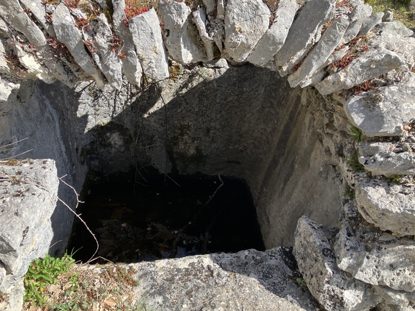
However, twenty metres later, we stop to look under the road. We then see curious constructions including a vaulted one and a covered Provençal well.
No reproduction is permitted without the written consent of the author. (id7594)
Cisterns in the rock under the Domaine de Cassoulen track
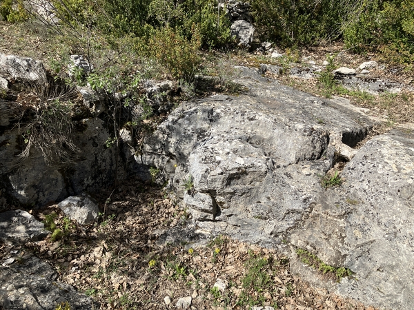
Going down on foot, we see other unnatural shapes in the rock such as a rectangular basin or surfaces for forced flow of rainwater towards the central cistern. We are here in the presence of constructions dating from the end of the 19th to the beginning of the 20th century as we also find, for example, at the Bergerie de Cabrone.
No reproduction is permitted without the written consent of the author. (id7595)
Covered cistern under the track of Domaine de Cassoulen
These installations made it possible to persist on the limestone plateaus where regular springs are lacking. This collection system on the ground was probably only used for watering livestock.
We go back towards the track and continue it until the bend we know from before. However, we take a right and ride uphill.
No reproduction is permitted without the written consent of the author. (id7596)
Surface water collection under the Domaine de Cassoulen track
The slope eases a little when we arrive at the signpost Chemin du Berbery. We continue straight ahead in a southerly direction. On this straight line, we cross the 800 metres altitude mark.
No reproduction is permitted without the written consent of the author. (id7597)
Signpost Chemin de Berbery
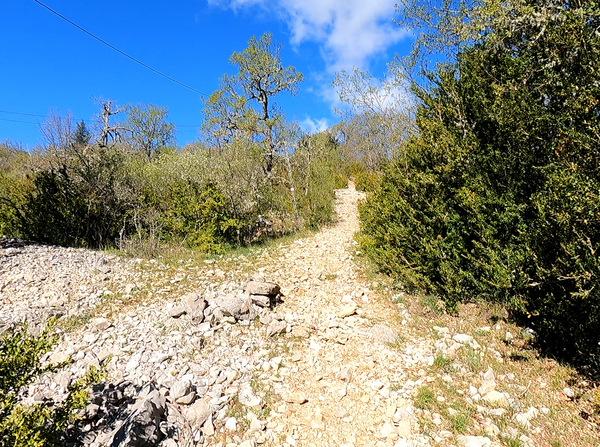
The main track turns right to goes around the Coulet de Grié hill to the west. We follow it despite the markers which indicate to continue straight. It would be an uphill path with large stones that we have already enjoyed enough this day.
No reproduction is permitted without the written consent of the author. (id7598)
Bend of the track which goes around the Coulet de Grié to the west
We thus pass to the left of Mas du Coulet and the track continues slightly uphill. We feel a little tired from the previous sections.
No reproduction is permitted without the written consent of the author. (id7599)
Champ de Sicaude track north of the D5
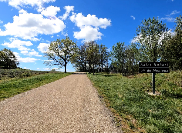
In a short time, we arrive on the D5 road. We continue straight and always uphill. The road goes around a large lavender field and at the highest point is the Ferme de St. Hubert farm. It is also the highest point of our tour with 832 metres. The rest is a long descent. There are only a few short and light climbs left and they are all on asphalt.
No reproduction is permitted without the written consent of the author. (id7600)
Last notable climb towards St. Hubert
The road undulates while maintaining a gentle slope. It therefore only goes down very little or even goes up again like here where we have a view back onto the Rocher du Cire. You must therefore look to the right as soon as the forest is a little less dense. The cliff is far away now!
No reproduction is permitted without the written consent of the author. (id7601)
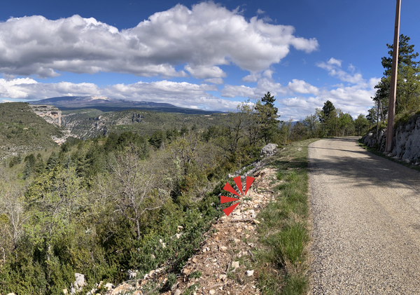
Panorama from the D5 on Malaval and the Rocher du Cire
On a bend in the D5 road there is an official viewpoint with an orientation table and historical reminders of the valiant actions of the Resistance against the Nazi German occupiers. An ambush massively slows down the enemy, it is part of more complex maneuvers brought together under the name Combat du Séderon.
No reproduction is permitted without the written consent of the author. (id7602)
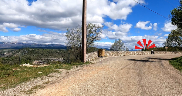
Arrival at the Belvédère du Rède
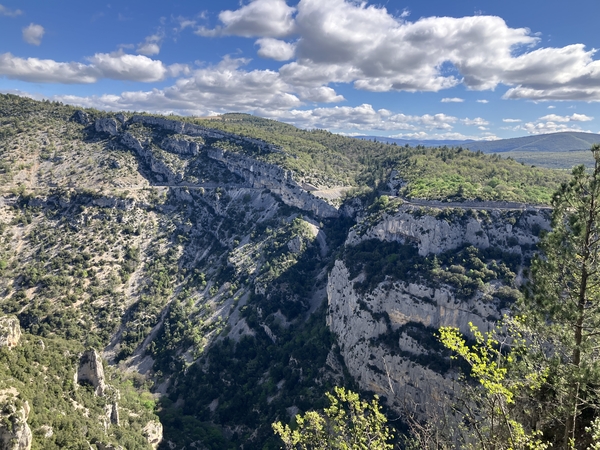
The view over the Rocher du Cire and the Gorges de la Nesque is very similar to the one we had from the viewpoint above the Vallat de Saume Morte valley. Of course, we cannot see into the canyon from this distant point. However, we can see Mont Ventoux better and in full behind.
No reproduction is permitted without the written consent of the author. (id7603)
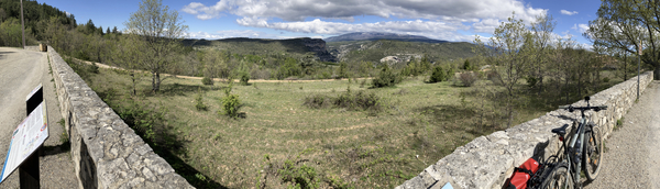
Panorama of Le Rède over the Gorges de la Nesque
We continue the road towards the east to take the left direction towards Monieux and Plan d'eau on the D96 road.
No reproduction is permitted without the written consent of the author. (id7604)
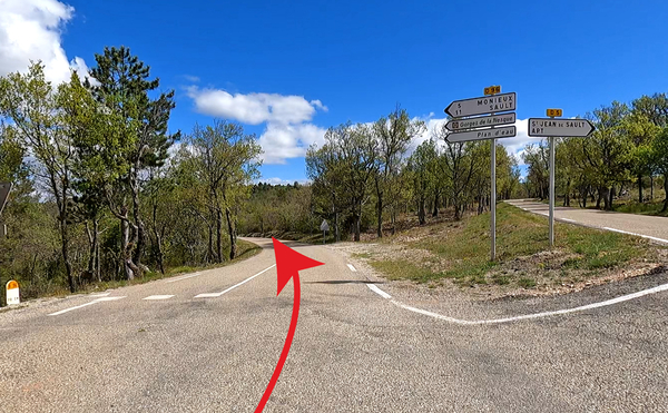
Crossing of D5 and D96 roads
The junction of the departmental roads is at an altitude of 787 metres. The road turns north and the curves are tighter. The slope steepens and we see road cyclists sweating uphill.
No reproduction is permitted without the written consent of the author. (id7605)
In the bends of the D96 road between Plane and Viguier
At La Plane, the road is a little less steep to engage in bends to descend into the plain. We take the left at the first opportunity to return to the lake.
No reproduction is permitted without the written consent of the author. (id7606)
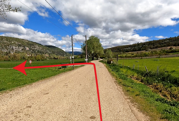
Turn left back towards the Monieux lake
We are quickly back at the starting point to the east of Lake of Monieux.
No reproduction is permitted without the written consent of the author. (id7607)
Back to the east of Lac de Monieux
Sources and additional information
It is better to use a good topographic hiking map: this tour is on the IGN map "Mont Ventoux", scale 1:25000, 3140ET.
If you don't want to bother with a paper map, you can also use mapping apps on your cell phone. On the one hand, it is the Cartes IGN app from the official map service. However, it requires access to the data network and this is sometimes difficult in canyons or remote locations.
Alternatively, you can use apps that store data directly on the device. They're generally not free, but they don't cost much. We mainly use OSMAnd, here it is possible to add contour lines, relief shading, markings and others. To store this data on your phone you need a lot of space.
Of course, one needs access to satellites for the GPS signal with any app. In some canyons this is not the case. Therefore, do not rely on the position shown, but read the map on your phone as you would read it on paper. Most apps are available for Android and iPhone. The applications usually allow us to record the route travelled and also view the GPS files offered for each of our hikes.
This page has been seen 2080 times since 20 March 2024.
No reproduction is permitted without the written consent of the author. (id7502)
Nesque gorge under Lake Monieux