Dry stone sheep farms north of Banon
The most remarkable stone buildings on the limestone plateau of the Montagne de Lure
hike
easy
3 h 15 min
no
yes
shelter
mountain
Introduction
This easy but long hike does not present any particular difficulties. You move mainly on forest roads that cross the extensive limestone plateau of the Montagne de Lure. You have to be a bit careful at the junctions, because the markings are sparsely distributed. There is a short and steep incline, but the rest of the vertical meters are mastered imperceptibly. This round tour is more culturally interesting, several former alpine pastures are on the way, you can shelter here even in the rain or wind.
The limestone landscapes of Provence are dotted with many different dry stone buildings. The best known are the bories, simple conical shelters. The shape goes back to the type of construction: flat stones are placed one on top of the other in such a way that rainwater runs off to the outside, but the roof is closed inwards in the overhang. Around Le Contadour on the Montagne de Lure there are still many much larger building complexes made of stone, including stables, huts and cisterns. These pastures have different substructures, but are covered like simple bories.
Warning: following changes in 2020 in the management of private property over which this walk passes, access to the dry stone structures appears to be undesirable on this tour. There is only one sign at the start of the tour forbidding access to Les Terres du Roux, Les Fraches and Les Bergeries. It is incomprehensible that historical paths are blocked without reason, since they now lead through completely unused land. Hikers really don't bother anyone and leave no traces.
From a purely legal point of view, the situation in open country in France is as follows: if a private person wants to make his property inaccessible, he must completely fence it off and/or put up appropriate signs around it at regular intervals. Just a sign on an entrance is not enough. It is legal to walk across country and one can only discern the intentions of the landowner when the property boundaries are clearly materialized.
The photos on this page were taken in 2014, at that time all points of the tour were freely accessible. They remain online here, along with the text, for documentation purposes.
The facts
11,9 km total distance
3 h 15 min walk time
30 min visiting time
330 m total elevation
orientation easy because of the extensive and easily visible terrain
mark 70% of the total distance
80% dirt roads
10% hard-surfaced quiet side streets
10% easy trails
dangers wind, dutiful shepherd dogs
children some sections of the trail could be too boring for children
useful picnic stuff
required hiking boots, hiking equipment and water
GPS coordinates (WGS84) of start and end point 44.115321,5.624613
downloads ![]()
![]()
No reproduction is permitted without the written consent of the author. (id3437)
Restored Jas des Terres du Roux, 1280 metres
Public transport
There is no public connection to Redortiers or Tinette.
The best way is to take a taxi from Banon (12 km).
Access by car
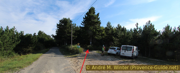
The cul-de-sac to Redortiers and Tinette branches off the road between Banon and Revest-du-Bion (or Sault) in a hairpin bend. The narrow road leads quite straight to the north and through the village of Le Contadour. 1.6 km further there is a parking bay on the right and a turn-off to Le Trait, less than 100 meters straight ahead there is another parking space on the right. The signpost already shows our first destination (Bouscarle). The round is counter-clockwise.
Useful parking spaces
Free parking at the start of the tour south of Tinette. Do not continue to the hamlets of Tinette or Le Trait, where parking is prohibited.
Hints
There is no source of drinking water on the plateau, so be sure to take enough water with you. The plateau is very wind-exposed in all seasons. The entire circular route is over 1200 meters above sea level, it can be cool here even in midsummer. In winter there can be heavy snowdrifts. However, three of the five alpine pastures along the way can be used as shelters. So you can do the tour even if the weather is not so good.
The whole region is a zone with a high risk of forest fires. In summer, but also in other seasons when it is very dry or by strong winds, access to the forest areas can be regulated. As a result, the roads may be closed to traffic and/or the trails prohibited to hikers. Current information: Access map to the forests of Alpes de Haute Provence (also english). The map shows the colours green, yellow, orange and red which correspond to levels of danger. The affected area is: Forcalquier-Entrevennes.
The sections
- The comfortable forest road imperceptibly takes us up in a dry valley, all well marked up to Bouscarle.
- Shortly back on the path, right up the ridge. Continue unmarked but on a road back into the dry valley and below the ridge to Jas des Agneaux.
- Now back south to Les Fraches (two different pastures) and to the pasture on the Terres du Roux.
- Back on a forest path and forest road to Tinette and briefly on asphalt to the starting point.
Section 1: Parking Le Trait - Jas de Bouscarle
➙ 2,4 km ... 40 min ➚ 160 m ➘ 20 m ↝ easy
100% dirt roads, few marks
The clues
- Le Trait car park, 1215 m, starting point with signpost
- Water cistern in the Ravin du Fond-Brune, 1230 m, turn right here and continue uphill
- Saddle Bouscarle, 1322 m, signpost, to the left, the Bouscarle pasture is already visible
- Jas de Bouscarle, 1325 m, shelter
Go up to the pastures and a first drystone stable.
See the notes at the top of the page!
No reproduction is permitted without the written consent of the author. (id3413)
Le Trait car park, 1215 m, starting point
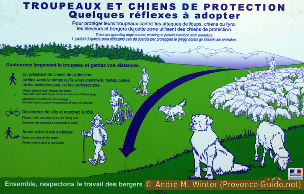
Danger! The whole plateau is an extensive grazing zone, sheep and goats are protected by herding dogs. Be sure to follow the basic rules of conduct.
With the extinction of wolves and the almost complete disappearance of grazing, these dogs also became increasingly rare. However, there are wolves and lynxes again, partly because they have been reintroduced, partly because they have migrated from far away. And rearing on pastures has experienced an upswing again. One encounters more and more large herds that are guarded and protected by several specially trained dogs.
Such guard dogs keep the herd together and protect them by chasing off attacking wild animals or warning the shepherd. Their main task is to recognize strangers. They do this by approaching, sometimes very close, in order to sniff better. They may also follow hikers for a while. This usually means that you have been accepted. The dogs are always in large numbers, usually come running in pairs, never bark and can appear threatening. Although rarely seen, a shepherd is always present and will have seen the wanderer long before you see him. Knowing these facts makes it easy to follow the rules on boards (photo) in the area:
- Stand still during the identification phase of the dogs. Stay calm, take care of children and avoid making them restless. Put away sticks or wear them close to your body. Never threaten or pet the dogs.
- If several hikers approach the herd from different directions, the dogs can come running very quickly to carry out the recognition. It's not an attack. These dogs also do not attack animal attackers, but should only push them back if necessary.
- Only when the dogs leave you continue on your way. If the path leads through a herd, it is better to go around it (especially with cattle). This can be uncomfortable, for example at the edge of a forest, but herds should never be divided.
- Get off and push bicycles. Dogs and herd animals know people and also identify them by their body size. So you have to present yourself a natural figure.
- Keep all of your own dogs on a leash or, better, leave them at home. The herd dogs are less of a problem, they can distinguish other dogs from wolves (as long as your dog knows how to behave), but herds can react unpredictably. This is especially the case with cows. If cows threaten (head down), never tie the dog to your body but release it (dogs are always faster than a cow). If you hold your dog back, the cow will try to trample it with you. The information given here also includes cattle, but fewer of them are found in Provence.
No reproduction is permitted without the written consent of the author. (id3412)
Notes on the shepherd dogs
No reproduction is permitted without the written consent of the author. (id3424)
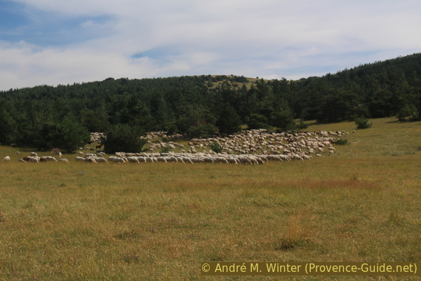
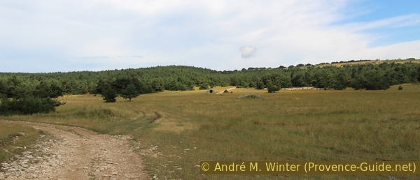
Large flock of sheep on the Fond-Brune pasture
Before we could go any further here, we were checked by herd dogs.
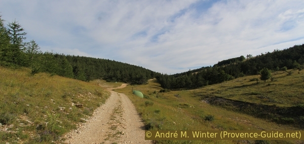
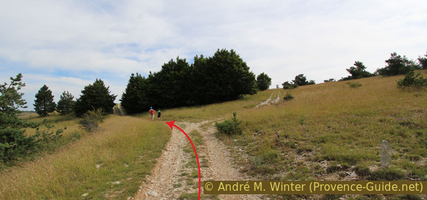
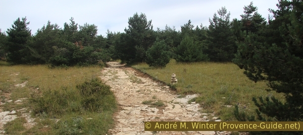
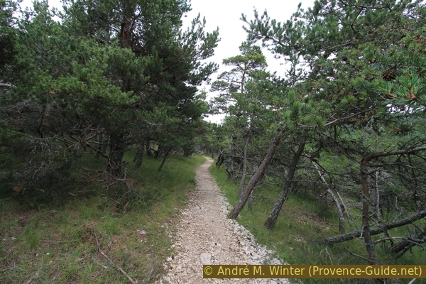
So we start at the Le Trait car park, 1215 m, which will probably rarely be crowded. A signpost indicates Bouscarle at 2 km. The field and forest path runs leisurely through the landscape. In places you will find subtle yellow markings, but you cannot get lost here. The forest road ascends a little to follow the Ravin du Fond-Brune dry valley.
No reproduction is permitted without the written consent of the author. (id3414)
Gravel road in the Ravin du Fond-Brune
After the cistern, turn right and climb steeply to Jas de Bouscarle.
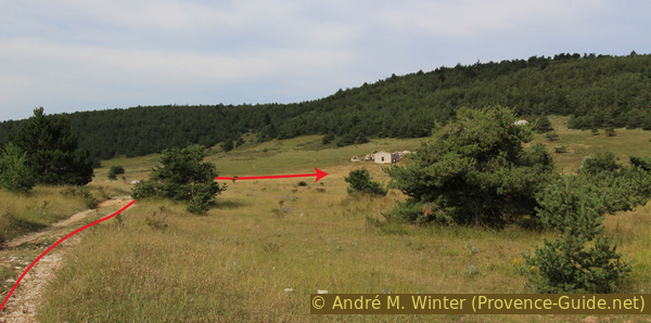
Even if the path seems so easy at first, after a while we see a steep gravel road going up to the right. At the level of a half-buried cistern (in the IGN map, altitude 1238), we turn right into this rugged road and climb the 85 meters in altitude. At the top, in a kind of flat saddle, we look over a gently rolling prairie, keep to the left and immediately see our first destination: Jas de Buscarle, which we reach in a large, flat curve.
No reproduction is permitted without the written consent of the author. (id3415)
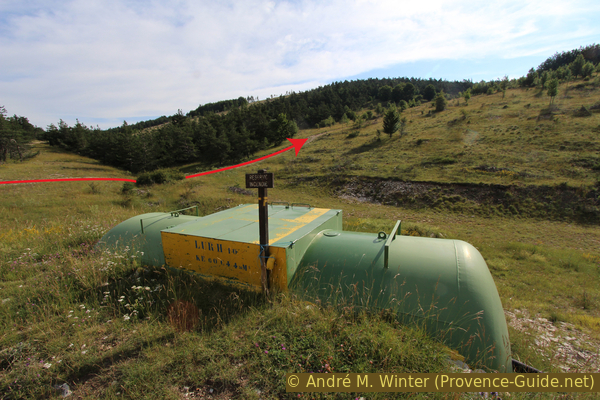
Cistern in the Ravin du Fond-Brune
The location of this sheep farm is well chosen: it lies under a wooded ridge that protects it from the strong north winds. It is on the sunny side and still on a hill to monitor the animals on the pasture in the south.
Although local signposts write "la Bouscarle" or "Jas de la Bouscarle", the correct name is "Jas de Bouscarle" because Bouscarle was the owner's surname in the 19th century, so the name is not a place name.
No reproduction is permitted without the written consent of the author. (id3418)
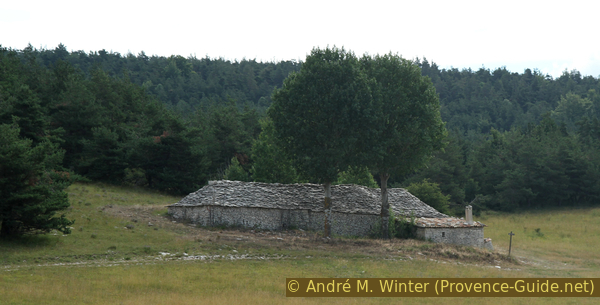
View of the Jas de Bouscarle on the way there
"Jas" is a Provençal term meaning "shelter" and refers to large and remote sheep farms. Often they are erected in drystone manner.
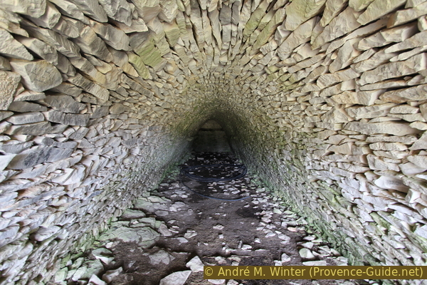
The large long stable is a series of five dry stone domes resting on large arches.
No reproduction is permitted without the written consent of the author. (id3416)
View of the Jas de Bouscarle stable
The flat stones of the roof are laid as in bories, but not quite as neatly as in a construction that has to support itself off the ground. Here broad side walls and brick arches support the domes.
Agricultural material is stored in the former stable.
No reproduction is permitted without the written consent of the author. (id3417)
Domes and arches inside the Jas de Bouscarle
Section 2: Jas de Bouscarle - Jas des Agneaux
➙ 4 km ... 1 h ➚ 155 m ➘ 115 m ↝ easy
45% dirt roads, with marks
20% dirt roads, wrong marks
35% dirt roads, faulty marks
The clues
- Jas de Bouscarle, 1325 m, shelter
- Bouscarle saddle, 1322 m, signpost, sharp right towards Le Pape, Crête de Lure
- Up to the Long Terme forest ridge, always keep left and later descend left to an abandoned alpine pasture (ignore other yellow markings)
- Down there right around the borie, the gravel road leads north through a pasture with a very large tree.
- The better road turns to the left, but we go straight ahead across the pasture, shortly after a dry stone shelter to the left of the path
- Continue slightly uphill north to the ruins of Jas des Agneaux, 1365 m
No more signs after Bouscarle.
See the notes at the top of the page!
vers = to
bergerie = farm
abri = shelter
Return from the Jas de Bouscarle to the saddle, but here turn right on the steep forest road up into the forest to the north. When the path flattens out, you return from the forest to meadows.
Always take the wider path on the left and head north. At another fork, the marked trail turns right and uphill, but we go down into the gentle valley to the left, even if the marking with a yellow cross indicates otherwise. We come to an alpine pasture (house ruins and borie, 1294 m on the IGN map).
No reproduction is permitted without the written consent of the author. (id3419)
Crossroads between Long Terme and Les Chouscles, 1375 metres
Keep right at the former farm and continue up the valley to the north, always keep right at the forks.
No reproduction is permitted without the written consent of the author. (id3420)
Gravel road from Les Chouscles down to the farm in Fond-Brune
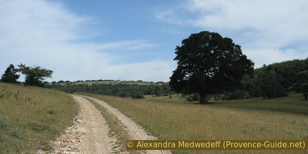
We are now back on the gravel road that we followed at the beginning and pass this remarkably large solitary tree.
No reproduction is permitted without the written consent of the author. (id3421)
Gravel road in the Fond-Brune valley with a large tree
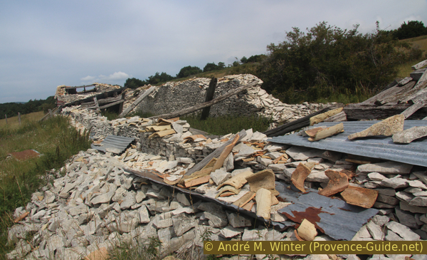
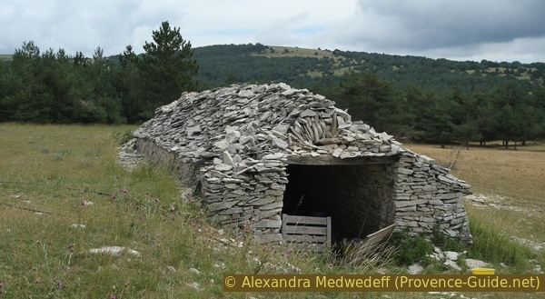
On the left it would go directly to the Jas des Fraches. We go straight north though, pass a massive stone shelter and onto Jas des Agneaux.
After a somewhat earthy section, it gets rocky again and we pass the shelter shown on the top of this page, the closed side faces north, from where the mistral also blows.
No reproduction is permitted without the written consent of the author. (id3422)
Junction north of Fond-Brune
Keep right here too! Unfortunately, the many parallel roads are created when farmers bring material to the plateau and old paths are full of water.
No reproduction is permitted without the written consent of the author. (id3425)
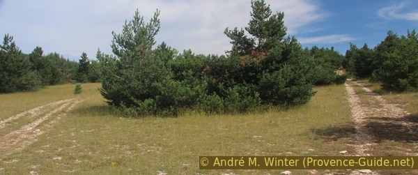
There are many junctions here on the plateau
We get higher and to the badly in shape Jas des Agneaux at the foot of the Sommet de Larran in the Crête de la Faye. The elevation is just behind the ruins. You can go up gravel roads to the left or right of it, you can also get through across the meadows. Even if it doesn't look like a ridge here, the descent on the north side is much steeper.
The Jas des Agneaux is falling into disrepair, although motion pictures have even been filmed here. However, the construction with a normal gable roof and the mixing of dry stone and cement is not stable enough for continued existence.
No reproduction is permitted without the written consent of the author. (id3426)
Jas des Agneaux ruin
Section 3: Jas des Agneaux - Jas des Terres du Roux
➙ 2,6 km ... 1 h ➚ 0 m ➘ 90 m ↝ average
100% dirt roads, without marks
The clues
- Jas des Agneaux, 1365 m, go south and keep right
- Bergerie des Fraches, 1315 m, ruins with arches
- Jas des Fraches, 1305 m, shelter
- Junction with rusty barrel, 1317 m, turn right
- Jas des Terres du Roux, 1270 m, shelter
No signposts on site for this section.
Standing in front of and below the Jas des Agneaux, we turn left briefly and take the first downhill dirt road on the left. Ignore the paths running east-west. You walk in the pine forest on a path that runs parallel to our ascent path to Jas des Agneaux.
See the notes at the top of the page!
crête = crest
sommet = summit
GR = long distance trail
bergerie = farm
The road descends south and becomes straighter. There is a turn-off in an area more open in the forest. Here we go to the right. Straight ahead we would get to the Ravin de Fond-Brune and the ascent path.
No reproduction is permitted without the written consent of the author. (id3427)
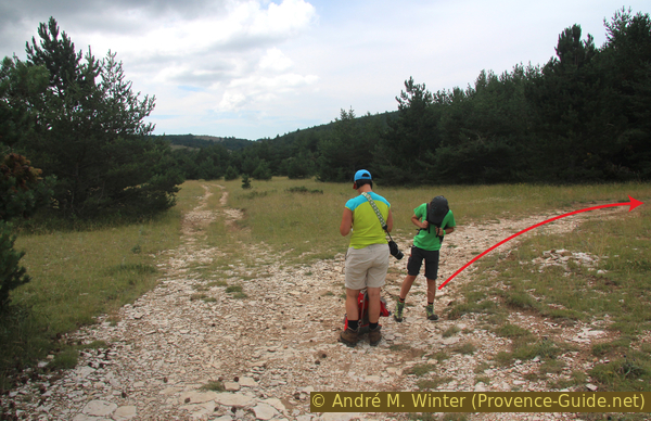
Junction to Les Fraches
There are no signposts or markers, but this cairn indicates that you are on the right path to the Bergerie des Fraches.
No reproduction is permitted without the written consent of the author. (id3428)
A cairn marks the way to Les Fraches
After the last junction, we soon come to the Bergerie des Fraches, 1315 m. This ruin is not marked on the IGN map.
It is a dilapidated sheep farm, of which, remarkably, four round arches of the roof construction have been standing for years. As with the Jas de Bouscarle, the substructure is built as dry stone masonry. Similarly, the arches were erected with a little bit of mortar and slightly better stones. But there was only a wooden roof over it, which is now weathered and gone except for the ridge beam. The arches are probably only standing because the masonry that supports them is so massive and sunk into the ground.
No reproduction is permitted without the written consent of the author. (id3429)
Free standing arches of Bergerie des Fraches
Entering the ruins is theoretically forbidden.
The strong walls support the arches fixed with mortar, which emanate directly from the ground for stability. In front there are still stones, which supported the straight rafters of the wooden construction on the round arch.
Looking south and standing in front of the ruins, you can see a small open shelter on the left at the edge of the forest, which is already collapsing.
No reproduction is permitted without the written consent of the author. (id3430)
Coarse wedge stones from the Bergerie des Fraches
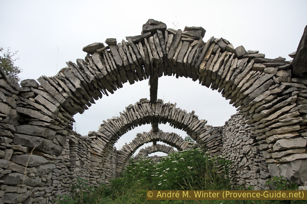
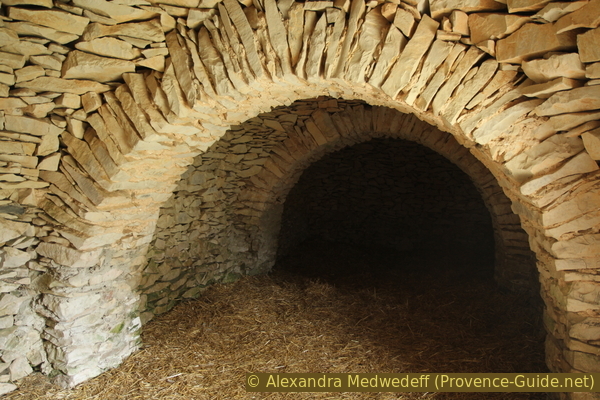
Less than 200 m further along the forest road we come to another interesting dry stone building. It is the Jas des Fraches, 1305 m, with a large stable and a cistern.
When you approach the main building from the north, you think it's about to collapse. But hidden under the jumbled capstones is a Nubian vault in excellent condition.
No reproduction is permitted without the written consent of the author. (id3431)
Entrance to the Jas des Fraches stable
As the name suggests, the Nubian vault technique dates back to ancient Egypt. The big advantage of this construction method is that you can build long and fairly wide buildings with relatively coarse stones. In contrast to the free-hanging vault of the bories, you need formwork, but this can be quite short if you push it further during construction.
No reproduction is permitted without the written consent of the author. (id3432)
Nubian vault of the Jas des Fraches
pas = (hier) saddle
vers = to
baril = barrel
dôme de pierres = stone cone
We return to the forest road, after about 100 m another road crosses at an angle, but we continue straight south. On the right later there is a kind of column made of small flat stones in a meadow. It seems as if the pasture was freed from stones. The road then follows a very wide and open ridge. On a plateau, which is actually a saddle between the Terres du Roux in the north and the Coulet Bastard in the south, a road branches off to the right, which we follow down to the Jas des Terres du Roux. The spot is marked with an old, rusty iron barrel filled with stones.
No reproduction is permitted without the written consent of the author. (id3439)
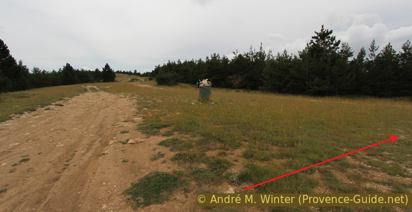
Iron barrel at the crossroads on the Terres du Roux
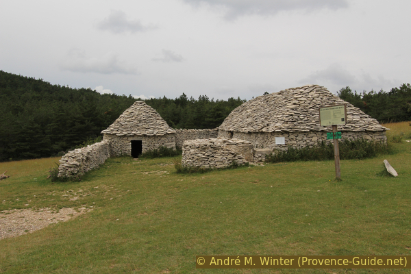
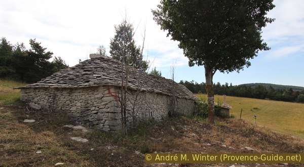
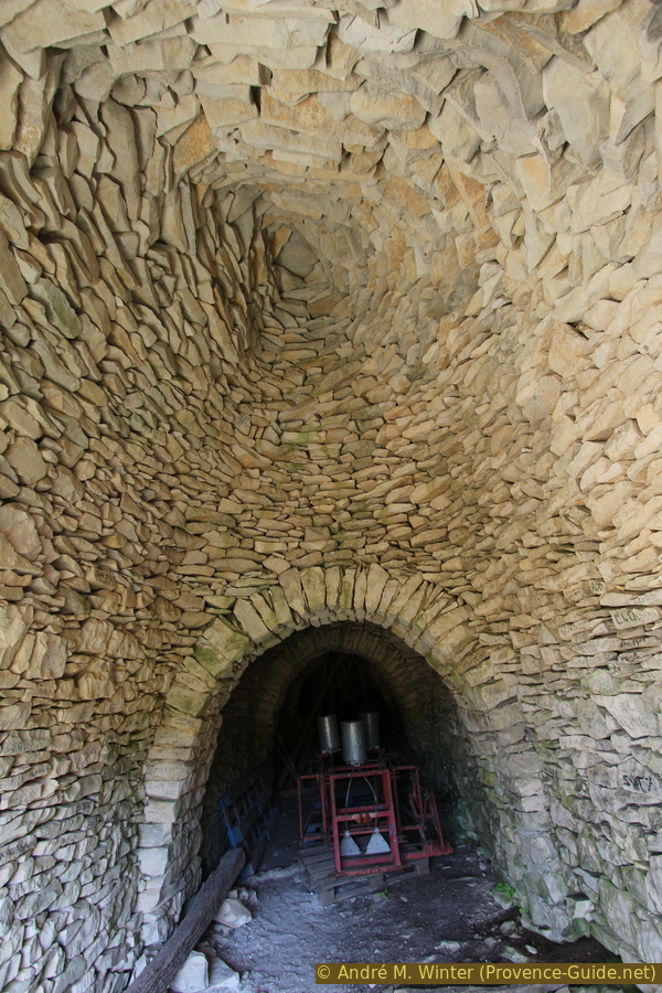
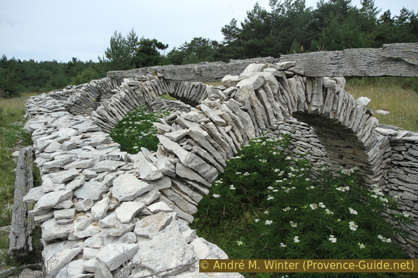
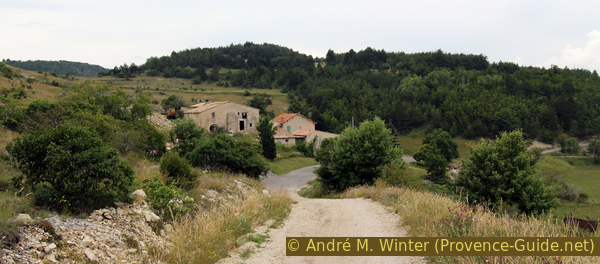
After the fork, we go down in a wide arc to the listed Bergerie du Jas des Terres du Roux. This dry stone building has been restored and is the best preserved in the area. The stable is built like the Jas de Bouscarle, but here the original shepherd's shelter has been preserved. There is also a cistern that was filled via gutters (which no longer exist).
No reproduction is permitted without the written consent of the author. (id3436)
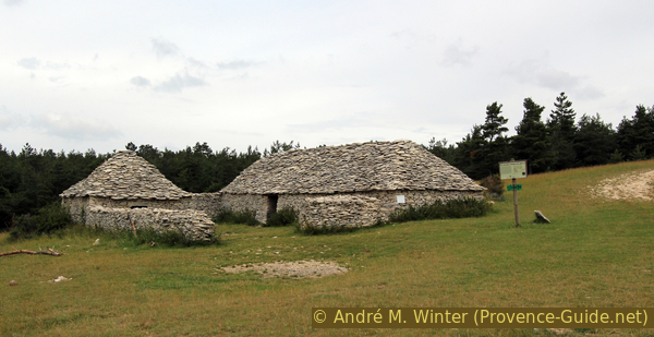
Rehabilitated Jas des Terres du Roux farm
The large building, more than 15 m long, consists of rows of domes in dry stone cantilever construction, which are placed between round arches fixed with mortar. The entrance is on the long side, so the narrow sides are also closed with corbel vault technique.
No reproduction is permitted without the written consent of the author. (id3438)
Round arches of the Jas du des Terres du Roux
Section 4: Terres du Roux - Tinette - Parking Le Trait
➙ 3 km ... 40 min ➚ 10 m ➘ 100 m ↝ easy
35% easy trails, few marks
25% dirt roads, few marks
40% hard-surfaced quiet side streets, faulty marks
The clues
- Jas des Terres du Roux, 1270 m, shelter
- Ruin in the forest
- Gravel road and lavender fields, 1280 m
- Hamlet Tinette, 1220 m
- Le Trait car park, 1215 m, start and end point
Back first via a leisurely path.
See the notes at the top of the page!
The gravel road ends in the clearing of the Terres du Roux. An old and flat forest path begins, you keep slightly left to find the entrance at the edge of the forest. A ruin follows shortly after on the left.
No reproduction is permitted without the written consent of the author. (id3435)
Forest path to the Jas des Terres du Roux
After about 10 minutes, this path leads to a wide saddle again on a gravel road, in front of us are lavender fields.
No reproduction is permitted without the written consent of the author. (id3434)
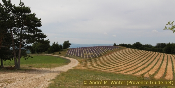
Lavender fields above Tinette
You quickly descend to Tinette. This is where the narrow strip of asphalt begins, which takes us back to the starting point of the tour after a slight incline after 700 m.
No reproduction is permitted without the written consent of the author. (id3440)
Road down to Tinette
Sources and additional information
This walk is inspired by this book: 25 balades sur les chemins de la pierre sèche (25 Hikes on tracks of the dry stone constructions, only french) between Monts de Vaucluse, Montagne de Lure and Lubéron, by Florence Dominique, Le bec en l'air publisher, ISBN 987-0-916073-45-3. If you are more interested in these constructions, this book will also pass on well-founded knowledge. The hikes are well explained with pictures and maps.
It is better to use a good topographic hiking map: This tour is on the IGN "Banon, Sault" map, scale 1:25000, 3240OT.
If you don't want to bother with a paper map, you can also use mapping apps on your cell phone. On the one hand, it is the Cartes IGN app from the official map service. However, it requires access to the data network and this is sometimes difficult in canyons or remote locations.
Alternatively, you can use apps that store data directly on the device. They're generally not free, but they don't cost much. We mainly use OSMAnd, here it is possible to add contour lines, relief shading, markings and others. To store this data on your phone you need a lot of space.
Of course, one needs access to satellites for the GPS signal with any app. In some canyons this is not the case. Therefore, do not rely on the position shown, but read the map on your phone as you would read it on paper. Most apps are available for Android and iPhone. The applications usually allow us to record the route travelled and also view the GPS files offered for each of our hikes.
This page has been seen 2090 times since 20 March 2024.
No reproduction is permitted without the written consent of the author. (id3433)
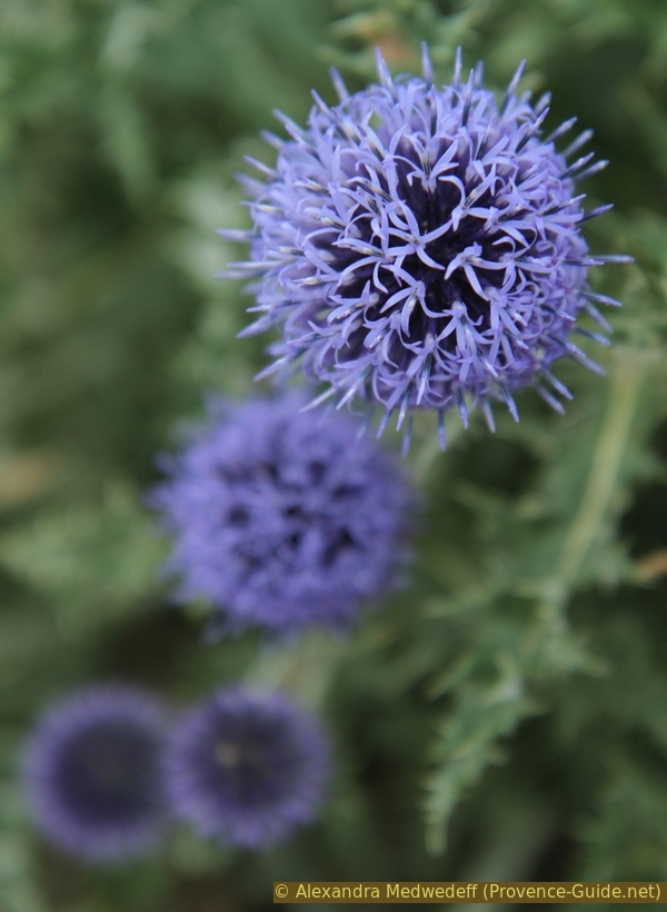
Southern globethistle