St. Cyr, Pointe du Défens and Port d'Alon
A loop on the wild coast between St. Cyr and Bandol
hike
average
3 h
far
yes
no
mountain
Introduction
Saint-Cyr-sur-mer is above all a large summer holiday village and everything is oriented towards the sea and the beach. South of the centre is a large cape between La Madrague and the Calanque du Port d'Alon. The coast is accessible by a hiking trail, but this stretch of coast is particularly long on foot because it cannot be shortened: the private residential area on the cape prohibits any passage, even for pedestrians. There are also a few meters of altitude to overcome and in 2017 a landslide made the section between Cape Pointe du Grenier and Pointe Fauconnière in the northern part impassable. There is no alternative posted locally, but we present a workaround for this missing section.
The facts
10 km total distance
3 h walk time
230 m total elevation
orientation easy in the coastal area, less inland
mark 65% of the total distance
60% easy trails
10% forest roads
10% hard-surfaced quiet side streets
10% hard-surfaced city roads
5% hard-surfaced city alleys
5% moderate trails
<5% dirt roads
<5% hard-surfaced paths
dangers wind, sun, landslides
children in some cases
useful picnic stuff, swimwear
required hiking boots, hiking equipment and water
GPS coordinates (WGS84) of start and end point 43.166372,5.694482
downloads ![]()
![]()
No reproduction is permitted without the written consent of the author. (id5871)
The coastal path west Port d'Alon
Public transport
Saint-Cyr-sur-Mer is on the Marseille-Nice railway line with a regular regional service, see TER PACA (only french). The municipality also offers a shuttle service to get to the starting point, taking the Navette des Quartiers, the Navette Estivale (only in summer) or the Navette Dominicale (only on Sundays) to the port of La Madrague, the starting point. Information at Navettes de St. Cyr (only french).
Access by car
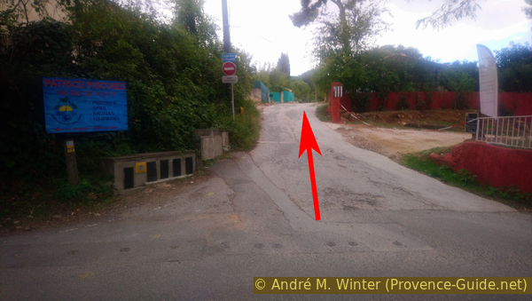
Saint-Cyr is located between Marseille and Toulon, more precisely between La Ciotat and Bandol. There is a highway exit north of town. Then follow the signs to the centre, then to Les Lecques and finally to La Madrague. You can't park here and before there are short-term parking zones in all streets between the end of March and the beginning of October. So by car there is another starting point, it is at the beginning of section 4. Pass La Madrague Port, then straight ahead at the following roundabout to exit the city. When you reach a kind of saddle, on the right side we see the prohibition signs on the access road to the Don Bosco school. You can park on the left.
Useful parking spaces
Along the Chemin de Nartette as indicated above.
To get to the starting point on foot, follow the instructions in section 4
Hints
The itinerary is described in an anti-clockwise direction as it bypasses the closed section of the coastal path between Madrague and Pointe Fauconnière right at the start. If there are other barriers to the ban in place since 2017, you won't end up in a dead end at the Pointe Fauconnière. So you can turn around and, for example, walk part of this tour in the opposite direction.
The section between La Madrague and Pointe Grenier remains open, but there is no way to continue along the coastal path from there.
As stated in the introduction, the tour is long without being able to shorten it. We walk a long time along the coast, which is white, very sunny and often very windy. That can be exhausting.
The whole region is a zone with a high risk of forest fires. In summer, but also in other seasons when it is very dry or by strong winds, access to the forest areas can be regulated. As a result, the roads may be closed to traffic and/or the trails prohibited to hikers. Current information: Map of access to the forests of the Var (also english). The map shows the colours green, yellow, orange and red which correspond to levels of danger. The affected area is: Monts Toulonnais (1).
The sections
- La Madrague - Pointe Fauconnière cape
- Pointe Fauconnière - Port d'Alon
- Port d'Alon - Sentier des Vignes
- Nartette - La Madrague
Section 1: La Madrague - Pointe Fauconnière
➙ 1,8 km ... 35 min ➚ 110 m ➘ 10 m ↝ average
10% hard-surfaced city roads, without marks
25% hard-surfaced city alleys, without marks
20% forest roads, without marks
25% moderate trails, without marks
20% easy trails, without marks
The clues
- La Madrague - Pointe Fauconnière cape
- Pointe Fauconnière - Port d'Alon
- Port d'Alon - Sentier des Vignes
- Nartette - La Madrague
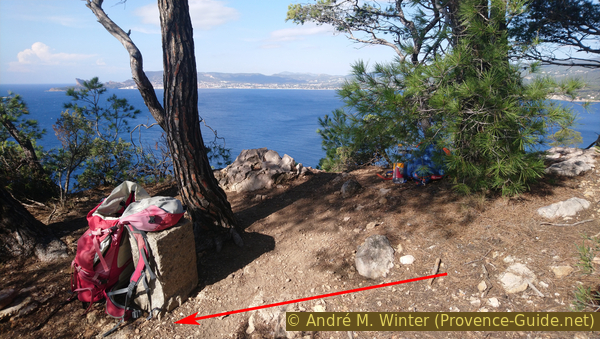
Coming from Port de la Madrague, walk up the narrow Avenue de l'Abbé Dol in a southerly direction, an arrow points towards Sentier des Vignes. Take the first right onto Boulevard Anatole Ducros, which is just as narrow. In front of a green gate we turn left up to a white automatic barrier, where we take the passage for pedestrians on the right.
The road seems to end 50 meters ahead. However, you go ahead, past a green gate and behind it on the right through another barrier. Then along this road, which is in bad condition here.
No reproduction is permitted without the written consent of the author. (id5845)
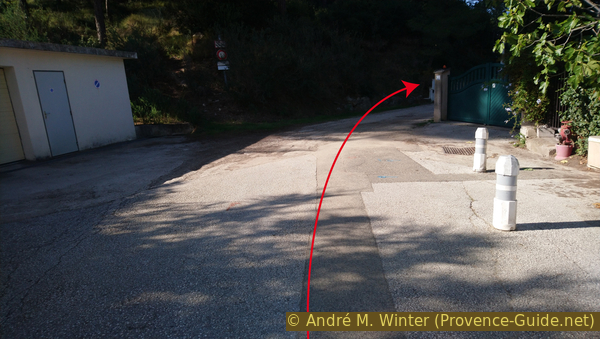
End of Boulevard Anatole Ducros
After a little more than five minutes, under tall pines behind which the luminous bay of Baie des Lecques shines through on the right, we arrive at the sewage treatment plant of the municipality.
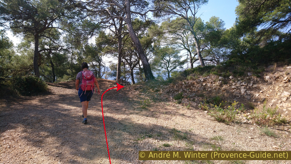
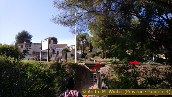
On the left is a wooden barrier blocking a forest road. It literally points left towards the slope and here is a path that climbs steeply. This is our warm-up stretch for the rest of the tour around the big peninsula. The steep ascent only takes five minutes. We come across a wider path at the top, where we turn right.
You can also take the old forest path on the outermost left and keep going to the right. The forest road progressively becomes a narrower and flatter path. You continue to the south-west and later come across the described route again.
No reproduction is permitted without the written consent of the author. (id5846)
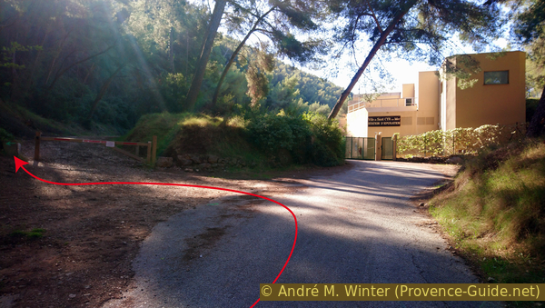
The sewage treatment plant of St.-Cyr
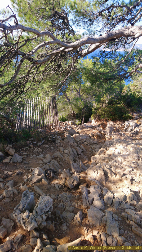
A clearly visible path now leads horizontally to the right into the wooded slope. After five minutes, it climbs much steeper, but not as vertically as before. This brings us to the wooded ridge of Le Pigeonnier hill, which below forms Cape Pointe Fauconnière. Along this ridge also runs an old, rusty fence, which ends right here, so we can switch to another path on the right.
No reproduction is permitted without the written consent of the author. (id5847)
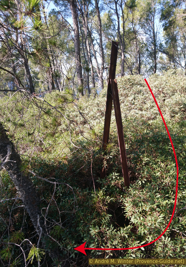
Rusty fence on Le Pigeonnier hill
We finally descend along this straight ridge and along the fence to the south-west. Less than two minutes after reaching the fence, the trail approaches the ledge near a survey stone. Here we see directly in a slope with loose rock, in which the now closed path between Pointe Grenier and Pointe Fauconnière passed.
No reproduction is permitted without the written consent of the author. (id5848)
Rest at Le Pigeonnier hill
We come from above on a forest path that ends on the right after a few meters at a large cairn. Here we turn right.
No reproduction is permitted without the written consent of the author. (id5849)
End of the forest road on Le Pigeonnier hill
You quickly reach the viewpoint on the Pointe Fauconnière and the blocked path towards St. Cyr on the right. We have completed the bypass of the closed section, after which we continue left on the classic coastal path.
No reproduction is permitted without the written consent of the author. (id5850)
Bay south of Pointe Grenier cape
Section 2: Pointe Fauconnière - Port d'Alon
➙ 4,2 km ... 1 h 30 min ➚ 50 m ➘ 150 m ↝ easy
45% easy trails, few marks
5% hard-surfaced quiet side streets, few marks
5% hard-surfaced paths, few marks
50% easy trails, few marks
The clues
- Crest of Pointe Fauconnière cape, 100 m
- Plage des Nations beach, 0 m
- Pointe du Défens cape, 40 m
- Calanque du Port d'Alon cove, 0 m
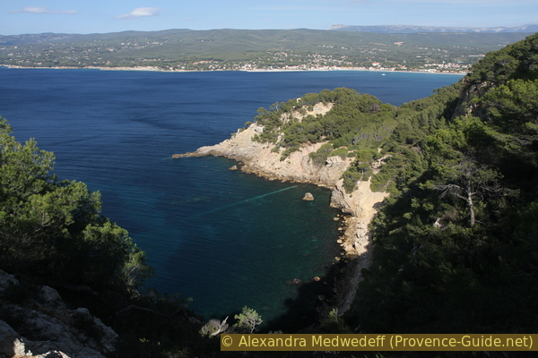
Here we are on the open part of the trail. The next four kilometres we stay close to the sea. Of course you have to climb to the capes and descend into the valleys, but you don't exceed 40 meters above sea level after descending from Pointe Fauconnière.
From the Pointe des Trois Fours we are in the presence of villas in the private district of Port d'Alon. Some houses by the sea have a magnificent view, but unfortunately they are usually particularly ugly.
We remind you that it is forbidden to go through these private areas. The first possibility to go inland is from the Calanque du Port d'Alon.
The path is marked in yellow and is easy, although it is quite steep and rocky downhill from the viewpoint at first. At around 70 meters above sea level, the path turns left and now leads more gently downhill. It finally stabilizes at an altitude of 40 meters.
No reproduction is permitted without the written consent of the author. (id5851)
Path under the Pointe Fauconnière viewpoint
We can then see the actual Pointe Fauconnière, completely devoid of vegetation.
No reproduction is permitted without the written consent of the author. (id5852)
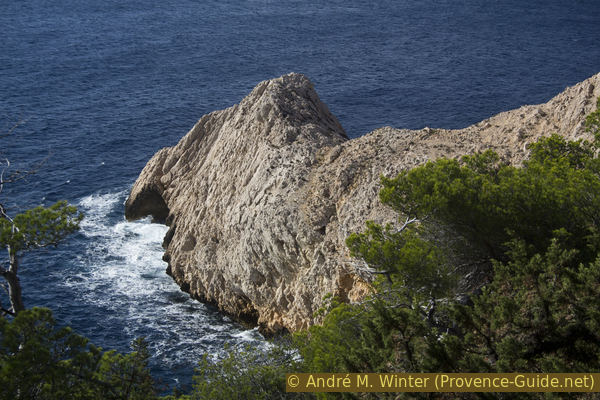
Pointe Fauconnière cape
We stay quite comfortably under tall pine trees, further down the blue Mediterranean Sea glitters on the white limestone coast. Landslides have occurred in places above the waterline, here the rocks are red like at Le Resquilladou. To be on the safe side, the path runs quite high here.
No reproduction is permitted without the written consent of the author. (id5853)
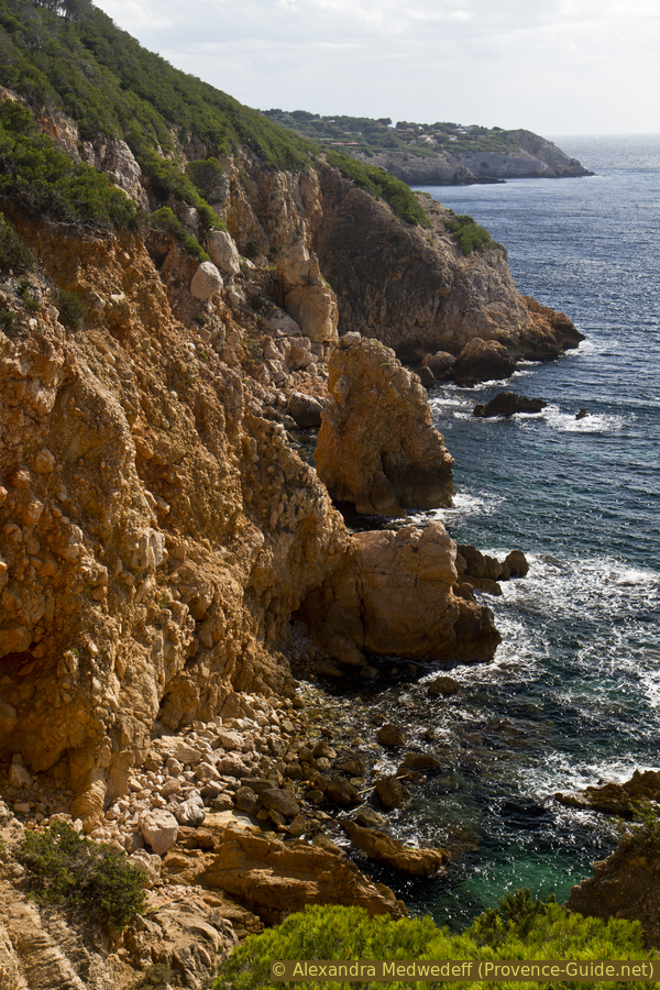
Le Resquilladou
Shortly afterwards we pass the peninsula that borders the Baie des Nations in the north. You only notice that when you're just past it and a narrow path leads down to the Plage des Nations beach. The bay is really well protected. On the crest of the narrow section is the base of a WWII gun. To the west of the beach is a walled hole, probably from the same period.
No reproduction is permitted without the written consent of the author. (id5855)
Baie des Nations and La Ciotat
So far we have been hiking in untouched nature for quite a long time. Now however we come to a section along the villas of Port d'Alon settlement. We always stay between houses and fences on one side and the sea on the other. After the first houses you come to a road, but after about a hundred meters a path continues, it is a concrete strip that descends into the Calanque du Défens.
No reproduction is permitted without the written consent of the author. (id5856)
Concrete walkway on the Pointe des Trois Fours cape
Although the residential area is private, you have free access to the beach of the Calanque du Défens, the direct coast is always public territory in France.
No reproduction is permitted without the written consent of the author. (id5857)
Calanque du Défens bay
We climb straight off the beach to the left onto large limestone slabs worthy of the Côte Bleue (further west).
No reproduction is permitted without the written consent of the author. (id5858)
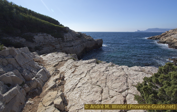
Limestone strata
We come back to villas, here we find the largest and not necessarily the most beautiful. Here we pass the wide Pointe du Défens without noticing it. As before, we always have a fence on our left.
No reproduction is permitted without the written consent of the author. (id5859)
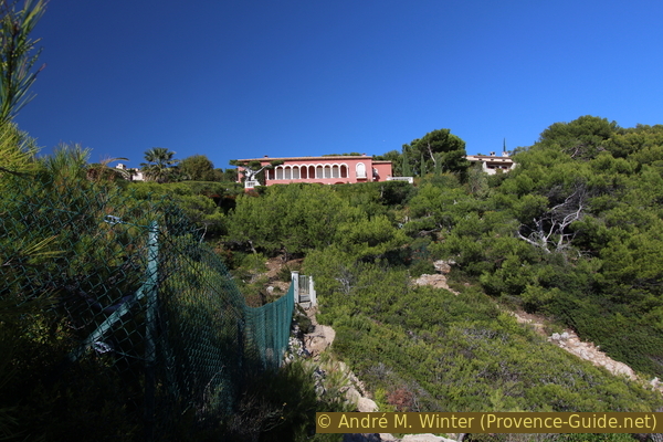
Villas at Domaine du Port d'Alon
Gradually we return to a more natural area, but remain quite high above the water.
No reproduction is permitted without the written consent of the author. (id5860)
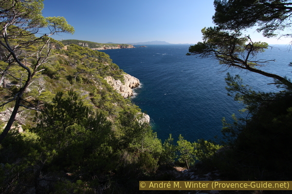
East of Pointe du Défens cape
After the Pointe des Termes, a path leads down to the first small beach in the bay of Calanque Port d'Alon, this is called Calanque de Jauffrey.
No reproduction is permitted without the written consent of the author. (id5861)
Calanque de Jauffrey bay
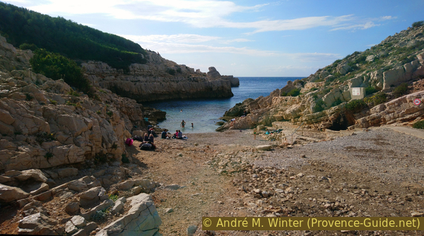
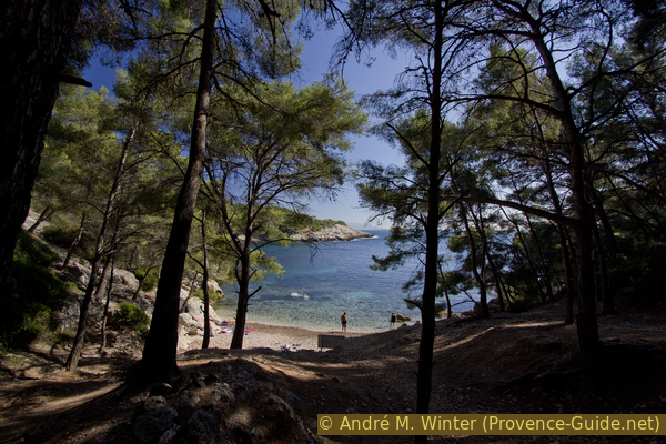
A little further ahead is the largest beach in the Calanque du Port d'Alon, surrounded by pine forests. It is just a natural bay, there are no port facilities here. In summer you can buy drinks.
No reproduction is permitted without the written consent of the author. (id5862)
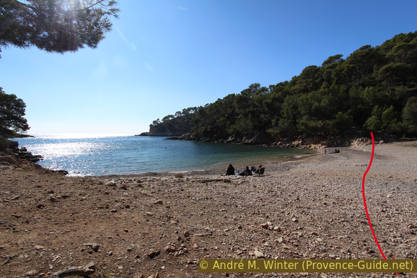
Calanque du Port d'Alon
Section 3: Port d'Alon - Sentier des Vignes
➙ 2,7 km ... 40 min ➚ 65 m ➘ 0 m ↝ easy
30% forest roads, without marks
20% hard-surfaced quiet side streets, few marks
20% easy trails, with marks
10% dirt roads, with marks
15% easy trails, with marks
10% hard-surfaced quiet side streets, few marks
The clues
- Calanque du Port d'Alon cove, 0 m
- Collège Don Bosco school, 70 m
- Nartette Wineyard
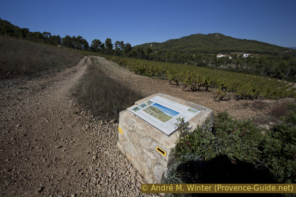
The return to the starting point is logically inland. We cross a segmented hilly landscape typical of the lower limestone Provence, which contrasts sharply with the coastal landscape open to the sea. The basin of the Port d'Alon and the Nartette plain is in a larger basin known as the Bassin du Beausset. Geologically speaking, this area consists of red clay, gypsum and white dolomites, limestone conglomerates and sandstone.
The Conservatoire du Littoral strives to maintain agricultural activity here in order to preserve ecological diversity. Otherwise, pine wood would spread in this area and the risk of forest fires would be much greater.
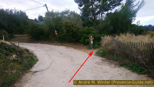
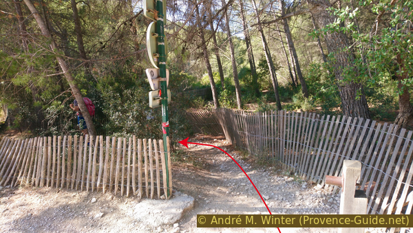
We leave the coast at Plage de la Calanque du Port d'Alon. We pass the snack and make our way under tall pines, we stay on the valley floor. We cross the lower car park and continue along the Chemin dit de la Douane path. Then we proceed on the asphalt road of the Camping du Port d'Alon and to a crossroads.
A little over ten minutes after leaving Port d'Alon beach, we arrive at Route de la Calanque, where we turn left. Immediately after 20 meters turn right again to take the Chemin privé de Paramido uphill, here our Sentier des Vignes is also signposted.
No reproduction is permitted without the written consent of the author. (id5863)
Chemin privé de Paramido road
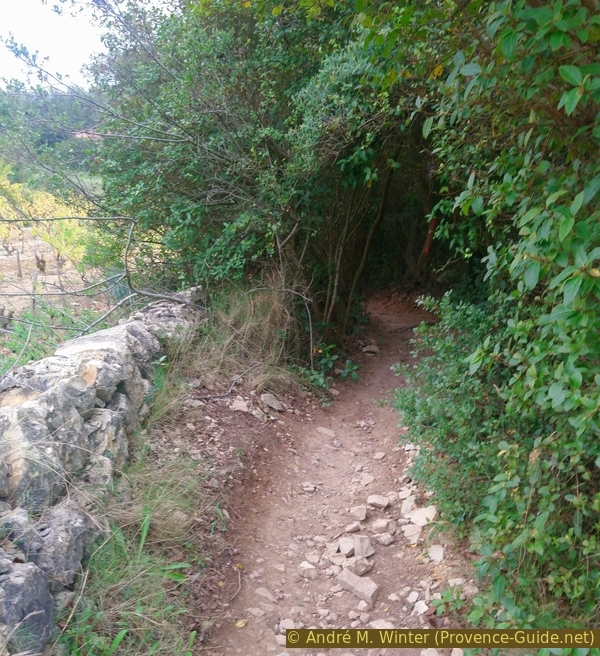
When the road turns left, we go straight ahead into a small forest.
No reproduction is permitted without the written consent of the author. (id5864)
Curve at Chemin privé de Paramido
Continue along part of the Bandol vineyards, through a small forest and down to houses.
No reproduction is permitted without the written consent of the author. (id5865)
Sentier des Vignes theme trail
Down left and again along a field in a forest with reeds.
Finally we reach the avenue of olive trees that leads to Don Bosco College. We turn left and come to the street where those who came by car park.
If you have some energy left, you may add the small tour on the Saint Cyr sand dunes that starts from here.
No reproduction is permitted without the written consent of the author. (id5866)
Sentier des Vignes
Section 4: Nartette - La Madrague
➙ 1,2 km ... 15 min ➚ 5 m ➘ 70 m ↝ easy
45% easy trails, few marks
55% hard-surfaced city roads, without marks
The clues
- Nartette vineyard
- Avenue de l'Abbé Dol
- La Madrague port, 5 m
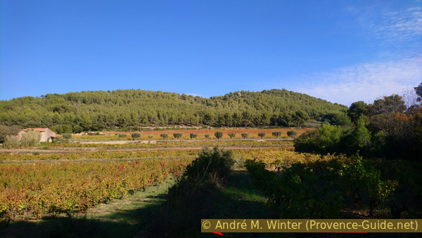
The final section runs under a vineyard managed directly by the Conservatoire du Littoral.
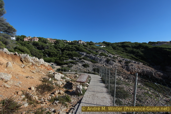
To get to the port of La Madrague, we cross the road and take the first path on the left (do not climb up to the vineyard). It runs parallel to the road and finally leads us south to the vineyards around the Bastide de Nartette. This vineyard and the house in the middle are special.
They belong to the Conservatoire du Littoral and are managed as they were in the early 20th century.
No reproduction is permitted without the written consent of the author. (id5867)
Access to the Sentier des Vignes under Bastide de Nartette
La Bastide de la Nartette dates from the 16th century and is the oldest building in the municipality after the Château de Baumelles. This farm was built on the slope near a small spring that also gives it its name. The Indo-European base NRT denotes a place where water is found.
Historically, there weren't that many vineyards in Provence. Mainly grain was grown, also here at La Nartette. Vines and olives, along with vegetables, were only grown around the dwellings. There is still a paved threshing floor from the time when grain was grown.
No reproduction is permitted without the written consent of the author. (id5868)
Bastide de Nartette, its vineyard and La Gâche
We walk south of the vineyards on a concrete strip interrupted by old railway sleepers. Arriving at the end of the field, the path continues downhill into the forest. We pass an old basin and our path climbs to the left to avenue de l'Abbé Dol. Turn right here and then left at the roundabout down to the port of La Madrague.
No reproduction is permitted without the written consent of the author. (id5869)
Up to Avenue de l'Abbé Dol
Sources and additional information
It is better to use a good topographical hiking map: this tour is on the IGN map "Aubagne, La Ciotat, Massif de la Sainte Baume", scale 1:25000, 3245ET.
If you don't want to bother with a paper map, you can also use mapping apps on your cell phone. On the one hand, it is the Cartes IGN app from the official map service. However, it requires access to the data network and this is sometimes difficult in canyons or remote locations.
Alternatively, you can use apps that store data directly on the device. They're generally not free, but they don't cost much. We mainly use OSMAnd, here it is possible to add contour lines, relief shading, markings and others. To store this data on your phone you need a lot of space.
Of course, one needs access to satellites for the GPS signal with any app. In some canyons this is not the case. Therefore, do not rely on the position shown, but read the map on your phone as you would read it on paper. Most apps are available for Android and iPhone. The applications usually allow us to record the route travelled and also view the GPS files offered for each of our hikes.
This page has been seen 3596 times since 20 March 2024.
No reproduction is permitted without the written consent of the author. (id5870)
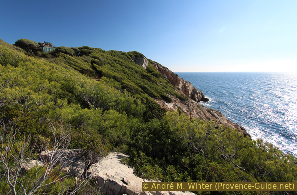
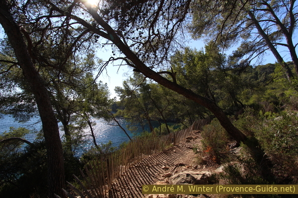
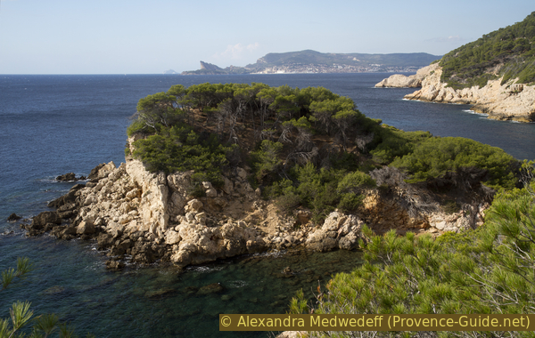
On the way to Pointe du Défens cape