Hike in the white limestone on the Côte Bleue of the Massif de l'Estaque
In addition to the coast, the impressive train route always accompanies you
hike
average
3 h
yes
with train
built-up area
mountain
Introduction
Coming from the west, the ridge of the Massif de l'Estaque is the first serious mountain range after the Pyrenees. In between there is only the Golfe du Lion with its beaches and lagoons and immediately to the west of our limestone mountains lies the extremely flat Camargue. The contrast is enormous, but you don't see much of the Camargue, as the view from the hiking trail goes into the Bay of Marseille, but on a clear day you can see part of the Calanques east of the big city. The limestone here is particularly white, the coast is steep and the sea is deep blue, a blue that gives the coast its name: Côte Bleue. In small bays, you can descend to even smaller beaches and down to the cool water. We also come through some inhabited bays. The imposing railway line from Miramas to Marseille accompanies us constantly. It was opened in 1915 and originally planned for military purposes, but successfully withstood all waves of branch line closures. So today, we can walk the path in just one direction and take the train back comfortably.
Several Côte d'Azur and Provence hiking guides describe a coastal path, usually signposted Sentier du Littoral, which is managed and maintained by the Conservatoire du Littoral, a government nature conservation agency. However, this is not the case here, in any case the quality of the path and markings is not as high as that on the Hyères peninsula further east, for example. Also, the official IGN map cannot always be trusted. Marked paths are partly private, while others are not registered at all. Thus, there are several very different types of trail between Niolon and La Redonne, but that is also what makes the hikes presented here so charming. Each one represents a small challenge, otherwise it would be boring.
The facts
7,6 km total distance
3 h walk time
220 m total elevation
orientation easy, with some confusing ramifications in the bays
mark 90% of the total distance
55% easy trails
25% hard-surfaced city alleys
10% cross country
5% hard-surfaced quiet side streets
5% stairs
<5% dirt roads
dangers landslides and possibly temporarily closed paths
children yes
useful picnic stuff, swimwear
required hiking boots, hiking equipment and water
GPS coordinates (WGS84) of starting point 43.340169,5.257002
GPS coordinates (WGS84) of end point 43.334406,5.197585
downloads ![]()
![]()
No reproduction is permitted without the written consent of the author. (id3326)
Train tracks on the Côte Bleue
Public transport
The Côte Bleue is not marred by a coastal road, only the train runs relatively high up, which is good for those looking for some peace and quiet! Around 15 connections between 7 a.m. and 8 p.m. make it possible to travel from Marseille in half an hour. That's ideal, you don't have to stress yourself or wait long anywhere. The journey time between La Redonne and Niolon is just 7 minutes. See TER PACA (only french) for travel times, search for the following route: Marseille to Miramas via Rognac and Port de Bouc.
Access by car
It has already been mentioned under public transport: there is no direct road connection along the coast. Parking is also very limited. One normally arrives via the A55 (Marseille-Martigues motorway), exiting at Gignac and then crossing the small massif from north to south via Le Rove and arriving directly at Niolon on the D48. The tour starts on the right before the underpass under the railway line, at the end of the Chemin des Poseurs.
Useful parking spaces
The situation is quite simple, there is practically no parking in Niolon (and even less in La Redonne). In Niolon, just turn right before the town sign (also dead end sign and glass container). In the low season, there are some parking spaces to the right before the underpass under the railway line. This is the Chemin des Poseurs and at the same time the starting point of this tour.
Hints
This white coast is steep and faces south, there is no drinking water outside the towns. When the weather is nice, it will be hot in all seasons, in summer you should avoid midday. For the first 5 km, there is no alternative to the path and no settlements at all. There are access roads from Méjean. Between Niolon and La Redonne, the train has no further stops. From the Calanque de Méjean, the first cape and possibly other sections to the north must be bypassed on the asphalt road. This section of the path is not very inviting, but the sea is gnawing at the brittle rock and some sections of the path have been washed away. Of course, the villas too close to the shore are also to blame.
The path is easy, but we are in a natural space. Trees may have fallen or sections of trail may have slipped. Especially in the off-season and after the winter, there can be obstacles because the paths are not regularly maintained by a recognized organization.
The whole region is a zone with a high risk of forest fires. In summer, but also in other seasons when it is very dry or by strong winds, access to the forest areas can be regulated. As a result, the roads may be closed to traffic and/or the trails prohibited to hikers. Current information: Map of access to forests and exposed areas in Bouches-du-Rhône (also english). The map shows the colours green, yellow, orange and red which correspond to levels of danger. The affected area is: Côte Bleue.
No reproduction is permitted without the written consent of the author. (id3319)
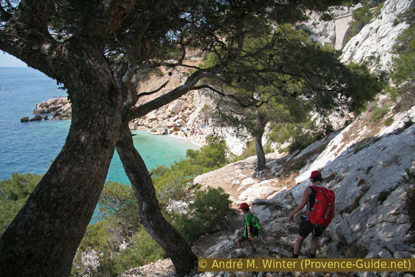
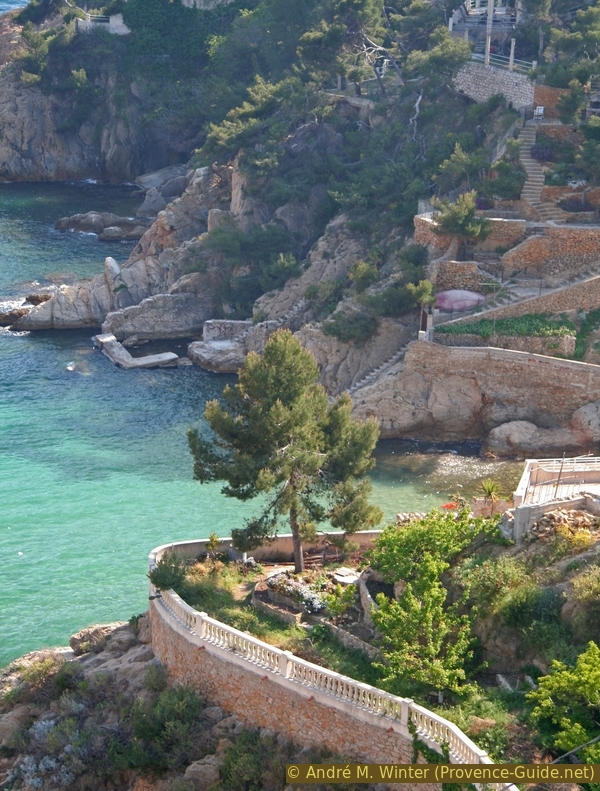
Calanque de l'Érevine is on our way
The sections
- Niolon - Méjean: the most impressive part.
- Méjean - La Redonne: inhabited bays.
No facilities outside of the larger bays.
Section 1: Niolon - Méjean
➙ 4,8 km ... 1 h 45 min ➚ 100 m ➘ 115 m ↝ easy
10% hard-surfaced quiet side streets, few marks
90% easy trails, few marks
The clues
- Start at the end of the Chemin des Poseurs, stay north of the railway line
- After the Calanque du Jonquier, switch to the sea side
- Pass the Le Moulon peninsula
- North of the railway again and the Calanque d'Éverine
- Along the coast at Cap Méjean
- Arrival at the small port of Méjean
The heart of the hike: only the sea, the path and the railway line.
vers = to
arrêt = station
fort = fortress
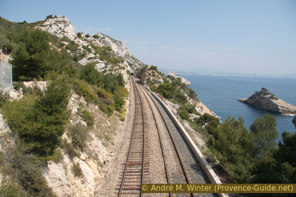
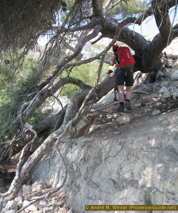
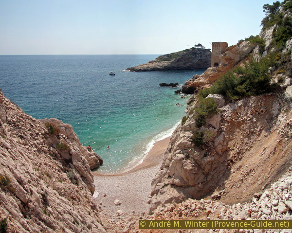
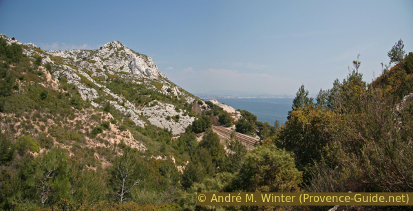
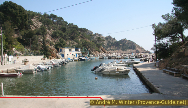
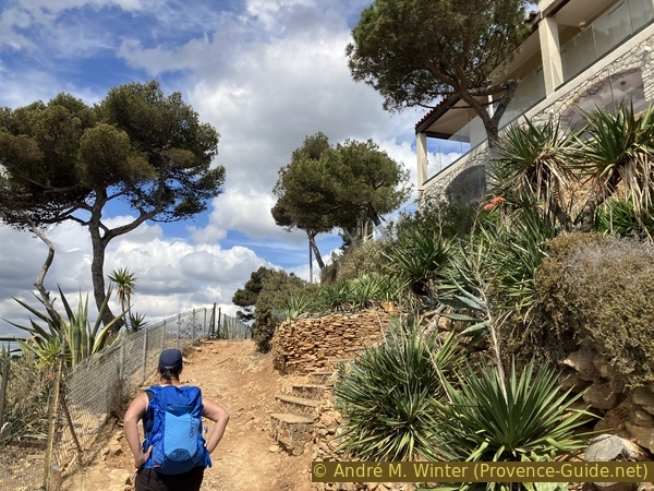
The Chemin des Poseurs only leads to a house and is only a parking lot for residents along the railway line. At its end, we follow the path which remains parallel to the rails. The Calanque du Jonquier is the first of a multitude of valleys descending from the ridge of the Massif de l'Estaque and forming small bays along the coast. We will bypass them all on the inside, however the railway will generally pass them over large and impressive viaducts. There will be several crossings of the railway, all of them are made by passages below or bridges over them, never enter the tracks, around fifty trains pass here every day!
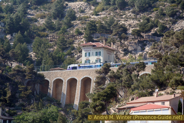
A train in Niolon on the Côte Bleue
The path Chemin des Poseurs is here to the right of the tracks.
The Calanque du Jonquier is also the first possibility to go down to the sea. You have to pass over scree, between the pillars of the viaduct, there is a small, very stony beach. Be careful though, not all the creeks are suitable for the descent, you should only go down if a path is clearly visible. If it's hot, a swim can be refreshing, but when swimming, don't go out too far out to sea, as boats can pass quite close.
Before the possibility of descending into the calanque, there is a fork. Our tour continues to the left. Those who have time can access from here, on the right, the Fort de Niolon, a military structure from the end of the 19th century and abandoned since the Second World War. You have to climb quite steeply 150 meters, from above you have an overview of this coast. Access by a walking and hiking trail (PR) marked in yellow and then climbing to Ensuès.
No reproduction is permitted without the written consent of the author. (id3313)
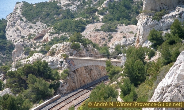
Railway viaduct in the Calanque du Jonquier
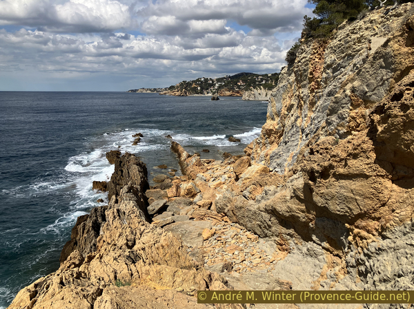
The path exits the bay again through an arch under the viaduct. You are thus between the railway line and the coast. The marking is poor to non-existent, but it's hard to get lost. One should never climb too far north and never descend to the sea as far as the Calanque de l'Érevine, because the coast here is much too steep. This is especially true for the gorge-like Calanque du Riflad. This is certainly the most beautiful and wildest section of this hike.
Wild also means that the trail is not always in the best condition. Trees may have fallen or stones may have slipped down and lie on the path. If such an obstacle occurs, you should scramble past it in such a way that you stay close to the original path, as there are hardly any viable alternatives to the original trail in the steep coastal sections.
No reproduction is permitted without the written consent of the author. (id3314)
Fallen tree on the way
We stay below the railway until the track disappears into a tunnel. As at the beginning of the hike, the slope is again very steep and the path turns right into a valley. Apparently the route has been changed several times, at least a small tunnel section is now much too high. Today, the path leads between the rock face and a rock pinnacle and into the valley filled with gravel. If you now look up, you can see Fort Niolon Haut. We come close to the railway line, which runs here in a closed gallery. Here you are above the Calanque du Riflad, a cove that is just a hostile indentation in this almost vertical stretch of coast, descending here is impossible. Attention on the steep embankment!
No reproduction is permitted without the written consent of the author. (id3316)
Way over the Calanque du Riflard
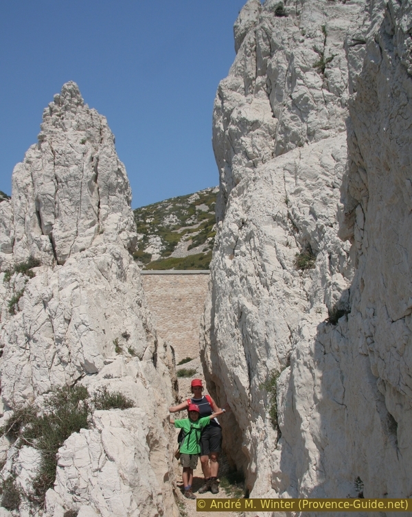
As we move forward, we see the oval rock of Moulon. It forms a peninsula after the Calanque du Riflard.
You have to climb to get there, the approach is best done from the east side.
Le Moulon is less nice from the other side.
No reproduction is permitted without the written consent of the author. (id3315)
Le Moulon, 48 m, seen from west
vers = to
pont = bridge
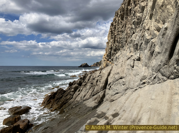
The path continues between the sea on the left and the sky on the right. The railway track has gone back into a tunnel. Be careful, the rocks are worn here by the passages of hikers and tourists in search of more original beaches.
No reproduction is permitted without the written consent of the author. (id3318)
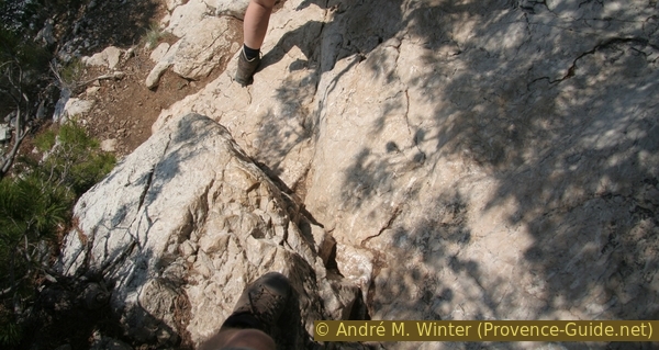
Smooth limestone on the coastal path
There remains a tower which must date from the construction of the railway, later we will pass in an area which was to serve as a stone quarry.
Sea access is after that nasty ravine only!
No reproduction is permitted without the written consent of the author. (id3320)
Calanque de l'Érevine
The Calanque de l'Érevine is a bit like the first larger bay of the hike (Calanque du Jonquier), a viaduct spans it. You can also descend here, the beach is even a bit wider and more open.
No reproduction is permitted without the written consent of the author. (id3321)
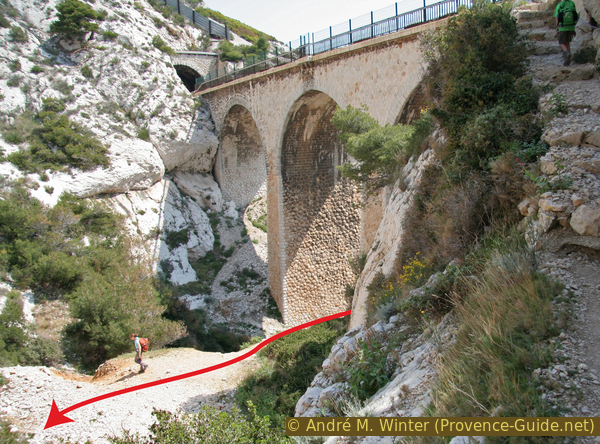
Baume de Lume railway viaduct at the Calanque de l'Érevine
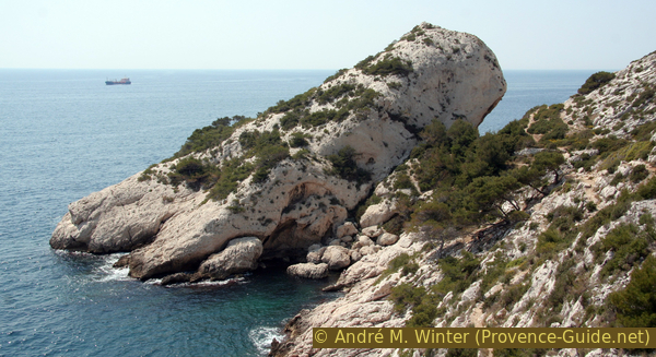
Opposite is the island of Île de l'Érevine, on which a beacon is installed. The island is less than 100 meters from the mainland, but its north coast is too steep for landing. It is best tackled from the east, but this makes the swim distance longer.
No reproduction is permitted without the written consent of the author. (id3324)
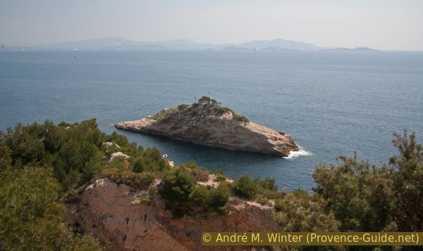
Île de l'Érevine island, 27 metres
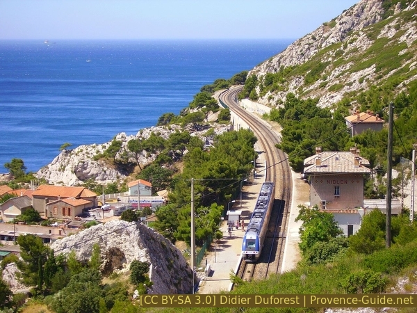
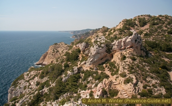
After the bay, the path goes north along the tracks again, comes through an unnatural-looking quarry field and also makes a hook further up north over a small ridge.
No reproduction is permitted without the written consent of the author. (id3322)
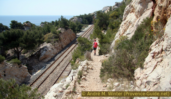
Path next to the Côte Bleue railway line between Miramas and Marseille
After the unexpectedly steep ascent, you stand on the ridge, looking back you can see Marseille.
No reproduction is permitted without the written consent of the author. (id3323)
La Cote Bleue
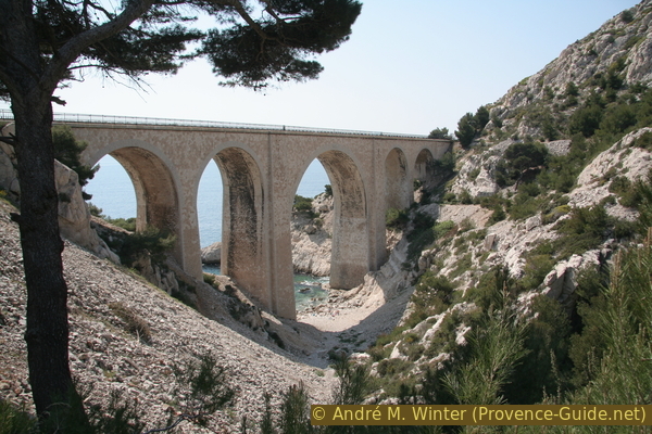
But the coastal footpath is not over yet: we descend again and cross the tracks on a footbridge.
No reproduction is permitted without the written consent of the author. (id3325)
Footbridge on the old path of the Côte Bleue customs officers
From now on, the railway line will remain further back in the country. We will only cross it once more at La Redonne to get to the train station. The condition of the path is getting better, but there are also more irregular steps up and down. So we hike over the still natural eastern flank of Cap Méjean.
No reproduction is permitted without the written consent of the author. (id3327)
Steps on the Côte Bleue coastal path
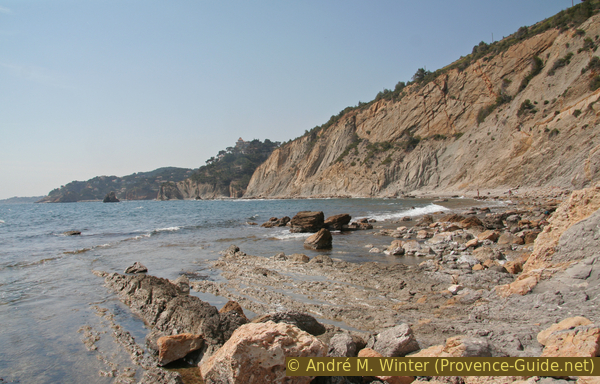
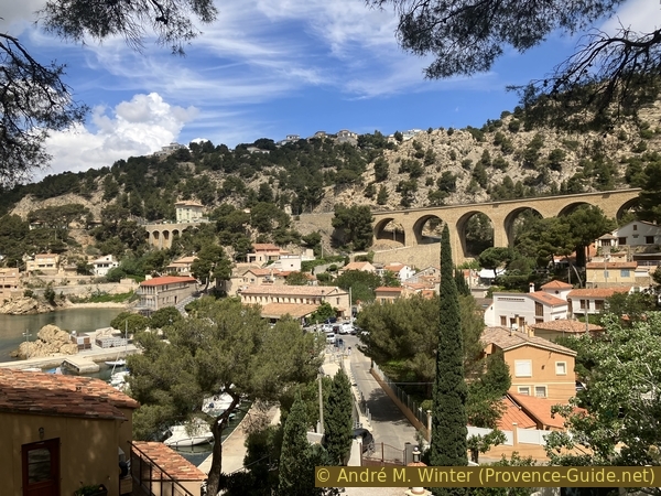
Another bay awaits us behind the cape. It is much larger than the previous ones, there is a port facility and a village with a small pub. We are back in civilization and it this will continue to accompany us in the second section.
Under pine trees we get directly to the port, which extends over two individual bays.
No reproduction is permitted without the written consent of the author. (id3328)
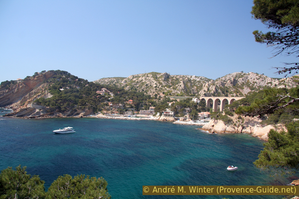
Port Mejean
Section 2: Méjean - la Redonne
➙ 2,8 km ... 1 h 15 min ➚ 120 m ➘ 100 m ↝ average
60% hard-surfaced city alleys, few marks
25% cross country
10% stairs, few marks
5% dirt roads, few marks
The clues
- Follow the streets Chemin du Tire-Cul and Chemin de Méjean, Chemin des Figuières and go down to the port
- Stay close to the water and take the path to the west of the Calanque des Figuières
- In the Calanque des Anthénors: walk right on the shore
- Staying close to the coast, up the stairs and down the Corniche des Anthénors to the port of La Redonne
Caution! On this section of the walk, parts or all of the coastal path may be closed or impassable. That depends on the condition of the path (or the theoretical possibility of rehabilitation), but also on wind and weather if the waves are too strong.
No reproduction is permitted without the written consent of the author. (id3329)
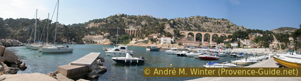
Port du Grand Mejean
Do not proceed on the quay, but up the road to the right.
The path runs along the edge of the rock step and alongside fences of private gardens.
One waterfront section is entirely with no apparent path or signage.
vers = to
chemin haut = upper path
Between the bay of Le Méjean and the calanque des Figuières, the rock is very loose and worn. Houses stand higher up right on the edge. There is no way down here, we have to accept a detour via the following village roads: on Chemin du Tire-Cul, we get from the bay of Le Grand Méjean to the bay of Le Petit Méjean. Here it is pointless to go to the water at the quay in front, there is no getting through. We ascend the Chemin de Méjean on the right, come across a flat saddle (the railway line is visible on the right) and descend via the Chemin des Figuières to the port of the village of the same name. The port area is private, but there is a passage for pedestrians next to the gate.
No reproduction is permitted without the written consent of the author. (id6956)
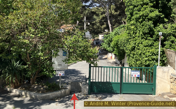
Gate with pedestrian passing at the end of the Allée des Figuières
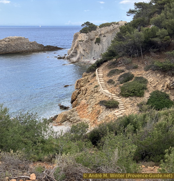
Proceed to the western cape (which faces east), go up the stairs and follow the narrow concrete path between fences.
The small map shows the start of a black hatched section that may be blocked. The full red path further north is the alternative to avoid everything.
No reproduction is permitted without the written consent of the author. (id3331)
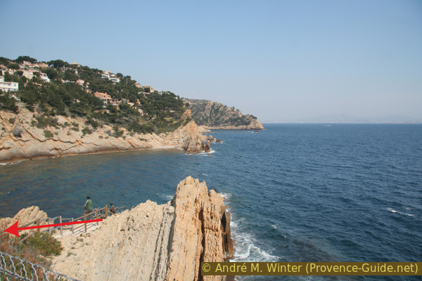
Headlands delimiting the Calanque des Figuières and the Calanques du Méjean
Look back. In the foreground the path to the Calanque des Anthénors.
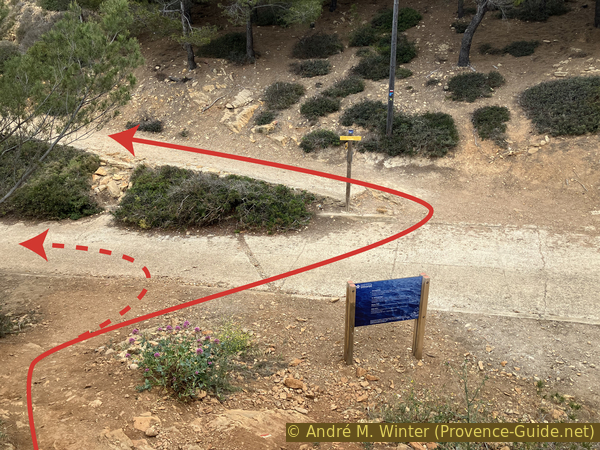
The path may be closed or impassable from the Calanque de Figuières on. If it is blocked by a posted municipal ordinance (Arrêté municipal), it is mainly because there is no path in the Bay of Anthénors. You can still go on, but the sea has to be calm, otherwise the breaking of waves is too strong and the risk of falling rocks is too great. The alternative is indicated in appendix and replaces the part between Calanque de Figuières and Calanque des Anthénors.
No reproduction is permitted without the written consent of the author. (id3330)
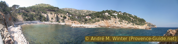
Port and Calanque des Figuières
View back.
vers = to
clôture = fence
privé = private
madrague = port
arrêt = station
After the path at the cape and past the fences, we come to a kind of valley next to a vertical block of rock. Everything leads down to the sea (photo).
No reproduction is permitted without the written consent of the author. (id6955)
Descent to the eastern Calanque des Anthénors
The path vanishes and we continue walking over rocks, always along the water. The scenery is desert-like and since access is difficult to forbidden, a nudist meeting place has emerged here.
No reproduction is permitted without the written consent of the author. (id3333)
Rocky coast of the Calanque des Anthénors
The rock wall is approaching alarmingly, you should not linger here, because stones can break out of the wall, especially after rain.
No reproduction is permitted without the written consent of the author. (id6954)
The narrow part of the Calanque des Anthénors
When you have passed the narrowest part, you arrive in the western part of the Calanque des Anthéors with rocks offshore. This is our next destination.
No reproduction is permitted without the written consent of the author. (id6950)
Stair from Anthénors beach to La Redonne
We climb from the small beach over steps and reach a narrow path between the abyss on the left and fences on the right. This path ends in the alley Corniche des Anthénors.
No reproduction is permitted without the written consent of the author. (id6953)
Chemin des Anthénors
This road leads us directly to the port of La Redonne. We see the city downhill, higher the railway with the small station.
No reproduction is permitted without the written consent of the author. (id6952)
The port of La Redonne seen from the Corniche des Anthénors
In La Redonne, you can take a short stroll along the harbour.
No reproduction is permitted without the written consent of the author. (id3334)
Port of La Redonne on the Blue Coast
La Redonne is a bit bigger than the other villages along our route: there is an inn (Auberge des Calanques) and it is a good place to quench your thirst while waiting for the train.
No reproduction is permitted without the written consent of the author. (id3338)
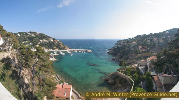
Calanque de la Redonne
You should save a some energy for the ascent to the train station, because it is far above the village. Aware hikers will already have recognized the typical historical building. The road up is clear: it is called Chemin de la Gare.
No reproduction is permitted without the written consent of the author. (id3335)
La Redonne-Ensuès railway station
Appendix: Port de Fuguières - Anthénors
➙ 0,7 km ... 20 min ➚ 60 m ➘ 50 m ↝ average
15% moderate trails, faulty marks
85% easy trails, with marks
The clues
- Port des Figuières, 0 m
- Under the hill named Anthénors, 50 m
- Calanque des Anthénors, 0 m
This path bypasses the very eroded part exposed to the sea between Port des Figuières and Calanque des Anthénors.
This route is indicated in burgundy red on the map above and is included in the downloadable GPX/KML files.
The alternative is to return to the port and go up the street to garbage cans on the left. Steps go up here, then the path goes to the left of a wall.
No reproduction is permitted without the written consent of the author. (id6949)
The uphill path from Figuières
We climb steeply towards a road leading to a property. Cross this road and continue climbing near the telephone pole.
The path continues to climb, but stabilizes quite quickly, it becomes much easier and there are beautiful views of the sea.
No reproduction is permitted without the written consent of the author. (id6948)
Crossing of the road in front of the gate of 100 Chemin du Méjean
The path leads down to the back of the Calanque des Anthéors. Cross the access road here and continue towards La Redonne or first descend to the small beach. A path with steps takes you to the last part of the path towards La Redonne.
No reproduction is permitted without the written consent of the author. (id6951)
Crossing the Chemin des Anthénors
Sources and additional information
It is better to use a good topographical hiking map, even if not all the paths are correctly marked on this sheet: the tour is on the IGN map "Étang-de-Berre, Istes, Marignane, Martigues", scale 1:25000, 3144OT.
If you don't want to bother with a paper map, you can also use mapping apps on your cell phone. On the one hand, it is the Cartes IGN app from the official map service. However, it requires access to the data network and this is sometimes difficult in canyons or remote locations.
Alternatively, you can use apps that store data directly on the device. They're generally not free, but they don't cost much. We mainly use OSMAnd, here it is possible to add contour lines, relief shading, markings and others. To store this data on your phone you need a lot of space.
Of course, one needs access to satellites for the GPS signal with any app. In some canyons this is not the case. Therefore, do not rely on the position shown, but read the map on your phone as you would read it on paper. Most apps are available for Android and iPhone. The applications usually allow us to record the route travelled and also view the GPS files offered for each of our hikes.
This page has been seen 3026 times since 20 March 2024.
No reproduction is permitted without the written consent of the author. (id3337)
Private gardens preventing a coastal footpath from being built here