Coastal path from Gigaro to Escalet
Gigaro, Plage du Brouis, Cap Lardier, Cap Taillat, Dolmen de la Briande, L'Escalet
hike
average
4 h
seasonal
no
no
mountain
Introduction
The Cap Lardier forms the southwestern half of the peninsula of Saint Tropez. In contrast to the northern part, the south is almost completely natural. A large part of the area between Gigaro and L'Escalet is a nature reserve, which also extends far into the hinterland. It is really an exceptional treasure that has been preserved in the heart of the Côte d'Azur. Away from the driveway and destination, the entire area can only be reached on foot. Due to the length of the route, you will be able to find peace and quiet in the middle of the hike even in high season.
The 10 kilometres one way will make it hard to go back in the same day. For this reason, the hike is described in both directions. This page explains the route from Gigaro to L'Escalet, from west to east. The way back is explained on this page: Coastal trail from L'Escalet to Gigaro.
At the end of July 2917 a big forest fire destroyed a large part of the nature reserve. The area touched by flames is shown on the map on this page. A large part of the coastline was spared, but between Cap Taillat and L'Escalet the burn marks will be visible for longer. More than 500 hectares burned between Gigaro and L'Escalet, Cap Taillat was completely reduced to ashes. Only the area around Cap Lardier was spared.
The facts
11,3 km total distance
4 h walk time
370 m total elevation
orientation easy
mark 90% of the total distance
75% easy trails
10% forest roads
10% on beach
5% hard-surfaced quiet side streets
<5% exposed trails
<5% moderate trails
dangers heat in summer, no drinking water on the way
children not too small, as it is a long walk
useful picnic stuff, swimwear
required trekking shoes, hiking gear and water
GPS coordinates (WGS84) of starting point 43.18377,6.600552
GPS coordinates (WGS84) of end point 43.18377,6.600552
downloads ![]()
![]()
Public transport
The starting point and destination are difficult to reach publicly.
Only in summer, between mid-June and mid-September, there is a beach bus from La Croix-Valmer to Gigaro. In the center, the stops Les Tennis and La Croix Constantin (under the lower roundabout) are relevant. At the finish in Gigaro you will find the Poste de Secours stop (when the quay continues behind a row of houses) and the one at the end of the street (before entering the residential area).
There is no regular bus service to Ramatuelle. In summer only, the beach bus (line 875) runs between St. Tropez bus station and Ramatuelle. Timetables for this line can be found at Zou! (only french). Our stop is called L'Escalet, but this is the saddle of the same name above the bay. You have to add 250 meters and 65 meters in altitude and you can cut off a hairpin bend on a path halfway up.
To complete the round with public transport, you still need the more frequent bus lines 873 or 878 between La Croix-Valmer and St. Tropez.
Access by car
Coming from the north and from Hyères via Cogolin, head towards Cavalaire and La Croix-Valmer. You will come to a first roundabout at the top of La Croix-Valmer, here turn right towards Cavalaire. At the next roundabout we turn off to Gigaro. This road leads us through vineyards and to a crossroads, turn left here and then continue towards Gigaro. When the road comes straight to the sea, it's time to look for a parking space.
Coming from Le Lavandou and Cavalaire you drive through Cavalaire and after the long plain you come to a roundabout where you can turn right to Gigaro.
Useful parking spaces
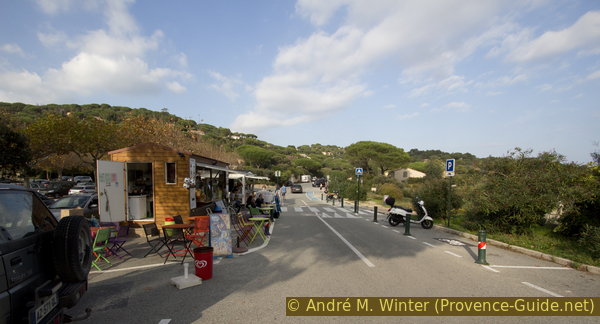
All car parks in Gigaro are chargeable from June to September. Parking is available on the road along the sea and there is a larger car park with height restrictions, access is on the left as the quay road continues past a row of houses.
If you only walk one direction of the path, it makes sense to place a second vehicle at the destination in L'Escalet. General access is described under Coastal trail from L'Escalet to Gigaro. To get from L'Escalet to Gigaro as quickly as possible, you drive up from the beach over the saddle back to the main road. Here left to La Croix Valmer and up in a pass. Behind it further curvy and under pine trees after ten minutes left to Gigaro. At the next crossroads turn left again and drive to Gigaro beach.
No reproduction is permitted without the written consent of the author. (id4990)
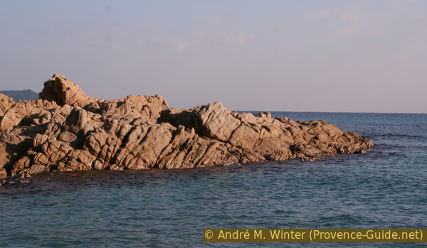
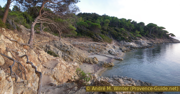
Rocks on the coast in the evening light
No reproduction is permitted without the written consent of the author. (id4991)
Cliffs east of Cap Lardier
Hints
As everywhere along the coast, there is much less activity in winter. But L'Escalet is well known and popular with the locals too. On fine winter days there are always people on the move up to Cap Taillat. Gigaro is generally less busy. In summer there are boats in most of the bays. But there is always enough space to dodge. Especially between Cap Taillat and L'Escalet there are numerous flat and easily accessible rocky outcrops.
In Gigaro, bars and restaurants are open during high season, but everything is closed in winter. In L'Escalet you will find a snack bar that is also opens in the off-season when the weather is nice. There is no drinking water or other supplies along the way. The sun and the wind can make you thirsty, it is essential to take enough water with you.
It is strongly advised not to go down to the sea between the Plage du Brouis beach and Cap Lardier. The rock is very fragile and the coast drops very steeply. There have been a number of deaths here.
Behind the Baie de la Briande there are a few scattered houses, in which there are also a few holiday apartments. Bastide Blanche and La Touraque are also good wine producers. We tried to make a circular route through this area, but the owners did everything they could to thwart this, even if you only stay on public forest roads. Signs are removed, markings alienated, fences hundreds of meters long stretch between two forest roads that are only a few meters apart. This is ridiculous and sad at the same time. We can only advise against looking for trails here and buying wine in La Touraque. There are several other good winemakers such as La Rouillère and Minuty.
The photos on this page are from different years and seasons.
The Cap Lardier, the Cap Taillat and a very wide area of forest behind form a nature reserve. Making a fire, smoking (!), camping and going off the marked paths is prohibited. Mountain biking is only permitted on forest roads. The front part of Cap Lardier is particularly well protected and completely inaccessible.
This tour leads through part of the area that fell victim to the forest fire of late July 2017. You can still walk through it, but it's even more important to only use the designated paths here to avoid further promoting erosion. This zone is marked on the map and in the GPS files. Images from this area also show the date they were taken.
The whole region is a zone with a high risk of forest fires. In summer, but also in other seasons when it is very dry or by strong winds, access to the forest areas can be regulated. As a result, the roads may be closed to traffic and/or the trails prohibited to hikers. Current information: Map of access to the forests of the Var (also english). The map shows the colours green, yellow, orange and red which correspond to levels of danger.
The sections
- Gigaro - Plage du Brouis - Cap Lardier: a south-west facing coast with beautiful and tall umbrella pine trees
- Cap Lardier - Plage de la Briande - Cap Taillat: the central area is away from fast approaches
- Cap Taillat - Dolmen de la Birande - L'Escalet: we stay closer to the water on this south-east facing coast
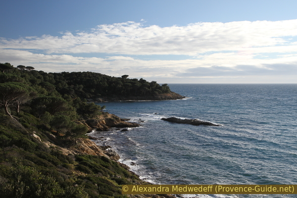
No reproduction is permitted without the written consent of the author. (id4992)
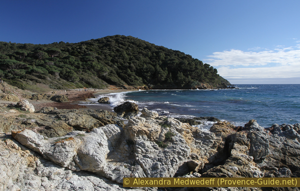
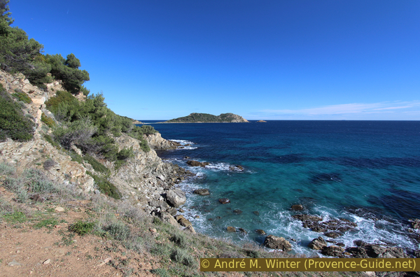
Cap Lardier seen from Gigaro
Evening photo.
Section 1: Gigaro - Plage du Brouis - Cap Lardier
➙ 4,1 km ... 1 h 30 min ➚ 75 m ➘ 145 m ↝ easy
5% hard-surfaced quiet side streets, without marks
<5% forest roads, few marks
5% on beach, without marks
35% easy trails, few marks
5% on beach, without marks
15% easy trails, few marks
<5% forest roads, with marks
30% easy trails, few marks
The clues
- Plage de Gigaro, 0 m
- Plage du Brouis, 0 m
- Under the coast guard tower ruins, 100 m
- Cap Lardier, 75 m
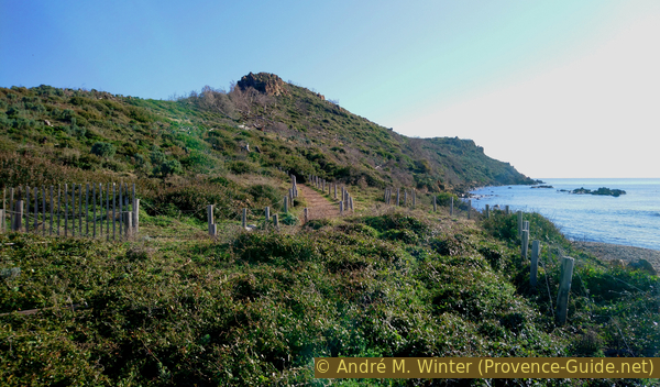
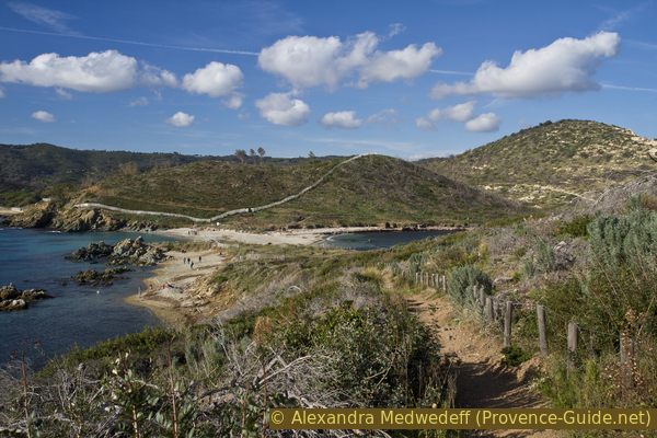
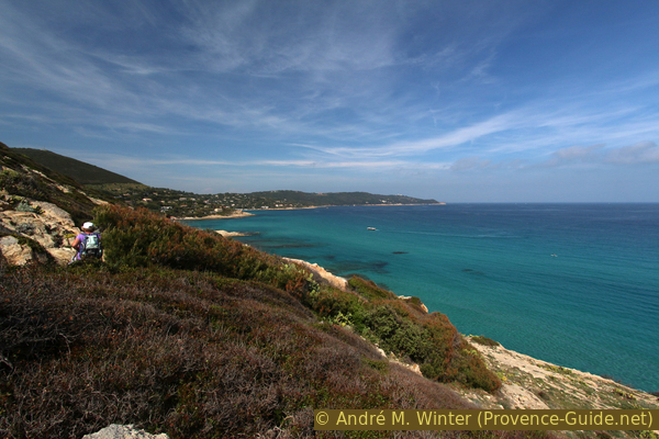
From Gigaro to the Plage du Brouis we walk along a typical coastal path. The large umbrella pines were not affected by the 2017 forest fire. Further on, the path climbs higher to avoid a cliff.
We're going south. There are two options here. Either directly at the beach to reach the coastal hiking trail at its southern end. Or at the end of the road, where it leads inland, you come straight after a barrier to the official start of the path. There are explanatory panels here, but also an original eucalyptus grove. These trees were planted here to drain the malaria-causing wetland.
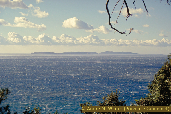
If you start early in the morning, the coast is initially in the shade. To the right you can see the bay of Cavalaire. The islands of Hyères also come into view further ahead.
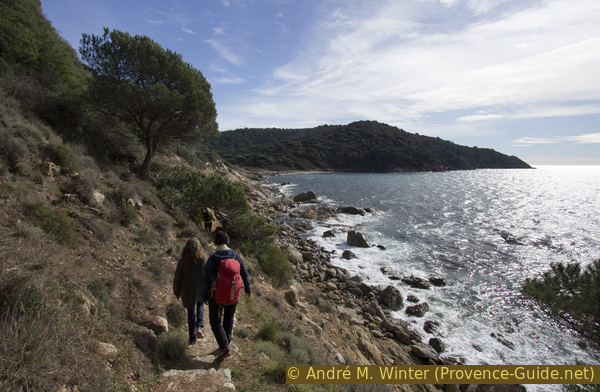
No reproduction is permitted without the written consent of the author. (id4993)
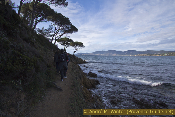
Long shadows on the coastal path in winter
The first bay worth mentioning is that of the fisherman's hut (Maison du Pêcheur). There hasn't been a house here for a long time and rarely does anyone fish here, but you can see the remains of a boathouse.
No reproduction is permitted without the written consent of the author. (id4994)
Crique de la Maison du Pecheur bay
As soon as the coast turns a little to the south, you can also go out in the sun earlier in the morning. The path stays higher above the water for longer because the direct coastal area is very irregular.
No reproduction is permitted without the written consent of the author. (id4995)
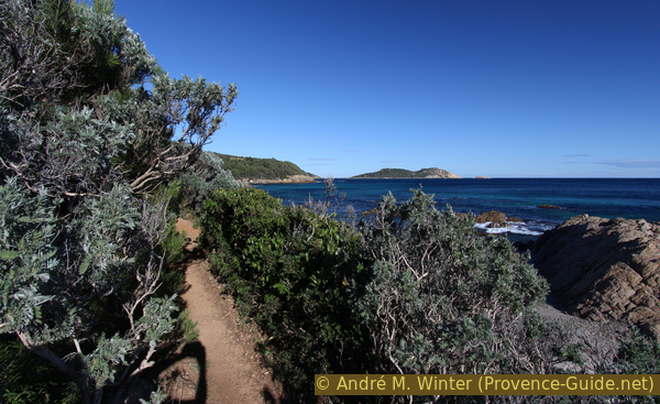
Coastal path to Plage du Brouis beach
The town of Cavalaire is getting smaller and smaller behind us.
No reproduction is permitted without the written consent of the author. (id4996)
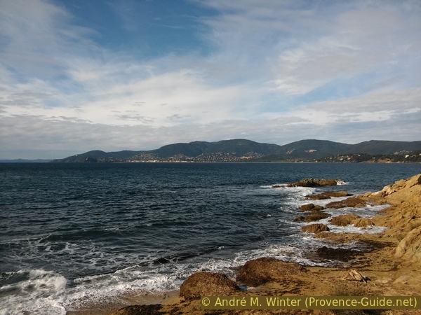
Looking back from Plage de Jovat beach
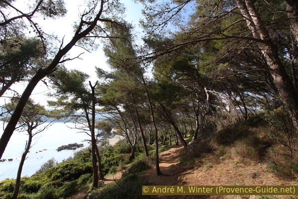
Later the slope becomes less steep and we come to an area with large umbrella pines that shine in the sun. In front of us is Cape Pointe du Brouis and behind it a beautiful beach awaits us.
No reproduction is permitted without the written consent of the author. (id4997)
On Pointe du Brouis cape
sémaphore = coast watchtower
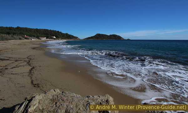
We go over the rocky cape on the well-laid path and come to the last beach before Cap Lardier: Plage du Brouis. In strong winds and in winter, the beach looks quite narrow.
No reproduction is permitted without the written consent of the author. (id4998)
The Plage du Brouis beach seen from the north
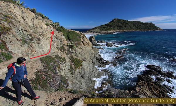
South of the beach you can see a wooded hill about 100 meters high. The coast below is very steep and brittle. Our path leads a little further along the water, but very soon and steeply we climb this hill. This is the only way to avoid the impassable coastal slope.
Towards the end of the ascent, the path turns into stairs made of railway sleepers. At the top we come to a forest road and keep to the right. Less than 40 meters ahead turn right again on a path to Cap Lardier.
We stay on the slightly hilly plateau and you rarely see the sea through the dense forest. In December 1999, storm Martin raged in Europe. Here it churns up the Bay of Cavalaire. Behind you can see the islands Île du Levant, Port-Cros and Bagaud.
No reproduction is permitted without the written consent of the author. (id4999)
Bay of Cavalaire during storm Martin at the end of 1999
The path leads almost straight to the south and we keep this direction. Sometimes it is wider, sometimes it leads through veritable tunnels of vegetation.
Further south our path widens and we come to a fortified platform. These are the remains of a command post from the early 19th century. This is also our vantage point of the front Cap Lardier.
No reproduction is permitted without the written consent of the author. (id5000)
View of Cap Lardier from the platform
Section 2: Cap Lardier - Plage de la Briande - Cap Taillat
➙ 3,4 km ... 1 h 10 min ➚ 140 m ➘ 130 m ↝ easy
65% easy trails, few marks
10% on beach, without marks
5% easy trails, with marks
5% on beach, without marks
20% easy trails, with marks
The clues
- Plattform Batterie du Cap Lardier, 75 m
- Plage de la Briande, 0 m
- Plage de Taillat, 0 m
- Hill Butte Hussenot on Cap Taillat, 65 m
We descend in direction of Cap Taillat, clearly visible on the left. We walk on mostly lonely paths to the first beach. Further ahead and in good weather you will usually find more people. The later course is also easier.
The front cape is subject to particularly strict protection, the coast here drops off vertically. So we follow the marked path that will progressively lead us back down to the water.
First it goes about 20 meters further south, but then to the left (east) and now the steeper descent begins. In front we see the Cap Taillat almost continuously.
No reproduction is permitted without the written consent of the author. (id5001)
Baie de la Briande and Cap Taillat
The path stabilizes at around 20 meters above sea level while continuing north. The condition of the coast here changes frequently. Even if it looks like you could walk directly onto the rocks by the water, this is hardly possible due to the brittleness and steepness. This leads to several unexpected counter increases.
The photo shows such a place where we have to go up to the left again.
No reproduction is permitted without the written consent of the author. (id5002)
Cap Taillat and another ascent of the path
Sometimes the way is very easy.
No reproduction is permitted without the written consent of the author. (id5003)
Coastal footpath between Cap Lardier and Plage de la Briande beach
After the last counter ascent, we walk directly along the coast again and so we soon come to the Plage de la Briande beach.
This sandy beach can only be reached on foot. Holiday homes are housed in the few houses behind it. However, most people on this beach come here along the hiking trail from l'Escalet. This brings us back to a somewhat busier area. The terrain also becomes easier in general.
No reproduction is permitted without the written consent of the author. (id5004)
Arrival at Plage de la Briande
With this beach we also come to the area that was affected by the forest fire in July 2017. The Cap Taillat was particularly destroyed. Those who knew it before will probably stand sadly before it. From now on we also show pictures from before and give the date of the recording.
To the east of the beach, a fence forces us to walk just above the water. After a last rocky area we come to the beach at the foot of Cap Taillat.
No reproduction is permitted without the written consent of the author. (id5005)
Path over rock between the beaches of La Briande and Cap Taillat
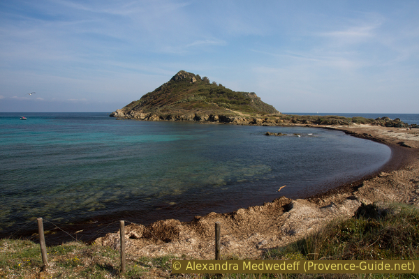
After the rocks we stay on the right beach area. Under the sand there are rocks that make Cap Taillat a real cape. It is therefore not an island that is connected to the mainland by a strip of sand (tombolo).
Since the forest fire in 2017, it is no longer possible to go up to Cap Taillat via several paths. A single path remains open to allow vegetation to recover. Access is on the south side of the beach. It leads first under the first rocky elevation and then to the highest point behind it (Butte Hussenot).
No reproduction is permitted without the written consent of the author. (id5006)
Up to Cap Taillat
Photo from late 2019.
The cape may appear green years after the fire. You have to know, however, that there used to be a whole pine forest on the south side!
No reproduction is permitted without the written consent of the author. (id5007)
Pine forest on the south slope of Cap Taillat
Photo from April 2017, three months before the July 2017 fire.
A lattice mast stood at the top of the cape until 2007. This landmark was erected in 1902 to record the speed of ships. Today only the base at the highest point remains.
The cape is also dotted with ruins of 18th-century command posts and sentry boxes. They were partially used by the German Nazis in 1944. Today only a small shelter near the summit is completely preserved.
No reproduction is permitted without the written consent of the author. (id5008)
Sentry box at the top of Cap Taillat
Photo from late 2019.
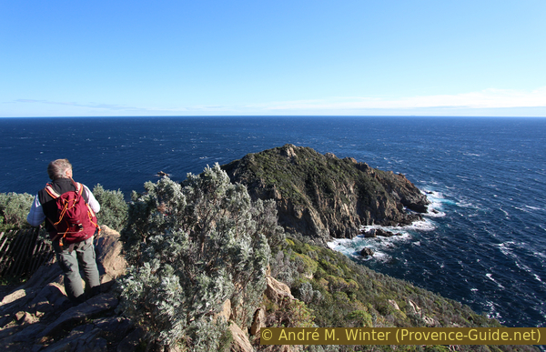
Of course, from the cape you have an ideal view over the south-eastern part of the peninsula of Saint Tropez. On the left is Cap Lardier and the bay of Baie de la Briande, on the right is Cap Camarat. The beach Plage de l'Escalet is still hidden in the back bay.
We have now come to the end of the second part of the tour. Even if it is often windy, you can take a good break here with a view.
No reproduction is permitted without the written consent of the author. (id5009)
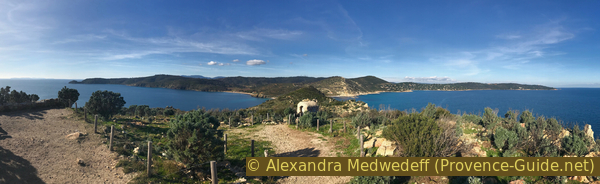
Panorama from Cap Taillat
Photo from late 2019.
Section 3: Cap Taillat - Dolmen de la Briande - l'Escalet
➙ 3,8 km ... 1 h 20 min ➚ 155 m ➘ 95 m ↝ easy
15% easy trails, with marks
5% on beach, without marks
5% easy trails, with marks
5% exposed trails, without marks
30% forest roads, few marks
20% easy trails, with marks
5% moderate trails, faulty marks
20% easy trails, with marks
The clues
- Summit Butte Hussenot du Cap Taillat, 63 m
- Plage de Taillat, 0 m
- Maison des Douanes, 10 m
- Dolmen de la Briande, 50 m
- Upper coastal path, 30 m
- Cape Pointe du Canadel, 10 m
- Parking de l'Escalet, 5 m
Even in winter, this coastal area is sunlit until the end of the day. We make a detour to a dolmen, then we proceed to L'Escalet. On this section there is an official path further above the water and a variant over the rocks in the coastal area. Both lead to the same goal, but there are only a few ways to switch from one to the other. The way described here is the upper one.
We go back to Taillat beach the same way.
No reproduction is permitted without the written consent of the author. (id5010)
View while descending from Cap Taillat
Photo from late 2019.
At the beach we turn north and take the upper path. Of course it makes sense to turn around to Cap Lardier more often in the future.
No reproduction is permitted without the written consent of the author. (id5011)
Cap Taillat in spring
Photo from April 2017.
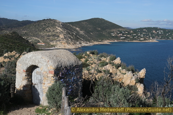
In front of us is a long and flat building. It was built under Napoleon to house border guards. The pergola is supported by massive columns and gives the building a noble appearance. The building was completely renovated in 2011 and was spared the forest fire of 2017. It now serves as a warehouse for the administration of the nature reserve.
No reproduction is permitted without the written consent of the author. (id5012)
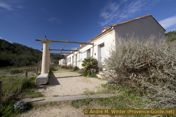
The pergola in front of the border guard's house
Photo from February 2016.
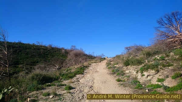
Behind the border guard house, a bumpy forest road leads up into a valley. We go up here and turn away from the sea.
Here we also see the sad state of the landscape after the forest fire of 2017. The large pines are dead and fallen over, bushes are charred down to the root area. At the end of 2019, more than two years after the disaster, only a few grasses and cacti are greening the slopes.
No reproduction is permitted without the written consent of the author. (id5013)
Ascent to the Dolmen de la Briande
Photo from December 2019.
We climb into a saddle at around 50 meters above sea level and a little further behind a short path leads to two vertically erected stone slabs.
This is the Dolmen de la Briande. Admittedly, it's not very impressive, but that's not due to the lack of care of Stone Age people. The mica slate of the coast does not allow large and stable rock slabs to be lifted out of the ground. The builders of the Dolmen de Gaoutabry in the Massif des Maures had similar problems.
No reproduction is permitted without the written consent of the author. (id5014)
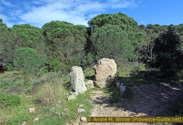
Dolmen de la Briande
Photo from February 2016.
Arrowheads, quartz pendants and serpentine beads have been found during excavations. No capstone could be detected. Only the main chamber survives today.
From the dolmen we can also see the plain of La Touraque and La Bastide Blanche. You can see pines here that survived the forest fire. This is mainly due to the large vineyards, which form a fire-retarding aisle here.
No reproduction is permitted without the written consent of the author. (id5015)
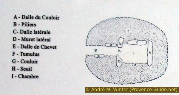
Diagram of the Dolmen de la Briande
We return to the coast by the same route. The photo shows the green pine trees before the 2017 fire, the difference is striking.
No reproduction is permitted without the written consent of the author. (id5016)
Path from the dolmen down to the house Maison des Douanes
Photo from February 2016.
Still above the border guard house, we turn left at the only permitted path. The photo shows the situation in retrospect.
No reproduction is permitted without the written consent of the author. (id5017)
Crossroads in the valley to the dolmen
View back. Photo from late 2019.
This path leads over a ridge and there to the left. Here is an ideal vantage point of Cap Taillat.
No reproduction is permitted without the written consent of the author. (id5018)
The authors of this hiking guide in front of Cap Taillat
Photo from April 2017.
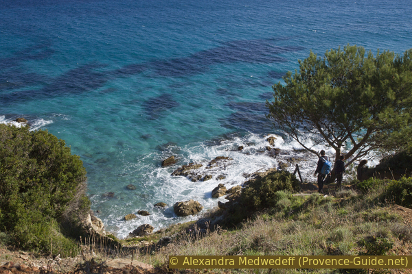
In a few places there are connecting paths down to the coast. Please stay on the paths and never trample on the vegetation.
No reproduction is permitted without the written consent of the author. (id5019)
Rest on the rocks
However, the main path continues at the top. We can already see the villas of L'Escalet, the Cap Camarat is on the right.
No reproduction is permitted without the written consent of the author. (id5020)
Cap du Canadel and Cap Camarat
Photo from April 2017.
The path leads through the sad remains of the forest fire of summer 2017.
No reproduction is permitted without the written consent of the author. (id5021)
Hiking trail between burnt bushes
Photo from December 2019.
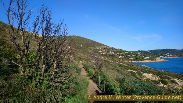
Until 2017, the path will pass through veritable tunnels of plants on the route from Cap Taillat to L'Escalet. Such plant tunnels are now only preserved directly under the houses of L'Escalet.
No reproduction is permitted without the written consent of the author. (id5022)
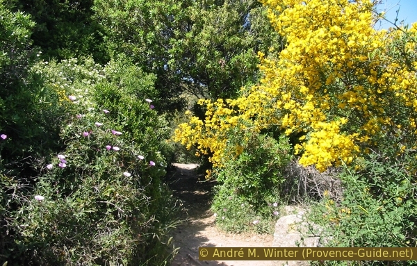
Flowering prickly gorse on the path south of L'Escalet
Photo from spring 2003.
Shortly before the settlement there is a tricky area where part of the path has slipped. In front of the wooden walkways you have to descend on the rocks just above the sea. A brook also crosses here and the algae that form are quite slippery in the off-season.
No reproduction is permitted without the written consent of the author. (id5023)
The two footbridges under the L'Escalet houses
Photo from late 2019.
After the two footbridges, stairs follow and the path climbs under low trees. There is a crossroads here. On the left it goes up to the street on which you quickly come to the parking lot.
The alternative, which we also choose, leads under the villas along the sea.
No reproduction is permitted without the written consent of the author. (id5024)
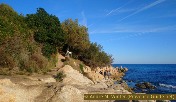
Stair under the L'Escalet estate
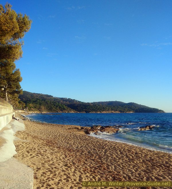
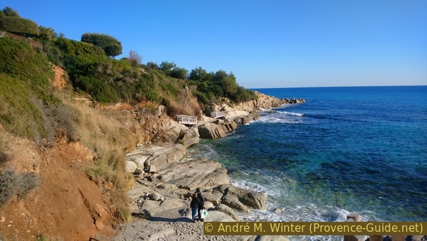
Shortly before the finish we can enjoy this view of the beach Plage de l'Escalet.
No reproduction is permitted without the written consent of the author. (id5025)
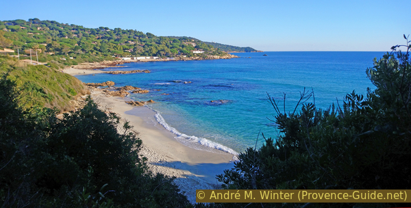
Arrival at Plage de l'Escalet beach
There is a snack bar at the parking lot, which is open in summer and otherwise on nice weekends.
No reproduction is permitted without the written consent of the author. (id5026)
Refreshment stand at the car park in L'Escalet
If you need the bus, you have to go up the street to the right of the parking lot. After the last house on the left you can cut off a bend on a path.
No reproduction is permitted without the written consent of the author. (id5027)
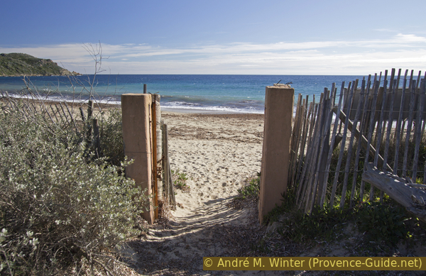
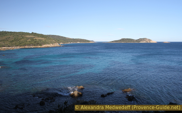
View through a gate onto the Plage de la Briande beach
Sources and additional information
It is better to use a good topographical hiking map: This tour is on the IGN map "Saint-Tropez, Sainte-Maxime, Massif des Maures", scale 1:25000, 3545OT.
If you don't want to bother with a paper map, you can also use mapping apps on your cell phone. On the one hand, it is the Cartes IGN app from the official map service. However, it requires access to the data network and this is sometimes difficult in canyons or remote locations.
Alternatively, you can use apps that store data directly on the device. They're generally not free, but they don't cost much. We mainly use OSMAnd, here it is possible to add contour lines, relief shading, markings and others. To store this data on your phone you need a lot of space.
Of course, one needs access to satellites for the GPS signal with any app. In some canyons this is not the case. Therefore, do not rely on the position shown, but read the map on your phone as you would read it on paper. Most apps are available for Android and iPhone. The applications usually allow us to record the route travelled and also view the GPS files offered for each of our hikes.
This page has been seen 3454 times since 20 March 2024.
No reproduction is permitted without the written consent of the author. (id5077)
Yellow ice plant blossom