Dolmen de Gaoutabry
Rare Stone Age tomb on a hill in the Massif des Maures
walk
easy
1 h 45 min
no
yes
no
walk
Introduction
Stone Age testimonies, especially burial sites, are quite common in Provence, but they all have their own regional characteristics. The Gaoutabry dolmen is unique in several ways: it is in a conspicuous place, it is relatively large and probably never had cover plates. Despite the low height of the hill, you have a comprehensive all-round view. We move mostly on forest roads, so this is the ideal family tour or with friends if you can chat comfortably.
The facts
7,1 km total distance
1 h 45 min walk time
190 m total elevation
orientation easy
mark 80% of the total distance
80% forest roads
10% easy trails
5% hard-surfaced quiet side streets
5% dirt roads
dangers heat in summer
children yes, despite long forest roads
useful picnic stuff
required trekking shoes, hiking gear and water
GPS coordinates (WGS84) of start and end point 43.159469,6.220275
downloads ![]()
![]()
Public transport
There is no way to get close to the starting point by public transport. The annex describes a walk from the center of La Londe-les-Maures where busses stop.
Access by car
Whether coming from Le Lavandou or Hyères, in both cases you have to drive into the center of La Londe and head north on the D88 (signposted Vallon des Borels and Notre Dame des Maures). This road takes us straight out of town to the destination and first under the express-way. It continues between vineyards and sparse forest. After a slight left turn and a subsequent right turn, we immediately see two gravel roads branching off to the right. The signs say Ginouviers and Dolmen de Gaoutabry.
Useful parking spaces
Directly at the starting point you can park a few cars on both sides of the street. It is important not to park the passage for agricultural machinery.
No reproduction is permitted without the written consent of the author. (id4212)
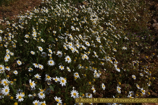
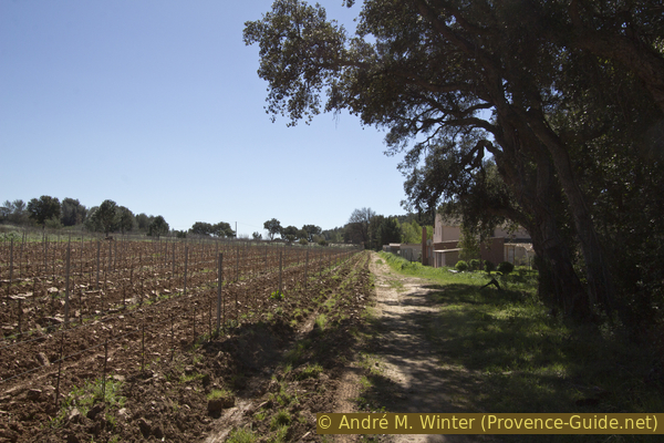
Spring flowers between the vines
No reproduction is permitted without the written consent of the author. (id4210)
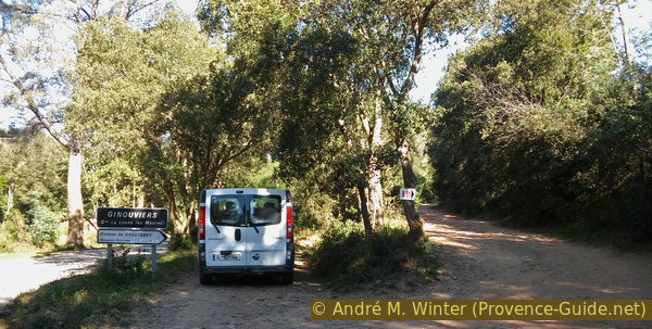
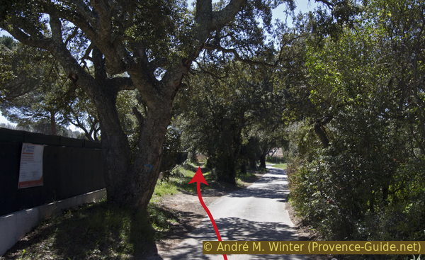
The starting point
You go up the forest road on the right. There are additional parking spaces to the left of the road.
Hints
This is a family tour, the majority of the ascent and descent runs on wide forest roads, it is nowhere really steep. The hike is suitable for groups, you can also walk next to each other in groups.
The name of the dolmen comes from Provençal, "gaouto" means "cheek" and the term reminds us that the summit is flat. In some maps the name is also spelled "Gautabry" or "Gauttobry".
The whole region is a zone with a high risk of forest fires. In summer, but also in other seasons when it is very dry or by strong winds, access to the forest areas can be regulated. As a result, the roads may be closed to traffic and/or the trails prohibited to hikers. Current information: Map of access to the forests of the Var (also english). The map shows the colours green, yellow, orange and red which correspond to levels of danger.
The sections
- Ginouviers D88 - Dolmen de Gaoutabry: Direkter access to the dolmen
- Dolmen de Gaoutabry - la Cabre - Notre Dame des Maures: Return via a forest road around the valley with view of the sea.
Section 1: Ginouviers - Dolmen de Gaoutabry
➙ 2,3 km ... 45 min ➚ 160 m ➘ 0 m ↝ easy
95% forest roads, with marks
5% easy trails, few marks
The clues
- D88 at Ginouviers south of village of Notre Dame des Maures, 40 m
- Saddle between Signal de Favanquet and Dolmen de Gaoutabry, 178 m
- Dolmen de Gaoutabry, 198 m
Straight up on a wide forest road.
At the starting point there is a map showing this round, among others. However, only on the ascent there are markers in the form of a dolmen. The signposts at some intersections only indicate tour numbers and are therefore not really helpful. But the terrain is easy and always visible, it's hard to get lost if you follow the instructions below.
We go up the wide field path, which later becomes a forest road. The street is called Piste de Notre Dame des Maures. After the first vineyard, the road turns east-north-east and goes slightly uphill. Little by little a mountain with a rocky crest appears in front of us, this is Le Signal du Favanquet. We approach its slopes, but then turn left, avoiding the rise. The forest road is now steeper.
No reproduction is permitted without the written consent of the author. (id4211)
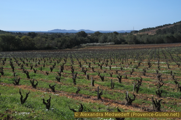
Vines and the island of Porquerolles
At the next crossing (marked 140 on the small map) we keep to the right and shortly thereafter we come to the wide saddle at 178 meters above sea level, to some signposts and a water tank. Le Signal du Favanquet mountain is now to the south and on the hill to the north is the Dolmen de Gaoutabry at the highest point. A path leads straight up.
The area around the dolmen is surrounded by a wooden fence to protect the prehistoric burial ground from wild boar rummaging around. We go in through the gate in the south and make sure to always lock the gate well!
No reproduction is permitted without the written consent of the author. (id4213)
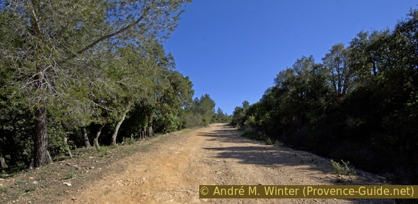
Piste de Notre Dame des Maures forest road
The ascent is a bit monotonous at times, but you can look at it as a sport.
The peculiarity of the dolmen can be found in its size, location and orientation. Unlike all other dolmens in the Var, this one has an antechamber and a long, rectangular main chamber like some in the Vaucluse further west. Most dolmens in the Var have only a small main chamber. Its location at the top of the hill places it high above others. It is oriented to the south-west and the winter solstice.
No traces of covering stone slabs have been found and probably never were. This is mainly due to the mica stone, which is not suitable for load-bearing slabs of this size. There was probably a wooden roof, and there may have been wooden beams in the gaps between the vertical panels. Like most tombs of this type, this dolmen was covered with stones and earth. However, the natural effects of the weather have worn away all this loose material and so the dolmen was discovered in 1876. Serious excavations began in 1976 and found the remains of at least 34 people who must have been cremated before burial. Unfortunately, due to the high acidity of the soil, not much else was preserved.
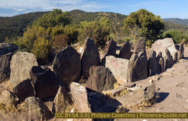
Dolmen de Gaoutraby
In the area of the dolmen there are panels with explanations and a box in which folders with further explanations can be found. Sandboxes with flat stones allow you to build small dolmens yourself.
No reproduction is permitted without the written consent of the author. (id4214)
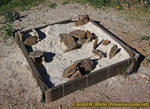
Sandbox with flat stones for replicating dolmens
The dolmen is also located on a hill with a good all-round view, on the horizon you can see: to the north the transmission masts at the church of Notre Dame des Anges (highest point of the Massif des Maures), to the east this same massif extends. To the south-east you can see Fort de Brégançon with the islands of Levant and Port-Cros beyond. To the west, the limestone mountain Coudon stands out.
No reproduction is permitted without the written consent of the author. (id4215)
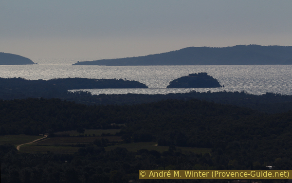
Brégançon and Port-Cros island behind
Section 2: Gaoutabry - Cabre - ND des Maures village
➙ 4,8 km ... 55 min ➚ 30 m ➘ 190 m ↝ average
10% easy trails, without marks
70% forest roads, faulty marks
10% hard-surfaced quiet side streets, without marks
10% dirt roads, without marks
5% forest roads, with marks
The clues
- Dolmen de Gaoutabry, 198 m
- Saddle west of La Cabre, 208 m
- Village Notre Dame des Maures, 45 m
- D88 south of hamlet Notre Dame des Maures, 40 m
We return to the starting point via a large loop in the north.
We leave the dolmen fence at the other gate (north). So we come to an old path, turn right here and go further north. To the west of a hardly noticeable saddle we come to a forest road and here we turn left. It is flat at first, but later rises a little.
No reproduction is permitted without the written consent of the author. (id4218)
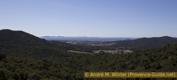
View of Porquerolles and the Giens peninsula
If you come here in winter, the wind can blow nasty from the north. The following place behind the ridge is a good place to take a break: back to the saddle with the water tank and continue down the road to the first bend. Here starts a narrow path heading north and the area is often sheltered from the wind. You don't have to go back into the saddle to continue walking, you continue along the path and come to a forest road, here to the right and up to a saddle with a water basin on the left. Here we turn left, it goes flat at first, later you gain some height.
No reproduction is permitted without the written consent of the author. (id4216)
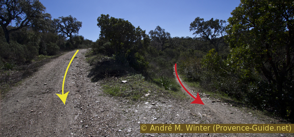
The path reaches the forest road under La Cabre
Looking back: we come from the small path (red arrow). On the alternative you come via the forest road on the left (yellow arrow.
This forest road takes us north of the hill with the dolmen, then we make a loop to the north, always on the slope under the wooded ridge. From the free spots you can see the Bay of Hyères.
No reproduction is permitted without the written consent of the author. (id4217)
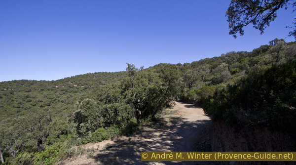
Forest road under La Cabre
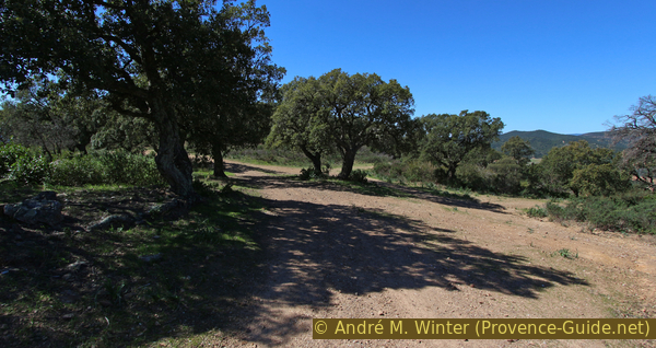
So we get on the forest road in another saddle with a crossroads of roads and paths, there is also a water basin here. We keep left here and stay on the wide forest road without deviating from it. Now the descent begins.
At the next crossing turn left again. After about 100 meters the road runs behind a hill with a small crest. To the north of this, the forest road makes a sharp turn to the left to rejoin the general south-west direction.
No reproduction is permitted without the written consent of the author. (id4219)
Junction at 208 metres above sea level east of point 226
Below we come back to the plain and now march between vineyards. In front of a group of trees, the road turns right and then with a few curves into the small hamlet of Notre Dame des Maures. In front of the village you cross a river bed and climb up a concrete ramp. In the center we turn right and immediately left again to leave the group of houses behind us in a southerly direction.
No reproduction is permitted without the written consent of the author. (id4220)
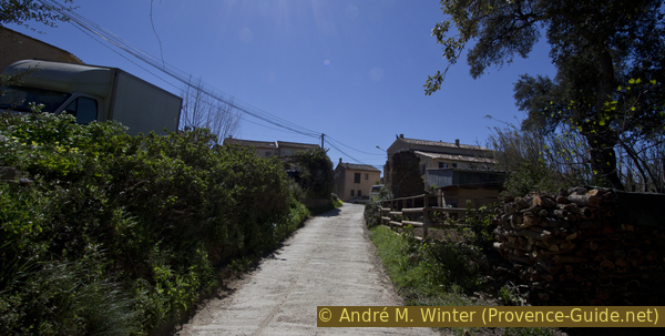
North access to the hamlet of Notre Dame des Maures
The road is dead straight. As soon as it turns slightly to the right, we look for a path to the left along the fence.
No reproduction is permitted without the written consent of the author. (id4221)
Way left of the road and south of Notre Dame des Maures
If we continue here, the fence changes to the other side and we have vines on the left again. So we get to the dirt road that we went up at the beginning of the tour. Turn right here and in a few minutes you will be back at the starting point.
No reproduction is permitted without the written consent of the author. (id4222)
Way south of Notre Dame des Maures
Appendix: La Londe - Dolmen de Gaoutabry
➙ 5,5 km ... 5 h 30 min ➚ 220 m ➘ 220 m ↝ average
30% hard-surfaced city alleys, without marks
10% dirt roads, without marks
5% moderate trails, without marks
50% forest roads, without marks
5% easy trails, without marks
The clues
- La Londe centre, 20 m
- Dolmen de Gaoutabry, 198 m
But you can also reach the destination from the center of La Londe. Buses run by Zou! (only french) (7801, 7082 or 7803) pass there. From the station, go north and at the level of the church, go east on Rue de la Paix (to Cimetière and Tennis). Proceed to the fields and turn left in rue des Nertas, passing two halls on the right. When we are in line at the express-way, we turn right and soon after turn left over a bridge north.
Straight ahead here between fields to the north. In front of us we see two hills, we have to climb up between them. When the dirt road branches off to the right, you go straight past a fountain. When the slope rises in front of us, we bypass it to the left. We continue north, next to a vineyard on the left and the foot of the slope on the right. When we are stopped, we go up to the right, but soon left sharply to come in north direction again. We reach a ridge pointing north-east, on which we continue on a forest road. Take left after a hill. You are therefore south of Le Signal du Favanquet mountain, which differs from the others for its rocky crest. Keep right at the water basin and so around the mountain. In the saddle on the other side we are already in front of the hill with the Dolmen de Gaoutabry (signpost).
Back the same way. Altogether about 11km and about 200 meters in altitude.
Sources and additional information
This walk is inspired by this good book: Le Rando Malin, le Var, du littoral au Verdon (Clever hiking, Var, between the coast and Verdon, only french), Mémoires Millénaires Éditions (Wise Wander, Var, from the coast to the Verdon, french only), ISBN 978-295266479-0. This book offers many hikes where history and nature are in the foreground. However, the maps in it are rather poor. The tour here shows a different descent route than that in the book and other vantage points are pointed out.
It is better to use a good topographical hiking map: This tour is on the IGN "Hyères, Île de Porquerolles" map, scale 1:25000, 3446OT.
If you don't want to bother with a paper map, you can also use mapping apps on your cell phone. On the one hand, it is the Cartes IGN app from the official map service. However, it requires access to the data network and this is sometimes difficult in canyons or remote locations.
Alternatively, you can use apps that store data directly on the device. They're generally not free, but they don't cost much. We mainly use OSMAnd, here it is possible to add contour lines, relief shading, markings and others. To store this data on your phone you need a lot of space.
Of course, one needs access to satellites for the GPS signal with any app. In some canyons this is not the case. Therefore, do not rely on the position shown, but read the map on your phone as you would read it on paper. Most apps are available for Android and iPhone. The applications usually allow us to record the route travelled and also view the GPS files offered for each of our hikes.
This page has been seen 1992 times since 20 March 2024.