Coastal path from L'Escalet to Gigaro
L'Escalet, Dolmen de la Briande, Cap Taillat, Cap Lardier, Plage du Brouis, Gigaro
hike
average
4 h
seasonal
no
no
mountain
Introduction
The Cap Lardier forms the southwestern half of the peninsula of Saint Tropez. In contrast to the northern part, the south is almost completely natural. A large part of the area between L'Escalet and Gigaro is a nature reserve, which also extends far into the hinterland. It is really an exceptional treasure that has been preserved in the heart of the Côte d'Azur. Away from the driveway and destination, the entire area can only be reached on foot. Due to the length of the route, you will be able to find peace and quiet in the middle of the hike even in high season.
The 10 kilometers one way will make it hard to go back in the same day. For this reason, the hike is described in both directions. This page explains the route from L'Escalet to Gigaro, from east to west. The way back is explained on this page: Coastal trail from Gigaro to L'Escalet.
At the end of July 2017 a large forest fire destroyed a large part of the nature reserve. The area touched by flames is shown on the map on this page. A large part of the coastline was spared, but between L'Escalet and Cap Taillat the burn marks will be visible for longer. More than 500 hectares burned between Gigaro and L'Escalet, Cap Taillat was completely reduced to ashes. Only the wider area around Cap Lardier was spared.
The facts
11,5 km total distance
4 h walk time
400 m total elevation
orientation easy
mark 80% of the total distance
70% easy trails
10% forest roads
10% exposed trails
10% on beach
5% hard-surfaced quiet side streets
<5% moderate trails
dangers average
children average
useful picnic stuff, swimwear
required average
GPS coordinates (WGS84) of starting point 43.187013,6.642009
GPS coordinates (WGS84) of end point 43.18377,6.600552
downloads ![]()
![]()
Public transport
The starting point and destination are difficult to reach publicly.
There is no regular bus service to Ramatuelle. In summer only, the beach bus (line 875) runs between St. Tropez bus station and Ramatuelle. Timetables for this line can be found at Zou! (only french). Our stop is called L'Escalet, but this is the saddle of the same name above the bay. You have to add 250 meters and 65 meters in altitude and you can cut off a hairpin bend on a path halfway up.
Only in summer, between mid-June and mid-September, there is a beach bus from La Croix-Valmer to Gigaro. In the centre, the stops Les Tennis and La Croix Constantin (under the lower roundabout) are relevant. At the finish in Gigaro you will find the Poste de Secours stop (when the quay continues behind a row of houses) and the one at the end of the street (before entering the residential area).
To complete the round with public transport, you still need the more frequent bus lines 873 or 878 between La Croix-Valmer and St. Tropez.
Access by car
The Plage de l'Escalet beach is located in the south of the Saint Tropez peninsula. The fastest access, also from Hyères via Cogolin, is via the large roundabout in La Foux. This is the major crossroads on the roads between St. Tropez and Cogolin and between Sainte-Maxime and Cavalaire. From there we first drive in the direction of St. Tropez. At the second bulky roundabout (in the middle there is a garden centre) we turn off towards Ramatuelle. We drive first between vineyards. At the first roundabout under the village of Ramatuelle, we turn left towards Les Plages. After the steep descent and a long left turn we can take the one-way right to L'Escalet, it is a legal shortcut. Turn right at the stop sign and left at the next crossing to L'Escalet. It goes into a saddle in front and behind it steeply down to the beach. The parking lot is at the bottom right.
Coming from Le Lavandou and Cavalaire you drive through Cavalaire and after the long plain you come to a roundabout where you can turn right to Gigaro. Go uphill and at the next roundabout turn left towards Ramatuelle. Further up, turn right again and continue to Ramatuelle. This road is narrow and very winding, but also nice to drive on with the many pine trees. We come in a saddle and behind it the curves continue. When we come to a plain, at the first crossroads we turn right towards L'Escalet. After another saddle it goes steeply down to the beach. The parking lot is at the bottom right.
Useful parking spaces
Driving down into L'Escalet bay, the car park is immediately on the right. It has a height limit and is subject to a fee in summer. Along the road by the sea there are other marked parking spaces on both sides, these are free of charge all year round. In summer and every other weekend with nice weather, parking spaces can get tight here. However, hikers who come early shouldn't have any problems with it.
If you only want to go one way, it makes sense to place a vehicle at the destination in Gigaro. The way to get there is basically described under Coastal trail from Gigaro to L'Escalet. To get to L'Escalet from Gigaro as quickly as possible, go back towards La Croix Valmer, but then turn right twice towards Ramatuelle. The now winding road leads up to a saddle under pine trees. Behind it is just as winding downhill. When we come to a plain, turn right towards L'Escalet. The now smaller road leads in a saddle and behind it it goes down steeply into the bay Baie de l'Escalet.
No reproduction is permitted without the written consent of the author. (id5030)
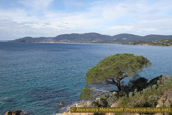
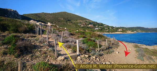
Cavalaire bay seen from Gigaro
No reproduction is permitted without the written consent of the author. (id5076)
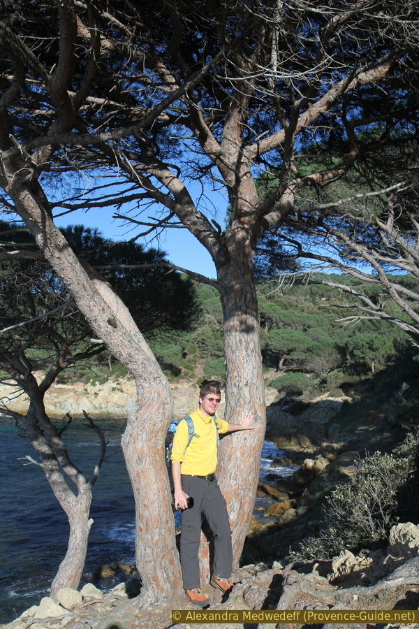
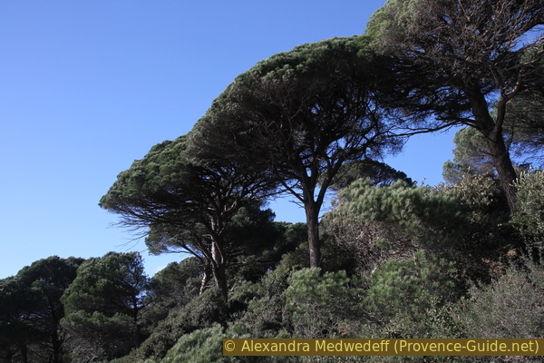
Path under the umbrella pines south of Gigaro
Hints
As everywhere along the coast, there is much less activity here in winter. But L'Escalet is well known and popular with the locals too. On fine winter days there are always people on the move up to Cap Taillat. Gigaro is generally less busy. In summer there are boats in most of the bays. But there is always enough space to dodge. Especially between L'Escalet and Cap Taillat there are numerous flat and easily accessible rocky outcrops.
In L'Escalet you will find a snack bar that is also open in the off-season when the weather is nice. In Gigaro, bars and restaurants are open during high season, but everything is closed in winter. There is no drinking water or other supplies along the way. The sun and the wind can make you thirsty, it is essential to take enough water with you.
It is strongly advised against going down to the sea between Cap Taillat and the Plage du Brouis beach. The rock is very fragile and the coast drops very steeply. There have been a number of deaths here.
Behind the Baie de la Briande there are a few scattered houses, in which there are also a few holiday apartments. Bastide Blanche and La Touraque are also good wine producers. We tried to make a circular route through this area, but the owners did everything they could to thwart this, even if you only stay on public forest roads. Signs are removed, markings alienated, fences hundreds of meters long stretch between two forest roads that are only a few meters apart. This is ridiculous and sad at the same time. We can only advise against looking for trails here and buying wine in La Touraque. There are several other good winemakers such as La Rouillère and Minuty.
The photos on this page are from many different stays and seasons.
The Cap Taillat, the Cap Lardier and a very wide area of forest behind form a nature reserve. Making a fire, smoking (!), camping and going off the marked paths is prohibited. Mountain biking is only permitted on forest roads. The front part of Cap Lardier is particularly well protected and completely inaccessible.
This tour leads through part of the area that fell victim to the forest fire of late July 2017. You can still walk through it, but it's even more important to only use the designated paths here to avoid further erosion. This zone is marked on the map and in the GPS files. Images from this area also show the date they were taken.
The whole region is a zone with a high risk of forest fires. In summer, but also in other seasons when it is very dry or by strong winds, access to the forest areas can be regulated. As a result, the roads may be closed to traffic and/or the trails prohibited to hikers. Current information: Map of access to the forests of the Var (also english). The map shows the colours green, yellow, orange and red which correspond to levels of danger. The affected area is: Corniche des Maures (4).
The sections
- L'Escalet - Dolmen de la Birande - Cap Taillat: we stay close to the water on this south-east facing coast
- Cap Taillat - Plage de la Briande - Cap Lardier: the central area is away from fast approaches.
- Cap Lardier - Plage du Brouis - Gigaro: a south-west facing coast with beautiful and tall umbrella pines
No reproduction is permitted without the written consent of the author. (id5029)
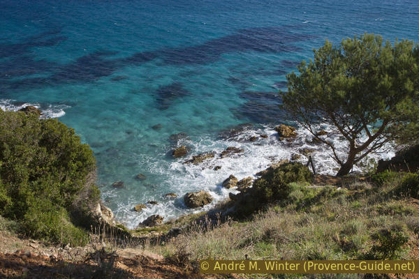
View from the coastal path to Cap Taillat
Photo from May 2012.
Section 1: L'Escalet - Dolmen de la Birande - Cap Taillat
➙ 4 km ... 1 h 20 min ➚ 180 m ➘ 120 m ↝ average
20% easy trails, with marks
5% moderate trails, faulty marks
20% exposed trails, without marks
5% easy trails, with marks
30% forest roads, few marks
5% exposed trails, without marks
5% easy trails, with marks
5% on beach, without marks
15% easy trails, with marks
The clues
- Parking de l'Escalet, 5 m
- Cape Pointe du Canadel, 10 m
- Rocky coast to Cape Pointe de la Douane, 30 m
- Dolmen de la Briande, 50 m
- Maison des Douanes, 10 m
- Beach of Taillat, 0 m
- Summit Butte Hussenot of Cap Taillat, 63 m
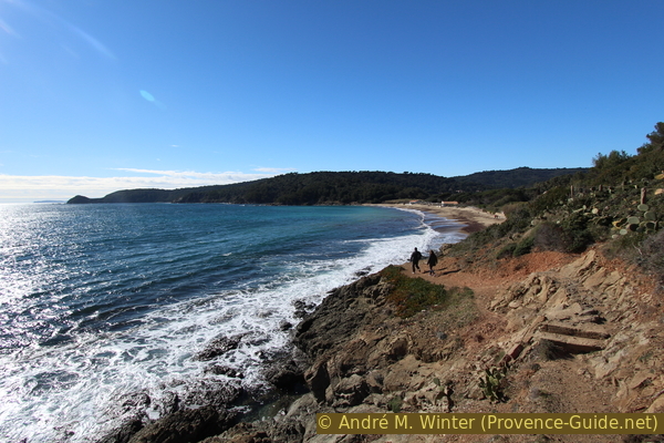
This section of the trail is in the sun for quite a long time in the morning and also in the evening, even in winter. There is an official path that leads up over the cliffs and a variant over the rocks by the sea. Both are worth hiking, but you can only rarely switch from one path to the other. We describe the lower path on the water here.
From the parking lot we go to the sea and in front of the beach huts to the right.
We thread the official coastal footpath here, it leads through narrow plant tunnels.
No reproduction is permitted without the written consent of the author. (id5031)
Start of the trail under the car park in L'Escalet
The photo is from December 1999 and was taken during storm Martin. You can see the spray pulling up the slopes. This effect characterizes the vegetation here.
No reproduction is permitted without the written consent of the author. (id5032)
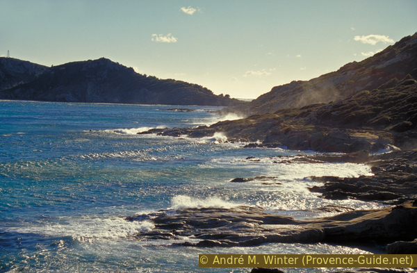
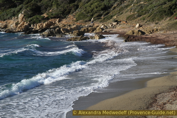
Coast east of L'Escalet during storm Martin in late 1999
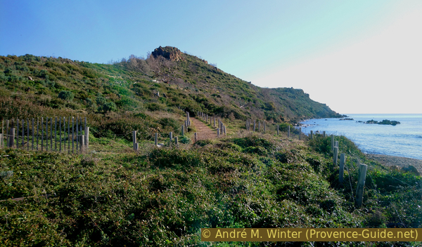
The path leads leisurely and without significant differences in height under the last villas of l'Escalet.
No reproduction is permitted without the written consent of the author. (id5033)
Coastal footpath under the villas of L'Escalet
Behind us we see Cap Camarat with the big lighthouse on it.
After about ten minutes we come to a crossroads. Here comes a way down from the end of the road.
If we continue along the sea, we come to a footbridge and and a second one behind it.
No reproduction is permitted without the written consent of the author. (id5034)
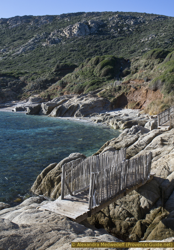
Two footbridges after the last houses of L'Escalet
Immediately after the second bridge follows a somewhat tedious section. After a landslide, the path now leads steeply down. A creek crosses below and the seaweed that forms here can be very slippery in the off-season.
No reproduction is permitted without the written consent of the author. (id5035)
Looking back at the small stream after the second jetty
The path leads up to a rock and now you can choose between the two variants: faster, easier, 200 meters shorter at the top, higher but still less summed up altitude than below. However, we describe here the lower path over the rocks between the water and the edge of the vegetation.
First we have to go down to a first small beach. Several such sandy beaches follow. They are quite wide in summer and when the sea is calm, but in winter the dry sandy area can become quite narrow.
After an easterly wind you may find washed up sea raft jellyfish (velella).
No reproduction is permitted without the written consent of the author. (id5036)
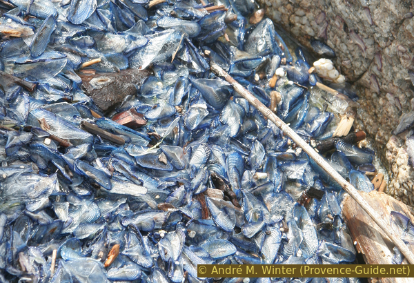
Stranded sea raft (velella) after east wind
Here we also notice a brutal change in vegetation. It has been a little greener again since 2017, but all the shrubs are missing. Black branches are still sticking up in places.
No reproduction is permitted without the written consent of the author. (id5037)
Burnt bushes south of L'Escalet
Photo from late 2019.
We have to cross two small rocky inlets to get onto a wider and flatter rocky promontory. Several more of these also follow on this stretch of coast.
On these rocky outcrops you can separate yourself from the others when there are a lot of people around. But you can also get an overview. Further up you can see the upper path.
No reproduction is permitted without the written consent of the author. (id5038)
Washed up tree trunks become whiter and whiter in the sun
There is no need to search for this special trunk, the photo is from 2005.
We turn back to land and turn left as soon as possible. We must always remain on the rocks and must not penetrate into the earthy area in order not to accelerate erosion.
Further ahead, deeper rocky bays follow, where you can no longer climb down, we go further south and past a rocky outcrop. A little further ahead in 2019 there was a washed up tree trunk on the rocks. Shortly thereafter follows a somewhat wider beach, which can be seen in the photo. The red arrow indicates one route, but there are many variations here.
No reproduction is permitted without the written consent of the author. (id5039)
One of the larger small beaches between L'Escalet and Cap Taillat
After that there will be no more beaches. We continue on the rocks between the surf on the left and the beginning of the vegetation on the right.
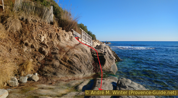
We come to a slightly larger cape. Here a connecting path leads up to the upper path. It is recommended to all those who found the route along the water too difficult. Further ahead it becomes even more vertical. The red arrow shows the route described further, the yellow arrow points to the connecting route.
No reproduction is permitted without the written consent of the author. (id5040)
Possible transition to the upper path
After the wider cape follows a deep rocky cove and after that the terrain becomes steeper. You can't see a path any more and you have to help yourself with your hands more and more often. After a traverse in the steep area, it becomes easier for a short time, but it remains steep. So we come to a rocky promontory with a large but loose stone at the top.
Further ahead we stand in front of a steep rock wall, which is best crossed on the right and far up. You then aim for a rock needle and pass behind it. The terrain beyond is still steep but stepped. After that it gets easier again.
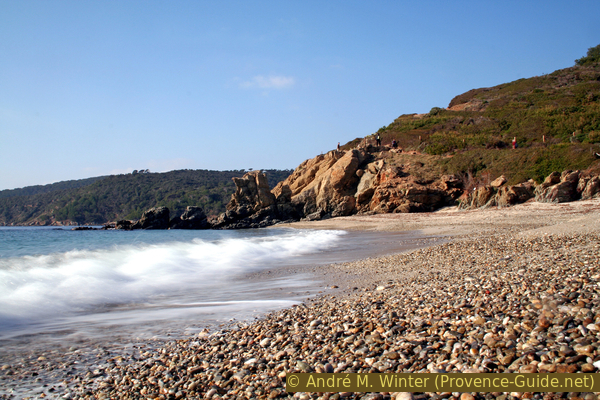
Further ahead there is another rock wall, but this time we have to go down. We walk directly on a beach. We proceed about halfway between the breakers and the start of vegetation. You can then look into a diagonal corridor, which you can also go down. This is how you get into the surf area of the beach. The photo shows the situation in retrospect.
No reproduction is permitted without the written consent of the author. (id5041)
Rocky slope north of the Plage de la Douane beach
Behind the beach, a path climbs to the upper trail.
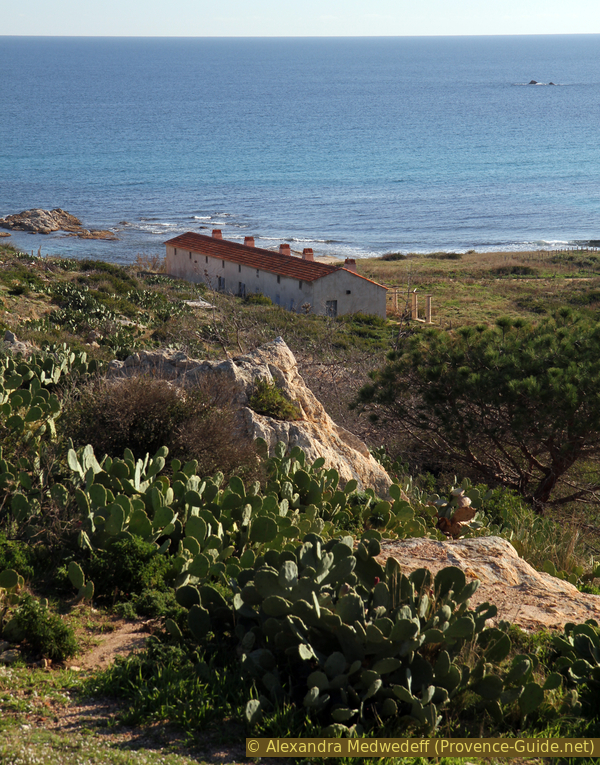
We then see an elongated house. It was built under Napoleon to house border guards. The pergola is supported by massive columns and gives the building a noble appearance. The building was completely renovated in 2011 and was spared the forest fire of 2017. It now serves as a warehouse for the administration of the nature reserve.
No reproduction is permitted without the written consent of the author. (id5042)
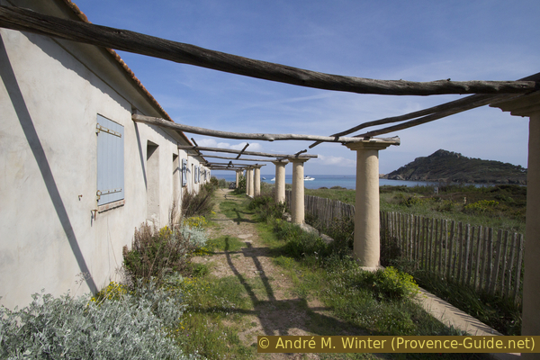
The house of the border guards with pergola
Photo from spring 2017.
Behind the border guard house, a bumpy forest road leads up into a valley. We go up here to the Dolmen de la Briande. It is about 500 meters inland. Here we also see the sad state of the landscape after the forest fire of 2017. The large pines are dead and fallen over, bushes are charred down to the root area. At the end of 2019, more than two years after the disaster, only a few grasses and cacti are greening the slopes.
No reproduction is permitted without the written consent of the author. (id5043)
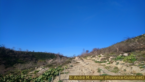
Ascent towards Dolmen de la Briande
Photo from late 2019.
We climb into a saddle at around 50 meters above sea level and a little further behind a short path leads to two vertically erected stones.
This is the Dolmen de la Briande. Admittedly, it's not very impressive, but that's not due to the lack of care of Stone Age people. The mica stone of the coast does not allow large and stable rock slabs to be lifted out of the ground. The builders of the Dolmen de Gaoutabry in the Massif des Maures had similar problems.
No reproduction is permitted without the written consent of the author. (id5044)
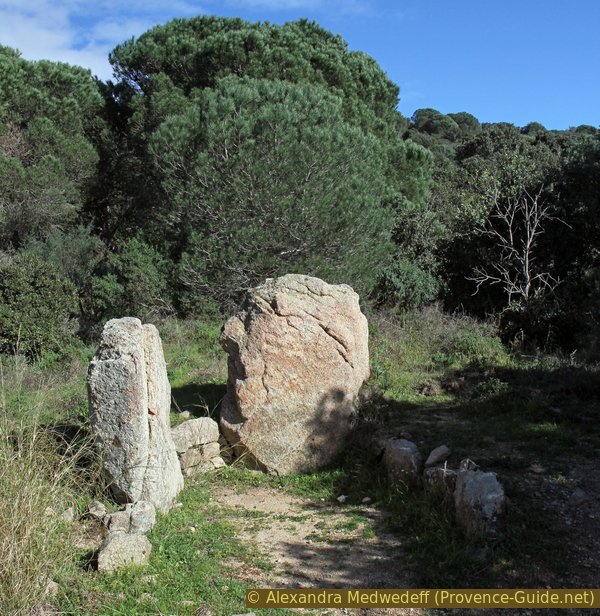
Dolmen de la Briande
Photo from spring 2016.
Arrowheads, quartz pendants and serpentine beads have been found during excavations. No capstone could be detected. Only the main chamber survives today.
From the dolmen we can also see the plain of La Touraque and La Bastide Blanche. You can see pines here that survived the forest fire. This is mainly due to the large vineyards, which form a fire-retarding aisle here.
No reproduction is permitted without the written consent of the author. (id5045)
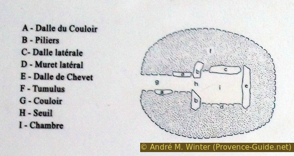
Diagram of the Dolmen de la Briande
We return to the coast by the same route. On the descent you can see a concrete platform on the right under the path. Here you can take a short rest while sitting and looking at the house of the border guards and the Cap Taillat.
No reproduction is permitted without the written consent of the author. (id5046)
Maison des Douanes house seen from above
Photo from late 2019.
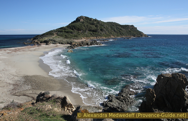
We are back in the coastal area. The section ends at Cap Taillat, which we see in front of us.
Rocks are hidden under the sandbank, making Cap Taillat a real cape. It is therefore not an island that is connected to the mainland by a strip of sand (tombolo).
No reproduction is permitted without the written consent of the author. (id5047)
Headland between mainland and Cap Taillat
Photo from spring 2003.
Since the forest fire in 2017, it is no longer possible to go up to Cap Taillat via several paths. A single path remains open to allow vegetation to recover. Access is on the south side of the beach. It leads first under the first rocky elevation and then to the highest point behind it (Butte Hussenot).
No reproduction is permitted without the written consent of the author. (id5048)
Up to Cap Taillat
Photo from late 2019.
A lattice mast stood at the top of the cape until 2007. This landmark was erected in 1902 to record the speed of ships. Today only the base at the highest point remains.
No reproduction is permitted without the written consent of the author. (id5051)
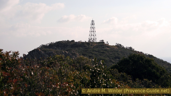
Former lattice tower at Cap Taillat
Photo from December 2005.
The cape may appear green years after the fire. However, you have to know that there used to be a dense pine forest on the south side!
No reproduction is permitted without the written consent of the author. (id5049)
Pine forest on the south slope of Cap Taillat
Photo from April 2017, three months before the forest fire.
The cape is also dotted with ruins of 18th-century command posts and sentry cabins. They were partially used by the German Nazis in 1944. Today only a small shelter near the summit remains entirely intact.
No reproduction is permitted without the written consent of the author. (id5050)
Old sentinel at the top of Cap Taillat
Photo from late 2019.
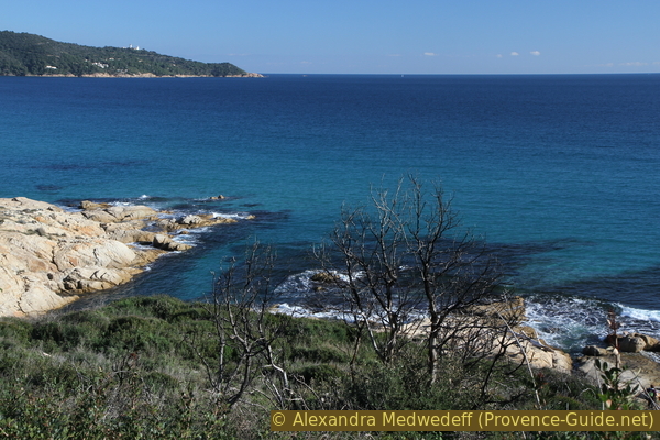
Of course, from the cape you have an ideal view over the south-eastern part of the peninsula of Saint Tropez. On the right you can see the Cap Camarat. The beach Plage de l'Escalet is already hidden in the bay far away. On the left, Cap Lardier closes off the Baie de la Briande.
We have now come to the end of the second part of the tour. Even if it is often windy, you can take a good break here with a view.
No reproduction is permitted without the written consent of the author. (id5052)
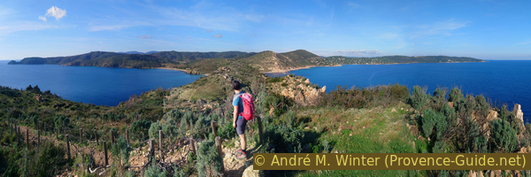
Panorama from Cap Taillat
Photo from late 2019.
Section 2: Cap Taillat - Plage de la Briande - Cap Lardier
➙ 3,4 km ... 1 h 10 min ➚ 140 m ➘ 130 m ↝ easy
20% easy trails, with marks
5% on beach, without marks
5% easy trails, with marks
10% on beach, without marks
65% easy trails, few marks
The clues
- Summit Butte Hussenot of Cap Taillat, 65 m
- Plage de Taillat, 0 m
- Plage de la Briande, 0 m
- Command post Batterie du Cap Lardier, 75 m
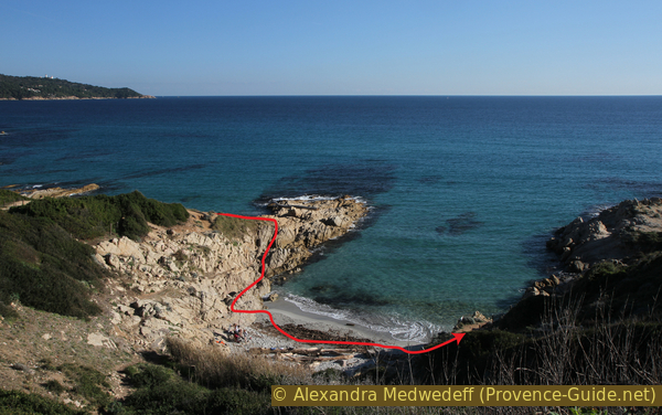
First, we go back to the beach Plage de Taillat on the ascent path. Left you can then see the entire second section. After a small rocky area comes the Plage de la Briande beach. The further course takes place over a rocky coast and finally we climb to the highest point of the tour behind the Cap Lardier.
No reproduction is permitted without the written consent of the author. (id5053)
Descent from the cape to Taillat beach
Photo from late 2019.
From the double beach we go left towards the rocks and find a path over them. You can quickly get to the Plage de Briande beach.
No reproduction is permitted without the written consent of the author. (id5054)
Transition from the Plage de Taillat beach to the Plage de Briande beach
Photo from December 2005.
In the rocky area, but also afterwards, you should turn around to Cap Taillat more often. In the afternoon the Cape shows itself from its most beautiful side.
No reproduction is permitted without the written consent of the author. (id5055)
Cap Taillat with south beach
Photo from february 2012.
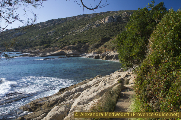
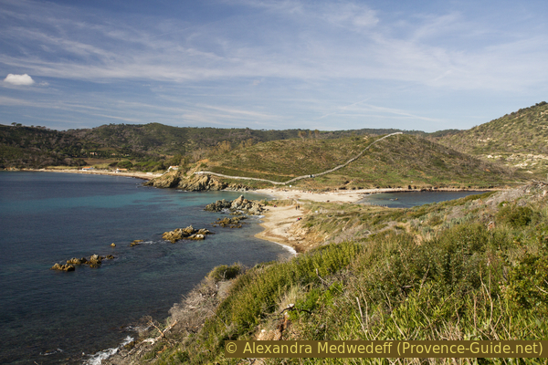
The Plage de Briande beach can only be reached on foot. There are a few apartments beyond, most people on the beach come along the L'Escalet trail.
No reproduction is permitted without the written consent of the author. (id5056)
Descent to Plage de la Briande beach
Photo from February 2012.
To the west, the beach narrows and the trail is then easy to find.
No reproduction is permitted without the written consent of the author. (id5057)
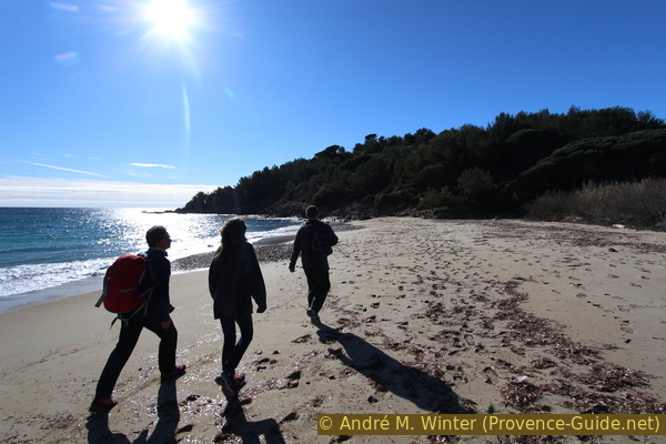
Hikers on La Briande beach
From now on we will be lonelier, we are in the central area of the tour. There are no beaches here. The trail is in good condition but of course much less worn.
After the Plage de Briande beach, we also leave the area of the forest fire of 2017. But only the coast was spared. The following images mostly all from february 2016, but we no longer mention the date when they were taken.
We go forward in a Mediterranean maquis. The path leads through plant tunnels and we collect meters of altitude in several counter climbs because you almost come down to the water several times.
No reproduction is permitted without the written consent of the author. (id5058)
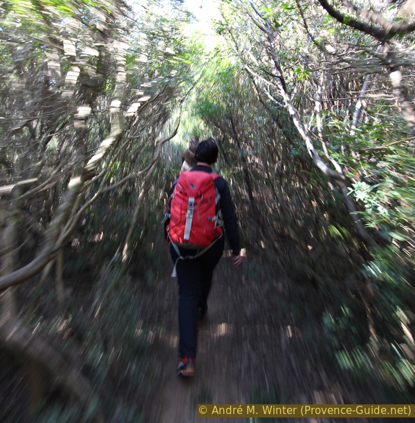
The coastal path in a plant tunnel
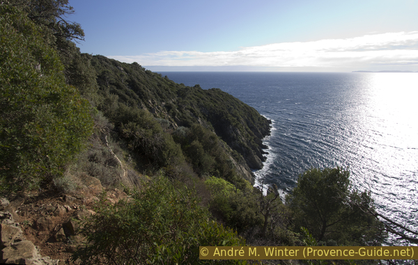
In front of us the Cap Lardier rises up, it is much more rugged than the previous capes. In addition, the path climbs much higher to avoid the brittle cliffs.
No reproduction is permitted without the written consent of the author. (id5059)
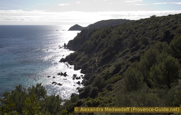
On the way north east of Cap Lardier
The waves thunder down on the rocky coast, here above you like to stay good on the hiking trail.
No reproduction is permitted without the written consent of the author. (id5060)
Steep coast before Cap Lardier
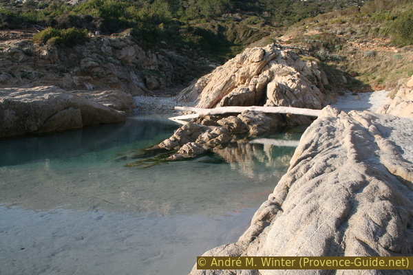
After a higher section of the trail, we come close to the water again and remain quite deep down until just before the cape. Here you will find some open areas and narrow beaches.
No reproduction is permitted without the written consent of the author. (id5061)
Coast between Plage de la Briande beach and Cap Lardier
However, just before the cape, the path suddenly ascends. So you cut off the front part of the cape, which is under strict nature protection anyway and is also practically inaccessible.
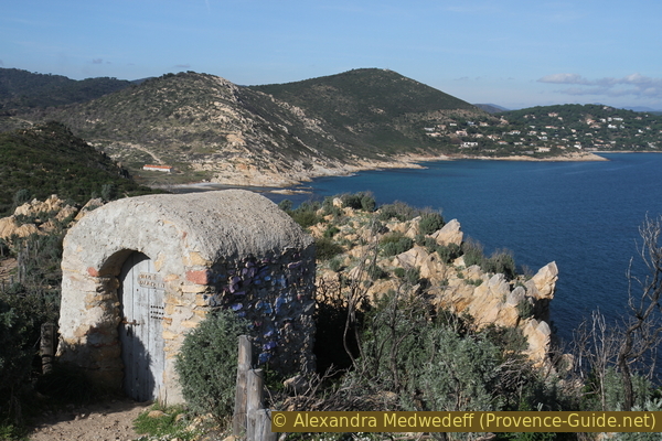
The Cape lookout consists of the base of an early 19th century command post.
No reproduction is permitted without the written consent of the author. (id5062)
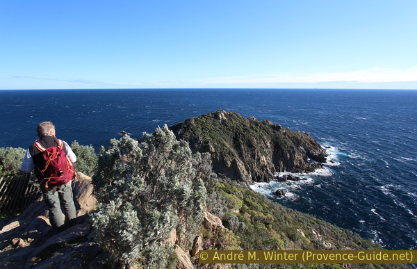
View from Cap Lardier
The Cap Lardier forms the area furthest from any easily accessible point. It's not overcrowded here, even in high season.
Section 3: Cap Lardier - Plage du Brouis - Gigaro
➙ 4,1 km ... 1 h 30 min ➚ 75 m ➘ 145 m ↝ easy
30% easy trails, few marks
<5% forest roads, with marks
15% easy trails, few marks
5% on beach, without marks
35% easy trails, few marks
5% on beach, without marks
<5% forest roads, few marks
5% hard-surfaced quiet side streets, without marks
The clues
- Cap Lardier, 75 m
- Under the coast guard tower ruins, 100 m
- Plage du Brouis, 0 m
- Plage de Gigaro, 0 m
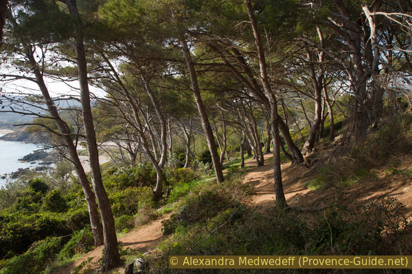
The path to the Plage du Brouis beach continues up a very steep and brittle coast. After the beach we find a classic coastal path again. The large pine trees on this coast were spared from the 2017 forest fire and glow green in the evening sun. On beautiful winter evenings you can experience fantastic sunsets here.
No reproduction is permitted without the written consent of the author. (id5063)
Umbrella pines at Cap Lardier
sémaphore = coast guard tower
After the view at Cap Lardier we continue north. It goes even further up here. In a saddle that is not very pronounced, we come to a crossroads. The tour continues to the left. On the right you could climb to a former coast watch tower.
No reproduction is permitted without the written consent of the author. (id5064)
Backlit shot in the dense vegetation of Cap Lardier
The path quickly leads to another forest saddle and to a forest road, which you follow to the left. Less than 40 meters ahead, turn left again and finally down over steps made of railway sleepers. So it's a quick descent of 60 meters. The remaining difference in altitude to the sea at the Plage du Brouis beach is reduced more leisurely.
No reproduction is permitted without the written consent of the author. (id5065)
Steps west under the former coast guard tower
By climbing so high on Cap Lardier, we avoided Cape Pointe Anditi in particular. You can see this cape in the photo, the point of view is halfway between the forest plateau and the beach. The cape looks quite peaceful, but the sea-side cliffs are extremely steep and fragile. Several hikers have had fatal accidents here!
No reproduction is permitted without the written consent of the author. (id5066)
Pointe Anditi cape in the north-west of Cap Lardier
We continuously lose height and the Plage du Brouis beach appears behind a last rocky outcrop. In the high season there are often many boats in the bay and sporty people come here from Gigaro to swim.
No reproduction is permitted without the written consent of the author. (id5067)
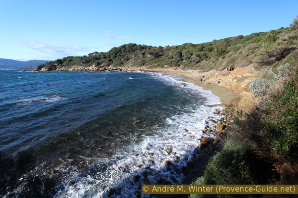
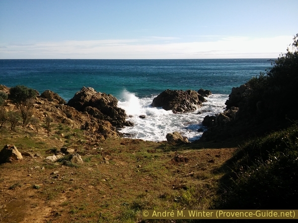
Plage du Brouis beach in winter
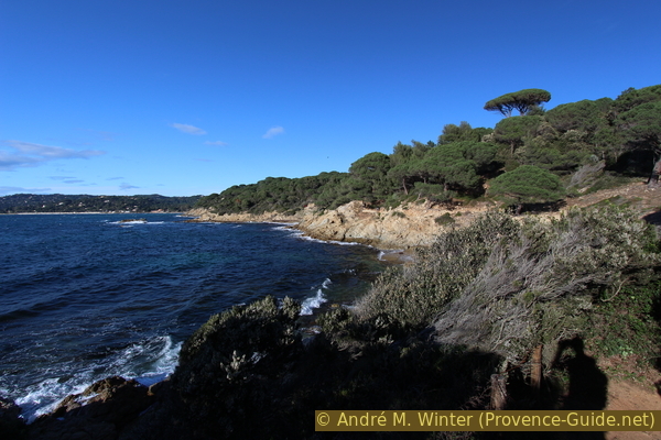
From the beach you can also see the bay of Cavalaire. The islands further back are Île du Levant and Port-Cros.
In winter there are only a few hikers to be found here.
No reproduction is permitted without the written consent of the author. (id5068)
Waves on Plage du Brouis beach
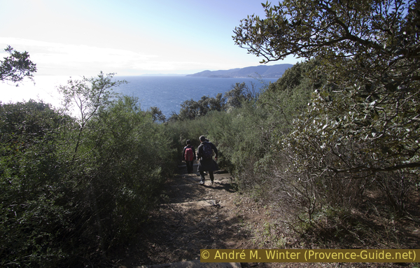
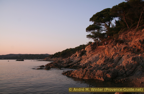
The further way to Gigaro is now more comfortable over the water to the north. There are more people here too. Nevertheless, it is one of the most beautiful coastal landscapes of the Côte d'Azur. The umbrella pine bend over the hiking trail.
No reproduction is permitted without the written consent of the author. (id5069)
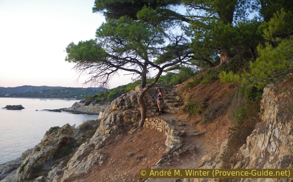
Evening on the coastal hiking trail
The Pointe du Brouis is the last notable cape before Gigaro. However, the rocky coast is steep down at the water and therefore the path remains nicely laid out a little higher.
No reproduction is permitted without the written consent of the author. (id5070)
The coast at Plage de Jovat beach
The solitary pine trees are really the main attraction of this stretch of coast. In the evening the sun really makes it glow.
No reproduction is permitted without the written consent of the author. (id5071)
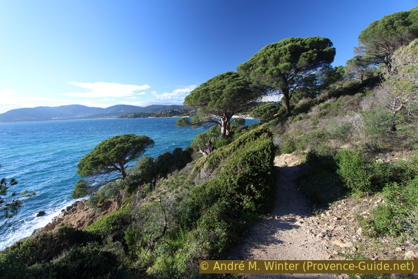
Coastal path between Plage du Bruis beach and Gigaro
Since no fire raged here, you can still find plant tunnels that have disappeared south of L'Escalet.
No reproduction is permitted without the written consent of the author. (id5072)
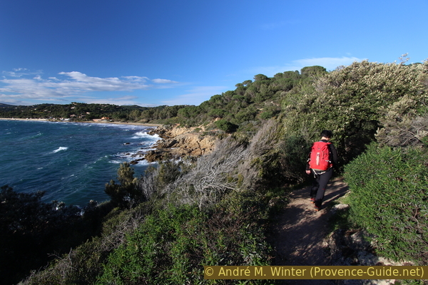
The coastal path south of Gigaro
We continue north and already see the Plage de Gigaro beach. There are two variants at the front. Either continue to the right under the trees and away from the sea or just continue along the beach. The first variant leads through an original eucalyptus forest. These water-loving trees were planted here to drain a swamp that caused malaria.
Before entering the forest, there is a beautiful view of the Bay of Cavalaire.
No reproduction is permitted without the written consent of the author. (id5073)
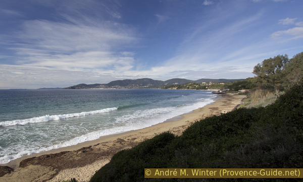
Plage de Gigaro beach and Cavalaire bay
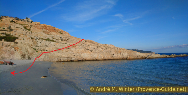
The beach is quite nice here. It is wide in the south and gets narrower in the north until it disappears under the road.
No reproduction is permitted without the written consent of the author. (id5074)
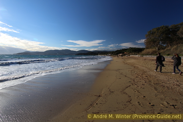
Gigaro beach
Sources and additional information
t is better to use a good topographical hiking map: This tour is on the IGN map "Saint-Tropez, Sainte-Maxime, Massif des Maures", scale 1:25000, 3545OT.
If you don't want to bother with a paper map, you can also use mapping apps on your cell phone. On the one hand, it is the Cartes IGN app from the official map service. However, it requires access to the data network and this is sometimes difficult in canyons or remote locations.
Alternatively, you can use apps that store data directly on the device. They're generally not free, but they don't cost much. We mainly use OSMAnd, here it is possible to add contour lines, relief shading, markings and others. To store this data on your phone you need a lot of space.
Of course, one needs access to satellites for the GPS signal with any app. In some canyons this is not the case. Therefore, do not rely on the position shown, but read the map on your phone as you would read it on paper. Most apps are available for Android and iPhone. The applications usually allow us to record the route travelled and also view the GPS files offered for each of our hikes.
This page has been seen 3400 times since 20 March 2024.
No reproduction is permitted without the written consent of the author. (id5075)
Evening on the way to Gigaro