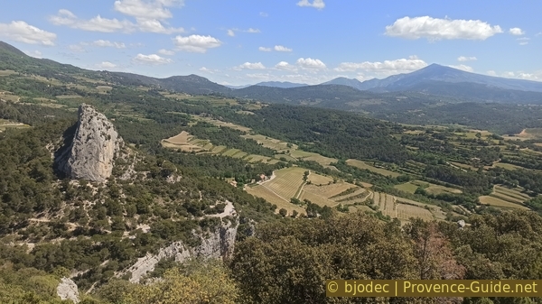
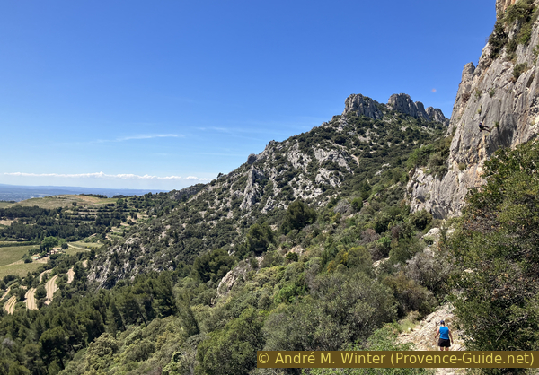
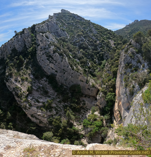
Crête de la Salle in Dentelles de Montmirail
We go around the southern ridge of this massif on difficult paths
scramble
difficult
2 h 45 min
no
yes
no
mountain
Introduction
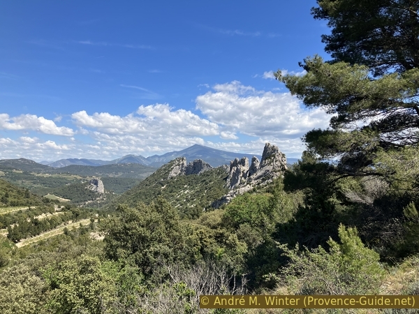
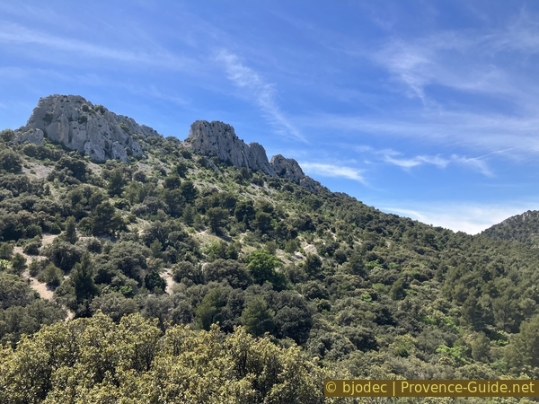
The Massif des Dentelles de Montmirail is located in the wine-growing areas between Beaumes-de-Venise and Gigondas. We are to the west of the imposing Mont Ventoux. Next to the latter, the term lace (Dentelles) is really well chosen. These are three fine, but wonderfully slender ridges. We are here close to the ridge between the waterfall on the Vallat de Fenouillet, the Falaise de la Salle and the pass between the ridge and the Grand Montmirail. It is sometimes called Crête de la Salle.
The difficult part is at the beginning. It is a smooth, steeply inclined rock slab. You need shoes with good grip and you must not be prone to dizziness. An altenate access exists however, see under section 2.
The facts
6,7 km total distance
2 h 45 min walk time
580 m total elevation
orientation average
mark 80% of the total distance
25% hard-surfaced quiet side streets
25% moderate trails
20% easy trails
10% exposed trails
5% forest roads
5% difficult trails
5% Trails with scramble passages
dangers exposed sections and very steep passages
children yes, but only with climbing experience
useful picnic stuff
required hiking boots, hiking equipment and water
GPS coordinates (WGS84) of start and end point 44.145782,5.051173
downloads ![]()
![]()
Public transport
There is no public transport to reach the starting point or nearby villages. Carpentras can be reached by several mainline buses, see Zou! (only french) as well as on train by TER PACA (only french). Carpentras is 12 kilometers from the starting point.
You can then continue by buses from Trans'CoVe (only french) with the A.RP and J.RP lines, those are rather school transports. In Carpentras, change either at the Gandie stop or at the main bus station, both are located north of the SNCF station. We only arrive at Beaumes-de-Venise, this village is four kilometres south of the starting point.
There are taxi services in Carpentras and Beaumes-de-Venise. A pleasant path between Beaumes-de-Venise and Lafare does not exist.
Access by car
We are north of Carpentras and northeast of Beaumes-de-Venise. Follow the signs towards Lafare.
The village of Lafare is located south of our hiking tour.
Useful parking spaces
The largest car park is to the south of the village. The tour starts from here, the approach kilometre towards more difficult paths is a good warm-up. We do not recommend parking at the Vallat de Fenouillet bridge, there are only around ten places and it is often full.
No reproduction is permitted without the written consent of the author. (id6980)
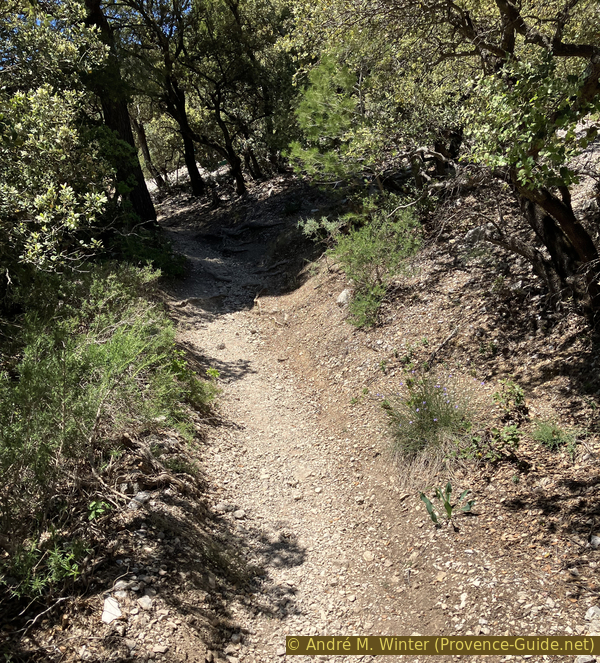
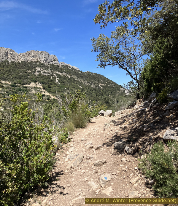
The path on rocky bands east of Pas de la Chèvre
Hints
We stay as close as possible to the ridge and we climb two passes in it. There are three really difficult sections. We can bypass them all on alternative routes or avoid them when it is just back and forth:
The inclined slab between the lower Vallat de Fenouillet waterfall and the Falaise de la Salle at the start of section 2, a bypass is proposed.
The climb to Col de la Chèvre in the middle of section 2, on an even more inclined slab. It's a round trip that can be left aside if you don't feel comfortable.
The passage to the top of the upper Vallat de Fenouillet waterfall at the end of section 3. You can bypass this passage on the north.
The whole region is a zone with a high risk of forest fires. In summer, but also in other seasons when it is very dry or by strong winds, access to the forest areas can be regulated. As a result, the roads may be closed to traffic and/or the trails prohibited to hikers. Current information: Map for access to the forests of the Vaucluse department (also english). The map shows the colours green, yellow, orange and red which correspond to levels of danger. The affected area is: Massif des Dentelles de Montmirail (12).
The sections
- Lafare - Car park at Vallat de Fenouillet bridge
- Lower waterfall on Vallat de Fenouillet - inclined slab - Pas de la Chèvre saddle - saddle between Crête de la Salle and Grand Montmirail
- Saddle between Crête de la Salle and Grand Montmirail- Vallat de l'Aiguille - upper waterfall on Vallat de Fenouillet
- Car park at Vallat de Fenouillet bridge - Lafare
Section 1: Lafare - Vallat de Fenouillet
➙ 1,2 km ... 20 min ➚ 40 m ➘ 5 m ↝ easy
45% hard-surfaced quiet side streets, with marks
5% easy trails, few marks
20% forest roads, few marks
30% hard-surfaced quiet side streets, few marks
The clues
- Lafare south car park, 160 m
- Car park at Vallat de Fenouillet bridge, 195 m
A connecting step to warm us up.
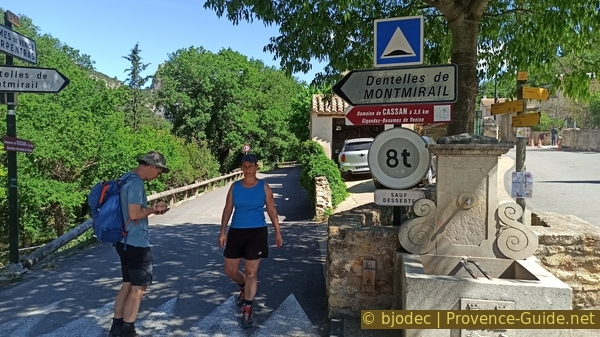
We leave the south parking lot at Lafare towards the village and upwards.
No reproduction is permitted without the written consent of the author. The permission of use was kindly given to Provence-Guide.net on 3 March 2024. (id6957)
Parking area south of Lafare
We walk along the small village and its shaded square.
The village is unfortunately too small to have a bar where we could drink something on the way back.
No reproduction is permitted without the written consent of the author. (id6958)
D90 road in the village of Lafare
Arriving at a water point, we turn left following the arrows towards Dentelles de Montmirail. The water from this fountain will also be very welcome on the way back when we pass here again.
No reproduction is permitted without the written consent of the author. The permission of use was kindly given to Provence-Guide.net on 3 March 2024. (id6959)
Lafare fountain
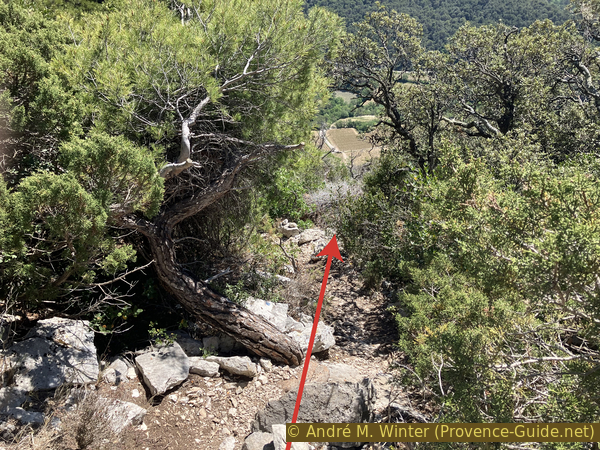
This smaller road first goes down a little, then goes up again. We pass over a bridge then near a last house with cypress trees on the right. Just after that, our ascending path deviates to the left.
No reproduction is permitted without the written consent of the author. (id6960)
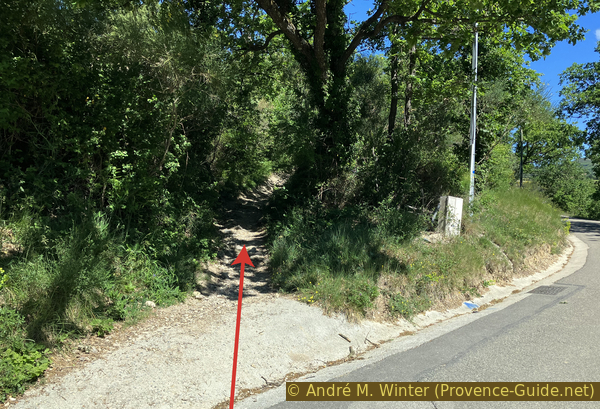
Marked shortcut to the left of Route des Dentelles
This shortcut takes us on an agricultural track between the forest on one side and the vineyards on the other. Take the right track at the crossroads and now pass between the vines.
The Rocher Saint Christophe is in front of us. We will often have it in sight during this hike.
No reproduction is permitted without the written consent of the author. (id6961)
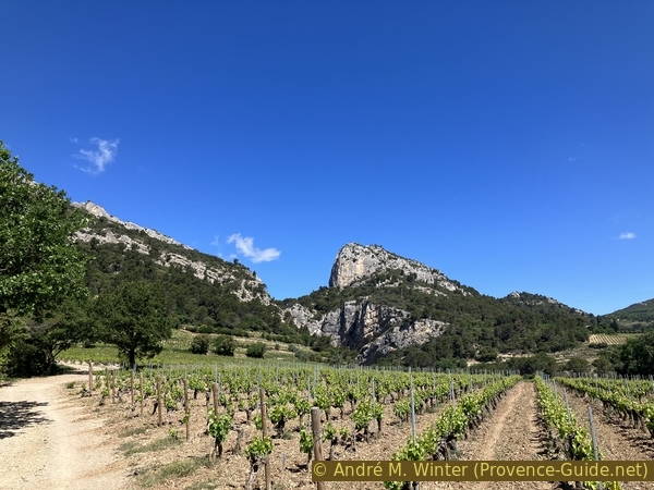
Falaise de la Salle and Rocher St. Christophe
We return to the road near a ruined cabin. Now we have no other alternative. We continue along the road towards the north.
No reproduction is permitted without the written consent of the author. (id6962)
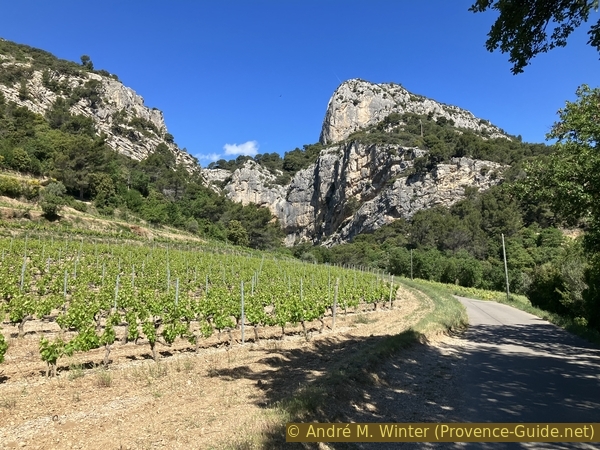
Route des Dentelles leads to Vallat de Fenouillet
In a few minutes, we are at the parking lot before the bridge over the Vallat de Fenouillet. We're leaving the road for good here.
We first follow the red arrow on the photograph.
No reproduction is permitted without the written consent of the author. The permission of use was kindly given to Provence-Guide.net on 3 March 2024. (id6963)
Small parking area at Vallat de Fenouillet bridge
Section 2: Crête de la Salle sud
➙ 2,3 km ... 1 h ➚ 450 m ➘ 230 m ↝ challenging
10% difficult trails, old marks
5% Trails with scramble passages, without marks
40% moderate trails, without marks
5% Trails with scramble passages, without marks
25% exposed trails, old marks
15% easy trails, few marks
The clues
- Car park at the bridge over Vallat de Fenouillet, 195 m
- Lower waterfall on Vallat de Fenouillet, 220 m
- Falaise de la Salle, 320 m
- Saddle east of Crête de la Salle, 415 m
- Pas de la Chèvre saddle, 440 m
- Intersection, 340 m
- Saddle between Crête de la Salle and Grand Montmirail, 425 m
The hardest part is at the beginning of this section.
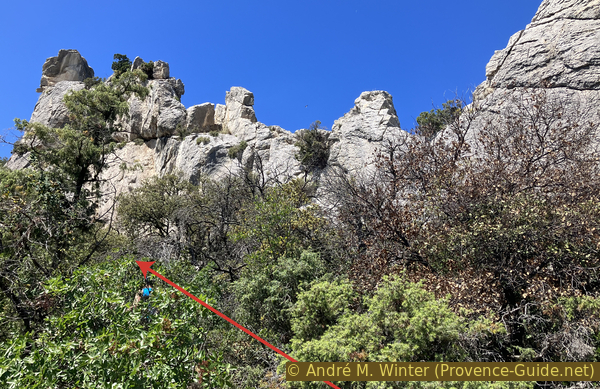
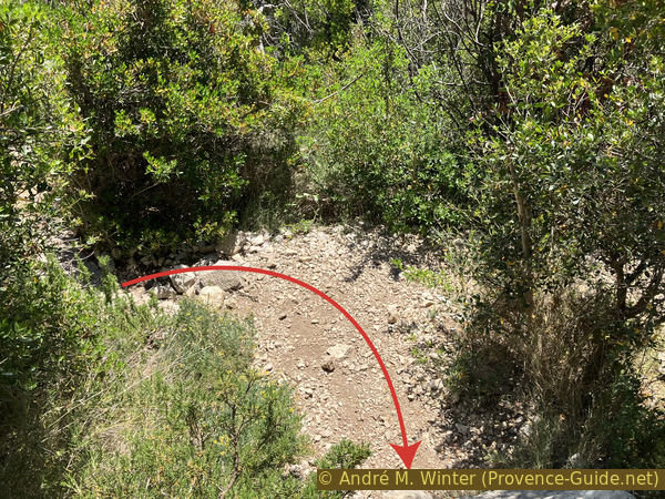
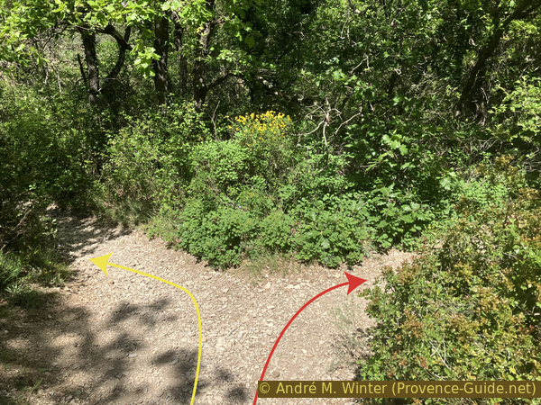
The normal route takes directly after the bridge on the left into the valley, follow the red arrow in the photo.
No reproduction is permitted without the written consent of the author. The permission of use was kindly given to Provence-Guide.net on 3 March 2024. (id6964)
The path in the Vallat de Fenouillet gorge under the waterfall
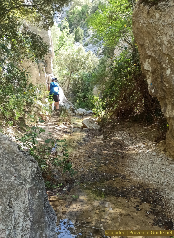
We basically follow the bed of the Vallat de Fenouillet creek upstream. The path changes banks at least three times, but you generally do not walk directly in the water.
No reproduction is permitted without the written consent of the author. (id6965)
Right bank path along the Vallat de Fenouillet
You have to climb a bit in places, but it's neither difficult nor slippery.
No reproduction is permitted without the written consent of the author. (id6966)
In the Vallat de Fenouillet gorge under the waterfall
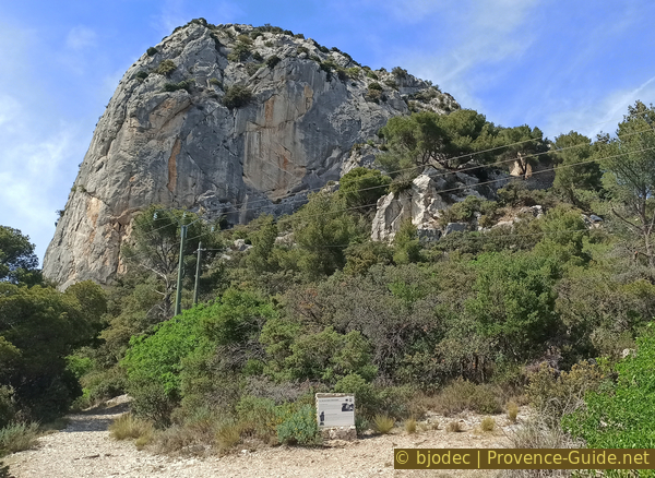
We arrive at the bottom of the lower waterfall on Vallat de Fenouillet. We will be especially busy admiring the waterfall which flows into these gorges. There is generally water until June and from October. A rope helps you climb onto the central rock to gain a little height in front of the waterfall.
No reproduction is permitted without the written consent of the author. (id6967)
Under the lower waterfall on Vallat de Fenouillet
It is clear that the waterfall would be more impressive with more water, but this only happens after storms and in this case the water has an uggly opaque ocher color.
No reproduction is permitted without the written consent of the author. (id6968)
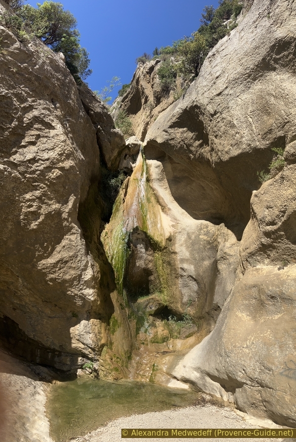
Lower waterfall in the Vallat de Fenouillet gorge
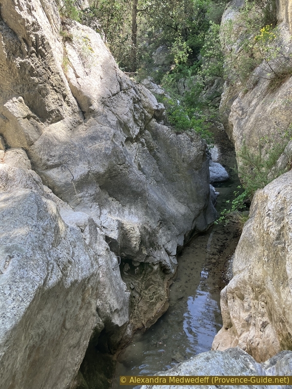
We can also see towards the exit of the small canyon, although it is too curved to see all the distance to the bridge.
No reproduction is permitted without the written consent of the author. (id6970)
Vallat de Fenouillet gorge seen from the inclined slab
The waterfall is a dead end, the only way out is to the left. Yes, it is the inclined slab on which we have already climbed to reach the central rock! The tilt here is approximately the same thereafter.
No reproduction is permitted without the written consent of the author. (id6969)
Base of the inclined slab to the south of the waterfall
This long slab is interspersed with vegetation, which is why it cannot be seen in its entirety from the level of the waterfall.
No reproduction is permitted without the written consent of the author. The permission of use was kindly given to Provence-Guide.net on 3 March 2024. (id6971)
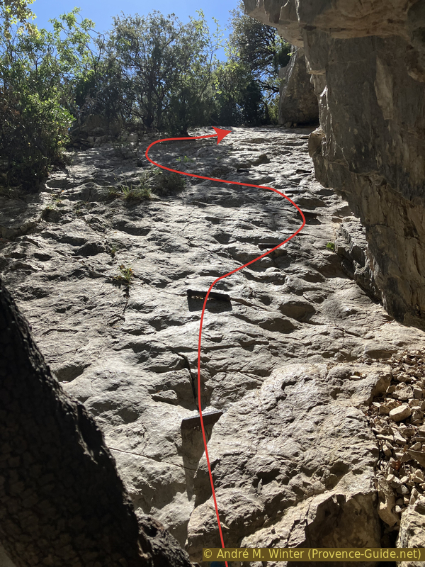
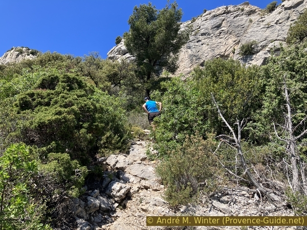
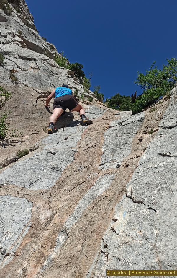
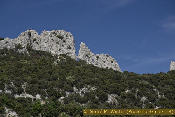
Above the first part of the inclined slab
You go quite easily from the waterfall level to a flat area at the top right. Subsequently, we cross to pass to the left of trees and an earthy area. The truly demanding area is visible beyond. The slab is much smoother here. There are no more noticeable cracks and growths to find grip. We can see some irons placed horizontally in the slab, they are at the beginning on the right.
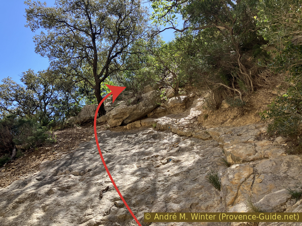
For those who doubt their skills to climb up this slab, also knowing that higher up follows a long corridor that is even steeper, there is an alternative: we return to the waterfall and walk back in the narrow valley to the parking lot at the bridge. We turn right, therefore as a return towards Lafare and we spot a path which goes up to the right after the last rocks placed so that the cars remain on the asphalt. This path climbs steep into the scrubland, briefly runs alongside a field of vines and climbs further into a low forest. At the next intersection, stay right and continue climbing steadily in a slightly clearer rocky area. We thus arrive under the Falaise de la Salle where the main route also leads via the slab and the inclined corridor. This access is also included in the GPX file provided at the top of this page.
No reproduction is permitted without the written consent of the author. (id6972)
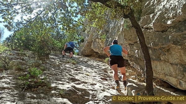
Irons in the second part of the inclined slab south
We climb along the irons planted in the slab. There are some on the right, then follows a last iron in the center of the slab. Then there are no more. It's time to walk even further to the left like André in front in the photo. This edge of the slab is rougher. But this is not a place to rest, we have not even made a third of the climb on this difficult section.
No reproduction is permitted without the written consent of the author. The permission of use was kindly given to Provence-Guide.net on 3 March 2024. (id6973)
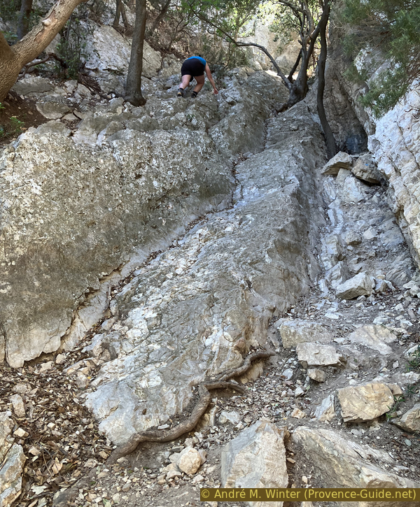
In the second part of the inclined slab
The challenges are not over. The track turns a little to the right and the inclination becomes even more pronounced. This steeply inclined corridor impresses from below even more than the slab below. But it offers a lot more good grip for the feet and hands.
No reproduction is permitted without the written consent of the author. (id6974)
In the corridor north of Falaise de la Salle
We basically stay at the bottom of this notch which narrows towards the top. We are a few metres from the exit when the slope becomes less steep.
No reproduction is permitted without the written consent of the author. (id6975)
At the exit of the corridor north of Falaise de la Salle
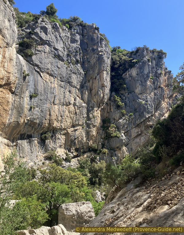
We are under the Falaise de la Salle. It's time to take a breather and enjoy the panorama gained by going up here.
No reproduction is permitted without the written consent of the author. The permission of use was kindly given to Provence-Guide.net on 3 March 2024. (id6976)
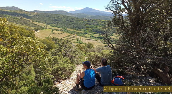
Break after the ascent to the south of the Vallat de Fenouillet waterfall
On the left is the Rocher Saint Christophe, at the foot of which we will pass on the way back.
No reproduction is permitted without the written consent of the author. (id6977)
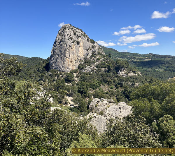
Rocher de Saint Christophe
We see a triangular-shaped elevation to the east. It is none other than Mont Ventoux. It is only white on the south side, here we see its west side.
No reproduction is permitted without the written consent of the author. (id6978)
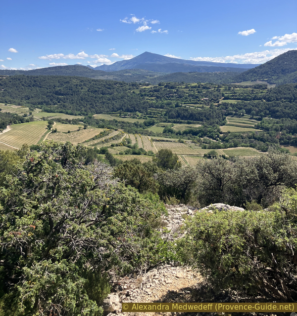
View towards the green face of Mont Ventoux
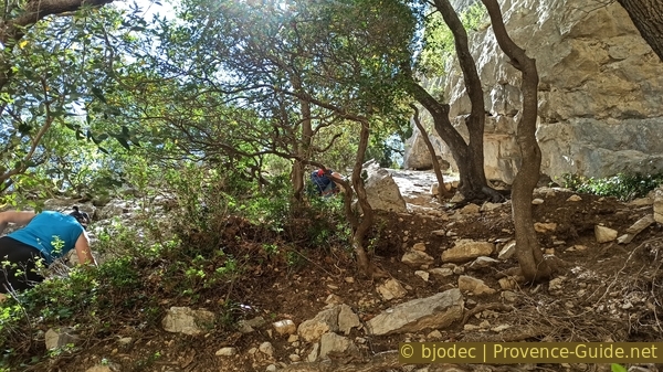
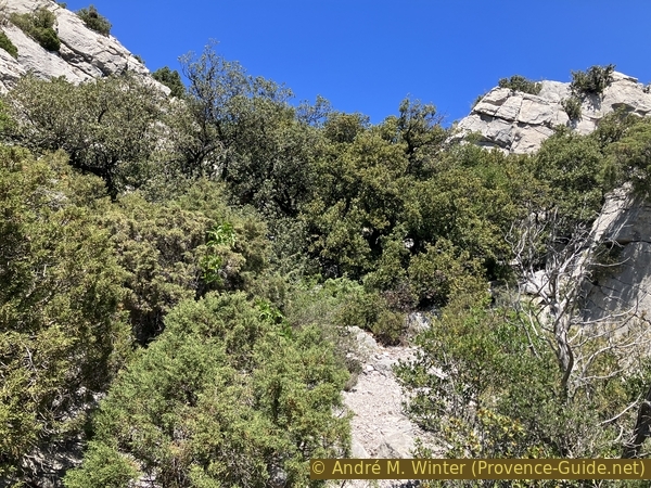
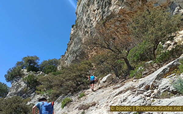
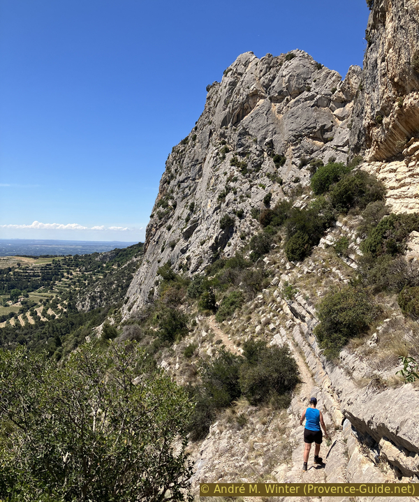
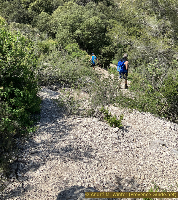
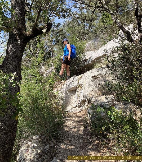
The following takes place exclusively under the ridge. There are several parallel paths at the beginning, the easiest is to stay constantly under the hard rock ridge wall, even if certain trees and boxwood sometimes force us to make detours.
No reproduction is permitted without the written consent of the author. (id6979)
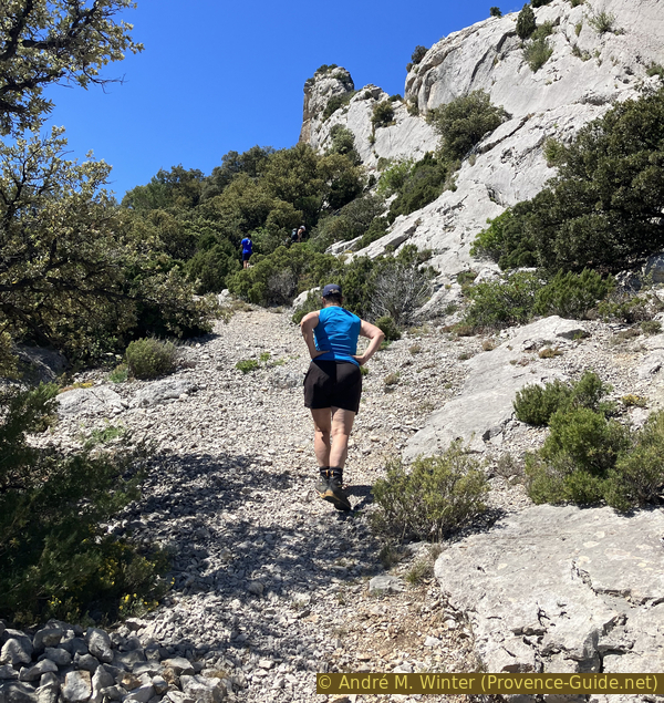
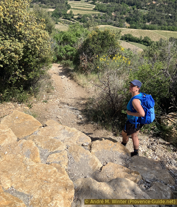
Continuation on scree south of Falaise de la Salle
The GPX track is quite precise, even if it does not fit ideally on an orthophoto for example. This is due to the distortion caused by the strong verticality of the terrain.
We continue to rise strongly and constantly.
No reproduction is permitted without the written consent of the author. (id6983)
Ridge of the Falaise de la Salle
About 15 minutes after leaving under the Falaise de la Salle, the rock wall on the right seems to leave a passage a little further ahead.
No reproduction is permitted without the written consent of the author. (id6984)
Ascent to the saddle west of Falaise de la Salle
Here is a fairly easy possibility of seeing to the other side of the rocky bar. We go up quite directly, walking around some boxwoods.
No reproduction is permitted without the written consent of the author. (id6985)
Ascent to the saddle west of Falaise de la Salle
After a flat area, we have an open view towards the north with the Dentelles Sarrasines.
No reproduction is permitted without the written consent of the author. (id6988)
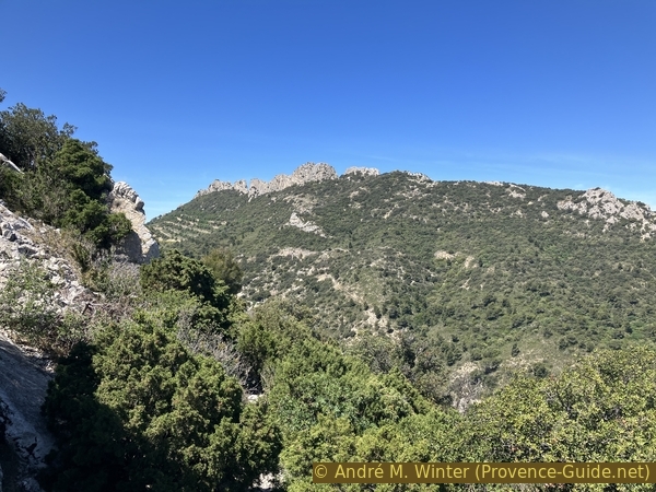
Dentelles Sarrasines
We also see back towards Rocher St. Christophe and the Vallat de Fenouillet gorges through which we accessed the Crête de la Salle.
No reproduction is permitted without the written consent of the author. The permission of use was kindly given to Provence-Guide.net on 3 March 2024. (id6987)
Rocher St.-Christophe and Mont Ventoux
There is no way to continue beyond this pass, it's just a viewpoint. We retrace our steps.
No reproduction is permitted without the written consent of the author. (id6986)
Descent from the saddle west of Falaise de la Salle
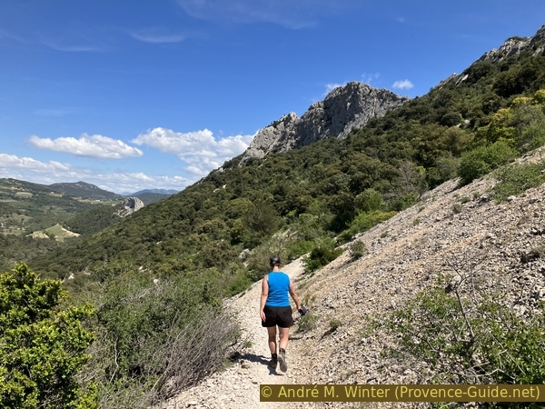
Afterwards, the path remains under the vertical rock wall again. First we continue to climb. The slope is south facing, which is a reason not to do this tour in summer. Here we are at the beginning of May and it is already very hot.
No reproduction is permitted without the written consent of the author. The permission of use was kindly given to Provence-Guide.net on 3 March 2024. (id6989)
We continue to climb south under Crête de la Salle
The height of the path then stabilizes a little to remain around 400 metres. We pass a few higher points.
No reproduction is permitted without the written consent of the author. The permission of use was kindly given to Provence-Guide.net on 3 March 2024. (id6990)
One of the higher points to the south below Crête de la Salle
The vegetation sometimes requires detours. Right in the middle of a peaceful path, you have to climb vertically upwards to resume your walk.
No reproduction is permitted without the written consent of the author. (id6991)
Right angle uphill under Crête de la Salle
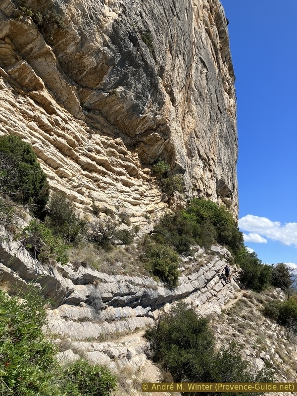
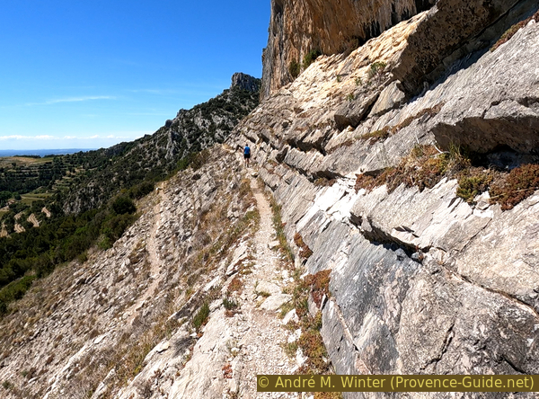
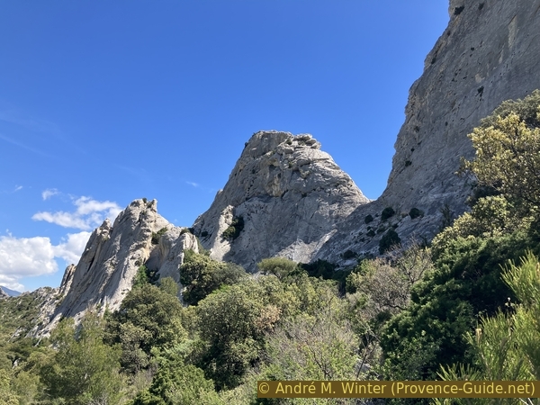
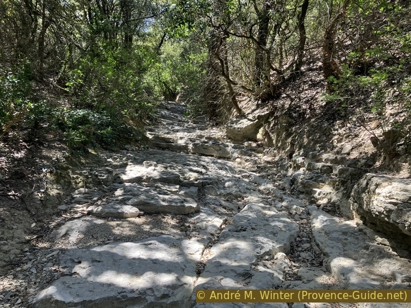
We walk on limestone strata which are under the more massive parts of rock which form the top of the ridge. It's quite fascinating, without these layers, it would be difficult to pass here because the slope is similar to the inclined slab at the beginning. The vegetation gives a semblance of assurance, the void on the left does not appear so dramatic.
No reproduction is permitted without the written consent of the author. (id6992)
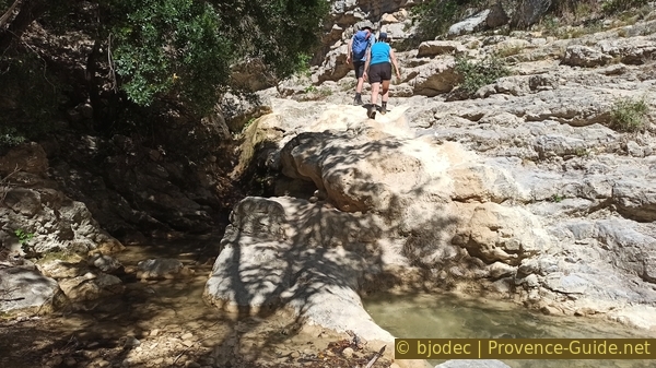
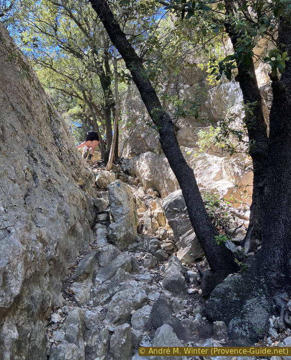
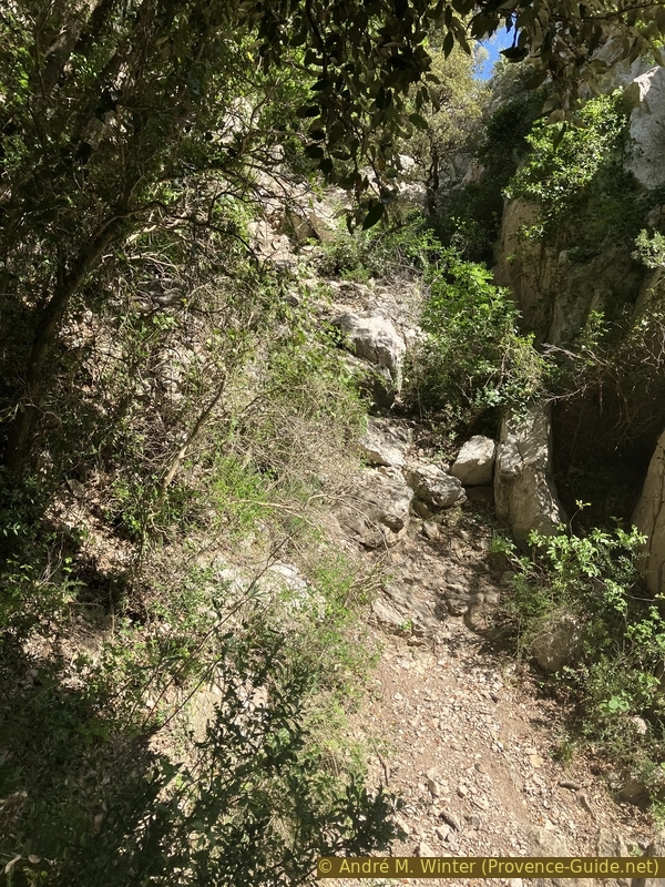
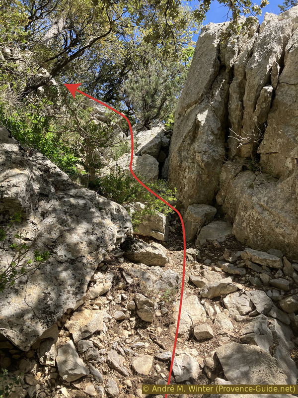
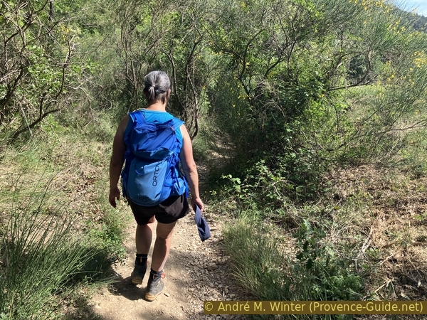
On rocky bands east of Pas de la Chèvre saddle
After the strata, we pass into a more earthy area and we again recognize a notch in the ridge on the right. It is the Pas de la Chèvre saddle which allows a passage towards the north because a path goes down on the other side towards the Vallat de l'Aiguille valley.
No reproduction is permitted without the written consent of the author. The permission of use was kindly given to Provence-Guide.net on 3 March 2024. (id6993)
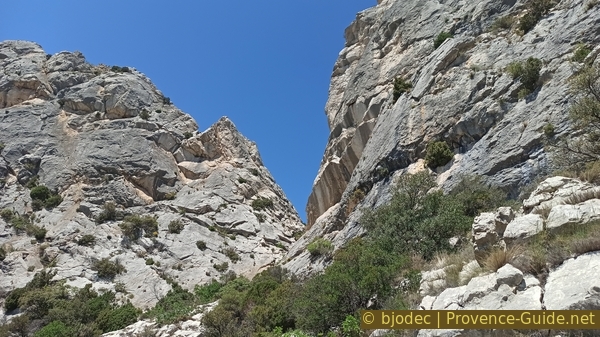
View towards Pas de la Chèvre saddle
We go up there for the challenge only. So it's optional. The cut is narrow, we can't see much on the north side.
It begins with a vertical climb on fairly high strata. Here you have to look for the easiest passages. It's vertical, but without any notable difficulty.
No reproduction is permitted without the written consent of the author. (id6994)
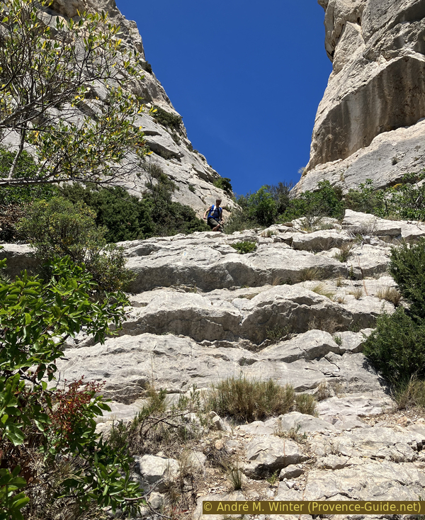
Vertical climb from the south towards Pas de la Chèvre saddle
The challenge lies in the smooth bowl that opens into the pass. It's more vertical than the inclined slab at the start of the section, but the rock is rougher and you have good grip with good shoes. But it is rather the grips for the hands that are lacking. The easiest holds are at the bottom rather on the right and higher on the left side.
Warning: the climb is easier than the descent. You have to include the descent in the consideration going up!
No reproduction is permitted without the written consent of the author. The permission of use was kindly given to Provence-Guide.net on 3 March 2024. (id6996)
In the fairly smooth wall south of Pas de la Chèvre saddle
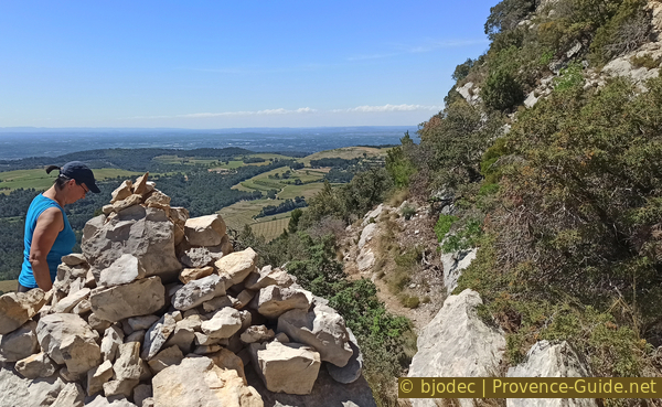
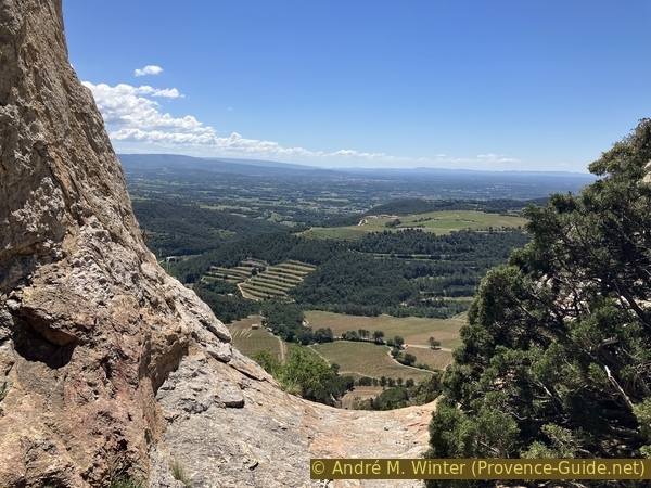
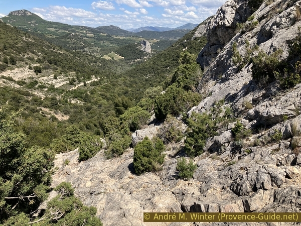
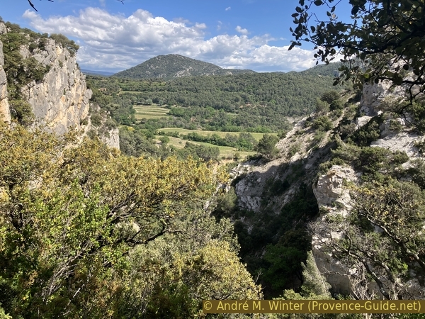
The view from the pass towards the south is more pleasant. We see on the plateau between the Dentelles de Montmirail and the Monts du Vaucluse which extend from the Plateau d'Albion in the east towards Isle-sur-la-Sorgue in the west. This massif is located between Ventoux to the north and Luberon to the south.
But we went up here to go back down towards the south of the ridge. It is wise to go down backwards and on the same path as when going up.
No reproduction is permitted without the written consent of the author. (id6997)
View from Pas de la Chèvre towards the plain north of Carpentras
When we return to the path, it does not resume its previous easy path, we have to descend on terrain mixed with hard rocks and rubble. Trees have fallen because they died from the drought caused by climate change. This requires various detours.
At the same time, a climbing area begins here on the rock face below the ridge line. You must therefore avoid paths that climb too vertically. In any case, we follow blue markers and the few facilities such as cables and steps.
No reproduction is permitted without the written consent of the author. The permission of use was kindly given to Provence-Guide.net on 3 March 2024. (id6998)
Steel cable to help with the descent
Subsequently, our path resumes a pleasant path along the strata as before the Pas de la Chèvre saddle. We can see in front of one end of the Grand Montmirail ridge at the foot of which is the pass where we will turn.
No reproduction is permitted without the written consent of the author. (id6999)
On the way on rocky bands west of Pas de la Chèvre saddle
We may think we can easily go straight through to the pass, but two things complicate this route. The beautiful strata are further covered with a large scree slope with a forest ontop trying to maintain itself there. The area is closed to access to protect this poor vegetation. We have to go down and we will lose a few more tens of metres of altitude.
No reproduction is permitted without the written consent of the author. (id7000)
On the way to Grand Montmirail
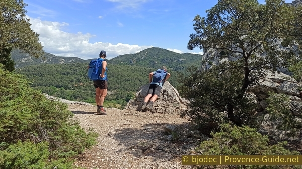
We arrive at around 340 metres altitude on a wider path where we turn right to go up. It's 100 metres of elevation gain, but a few large trees provide shade. This path leads us directly to the pass between Grand Montmirail to the west and Crête de la Salle to the east.
No reproduction is permitted without the written consent of the author. (id7004)
The path climbs towards the saddle east of Grand Montmirail
Just before the pass, you can see clearly towards the western part and the southern side of Crête de la Salle.
No reproduction is permitted without the written consent of the author. (id7005)
View back towards the western part of Crête de la Salle
Here we turn right at the first opportunity to change to the north side of Crête de la Salle.
No reproduction is permitted without the written consent of the author. (id7006)
Lower crossing at the saddle east of Grand Montmirail
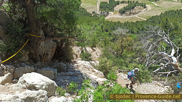
The main tour continues right into the next section. However, you can turn left for about five minutes. We did this during the inspection of this tour mainly to find a place in the shade for the snack. We advance by gaining a little height, but above all by turning a little to the right. We thus can see the Crête de la Salle north side with Mont Ventoux in the background. On the left is St. Christophe rock. The section shows some yellow markers. This extension is included in the GPX file available at the top of this page.
No reproduction is permitted without the written consent of the author. (id7009)
Vallat de l’Aiguille valley and Dentelles de Montmirail
On the north side are the Dentelles Sarrasines, they have a few holes in their rocky crest.
No reproduction is permitted without the written consent of the author. (id7008)
Holes in the crest of Dentelles Sarrasines
In any case, we return to the pass between Grand Montmirail and Crête de la Salle to resume the tour of this page.
No reproduction is permitted without the written consent of the author. The permission of use was kindly given to Provence-Guide.net on 3 March 2024. (id7007)
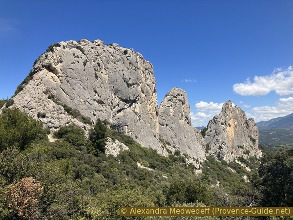
Crête de la Salle seen from the pass to the west
Section 3: Crête de la Salle nord
➙ 2,2 km ... 1 h ➚ 80 m ➘ 300 m ↝ difficult
35% moderate trails, faulty marks
25% easy trails, few marks
10% difficult trails, without marks
10% hard-surfaced quiet side streets, few marks
15% easy trails, few marks
The clues
- Saddle between Crête de la Salle and Grand Montmirail, 425 m
- Vallat de l'Aiguille, 325 m
- Upper waterfall on Vallat de Fenouillet, 245 m
- Road, 290 m
- Car park at Vallat de Fenouillet bridge, 195 m
We return more easily on the north of the Crete de la Salle.
Having taken the pass between Grand Montmirail and Crête de la Salle on the right, the path takes us up a few metres.
No reproduction is permitted without the written consent of the author. (id7010)
The path northwest of Crête de la Salle
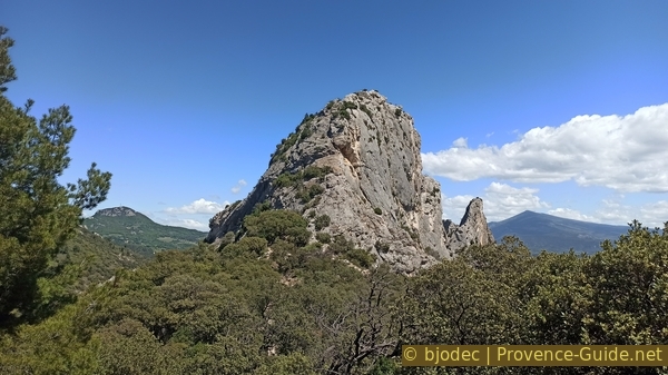
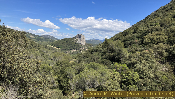
It's time to turn around to see the north side of the Grand Montmirail. This solitary ridge is also more vertical on the south side.
No reproduction is permitted without the written consent of the author. The permission of use was kindly given to Provence-Guide.net on 3 March 2024. (id7011)
View back towards Grand Montmirail
As we continue, however, we must also look carefully at the ground. We pass rocky areas just as the path begins its long descent.
No reproduction is permitted without the written consent of the author. (id7012)
In the downhill part to the northwest of Crête de la Salle
In front of us on the right is the western part of the Crête de la Salle, but this time it is the northern side. In May, the sun is so high that it also lights up the north slope.
No reproduction is permitted without the written consent of the author. (id7013)
North face of Crête de la Salle
The north side of Crête de la Salle also has its large scree slopes. We pass along some of them on an almost flat portion of the path.
No reproduction is permitted without the written consent of the author. (id7014)
A scree to cross north under the Pas de la Chèvre saddle
At approximately the height of a small hole in the Crête de la Salle, we must locate a path which goes down to the left.
Be careful, don't take the first visible one, it's a slippery slope. Better to move forward about fifteen metres and then turn left. The descent remains rapid there too.
No reproduction is permitted without the written consent of the author. (id7015)
Fairly steep descent into Vallat de l'Aiguille valley
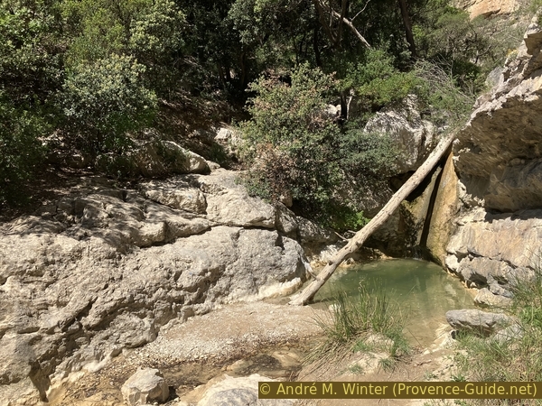
At the bottom we reach the creek bed of Vallat de l'Aiguille. This stream is only supplied with water by this small valley and therefore generally dry. We cross it to go up on the opposite side.
No reproduction is permitted without the written consent of the author. (id7016)
Dry creek bed of Vallat de l’Aiguille
Here awaits us a much wider and much easier path. It leads mainly downhill and in the forest.
No reproduction is permitted without the written consent of the author. (id7018)
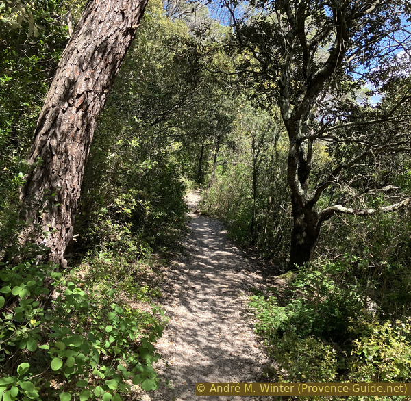
Path on the left bank of Vallat de l'Aiguille
At times the forest is a little more open and we can see ahead of us. In this case, it is always the Rocher St. Christophe which is in sight.
No reproduction is permitted without the written consent of the author. (id7017)
Rocher St. Christophe
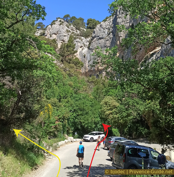
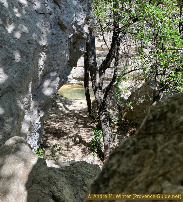
We arrive at the mouth into the Vallat de Fenouillet creek in another fifteen minutes. The main tour described here follows it in a downstream direction to the top of the upper waterfall on this watercourse (red arrow)
You have to walk in the water and you don't necessarily see much, the exit is also very vertical. We can therefore alternately exit here to the left (yellow arrow) until we come across another path which we take to the right. This leads us to the road under the Rocher St. Christophe near where the main path described here goes up. The GPX file provided at the top of this page contains this alternative route.
No reproduction is permitted without the written consent of the author. (id7019)
Crossroads to exit or continue along the Vallat de Fenouillet
We now continue to the right and follow the Vallat de Fenouillet creek. It has a larger watershed and also sometimes contains water in summer. You walk either on a path next to the watercourse or in the bed of the stream. The creek flows slowly, there is almost no difference in altitude. However, the rock walls approach very quickly on both sides. We enter the Vallat de Fenouillet gorge from above. This is of course the same canyom through which we entered at the start of the tour.
No reproduction is permitted without the written consent of the author. The permission of use was kindly given to Provence-Guide.net on 3 March 2024. (id7020)
Vallat de Fenouillet just upstream of the upper waterfall
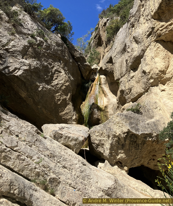
We arrive in front of a large rocky step which should form a first waterfall when there is more water.
There are certainly helping irons below on the left side, but there was a little too much water at the lower level for us to continue. We should normally arrive here at the top of another waterfall, but not the one we saw from below at the start of the tour.
No reproduction is permitted without the written consent of the author. (id7021)
View over the upper waterfall of Vallat de Fenouillet
In any case, even if we manage to descend this first level, we cannot continue along the water thereafter without abseiling ropes. We therefore move back a few metres to look for an exit on the left bank (i.e. to the right when moving back upstream). It is a valley filled with rubble and some scrubland plants.
No reproduction is permitted without the written consent of the author. (id7022)
Uphill exit left of the upper Vallat de Fenouillet waterfall
Higher up, larger rocks come closer. We arrive on a flat area which forms a bifurcation.
No reproduction is permitted without the written consent of the author. (id7023)
Uphill exit left of the upper Vallat de Fenouillet waterfall
On the right you come to a climbing site, but you cannot go down any further. We don't see much of the valley below.
No reproduction is permitted without the written consent of the author. (id7024)
View over the Vallat de Fenouillet gorge on Le Devès
We therefore turn left for about fifteen metres. It is indeed a trail, but you have to climb a few rocky steps. A few irons help with certain passages and there are blue markers.
No reproduction is permitted without the written consent of the author. (id7025)
Continuation of the exit north of the Vallat de Fenouillet waterfalls
We come to another path where we turn right. Here is a first point of view which above all allows us to see back towards the valley from which we have just came out. You have to continue a little further for an ideal viewpoint over the waterfall from the start.
No reproduction is permitted without the written consent of the author. The permission of use was kindly given to Provence-Guide.net on 3 March 2024. (id7026)
At a first viewpoint back in the gorge
The path leads us onto the road, we turn right to follow a long bend to the right. When the road turns left again, it approaches the cliff and here we have the ideal viewpoint.
We see the waterfall with the central rock at the bottom, but above all also the inclined slab and particularly the even steeper corridor. At the very top is the Falaise de la Salle. We went straight up here!
No reproduction is permitted without the written consent of the author. (id7027)
Plunging view into the Vallat de Fenouillet gorge
Opposite the viewpoint is the classic access to the St. Christophe Chapel under the eponymous rock.
No reproduction is permitted without the written consent of the author. The permission of use was kindly given to Provence-Guide.net on 3 March 2024. (id7028)
Path to St. Christophe chapel
A few metres further along the road, we look for a path under the road so as not to have to go down on it. There are several paths, it is better to take the one that stays close to the road first and not those that go down vertically.
No reproduction is permitted without the written consent of the author. (id7029)
Descent path to the car park the Vallat de Fenouillet bridge
We make a bend just like the road makes one further, but we cut the others to very quickly return to the parking lot of the bridge over the Vallat de Fenouillet.
No reproduction is permitted without the written consent of the author. (id7030)
Small parking area at Vallat de Fenouillet bridge
Section 4: Vallat de Fenouillet - Lafare
➙ 1,2 km ... 15 min ➚ 5 m ➘ 40 m ↝ easy
30% hard-surfaced quiet side streets, few marks
20% forest roads, few marks
5% easy trails, few marks
45% hard-surfaced quiet side streets, with marks
The clues
- Car park at Vallat de Fenouillet bridge, 195 m
- Lafare south car park, 160 m
We return by the same path to the starting point, that is to say the parking lot south of the village of Lafare.
Sources and additional information
It is better to use a good topographic hiking map: this tour is on the IGN map "Carpentras, Vaison-la-Romaine, Dentelles de Montmirail", scale 1:25000, 3040ET.
If you don't want to bother with a paper map, you can also use mapping apps on your cell phone. On the one hand, it is the Cartes IGN app from the official map service. However, it requires access to the data network and this is sometimes difficult in canyons or remote locations.
Alternatively, you can use apps that store data directly on the device. They're generally not free, but they don't cost much. We mainly use OSMAnd, here it is possible to add contour lines, relief shading, markings and others. To store this data on your phone you need a lot of space.
Of course, one needs access to satellites for the GPS signal with any app. In some canyons this is not the case. Therefore, do not rely on the position shown, but read the map on your phone as you would read it on paper. Most apps are available for Android and iPhone. The applications usually allow us to record the route travelled and also view the GPS files offered for each of our hikes.
This page has been seen 1952 times since 20 March 2024.
No reproduction is permitted without the written consent of the author. (id7031)
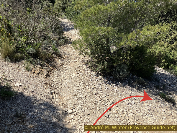
On the shortcut to the Route des Dentelles