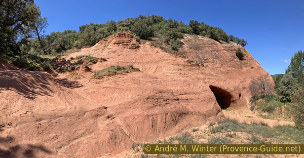
Ochre hoodoos of Bédoin
The complete tour of the accessible sites in yellow and orange tones of Provence
walk
average
1 h
no
yes
no
walk
Introduction
There are different ochre deposits in Provence and more precisely in Vaucluse. The best known are those of Rustrel and Roussillon, but they are also victims of their success. To the north-east of Bédoin, therefore at the foot of Mont Ventoux, are the Demoiselles Coiffées hoodoos. They are formed of ochre and are located at the foot of a hill composed entirely of this form of ancient sandstone. In our opinion, the real Provençal Colorado is found here with its hoodoos, its monoliths and its erosion forms which are indeed very reminiscent of the American West.
We are here in the presence of sandstone, therefore marine sandy conglomerates with oxidised irons. The American formations have a higher limestone content and the colors often come from erosion and are therefore often only exterior.
Monday morning you can stock up on provisions at the market in Bédoin.
The facts
2,7 km total distance
1 h walk time
70 m total elevation
orientation not always clear west of the ochre hill
mark 30% of the total distance
50% easy trails
20% dirt roads
20% forest roads
15% cross country
<5% trail through a cave
dangers steep parts are not secured
children yes
useful picnic stuff
required Trekking boots, hiking equipment and water
GPS coordinates (WGS84) of start and end point 44.126549,5.206751
downloads ![]()
![]()
No reproduction is permitted without the written consent of the author. (id7450)
Ochre of Bédoin and Mont Ventoux
Public transport
Access by public transport to the starting point of the tour is not easy. There is a train from Avignon to Carpentras about every 30 minutes, look under TER PACA (only french), this is the terminus of the line. Right at the exit of the train station is the bus station, this is where the buses from Trans'CoVe (only french) depart from. Line L takes you to Bédoin. Be careful, there are special courses for students from Bédoin to Carpentras, but there is no course from Carpentras to Bédoin around noon, for example. Get off at the Centre station and cross the city centre from south to north, preferably through small alleys.
arrêt = bus stop
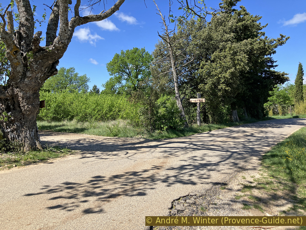
At the roundabout, continue onto Route de Crillon le Brave (arrow) but take an immediate right onto Rue des Époux Tramier. At the crossing with the large plane tree (Place de la Bourgade), turn left: follow Rue de la Calade, then continue along Rue du Four Neuf to the Église Saint-Pierre. Continue north and go down the Traverse Saint-Pierre. At the bottom turn left (Rue de la Coste Froide) and at the end turn right (Rue du Vieil Hôpital). We come to a roundabout with an olive tree in the middle.
A small lane continues north (a little to the right of the roundabout), we take the Chemin de la Ferraille, which first makes a big curve to the right, then at a right angle to the left and another curve to the right. We arrive on the Chemin de la Montagne. When the arrow to Chambre d'hôtes de Curnier point into a grove, turn right onto the road between the vines. We see the ochre hill on the right. Go straight ahead to the Hameau des Couguious and continue straight on the agricultural track. We are here at the start of section 1. 3 km and 130 vertical meters there and back in addition to the tour.
This access from Bédoin is also included in the GPX-file available on this page. It is shown in red on the map.
Access by car
The tour is located between Carpentras and Mont Ventoux. The D974 road leads from Carpentras to Bédoin, then continue towards Flassan. Continue on the Route de la Montagne at the town exit. You see a parking lot at the right and turn then to the left. Follow this road (signs for the Chambre d'hôtes de Curnier). When the arrow to Chambre d'hôtes de Curnier point into a grove, turn right onto the road between the vines. We see the ochre hill on the right. Go straight ahead to the Hameau des Couguious. Turn left here and then quickly right into the parking lot.
Useful parking spaces
New parking lot, see above under access by car. It may by muddy after rain.
Hints
The ochre hill of Bédoin is divided into various private plots. Access is however free. We only ask that you do not pass through the Hameau des Couguious, for this we suggest an original detour.
There are no markings on site and we ask you to stay on the paths. It's a bit contradictory because only the hoodoos are clearly forbidden to climb. The proposed route, which is also found in the GPX file provided, attempts to preserve the site while making the most of the possibilities on site.
We start with the little-known part, the entire western part of the hill, to end with the Demoiselles Coiffées hoodoos.
The whole region is a zone with a high risk of forest fires. In summer, but also in other seasons when it is very dry or by strong winds, access to the forest areas can be regulated. As a result, the roads may be closed to traffic and/or the trails prohibited to hikers. Current information: Map for access to the forests of the Vaucluse department (only french). The map shows the colours green, yellow, orange and red which correspond to levels of danger.
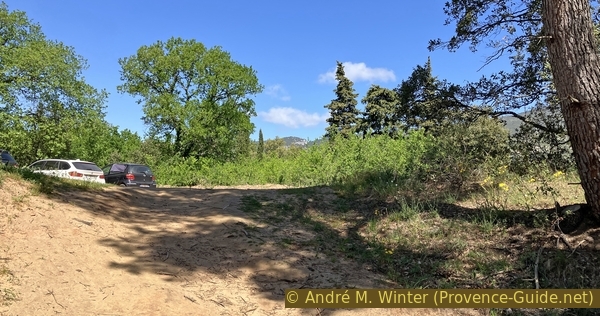
No reproduction is permitted without the written consent of the author. (id7451)
Access to the Bédoin ochre area car park from the east
The sections
- First impressions of the Ocres de Bédoin and start of the loop counterclockwise.
- West of the ochre hill.
- The east with the Coiffées Demoiselles.
Section 1: Hameau des Couguious
➙ 0,7 km ... 10 min ➚ 12 m ➘ 15 m ↝ average
45% dirt roads, faulty marks
5% cross country, without marks
30% dirt roads, without marks
5% trail through a cave, without marks
5% forest roads, without marks
10% easy trails, without marks
The clues
- Ocres de Bédoin car park, 393 m
- Central viewpoint over the eastern part of the ochre area, 395 m
- Old agricultural equipment and cellar in the ochre, 390 m
- Cavity dug in the ochre to the west of the Hameau des Couguious, 382 m
We take a look from above at the eastern side of the ochre area, but we focus on the central part of the hill in this section.
We exit the parking lot by turning left twice to take a farm path. Signs remind you to preserve the site and not to enter the Hameau des Couguious.
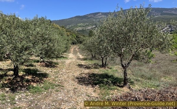
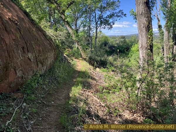
We pass a well outside the hamlet and continue this dirt road in a straight line. On the left is a forest, it hides the eastern part of the ochre area. To the right is an oak grove and further on are replanted olive trees.
No reproduction is permitted without the written consent of the author. (id7452)
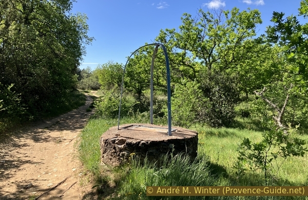
Well on the track between the Ochre of Bédoin
The track makes a few turns. In a long left bend, we spot a faint agricultural track on the right. We'll need it later.
No reproduction is permitted without the written consent of the author. (id7453)
Tracks and olive trees between the Ochre of Bédoin
However, we continue our long left turn and when the track turns right, we continue straight uphill.
No reproduction is permitted without the written consent of the author. (id7454)

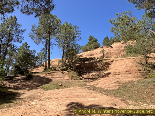
Access to the southeast ochre area from above
We arrive without warning at the top of the erosion and former exploitation zone to the east of the hill. We find the intensive ochre colors. Islets of vegetation maintain themselves as best they can on this slope subject to massive erosion, both natural and human through our passages.
It is technically possible to go down here, but it is dangerous and not conducive to the conservation of the site.
No reproduction is permitted without the written consent of the author. (id7455)
Water channel in the south-east ochre zone
Let's retrace our steps back to the long bend to turn left and head west. This agricultural path is not very marked and it can be covered with tall vegetation in winter. We first follow a sparse oak grove to arrive at a more recent olive grove.
No reproduction is permitted without the written consent of the author. (id7456)
Track towards the west between the Ochre of Bédoin
Although it does not seem very logical, we pass into the olive field after the first row of trees. We can see in the distance that another agricultural track traces here towards the north.
After the olive trees follows a forest on the left. It hides the summit of the ochre hill. The foot of this hill is densely forested.
No reproduction is permitted without the written consent of the author. (id7457)
Path towards the north between olive trees on the ochre plateau
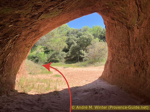
Fifty meters after the olive grove, you'll see a narrow passage between the trees on the left. There used to be old agricultural machinery here, but unfortunately, it was removed at the end of 2024. A mower is visible in the photo, marking the spot in the woods. Here, you can access a cellar dug into the ochre.
No reproduction is permitted without the written consent of the author. (id7459)
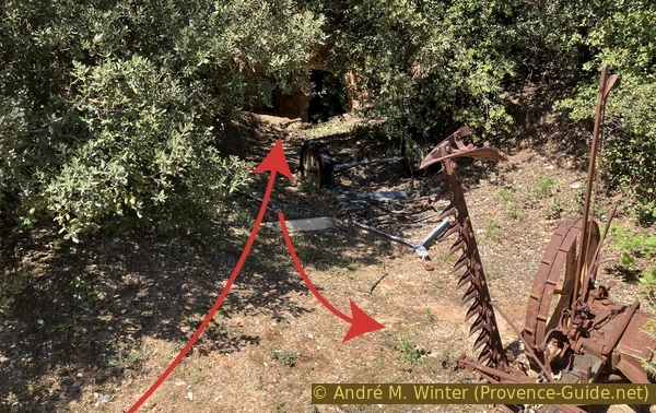
New Ideal Deering mower and access to the dug cellar
Here, you can access a cellar dug into the ochre.
No reproduction is permitted without the written consent of the author. The permission of use was kindly given to Provence-Guide.net on 16 April 2025. (id7458)
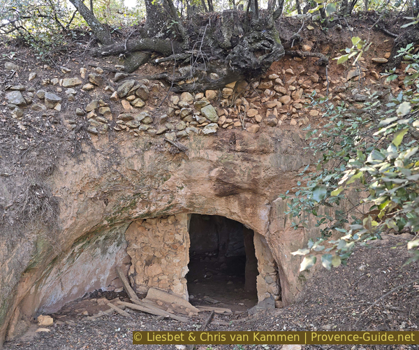
Access to a cellar in the ochres of Bédoin
The cellar has several compartments. It is dug out of ochre and appears to have been whitewashed.
No reproduction is permitted without the written consent of the author. (id7460)
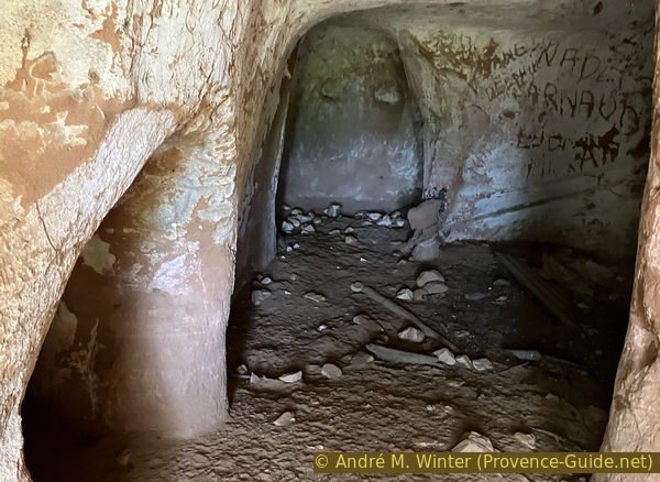
Chambers of the cellar dug into the ochre of Bédoin
After this excursion into the past century, we continue our walk towards the north. The agricultural road gets lost a little, we turn a little to the right without changing path.
No reproduction is permitted without the written consent of the author. (id7461)
Path towards the north on the plateau between the ochre slopes
We emerge from the forest in front of a large dip which corresponds to another area of ochre exploitation. We are now directly behind the Hameau des Couguious.
No reproduction is permitted without the written consent of the author. (id7462)
Ochre behind the Hameau des Couguieux
To the left is a slope completely devoid of vegetation. We recognize parallel oblique traces. Some correspond to the digging of the ochre, but most are slightly harder ridges which are more resistant to wind and water erosion.
No reproduction is permitted without the written consent of the author. (id7463)
Ochre with cavity behind the Hameau des Couguieux
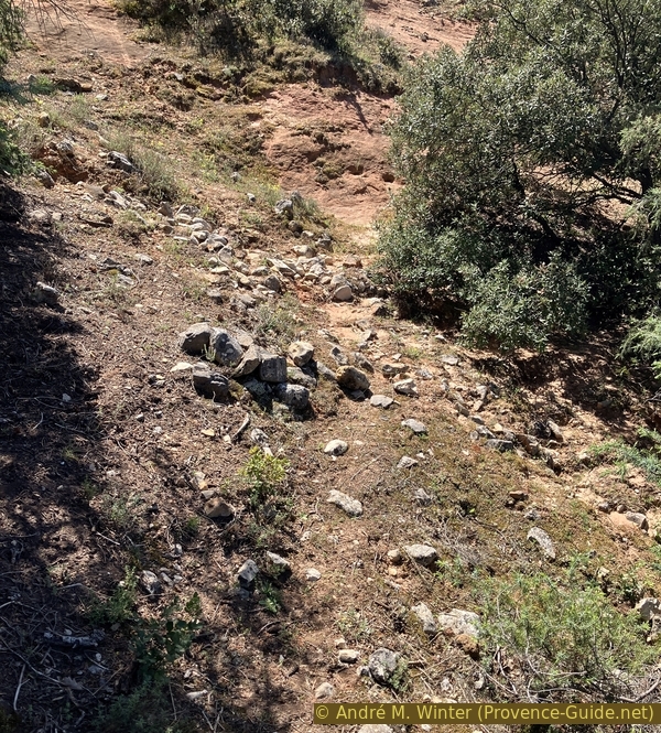
At the lowest point there is a large artificial cavity.
The soil is composed of fine sand which is the end product of ochre erosion. On the wall you can see traces of chiseling to create this opening. They are more irregular and therefore differ from those seen on the surface. In places, the wall seems to be peeling. These are the basis of algae and moss which form in these areas which remain constantly humid. As it dries, this plant cover shrinks and peels.
No reproduction is permitted without the written consent of the author. (id7464)
Cavity in the ochre behind the Hameau des Couguieux
Section 2: Tour par l'ouest
➙ 1,1 km ... 25 min ➚ 23 m ➘ 30 m ↝ difficult
60% easy trails, without marks
40% forest roads, faulty marks
The clues
- Cavity dug in the ochre to the west of the Hameau des Couguious, 382 m
- Round to the north of the ochre hill, 365 m
- Valley west of the ochre hill, 370 m
- Around the south, 375 m
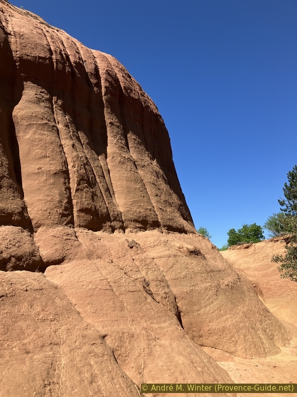
We emerge from the large dip in the ochre to the left.
The rocks are worthy of the great American West. Similar shapes and colors exist at the Grand Canyon.
No reproduction is permitted without the written consent of the author. (id7465)
At the northern foot of the Ochre de Bédoin
Turning left, we go around the ochre hill counterclockwise. A path runs along the foot. We are here far from the crowds that can gather in the eastern part.
No reproduction is permitted without the written consent of the author. (id7466)
Path north of Ocres de Bédoin
We gradually turn towards the western part. The cliff becomes less high and then it's just a simple slope with lots of parallel paths.
No reproduction is permitted without the written consent of the author. (id7467)
Path at the northwest foot of the Ocres de Bédoin
There are a few cairns, the goal is to always stay at the same height between 365 and 370 meters above sea level.
No reproduction is permitted without the written consent of the author. (id7468)
Path at the northwest foot of the Ocres de Bédoin
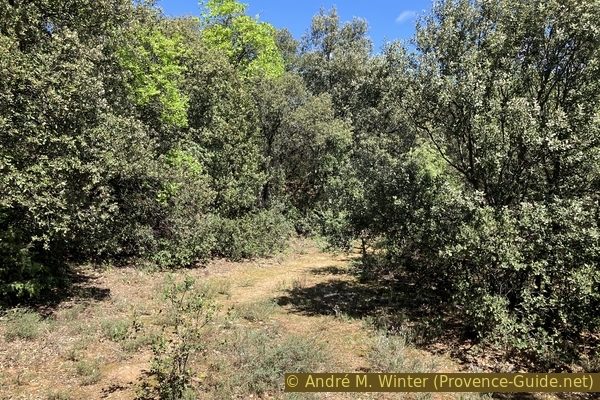
Little by little we arrive in a more densely wooded area and the trail continues to turn left.
No reproduction is permitted without the written consent of the author. (id7469)
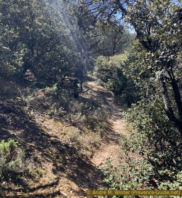
Path at the northwest foot of the Ocres de Bédoin
We see bare ochre slopes again on the left and we follow the path at their foot. Here we enter a side valley from which we will have to exit later. The forms of erosion are also very interesting here. We are usually alone here.
No reproduction is permitted without the written consent of the author. (id7470)
Valley southwest of Ocres de Bédoin
We try to stay in the lowest part of the valley. When it starts to rise, we turn around. All the passages towards the east here are very bushy and do not lead south of the hill.
No reproduction is permitted without the written consent of the author. (id7471)
River bed of the valley southwest of Ocres de Bédoin
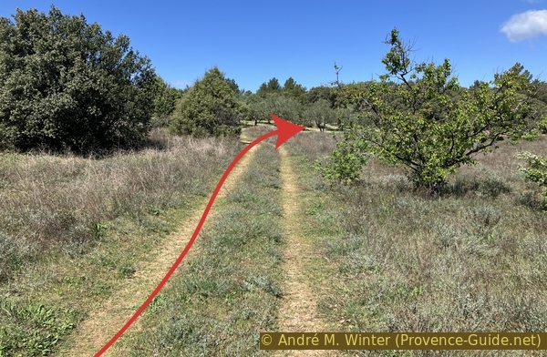
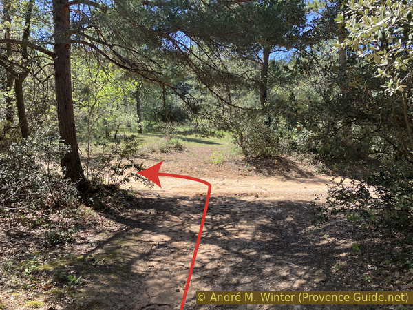
Coming out towards the west of the valley, we keep to the left. We arrive at a slightly more open place. Further to the left a forest track begins.
No reproduction is permitted without the written consent of the author. (id7472)
Exit from the valley southwest of Ocres de Bédoin
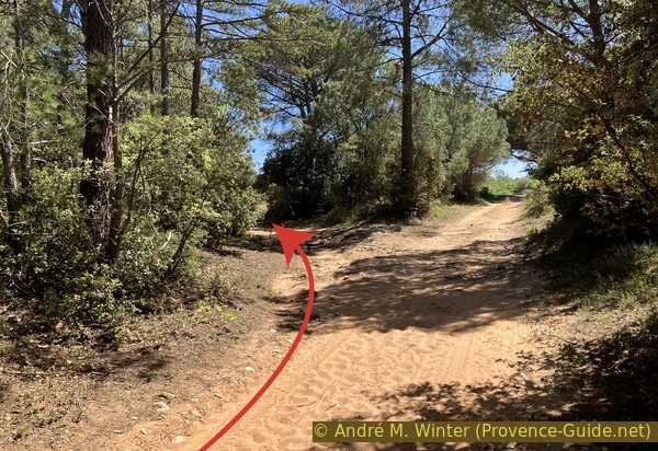
We go down in a straight line towards another forest track. We take a left here to continue around the hill.
No reproduction is permitted without the written consent of the author. (id7473)
Track under the valley southwest of Les Ocres de Bédoin
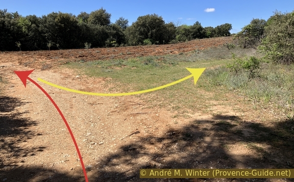
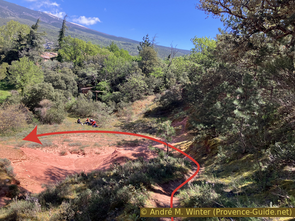
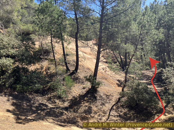
This track transforms at times into a real desert trail, the sand is soft and deep when the vegetation does not fix it.
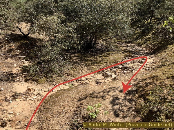
We turn left at the large triangular intersection.
No reproduction is permitted without the written consent of the author. (id7474)
Crossing of tracks south of Ocres de Bédoin
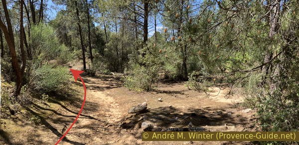
Going up, you now have the choice of walking in the shade in the sand or in the sun on a more stony parallel track. The two come together more in the form of a large crossing with a wooden post.
We take a right here and without going up.
No reproduction is permitted without the written consent of the author. (id7475)
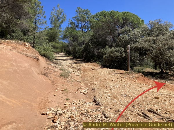
The track between the Ochre of Bédoin
Section 3: Demoiselles Coiffées
➙ 0,8 km ... 25 min ➚ 35 m ➘ 15 m ↝ average
55% easy trails, without marks
35% cross country, without marks
10% easy trails, without marks
The clues
- In the south center of the Ocres de Bédoin, 375 m
- Demoiselles Coiffées hoodoos, 373 m
- The monoliths, 380 m
- Ocres de Bédoin car park, 393 m
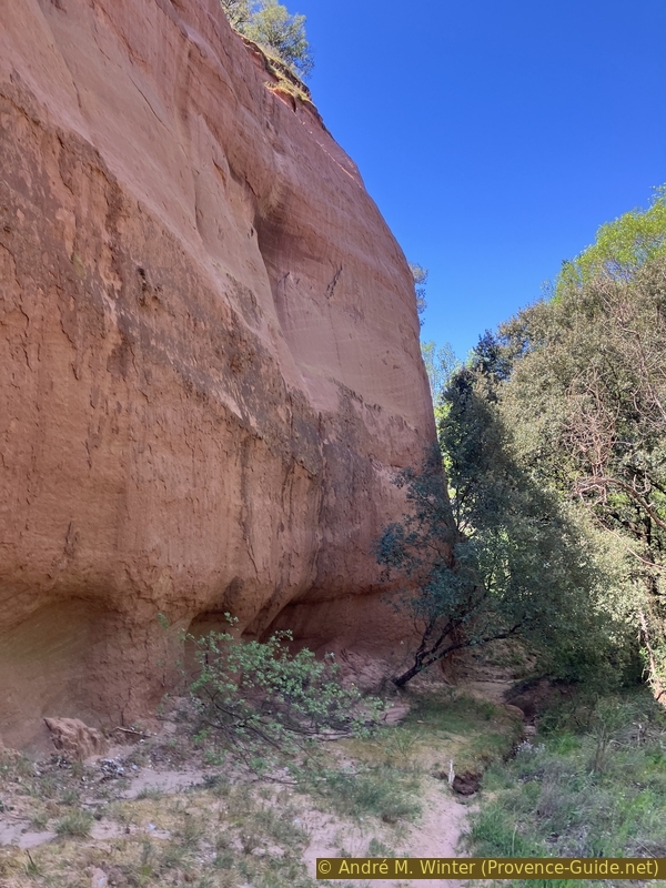
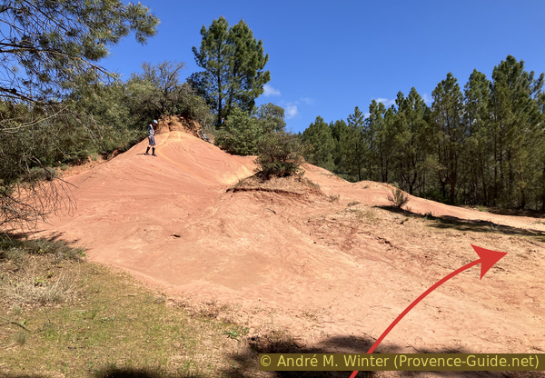
We are now approaching the most famous part of the Ocres de Bédoin. We arrive from the south-east in the eastern part of the hill where there is a large bare slope with the Demoiselles Coiffées hoodoos in front.
We walk again accompanied by a rocky ochre embankment on the left.
Behind a tree is a small artificial opening.
We wonder what one was looking for here. Perhaps it was a prospecting gallery to find purer or more colorful ochre.
No reproduction is permitted without the written consent of the author. (id7476)
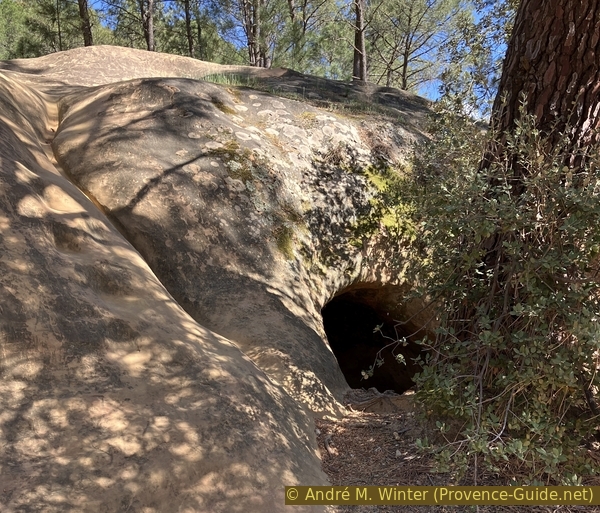
Cavity dug south-east of the Bédoin ochre
In any case, the ground remains covered with sand. It's like a beach without water.
No reproduction is permitted without the written consent of the author. (id7477)
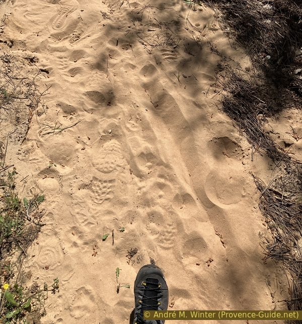
Sandy path south-east of the ochre of Bédoin
Turning a little further to the left, you can see straight towards the large group of hoodoos. There is another one on the right.
No reproduction is permitted without the written consent of the author. (id7478)
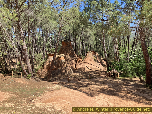
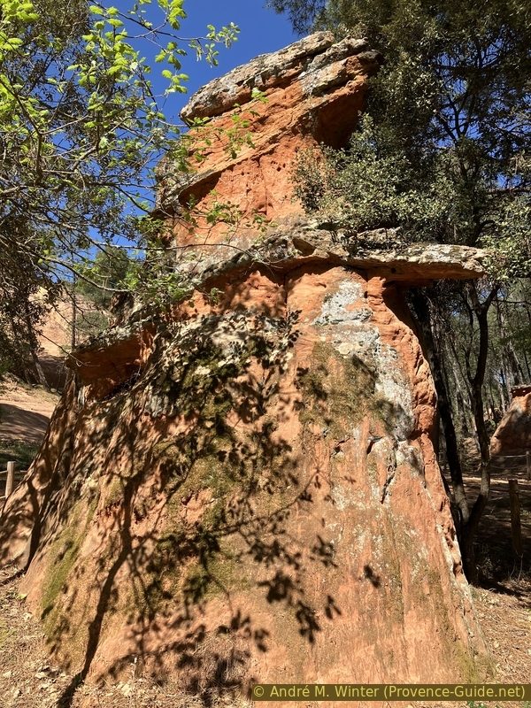
Hoodoos of Bédoin ochre
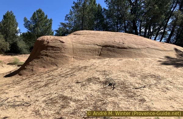
They all have a covering of harder rock and it is the very definition of a hoodoo. You therefore need a material that is soft and easily eroded and occasionally covered with hard rocks preventing erosion below.
These columns initially formed a large geological layer at least as high as the remaining hoodoos. It is only the chance of the remaining hat that creates the column. When the cap slips or erodes, the column below is also very quickly reduced to the level on which we walk. So it's an ongoing process. There were undoubtedly other hoodoos before and others may perhaps reappear at the edge of the hill on the more vertical slopes.
No reproduction is permitted without the written consent of the author. (id7479)
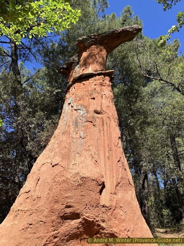
Hoodoos of Bédoin ochre
Here, it is a covering which must have originally been continuos layer because we can recognize traces of breakage on the hats of the hoodoos. It is undoubtedly also a recomposed sandstone rock like the ochre below.
No reproduction is permitted without the written consent of the author. (id7480)
Hoodoos of Bédoin ochre
In the Alps, hoodoos are also known in the loose material of glacial moraines when a single rock protects the erosion below. Directly on the ice of glaciers a similar effect occurs when a large stone on the surface protects the ice below from melting. The stone then seems to have been lifted from the ice in the shape of a table.
No reproduction is permitted without the written consent of the author. (id7481)
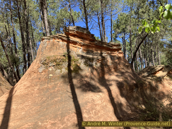
High hoodoos of Bédoin ochre
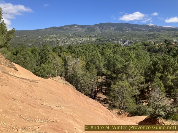
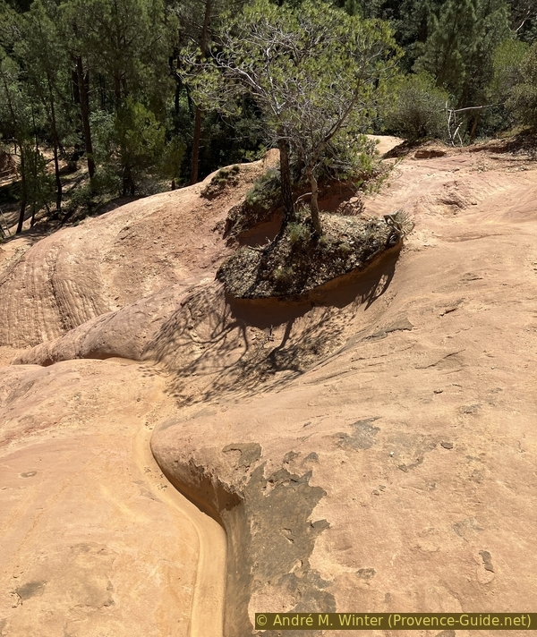
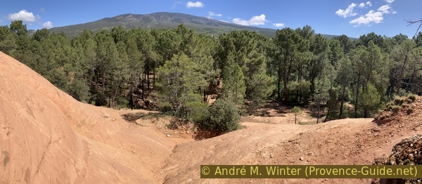
The large group of hoodoos is covered by tall pine trees. This perhaps slows down their erosion a little. In any case, we can see Mont Ventoux through the trunks of the trees.
No reproduction is permitted without the written consent of the author. (id7482)
Hoodoos of Bédoin and Mont Ventoux
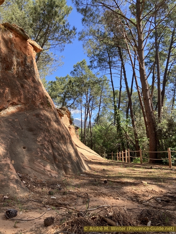
To the left of the hoodoos is the eastern slope of the ochre hill. It glows best before noon. Having started the tour in the morning, we will be here at the right time.
No reproduction is permitted without the written consent of the author. (id7483)
Ochre area northeast of Bédoin
You can climb this slope while looking for your way. We then see above the trees on the southern slopes of Mont-Ventoux. The summit is all white and to the right.
In April 2024, when we were there, the white of the summit was snow. But the white also remains in summer because the white limestone glows the same.
No reproduction is permitted without the written consent of the author. (id7484)
The northeast ochre of Bédoin and Mont Ventoux
For the rest of the tour, we leave this ochre cirque surrounding the Demoiselles Coiffées towards the north. This area has no real path. There is bare ochre between wooded areas.
No reproduction is permitted without the written consent of the author. (id7485)
Ochre northeast of Bédoin
Keeping to the right, you arrive at this monolith worthy of those in Australia. However, its length does not exceed ten metres.
No reproduction is permitted without the written consent of the author. (id7486)
Monolith in the ochre of the northeast of Bédoin
Going back to the left, specifically towards the northwest, we find a path which goes up towards the car park and therefore to the starting point.
No reproduction is permitted without the written consent of the author. (id7487)
Way uphill back from the ochre zone towards the car park
Sources and additional information
It is better to use a good topographical hiking map: this tour is on the IGN "Mont Ventoux" map, scale 1:25000, 3140ET.
If you don't want to bother with a paper map, you can also use mapping apps on your cell phone. On the one hand, it is the Cartes IGN app from the official map service. However, it requires access to the data network and this is sometimes difficult in canyons or remote locations.
Alternatively, you can use apps that store data directly on the device. They're generally not free, but they don't cost much. We mainly use OSMAnd, here it is possible to add contour lines, relief shading, markings and others. To store this data on your phone you need a lot of space.
Of course, one needs access to satellites for the GPS signal with any app. In some canyons this is not the case. Therefore, do not rely on the position shown, but read the map on your phone as you would read it on paper. Most apps are available for Android and iPhone. The applications usually allow us to record the route travelled and also view the GPS files offered for each of our hikes.
This page has been seen 2122 times since 20 March 2024.