Rocher de Rocalinaud in Beaumes-de-Venise
A walk from the village to the perforated rock
walk
easy
1 h
very rare
yes
shelter
walk
Introduction
The Vaucluse department consists mainly of limestone. But it also contains some other types of rock such as sandstone. This is a rock with a rough surface that consists of sand and breaks down into sand again. The sand consists of small grains of crystallized clay held together by calcite. Sandstone is naturally eroded into round shapes and it is easy to work with because it is also very homogeneous. Sandstone is found in the form of hills south of Beaumes-de-Venise.
Cellars and rooms were dug in this rock, as it is the case with the Rocher de Rocalinaud. Baume means cave in Provençal and gives the village of Beaumes-de-Venise its name. The addition Venise means Venice, but does not come from the old city on the Adriatic, but is a conversion of Venisse, i.e. from Comtat Venaissin, a historical county to which Beaumes-de-Venise belonged.
Let's take a look at one of these rocks, nestled between the famous vines of Beaumes-de-Venise!
The facts
3,5 km total distance
1 h walk time
90 m total elevation
orientation easy
mark 65% of the total distance
60% hard-surfaced quiet side streets
15% hard-surfaced country road
10% moderate trails
5% dirt roads
5% hard-surfaced city alleys
5% easy trails
dangers exposed sections
children yes
useful picnic stuff
required trekking boots, hiking equipment and water
GPS coordinates (WGS84) of start and end point 44.12093282112743,5.028577733634295
downloads ![]()
![]()
Public transport
Carpentras can be reached by several long-distance buses, see Zou! (only french) and by the trains TER PACA (only french). Carpentras is 8 kilometers from the starting point.
You can then continue with the buses of Trans'CoVe (only french) on the A.RP and J.RP lines, although these are more school bus lines. Change in Carpentras either at the Gandie stop or at the main bus station, both located north of the SNCF train station. This brings us to the starting point in Beaumes-de-Venise.
There are taxi services in Carpentras and Beaumes-de-Venise.
Access by car
We are north of Carpentras, east of Orange and south of Vaison-la-Romaine. The quickest approach via the motorway is on the A7 and the Vaison-la-Romaine exit. Follow the signs for Sarrians, then Beaumes-de-Venise and Beaumes-de-Venise Centre.
Useful parking spaces
At the village's two central roundabouts, follow the signs to the 135-space car park. There is usually enough space in this car park, except perhaps on market days in Beaumes-de-Venise. This large square is called Place du Marché, the name comes from a time when markets were still real sales centers.
No reproduction is permitted without the written consent of the author. (id6141)
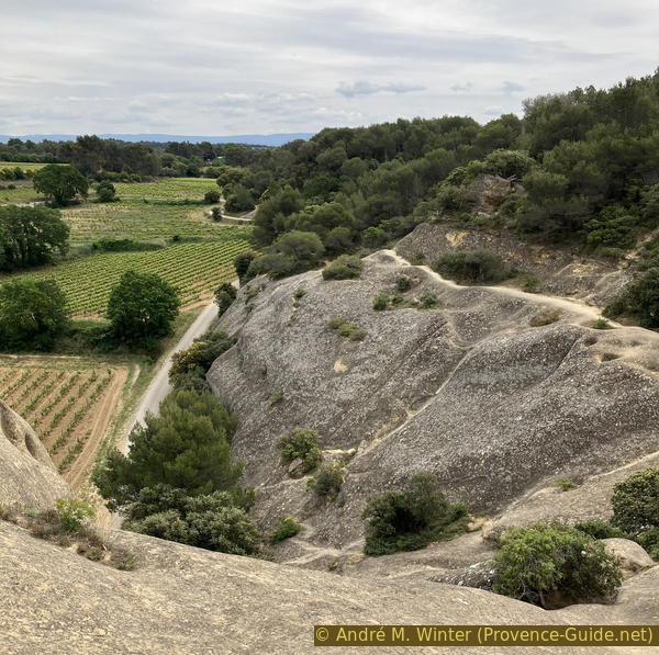
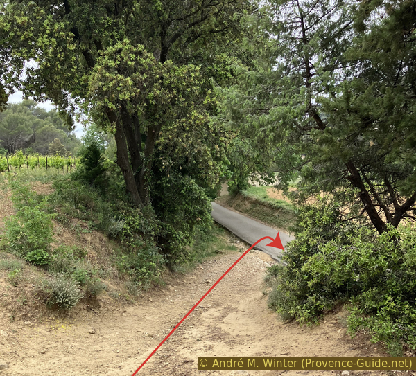
Looking back at the access on Rocher de Rocalinaud
No reproduction is permitted without the written consent of the author. (id3094)
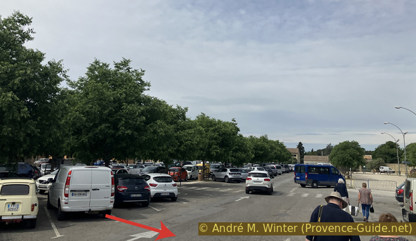
Car park in Beaumes-de-Venise
Hints
It is just a short walk from the city center. We stay mostly on small country roads.
The access to the rock is easy, but not secured. Be careful with young children.
The whole region is a zone with a high risk of forest fires. In summer, but also in other seasons when it is very dry or by strong winds, access to the forest areas can be regulated. As a result, the roads may be closed to traffic and/or the trails prohibited to hikers. Current information: Map for access to the forests of the Vaucluse department (also english). The map shows the colours green, yellow, orange and red which correspond to levels of danger. The affected area is: Massif des Dentelles de Montmirail (12).
The sections
- Beaumes-de-Venise - Vallée de la Salette - Rocher de Rocalinaud
- Rocher de Rocalinaud - Chemin de Roquefiguier - Beaumes-de-Venise
Section 1: Beaumes - Rocalinaud
➙ 2 km ... 30 min ➚ 80 m ➘ 30 m ↝ average
15% hard-surfaced country road, few marks
45% hard-surfaced quiet side streets, few marks
10% easy trails, without marks
15% hard-surfaced quiet side streets, without marks
15% moderate trails, without marks
The clues
- Beaumes-de-Venise car park, 90 m
- Bridge over La Salette creek, 95 m
- Rocher de Rocalinaud west 135 m
- Rocher de Rocalinaud, 155 m
The direct route to Rocher de Rocalinaud.
To the north of the large parking lot is the old castle of the Fortia de Pilles family, today it is the town hall. The tourist office is located in the old stables.
Before the park in front of the town hall we turn right to leave the parking lot. This alley leads up to a large central roundabout. We go right here. Ideally, we move to the left side of the street to avoid detours at the next intersection.
No reproduction is permitted without the written consent of the author. (id3535)
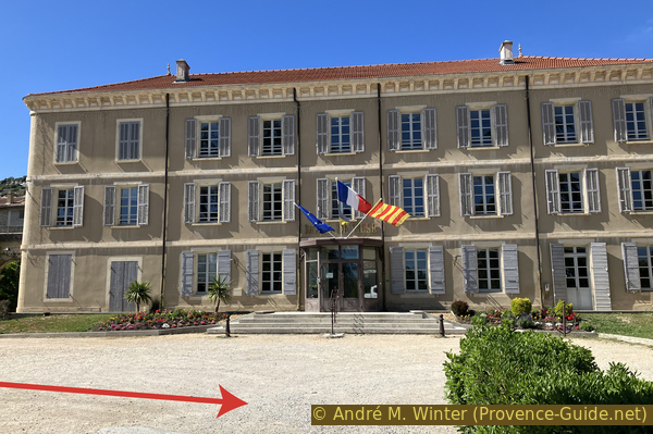
Beaumes-de-Venise town hall
The intersection of the Carpentras and the Lafare streets is bordered by the southern facade of the parish church of Beaumes-de-Venise. Although it is a reconstruction from the beginning of the 19th century, it retains its medieval defensive appearance on the south side. We walk right below.
We go straight east towards Lafare. Now it's best to switch to the right-hand sidewalk.
No reproduction is permitted without the written consent of the author. The permission of use was kindly given to Provence-Guide.net on 6 March 2024. (id4486)
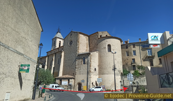
The church of Beaumes-de-Venise
Now we walk under an avenue of old plane trees. In the middle of this row of trees we see a missing house on the other side of the street. Here houses are built in and on ocher rock. It is the sand-lime stone that we will also find at the Rocher de Rocalinaud.
No reproduction is permitted without the written consent of the author. (id6138)
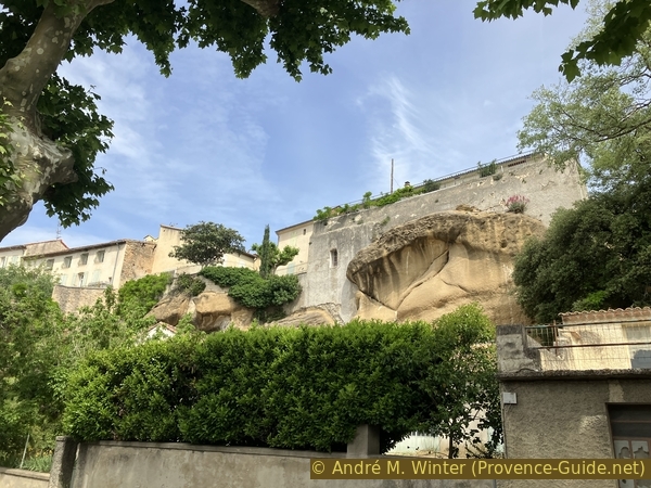
Houses in the rocks on Avenue Gambetta
We always go straight ahead. We come to the cellar of the Domaine des Bernardins, where are good wines and of course the Muscat from Beaumes-de-Venise to buy.
At the corner of the intersection stands the chapel of Sainte-Anne, built here after the plague of 1629 to place the access via Lafare Street under the protection of the saint woman. Because it was poorly built, it had to be rebuilt in 1634 and at the beginning of the 18th century. The arched door is surmounted by an oval oculus and a small bell tower wall.
We finally leave the departmental road and take the small alley to the right of the Sainte Anne chapel. It's not completely straight, but we are still heading east. We pass above the municipal campsite Roquefiguier. We are on the Route des Moulins and walk next to a first vineyard lined with cypresses.
No reproduction is permitted without the written consent of the author. (id6115)
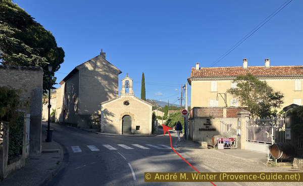
Sainte-Anne chapel
When the road begins to be lined with reeds, we go down to the right to cross the Salette stream on a bridge. Immediately afterwards left.
No reproduction is permitted without the written consent of the author. (id6116)
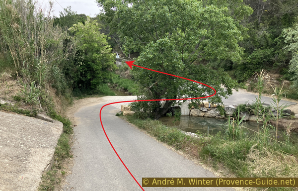
Chemin de Rocalinaud and the bridge over La Salette
We walk upwards on Chemin de Rocalinaud. The rocks on the right side of the street are also made of sand-lime stone.
No reproduction is permitted without the written consent of the author. (id6117)
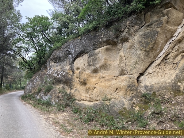
Rocalinaud sand-limestone
The forest is a little less dense as we reach the first access to a house on the right. The number 312 is written on the mailbox. We go up this concrete ramp and after a few metres turn left. We walk on a strip that also looks like concrete, but is made of natural sand-lime stone.
No reproduction is permitted without the written consent of the author. (id6118)
Climb at number 312 on Chemin de Rocalinaud
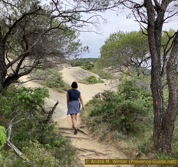
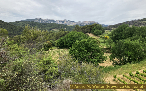
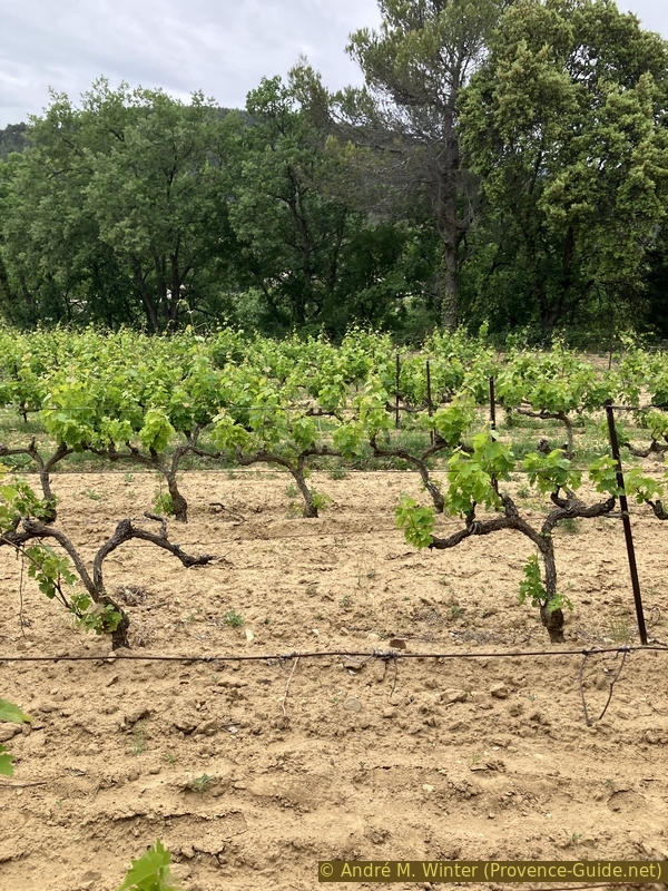
We cross the sandstone hump and reach the edge of a vineyard with sandy soil. It is the decomposition product of sandstone. We follow the edge of this field on the right. We can already see the Rocher de Rocalinaud in front of us.
No reproduction is permitted without the written consent of the author. (id6120)
Vineyards and the western part of Rocher de Rocalinaud
Don't climb onto one of the paths up the rock yet, we'll first circle around it clockwise.
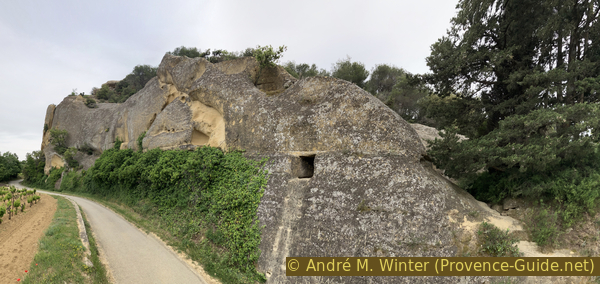
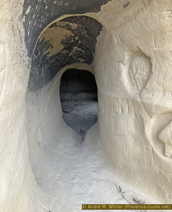
At the western foot of the rock we see an opening into a small chamber.
No reproduction is permitted without the written consent of the author. (id6121)
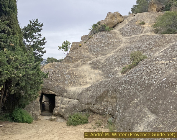
Troglodyte cave in the west of the Rocher de Rocalinaud
This room has a window. The walls are notched to accommodate shutters and tables. Natural or enlarged cavities have been used since prehistoric times. Since the rock is very soft, there is nothing left of these previous uses. Current structural traces of usage date back to the 18th century. All other recent engravings deface the site.
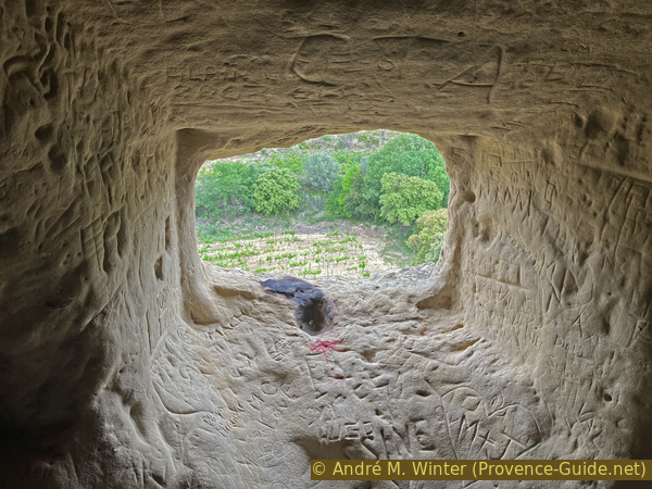
This sandstone is the remnant of an underwater dune that was formed in the Miocene, i.e. 23 to 5 million years ago. The region was covered by a shallow and warm sea, in which Mont Ventoux and the Dentelles de Montmirail formed islands. Limestone dissolves mainly in water, but also contains small amounts of sand, which is often crystallized clay. These islands were eroded and the remaining product is washed into the sea, where this sand accumulates and is accumulated by the ocean currents. At the end of the Miocene, the climate cooled and the sea retreated. Since then, this sandstone has been exposed and it is once again subject to erosion. Here it is also rubbed away by the wind and the mistral has its share of progressive destruction.
No reproduction is permitted without the written consent of the author. (id6122)
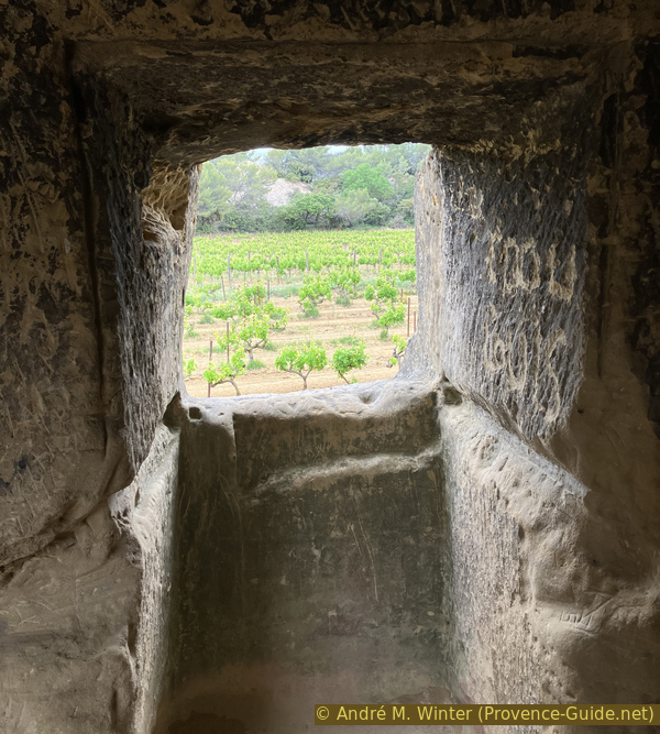
View from the troglodyte cave of Rocher de Rocalinaud
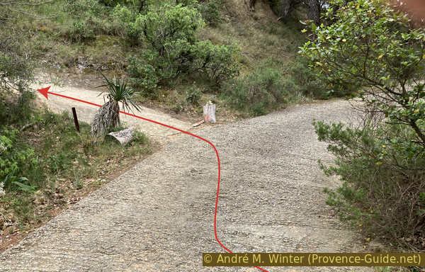
We leave the small room, keep right and go downhill to get to the road. Below again to the right.
No reproduction is permitted without the written consent of the author. (id6123)
Descent to the west of Rocher de Rocalinaud
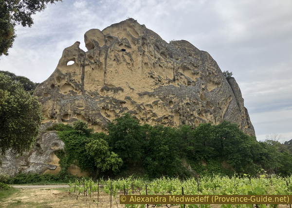
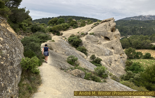
We see that the road leads around the rock. You can climb up to the left to gain some height and distance. Apart from the small room window, the other shapes appear natural.
No reproduction is permitted without the written consent of the author. (id6124)
Rocher de Rocalinaud seen from the street
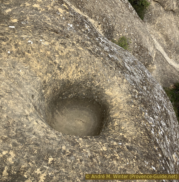
The highest vertical rock face is on the northeast side. It is covered with holes of different sizes. This is also a form of natural erosion and has the Corsican name taffoni. Sandstone consists of sand and natural cement. This cement here is lime. On the sides that remain in the shade, more condensation forms and rainwater dries more slowly. This water dissolves the cement and the process intensifies when a cavity is formed, because the deeper it is, the slower the water dries there. This dissolves the cement and the sand largely forms the surrounding vineyards soil. So it is the second cycle of sand decomposition that we see here.
A single opening on this surface is rectangular and artificial. This is the window of an upper room, which we go to now.
No reproduction is permitted without the written consent of the author. (id6125)
Hole in the ridge to the east of the Rocher de Rocalinaud
We continue on the street. When we are past the rock and the road turns left, we look for a passage in the forest on the right.
No reproduction is permitted without the written consent of the author. (id6126)
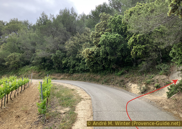
Climb to Rocher de Rocalinaud from the east
We walk more or less directly on the rock again. A lunar landscape lies before us as we emerge from the small forest. For this reason, the Rocher de Rocalinaud is also called the moon rock (Rocher lunaire).
No reproduction is permitted without the written consent of the author. (id6127)
Access path on the Rocher de Rocalinaud to the east
In front of us we see a path to an opening on the right, this is the upper room.
No reproduction is permitted without the written consent of the author. (id6128)
Path on Rocher de Rocalinaud
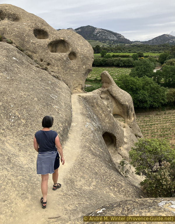
We find many rounded shapes on the rock. The cavities are often filled with vegetation, but at the edge of the cliff the shapes are usually bare.
No reproduction is permitted without the written consent of the author. (id6129)
Rounded shapes of the sand-lime stone of Rocher de Rocalinaud
There are other historical traces such as stairs around this entrance. All of these have been severely eroded.
No reproduction is permitted without the written consent of the author. (id6130)
Access to the upper cave chamber
The upper room has a longer access corridor than the lower room. Unfortunately, silly graffiti is also omnipresent here. But erosion will soon wipe all of this out.
The room is also bigger. We also see old traces of furniture fasteners. One side has a bench.
No reproduction is permitted without the written consent of the author. (id6131)
Upper cave chamber to the east of Rocher de Rocalinaud
The window is small.
Although this rock is soft, opening such chambers is a daunting task. The two openings look out onto the street and the Salette valley. Access to the rooms are hidden. Although nothing is documented in this regard, they may have been observation posts, perhaps from the time of the religious wars in the 16th century.
No reproduction is permitted without the written consent of the author. (id6132)
Window of the upper cave room
The summit of the Rocher de Rocalinaud is natural and covered with some vegetation.
No reproduction is permitted without the written consent of the author. (id6133)
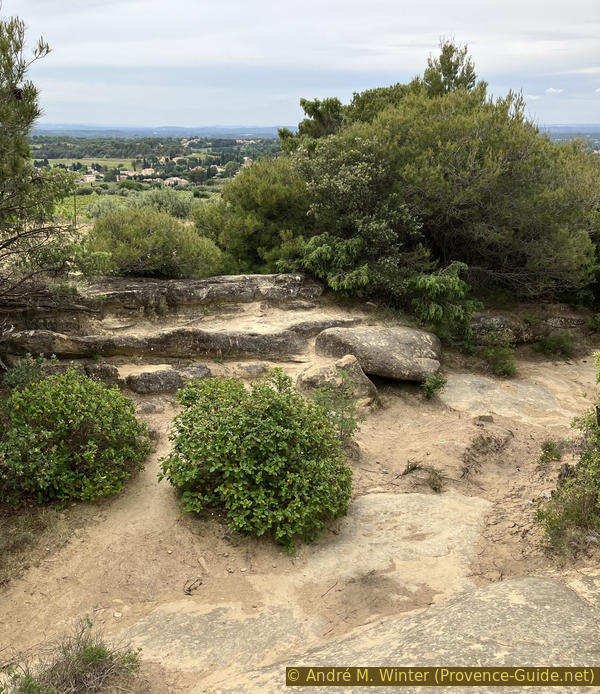
Vegetation on the summit of Rocher de Rocalinaud
We climb to the highest point mainly for the view. On the one hand we see back to Beaumes-de-Venise with the Courens ridge on the right.
No reproduction is permitted without the written consent of the author. (id6135)
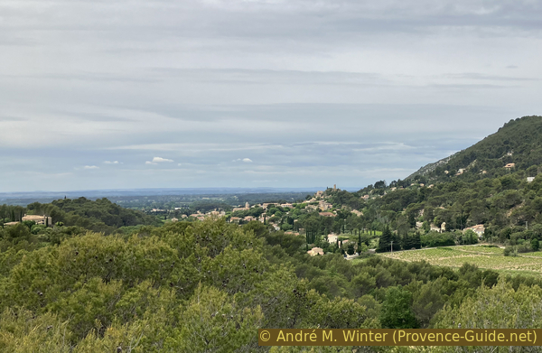
View from Rocher de Rocalinaud towards Beaumes de Venise
To the north stand out the Dentelles de Montmirail. In front is the Crête de la Salle, behind it are the Dentelles Sarrasines. In the Miocene, these ridges formed a plateau. What we see today are only the sparse remains preserved from erosion.
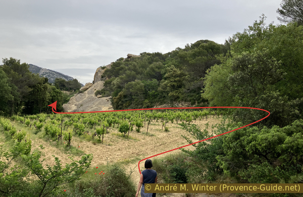
The planned return route to Beaumes-de-Venise runs between vineyards and houses. If it is very hot, it is better to take the same route back to the village. In this case we descend from the top of the rock to the right (yellow arrow on the photograph below). This descent takes us back to the edge of the vineyard at the foot of the rock. So we ignore the section 2 below.
No reproduction is permitted without the written consent of the author. (id6134)
Dentelles de Montmirail seen from Rocher de Rocalinaud
Section 2: Rocalinaud - Beaumes
➙ 1,5 km ... 30 min ➚ 5 m ➘ 55 m ↝ easy
15% dirt roads, without marks
15% hard-surfaced quiet side streets, few marks
15% hard-surfaced country road, few marks
40% hard-surfaced quiet side streets, few marks
5% hard-surfaced country road, without marks
15% hard-surfaced city alleys, without marks
The clues
- Rocher de Rocalinaud, 155 m
- Chemin des Vignaux nord
- Chemin de Roquefiguier
- Beaumes-de-Venise car park, 90 m
Way back through vineyards.
From the highest point we now look south. Depending on the position we may have to go south until we see a vineyard. We see a small house on the left and a farm path lined with a few cypresses. So we go down to this house and then down this agricultural track until we come to a small asphalt road.
This is Chemin des Vignaux Nord, we turn right. We now hike through vineyards and olive trees. After a few minutes we come to the Caromb road (D21), here again right.
We don't stay on this road for more than 200 meters. Take the first small street on the right. This is the Chemin de Roquefiguier. We pass olive trees and villas. At the beginning we see sandstone rocks in the gardens.
No reproduction is permitted without the written consent of the author. The permission of use was kindly given to Provence-Guide.net on 6 March 2024. (id6139)
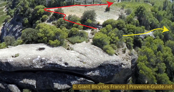
Rocher de Rocalinaud seen from a drone
The lane remains narrow and later leads downhill towards the south of Beaumes-de-Venise. We come to a small roundabout that we have to cross straight ahead.
On the left is the Saint Roch chapel. Like the Sainte Anne chapel, it was built in connection with the plague of 1586, which spared the village. It was rebuilt in 1714 and again in the 19th century when the Malaucène road was widened.
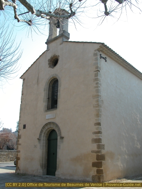
Chapel of St. Roch
So we continue straight ahead and past the chapel on the right. We are on the road to Aubignan. It turns a little to the left and we then take the first street on the right. This is the entrance to a retirement house. A little further on, however, to the left of a playground, is the path to a pedestrian bridge over the La Salette creek. This takes you directly to the parking lot and the starting point.
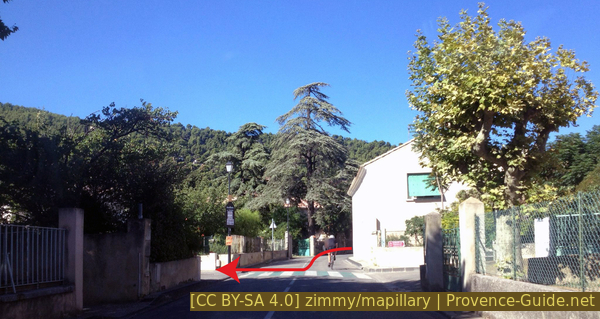
The road to Aubignan
Sources and additional information
It is better to use a good topographic hiking map: this tour is on the IGN map "Carpentras, Vaison-la-Romaine, Dentelles de Montmirail", scale 1:25000, 3040ET.
If you don't want to bother with a paper map, you can also use mapping apps on your cell phone. On the one hand, it is the Cartes IGN app from the official map service. However, it requires access to the data network and this is sometimes difficult in canyons or remote locations.
Alternatively, you can use apps that store data directly on the device. They're generally not free, but they don't cost much. We mainly use OSMAnd, here it is possible to add contour lines, relief shading, markings and others. To store this data on your phone you need a lot of space.
Of course, one needs access to satellites for the GPS signal with any app. In some canyons this is not the case. Therefore, do not rely on the position shown, but read the map on your phone as you would read it on paper. Most apps are available for Android and iPhone. The applications usually allow us to record the route travelled and also view the GPS files offered for each of our hikes.
This page has been seen 2418 times since 20 March 2024.
No reproduction is permitted without the written consent of the author. (id6140)
Vineyards near the Rocher de Rocalinaud