Waterfalls and sinter pools at Sillans-la-Cascade
More than the short walk to the Belvédère
hike
average
3 h 30 min
no
yes
built-up area
mountain
Introduction
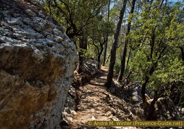
The waterfall of Sillans is well known. It is over 40 meters high and is frequently visited by locals and tourists. That's why it makes sense to do a longer tour with other sights and other vantage points, so you can get to more lonely areas. We come down to the river la Bresque and slowly climb back to the village along the right bank. We walk through a dense forest and also pass the lesser-known lower waterfall and its lake.
The waterfront trail can be slippery and has some steep sections. This keeps ill-equipped walkers away and there is a natural sorting between tourists upstream and hikers downstream.
Access to the large and better-known waterfall is severely restricted, you can only see it in full from the north-facing Belvédère. Access to the lake below is forbidden because large rocks keep breaking out of the rock face below the waterfall. No approach to this lake is explained here and we advise against bypassing the barriers. The stinging bindweed that proliferates here also forms a natural barrier.
The facts
9,5 km total distance
3 h 30 min walk time
380 m total elevation
orientation average
mark 65% of the total distance
30% forest roads
25% easy trails
15% moderate trails
10% hard-surfaced quiet side streets
10% hard-surfaced city roads
10% hard-to-recognize trails
5% hard-surfaced city alleys
<5% with marks
<5% stairs
dangers slippery sections
children yes, but they must be able to swim
useful picnic stuff, swimwear
required hiking boots, shoes for the water, hiking equipment and drinking water
GPS coordinates (WGS84) of start and end point 43.567269,6.18244
downloads ![]()
![]()
Public transport
There is no public transport to the tour apart from school buses which are not useful for hikers. It ist useful to complain about at the tourist offices of the region.
Access by car
Sillans-la-Cascade is halfway between the A8 motorway and the Verdon region. Coming from Marseille, the quickest way is via Brignoles. After the motorway exit head for Le Val, pass under Montfort and cross Cotignac. Finally, from the south-west, you come to Sillans-la-Cascade. From Nice, exit at Le Luc and then follow the direction for Vidauban, but at the roundabout after the tollbooth, follow the signs for Le Thoronet, later for the Abbey of Thoronet, then Carcès and Sillans-la-Cascade.
Useful parking spaces
All parking spaces are paid or reserved for villagers. For those with barriers you pay at the end of the exit, they are recommended for hikers. In 2019 only the parking lot behind the school was without barriers, here you have to determine the parking time in advance and pay for it straight away. You pay EUR2/h, off-season parking is free, in the off-season only the weekends are chargeable.
The starting point is at the car parks in front and behind the school, this is to the east of the village and on the road to Salernes. The one at the bridge and in front of the school is equipped with barriers, the one behind the school only with a parking meter. The other car park with barrier system is to the west on the road to Barjols, this is also the largest.
The only free parking on the tour is on the D22 road after the St. Laurent Chapel, this is at the end of section 1. However, you are standing here in nature on the main road.
All possible parking spaces are located at section 1
No reproduction is permitted without the written consent of the author. (id4409)
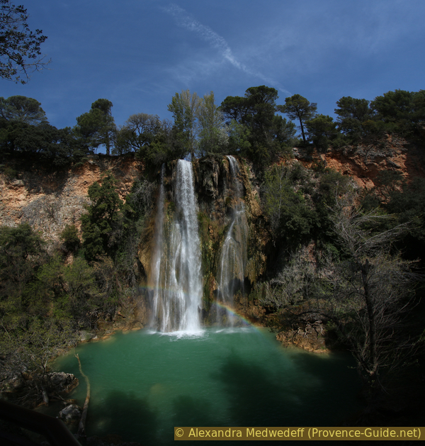
View of the large Sillans waterfall from the Belvédère
No reproduction is permitted without the written consent of the author. (id4367)
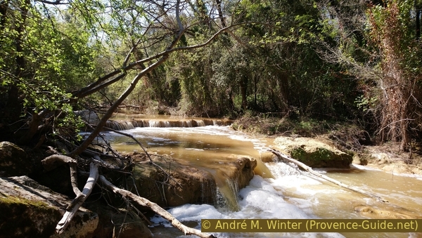
La Bresque river after a rainy day
Hints
A long section of the tour runs right along the banks of the creek in wet and shady areas. Partly it goes over slippery clay and you need good shoes. Especially after the rain, steep areas can be tedious.
In warmer periods you can refresh yourself in the pools, you can even swim in the lake under the lower waterfall. But you have to know that the pools consist of very solid and irregular rock and that there is a certain current everywhere. You have to be able to swim and not shy away from cold water. There are no auxiliary facilities and in the event of an accident, help can only come after a long time.
The locals know the pools at La Bresque creek, foreign hikers rarely pass here. However, in the high season and generally when the weather is nice, you have to expect crowds. You should then avoid the weekends and during the week you should start early to be able to enjoy some peace and quiet in these beautiful spots. Downriver there are fewer and fewer people to be found.
Climate change also affects this river and it may fall dry from june to september.
The whole region is a zone with a high risk of forest fires. In summer, but also in other seasons when it is very dry or by strong winds, access to the forest areas can be regulated. As a result, the roads may be closed to traffic and/or the trails prohibited to hikers. Current information: Map of access to the forests of the Var (also english). The map shows the colours green, yellow, orange and red which correspond to levels of danger.
The sections
- Up to the village of Sillans, to the Chapel of St. Laurent and down to Bas Ricoui
- Ascent to the Avencs plateau, to the Roque Bérard cliff with a view of the waterfall and to Sillans, further down to La Bresque creek
- Upstream to Sillans along the pools and waterfalls of La Bresque.
- To the belvédère opposite the Sillans waterfall
Section 1: Sillans - St. Laurent - Bas Ricoui
➙ 2,2 km ... 40 min ➚ 100 m ➘ 65 m ↝ average
30% hard-surfaced city roads, without marks
5% forest roads, without marks
10% easy trails, few marks
10% hard-to-recognize trails, faulty marks
15% forest roads, faulty marks
30% hard-surfaced quiet side streets, with marks
The clues
- Parking lots at the school,, 365 m
- Sillans-la-Cascade village, 375 m
- St. Laurent chapel, 450 m
- Memorials, 440 m
- Bas Ricoui, 400 m
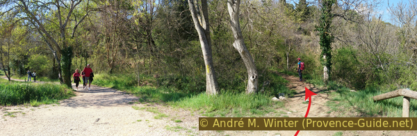
We quickly leave civilization and tourists behind to climb to a lonely chapel in the forest.
No reproduction is permitted without the written consent of the author. (id4340)
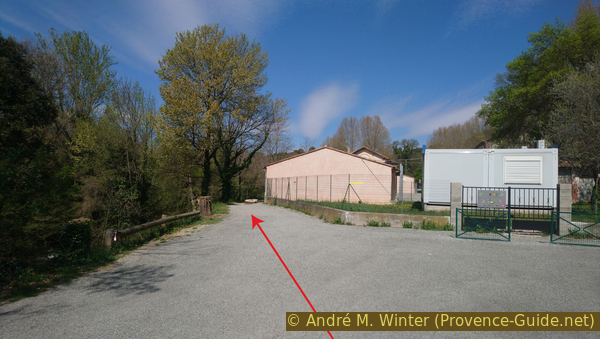
Rear of Sillans school
école = school
We leave the parking lot at the school and go over the one-lane road bridge. Below it flows the Bresque, here in a small, quiet stream. But only a little further follows the big large waterfall. At the foot of the village are two options: climb the stairs through the town centre or go around it in the north. For the second variant, go right after the bridge (yellow arrow).
No reproduction is permitted without the written consent of the author. (id4341)
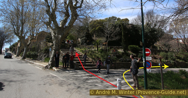
Stair climbs up from the D560 road into the village
In both cases we get to the west of the town centre and if we cross the street we come to the large parking lot. Here you should turn around to have a look at the old walls of the castle of Sillans.
We pass the barriers and on the wide dirt road, keep the direction up.
No reproduction is permitted without the written consent of the author. (id4342)
View from Rue des Remparts to the western car park
stèles = monuments
At the first opportunity we turn right and about 20 meters further we find a narrower path that leads to the left. A sign here points to Chapelle St. Laurent.
No reproduction is permitted without the written consent of the author. (id4343)
On the left the Chemin de St. Laurent path
This trail heads south first and is marked green and white. After about 100 meters we turn right, even if the marking indicates straight ahead.
It goes straight up to the chapel, after a few minutes you are in front of it.
The small building is empty but is adorned with a wrought iron Provençal campanile.
No reproduction is permitted without the written consent of the author. (id4344)
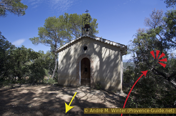
Saint Laurent chapel above Sillans
You have to pass the chapel on the right to get to the viewpoint. The view goes down to the village, the olive trees and the valley of the Bresque. Only from this rock you can see well beyond the trees.
No reproduction is permitted without the written consent of the author. (id4345)
The village of Sillans seen from the chapel
The further way is less recognizable. It is best to stand with your back to the entrance of the chapel and look for a path that leads roughly in this direction (south-west) into the forest. A faint yellow marker on a rock in the ground also marks the direction. This path rises imperceptibly to the highest point of the wooded hilltop.
When descending on the other side, the path makes a wide curve to the left and we pass two whitewashed monuments in the middle of the forest. Here German Nazis executed two French Resistance fighters in 1944.
No reproduction is permitted without the written consent of the author. (id4346)
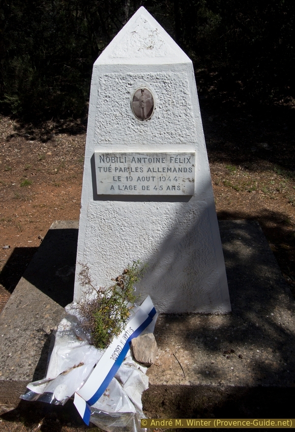
Monument to Antoine Nobili, murdered in 1944
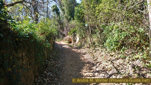
After the sad monuments we quickly come to a forest road, here we turn left. It takes us to a wider forest road, here also left while maintaining the general direction.
No reproduction is permitted without the written consent of the author. (id4347)
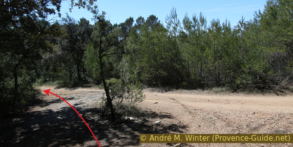
Left onto the Piste du Haut Ricoui forest road
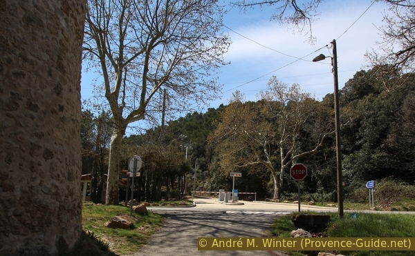
The forest road soon turns into an asphalt band and is called Chemin du Haut Ricoui here. We now go straight on between villas and thus come to the D22 provincial road. We cross this and go down the dirt road opposite and under the recycling containers.
No reproduction is permitted without the written consent of the author. (id4348)
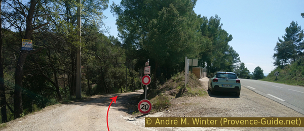
Descent under the D560 road
Here on the street is the only free parking space along the circuit.
Section 2: Bas Ricoui - Roque Bérard - Bresque
➙ 3,5 km ... 1 h ➚ 65 m ➘ 202 m ↝ average
<5% forest roads, with marks
25% easy trails, few marks
15% hard-to-recognize trails, cairns
40% forest roads, few marks
20% easy trails, few marks
The clues
- Bas Ricoui, 400 m
- Plateau Les Avencs, 440 m
- Cliff edge of Roque Bérard, 450 m
- Courourette, 350 m
- Les Tourons, 330 m
- La Bresque creek, 260 m
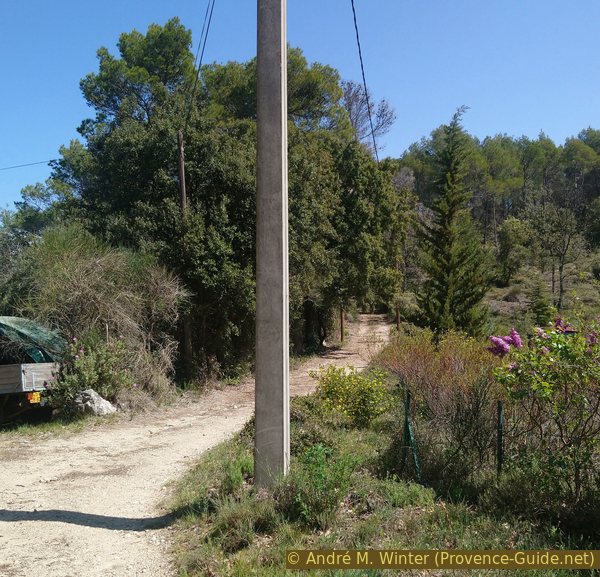
After the last houses we walk through a sparse forest to a natural vantage point of the waterfall and the village of Sillans. Our path then leads in long hairpin bends down through an increasingly dense forest to the Bresque river bed.
Under the country road we come to a somewhat confusing crossroads between houses. There are signposts, but they don't indicate our direction.
We go straight past the first downhill junction, but immediately after that we turn left, only at this point the road is flat. You can only see two driveways and you actually have to go between these two, even if cars are parked here. We are now on the Chemin des Avencs.
No reproduction is permitted without the written consent of the author. (id4349)
Chemin des Avencs behind the houses
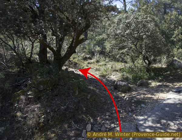
So we climb first to the east and leave the last houses behind us. Straight ahead, however, we soon see a prohibition sign. Shortly before we have to look for a narrower path on the right. This one first leads along a fence.
No reproduction is permitted without the written consent of the author. (id4350)
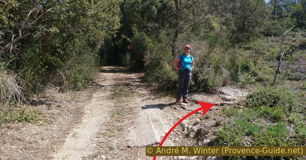
On the right is the beginning of the path up to the Avencs plateau
Very quickly, however, the path climbs steeper and turns east again. After a few minutes we find ourselves on a flat plateau covered with a sparse forest. Our path is now a little wider, dead straight and flat.
About 150 meters to the left is the cliff edge down into the Bresque valley. For 15 minutes you see nothing of it. When our path abruptly descends from the plateau, the view opens to the east.
You have to be careful here, because barely 20 meters after the path begins to go down, there is a small cairn on the left that marks our way to the cliff edge.
No reproduction is permitted without the written consent of the author. (id4351)
Forest road on the plateau and start of the path to the vantage point
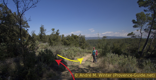
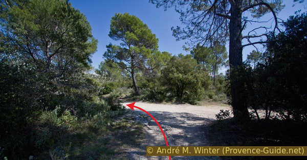
So pass the cairn and go on in the direction of the cliff edge. The path is only weakly marked by several other cairns. It leads slightly uphill to the north-west, crossing paths should be ignored. Sometimes you walk along old stone walls.
In front of the cliff edge, the trees look bigger and denser, so you can't see it. When you have followed the path, you have to turn left at a slightly larger cairn.
No reproduction is permitted without the written consent of the author. (id4352)
Cairn on the edge of Roque Bérard
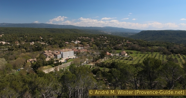
After a few meters you come to an open area with a good view down the valley and to the north. There you can see the big waterfall and to the left of it the village of Sillans. You can also take a break here.
No reproduction is permitted without the written consent of the author. (id4353)
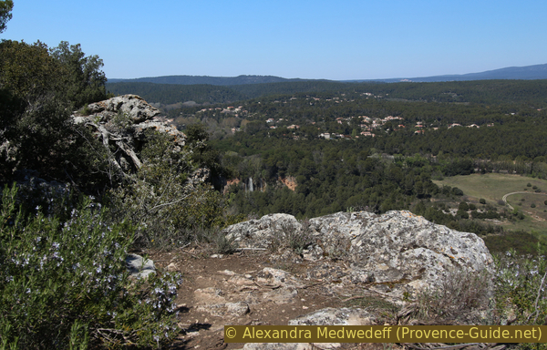
View to Sillans and the waterfall
On the same path we go back to the main forest road and from there further down from the plateau to the east (i.e. to the left). We come to a wider forest road, turn left again here and descend over two hairpin bends. Ignore the smaller driveways on the left.
No reproduction is permitted without the written consent of the author. (id4354)
Junction Chemin des Avencs with Chemin de Courourette
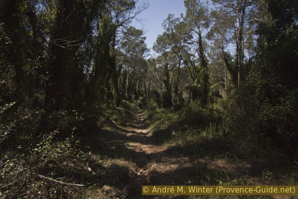
After the hairpin bends we are in a higher forest that is literally flooded with stinging bindweed and ivy. You can't get through anywhere off the beaten track. The humidity of the valley allows for this growth of vegetation.
No reproduction is permitted without the written consent of the author. (id4355)
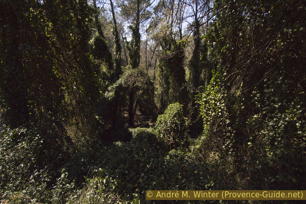
Forest overgrown with stinging bindweed and ivy
350 meters further down there is a larger junction, here we turn left again. A signpost points to Sillans.
No reproduction is permitted without the written consent of the author. (id4356)
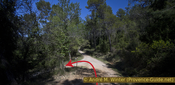
Junction to Sillans left
A few minutes later the forest road rises briefly. At the crest, the path leads to the right into the forest (signpost).
No reproduction is permitted without the written consent of the author. (id4357)
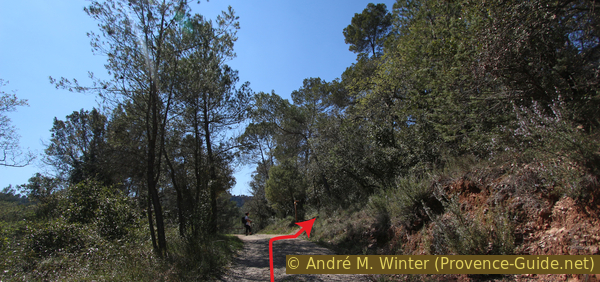
At the top you have to turn right into the forest
This path leads over some rocks and then back to the previously abandoned forest road.
Shortly thereafter, it turns sharp right again and continues downhill.
No reproduction is permitted without the written consent of the author. (id4358)
Way north of Les Tourons
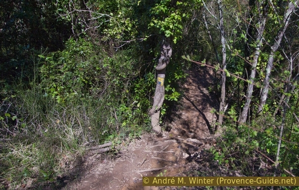
Further down, a yellow marker points to the left. After the fork, we go straight down to the bank of the Bresque river.
No reproduction is permitted without the written consent of the author. (id4359)
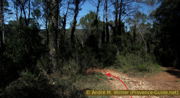
Junction under Les Tourons
We walk again through a forest overgrown by stinging winds. This time we get closer to this uncomfortable growth because the path is much narrower.
No reproduction is permitted without the written consent of the author. (id4360)
Path under Les Tourons down to the creek
Section 3: Cascades et vasques - Sillans
➙ 2,5 km ... 1 h 20 min ➚ 173 m ➘ 71 m ↝ average
55% moderate trails, without marks
5% stairs, with marks
15% hard-surfaced city alleys, without marks
5% with marks, without marks
10% forest roads, without marks
15% hard-surfaced city roads, faulty marks
The clues
- La Bresque below Les Tourons, 260 m
- Sillans-la-Cascade village, 375 m
- Parking lots at the school, 365 m
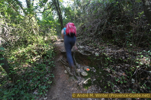
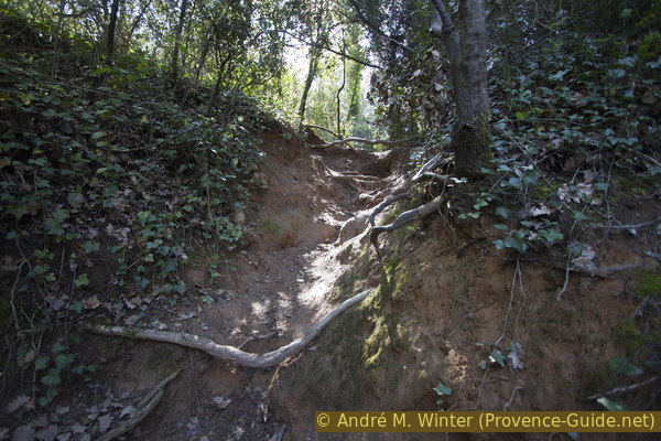
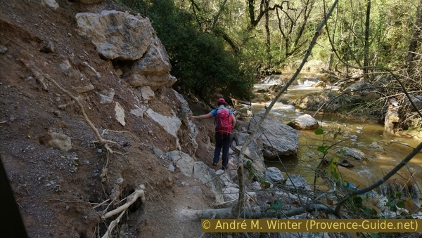
Along the bank are several forced detours up to the left, steep slopes or protected areas have to be avoided. These climbs and descents represent the real difficulties of the section. You have to hold on to branches and roots, the slippery clay rarely offers enough support.
Our path comes directly to the water and from here we continue upstream. At least here it can be muddy.
The water can be turquoise and transparent or brown and opaque, it always depends on the weather of the previous days and not on the season. All these differences, which also result from the varying position of the sun, offer different impressions of the river valley. It is really worth coming to Sillans more often.
No reproduction is permitted without the written consent of the author. (id4361)
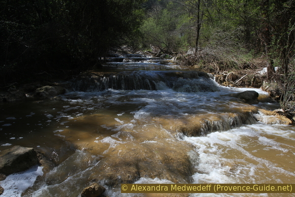
Sinter barriers in the La Bresque creek after a rainy day
We usually try to stay as close to shore as possible. There are detours due to nature conservation areas (colubrid nesting sites, etc.) and because the bank is too steep in places. It's also constantly changing. Basically it is a marked and official path, but often you have to find the path yourself. However, one should not bypass any barriers and also not go off the beaten track, this damages the vegetation and would increase the erosion of the bank slopes.
No reproduction is permitted without the written consent of the author. (id4362)
Detour to the left around a natural sanctuary
A few houses in the hamlet of Les Courdeiron lie opposite on the north bank. In places, theoretically opaque curtains are stretched so that you cannot see across. However, prohibition signs only apply to the opposite bank. Anyhow, the course of the stream is not particularly interesting here, the beautiful sinter pools come further up.
No reproduction is permitted without the written consent of the author. (id4363)
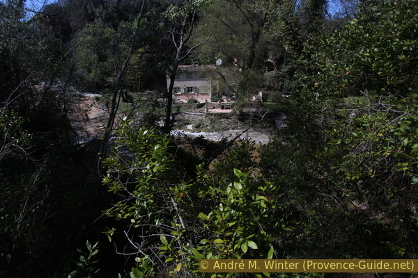
A house in the hamlet of Les Courdeirons on the other bank
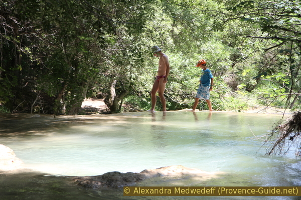
We continue to climb along the body of water and come to a lake into which the lower waterfall plunges. Hardened people can swim here, higher up the pools are shallower or not accessible. The water stays quite cool even in summer.
No reproduction is permitted without the written consent of the author. (id3376)
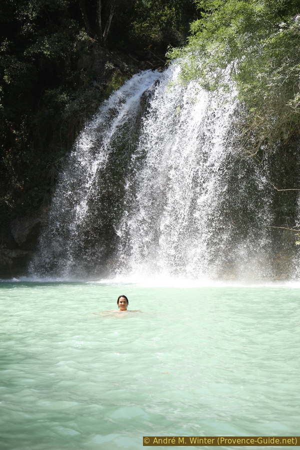
Swimming in the lake under the lower waterfall
The lake and the waterfall are usually admired from the south, but you can also switch to the other shore via the sinter basin edges. From the path you go towards the rock and in front of it you climb down to the right. On the plain below the natural dam you can cross the stream and go under the waterfall without getting too wet. Of course you have to go back to the path here.
No reproduction is permitted without the written consent of the author. (id3375)
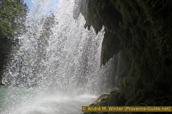
Moss on the tufa under the waterfall
cascade basse = lower waterfall
passage vers la = access to
raccourci - shortcut
There are two options for the next section:
The first variant is more comfortable and marked, it is a bit longer but we recommend it. This path goes up the slope to the left from the rock on the lake shore. It leads over some terrain steps and progressively to the right.
No reproduction is permitted without the written consent of the author. (id4364)
On the bypass of the lower waterfall
We come to a green plateau with a ruined house. We pass it to the right and so we get back to the river bed, but now at the top edge of the waterfall. Here we continue further upstream.
No reproduction is permitted without the written consent of the author. (id4365)
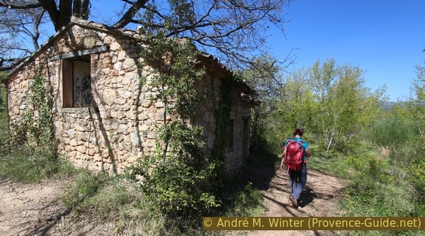
Ruins on the plateau under the Roque Bérard cliff
The second way is faster, steeper and much more slippery. It's hard to get up here after rain. Pass the rocks on the lake shore to the left and walk along the water until you come to the rock wall. Here left very steep and in almost a straight line up. This is how we get to the plateau and to the right we come back to the creek bank.
No reproduction is permitted without the written consent of the author. (id4366)
On the steeper bypass
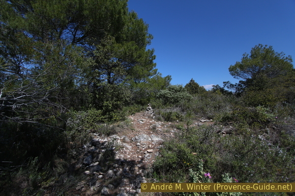
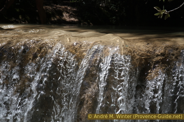
Further upstream we come to the most beautiful tufa pools along the La Bresque stream. The pools follow one another, with small waterfalls splashing in between. The edges are made of hard sinter. In summer, when they are not covered with clay, you can walk barefoot over them.
Attention: the pools are not particularly deep and all parts of them, including the bottom, are made of hard rock. Falls from the natural walls can end in broken bones.
No reproduction is permitted without the written consent of the author. (id3372)
Walk on the sinter walls
This fantastic stretch of river is a few hundred meters long. The path here is flatter and easier, you can stop several times to admire the luminous pools and the small waterfalls.
No reproduction is permitted without the written consent of the author. (id3374)
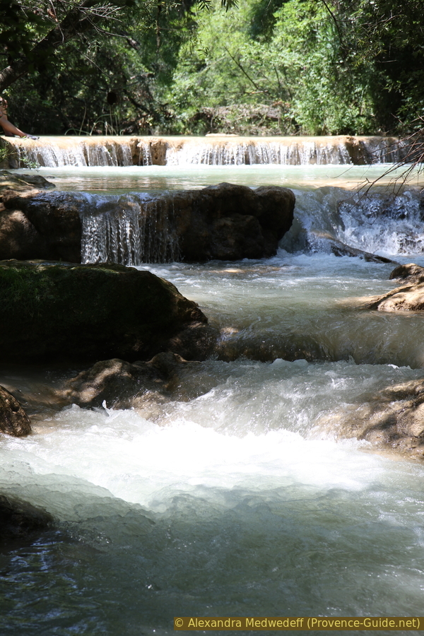
Sinter pools at the La Bresque stream
Further ahead you have to cross a landslide, which reminds us of the unstable terrain. This section is also a natural barrier against ill-equipped walkers coming down from the village. Further upstream you often meet a lot more people.
No reproduction is permitted without the written consent of the author. (id4368)
Landslide on the south bank of la Bresque 2019
About five minutes ahead you can cross the stream and go up to the new Belvédère. A sinter wall allows you to cross part of the stream, after which you have to wade through the water or balance over shaky tree trunks. Opposite, to the left of a rock and at the prohibition signs, a steep and slippery path leads up. Of course, this way is dangerous and forbidden.
No reproduction is permitted without the written consent of the author. (id4369)
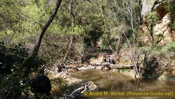
Possible climb opposite to the new Belvédère
Further ahead on our south bank trail we come into a more open area with taller trees. The stream winds to the right and we come across barriers and prohibition signs. You can hear the big waterfall, but you can't see it. The trellis were erected in 2011 after several rockfalls from the waterfall's cliff into the lake below. Geological investigations have also shown that the tuff rock wall is very unstable.
So we have to follow the marked path and climb to the left towards the village.
This path leads over steps to a small lookout point with a bench. You can see a little more from here than from the last vantage point on the waterfall.
No reproduction is permitted without the written consent of the author. (id3371)
The big waterfall seen from the right bank
école = school
falaise = cliff
interdit - forbidden
ouest - west
After the viewing point we come to a first field. If the main path branches off to the left, we have two options again:
Turn left back to the car park west of the village, ignoring the path to the new Belvédère.
On the right you can get to the parking lot at the school faster and on to the Belvédère. This variant is described below.
No reproduction is permitted without the written consent of the author. (id4370)
Chemin de la Cascade on the left and shortcut to the village on the right
After this crossroads we go straight ahead and up a narrower path through a strip of forest.
No reproduction is permitted without the written consent of the author. (id4371)
Direct climb to the cemetery and the village
Then we come to another field and if the path continues to the right, we can cut a bend through the slope.
No reproduction is permitted without the written consent of the author. (id4372)
Cut straight off a bend here
école = school
We come so in the south under the village and on a wide field with olive trees. We are now targeting the church tower. Depending on the season, you have to deviate different distances to the left because sometimes the pastures are fenced.
From the road under the village you can either stroll through Sillans again or turn right at the bypass road and get back to the bridge on La Bresque creek and the car parks at the school.
No reproduction is permitted without the written consent of the author. (id4373)
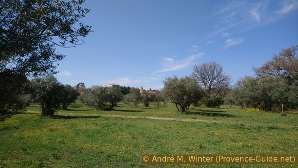
Olive grove under Sillans cemetery
Section 4: Sillans - Belvédère de la Cascade
➙ 1,4 km ... 30 min ➚ 42 m ➘ 42 m ↝ easy
15% hard-surfaced quiet side streets, with marks
15% forest roads, with marks
40% easy trails, with marks
15% forest roads, with marks
15% hard-surfaced quiet side streets, with marks
The clues
- Parking lots at the school, 365 m
- Belvédère de la Cascade, 320 m
- Parking lots at the school, 365 m
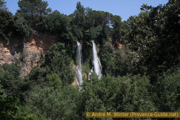
After the permanent blocking of access to the lake under the great waterfall of Sillans in 2011, you had to wait until 2014 for a new viewpoint to be installed. The path is now shorter and better equipped. The view may be better, but that way more people come. So you should choose your day and time well if you don't want to queue at the viewpoint. The waterfall is south facing but in a deep basin, too early in the morning the sun doesn't reach the lake and this detracts from the overall impression. Midday is ideal, when maybe everyone else is lunching.
école = school
falaise = cliffs
We go past the school on the right, cross the rear parking lot and stay on the narrower road on the right under the main road. This flat path is a former railway line and the school is the old railway station.
No reproduction is permitted without the written consent of the author. (id4406)
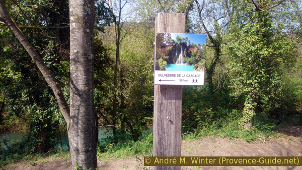
Signpost to the Belvédère
A little further on, the path branches off from the old railway line and at a sewage treatment plant, the path to the Belvédère turns right. The spot is clearly visible.
No reproduction is permitted without the written consent of the author. (id4407)
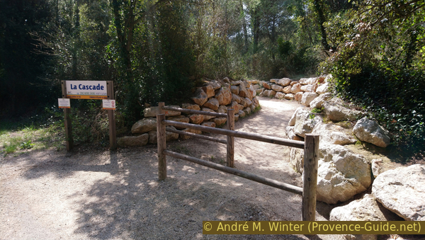
Access to the Belvédère
The new path is paved with natural stones, the limestone is sometimes slippery, but a handrail accompanies some sections. In any case, the path is set up for many visitors, but not accessible to disabled individuals.
No reproduction is permitted without the written consent of the author. (id4408)
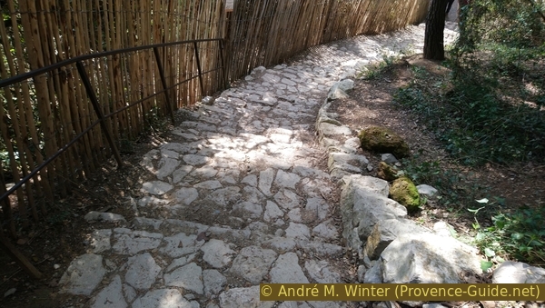
Natural stone paved approach
In a few minutes we are at the viewpoint and we are really in front of the waterfall and halfway up. The position is truly ideal.
The spray of the falling water forms a small rainbow just above the turquoise lake in the midday hours. The water of the waterfall can be white and clear or brown and dirty, it always depends on the weather on the previous days on the limestone plateau south of the Verdon.
We return to the parking lot at the school the same way.
No reproduction is permitted without the written consent of the author. (id4410)
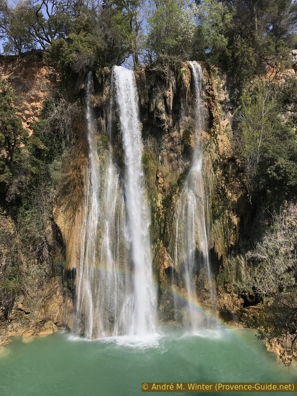
Cascade de Sillans
Sources and additional information
It is better to use a good topographical hiking map: This tour is on the IGN "Aups, Salernes" map, scale 1:25000, 3443OT.
If you don't want to bother with a paper map, you can also use mapping apps on your cell phone. On the one hand, it is the Cartes IGN app from the official map service. However, it requires access to the data network and this is sometimes difficult in canyons or remote locations.
Alternatively, you can use apps that store data directly on the device. They're generally not free, but they don't cost much. We mainly use OSMAnd, here it is possible to add contour lines, relief shading, markings and others. To store this data on your phone you need a lot of space.
Of course, one needs access to satellites for the GPS signal with any app. In some canyons this is not the case. Therefore, do not rely on the position shown, but read the map on your phone as you would read it on paper. Most apps are available for Android and iPhone. The applications usually allow us to record the route travelled and also view the GPS files offered for each of our hikes.
This page has been seen 5443 times since 20 March 2024.
No reproduction is permitted without the written consent of the author. (id3373)
Small waterfall over a sinter barrier