Hike around the island of Port-Cros
Preserved Mediterranean forest in the national park
hike
average
5 h
yes
yes
built-up area
mountain
Introduction
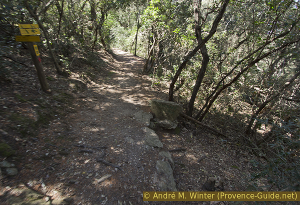
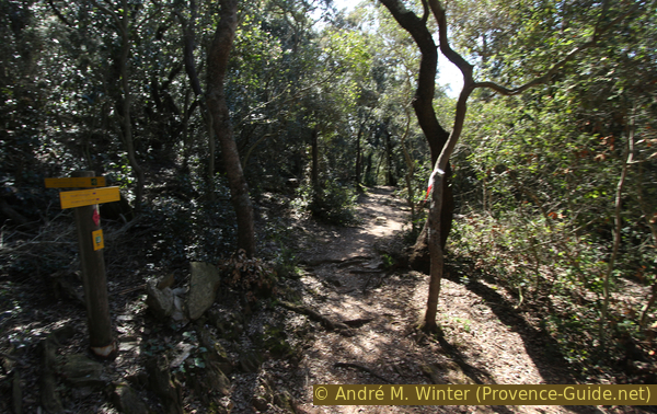
Since 1963, the island of Port-Cros has formed France's first national park, which also includes the surrounding sea. The protected area was also extended to large parts of the neighbouring island of Porquerolles. The vegetation on the mainland and on the island is very similar, but here, in the national park, everything is better preserved and protected. This is particularly noticeable in the density of the bushes and the height of the trees: on Port-Cros almost all sections of the path are in the shade.
As very few people can stay overnight on the island, most visitors come in the morning and leave in the evening. For all activities on the island, you always have to keep an eye on the clock, the last ship leaves without waiting. Despite its compact size, the island is too big to circumnavigate in its entirety in one day, especially if you aim for all the capes and all the viewpoints or take your time on the beaches.
On the north side, an underwater path was marked and signposted with buoys by the national park administration. To get to know this unique nature trail, you need diving goggles, snorkel and fins. The Baie de la Palud is well protected by the Rocher du Rascas rock. Early in the morning the water is often still calm and clear. However, if you invest two hours in this excursion, the tour described here will no longer be manageable in its entirety.
The facts
15,8 km total distance
5 h walk time
610 m total elevation
orientation average
mark 85% of the total distance
35% moderate trails
35% easy trails
15% forest roads
5% hard-to-recognize trails
<5% exposed trails
<5% on beach
<5% hard-surfaced city alleys
<5% hard-surfaced quiet side streets
<5% stairs
dangers heat, jellyfish and steep rocky cliffs
children yes
useful picnic stuff, swimwear
required hiking boots, hiking equipment and water
GPS coordinates (WGS84) of start and end point 43.009799,6.381637
downloads ![]()
![]()
No reproduction is permitted without the written consent of the author. (id4379)
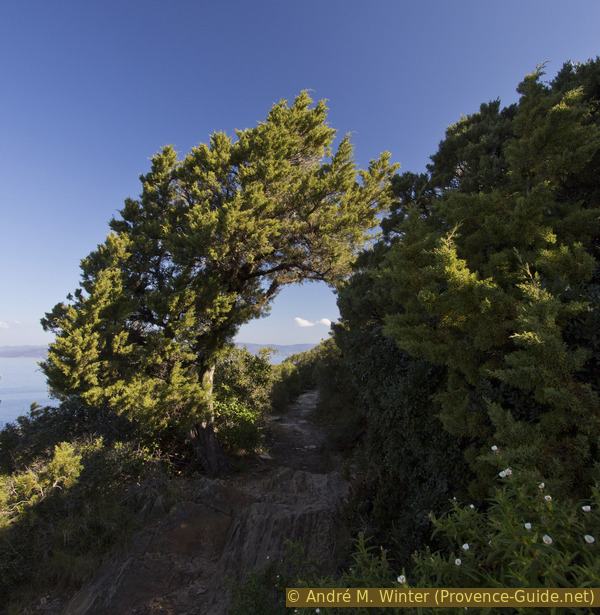
The coastal path and a large juniper tree
No reproduction is permitted without the written consent of the author. (id3217)
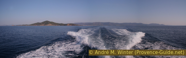
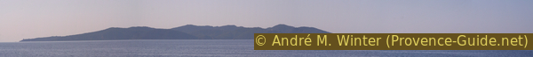
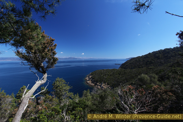
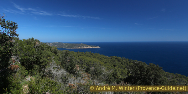
Cap Bénat and the Maures Massif
Public transport
There are two places where ferries leave for the island. Both are on the coast between Toulon and Cavalaire-sur-Mer. This part of the coast is fairly well served by bus.
To get to the port of Hyères you first have to take bus 878 from Zou! (only french) to get to the city centre. It runs around 20 times a day between St Tropez and Toulon. From both directions, get off at the Soldat Bellon stop. Continue by bus 67 from Réseau Mistral (only french) to Giens and La Tour Fondue (around 15 times a day). This second ride takes about 15 minutes.
No reproduction is permitted without the written consent of the author. (id4374)
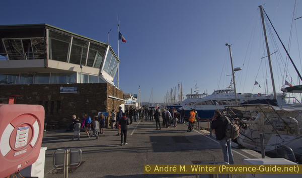
Harbor master's office on Gilles Barbanson quay in the port of Hyères
Ticket sales are opposite the pier.
Bureau = office
embarquement = boarding
débarquement = landing
We get off at La Gavine station. You can walk to the harbour in another five minutes. For the way back, take bus 67 again in the same alley. In the centre of Hyères we get off at the Jean Aicard stop. The bus stop Soldier Bellon for the 878 bus is one lane further up.
No reproduction is permitted without the written consent of the author. (id4375)
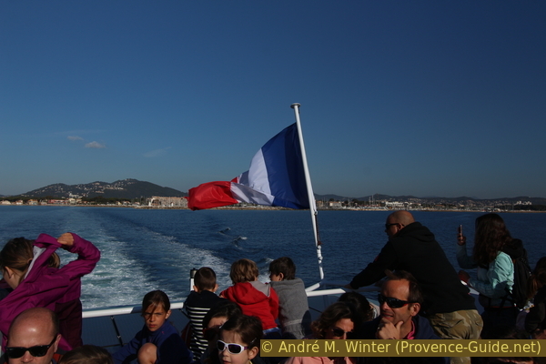
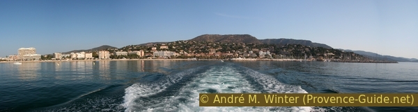
On the ship to Port-Cros after leaving the port of Hyères
Le Lavandou can be reached by bus line 878 between St Tropez and Toulon (20 times a day) and by line 873 between St Tropez and Aéroport d'Hyères Airport (4 times a day). Information at Zou! (only french). We get off at Gare Routière Le Lavandou from both directions. From the main street we go down to the parallel Avenue des Martyrs de la Résistance and there we go east. We come to a large square planted with plane trees. Now to the beach and now we are already longing for the ferry dock.
No reproduction is permitted without the written consent of the author. (id3216)
Departure from Le Lavandou and the Maures massif
Passenger ferries make regular trips to Port-Cros throughout the year. In summer there are around 10 connections a day from both Hyères and Le Lavandou, and in winter there is always at least one ship.
- from Port Saint-Pierre in Hyères-Plage with the company TLV in less than an hour. Ticket sales take place in the harbour master's building, the office is on the sea side opposite the pier.
- from Port du Lavandou with the company Vedettes des Îles d'Or in just over 30 minutes. Tickets are available in the building directly opposite the ferries at the pier.
Sometimes the island Île du Levant (but never Porquerolles) is also approached on the ferry route. This increases the travel time by around 30 minutes.
The price always includes the return trip on the same day. In the low season you can go back with any ship. In the high season, you may be assigned a fixed time for the return trip. For hikes, it makes sense to get the exact times in the sales office. In all cases, you must be back in port by the specified time and also keep the ticket until then.
Both connections offer great views of the coast and islands. The ferries have open decks and since they usually start early in the morning, it can still be quite chilly. Sometimes the wind comes to the 30 km/h speed of the ship. So even in summer you need at least one fleece jacket, in the off-season a good jacket and hood can also come in handy.
Access by car
The port of Hyères is on the Giens peninsula. From the A8 motorway and via the A57 or from Toulon and on the A57, continue east on the A570 (Hyères, St Tropez) and come south under the old town of Hyères. After the big roundabout, keep right and follow the indications to the port (Port, Giens). After a long and straight stretch of road with boat dealers, we come to another roundabout. In the low season you can continue to follow the signs to the port. In summer you should aim for the indicated Arromanches car park.
Le Lavandou is further east between Hyères and St. Tropez. The ferry terminal is located right in the town centre at Quai Gabriel Péri. To get there, you have to follow the port signs from either direction quite early.
Useful parking spaces
In Hyères, the Arromanches car park is free. In high season there is a free shuttle bus to the port.
The car park at the port is chargeable only in summer. However, every Sunday takes place the market on Hyères harbour, then the square is closed. From Monday to Saturday and in the low season you can aim for this parking lot when you start with the first boat. On Sundays the parking lot at the racecourse (Hippodrome) is free.
In Le Lavandou, the Les Îles d'Or car park on Quai Gabriel Péri is the closest. From April to the end of October it is chargeable and often full. The car park at the new port (Nouveau Port, Quai du Labbé) is free. Coming from Cavalaire, follow the signs to the Port. From Hyères you first drive to the beach and then to the Nouveau Port.
No reproduction is permitted without the written consent of the author. (id3219)
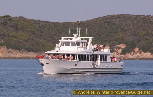
Le Corsaire I in 2009
No reproduction is permitted without the written consent of the author. (id4378)
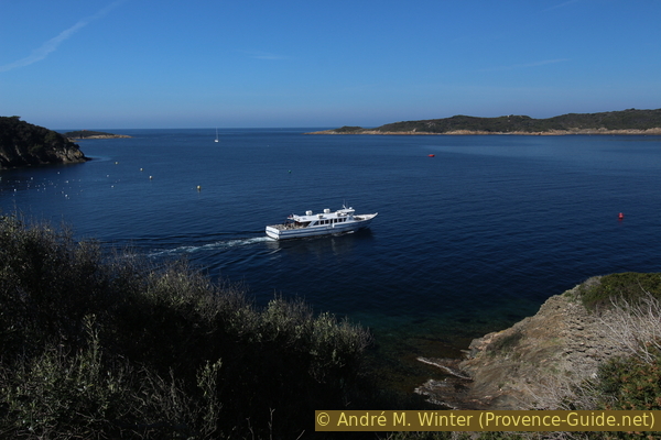
Ferry in the Passe de Bagaud strait
Hints
The entire island of Port-Cros and the surrounding sea area is a national park area and particularly strict rules apply here: smoking is prohibited throughout the island (except in the port), you have to stay on the paths and dogs are only allowed on a small section around the port. Paths may be closed in strong winds or other hazards. Thanks to these rules, the nature of the island is well preserved, let's make sure it stays that way!
The island is well known and in summer it is almost overrun. The two ships in the low season are enough to fill the few beaches and meet many hikers, especially in the north part.
In summer, several ships drop off almost 4000 people daily on the island. If you are looking for secluded hikes, it is better to come in the off-season between November and Easter.
There is a lot of shade on the paths, together with the often present breeze from the sea, it can be pleasantly cool. The interior of the island is covered with a dense forest, so we prefer the circular route along the coast, here there are several viewpoints. However, the full lap is only possible in time if you are on the go without breaks and at a run. But since you also want to enjoy the landscape, there are several shortcuts back to the harbour on this tour.
All travel times are given excluding breaks!
There are no sources of drinking water on the whole island and drinks can only be bought in the village by the port.
The whole region is a zone with a high risk of forest fires. In summer, but also in other seasons when it is very dry or by strong winds, access to the forest areas can be regulated. As a result, the roads may be closed to traffic and/or the trails prohibited to hikers. Current information: Map of access to the forests of the Var (also english). The map shows the colours green, yellow, orange and red which correspond to levels of danger.
The sections
- The whole north coast from the village of Port-Cros to the bay of Port-Man via the Baie de la Palud
- From Port-Man on the South Ridge and Fortin de la Vigie Fortress
- Via the south coast and back to the port
Section 1: Village - Baie de la Palud - Port-Man
➙ 5,9 km ... 1 h 40 min ➚ 190 m ➘ 190 m ↝ easy
<5% hard-surfaced city alleys, few marks
5% forest roads, few marks
10% easy trails, with marks
5% moderate trails, few marks
10% easy trails, with marks
5% on beach, without marks
<5% stairs, with marks
60% moderate trails, few marks
5% on beach, without marks
The clues
- Port-Cros, 0 m
- Sentier des Plantes, 70 m
- Plage de la Palud beach, 0 m
- Plateau de Marma, 85 m
- Calanque Longue, 12 m
- La Mirte, 40 m
- Calanque du Palangrier, 0 m
- In front of Port-Man, 15 m
- Plage de Port-Man beach, 0 m
It is the usual and much used route to the Baie de la Palud. The way further into Port-Man may be less crowded.
No reproduction is permitted without the written consent of the author. (id3218)
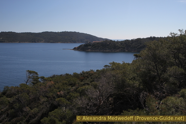
Port-Cros and Bagaud Island seen from the north
No reproduction is permitted without the written consent of the author. (id3220)
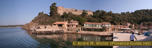
The village of Port-Cros seen while entering the port
On the left the national park office and in the extension of the harbor wall the passage up to the fortress.
maison du Parc Nat. = national park house
embarquement = boarding
débarquement = landing
At the harbour you can see a row of houses. The house on the far left is the National Park Office, here you can buy hiking maps and a plastic brochure for the underwater trail. Here you can also inquire about any blocked trails.
No reproduction is permitted without the written consent of the author. (id4376)
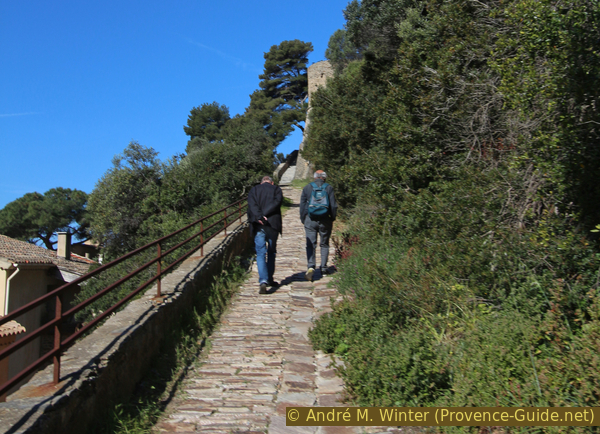
Ascent to Fort du Moulin
We leave the national park office, follow the row of houses and turn left at the first opportunity. It goes up a cobbled path to the Fort du Moulin, which was renovated in 2019. You can walk around the walls clockwise. You can see back to the harbour from this path, but the bushes are a bit intrusive.
No reproduction is permitted without the written consent of the author. (id4377)
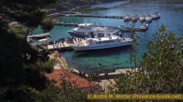
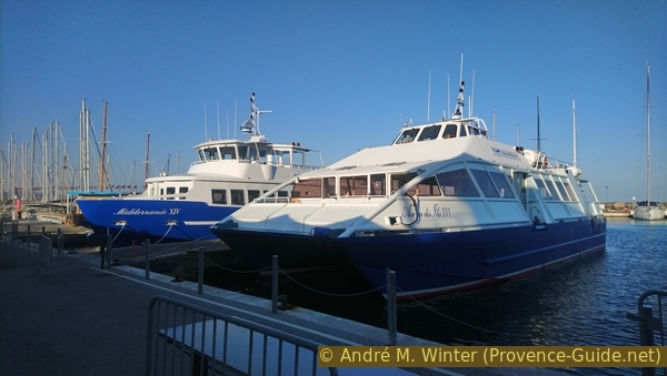
Two ferries at Port-Cros pier
After the fortress, the path begins over the ridge of the north coast. Tall bushes and trees provide good shade. In the low season it is still noticeably cool here. 50 meters after the fortress we come to a crossroads. On the left we go to the tiny cemetery of the island, but we pass the cemetery on the right and then left at the following junctions.
No reproduction is permitted without the written consent of the author. (id3221)
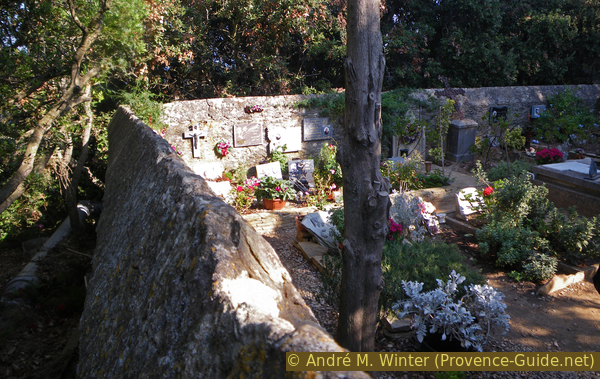
Port-Cros cemetery in the forest
Without seeing it, we pass under the Fort de l'Estissac and then stand at a fork in the path. The path on the left (Sentier des Plantes) is a little longer and steeper in places, but the vegetation is lower and so you have a better view. The other path leads inland and through an opaque forest.
No reproduction is permitted without the written consent of the author. (id4380)
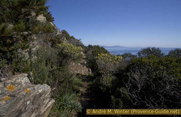
On the Sentier des Plantes path
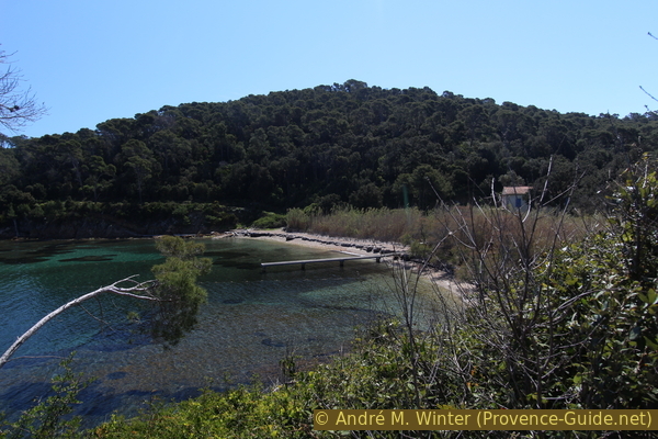
Both variants bring us directly to the Plage de la Palud beach. Everything remains natural here, the narrow strip of sand is usually thickly covered with seaweed. A first break is advisable. From the beach you can now see the Fort de l'Estissac back.
No reproduction is permitted without the written consent of the author. (id4381)
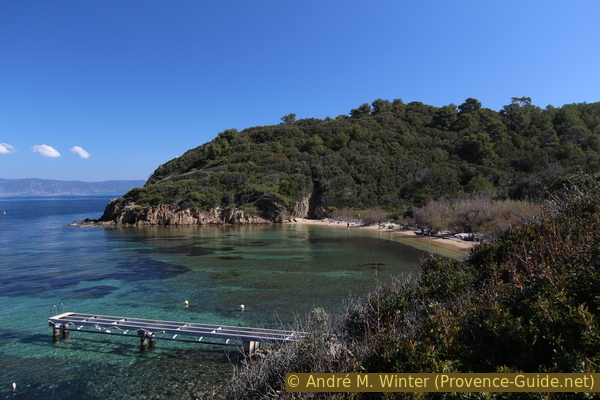
Beach in the Baie de la Palud bay
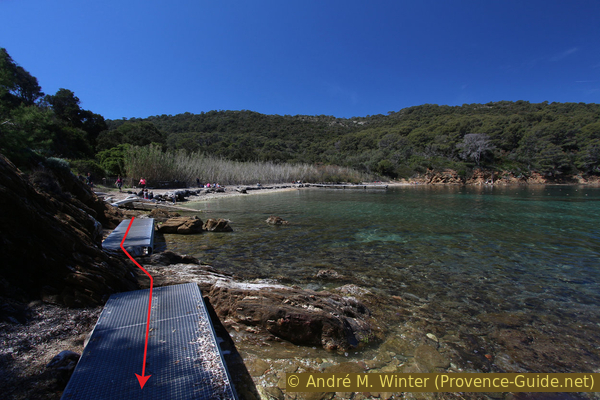
For some, the beach is both the destination and the starting point for the underwater trail in La Palud Bay. The buoys are found between the middle of the beach and the Rocher du Rascas rocks with their sharp peaks. Goggles, snorkel, fins and the National Park's plasticized brochure are required. In the low season, a warm diving suit is advisable, because you can stay in the water for about an hour without moving too much. In summer and mostly in the afternoon, the water often gets murky.
But there are also real dangers. Firstly, it is the sun that mercilessly burns your neck, back and legs, also because sunscreen does not stay in the water as well as it should. A t-shirt definitely helps. The other danger comes from the nettles of the pink-transparent small jellyfish. As the summer progresses, they become even more transparent, but no less dangerous. It becomes threatening if you are hit in the head or chest. You experience a real shock, have severe pain and skin swelling. It's easy to panic, choke, and even drown. With diving goggles you see the distances under water differently, with wind and waves a jellyfish five meters away can be very close in seconds. It is therefore advisable to go on this snorkelling expedition with at least two people and to go into the water with long-sleeved clothing. After an encounter with a jellyfish, there are no real remedies. Rubbing with sand and sea water works best. If you have breathing problems, you need to see a doctor. In summer there are often paramedics on site at the beach or in the village at the port. For smaller burning spots, the pain lasts for a few days. In pharmacies you can get cortisone ointments without a prescription that bring a little relief.
No reproduction is permitted without the written consent of the author. (id3223)
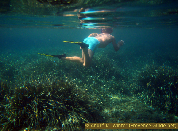
With diving goggles and fins on the underwater path
Once you arrive at La Palud beach, you will see a steep stairway at the other end on the trail to Port-Man. We have to go up here, that's how we get going again. Although the path quickly becomes more comfortable afterwards, it climbs steadily.
No reproduction is permitted without the written consent of the author. (id3222)
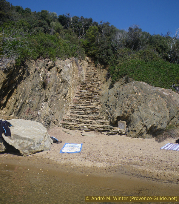
Stair up from the Baie la Palud bay
At the junction with the Plateau de Marma trail, you reach a saddle 85 meters high.
Here we turn left again and descend seaside to Cape Pointe de la Galère.
No reproduction is permitted without the written consent of the author. (id4382)
Pointe de Marma cape
Above the Pointe de la Galère, the path descends in hairpin bends through loose and bare rock.
No reproduction is permitted without the written consent of the author. (id4383)
Pointe de la Galère cape
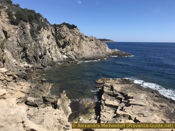
At Cap de la Mitre we are almost at sea level for a while, but of course there are always short ups and downs here too. Between here and Port Man there are some small bays with tiny sandy beaches, which you can also descend to.
No reproduction is permitted without the written consent of the author. (id4385)
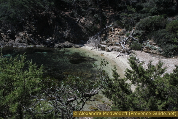
Beach in the Calanque du Palangrier
One advances to the Port Man beach and at the cape opposite one sees the Fort of Port Man. You should admire it from here, because the cul-de-sac to the fort is pointless: you cannot circumnavigate the cape, the fort is closed and the view from the pier there only looks back into the bay. The forest road there and back is not particularly charming either.
No reproduction is permitted without the written consent of the author. (id4384)
Port-Man fort and bay
Boats are often anchored in Port Man Bay over night. We can take a break here, because in the further course we go to the much higher southern ridge of the island.
No reproduction is permitted without the written consent of the author. (id4386)
Port Man beach
Section 2: Port-Man - La Sardinière - Fortin de la Vigie
➙ 3 km ... 1 h ➚ 265 m ➘ 65 m ↝ average
5% moderate trails, with marks
25% forest roads, few marks
20% hard-to-recognize trails, without marks
35% forest roads, few marks
20% moderate trails, few marks
The clues
- Port-Man, 0 m
- Ridge line above Le Tuf, 75 m
- Le Tuf, 0 m
- La Sardinière ruin, 95 m
- Fortin de la Vigie fortress, 200 m
Ascent to the southern ridge and a single descent down the southern slope to the water.
We go to the east side of the beach and there over some grating walkways and rocks. So we come up to an intersection. On the left you could go to the Fort de Port Man, on the right is a closed road and our forest road up to La Sardinière.
No reproduction is permitted without the written consent of the author. (id4387)
Footbridges and rear view of Port Man beach
It goes continuously uphill to a junction at about 70 meters above sea level. Apart from a signpost there is little guidance. The sign reads the confusing "Pointe du Tuf, 0h05".
First of all, it is not tuff but coarse sandstone that erodes into bizarre shapes. No vegetation grows on it either.
Second, you don't get as far as the cape, you have to be content with the bay in front of it.
No reproduction is permitted without the written consent of the author. (id4388)
Signpost to Le Tuf
Third, you can't make it down in five minutes. The path is heavily overgrown and leads into the ridge and then down steep hairpin bends directly to the rocky coast. Of course, it also takes more than five minutes to get back up, and here you are on a steep, full south-facing slope.
No reproduction is permitted without the written consent of the author. (id4389)
Overgrown path to Le Tuf
It is the only place where you can descend into the steep south coast. Here you are also at the open sea and the water is rarely calm. As a rule, you cannot swim here.
No reproduction is permitted without the written consent of the author. (id4391)
Pointe du Tuf cape
In addition to the worthwhile sight of the original rock formations, there is also another attraction: very few people descend here.
When we are back at the top of the forest road, continue to the left, now again under dense and shady forest.
In the following saddle, which is not very distinctive, and just after a hairpin bend, there is a first opportunity to shorten the tour. Crossing the Plateau de Marma you reach the path that we have already walked between the bay of La Palud and the Pointe de la Galère. So you can go back to the village and the port in about an hour. The rest of the loop sums up about 2h40.
No reproduction is permitted without the written consent of the author. (id4390)
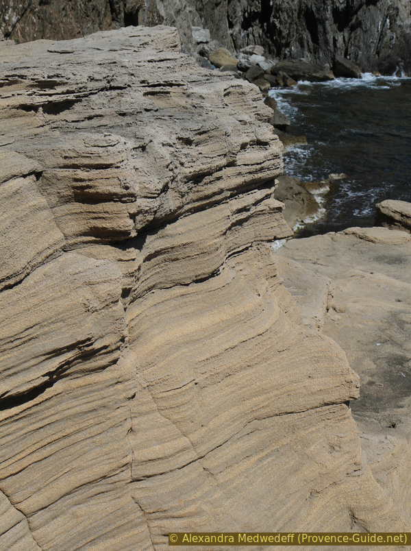
Rock erosion at the Pointe du Tuf
We have now climbed to 100 meters above sea level and still remain under a tall and dense forest. This is how we come to the ruins of La Sardinière. The building must have had some connection with the fortress higher up, it probably has nothing to do with sardines in this location. In the forest floor you can see ditches collecting rainwater and abandoned underground cisterns.
No reproduction is permitted without the written consent of the author. (id4392)
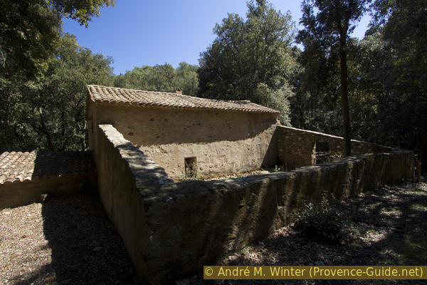
La Sardinière
In front of the building we look for a signpost to the left into the forest (la vigie - les crêtes). This is our path, it is narrower now. Sometimes you go directly into the old rainwater collecting system.
No reproduction is permitted without the written consent of the author. (id4393)
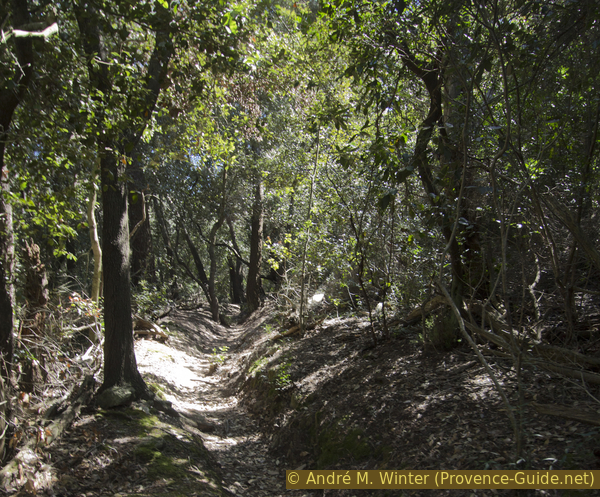
Path in a gully from La Sardinière to La Vigie fortress
Further up we come to the ridge and in places you can see down to the sea. But you continue to climb up to about 190 meters to the Fortin de la Vigie fortress.
No reproduction is permitted without the written consent of the author. (id4394)
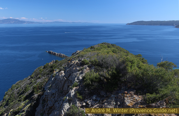
Pointe de Maupertuis cape on Le Levant island
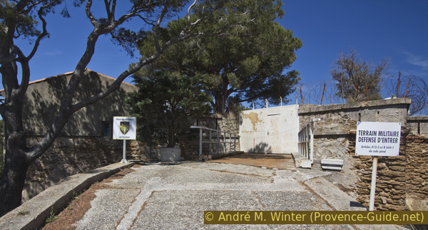
The fortress is locked and theoretically still used by the army.
No reproduction is permitted without the written consent of the author. (id4395)
Bridge over the moat of the Fortin de la Vigie
Section 3: Fortin de la Vigie - Mont Vinaigre - Village
➙ 6,9 km ... 2 h 20 min ➚ 150 m ➘ 350 m ↝ average
<5% hard-surfaced quiet side streets, few marks
25% easy trails, few marks
5% hard-to-recognize trails, without marks
20% easy trails, few marks
5% exposed trails, without marks
10% moderate trails, few marks
10% moderate trails, without marks
20% easy trails, with marks
5% forest roads, few marks
<5% hard-surfaced city alleys, few marks
The clues
- Fortin de la Vigie fortress, 190 m
- View of the Îlot de la Gabinière island, 175 m
- Col des Gobis saddle, 120 m
- Mont Vinaigre, 194 m
- Col de la Fausse Monnaie saddle, 155 m
- Pointe du Cognet cape, 35 m
- Plage du Sud beach, 0 m
- Under the Sentier de la Pomme d'Or trail, 30 m
- Port-Cros, 0 m
This section covers the vast western area of the island. Several shortcuts make it possible to get back to the port faster.
No reproduction is permitted without the written consent of the author. (id4396)
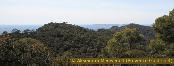
Range of hills on the south ridge of Port Cros
vallon = valley
sentier = path
pointe = cape
île/îlot = island
We go less than 100 meters down on old asphalt into a hairpin bend and continue straight ahead on a forest road. At the crossroads in the photo we keep to the right. On the left you would only come to a fallow area, under which a water reservoir is hidden.
Our path now often goes up and down, but we remain over 160 meters above sea level.
No reproduction is permitted without the written consent of the author. (id4397)
Junction in front of the water reservoir
We take the path to the right, bypassing the water reservoir on the left.
There is a fork in a valley. To the right, through the Vallon de la Solitude, you come to a small reservoir and then to the village. This takes around 50 minutes. The rest of the tour takes about 2h10.
No reproduction is permitted without the written consent of the author. (id4398)
Turnoff into the Vallon de la Solitude
The tour continues straight ahead, on the right the faster way back to the port.
200 meters further the path leads to the edge of the terrain and the forest becomes lighter. So we have an ideal view of the rocky island Îlot de la Gabinière in the south.
Then the path takes us again for a long time in a dense Mediterranean forest. It's a leisurely stroll, unless you're running out of time for the last ferry.
100 meters after the viewpoint there is another turn-off into the Vallon de la Solitude. In 45 minutes you are in the harbour below. The rest of the round takes about two hours from here.
No reproduction is permitted without the written consent of the author. (id4399)
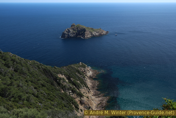
Îlot de la Gabinière
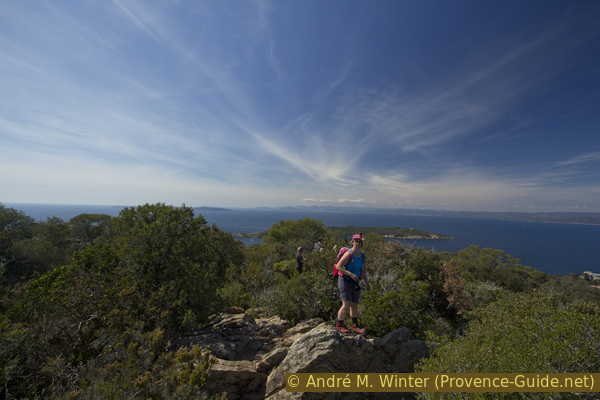
Continuing along the ridge path, we get north under Mont Vinaigre. The summit, at 194 meters above sea level, is quickly reached via a dead-end path.
At the top you can balance on vertical stones and enjoy an all-round panorama, only a few bushes disturb the picture. It is the highest easily accessible point on the island.
No reproduction is permitted without the written consent of the author. (id4400)
Looking west from the cliffs of Mont Vinaigre
Just after the junction for Mont Vinaigre, there is another shortcut via the Sentier de la Pomme d'Or trail. It is the only one that goes over a small ridge with viewpoints of the port. In 40 minutes you are down in the village. The rest of the round takes about 1h30.
No reproduction is permitted without the written consent of the author. (id4402)
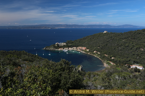
Bay of Port-Cros seen from the Sentier de la Pomme d'Or path
The further way leads to Cape Pointe du Cognet in the south-west of the island.
No reproduction is permitted without the written consent of the author. (id4401)
Sentier des Crêtes (Crest Path) on Port-Cros
Approximately five minutes after the crossing under Mont Vinaigre, another shortcut follows the tour through the Vallon de la Fausse Monnaie. You can reach the village in around 50 minutes. The rest of the round comes to at least 1h20.
After Mont Vinaigre, the ridge trail maintains altitude and circles a 171 m high hill. After that it goes downhill in hairpin bends more seriously. You have a better view again, the path now follows the ridge line. Despite this, there is nowhere to descend to the sea.
A last shortcut follows in a saddle 50 meters above sea level. It crosses the Vallon du Janet and reaches the port in 55 minutes. The remaining lap is slightly longer at 1h10.
You can go south along the crest of the Pointe du Cognet cape. The stratification of the rock is vertical here.
After that the path flattens out. Just before reaching the ruins of the Batterie du Sud, you can proceed to the cliffs of the Pointe du Sud.
But the round goes right past the ruins and the path now leads back into the dense forest. After a few minutes we reach the Plage du Sud beach.
No reproduction is permitted without the written consent of the author. (id4404)
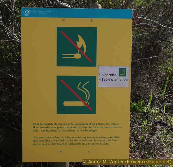
Reminder: No smoking anywhere on the island
After another 15 minutes we reach the bay Anse de la Fausse Monnaie, there is also a small beach here. Ten minutes later we come to a statue in the forest. Here we turn left, crossing the swamp of Port-Cros Bay and along the shore we arrive at the bars in the village in about 15 minutes.
There are no ferry company offices in the port on Port-Cros. With the day ticket you get on and drive back to the mainland.
No reproduction is permitted without the written consent of the author. (id4403)
Path through the marshland of Port-Cros bay
Sources and additional information
It is better to have a good topographic hiking map: this tour is on the IGN map "Le Lavandou, Corniche des Maures, Parc National de Port-Cros", scale 1:25000, 3446ET.
If you don't want to bother with a paper map, you can also use mapping apps on your cell phone. On the one hand, it is the Cartes IGN app from the official map service. However, it requires access to the data network and this is sometimes difficult in canyons or remote locations.
Alternatively, you can use apps that store data directly on the device. They're generally not free, but they don't cost much. We mainly use OSMAnd, here it is possible to add contour lines, relief shading, markings and others. To store this data on your phone you need a lot of space.
Of course, one needs access to satellites for the GPS signal with any app. In some canyons this is not the case. Therefore, do not rely on the position shown, but read the map on your phone as you would read it on paper. Most apps are available for Android and iPhone. The applications usually allow us to record the route travelled and also view the GPS files offered for each of our hikes.
This page has been seen 3263 times since 20 March 2024.
No reproduction is permitted without the written consent of the author. (id3224)
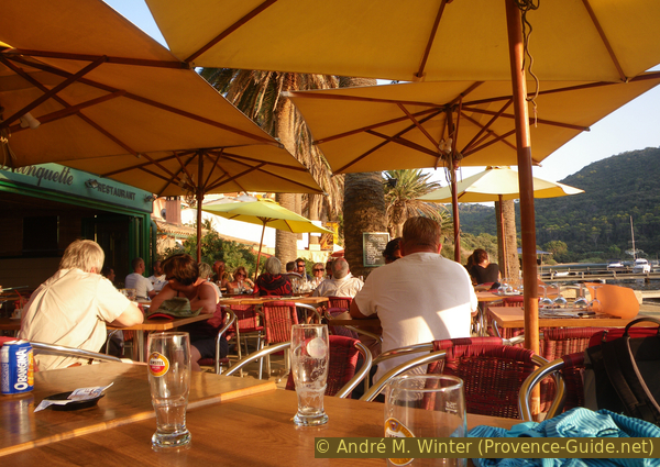
Waiting for the ferry at a bar on Port-Cros
No reproduction is permitted without the written consent of the author. (id4405)
The ferries in the port of Hyères in the evening