Coastal path in the Bay of Cavalaire
From Plage du Débarquement to Gigaro
hike
easy
1 h
yes
no
built-up area
walk
Introduction
A rocky stretch remains between the large beach of Cavalaire and that of Gigaro. It takes a little over an hour one way on the marked coastal path. This is the ideal change on a winter's day or even in the evening when the sun sets over the sea and the Massif des Maures.
We pass under some old and venerable mansions. At the very beginning we come to a Roman villa and also at the beginning you have to commemorate the Allies, who started here on 15 August 1944 to expel the German Nazis from southern France.
The facts
4,4 km total distance
1 h walk time
130 m total elevation
orientation average
mark 90% of the total distance
40% on beach
25% easy trails
15% moderate trails
10% hard-surfaced city alleys
10% hard-surfaced quiet side streets
<5% stairs
dangers slippery sections
children yes
useful picnic stuff, swimwear
required trekking shoes, hiking gear and water
GPS coordinates (WGS84) of start and end point 43.191452,6.556099
downloads ![]()
![]()
Public transport
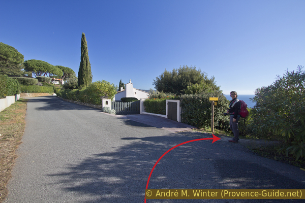
The beach can be easily reached by public transport: via the line 878 between St. Tropez and Toulon (around 20 times a day) and line 873 between St. Tropez and Hyères airport (four times a day). Our destination stop is called Plage du Débarquement. Check Zou! (only french) for timetables. From the main road we go to the roundabout and from there to the sea.
Only in summer, between mid-June and mid-September, runs a frequent beach bus from La Croix-Valmer to the starting point and on to Gigaro. In the centre of La Croix-Valmer, Les Tennis and La Croix Constantin stops (under the lower roundabout) are relevant. We get off at the Plage du Débarquement stop behind the beach. To return from your destination, there is the Poste de Secours stop in Gigaro (where the road passes behind a row of houses).
Access by car
Coming from the north and also from Hyères via Cogolin, head in the direction of Cavalaire. It first drive up in a saddle with the village of La Croix-Valmer and then descend between villas and vineyards. When you reach sea level, you come to a large roundabout, here you turn left towards Plage du Débarquement. This cul-de-sac leads directly to the parking spaces on the right.
Coming from Le Lavandou and Cavalaire, you cross the elongated town of Cavalaire and the subsequent broad plains. So we come to a large roundabout, here we turn right to the beach Plage du Débarquement. This street leads directly to the parking lots.
Useful parking spaces
The first parking spaces are under and to the right of the avenue. Depending on the number of visitors also further back. They are all chargeable from June to September inclusive. In midsummer it can happen that you are directed to parking lots that are further away.
If you only want to walk the route in one direction, you can place a second vehicle at the finish in Gigaro. To do this, drive south-west at the big roundabout and follow the indications to Gigaro until you see the sea again. There is parking here and further ahead left when the road goes behind a row of houses. The chargeable period here corresponds to that of the Plage du Débarquement beach.
No reproduction is permitted without the written consent of the author. (id5181)
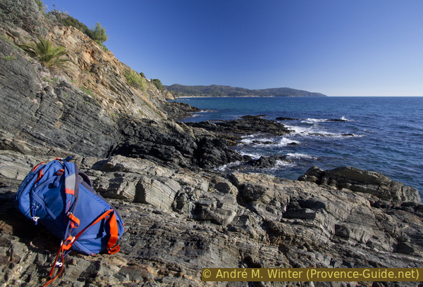
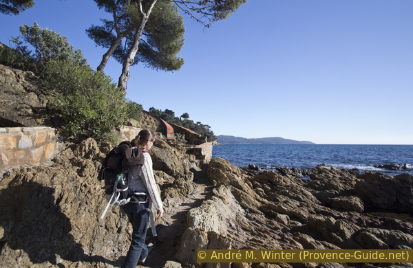
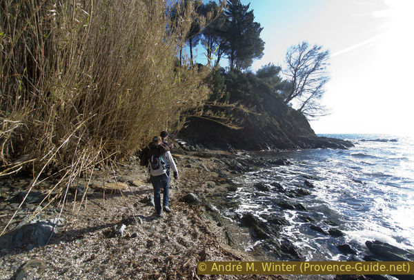
Backpack, rocks and in the back the Cap Lardier
No reproduction is permitted without the written consent of the author. (id5182)
Stair to Plage de Sylvabelle beach
Hints
This rocky section is quite short, taking just over an hour one way. It is therefore advisable to walk the route in both directions. That's not boring, because the position of the sun changes in the short time and bays and small bays then appear completely different. With extended breaks, you can plan good half a day.
Although the hike is short, it is still a classic coastal walk with rocks and lots of ups and downs. In summer, the beaches at the beginning and at the end are certainly well attended.
The stretches of beach in the large bay of Cavalaire have different names. Those far west are Plage de Pardigon and Plage du Débarquement. Roughly speaking, Pardigon is in the municipality of Cavalaire and Plage du Débarquement in that of La Croix-Valmer.
The whole region is a zone with a high risk of forest fires. In summer, but also in other seasons when it is very dry or by strong winds, access to the forest areas can be regulated. As a result, the roads may be closed to traffic and/or the trails prohibited to hikers. Current information: Map of access to the forests of the Var (also english). The map shows the colours green, yellow, orange and red which correspond to levels of danger.
The sections
- Plage du Débarquement - Pointe de Vergeron: you continue straight from the beach over the rocky coast
- Pointe de Vergeron - Plage de Gigaro: the easier stretch with longer beaches
Section 1: Plage du Débarquement - Pointe de Vergeron
➙ 2,4 km ... 30 min ➚ 70 m ➘ 60 m ↝ easy
15% hard-surfaced city alleys, without marks
20% on beach, with marks
20% easy trails, with marks
<5% on beach, with marks
10% easy trails, few marks
15% hard-surfaced quiet side streets, few marks
5% easy trails, with marks
5% on beach, with marks
15% moderate trails, with marks
The clues
- Plage du Débarquement beach, 0 m
- Allée des Géraniums, 40 m
- Pointe de Vergeron cape, 10 m
At first we stumble across two historical points before we get to the rocky bays.
bus de ligne = bus stop
navette estivale = summer shuttle
A lookout point has been set up in the open space to the west of the parking lot. Only if you look closely can you see the foundations of a large old building. It is the Roman villa called Pardigon II. It lies on a slight rise about 200 meters from the coast.
The first walls date back to the 1st century AD and excavations revealed that major restructuring took place in the 4th century. The building probably remained usable until the 7th century. During this long period it changed from a villa to an agricultural building. In the Middle Ages there are still walls that are used as a lime kiln and for firing ceramics. The ruins were rediscovered in the 1830s, but in 1895 the customs administration built barracks directly on the ancient remains. Its foundations can be seen on the right. The barracks were razed by the German occupying forces in 1943.
It could be assumed that after the war the archaeological treasure was examined and protected. Nothing of the sort happened, in 1980 the area was dedicated to tourist purposes. Environmentalists protested and the area was placed under protection in 2009. Since 2013, the villa has been owned by the non-profit organization Conservatoire du Littoral, which also oversees the coastal trails. Since then, the remains of the villa have been stabilized.
There are other areas of archaeological interest around this Roman villa, but they are all buried under modern construction. So there is also a Villa Pardigon I.
No reproduction is permitted without the written consent of the author. (id5183)
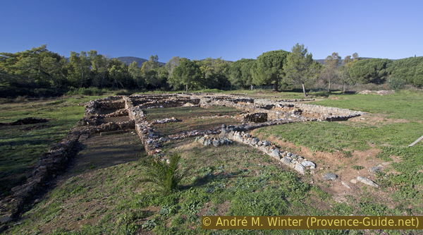
Roman Villa Pardigon II
The beach was also the scene of another important event, with Operation Dragoon, the Western Allies launched their liberation from the Nazi German occupiers on 15 August 1944. It is the southern counterpart of Operation Overlord in Normandy. Lattre de Tassigny, who liberated southwestern Germany via the Rhône valley, also landed here.
The event is commemorated annually on 15 August. Old military vehicles parade and the municipality of Cavalaire puts on a big fireworks display (bigger than the 14 July, the national holiday). For major anniversaries, a military ship from the American Navy also anchors in the bay.
There is nothing more to be seen of the acts of war on site. A board at the top of the parking lot (photo) and explanatory signs on the promenade are on display.
No reproduction is permitted without the written consent of the author. (id5184)
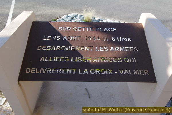
Plaque commemorating the Allied landings on this beach
After this very historical beginning we can finally proceed to the beach. In front of us is the pier for the ferries to Porquerolles (summer only). On the right you can see Cap Cavalaire, which closes off the Bay of Cavalaire to the west.
No reproduction is permitted without the written consent of the author. (id5185)
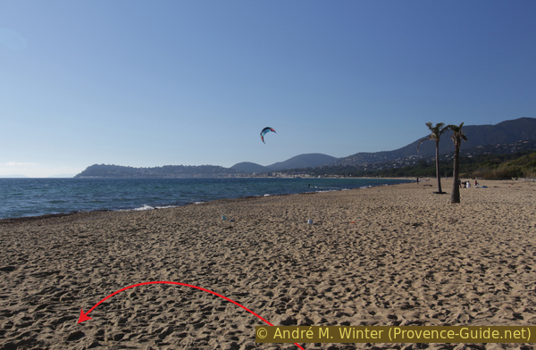
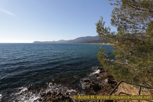
Bay of Cavalaire and Plage du Débarquement beach
However, we must turn left. In the background you can see the distant Cap Lardier, it can be reached by another hike: Coastal trail from Gigaro to L'Escalet. In the middle plane and in the center of the photo you can see a promontory of the rocky coast over which we will go west. The visible cape is called Pointe de Vergeron, it is about halfway through the hike and marks the end of the first section.
The coast is built up with many villas, but underneath there are also some older ones, dating back at least to the 1930's. You can see one of these from the west end of the beach.
No reproduction is permitted without the written consent of the author. (id5186)
Plage du Débarquement beach and Cap Lardier
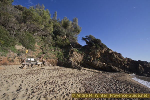
Neptune grass accumulates to the west of the beach. You can also see that the rocks start abruptly and drop steeply to the water. We're going up stairs here. The coast is not particularly high, but the steepness remains in this form for a long distance.
No reproduction is permitted without the written consent of the author. (id5187)
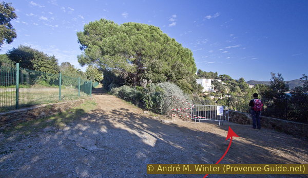
Transition from the beach to the coastal path to Gigaro
In places you can see through the trees on the coastal area. You may see that you can get off more often, but you can hardly get through directly on the water line.
No reproduction is permitted without the written consent of the author. (id5188)
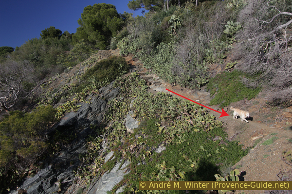
Rock passage west of Plage du Débarquement
We pass several stairs that cross the path and lead down to the water. They come from private houses, but are in public space, so they can be used. But these are only dead ends.
No reproduction is permitted without the written consent of the author. (id5189)
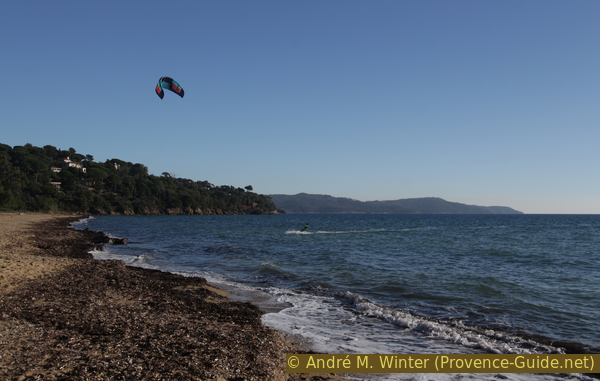
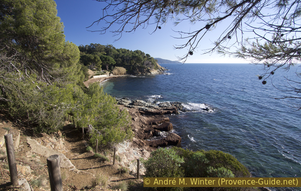
Bay of Cavalaire
Let's continue to the Pointe de la Bouillabaisse cape. We doubt that historically this headland really bears the name of this hearty Provençal fish dish. In any case, there is a house right on the cape very close to the water. The easement here means that we are allowed to walk over terraces and stairs below the villa.
All these sections are well marked.
No reproduction is permitted without the written consent of the author. (id5190)
Coastal path at Pointe de la Bouillabaisse cape
The paved path continues on the other side of the cape. We come to the Baie de la Bouillabaisse, where there are two small gravel beaches.
No reproduction is permitted without the written consent of the author. (id5191)
Arrival at Baie de la Bouillabaisse
We advance in the bay by the water. Steps offset by the waves lead over a few flat rocks. Then markings tell us that we have to go to the top left.
You can clearly see from the front that the coast is too steep for a path.
No reproduction is permitted without the written consent of the author. (id5192)
Rocks on the Plage de la Bouillabaisse beach
We are now leaving the coastal area and ascending in sections. After a first set of stairs we come to the end of a dead end and garbage cans. Then follows another stairs that brings us to another dead end. This alley is branched at the end and you have to cross both streets and then continue in the same direction.
No reproduction is permitted without the written consent of the author. (id5193)
Ascending stair
The path that follows is flatter, climbing between hedges and gardens.
So we come to another street, the Boulevard des Roches. Here we turn right and after about 50 meters we look for a signpost. Stairs leads down to the right.
No reproduction is permitted without the written consent of the author. (id5194)
Descent from the Boulevard des Roches
Below we go left and this time a little longer than before. In the following left turn we keep to the right, there are steps leading down to the Plage du Vergeron beach.
No reproduction is permitted without the written consent of the author. (id5195)
Descent to Plage du Vergeron beach
After the beach we have to go up a bit again and there we continue in a green corridor towards Pointe de Vergeron cape.
No reproduction is permitted without the written consent of the author. (id5196)
Southwest side of the Baie du Vergeron
At the cape the soil will be drier. The green hedges give way and only pines and cacti grow.
No reproduction is permitted without the written consent of the author. (id5197)
Path at Pointe de Vergeron cape
A lone tree marks the Pointe de Vergeron cape and thus the end of the first section. You can proceed on the ridge and see the starting point and the destination. At the very front lays Cap Lardier.
No reproduction is permitted without the written consent of the author. (id5198)
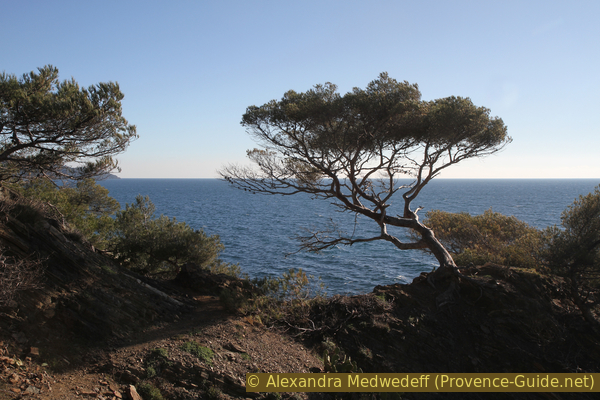
Lonely pine at Pointe de Vergeron cape
Section 2: Pointe de Vergeron - Plage de Gigaro
➙ 2 km ... 35 min ➚ 55 m ➘ 65 m ↝ easy
20% moderate trails, with marks
5% stairs, with marks
10% on beach, with marks
15% easy trails, with marks
50% on beach, with marks
The clues
- Pointe de Vergeron cape, 10 m
- Plage de Sylvabelle beach, 0 m
- Plage de Gigaro beach, 0 m
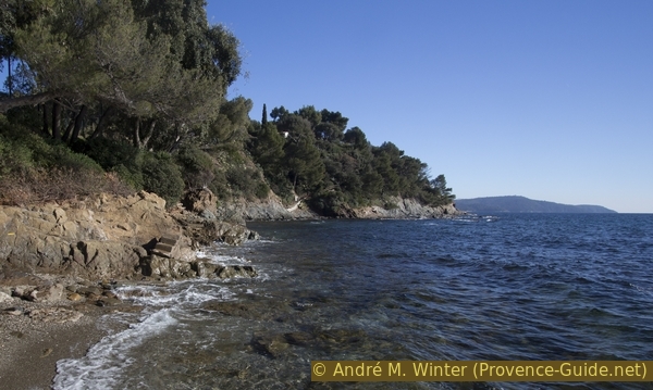
The coast remains steep and rocky, but there are longer stretches of beach.
The western side of the cape is still quite wild. So we climb over the trunk of a flat but very lively umbrella pine.
No reproduction is permitted without the written consent of the author. (id5199)
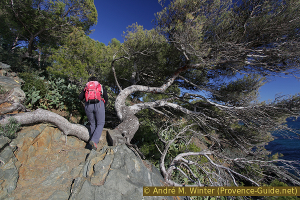
Way over pine trunk at Pointe de Vergeron cape
At the settlement of Sylvabelle, we come through a small gate onto a forest road, where we briefly turn right.
No reproduction is permitted without the written consent of the author. (id5200)
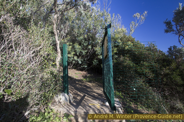
Gate to the west above the Plage de Sylvabelle beach
At the first possibility we go down to the right.
No reproduction is permitted without the written consent of the author. (id5201)
Descent to Plage de Sylvabelle beach
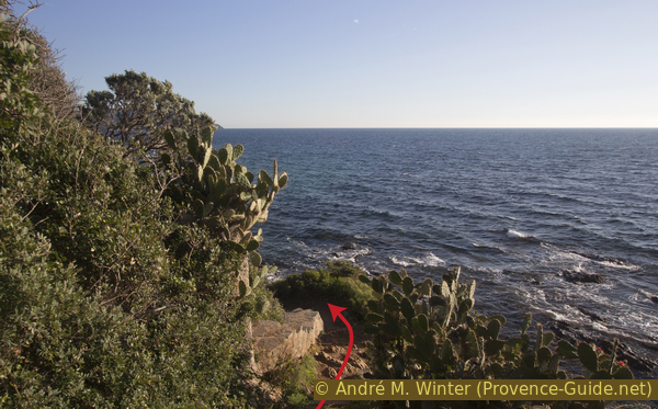
In 2019, part of the path was officially closed, but passable.
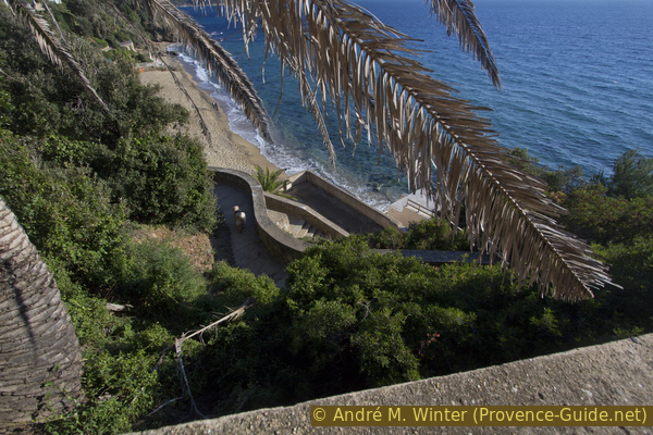
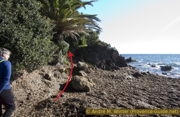
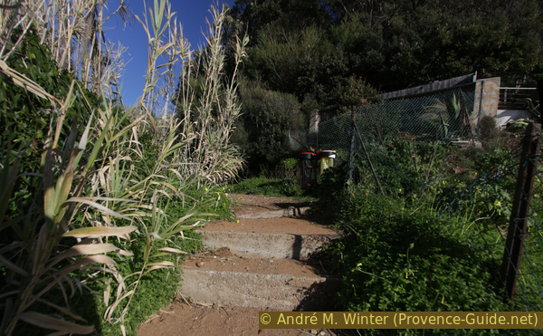
A large and magnificent stairway descends in bends to the beach of Sylvabelle. The pompous stairs may come as a surprise, it goes back to the older settlement areas. Now everyone can use this descent.
No reproduction is permitted without the written consent of the author. (id5202)
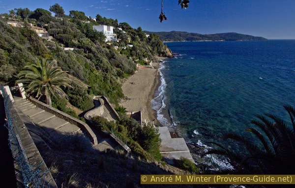
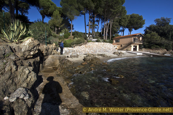
Stair to Plage de Sylvabelle beach and Villa Couadan
Villa Couadan, built in 1914, towers over the Plage de Sylvabelle. It belonged to Sarah Bernhardt, an actor who was a world star in her time. She died in 1923.
No reproduction is permitted without the written consent of the author. (id5203)
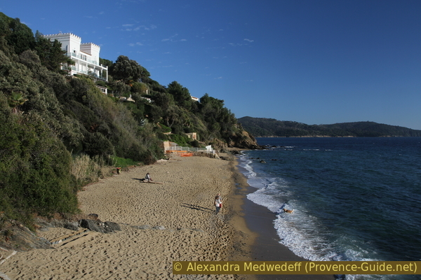
Sylvabelle beach and Villa Couadan
After each beach come sections of rock. This time it is the last before the larger beaches at the finish.
No reproduction is permitted without the written consent of the author. (id5204)
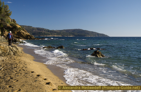
Hiker on Plage de Sylvabelle beach
Stairs help to gain altitude quickly, but we're not climbing as high as before.
No reproduction is permitted without the written consent of the author. (id5205)
Coastal path to the east of the Plage de Sylvabelle beach
At the end of 2019, part of the railing had slipped and the path was therefore closed. But you can pass anyway.
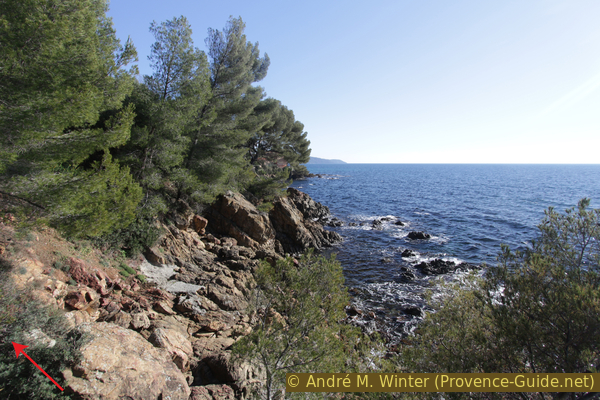
There are no longer any tall trees here, the vegetation remains low and there are more cacti growing. After the ascent it goes down again. We circle private stairs.
No reproduction is permitted without the written consent of the author. (id5206)
Coastal path between Sylvabelle and L'Héraclée
The coastal path now remains at a medium altitude and finally we descend onto a large sandy beach. In winter and after heavy thunderstorms, the small creek can be a wet obstacle.
Behind the reeds lies the large wine-growing region of Domaine de la Madrague. There is also an old palm tree avenue. If you go left behind the reeds, you can see them better.
No reproduction is permitted without the written consent of the author. (id5207)
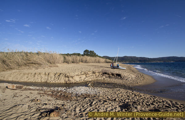
Ruisseau de Valescure creek and Plage de l'Héraclée beach
The beach is quite wide, but there are flat rocks further ahead. Behind it begins the beach of Gigaro.
No reproduction is permitted without the written consent of the author. (id5208)
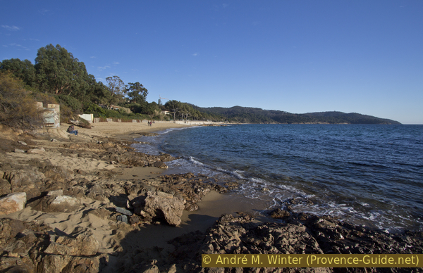
Plage de Gigaro beach and Cap Lardier
The central part of the Gigaro beach is quite narrow. You can go under the retaining wall or more easily on the footpath above.
If you are here in the summer period, you can proceed along the road until it continues behind a row of houses. There is the bus stop that takes you back to the Plage du Débarquement starting point or to La Croix-Valmer village.
However, you can also return to the starting point via the same path. Along the street it goes a little faster, but the footpath is not continuous and the traffic is quite annoying.
Sources and additional information
It is better to use a good topographical hiking map: This tour is on the IGN map "Saint-Tropez, Sainte-Maxime, Massif des Maures", scale 1:25000, 3545OT.
If you don't want to bother with a paper map, you can also use mapping apps on your cell phone. On the one hand, it is the Cartes IGN app from the official map service. However, it requires access to the data network and this is sometimes difficult in canyons or remote locations.
Alternatively, you can use apps that store data directly on the device. They're generally not free, but they don't cost much. We mainly use OSMAnd, here it is possible to add contour lines, relief shading, markings and others. To store this data on your phone you need a lot of space.
Of course, one needs access to satellites for the GPS signal with any app. In some canyons this is not the case. Therefore, do not rely on the position shown, but read the map on your phone as you would read it on paper. Most apps are available for Android and iPhone. The applications usually allow us to record the route travelled and also view the GPS files offered for each of our hikes.
This page has been seen 2626 times since 20 March 2024.
No reproduction is permitted without the written consent of the author. (id5209)
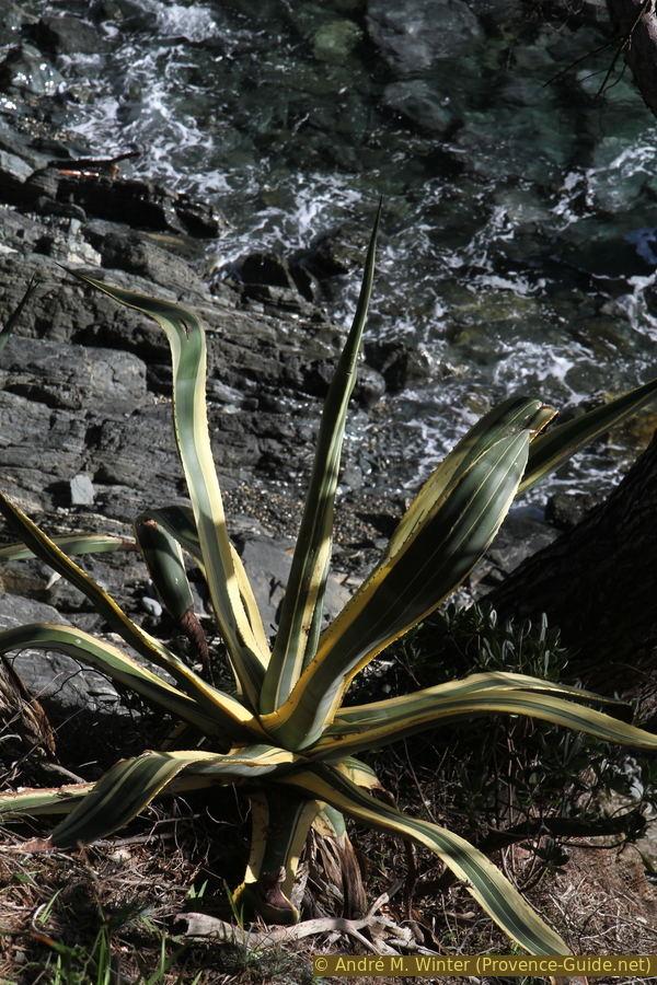
An agave by the wayside