Loop around the eastern cape of Giens
La Badine, Cap Esterel, Tour Fondue and Pointe de la Vignette
hike
easy
2 h 45 min
yes
yes
built-up area
mountain
Introduction
The peninsula of Hyères is well developed for tourism and the coastal hiking trail is also used to reach other bays and beaches. You will rarely be completely lonely here, but the coast is still very natural. Although this eastern cape is less high, the trail goes up and down all the time. The section in the south is consistently exposed to the sun and accordingly hot.
The facts
9 km total distance
2 h 45 min walk time
180 m total elevation
orientation easy
mark 75% of the total distance
55% easy trails
20% hard-surfaced quiet side streets
15% hard-surfaced city roads
10% on beach
<5% forest roads
dangers exposed path, derelict military installations
children yes
useful picnic stuff, swimwear
required trekking shoes, hiking gear and water
GPS coordinates (WGS84) of start and end point 43.041265,6.145309
downloads ![]()
![]()
No reproduction is permitted without the written consent of the author. (id3404)
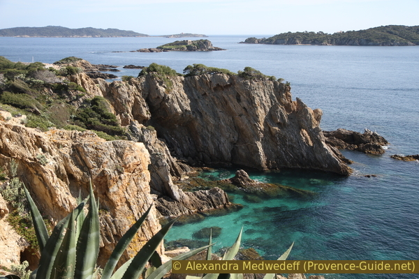
Porquerolles and the Ribaud islands
Public transport
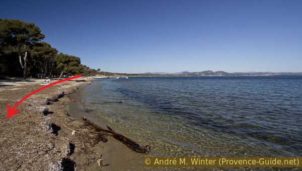
Bus line 67 departs from Hyères SNCF train station towards Presqu'île d'Hyères, 12 times a day in summer and around 6 times a day in winter. So we come to the Majastre roundabout at the end of the long straight stretch, the stop here is called Badine. On the way back you can get on at the Arbanais station if you want to go back to Hyères. Timetables for these connections can be viewed at Réseau Mistral (only french).
Proceed to the roundabout and turn left onto Boulevard d'Alsace Lorraine. Continue in the direction and further to the beach Plage de la Badine.
Access by car
Hyères is a large city east of Toulon. From the wide avenue of palm trees in the center follow the signs to Giens and Les Îles. You drive along the industrial area, the airport, the pines of La Capte on the left and the old salt pans on the right. The road goes through a bland stretch and hits the large Majastre roundabout. Here on the left, the arrow points to La Badine.
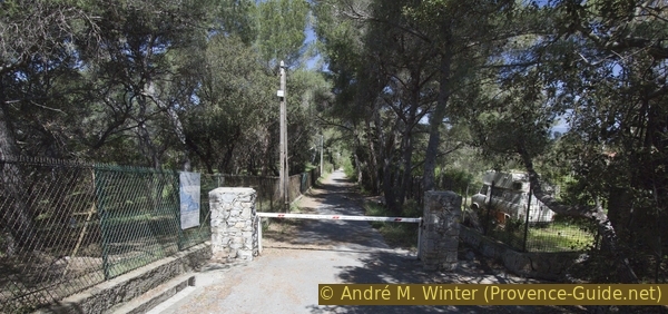
Useful parking spaces
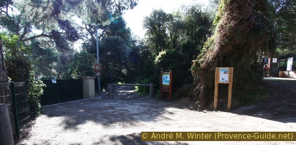
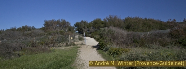
Just after the roundabout, the Boulevard d'Alsace-Lorraine is very wide and there is plenty of parking. At the end of the street and if you come early in the morning you can also find places that are in the shade all day long. The tour starts here, between the roundabout and the last parking lot.
No reproduction is permitted without the written consent of the author. (id4029)
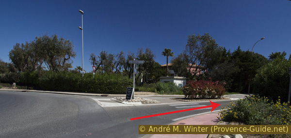
Road to La Badine
Hints
This hike leads mostly through the low maquis in the coastal area. You can find shade, but it won't really cool you down in the summer. However, there is often a stiff breeze. You can often descend to the water. There are neither drinking water nor shelters along the way.
The Cap de l'Esterel is a former military area with unsecured ruins, which are also hidden behind or under bushes. Access to the rocky cape is in principle forbidden, but is tolerated.
This loop is designed to complement the Loop around the eastern cape of Giens. Nevertheless, the tours do not connect well. The main reason is a large section that has to be bypassed over a wide area. It's not a military area, it's a hospital, but that doesn't make things any better. The circuit described here ends at the fence of the apparently deserted Renée Sabran hospital and from the saddle you return to the starting point through a residential area. The round is described clockwise.
The whole region is a zone with a high risk of forest fires. In summer, but also in other seasons when it is very dry or by strong winds, access to the forest areas can be regulated. As a result, the roads may be closed to traffic and/or the trails prohibited to hikers. Current information: Map of access to the forests of the Var (also english). The map shows the colours green, yellow, orange and red which correspond to levels of danger. The affected area is: Corniche des Maures (4).
The sections
- North coast of the eastern part of the peninsula to Cap Esterel
- South Coast to Tour Fondue
- Continue along the southern coast to the Pointe de la Vignette and the fence of the Sabran hospital
- Back through the settlement area to the starting point
In the summer months, the restaurants in the holiday resort at Cap de l'Esterel and the bars at La Tour Fondue are open. The shops at the campsites are then also open.
No reproduction is permitted without the written consent of the author. (id3405)
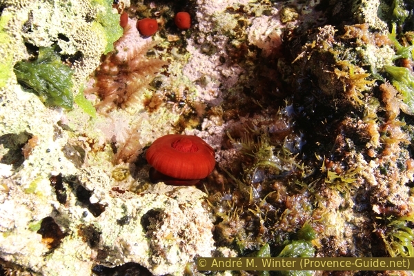
Sea anemone on the Giens coast
Section 1: La Badine - Plage de la Baume - Cap de l'Esterel
➙ 3 km ... 50 min ➚ 40 m ➘ 30 m ↝ easy
15% hard-surfaced city roads, without marks
5% forest roads, few marks
10% on beach, few marks
20% easy trails, few marks
10% on beach, few marks
40% easy trails, faulty marks
The clues
- Proceed to Plage de la Badine beach
- Along the north coast via the Plage de la Baume
- Continue to the Cap Esterel with the ruins of the military installations
We leave the long east beach to the south and enter the most natural stretch of this part of the peninsula.
No reproduction is permitted without the written consent of the author. (id3403)
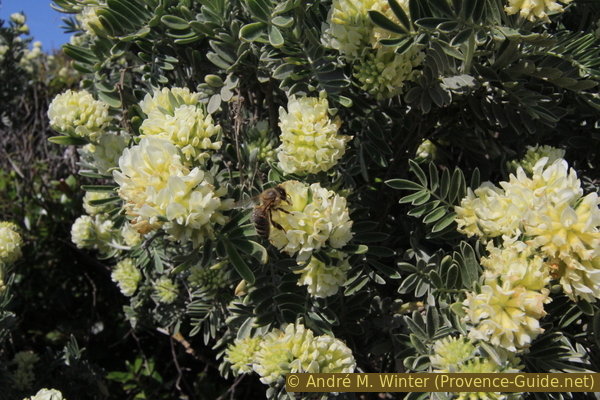
Blooming jupiter kidney vetch
rade = large bay
If you continue on the road with the many campsites, you will come to a barrier and this is where the coastal trail (Sentier du Littoral) starts.
No reproduction is permitted without the written consent of the author. (id4003)
Access to the Plage de la Badine beach
The path literally runs very quickly in the arduous sand to the Plage de la Badine beach.
No reproduction is permitted without the written consent of the author. (id4004)
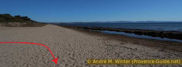
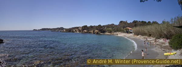
Plage de la Badine linear beach
Turn right at the water and we see in front of us the north coast of the eastern part of Giens, this is where we will walk in a moment. One does not yet foresee the main cape, it turns to the south-east.
Very quickly you come to two rocky outcrops with a former bunker of Nazi Germany. But steps make it easier to cross.
No reproduction is permitted without the written consent of the author. (id4005)
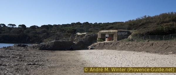
German bunker on La Badine beach
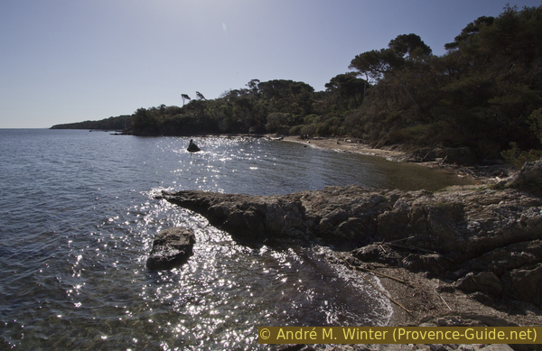
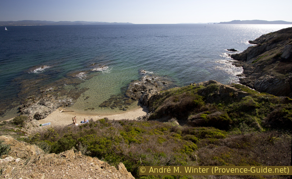
The marked trail runs slightly above the water as soon as we definitely leave the sand. You can see into small bays, some of which you can only get to by climbing or swimming. The acesses are short, but our way is still long, it is probably not possible to descend into every cove. But it is nice to find wild little beaches here.
This coast, which seems so well protected and peaceful, is nevertheless the setting for the sinking of the Arrogante on 19 March 1879. This military ship with three masts and a steam engine trains with another one in this bay when the waves grow massively. The vessel dived forward to the bottom and sank completely within hours 600 meters from shore. Out of 130 crew members, around 40 disappear into the waves because not all off these sailors can swim. A large part also perishes in the rocks which are struck by the waves.
No reproduction is permitted without the written consent of the author. (id4006)
Lonely beach under Estanci
centre de vacances = holiday settlement
Plage de la Baume beach is located in a larger bay, there is a pier and sailing school facilities in the eastern part.
At the end of the beach there is access to the resort's restaurant.
No reproduction is permitted without the written consent of the author. (id4008)
Plage de la Baume beach
If there is a strong north or east wind, you can cut off the Cap de l'Esterel here. About 50 meters after the jetty, a path climbs up through the forest. At the top of the saddle you come to a narrow paved road. It takes us down between tennis courts and a parking lot. Turn left about 100 meters below and look for the descent to the coastal path to the right again.
Here below the description of the normal route continues, the path still runs comfortably a few meters above the waterline.
No reproduction is permitted without the written consent of the author. (id4007)
Forest behind the Plage de la Baume beach
You can shorten the tour here.
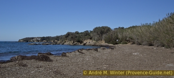
After the Plage de la Baume beach, the path runs a little further back. However, you can reach the sea shore on narrow paths.
No reproduction is permitted without the written consent of the author. (id4009)
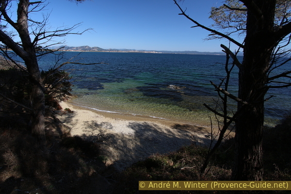
Small beach east of Pointe de la Badine cape
We then come to a desolate area of trees and shrubs that was devastated by a forest fire in August 2021. Luckily it was brought under control quickly, but 3200 m² went up in smoke. On this coast, the vegetation looks lush, but it has a hard time recovering. Don't stomp through this area, every blade of grass is a chance for vegetation to resume.
No reproduction is permitted without the written consent of the author. (id282)
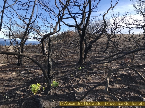
Charred trees from the August 2021 fire in east Giens
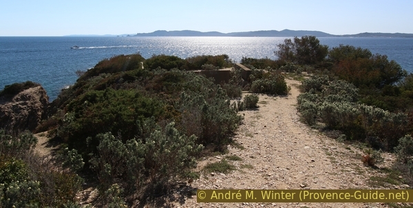
Shortly afterwards we come to the Cap de l'Esterel area. The name has nothing to do with the Massif de l'Esterel further east, you can't even see it from here. This cape, like many rocky outcrops throughout the coastline, has ruins of former military installations. Here you will find old walls, fences, artillery positions, a parking lot for the Belambra holiday complex and prohibition signs that are no longer valid.
Beneath this chaos, however, are nice beaches.
No reproduction is permitted without the written consent of the author. (id4010)
Beach north of Cap Esterel
The front cape (to the east) is fenced off, but in 2022 the gate was wide open and you could walk around everywhere. On the way back you should aim for this gate again.
No reproduction is permitted without the written consent of the author. (id4011)
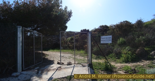
Fence around the military area around the Cap de l'Esterel
The area has unnatural terrain and you have to watch where you step. The coast drops off steeply, the rock is brittle, old iron parts are lying around and you also stumble over deep ditches and holes that are hidden by vegetation!
No reproduction is permitted without the written consent of the author. (id4012)
Cap de l'Esterel
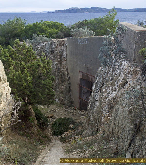
As on other capes like at Escampo-Barriou or at Cap Sicié, we find here remnants of oblique and vertical elevators.
No reproduction is permitted without the written consent of the author. (id6588)
Former oblique lift of Cap de l'Esterel on Giens
Section 2: Cap de l'Esterel - Tour Fondue
➙ 1,9 km ... 30 min ➚ 40 m ➘ 50 m ↝ easy
20% easy trails, without marks
30% hard-surfaced quiet side streets, faulty marks
25% easy trails, few marks
25% hard-surfaced quiet side streets, without marks
The clues
- Head west from the Cape along the south coast
- On roads through the holiday settlement
- A short section as a coastal path on the water
- Arrive at the Tour Fondue between houses
Here the environment is less natural.
After the cape we head to the south coast of the peninsula for a longer period of time. We leave the former military zone through the gate in the fence and then a wide path leads us west.
No reproduction is permitted without the written consent of the author. (id4013)
Old fence at Cap de l'Esterel
However, we quickly come to a paved path that passes under cottages of a very dubious style. The coast here is very steep and the coastal path runs along the paths of the Belambra Holiday Club for about 600 meters.
No reproduction is permitted without the written consent of the author. (id4014)
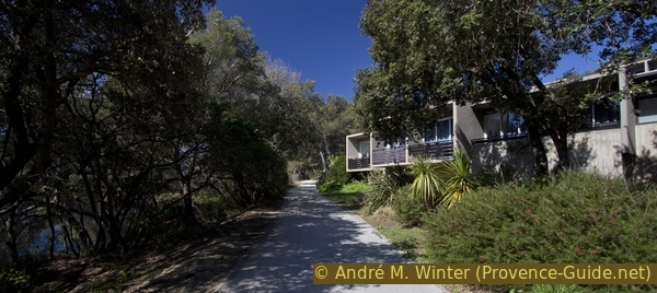
Apartments Belambra Club
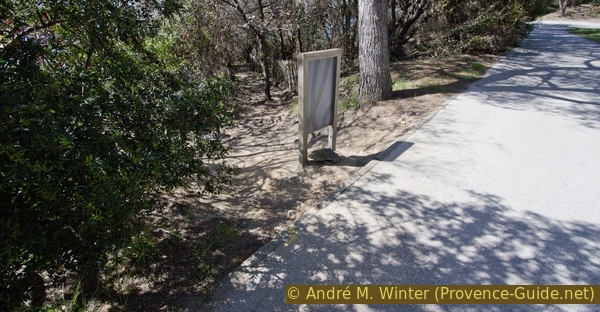
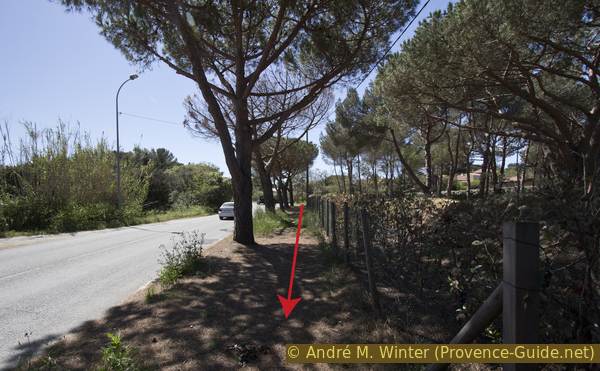
A few minutes after we have passed a pétanque court, the coastal path branches off downwards. The area is not well marked, there is only a yellow marker on the ground and a sign, but this can only be read from the other side.
You can shorten the tour here and return to the starting point: continue for about 100 meters and turn right under a parking lot. Up there, leave the car park through the driveway, turn right and continue up past tennis courts. When the road turns right at the saddle, we go straight and slightly left. Now it goes downhill on a forest road to the beach Plage de la Baume. The parking lot, the tennis courts and the road belong to the private area of the Belambra Holiday Club.
No reproduction is permitted without the written consent of the author. (id4015)
The coastal path leads down here
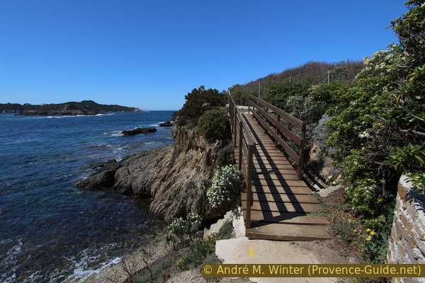
Once past this architectural eyesore, we can walk the Coastal Path again. Here is one of the most interesting sections, with bridges and steel cables to hold yourself. When the sea makes bigger waves, you can get soaked here because you are very close to the water.
No reproduction is permitted without the written consent of the author. (id4016)
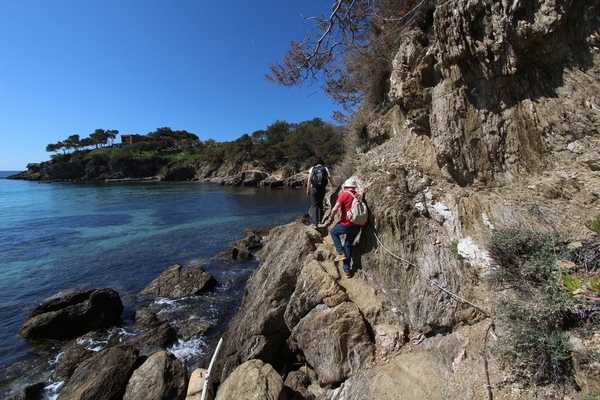
Coastal footpath east of the Pointe du Bouvet cape
A detour follows at Pointe du Bouvet cape, because unfortunately a villa was built too close to the water. Behind it we pass under a campsite on a dusty gravel road and so we come to the hamlet of Tour Fondue. It's just a few houses and an old fortress, but there's also a ferry terminal for Porquerolles with large parking areas (fee). There are also a grocery store and restaurants here.
No reproduction is permitted without the written consent of the author. (id4017)
On the coastal path to the Tour Fondue
The Tour Fondue fortress dates back to the 17th century. Today it marks the entrance to the harbor where the ships leave for the islands. The old building has been renovated, but the inside cannot be visited.
No reproduction is permitted without the written consent of the author. (id3401)
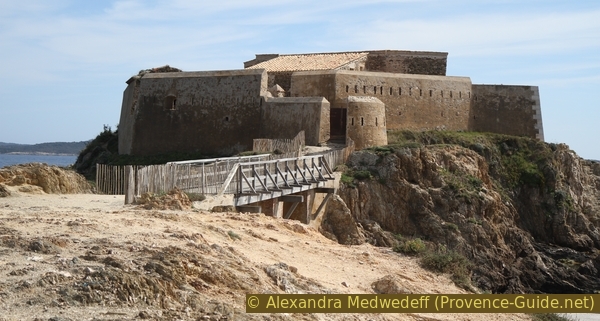
Tour Fondue on the Giens peninsula
At the pier there is also the terminus of bus line 67, which you can use to return to the starting point or to Hyères. From the quay, departure of the ferries for Porquerolles (journey time 20 minutes).
No reproduction is permitted without the written consent of the author. (id3406)
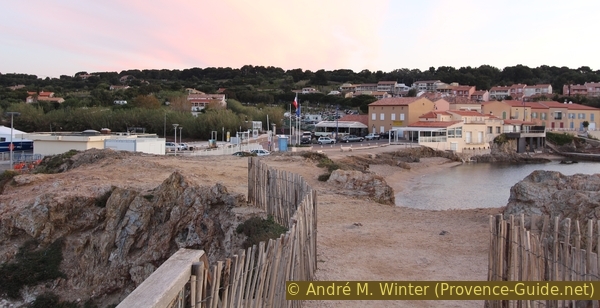
Tour Fondue Village
Looking back from the fortress.
Section 3: Tour Fondue - Port Auguier - Pointe Vignette
➙ 2,5 km ... 50 min ➚ 60 m ➘ 50 m ↝ easy
5% hard-surfaced quiet side streets, few marks
5% on beach, few marks
5% easy trails, few marks
5% on beach, few marks
80% easy trails, few marks
The clues
- Continue west along the coast across two beaches
- On the classic section of the coastal path over rocks to the small port of Port Auguier
- Slowly much higher above the badly rugged coast to the fence around the Sabran hospital
At Cape Pointe de Terre Rouge we pass the southernmost point of the hike, the peninsula and the whole Côte d'Azur.
We pass the Tour Fondue fortress and the jetty to land on the Plage du Pradeau. It consists of two parts, the eastern and first for us, is often completely covered with Neptune grass. This top layer protects the beach from further erosion.
It is possible that rainwater collects behind the large mounds of brown Neptune grass. Then the beach can be quite difficult to pass. You can dodge the parking lot behind (even if signs say otherwise). At the other end of the parking lot you come back to the water and have bypassed the first beach.
No reproduction is permitted without the written consent of the author. (id4018)
Plage de Paradeau eastern beach with Neptune grasses
There is a rocky section between the two beaches. After the second beach you go round the back of a house.
No reproduction is permitted without the written consent of the author. (id4019)
Plage du Paradeau western beach
We now proceed to the Pointe de Terre Rouge cape. The path climbs a little because the coast becomes steeper.
No reproduction is permitted without the written consent of the author. (id4020)
Wooden bridge west of Plage du Paradeau beach
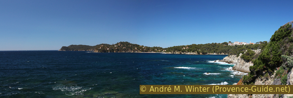
In front of us we can already see the Port Auguier, built between rocky islands and the coast. You can proceed from the quay and now reach the islands with dry feet. Further ahead are the Îles du Ribaud islands, which are often hit by the waves.
No reproduction is permitted without the written consent of the author. (id3402)
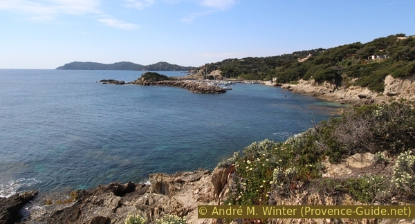
Port Auguier and Pointe de Salis cape far behind
After the port, the path along the shore rises even more, because the coast becomes steeper and higher. The deep views are particularly impressive when the waves are high.
No reproduction is permitted without the written consent of the author. (id4021)
Coast between Port Auguier and Pointe Madame cape
We come further ahead in an area of villas to the upper right, but the coast remains steep. Some stairs lead down into coves and concrete moorings, these facilities are basically private. However, most of them are erected illegally in public coastal areas. The access is therefore not blocked and you can go down. Be careful though, some of the stairs are in a state of disrepair and banisters are rare.
No reproduction is permitted without the written consent of the author. (id4022)
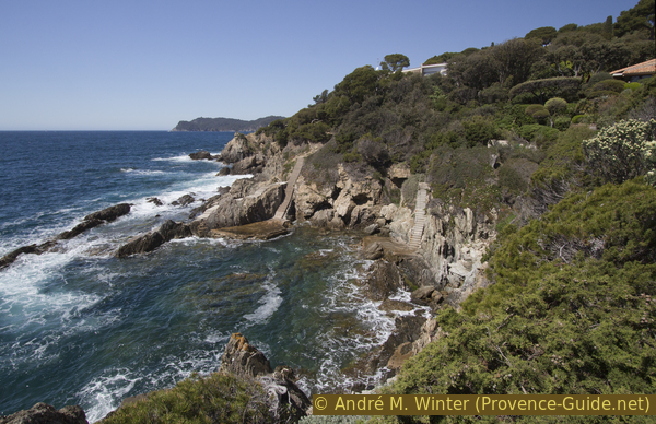
Stair down to the sea
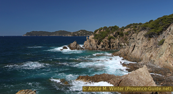
From Pointe Madame cape we see up to the south-west cape of Giens, that is the Pointe Escampo-Barriou cape, it lies on the circuit around the western cape of Giens.
No reproduction is permitted without the written consent of the author. (id4023)
Pointe des Salis, Pointe des Morts and Baie du Niel
Now we're on the last stretch along the coast because we'll soon be arriving at the nasty fence in front of Pointe de la Vignette cape. Hikers are not allowed in the huge area of the Renée Sabran hospital. But the tour was already long enough up to here, we also need energy reserves to return to the starting point.
No reproduction is permitted without the written consent of the author. (id4024)
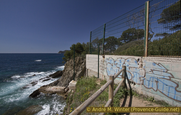
End of the trail on the coast in front of Pointe de la Vignette cape
Section 4: Pointe de la Vignette - Polynésie - La Badine
➙ 1,6 km ... 35 min ➚ 40 m ➘ 50 m ↝ easy
25% easy trails, with marks
30% hard-surfaced quiet side streets, few marks
45% hard-surfaced city roads, without marks
The clues
- Up along the fence of Sabran Hospital
- Cross the ridge of the peninsula on Avenue des Cyprès
- Downhill to the starting point via streets in the local area
A charm-free way back.
hôpital = hospital
vers = to
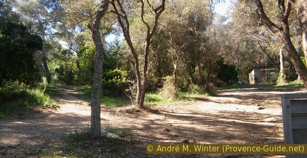
When the hospital grounds are fenced off, the path ahead is clear: upwards to the east. Soon you go up between two fences, but it stays green for the time being, from noon there is already some shade here, which is good, because it leads 50 meters up.
No reproduction is permitted without the written consent of the author. (id4025)
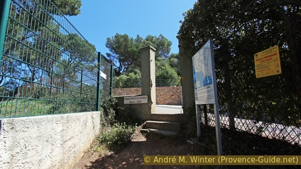
The path leads through La Polynésie villa district
Once at the top, we end up on the roads of the private domain of La Polynésie and on the left is still the fence of the hospital. We also always keep to the left and we are not put off by barriers, we are on the official Sentier du Littoral (although we are now a long way from the sea).
No reproduction is permitted without the written consent of the author. (id4026)
Barriers on Rue Saint John Perse
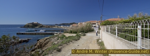
The last long straight stretch along the hospital area is Rue Saint John Perse, it merges with Boulevard Édouard Herriot, turn right here to return to the starting point at La Badine.
The coastal walk can be continued further west by turning left on Boulevard Édouard Herriot to the centre of Giens. Here the first street on the left (Chemin du Béton). In 30 minutes you are at Port du Niel and in another hour you are at Plage des Darboussières. See the Loop around the eastern cape of Giens which passes here.
rade = big bay
So, to get back to where you started, turn right slightly downhill along Boulevard Herriot.
Turn left at the next crossing. There is also a bus stop to go to the centre of Hyères or to La Tour Fondue.
No reproduction is permitted without the written consent of the author. (id4027)
Boulevard Edouard Herriot
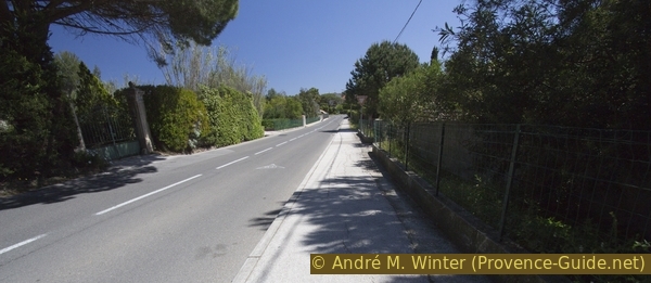
On foot, take the Avenue des Arbanais to the left. It is quite incomprehensible that 70km/h are allowed in the local area of Hyères. As pedestrians we can flee behind the trunks of the umbrella pines, a trail replaces the missing footpath here. After 500 meters We are back at the roundabout.
No reproduction is permitted without the written consent of the author. (id4028)
Avenue des Arbanais with umbrella pines
Sources and additional information
This hike is inspired by this book: "Sentiers du littoral méditerranéen: Randonnées de Marseille à Saint-Tropez" ("Mediterranean coastal paths, hikes from Marseille to Saint-Tropez"), by Pierre Garcin and Nicolas Lacroix, Glénat publishers, Montagne Randonnée series, ISBN 987-2-7234-6259-4 (only in French). If you are interested in other sections of the coastal path, this book will help with good directions, lots of nice photos and maps. However, the coastal sections are described linearly from west to east and no round trips are offered.
t is better to use a good topographical hiking map: the tour is on the IGN "Hyères, Île de Porquerolles" map, scale 1:25000, 3446OT.
If you don't want to bother with a paper map, you can also use mapping apps on your cell phone. On the one hand, it is the Cartes IGN app from the official map service. However, it requires access to the data network and this is sometimes difficult in canyons or remote locations.
Alternatively, you can use apps that store data directly on the device. They're generally not free, but they don't cost much. We mainly use OSMAnd, here it is possible to add contour lines, relief shading, markings and others. To store this data on your phone you need a lot of space.
Of course, one needs access to satellites for the GPS signal with any app. In some canyons this is not the case. Therefore, do not rely on the position shown, but read the map on your phone as you would read it on paper. Most apps are available for Android and iPhone. The applications usually allow us to record the route travelled and also view the GPS files offered for each of our hikes.
This page has been seen 5425 times since 20 March 2024.
No reproduction is permitted without the written consent of the author. (id6589)
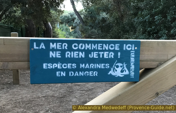
Sign reminding not to throw anything away because the sea is already beginning on land