Lake, canal and creeks around Carcès
Loop through town and along the canal to the lake and waterfalls
hike
average
4 h
no
yes
no
walk
Introduction
Like many villages in Provence, the village of Carcès was deliberately built near water. In contrast to Cotignac or Villecroze, the Carcès waterfalls are not directly in the village, you have to hike there for a while. Two streams flow around the village: the Argens and the Caramy. For a long time, their water power was used to drive various mills: oil, tanning charcoal (oak bark for leather tanning) and lime were ground here for the production of gypsum. The water also powered silk mills. Carcès also ran its own power station until 1951. This history is very similar to that of Barjols, but here in Carcès these pre-industrial structures have almost entirely disappeared. Now we find a peaceful and pretty village. The village is enlivened by the market on saturday.
The facts
12,6 km total distance
4 h walk time
260 m total elevation
orientation average
mark 70% of the total distance
40% easy trails
25% hard-surfaced quiet side streets
15% forest roads
10% hard-surfaced city alleys
5% hard-surfaced city roads
5% cross country
<5% moderate trails
dangers slippery sections
children yes
useful picnic stuff
required trekking boots, hiking equipment and water
GPS coordinates (WGS84) of start and end point 43.475629,6.183033
downloads ![]()
![]()
Public transport
Only school buses reach Carcès, they cannot be used for hiking according to the timetable. It ist useful to complain about at the tourist offices of the region. But the place is also worthwhile for a longer stay and there are good accommodation options here.
Access by car
Carcès is located in the hinterland, in the tourist region of Provence Verte, between Brignoles and Draguignan, but away from the main traffic routes. Take the exits Brignoles or Le Luc on highway A8.
Useful parking spaces
The central car park Place de la Respélido is the starting point of the tour. In summer, however, this is a short-term parking zone and the duration is not long enough for the round. There are several other car parks in town, however many are for residents only.
There is a newer car park near the schools, this is where you pass the end of section 4. To the north, on the way back to town, there is another medium-sized car park, it is noted on the first map. Away from the village, parking is available at the Notre-Dame de Carami chapel, but space is limited here. That's at the end of section 1.
No reproduction is permitted without the written consent of the author. (id4783)
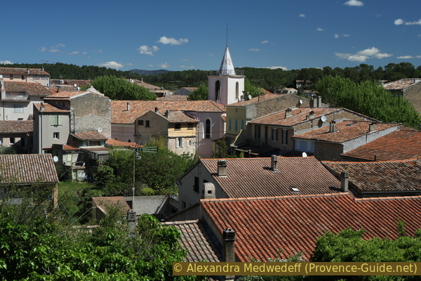
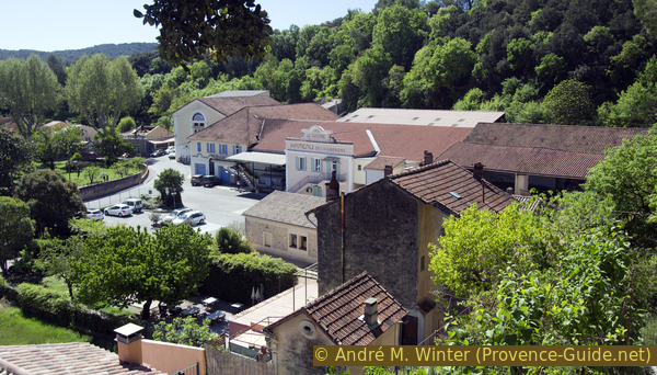
Center of Carcès seen from the canal path
Hints
You can shorten the round in several places. Markings are rare and sometimes even wrong. You hardly find any signposts. The text, the pictures, the GPS-track and the maps should help to find the way.
There are many wells in the village, but only a few provide drinking water. For the loop, there is no potable water source, bar, or inn.
A large part of the tour takes place under tall and shady trees. But there are also stretches of road in the blazing sun. The ascent to the Colle du Montjour is steep. We advise against doing the tour in the summer months.
We show detours to the water in several places. These trails can be very slippery and should be avoided after rain or during high tide.
The whole region is a zone with a high risk of forest fires. In summer, but also in other seasons when it is very dry or by strong winds, access to the forest areas can be regulated. As a result, the roads may be closed to traffic and/or the trails prohibited to hikers. Current information: Map of access to the forests of the Var (also english). The map shows the colours green, yellow, orange and red which correspond to levels of danger.
The sections
- The village of Carcès, the confluence of the streams, a first part of the canal and two chapels: after the circuit in the village we quickly find ourselves in nature
- Ascent to the Colle du Montjour: the altitude difference of the tour lays here
- Descend to the Lac de Carcès reservoir, locate the beginning of the canal and finally arrive at the Chutes du Caramy waterfalls
- Return to Carcès along the canal and the Caramy stream
Section 1: Carcès - Confluent - Notre-Dame de Carami
➙ 3,3 km ... 1 h 20 min ➚ 50 m ➘ 40 m ↝ average
15% hard-surfaced city roads, few marks
5% moderate trails, without marks
30% hard-surfaced city alleys, few marks
30% easy trails, few marks
20% hard-surfaced quiet side streets, few marks
The clues
- Place de la Respélido, 140 m
- Le Confluent, 115 m
- The Castle, 160 m
- Carcès canal, 150 m
- St. Jaume chapel, 155 m
- Notre-Dame de Carami chapel, 150 m
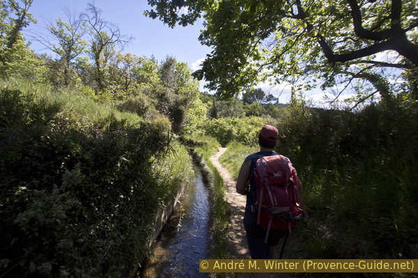
We explore the village by the Caramy river and then we leave it along a canal that still carries water.
We leave the central car park, Place de la Respélido, go down Rue Florentin Giraud and take the first street on the left. The avenue is called Boulevard Fournery. Further ahead you pass between the church and the post office.
No reproduction is permitted without the written consent of the author. (id4784)
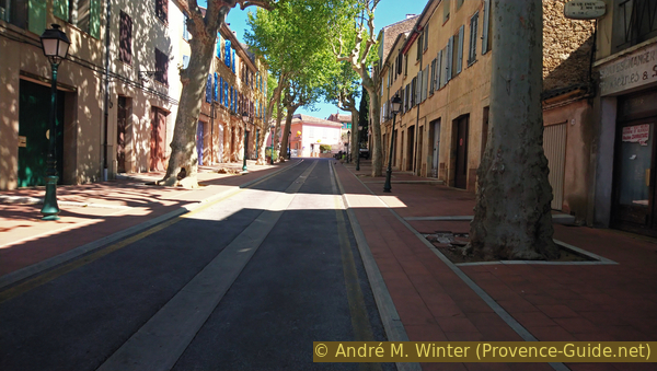
Boulevard Fournery
At the end of the alley we turn right and after a crossroads we come to Place Gabriel Péri. Here is one of the many fountains in town.
Fontaine de la Capelette from 1827
After the square we continue in the same direction, the footpaths are getting narrower, but we branch off at the first opportunity into the narrow Rue des Moulins (mill road). At the next crossroads turn right again and down into Rue des Usines (factory street). All the small businesses that used the water power of the stream up to the beginning of the 20th century were located here.
This is how we get to the Place du Confluent (Confluence). Today there is a small residents' car park and a viewpoint over the confluence of the Argens and Caramy creeks. Both rivers have a similar catchment area, after local thunderstorms you can easily watch the waters mixing here.
Of all the small pre-industrial facilities, only the wash house and oil presses remain.
No reproduction is permitted without the written consent of the author. (id4786)
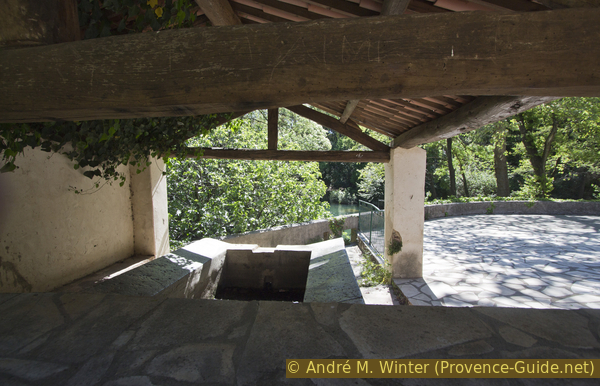
Place du Confluent washhouse
There are two places where you can descend from the large square laid out with stone slabs.
To the left of the wash house you come to a meadow and a wall with the remains of two oil presses. No water power was used here, the olives were only pressed with muscle power (people or donkeys).
No reproduction is permitted without the written consent of the author. (id4789)
Old oil presses
To the right of the wash house you can descend to the river bed via steps. The possibility of proceeding here depends on the water level. You end up in a kind of meadow and stumble over driftwood and washed out roots of the big trees.
No reproduction is permitted without the written consent of the author. (id4787)
Confluence of Argens and Caramy rivers
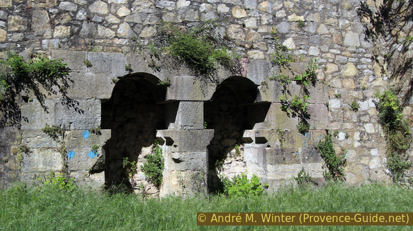
On the wall under the Place du Confluant you can look into old arches where businesses were probably located in the past.
No reproduction is permitted without the written consent of the author. (id4788)
Confluence of Argens and Caramy rivers
We go back to the village via the Rue des Usines, but this time straight ahead to the main road and turn left there. We keep right at the next crossroads, a first house with wall paintings and tiles forms the road junction here. In Rue Maurice Janetti we continue to advance.
No reproduction is permitted without the written consent of the author. (id4790)
Carcès after the bridge over the Argens river
At the following intersection, turn left in front of a wide-looking house. Likewise in the next place.
No reproduction is permitted without the written consent of the author. (id4791)
Crossing Rue Maurice Janetti
So we come back to a main road and turn right. This is also where most of the shops, a small supermarket and bars are located.
We quickly come back to the Sainte Marguerite church. Originally this was a small 16th century chapel. The main church of the village was completely destroyed during the revolutionary years, so in the 19th century this chapel was converted into a church, enlarged and decorated more beautifully.
We pass the main facade of the church and continue forward along Rue du Maréchal Foch.
No reproduction is permitted without the written consent of the author. (id4792)
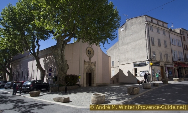
Saint Marguerite Church
Porte de Lorgues = Lorgues' gate
tour de l'horloge = clock tower
chemin du canal = canal path
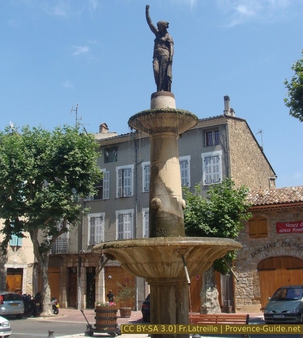
In front of the municipal office (Hôtel de Ville) is a square with the fountain of the 4 seasons.
It dates from 1722 but has often been redesigned. Depending on the form of government, the symbols of the republic or of the dictator Napoleon were found here.
The clock tower (Tour de l'Horloge) stands out in the square.
Directly at the passage there is a fountain where drinking water flows today.
We pass under the clock tower.
At the back you can see a ladder leaning against the wall. This is the folding stairway to the clock tower.
No reproduction is permitted without the written consent of the author. (id4793)
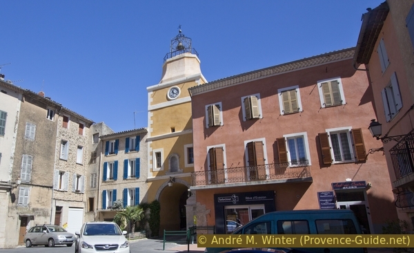
Carcès clock tower
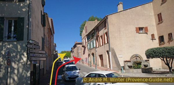
Behind the tower, we turn left twice to end up back on Rue du Maréchal Foch. Here right up to the most beautiful houses with fired tiles on the facades. They come from the pottery town of Salernes and were installed in the 19th century. In addition to the decorative purpose, the glazed tiles also protect the facade from the weather.
We turn right onto Place du Bramadou, shaded by a plane tree. Brama means to shout in Provençal, this is where the cattle market used to be held. The tourist office is housed in the building with a high wall painting.
No reproduction is permitted without the written consent of the author. (id4794)
Houses with glazed tiles on the facade
When the square narrows to an alley, we go left up a cobbled alley with long steps. In front we come through the city gate Porte de Lorgues.
It is the north gate in the city wall around the castle.
No reproduction is permitted without the written consent of the author. (id4795)
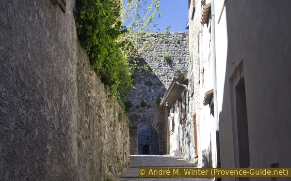
Climb to the Porte de Lorgues city gate
We advance in the Rue du Roy, it runs roughly where the city walls used to be. So you turn to the left and come to a small square with a view to the west. Far behind the fields you can mainly see the Gros Bessillon and the village of Cotignac on the far right.
No reproduction is permitted without the written consent of the author. (id4796)
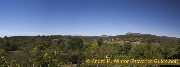
Looking west from Carcès
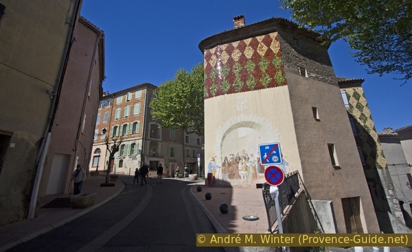
After the vantage point, we make sure that we get to the highest point of the old town centre. Several alleys and stairs are ideal for this. The ruins of the castle are in the middle.
The remains of the wall have now been stabilized and the square now serves as an open-air theatre.
Ruins of the castle and now an open-air theatre
Nested around the castle are small houses that used to be protected inside the city wall. Nevertheless, there are many vacancies here, but that is because some houses are missing today. In the Middle Ages it was much narrower here.
No reproduction is permitted without the written consent of the author. (id4798)
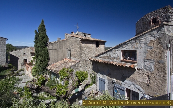
Houses around the Carcès castle
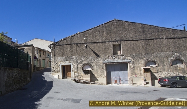
We leave the castle to the south and first on paved roads. It zigzags steeply downhill. This brings us to the access road from Brignoles (D562), which curves here and becomes Rue Florentin Giraud and descends.
Inside the bend is a large mural.
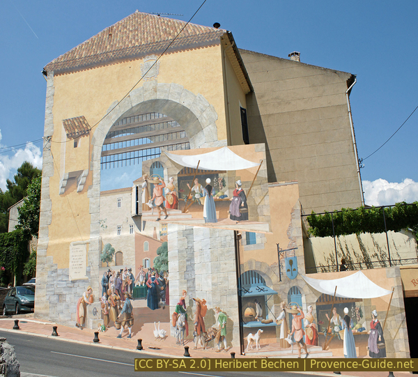
Mural painting in Carcès
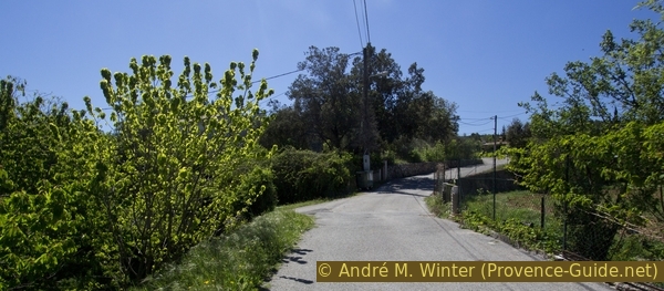
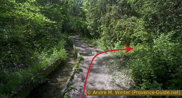
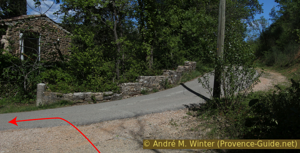
Inside the curve there is a garbage collection point and a small parking lot. Here is the entrance to the Carcès Canal, even if it doesn't look like it at first glance.
An arrow can be seen in the picture that indicate the route. Proceeding towards the yellow house (to the right of the arrow in the centre of the picture) you can see an open section of the canal.
No reproduction is permitted without the written consent of the author. (id4799)
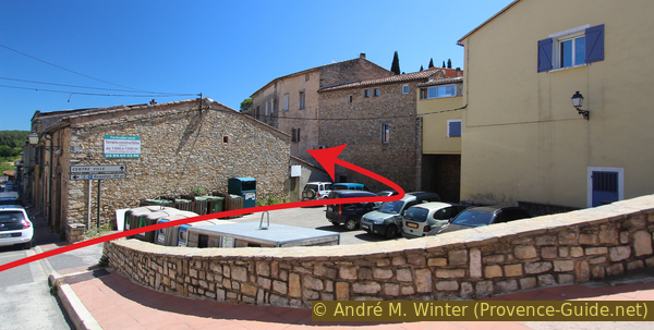
Street curve Avenue Clemenceau and Rue Florentin Giraud
A little further ahead we have to go under a house that was built over the canal. Only then do we sometimes see the canal flowing freely.
No reproduction is permitted without the written consent of the author. (id4800)
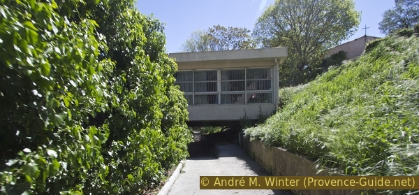
Underpass on the canal path
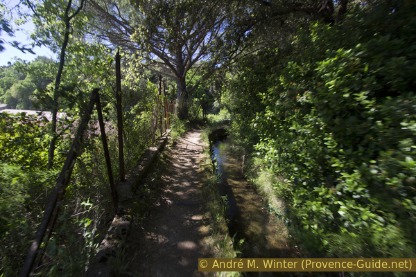
You'll pass a few driveways. Then we can walk along the canal in the open state.
No reproduction is permitted without the written consent of the author. (id4801)
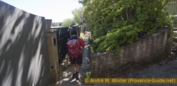
The canal runs underground at the driveways
The path is well laid out, you simply follow the artificial watercourse against the flow direction.
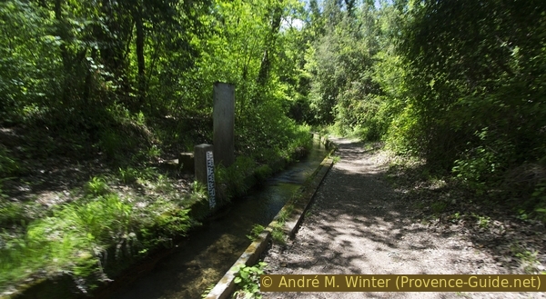
On the left you can see the colourful houses of Carcès.
No reproduction is permitted without the written consent of the author. (id4802)
On the Carcès canal path
The canal and the path are always at about the same sea level, but the village is always lower in relative terms. So it seems that one would go upwards. The canal follows the terrain and so we walk around the local wine cooperative.
No reproduction is permitted without the written consent of the author. (id4803)
Wine cooperative La Carçoise from 1910
After the wine cooperative, we slowly come out from under the big trees and through fields and gardens.
No reproduction is permitted without the written consent of the author. (id4804)
Carcès canal above the cooperative
We come to an asphalt road, here we have to turn left and no longer follow the canal. You could still walk along the canal for a while, but after the field the canal disappears under thorny blackberry hedges. So we proceed along the Chemin Notre-Dame road, keep left at the only paved crossing and come to two chapels.
No reproduction is permitted without the written consent of the author. (id4805)
Chemin de Notre Dame
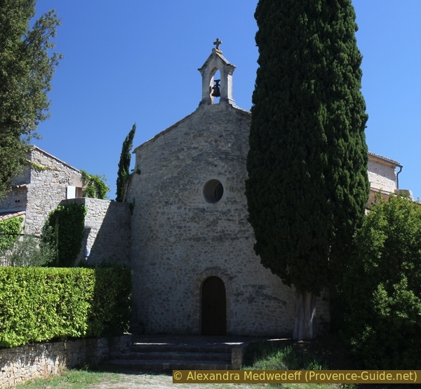
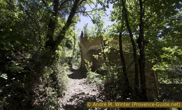
After about 400 meters we are next to the Saint-Jaume chapel.
It dates from the 11th century. Jaume is Provençal and means Jacques (James). The building was a ruin for a long time until it was rebuilt and rededicated in 2001. The church is totally empty.
No reproduction is permitted without the written consent of the author. (id4806)
St. Jaume chapel (11th century)
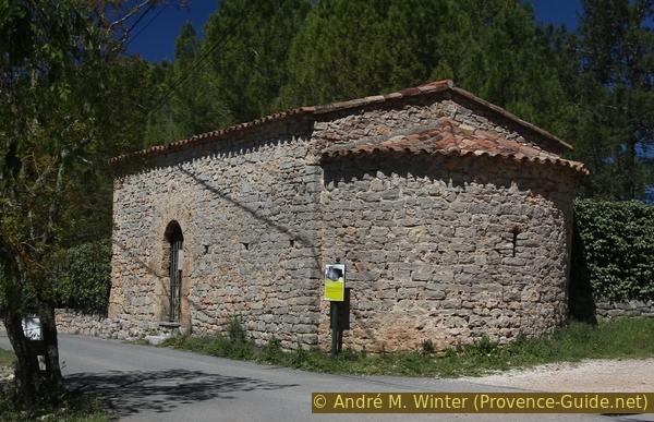
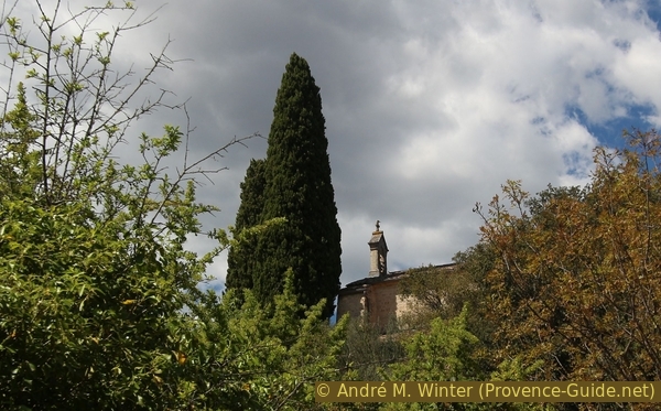
We keep the previous direction and after a few minutes we come to another and slightly larger chapel.
It was built by the monks of the monastery of St. Victor (Marseille) between the 11th and 12th centuries. In 1791, during the turmoil of the Revolution, it was bought by 12 local families to protect it from profanation. In 1855 it was handed over to an association that managed church property. It seems that the practice of religion was preserved throughout, at least that is what ex-voto plaques suggest. Since 1905, the year of strict separation of church and state in France, the chapel has belonged to the parish of Carcès. It still serves the practice of religion.
No reproduction is permitted without the written consent of the author. (id4807)
Chapelle Notre Dame de Carami
Section 2: Notre-Dame de Carami - Colle du Monjour
➙ 2,6 km ... 1 h ➚ 155 m ➘ 30 m ↝ average
20% hard-surfaced quiet side streets, few marks
5% cross country, without marks
5% hard-surfaced quiet side streets, without marks
75% easy trails, wrong marks
The clues
- Notre-Dame de Carami chapel, 150 m
- On the banks of Caramy river, 120 m
- Saddle west of Colle du Monjour, 275 m
You could go pretty quickly to the falls at Caramy. But this trail is flat and we need a few meters of elevation gain for a real hike. So we climb to the saddle at the Colle du Monjour.
With our backs to the chapel, we turn left and down.
So we soon see a wall with conspicuous niches at the top right. Originally it was a dry stone construction, but now it has been stabilized with cement. This is a so-called Mur Apié (Provençal term). Beehives used to be placed here.
No reproduction is permitted without the written consent of the author. (id4808)
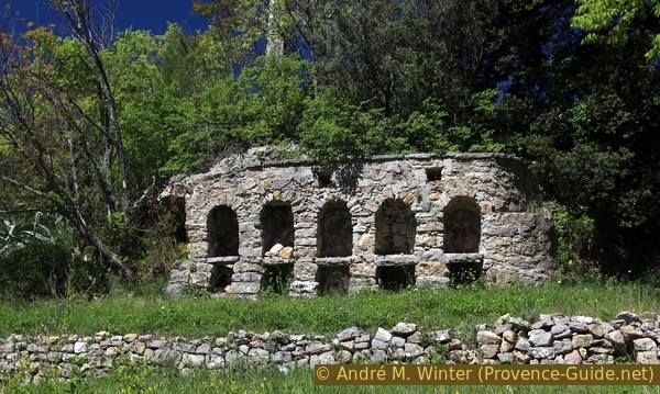
Wall for beehives
Below we come to a crossroads and turn right onto the Chemin des Prés Neufs, which is still asphalted here. It takes us in a straight line along fields and gradually approaches the bed of the Caramy stream.
No reproduction is permitted without the written consent of the author. (id4809)
Chemin des Pres Neufs
After a section where the embankment of the road is held up by a retaining wall, you can descend to the left towards the Caramy bank. The stream is very wide here and runs over tuff barriers.
Unfortunately, you can't go any further along the shore, so we go back onto the road and turn left there.
No reproduction is permitted without the written consent of the author. (id4810)
Small waterfall on Caramy river
About 100 meters ahead, the road suddenly turns to the left, but we continue straight ahead on a rocky path.
No reproduction is permitted without the written consent of the author. (id4811)
Junction to the Colle du Monjour
So we pass an old house and we notice that things are looking up now.
A little further up we are again on a section of the canal. We now walk along this for about 150 meters in the direction of flow. However, when it turns right, we continue straight ahead into the forest.
No reproduction is permitted without the written consent of the author. (id4812)
Old house on the way
Now things are really going uphill. We are on an old connecting path that seems to have been paved with natural stones. In the forest you can see walls of old cultural terraces (restanques).
No reproduction is permitted without the written consent of the author. (id4813)
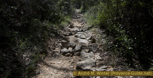
Old paved path
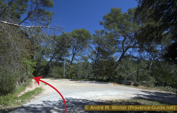
Further up the path flattens out and we cross a power line. Orientation becomes a bit more complicated 60 meters ahead. All yellow markings are wrong here!
We come to a crossing forest road and turn left here. After 30 meters our path branches off to the right and uphill. In 2019 there was a bare signpost with a yellow cross on it. Here we have to go up, it is also the way that is noted in the official IGN map.
No reproduction is permitted without the written consent of the author. (id4814)
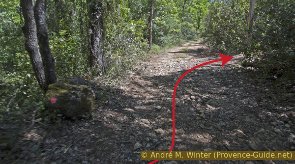
Left and right again
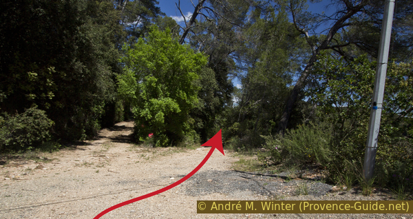
This path is narrower, more overgrown and steeper than the path before. It first makes a long arc to the right. We cross a forest aisle with another power line.
No reproduction is permitted without the written consent of the author. (id4815)
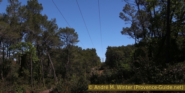
Crossing of a power line
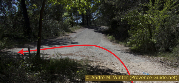
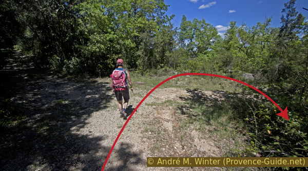
As the path flattens out, it turns left. Forestry work took place here in 2019.
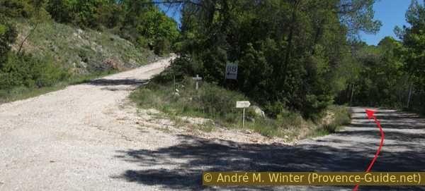
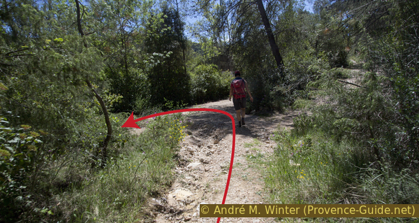
So we come to a forest road and turn right twice in quick succession. Now we are at the saddle west of the Colle du Monjour.
After about 200 meters we come to a paved road. It leads to the modern but dead Village du Lac. We turn left and begin the descent towards Lac de Carcès.
No reproduction is permitted without the written consent of the author. (id4816)
The forest road joins the Route du Village du Lac
Section 3: Lac de Carces - Cascades du Caramy
➙ 3,3 km ... 50 min ➚ 0 m ➘ 120 m ↝ average
25% hard-surfaced quiet side streets, without marks
15% easy trails, few marks
55% forest roads, few marks
<5% easy trails, without marks
<5% cross country, without marks
5% easy trails, few marks
The clues
- Saddle west of Colle du Monjour, 275 m
- Lac de Carcès reservoir, 170 m
- Dam wal, 170 m
- Old weir on Caramy, 155 m
- Belvédère des Cascades, 155 m
- Descent to the waterfall, 150 m
Down over hairpin bends to the lake and there further to the dam. Pass the water intake of the canal, detour to an old weir and the Cascades du Caramy.
We go down the old asphalt road.
At the first junction we stay to the right, always downhill and on the asphalt. Then we come to the villas of the Village du Lac. These are mainly second homes, which appear deserted in the off-season.
No reproduction is permitted without the written consent of the author. (id4817)
Junction on the Route du Village du Lac
Further down, the road turns to the right, but we continue straight ahead on a forest road.
No reproduction is permitted without the written consent of the author. (id4818)
Turn onto Route du Village du Lac
At the junction that follows shortly thereafter, we take the dirt road down to the right.
No reproduction is permitted without the written consent of the author. (id4819)
End of the asphalt strip
We are on the course of a buried sewer. At another fork in the path, we take the bend to the right downhill. Here the path becomes narrower and washed out. Sometimes there are trees lying here. However, one sees manhole covers again and again.
No reproduction is permitted without the written consent of the author. (id4820)
Turn on the way
Another hairpin bend follows, on the right you can see the ruins of a house behind the trees. However, we go to the left.
No reproduction is permitted without the written consent of the author. (id4821)
Second turning and crossing
The further descent leads over a narrow path, which is overgrown again by the vegetation. Another turn to the right follows here.
No reproduction is permitted without the written consent of the author. (id4822)
Way down to the lake
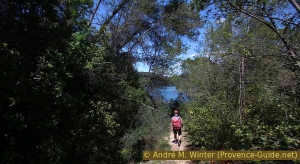
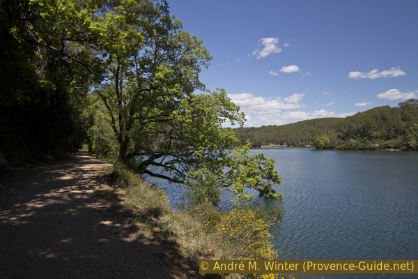
Finally we come to the lake. At the Chemin du Lac we turn left. This traffic-free gravel road follows the western shore of the lake and is much more comfortable than the paths before. In some places you can descend to the water.
No reproduction is permitted without the written consent of the author. (id4823)
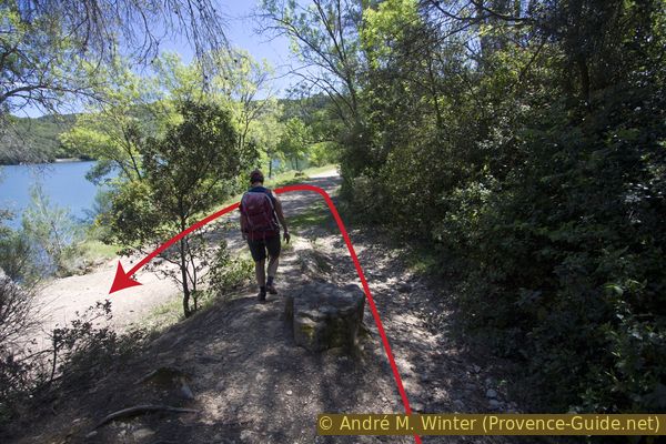
Down the path by the lake shore
The reservoir is officially called Lac Sainte-Suzanne, but it is almost always called Lac de Carcès. It floods the confluence of the Caramy and Issole creeks. Eight million cubic meters of drinking water for Toulon and its urban environment have been stored here since the 1930s. For this reason, any kind of boating and bathing is prohibited. Since this is a large drinking water reservoir, it can be assumed that the lake will not be used for tourism for a long time.
No reproduction is permitted without the written consent of the author. (id4824)
Chemin du Lac de Carcès
We only walk a short section along the lake and come to the north of the dam wall, which holds back all the water. Special locks can even raise the water level by two meters.
About 400 meters after the dam we cross another power line. A tangle of paths leads down to the right of the road. We turn right here and make sure that we stay on the widest dirt road. You will find yellow markings here, which definitely point the right way.
Other signs warned of tidal waves that may arise when the dam locks open. However, Toulon's drinking water is rarely wasted this way.
No reproduction is permitted without the written consent of the author. (id4825)
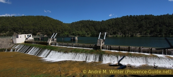
Dam of the Lac de Carcès
prise d'eau = water intake
barrage = dam wall
We follow the forest road and thus approach the banks of the Caramy. Here the road also turns downstream. If we continue straight ahead, the road ends and we literally stumble over the water intake for the canal, which we have already accompanied a few times. To cross it, look for steps on the left. Then just follow the open watercourse.
When we pass a water measuring point, we note the following left turn.
No reproduction is permitted without the written consent of the author. (id4826)
Carces canal just after the fork from the river
Directly in the curve, a path leads to the right into the forest.
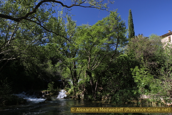
It leads us first over a wide stone wall, which probably earlier referred the stream back to its bed.
Behind it we come to a weir that leads across the stream bed. This weir dams up the Caramy a bit so that enough water can get into the canal. Below you can see a sloping surface that was laid out with stone blocks. Many blocks are still connected with iron clamps. The water was able to drain away regularly and without turbulence over this area, thus preventing the weir from being backwashed.
No reproduction is permitted without the written consent of the author. (id4827)
Junction to the old weir
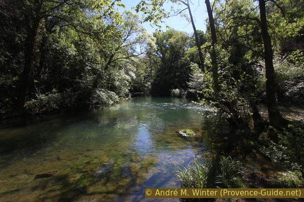
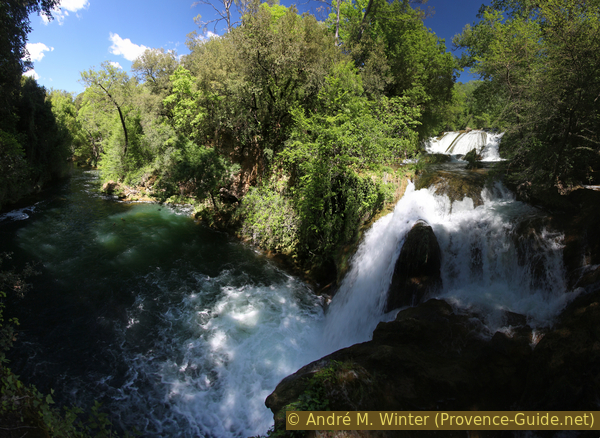
We are now upstream of the larger falls. There are also several smaller waterfalls to see here.
After the detour to the headwaters of the falls, we return to the path along the canal.
No reproduction is permitted without the written consent of the author. (id4828)
One of the waterfalls under the old weir
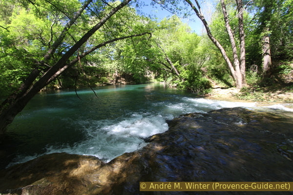
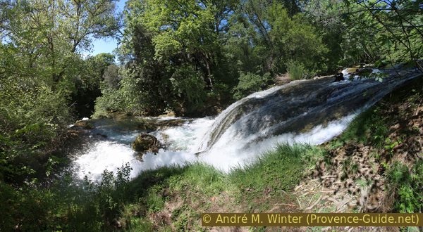
Less than 100 meters ahead we see a railing. This is the viewpoint of the Chutes du Caramy waterfalls. You can actually see them very well from here and you can also see that the stream branches out several times here.
No reproduction is permitted without the written consent of the author. (id4829)
Viewpoint on the Chutes du Caramy waterfall
To the right of the railing, a steep and bumpy path leads to the foot of the falls.
No reproduction is permitted without the written consent of the author. (id4830)
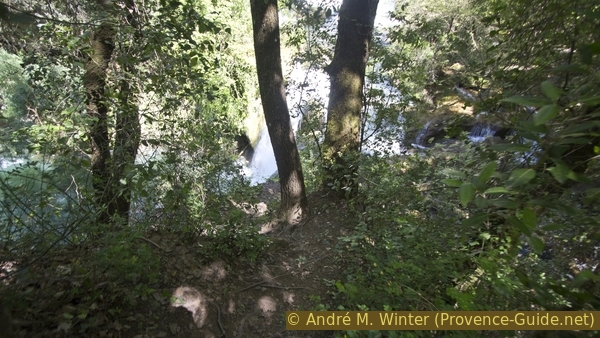
Access to the waterfall
If the path dry, you can descend here and get closer to the white, foaming masses of water.
No reproduction is permitted without the written consent of the author. (id4831)
Panorama of the falls at Caramy
Downstream, the Caramy leads into a green gorge.
No reproduction is permitted without the written consent of the author. (id4832)
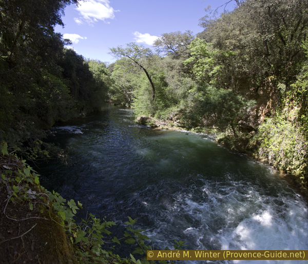
Caramy creek under the falls
Section 4: Chutes du Caramy - Carcès
➙ 3,5 km ... 50 min ➚ 55 m ➘ 70 m ↝ average
5% cross country, without marks
5% easy trails, few marks
5% cross country, without marks
35% easy trails, few marks
5% easy trails, without marks
40% hard-surfaced quiet side streets, few marks
5% easy trails, without marks
10% hard-surfaced city alleys, without marks
The clues
- Belvédère des Cascades, 155 m
- Under Notre-Dame de Carami chapel, 135 m
- Under the schools, 125 m
- Place de la Respélido, 140 m
We're going back to town as quickly as possible. However, some detours to the water are possible.
After the viewpoint of the falls we simply continue along the canal.
80 meters ahead a path leads down into a dark section of gorge at Caramy. The water seems to stagnate here, you can only hear the waterfall very faintly.
No reproduction is permitted without the written consent of the author. (id4833)
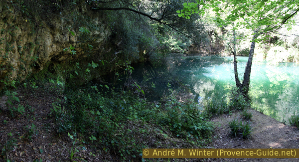
Caramy creek in the gorge under the falls
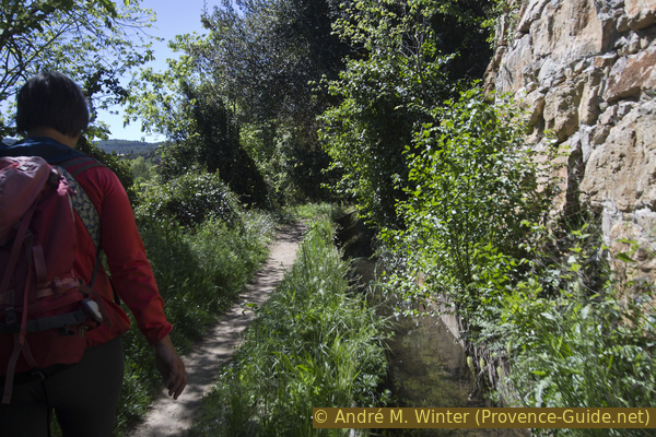
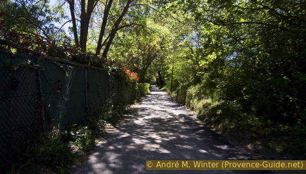
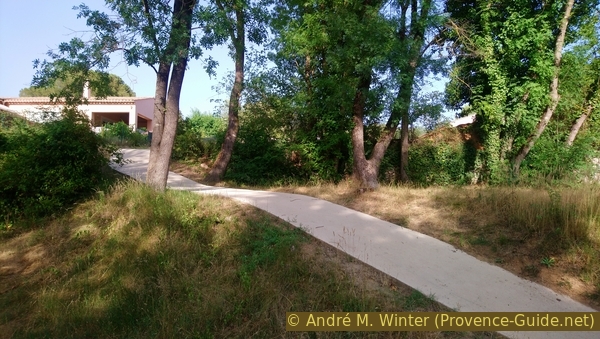
We return to the canal and do not leave it for more than a kilometre now. The forest here is high and dense, the sun rarely penetrates to the path. You pass some houses but otherwise you are completely in nature.
No reproduction is permitted without the written consent of the author. (id4834)
On the way along the canal
The canal is still maintained, it flows in an open concrete channel. But sometimes the nice way becomes boring, then you have to look for other perspectives.
No reproduction is permitted without the written consent of the author. (id4835)
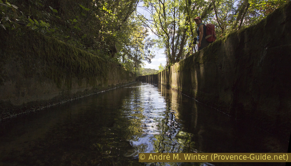
View of the Canal de Carcès
Open sections alternate with heavily shaded areas. However, there is no practical place for a break here.
No reproduction is permitted without the written consent of the author. (id4836)
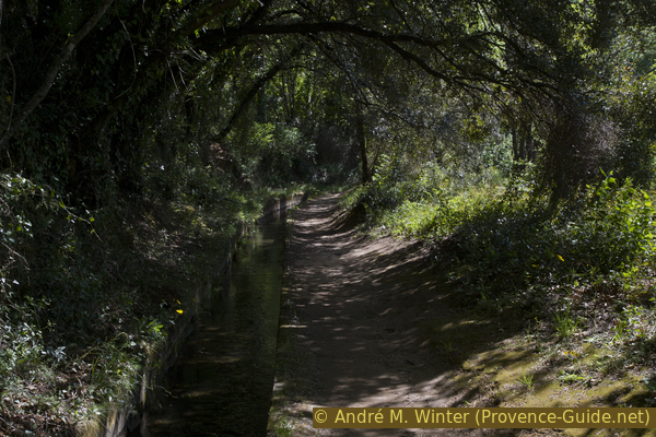
The shady path by the canal
We come back to civilization when we cross a road. It is the road from Carcès to the dam. Now there are two options: either turn right down the paved road and later continue on the Chemin des Prés Neufs, which we already know from the way there. Or we continue to follow the canal.
We choose the second option to avoid as much of the road as possible. The canal and the path lead slowly to the left and then we come back to the path where we climbed towards the Colle du Montjour. But this time we go right, down and past the old house again.
No reproduction is permitted without the written consent of the author. (id4837)
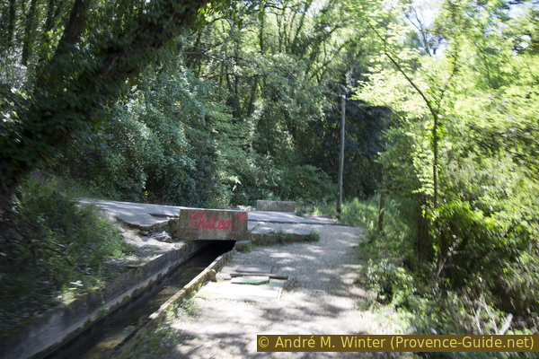
The canal crosses the Chemin des Prés Neufs
At the bottom, we come out again at the bend of the Chemin des Prés Neufs and turn left.
No reproduction is permitted without the written consent of the author. (id4838)
Again at the Chemin des Prés Neufs
Now the route is the same as on the way there for a few minutes. This is how we pass under the Notre-Dame de Carami chapel. But this time we remain below it and pass it on the right in the direction of Carcès.
After 500 meters you can simply switch up to the canal if you want to go back to the upper part of the village. But we continue on the road and after 300 meters we come to a crossroads. On the left we see a road bridge over the Caramy, the lane on the right leads to the campsite. If you turn right, after about 100 meters you come to a kind of amphitheatre on the banks of the Caramy. Here you can take a break before going into town.
No reproduction is permitted without the written consent of the author. (id4839)
We pass below the ND de Carami chapel
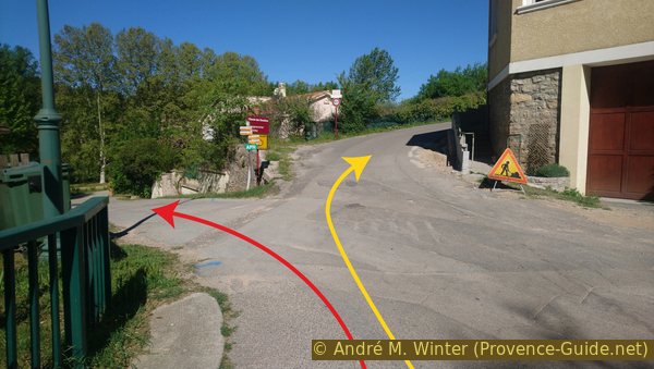
écoles = schools
lac = lake
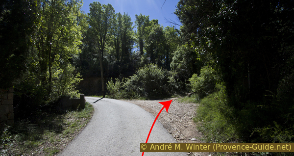
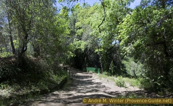
However, the tour continues to the left over the road bridge. Right after that we try to go down to the left. We say try because a gate below may be closed. If it's open we'll go down and into the park area. If not, the bypass leads up to the right (yellow arrow on the photo). Keep left at the following intersection and proceed past the school car park.
No reproduction is permitted without the written consent of the author. (id4840)
Chemin du Caramy and access to the Caramy river
When the park on the banks of the Caramy is open, you come across a wide meadow and some facilities are reminiscent of an abandoned campsite. But there are benches and the spot is fairly quiet.
No reproduction is permitted without the written consent of the author. (id4841)
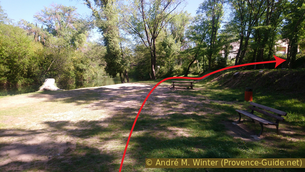
Grounds on the creek bank
At the other end you can leave the site via a newly paved path.
No reproduction is permitted without the written consent of the author. (id1411)
Path up from the Caramy bank
We don't have to walk long on the street. A few meters further there is a passage between fences to a footbridge for pedestrians. So we come back to the village centre.
No reproduction is permitted without the written consent of the author. (id4842)
Chemin du Caramy and the nursery
From the footbridge you have a good view of the Caramy and the area previously crossed. After the footbridge there is another small park on the bottom right.
No reproduction is permitted without the written consent of the author. (id4843)
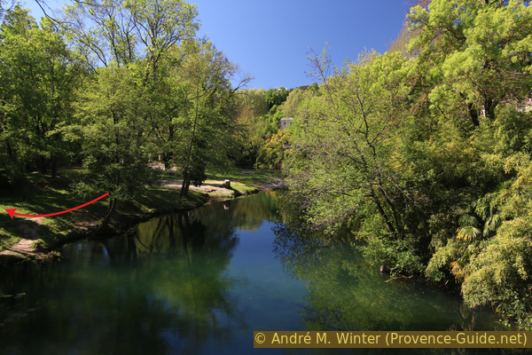
View of the Caramy from the footbridge
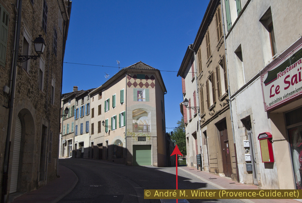
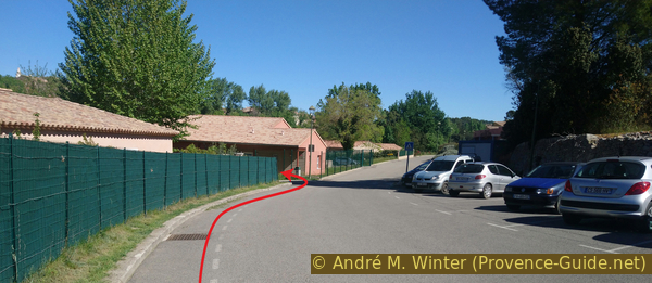
Arriving on the main road, we turn right. In front, under the tall avenue trees and on the right side of the street, is the large wash house le Paramal, it was built in 1808.
The road on the left leads to the Place de la Respélido car park and thus up to the starting point (yellow arrow). If you turn right beforehand (red arrow), you come to the village centre with its shops.
No reproduction is permitted without the written consent of the author. (id4844)
Rue Florentin Giraud
Sources and additional information
It is better to use a good topographic hiking map: this tour is on the IGN "Brignoles, Le Luc, Lac de Carcès" map, scale 1:25000, 3444OT.
If you don't want to bother with a paper map, you can also use mapping apps on your cell phone. On the one hand, it is the Cartes IGN app from the official map service. However, it requires access to the data network and this is sometimes difficult in canyons or remote locations.
Alternatively, you can use apps that store data directly on the device. They're generally not free, but they don't cost much. We mainly use OSMAnd, here it is possible to add contour lines, relief shading, markings and others. To store this data on your phone you need a lot of space.
Of course, one needs access to satellites for the GPS signal with any app. In some canyons this is not the case. Therefore, do not rely on the position shown, but read the map on your phone as you would read it on paper. Most apps are available for Android and iPhone. The applications usually allow us to record the route travelled and also view the GPS files offered for each of our hikes.
This page has been seen 2928 times since 20 March 2024.
No reproduction is permitted without the written consent of the author. (id4845)
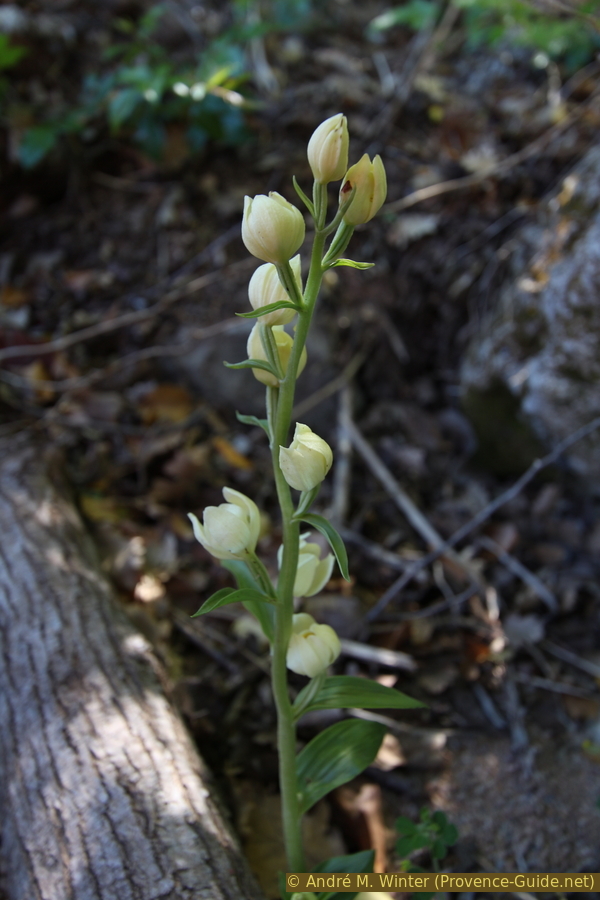
Orchid