Cotignac waterfalls and towers
Via different paths on the plateau and down, as well as the Vallon Gai
walk
easy
1 h 45 min
yes
yes
built-up area
walk
Introduction
Cotignac is a pretty village on the way to the Verdon and quite the opposite of the neighboring town of Barjols. Nevertheless, the history and the natural situation of both places is very similar: both lie at the foot of a rock wall, over which calcareous water has deposited a lot of tuff. In the Middle Ages, the stream was diverted in Cotignac to take advantage of the caves in the tuff. The diversion created two powerful artificial waterfalls that look completely natural today and we will both take a look at. We start in the village center and also pass the large towers on the Plateau Saint Martin. Up and down there are two historical paths.
The lower waterfall can only be reached via a path that we also have to go back. It is planned as the last stage because the entire approach is in nice shade, and it is quite cool here even during the warmer days of the day. In this way, we come several times through the central Gambetta square, where cafés and restaurants await with their terraces.
Information: between May and September the waterfalls have very little water. In this case, the cul-de-sac in Vallon Gai can be disappointing.
The facts
5,1 km total distance
1 h 45 min walk time
160 m total elevation
orientation easy
mark 35% of the total distance
40% easy trails
25% hard-surfaced quiet side streets
20% hard-surfaced city alleys
5% dirt roads
5% hard-surfaced country road
5% stairs
<5% moderate trails
<5% forest roads
dangers only near the waterfalls
children yes
useful picnic stuff
required trekking shoes, hiking gear and water
GPS coordinates (WGS84) of start and end point 43.527033,6.149284
downloads ![]()
![]()
No reproduction is permitted without the written consent of the author. (id4166)
Waterfall in Vallon Gai valley
Public transport
There is no viable public transport for this hike. Only school transport is available. It ist useful to complain about at the tourist offices of the region.
Access by car
Cotignac is located between Brignoles and the Lac de Sainte Croix (Verdon). The starting point is the central Cours Gambetta in the south-west of the village.
Useful parking spaces
In the high season the place is very touristy and accordingly visited, on market days, private transport comes to a standstill. There is a car park by the tennis courts on Rue Hubert Blanc, this is south of the village centre. Another is in the long curve of the D13 road towards Verdon. Another car parc is to be found before the tourist office on the south entrance to the village. It is also possible to start the tour at the two towers, there you can usually park well. You start then at section 2.
Hints
No city tour is presented here, the hike mainly runs around the town and therefore does not include all the sights that can be seen in the centre. But of course you can also stroll through the streets.
The tour does not offer an ideal view of the Rock, as it is best seen from the road. It is by entering from the south, therefore coming from Carcès to the village and at the height of the higher bend on the road which goes up towards Sillans-la-Cascade.
The cave dwellings in the rock can only be visited as part of a guided tour through the tourist office (reservation the evening before is sufficient). This tour is warmly recommended, you also learn a lot about Cotignac. This is how you get into these caves, which were at times a castle, at times a place of refuge in times of war. These guided tours start at the Office de Tourisme and lead to the cliff above the Place de la Mairie. After the tour, you can ideally continue the tour described here at the Place de la Mairie.
The whole region is a zone with a high risk of forest fires. In summer, but also in other seasons when it is very dry or by strong winds, access to the forest areas can be regulated. As a result, the roads may be closed to traffic and/or the trails prohibited to hikers. Current information: Map of access to the forests of the Var (also english). The map shows the colours green, yellow, orange and red which correspond to levels of danger. The affected area is: Haut Var (3).
No reproduction is permitted without the written consent of the author. (id3805)
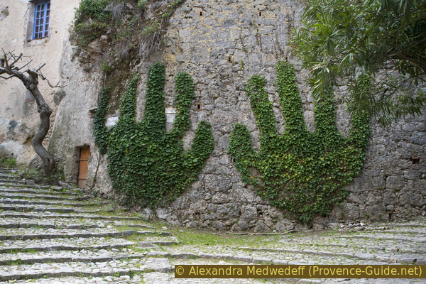
Ivy on a wall forms hands
The sections
- From under the rock wall up to the towers on the plateau
- To the St. Martin chapel and between the two waterfalls back to the village
- There and back in the Vallon Gai to the large lower waterfall
Section 1: Cours Gambetta - Tours Sarrasines
➙ 1,2 km ... 40 min ➚ 90 m ➘ 10 m ↝ easy
25% hard-surfaced city alleys, without marks
10% stairs, faulty marks
20% dirt roads, faulty marks
10% easy trails, faulty marks
5% dirt roads, faulty marks
15% hard-surfaced quiet side streets, without marks
15% easy trails, without marks
The clues
- Cours Gambetta, 225 m
- Place de la Mairie
- Rue du Rocher and Sentier des Escaillons path
- Tours Sarrasines towers, 315 m
The ascent is as close as possible to the cliff, with several good views of the roofs of Cotignac. A small water-carrying canal often leads next to the path in the village, in the rock wall and on the plateau.
It is recommended to do the first part of this section as part of a guided tour of the cave dwellings. In this case, after the guided tour, you come back to the Place de la Mairie with the clock tower and continue the hiking tour from there.
lavoir = washhouse
The Cours Gambetta is the parade and almost oversized for the village. One could spend the whole day here at one of the many café terraces. Since we pass here several times, one often may succumb to this temptation.
No reproduction is permitted without the written consent of the author. (id4159)
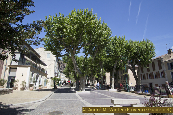
Place Cours Gambetta in Cotignac
If we go north up from the square, we come to the Grand Rue, which leads straight to the Place de la Mairie with the big clock tower. From here you can explore the old village centre.
No reproduction is permitted without the written consent of the author. (id3377)
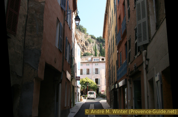
The Grand Rue leads to the Place de la Mairie
Rocher = cliff
moulin = mill
mairie = municipal office
campanile = clock tower
sentier = path
There are several ways up from the village to Rue du Rocher. The alley is partly just a path and it is the highest and just below the cliff. An access is described here, where you can also get far under the rocks.
On the square, standing in front of the clock tower, we turn left and pass the ochre municipal office on the left.
No reproduction is permitted without the written consent of the author. (id3378)
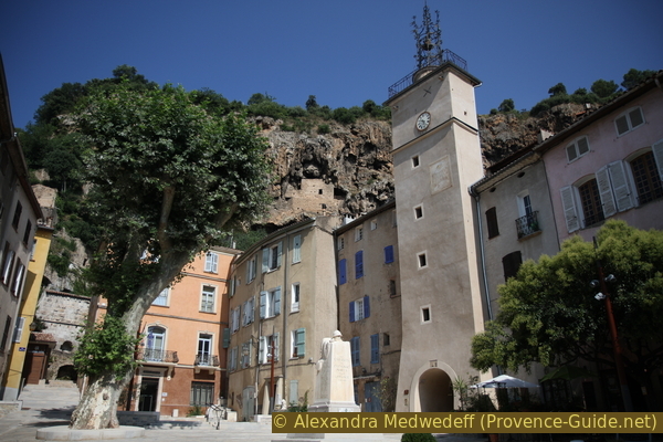
Place de la Mairie and clock tower
Behind the municipal office, follow the paved path uphill in bends to pass in front of the remains of several oil presses. It is a former public oil mill, it was operated with donkeys or just human muscle power. Before the mill was shut down end of the 19th century, it was hydro-powered for a few years.
No reproduction is permitted without the written consent of the author. (id3379)
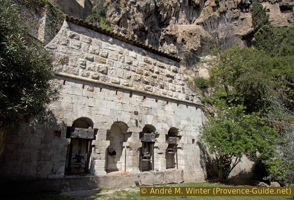
Presses of the former mill
If you continue uphill and keep to the right, you will come to Rue du Rocher. In this way, it is possible to get directly under the current entrance to the caves.
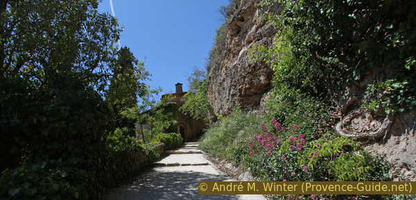
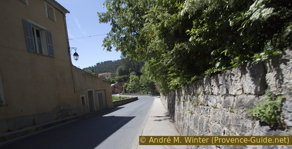
We keep left when it no longer goes up and then it almost horizontally next to old houses, walls and the rock wall.
No reproduction is permitted without the written consent of the author. (id3380)
Paved path under the Cotignac tuff cliff
If you continue like this, you will come to a fork in the path with an additional entrance to a house in between. You can also see cellars dug into the rock, which today serve as a car park.
On the photo you come from the bottom right and go up to the left.
No reproduction is permitted without the written consent of the author. (id4169)
Junction on the Rue du Rocher
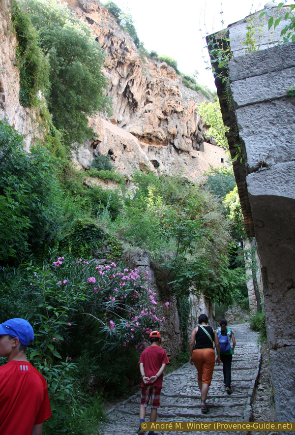
We now go up a gravel path, the Sentier des Escaillons. A small arrow points to the towers (Tours Sarrasines). This path is also the main entrance to some of the houses that can really only be reached on foot. After a hairpin bend with a rickety but picturesque house, the path turns west for a long time, now paved with concrete and wide steps.
No reproduction is permitted without the written consent of the author. (id4170)
Uphill at Sentier des Escaillons
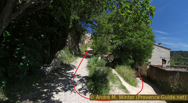
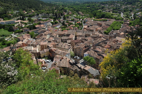
In a narrower section, where the steps are also shorter with a wall on the left, there is a path up the slope to the right, it is sometimes closed, but it is worth the detour. You come up here between retaining walls for small fields (restanques) and after a few meters you have an ideal view of the city. In 2019, the path was clean of undergrowth.
No reproduction is permitted without the written consent of the author. (id4171)
Approach to the path above the Sentier des Escaillons
After returning to the Sentier des Escaillons, we continue to climb it.
No reproduction is permitted without the written consent of the author. (id4172)
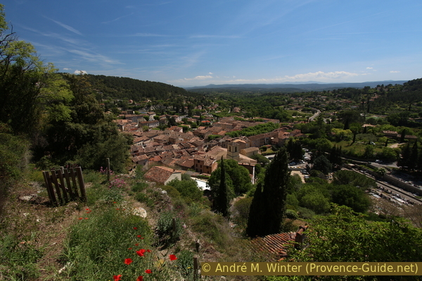
View over Cotignac from the end of the small path
In a bend there is a bench for a well-deserved rest in the shade, but after a few more minutes you are at the top of the plateau. The marked path leads to a crossroads, here we turn right onto the paved Chemin des Tours.
No reproduction is permitted without the written consent of the author. (id4173)
The Sentier des Escaillons path meets the Chemin des Tours
So we make a short detour to the towers above the village. Those are the remains of a castle complex, all other buildings have long been removed. They are called Tours Sarrasines (Saracen Towers), but there is no historical connection with the Arab pirates who invaded Provence in the Middle Ages.
No reproduction is permitted without the written consent of the author. (id4174)
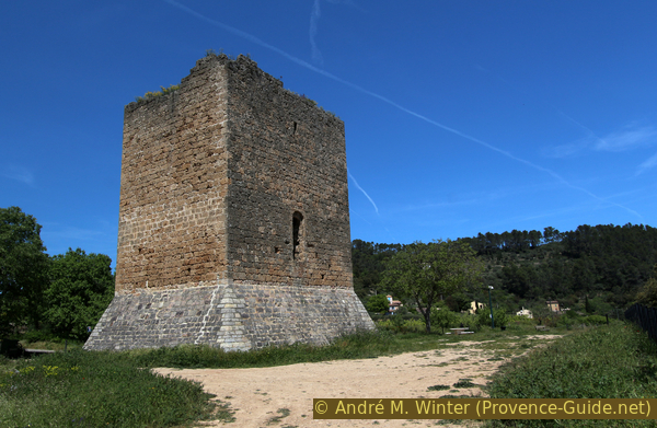
Western tower of Cotignac
To see Cotignac from here you need either a long neck, a long arm to hold the camera over the edge or a long selfie stick. Do not climb over the fence, behind it is a steep descent and the tuff is fragile. There are benches here for a picnic when the sun isn't too hot.
No reproduction is permitted without the written consent of the author. (id4175)
Deep view of Cotignac
Section 2: Tours - St. Martin - Derroc - Cours Gambetta
➙ 2,1 km ... 25 min ➚ 30 m ➘ 110 m ↝ easy
15% hard-surfaced quiet side streets, without marks
15% easy trails, faulty marks
35% hard-surfaced quiet side streets, faulty marks
5% forest roads, faulty marks
5% moderate trails, faulty marks
25% hard-surfaced city alleys, without marks
The clues
- Tours Sarrasines, 315 m
- Chapel St. Martin, 325 m
- At the upper edge of the lower waterfall, 260 m
- Cours Gambetta, 225 m
Back to the town centre, often crossing the Cassole creek.
vignes = vineyards
fenêtre latérale = side window
Starting from the two towers, we return to the crossroads and turn right there. So you quickly come to a path between fields and an open water pipe. The path leads us under a large tree and then seems to end in the courtyard of a residential building. But we are on the correct way, the path leads between a wall on the left and houses on the right onto a street.
No reproduction is permitted without the written consent of the author. (id4176)
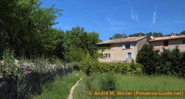
The Sentier des Escaillons path passes by these houses
Now sharp left and follow the small winding road. We come across a small bridge without railings, below which flows an inconspicuous creek. However, this is the Cassole river, which forms the two mighty waterfalls further down.
No reproduction is permitted without the written consent of the author. (id4147)
Bridge over the Cassole on the Chemin de la Chapelle Saint-Martin
We continue along the road and come to the Saint Martin chapel. It has been documented since 1174. The Cotignac cemetery was here up until the 16th century. Today the area with the fields and the scattered houses is called Saint-Martin. The outer walls are renovated, but in 2019 the inside of the chapel was still bare and dusty. It is usually closed.
You may be able to take a look across the two naves by walking around the ruined house to the right and looking in through a side window.
No reproduction is permitted without the written consent of the author. (id4148)
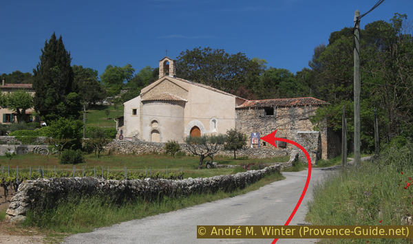
Chapelle Saint Martin above Cotignac
The chapel forms the northernmost point of our tour.
We continue along the south facade of the chapel along the Chemin du Derroc and to the south-west. At first the road remains flat, but then begins to descend quickly. We keep going straight ahead along the asphalt strip to a pink house where the small road turns left and descends more steeply. The direction is now longer to the south-east.
No reproduction is permitted without the written consent of the author. (id4149)
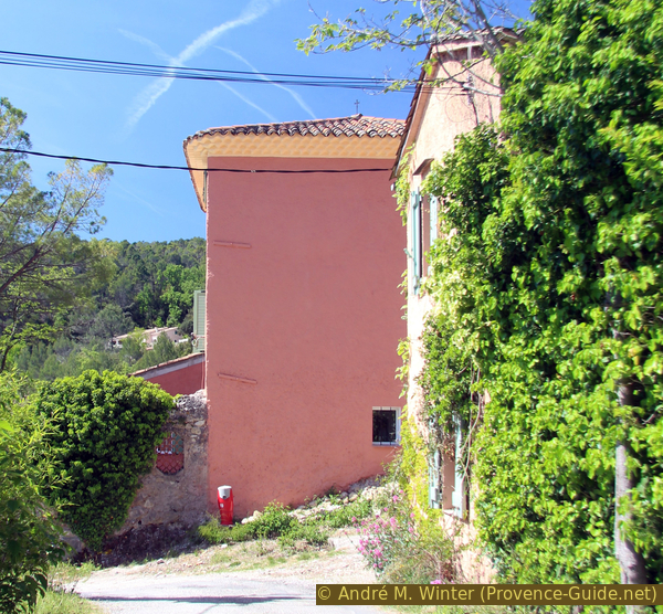
Curve at the Chemin du Derroc
vue = view
supérieure = upper
inférieure = lower
After the last house on the left we look for a hole between the trees on the left. Here you have a view of the upper Cassole waterfall.
No reproduction is permitted without the written consent of the author. (id4150)
Location with a view of the upper waterfall
You can't walk easily to the upper waterfall. You would have to walk along the stream about 100 meters upstream in the river bed. However, there is hardly any space between the fences on the left and right and the slippery creek bed. Further down we come to a footbridge over the creek. In order to wade to the upper waterfall, one would have to enter the creek bed here.
No reproduction is permitted without the written consent of the author. (id4151)
Upper waterfall on the Cassole
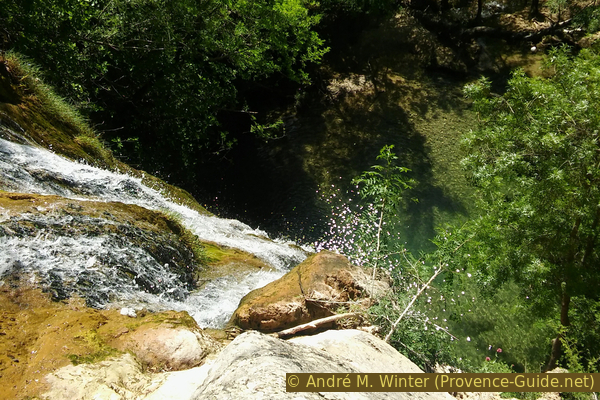
However, it is easier to look at the top of the lower waterfall from the footbridge.
No reproduction is permitted without the written consent of the author. (id4152)
River bed between the two waterfalls
Directly in front of the footbridge on the right, you are on a bumpy path leading a few meters to the edge of tuff rock, where the water plunges into the depths.
Attention, the area is not secured at all. The rocks can be slippery and the branches that offer support are not particularly trustworthy.
No reproduction is permitted without the written consent of the author. (id4153)
The waterfall plunges into the lake in Vallon Gai
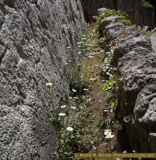
We return to the path, go across the footbridge and further ahead. So we stride back towards the village between rocks, walls and houses on the Rue des Jardins. Water runs down the wall on the left.
No reproduction is permitted without the written consent of the author. (id4154)
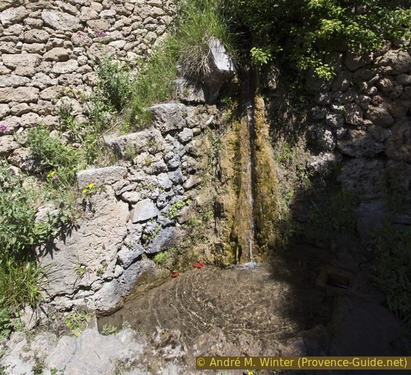
Flow of an old irrigation pipe
At the first real crossroads, we go down to the right.
No reproduction is permitted without the written consent of the author. (id4155)
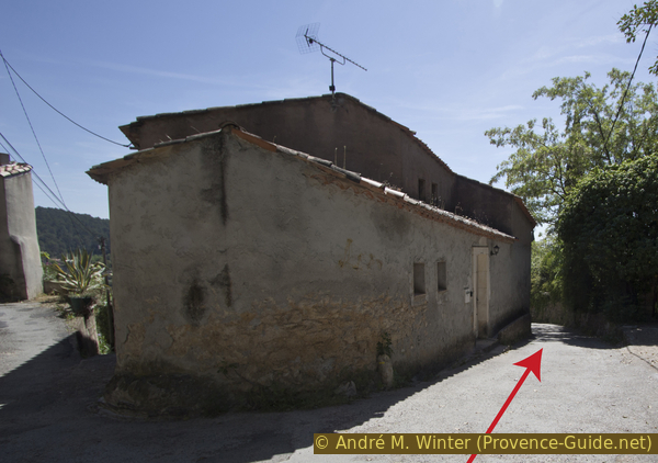
Crossroads with Rue du Rocher
Along the house at the crossroads and after that there is a small gully.
No reproduction is permitted without the written consent of the author. (id4156)
Open watercourse along a house wall
We pass the path downhill at the cemetery. From here you have a lesser-known view of the rock, it looks more stepped and greener from this angle.
No reproduction is permitted without the written consent of the author. (id4157)
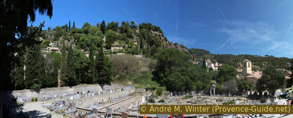
Cemetery and cliff of Cotignac
We trudge further down, the street narrows and leads directly to the main square Cours Gambetta with its culinary temptations.
We turn at the square to the right.
No reproduction is permitted without the written consent of the author. (id4158)
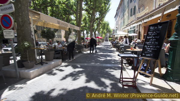
Café terraces on Cours Gambetta
Section 3: Cours Gambetta - Vallon Gai - Cours Gambetta
➙ 1,9 km ... 45 min ➚ 40 m ➘ 40 m ↝ easy
5% hard-surfaced city alleys, without marks
<5% stairs, without marks
5% hard-surfaced country road, without marks
85% easy trails, without marks
5% hard-surfaced country road, without marks
<5% stairs, without marks
<5% hard-surfaced city alleys, without marks
The clues
- Cours Gambetta, 225 m
- Pont sur la Cassole bridge, 210 m
- Lake under the cascade, 235 m
- Pont sur la Cassole bridge, 210 m
- Cours Gambetta, 225 m
The Vallon Gai is a dead end, but the detour is really worth it when you see water flowing in the creek!
No reproduction is permitted without the written consent of the author. (id4160)
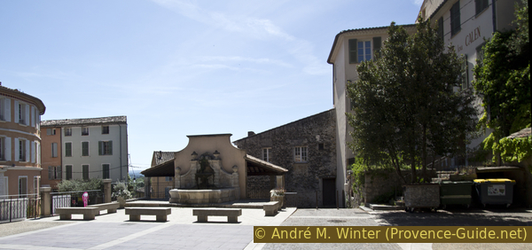
Fountain in the south of the Cours Gambetta
Behind it is the wash house. We go down to the right.
lavoir = washhouse
At the Cours Gambetta we go down and over the stairs under the washhouse. Attention, at the bottom you end up directly on the busy main road. On an unfortunately narrow footpath you come to the road bridge over the Cassole. Opposite, those who did the guided tour will recognize the Tourist Office.
No reproduction is permitted without the written consent of the author. (id4161)
The main road descends to the bridge over the Cassole
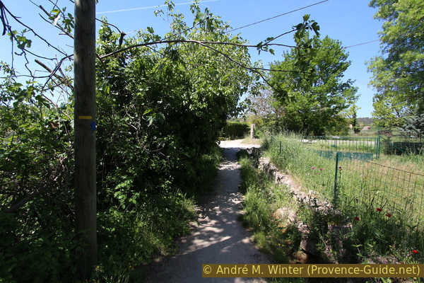
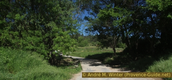
Immediately after the bridge, we take the path on the right into the forest (Vallon Gai sign). For us hikers it is also a cul-de-sac that ends on a lake and a waterfall. But this valley is very quiet, very shady and really worth seeing.
No reproduction is permitted without the written consent of the author. (id228)
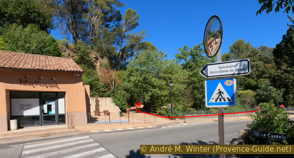
View from the tourist office to the access to the Vallon Gai
Quite quickly we pass a shady picnic spot on the banks of the Cassole.
No reproduction is permitted without the written consent of the author. (id4162)
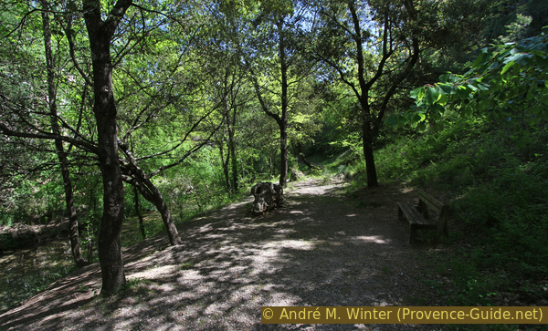
Looking back along the path in Vallon Gai
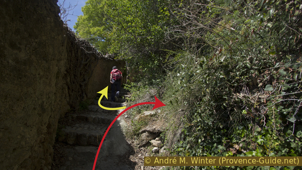
On has to change to the upper path as it is the only passing through upstream.
No reproduction is permitted without the written consent of the author. (id227)
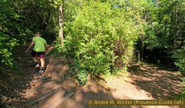
The trail leads up left
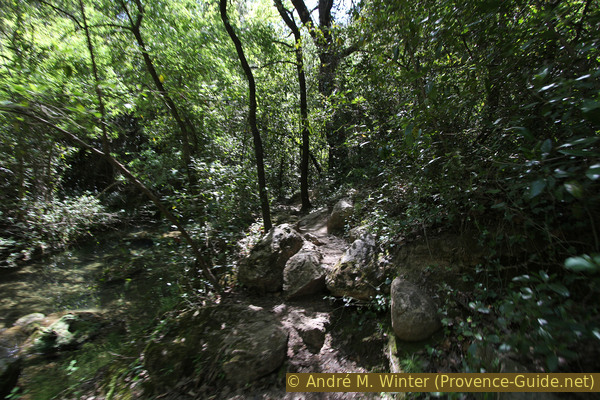
We descend to the stream and walk upstream along the water. You think you are in a real jungle.
No reproduction is permitted without the written consent of the author. (id4163)
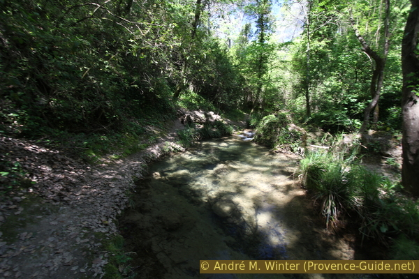
Lower shore path in Vallon Gai
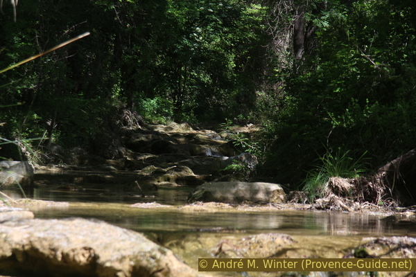
After a few minutes, the creek forms a small waterfall in a rocky section. Here at the latest we have to turn left again up to the main path. From there we go further into the valley.
No reproduction is permitted without the written consent of the author. (id4164)
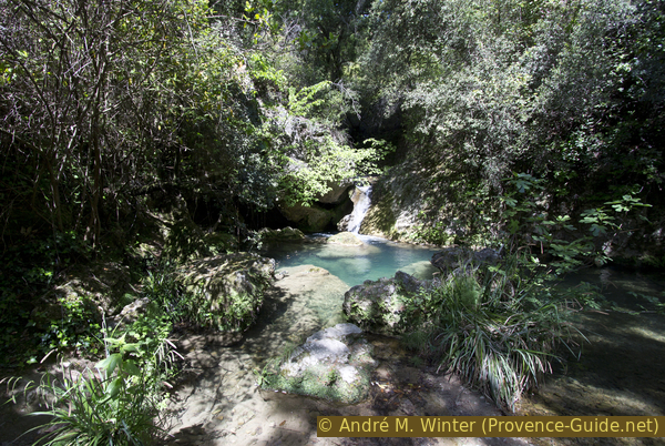
Small waterfall at the Cassole
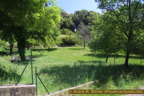
This brings us to a somewhat more open area. Ruins in the water and on the other bank seem to be the remains of a former mill. You can descend to the water in various places, there are deep pools in the stream bed.
Further on, the path approaches the cliff on the left, it becomes narrower and bumpier, but remains easy to walk. You should hear the waterfall from here.
No reproduction is permitted without the written consent of the author. (id4165)
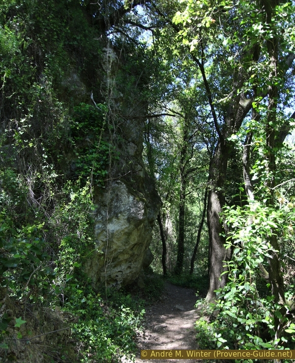
The path between the rock wall and the creek
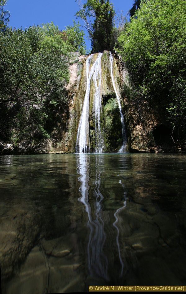
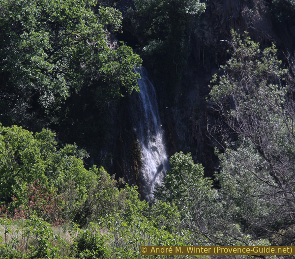
The outstanding feature of the waterfall is the large, crystal-clear lake in which it falls (except after a thunderstorm, when it is reddish brown). It is better to stay away from the waterfall, the tuff wall that it forms and over which it flows is very unstable.
There is no other way out of the cauldron.
No reproduction is permitted without the written consent of the author. (id4167)
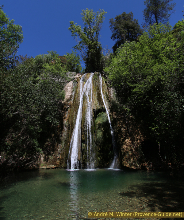
Cassole waterfall in the Vallon Gai cirque
So we take the same way back out of the valley. This time we can stay on the main path until the road bridge. After the picnic area, return to the Office de Tourisme or the Cours Gambetta.
No reproduction is permitted without the written consent of the author. (id4168)
On the way back from the waterfall
Sources and additional information
It is better to use a good topographic hiking map: This tour is on the IGN "Aups, Salernes" map, scale 1:25000, 3443ET.
If you don't want to bother with a paper map, you can also use mapping apps on your cell phone. On the one hand, it is the Cartes IGN app from the official map service. However, it requires access to the data network and this is sometimes difficult in canyons or remote locations.
Alternatively, you can use apps that store data directly on the device. They're generally not free, but they don't cost much. We mainly use OSMAnd, here it is possible to add contour lines, relief shading, markings and others. To store this data on your phone you need a lot of space.
Of course, one needs access to satellites for the GPS signal with any app. In some canyons this is not the case. Therefore, do not rely on the position shown, but read the map on your phone as you would read it on paper. Most apps are available for Android and iPhone. The applications usually allow us to record the route travelled and also view the GPS files offered for each of our hikes.
This page has been seen 5144 times since 20 March 2024.
No reproduction is permitted without the written consent of the author. (id214)
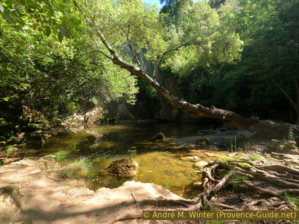
Vallon Gai lake is a smelly pond due to lack of water in June 2022