Waterfalls in the Vallon des Carmes and ruins of Pontevès Castle
History of water and fountains in Barjols
walk
easy
2 h 30 min
very rare
yes
built-up area
walk
Introduction
Barjols is the town of water. It is located on the edge of the limestone plateau south of the Verdon Gorge, where several watercourses rise to the surface. There are similar geological falls in Cotignac, Sillans-la-Cascade and Villecroze. But only in Barjols did this water supply lead to early industrialisation. Around 1900, there were about 30 tanneries in the town. Water power was used in various places and a small power station is still in operation here. This small-scale industrial past strongly distinguishes Barjols from the villages in the surrounding area, here you can also find real city palaces.
The Vallon des Carmes valley is the main attraction of this circuit, we pass two large waterfalls and the remains of a monastery in a cave in the tuff. Many fountains line our path in the town. We also reach a vantage point from which we have a good view of the town in its basin. To extend the circuit a little, we also walk overland to the ruins of the castle in Pontevès and return to the starting point along the course of the former railway line.
The facts
7,9 km total distance
2 h 30 min walk time
400 m total elevation
orientation esay
mark 70% of the total distance
40% hard-surfaced quiet side streets
25% hard-surfaced city alleys
15% forest roads
15% easy trails
5% dirt roads
5% hard-to-recognize trails
<5% hard-surfaced country road
<5% stairs
dangers slippery section
children yes
useful picnic gear
required walking shoes, hiking gear and water
GPS coordinates (WGS84) of start and end point 43.557727,6.005264
downloads ![]()
![]()
Public transport
A few buses serve Barjols, but they are only optimised for students. It ist useful to complain about at the tourist offices of the region. More public transport may also help the local population.
Access by car
Barjols is located north of the A8 motorway and north-east of the Saint-Maximin-la-Sainte-Baume exit. Then drive nord-east in direction of Verdon.
Useful parking spaces
There is a large car park to the south-west of the village centre on the Place de la Rouguière, which you pass when coming from Saint-Maximin-la-Sainte-Baume. The starting point is by the fountain on this square. The big market takes place here on Sundays. In this case, it is better to stop at the Oratoire Saint Michel chapel (above the Vallon des Carmes, at the end of the section 1). You can also park at the school in Pontevès, at the end of section 2. All these parking spaces are free of charge.
No reproduction is permitted without the written consent of the author. (id3724)
View of Barjols from the Croix du Castellas cross
Hints
The tour has no difficulties worth mentioning. The Vallon des Carmes valley is deeply cut and of course it looks ideal in fine weather in spring. After heavy rains, the fords can be difficult to cross, and in extreme cases the whole valley can be closed.
Here in the south, S is often pronounced at the end of proper names, i.e. PontevèS or CastellaS. Not, however, Barjols or Carmes (Carmelite name).
The whole region is a zone with a high risk of forest fires. In summer, but also in other seasons when it is very dry or by strong winds, access to the forest areas can be regulated. As a result, the roads may be closed to traffic and/or the trails prohibited to hikers. Current information: Map of access to the forests of the Var (also english). The map shows the colours green, yellow, orange and red which correspond to levels of danger.
The sections
- Through the centre of Barjols into the Vallon des Carmes valley and climb to the Croix du Castellas cross.
- To Pontevès and its castle ruins.
- Back to Barjols via the former railway line.
Section 1: Barjols - Vallon des Carmes - Castellas
➙ 2,3 km ... 1 h 15 min ➚ 270 m ➘ 170 m ↝ easy
30% hard-surfaced city alleys, without marks
5% stairs, without marks
10% hard-surfaced city alleys, few marks
30% easy trails, few marks
5% hard-surfaced quiet side streets, without marks
10% forest roads, without marks
5% hard-surfaced quiet side streets, without marks
15% easy trails, few marks
<5% hard-surfaced quiet side streets, without marks
The clues
- Place de la Rouguière, 255 m
- Porte du Réal, 290 m
- Camyon Gouffre aux Épines, 270 m
- Waterfall Cascade des Carmes, 280 m
- Couvent des Carmes cave chapel, 310 m
- Oratoire St. Michel chapel, 330 m
- Croix du Castellas cross, 350 m
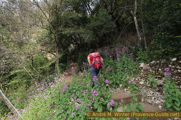
We ascend through the town into the Vallon des Carmes. In order to get to the caves and some viewpoints, sections of path have to be walked there and back.
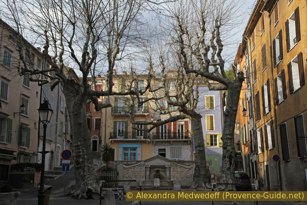
Barjols is famous for its 30 fountains, but also because some have very strange shapes. The water is heavily enriched with lime and this is released especially in fountains. This is how they turn into large mushrooms. This growth is irregular and can destabilise the fountains, so they are often restored to a balanced shape.
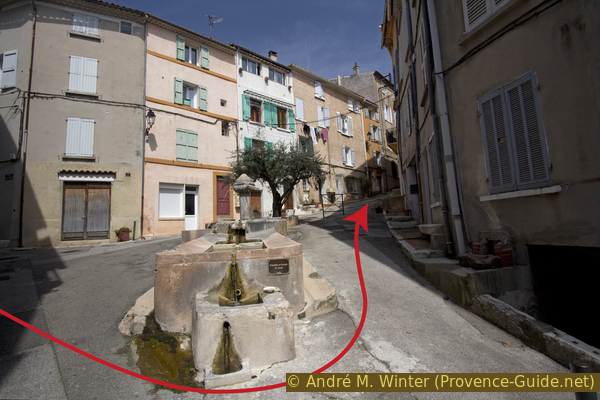
A large fountain of this type is located in the Place de la Rouguière car park. The Fontaine Raynoard fountain was originally adorned by a faun. Since 1910, the sculpture has completely disappeared under the tuff deposits.
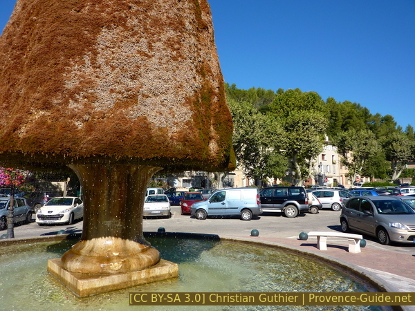
The Raynoard Fountain and the car park of the Place de la Rouguière
monument aux morts = war memorial
champignon = mushroom
église = church
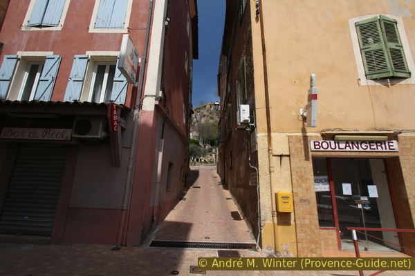
Standing by the Fontaine Raynoard, we look out for the Café de l'Europe with its large terraces. Our path leads through the short street to the right of this bar.
We reach Boulevard Grisolle and cross the street.
Fontaine de la Burlière
However, we continue in the direction coming from the large car park, we are now in Rue du Barri. After the first house, there is a square on the left, the entrance to the former hospital.
At the back, there are two fountains in the façade of the house, and under a high vault, there is a former washhouse of the hospice.
Fontaines de l'Hospice
From the square in front of the old hospital, we go opposite into the Portail des Fainéants and under an arch. As we continue, we keep to the left.
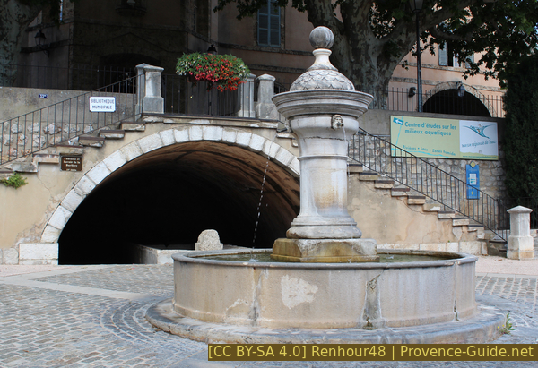
When we come to a triangular square, we stumble upon the St. Jean fountain and washing place from 1850.
Originally, there was also a cattle trough here.
Standing under the fountain, we now go right up Rue Frédéric Mistral. In the picture, this is the alley on the right. We turn right at the first opportunity and thus come to Rue des Audiffren.
No reproduction is permitted without the written consent of the author. (id4421)
Saint Jean fountain and washhouse
Further down, we come to Place Victor Hugo, here stands the fountain with the Monument aux Morts (war memorial).
The design dates from 1922 and incorporates a previously existing fountain. On one side, soldiers are depicted marching joyfully into battle, on the other side, they return from the war devastated. The people depicted represent real inhabitants of Barjols who died in the First World War.
No reproduction is permitted without the written consent of the author. (id3780)
Victor Hugo square and war memorial
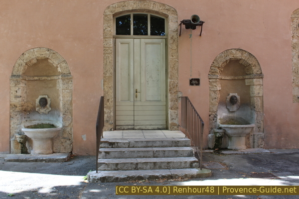
Below this square is another, the Place du Capitaine Vincens. The municipal office is located here and the small market is held here. Two fountains also adorn this square.
The Mushroom Fountain (Fontaine du Champignon) stands in front of the municipal office. The date of construction and the original shape are not known, it possibly consisted of two well bowls that have long been covered with tuff and moss.
No reproduction is permitted without the written consent of the author. (id4422)
Fountain of the Mushroom in front of the town hall
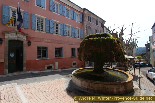
Further down is the Fontaine Capitaine Vincens from 1894.
The washhouse behind it previously stood by the upper fountain.
No reproduction is permitted without the written consent of the author. (id4423)
Fontaine Capitaine Vincens
At the fountain Fontaine Capitaine Vincens, we turn left twice and climb to Place Émile Zola.
Here is the Fontaine de l'église from 1867, further back is the gate of the church Saint-Marcel. It dates from the 14th century and is almost completely surrounded by attached houses.
Opposite the square in front of the church, we climb up through the narrow Rue du Réal. From now on, we go up into the Vallon des Carmes valley. Water will also accompany us on this ascent.
No reproduction is permitted without the written consent of the author. (id4424)
Rue du Réal
The narrow alley quickly turns into a steep square.
It is decorated with several fountains and monuments.
At the bottom, you can see the Fontaine du Piquet, with a small washing place.
The fountain marked the division between Rue du Réal and the former castle.
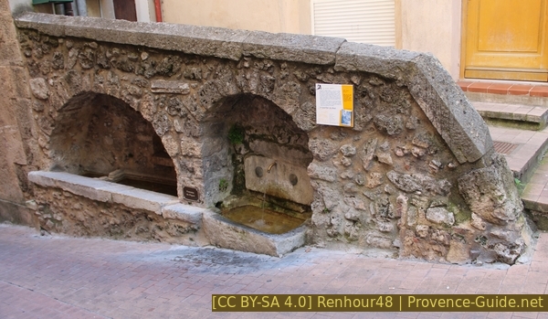
Fontaine du Piquet
Further up follow the artificial waterfalls of the Chutes du Réal. Here, too, the water forms tufa deposits that must be regularly cut.
No reproduction is permitted without the written consent of the author. (id4425)
Lower part of the Chutes du Réal waterfall
On the same level as the lower waterfalls are two old olive presses.
Under the arches is the Declaration of the Rights of Man and of the Citizen of the French Revolution of 1789.
No reproduction is permitted without the written consent of the author. (id3106)
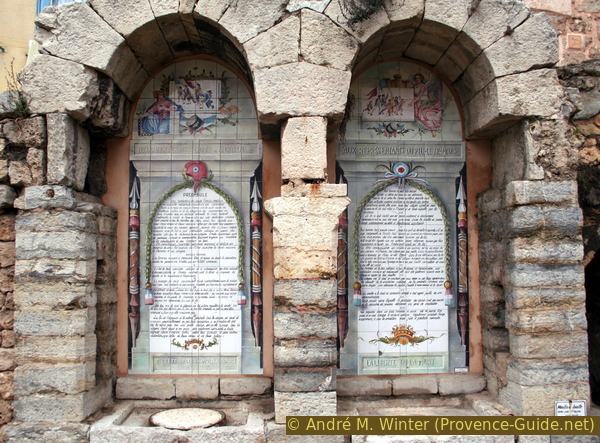
Declaration of the Rights of Man and the Citizen
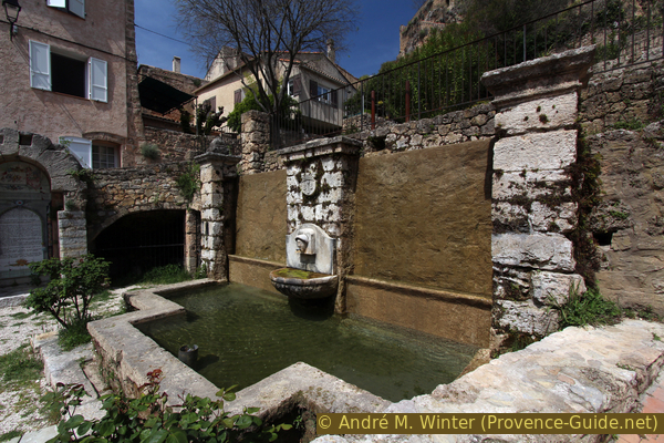
We walk around the lower fountain to the right, and just before leaving the square, we can take a staircase on the left up to the upper fountain of the Réal.
There's also a waterwheel there, under an arch.
Afterwards, we go back down the same staircase into Rue du Réal and continue uphill to the left.
No reproduction is permitted without the written consent of the author. (id4426)
Upper platform of the Chutes du Réal waterfall
A little later we come to a double fountain and a washing place. The fountain is called Fontaine de la Porte Rouge, there used to be a red city gate here.
No reproduction is permitted without the written consent of the author. (id4427)
Double fountain of the Porte Rouge
Left here.
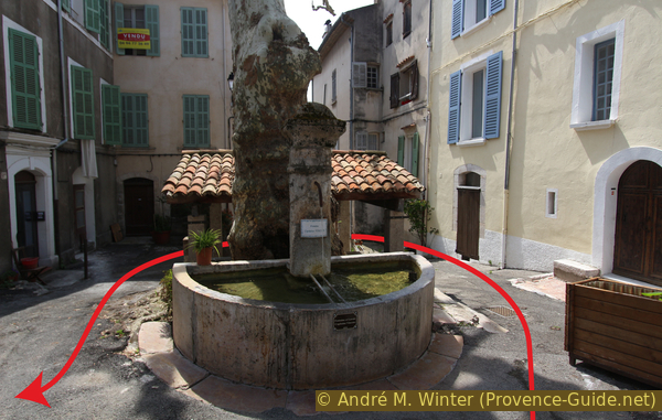
We continue uphill along the lane to reach the Fontaine du Réal. This is the last fountain before the Vallon des Carmes.
The signposts Vallon des Carmes and Croix du Castellas lead us further up.
No reproduction is permitted without the written consent of the author. (id4428)
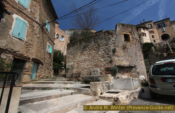
Fontaine du Réal
Go on left here.
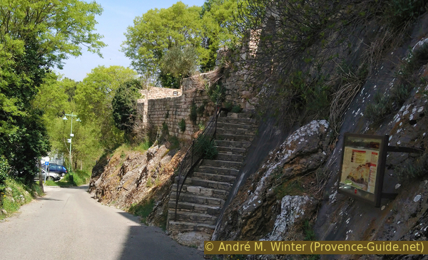
Now the steep and narrow road becomes a staircase, on the left there are city palaces, on the right you have a good view over the city.
When we pass through the Porte du Réal gate, we leave the old town centre. We are now on a part of the plateau that forms the edge of the basin in which the town lies.
No reproduction is permitted without the written consent of the author. (id4429)
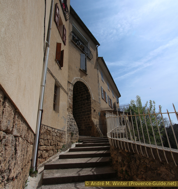
Stair and Gate of the Réal
After the town gate, we continue straight on between newer houses. At the first crossroads we turn right.
No reproduction is permitted without the written consent of the author. (id4430)
Crossing of the Chemin de l'Oratoire Saint Marcel
oratoire = chapel
ermitage = hermitage
gouffre = gullet
épines = spines
croix = cross
ZA = business park
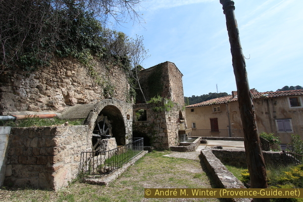
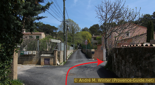
Soon after, the asphalt stops and the road continues into the Vallon des Carmes valley. There are explanatory and warning signs in a wider square.
We follow the path that leads downwards here. In the rock face above you can see a rusty pressure pipe that feeds a small hydroelectric power station further down. At this pipe there is also a fork, we continue downhill to the right into the gorge Gouffre aux Épines.
No reproduction is permitted without the written consent of the author. (id3720)
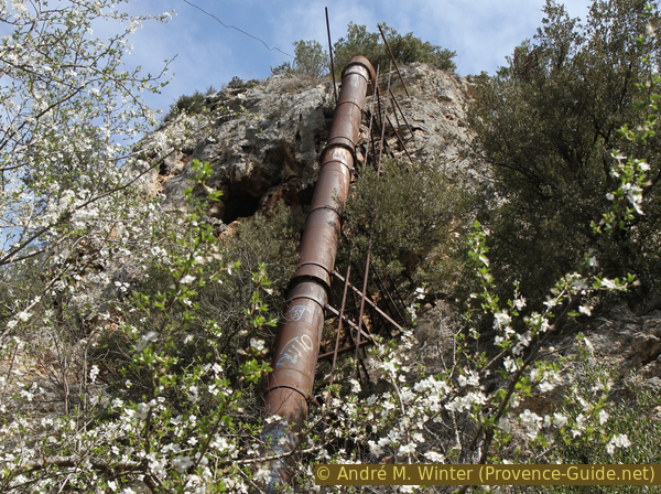
Penstock of the Carmes micro-power station
On the way down, we pass the whirring power station building. We are now at the Fauvery stream, this small body of water forms the waterfalls, lakes and gorge sections further up.
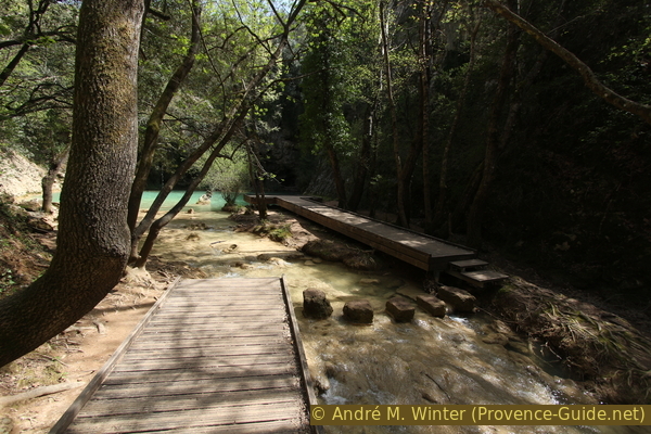
Wooden footbridges form the path along the water, to cross to the last one you have to step over cuboid stone blocks that can be slippery.
No reproduction is permitted without the written consent of the author. (id4431)
Path in the Gouffre aux Epines chasm
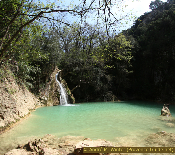
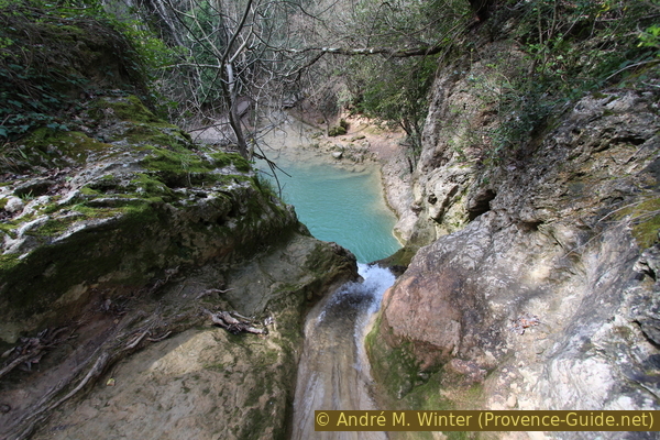
In front is a lake in a deep basin. A naturally channelled waterfall at the top continues to fan out below.
It is not forbidden to swim here, but we do not recommend it. The bottom of the lake is littered with rocks and deadwood.
No reproduction is permitted without the written consent of the author. (id4432)
Waterfall and lake of the Gouffre aux Épines chams
We go back up the same path to the junction under the penstock and turn and right. It goes up a little and so we come to the upper edge of the waterfall. You can walk a little ahead along the water on the right here and look down into the water channel and onto the lake.
No reproduction is permitted without the written consent of the author. (id3721)
Natural channel feeding the Gouffre aux Epines waterfall
The main trail crosses the Fauvery stream again here. The stone blocks for crossing are less clear here and you also have to walk on rock and over roots. Afterwards, the path leads over steps to the second lake.
No reproduction is permitted without the written consent of the author. (id4433)
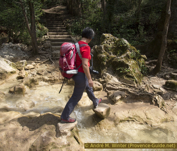
Passage over the Fauvery upstream from the Gouffre aux Épines chams
oratoire = chapel
ermitage = hermitage
point de vue = view point
gorges = canyon
ZA = business park
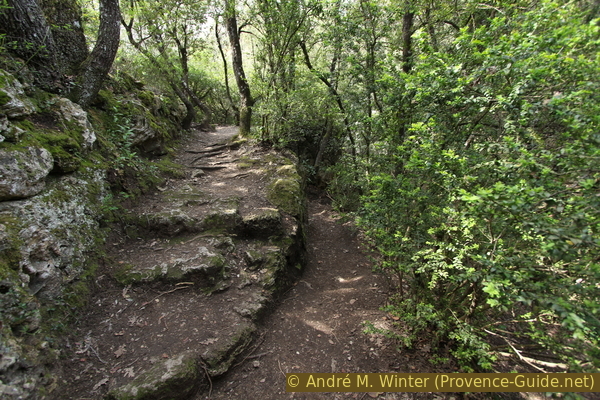
In a high and dense forest, we come to a crossroads with no special marking. We pass under an old wall on the left, for which we first have to descend a few steps. Continuing along the wall, we come to another wooden footbridge on the shore of a slightly larger lake. The waterfall is also higher and wider here.
We are in the southern part of the small map, it is an enlargement of the previous section.
No reproduction is permitted without the written consent of the author. (id3722)
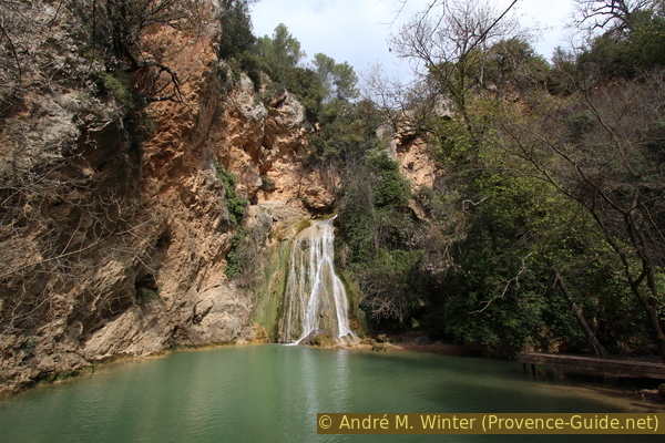
Turquoise lake under the Cascade des Carmes
We leave the wooden footbridge at the other end and follow the path that turns to the right. We come across a kind of terrace in the forest. This is the ruin of a former mill.
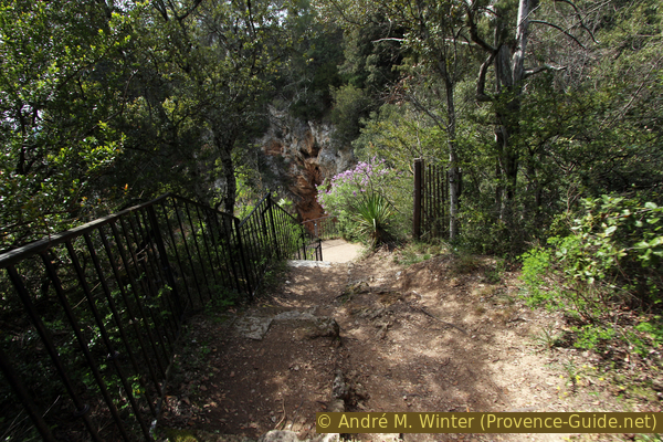
After this platform, turn left and continue uphill, at the following crossroads turn left again towards Couvent des Carmes. After a short climb, we come to a flat area with a rock wall on the right and two openings in it.
No reproduction is permitted without the written consent of the author. (id4434)
Path in front of the Grotte des Carmes cave
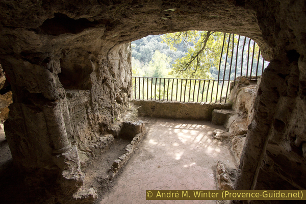
It is a cave chapel of the Discalced Carmelites, enlarged and furnished around 1670. It is open from mid-September to mid-June on Wednesday, Saturday and Sunday from 10am to 4pm, and in summer every day from 9am to 6pm. By fine weather, it can also be open more often.
You can enter through one opening and exit through the other. In the right passage, there are widened side openings. The left passage is wider and here are the remains of the shell chapel (Chapelle à Coquillages).
No reproduction is permitted without the written consent of the author. (id3723)
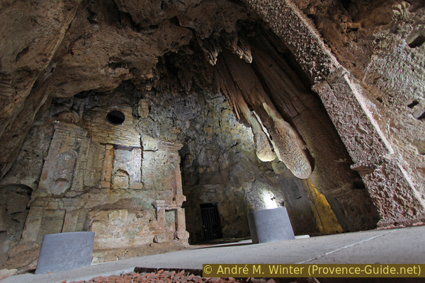
Shellfish chapel in the Carmes cave
oratoire = chapel
ermitage = hermitage
point de vue = view point
gorges = canyon
ZA = business park
We leave the cool chapel and continue to the right. After a few metres, we turn right towards the Grotte de l'Ermitage.
We are now at the top (north) of the small map.
No reproduction is permitted without the written consent of the author. (id4435)
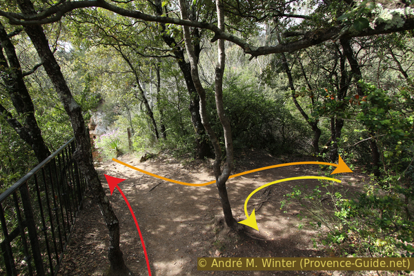
Crossing on the path to the upper lookout
Access to the upper viewpoint in red and to the Grotte de l'Ermitage and the gorge route in orange and yellow.
This is where the wayfinding gets complicated. There are three individual pathways to the sights:
- The viewpoint above the upper waterfall Cascade des Carmes
- The Grotte de l'Ermitage cave
- The gorge of the Fauvery above the waterfalls
To get to the lookout point above the upper waterfall, simply continue straight on. After a few steps downhill, you come to the Belvédère. The view is better in winter because there are fewer leaves on the trees.
No reproduction is permitted without the written consent of the author. (id4436)
Path to the lookout above the upper waterfall
To Cave Grotte de l'Ermitage we go up again from the viewpoint and after the steps we look for a path in the forest on the left. It soon leads back to the right and down old steps into a kind of passage between a small wall on the left and the rock face on the right. This path leads under a vault carved into the tuff.
No reproduction is permitted without the written consent of the author. (id4437)
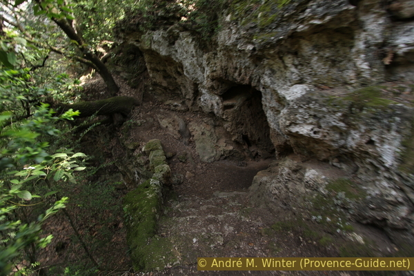
Path to the Grotte de l'Ermitage
Here you stand in front of two rock chambers under the path to the Belvédère that you walked on before. You can see columns, niches, benches and graves carved into the rock.
No reproduction is permitted without the written consent of the author. (id4438)
Right chamber of the Hermitage Grotto
We get to the Gorge des Fauvery by going down instead of up after the Grotte de l'Ermitage cave. There is no real path here, you wind your way between trees and boulders.
No reproduction is permitted without the written consent of the author. (id4440)
Paths near Grotte de l'Ermitage
Right to the gorge section.
After a few minutes we are at the stream, which is cut deeply here between very irregular rock faces. On the right (upstream) is the road bridge to the business park. On the left (downstream) you can walk a little further under an overhang. There is little sunlight coming through the forest, but the rare rays of sunshine make the turquoise waters of the lakes glow all the more.
No reproduction is permitted without the written consent of the author. (id4439)
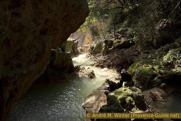
Fauvery Gorge
We go back to the main path and turn left up to the road. There we turn left again and cross the bridge that we saw before from below. On the other side there is an area that serves as a car park, we cross this place without changing our direction of march. A forest path begins there in the bushes.
We walk upwards here and come to the Oratoire Saint Michel chapel. A torso without a head is set up here. In the past, there was certainly a good view here, but the trees have now obstructed the panorama.
No reproduction is permitted without the written consent of the author. (id4441)
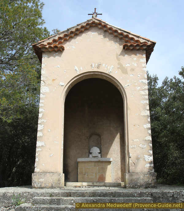
Saint Michael's oratory
The last destination of this section is the Croix du Castellas cross. We go back and over the bridge, past the cave chapel again and continue downhill.
After a treeless area, we come to the path junction where we climb again on the right. A sign warns of hunting. The path is marked green-white and red. We climb in switchbacks between holm oaks.
The lower part of the path has steps.
No reproduction is permitted without the written consent of the author. (id4442)
Ascent from the Vallon des Carmes to the Croix du Castellas cross
We keep to the right and upwards along the path, no matter how some other paths cross. After a few minutes we come to an asphalt road and a large antenna. Passing it on the left, we come to a large metal cross. At night it is illuminated and easily visible from the city.
No reproduction is permitted without the written consent of the author. (id3725)
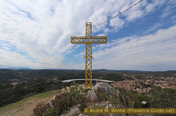
Castellas Cross and the large orientation table
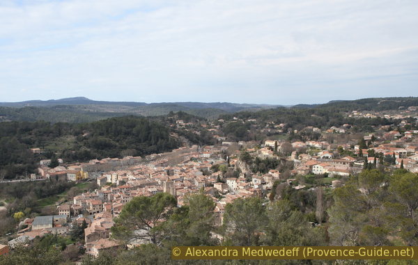
The view of Barjols is optimal. A large orientation board points to some other great hiking mountains: Sainte Baume, Mont Aurélien and Montagne Sainte Victoire further behind.
No reproduction is permitted without the written consent of the author. (id4443)
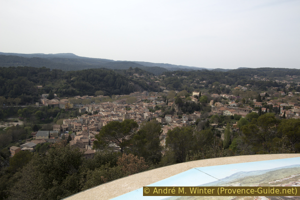
Barjols seen from the Croix du Castellas
Section 2: Croix du Castellas - Pontevès
➙ 2,5 km ... 30 min ➚ 130 m ➘ 80 m ↝ easy
35% hard-surfaced quiet side streets, few marks
35% forest roads, few marks
20% hard-surfaced quiet side streets, few marks
10% hard-surfaced city alleys, few marks
The clues
- Croix du Castellas cross, 350 m
- Garbelle, 345 m
- Château de Pontevès castle ruin, 405m
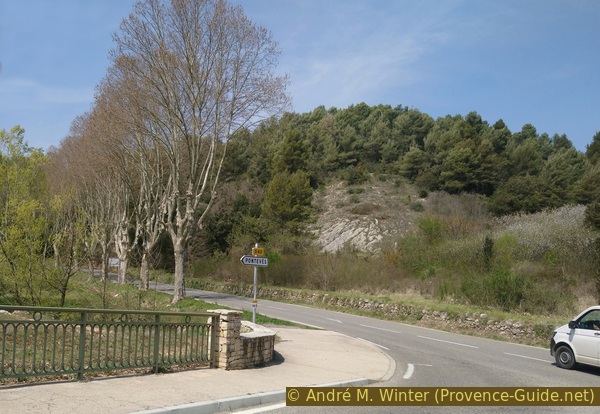
After many sights that were very close to each other, there is now a connecting section to Pontevès.
We take the road that leads in a straight line away from the cross and the antenna. It goes slightly uphill, when we are under the crest, we are under the Castallas top.
After that, it is just as straight downhill again, we arrive in a pine forest. Finally, we reach a crossroads, where we keep to the left.
No reproduction is permitted without the written consent of the author. (id4444)
Bend at the end of the Route du Castellas
70 metres further on, you have to look out for a green-white and a red marker, both pointing to the right into the forest. Here we cross down to a forest path, there continue to the right.
From the rocky path you can see a mountain with two peaks. This is the Petit Bessillon, an easy mountain to be hiked from Pontevès.
No reproduction is permitted without the written consent of the author. (id4445)
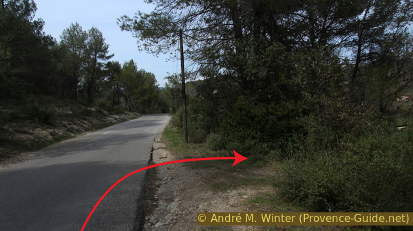
Garbelle road
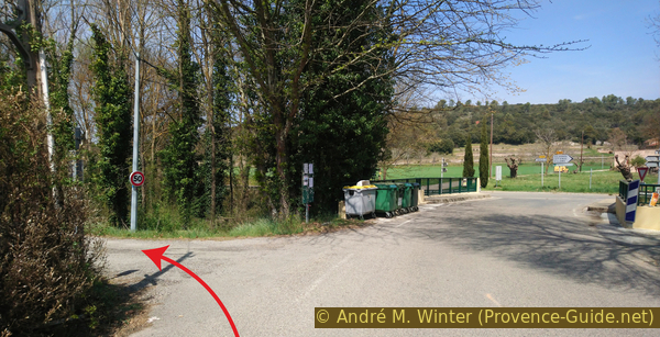
From now on, we always stay on the wider road at intersections. After 600 metres, we turn left onto the Chemin de Brignoles. 200 metres further on, the asphalt begins and later the road turns right. We thus reach Pontevès from the south-east.
The road climbs under a wall with a turret at the corner. Below and above, behind the wall, is the central car park of Pontevès, where you can also park for this tour. There is a toilet at the top of the turret.
No reproduction is permitted without the written consent of the author. (id4446)
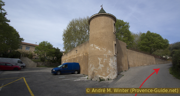
Pontevès car parks
château = castle
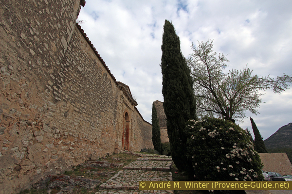
After the entrance to the car park, we turn left and continue straight across the main road, which is not particularly wide here either. This takes us into a paved and even narrower alley. When it is no longer straight ahead, we turn right and then left twice. We are now at the foot of the south façade of Pontevès Castle.
No reproduction is permitted without the written consent of the author. (id3726)
Ascent to the Château de Pontevès
All that remains of the castle that once dominated Barjols are the outer walls and the defence towers. It was built in the 11th century and has been decaying since the 17th century. On the west side, houses are built directly against the outer wall.
No reproduction is permitted without the written consent of the author. (id3727)
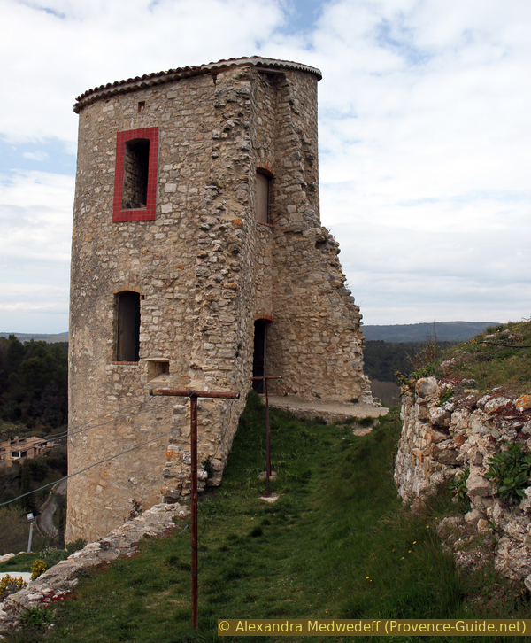
A tower of the Château de Pontevès
Section 3: Pontevès - Barjols
➙ 3,2 km ... 40 min ➚ 0 m ➘ 150 m ↝ easy
5% hard-surfaced city alleys, few marks
50% hard-surfaced quiet side streets, few marks
10% hard-to-recognize trails, without marks
5% hard-surfaced country road, without marks
10% dirt roads, without marks
5% hard-surfaced city alleys, without marks
<5% hard-surfaced country road, without marks
15% hard-surfaced city alleys, without marks
The clues
- Château de Pontevès castle ruins, 405m
- Chemin de l'ancienne voie ferrée (former railway line), 330 m
- Rue St. Marc, 300 m
- Place de la Rouguière, 255 m
We go back to Barjols, this time on the former railway line. On the way back, we pass by fountains again.
We leave the castle complex in a westerly direction, the path leads past the large and roofed tower in the north-west. Then we follow a path between walls and houses that are still inhabited.
Finally, descend a stone staircase to the Chemin de Tavernes road. Turn right here and continue north. Shortly afterwards, you will pass the other car park of Pontevès.
No reproduction is permitted without the written consent of the author. (id4411)
Descent from the castle and road to the north
We follow this quiet and straight road for about 10 minutes until before the bridge over the Fauvery stream. Behind it is the busy road to Barjols. However, we turn left before the bridge (Chemin de l'ancienne voie ferrée).
No reproduction is permitted without the written consent of the author. (id4412)
Chemin de Tavernes and the bridge over the Fauvery creek
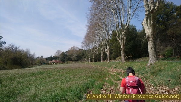
We walk for about 15 minutes along this former railway line. You pass a few houses and fields on the riverbank.
No reproduction is permitted without the written consent of the author. (id4413)
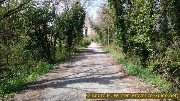
Track of the former railway
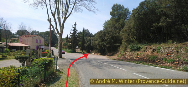
The small road joins a larger one coming from Pontevès, this time we turn right and also cross the bridge. The marked path now runs along the busy D560 road. It is not possible to continue along the railway track because the bridge over the stream is missing further ahead.
No reproduction is permitted without the written consent of the author. (id4414)
The D560 road east of Barjols
However, there is a path below the road and to the left of the plane trees. You can walk here to the first house on the road.
No reproduction is permitted without the written consent of the author. (id4415)
Path and alley along the D560 road
As a fence forces us closer to the edge of the road, we stay on that side of the road until we see a free space opposite. We can now cross the road, paying attention to the traffic.
To the right of the cypress tree seen in the photo, we continue on a path with a ban on driving.
No reproduction is permitted without the written consent of the author. (id4416)
The crossing of the D560 road is necessary here
This gravel road is again on the former railway line, this time the route is deeply cut into a hill. After the narrow section, the route continues over an embankment with the same large radius of curve.
No reproduction is permitted without the written consent of the author. (id4417)
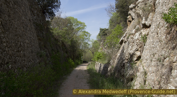
Notched passage of the old railway east of Barjols
At the first crossroads, we go downhill to the left. The buildings on the right belong to the Barjols school complex. We cross the main D560 road again, but this time at an angle. On the other side, we keep our direction in Rue St. Marc.
Before crossing the main road, you can have a look into an open water channel.
No reproduction is permitted without the written consent of the author. (id4418)
Canal passing between the schools
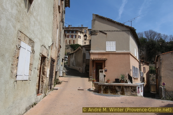
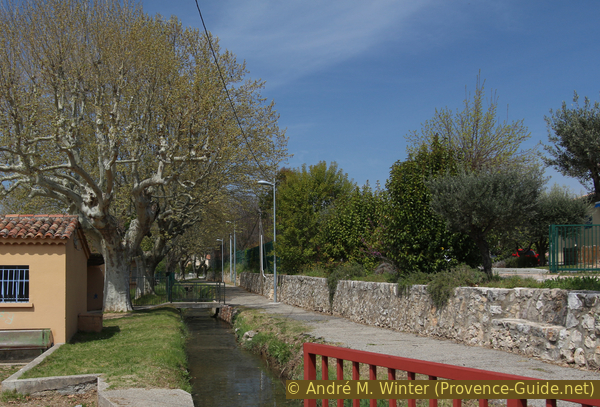
The Rue St. Marc is straight and flat at the beginning. However, we still have to descend to the starting point.
From the Fontaine St. Marc, the road goes downhill. Along with the washing area, it now adjoins a new residential building. This fountain dates from 1856.
The picture shows that Rue Saint-Marc ends at the front, where you have to turn left.
No reproduction is permitted without the written consent of the author. (id4419)

Saint-Marc fountain and washhouse
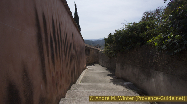
The alley becomes a staircase. As we descend, we see terraces on the left that were built before the invention of reinforced concrete.
The staircase makes turns, but at the bottom we go straight on into Rue du Barri. On the left, under the crossroads, you would see the Fontaine des Audriffen.
The Rue du Barri is the one we took at the beginning to get to the city. If we continue straight on, we come to the exit point at the Place de la Rouguière car park
.No reproduction is permitted without the written consent of the author. (id4420)
Escalier de la Rue Saint-Marc
Sources and additional information
It is better to have a good topographic hiking map: this tour is on the IGN map "Saint-Maximin-La-Sainte-Baume, Barjols, Trets, Mont-Aurelien", scale 1:25000, 3344OT.
If you don't want to bother with a paper map, you can also use mapping apps on your cell phone. On the one hand, it is the Cartes IGN app from the official map service. However, it requires access to the data network and this is sometimes difficult in canyons or remote locations.
Alternatively, you can use apps that store data directly on the device. They're generally not free, but they don't cost much. We mainly use OSMAnd, here it is possible to add contour lines, relief shading, markings and others. To store this data on your phone you need a lot of space.
Of course, one needs access to satellites for the GPS signal with any app. In some canyons this is not the case. Therefore, do not rely on the position shown, but read the map on your phone as you would read it on paper. Most apps are available for Android and iPhone. The applications usually allow us to record the route travelled and also view the GPS files offered for each of our hikes.
This page has been seen 3358 times since 20 March 2024.
No reproduction is permitted without the written consent of the author. (id3107)
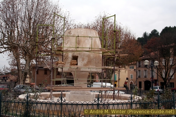
Raynouard Fountain freshly cut in 2005