Five panoramic views of the Verdon Gorge
A very long hike to impressive natural vantage points and the griffon vultures as a bonus
hike
difficult
7 h
seasonal
yes
yes
mountain
Introduction
A very long tour in the most impressive area of the Gorges du Verdon is described here. In addition, we mostly walk on little-used paths. We arrive at five unforgettable viewpoints that overlook the following sections: the Clue de Carajuan, the well-known Couloir Samson and the Escalès area. The chances of seeing griffon vultures are very high as we move around the release site.
The round includes several steep sections back up, including some in the blazing sun. The summer is certainly not recommended, unless you start very early and treat yourself to a very long siesta at the hottest time. Spring and especially autumn are really advisable, you should only avoid snow and frost because the paths become very slippery.
We recommend starting at the Pont de Carajuan bridge. In the summer months, a shuttle bus runs between Riez and Castellane. In the low season, you can easily park here. We also offer a variant from and to Trigance further south. From there you can also combine the tour with that from Trigance to Rancoumas. However, you have to add over an hour to the already long tour.
The facts
24,7 km total distance
7 h walk time
1010 m total elevation
orientation average
mark 80% of the total distance
40% easy trails
35% forest roads
10% hard-to-recognize trails
10% hard-surfaced city alleys
10% cross country
<5% hard-surfaced city roads
<5% moderate trails
<5% hard-surfaced quiet side streets
<5% hard-surfaced country road
dangers duration and sun
children no
useful picnic stuff
required hiking boots, hiking equipment, snack and water
GPS coordinates (WGS84) of start and end point 43.792159,6.432594
downloads ![]()
![]()
Public transport
Buses line 51 run between Nice and Grenoble twice a day in both directions with a stop in Castellane.
From mid-April to mid-October, a hiking bus runs around five times a day in both directions between Riez and Castellane. There is a bus stop at Camping de Carajuan, but you can also ask the driver to stop directly at the bridge. Information at Zou! (only french) and at the Castellane tourist office. The distance from Castellane to the starting point is around 20 kilometres, so it can also be managed by taxi.
Access by car
We are in the north-east of the central area of the Verdon region. The quickest way to get to Castellane from Nice and Grasse is to take the N85 road. From the north you come south on the same road from Sisteron and Digne-les-Bains. Coming from Castellane, head towards Moustiers-Sainte-Marie and stop when you reach the first true bottleneck.
The journey from Marseille is longer, you have to go through Gréoux-les-Bains and Moustiers and continue north of the gorge towards Castellane. You'll pass Point Sublime and you'll be at the trailhead as you come out of the last bottleneck in an open area.
Useful parking spaces
There are large parking bays along the road between the bridge and the Carajuan campsite. In the summer, these are fully parked during the day, but we have to start quite early anyway, so finding a space shouldn't be a problem.
No reproduction is permitted without the written consent of the author. (id5343)
Barres de l'Escalès rock walls
Hints
The only drinking water points can be found in the last third of the tour in Rougon. At ruins before the Belvédère Rancoumas, you can find small but sweet wild apples in autumn. Inns can be found at Point Sublime and in Rougon, but all are only open during the summer season.
You can do the loop at any time as long as you don't see any ice or snow in the shaded area for the first few meters after the Pont de Carajaun and in the visible pits around the starting point.
The viewpoints are mostly natural and one should watch out for children, otherwise there are no particular dangers. Orientation is a bit more challenging in the pathless area of the Crête de Casseyère ridge and after Rancoumas. All other sections are well marked.
The whole region is a zone with a high risk of forest fires. In summer, but also in other seasons when it is very dry or by strong winds, access to the forest areas can be regulated. As a result, the roads may be closed to traffic and/or the trails prohibited to hikers. Current information: Access map to the forests of Alpes de Haute Provence (only french). The map shows the colours green, yellow, orange and red which correspond to levels of danger.
The pines on the sunny sides suffer from the pine processionary caterpillars. The fine stinging hairs are particularly dangerous for humans. These hairs fall from the nests in the trees, especially when it is windy, and whirl through the air without losing their irritating effectiveness. This is especially true in spring and well into early summer. One should never touch the caterpillars or the nests. The hairs cause severe itching like nettles, but the effect comes later and lasts for several days. The caterpillars can be deadly to dogs because their tongues can become swollen.
The sections
- Pont de Carajuan bridge - Belvédère de Carajuan - Crête de Casseyère ridge: solitary climb that ends pathless through the karst.
- Crest Crête de Casseyère - Encastel - Belvédère de Rancoumas: connecting path without significant gradient but with the highest point of the tour
- Belvédère de Rancoumas - Pont du Tusset - Point Sublime: Long descent and up again vis-à-vis
- Point Sublime - Rougon: another climb, this time in the sun
- Rougon - Barre de l'Aigle - Pont de Carajuan: final climb, griffon vultures and final long descent
Section 1: Pont de Carajuan - Belvédère de Carajuan
➙ 3,2 km ... 45 min ➚ 425 m ➘ 20 m ↝ challenging
5% hard-surfaced country road, with marks
35% hard-to-recognize trails, without marks
60% cross country, few cairns
The clues
- Pont de Carajuan bridge 640 m, start south of the bridge
- Belvédère de Carajuan, 895 m, view of the Barre de l'Aigle ridge
- Crest Crête de Casseyère, 1040 m, again on a marked trail
A first strong gain in altitude, finally pathless.
There is a picnic area south of the bridge on the lower left bank. Signs warn of the flood and prohibit bathing. It is seldom, however, that water is drained from the upper dams through the Verdon Gorge. As a rule, this does not take place in summer and on weekends. Unfortunately, the energy supplier EDF does not communicate the opening of the floodgates online.
No reproduction is permitted without the written consent of the author. (id5376)
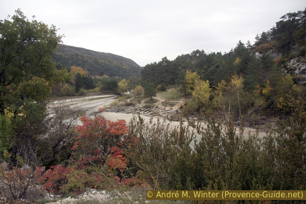
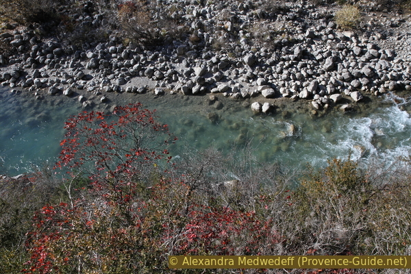
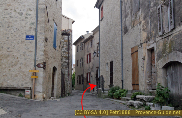
Confluence of Jabron and Verdon
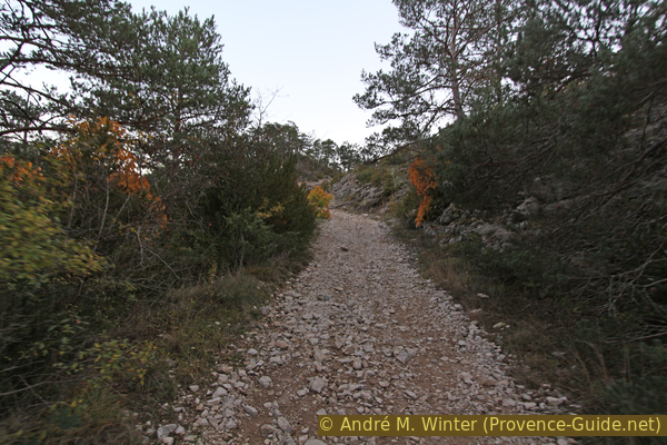
We cross the pedestrian bridge and then immediately turn right, even if there is no arrow on the signpost pointing there.
No reproduction is permitted without the written consent of the author. (id5375)
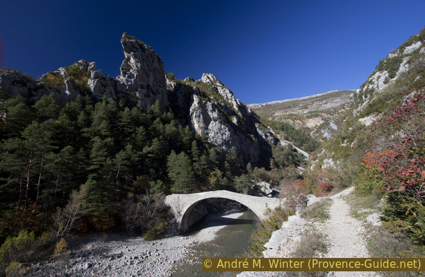
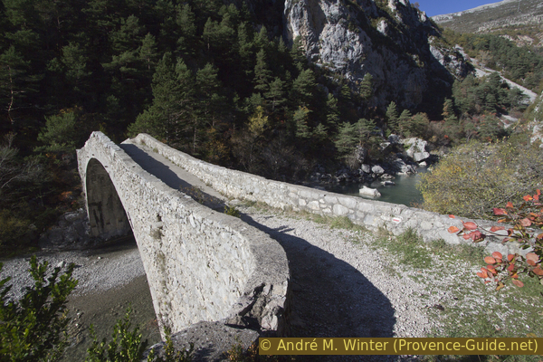
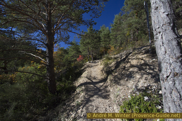
Pont de Carajuan
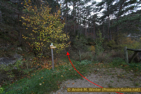
This path is initially unmarked and very little used. It first follows the river, but soon climbs through a notch into the ridge and then leads steeply and progressively higher.
You really go into the forest to the right of the signpost in the picture! Markers follow later.
No reproduction is permitted without the written consent of the author. (id5377)
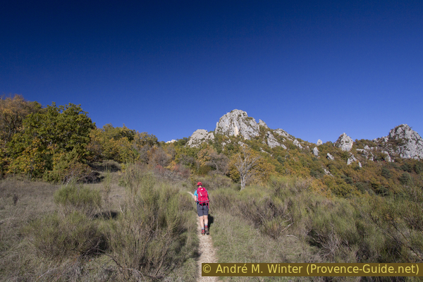
Path access towards Belvédère de Carajuan
The beginning of the path can be overgrown, especially in autumn. There is also a way around it: from the bridge, take the bumpy forest road towards Trigance. After around 200 meters, take the forest road to the right and then right again at the other junctions. See also the dark red trail in the map at the top of this page.
No reproduction is permitted without the written consent of the author. (id5378)
Bumpy forest road from the Pont de Carajuan towards Trigance
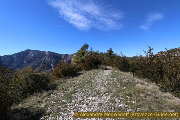
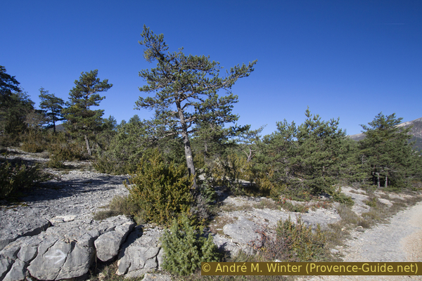
Both route variants lead through a fairly dense forest to the natural Belvédère de Carajuan. It is a rock that protrudes a little into the gorge. The way there finally leads downhill. Griffon vultures can also be observed here, but hardly in the early morning due to the lack of thermals.
Below you can see the road between Castellane and La Palud and the Verdon flowing 270 meters below.
No reproduction is permitted without the written consent of the author. (id5327)
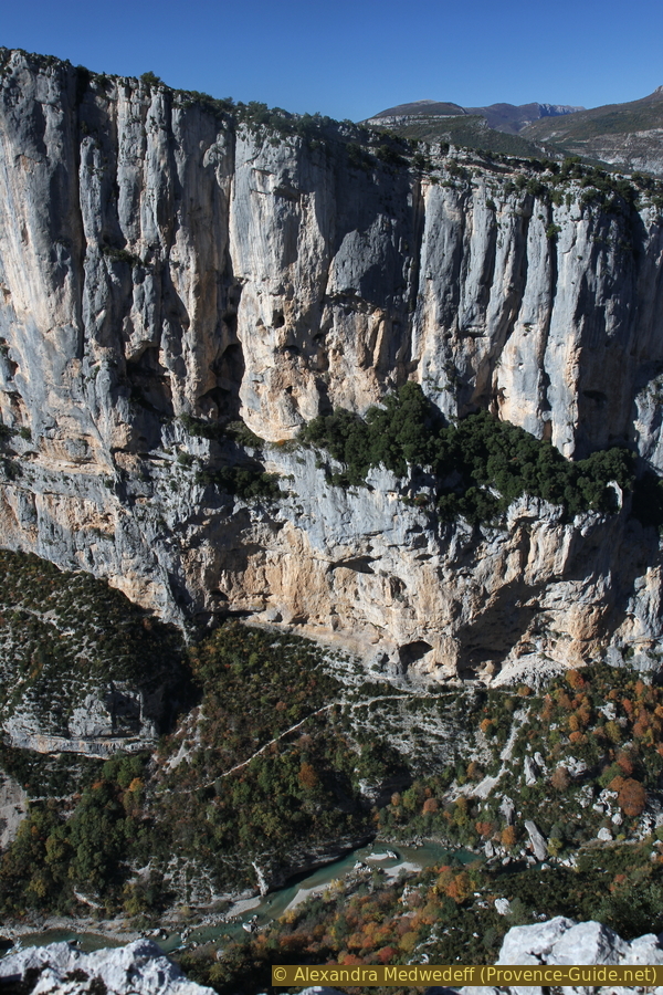
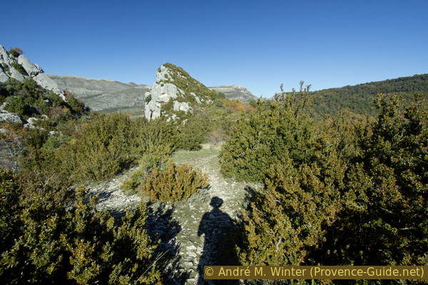
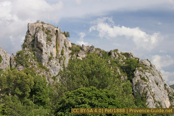
Barre de l'Aigle
On the right you can see the Clue de Carajuan gorge section, the mountains of La Colle, Montagne de Robion, Le Beysse and Le Rouissas. Below you can also see the starting point with the bridge of Carajuan.
No reproduction is permitted without the written consent of the author. (id5328)
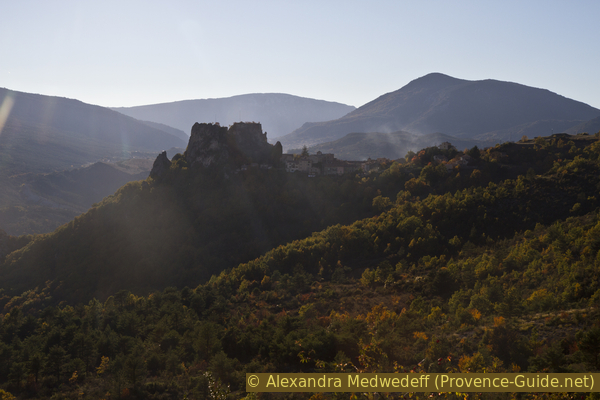
Clue de Carajuan
You leave the vantage point and return to the crossroads. You come up the path and you continue along the narrow path on the right in the direction of Crête de Cassayère. The photo shows the situation.
No reproduction is permitted without the written consent of the author. (id5330)
Paths at the Belvédère de Carajuan
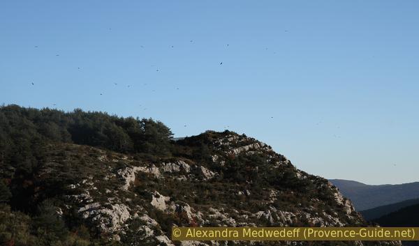
As the forest in the karst thins out, the trail gradually gets lost. Cairns now mark the route. However, you easily lose sight of them. The terrain is pitted and small bushes can hide an important cairn. There is no ideal way anyway. You have a good all-round view, but the karst doesn't forgive any stumbling either.
No reproduction is permitted without the written consent of the author. (id5332)
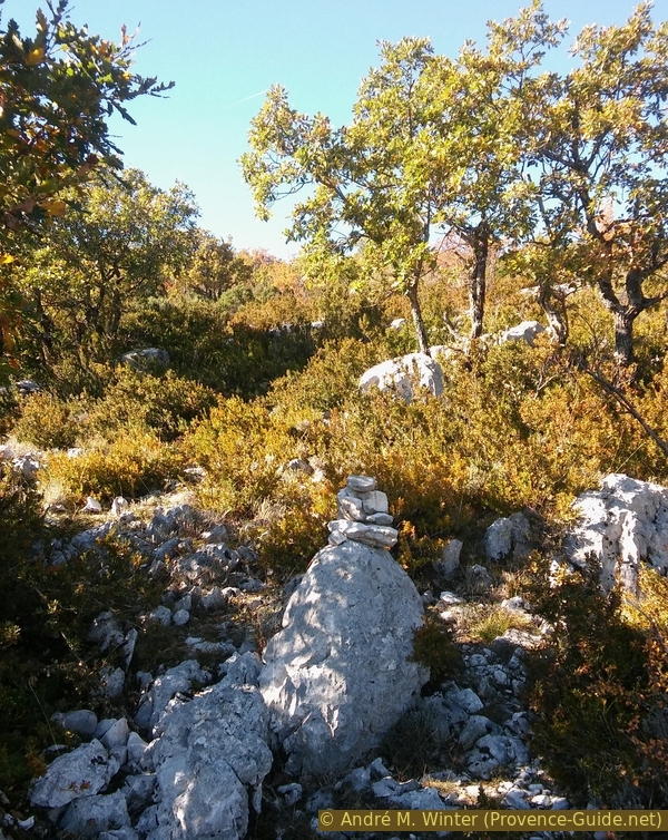
Cairn under the La Casseyère ridge
From the Belvédère you continue in the same direction for another 10 minutes.
No reproduction is permitted without the written consent of the author. (id5334)
Arrival at the northern part of the Crête de Casseyère
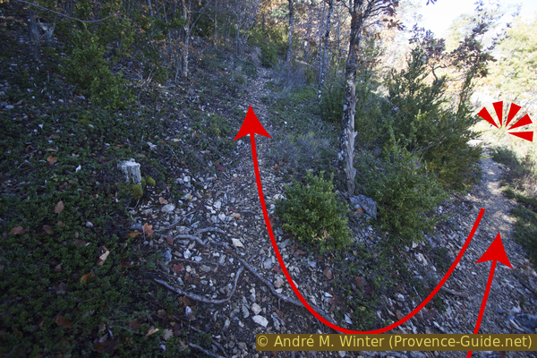
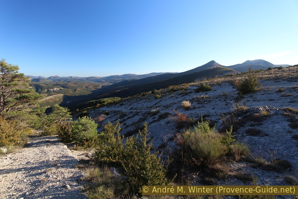
When you come to the flatter plateau you change direction slightly to the left and go strictly west. If you're faced with a downhill slope, you swipe left and south. From here you can walk a little better on the limestone layers. There are no more signs or cairns, you stay on the ridge until you meet the marked path to Entreverges.
The photo shows the site in retrospect.
No reproduction is permitted without the written consent of the author. (id5337)
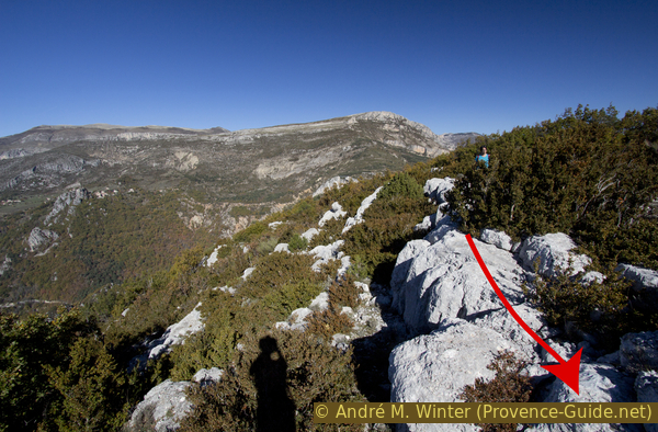
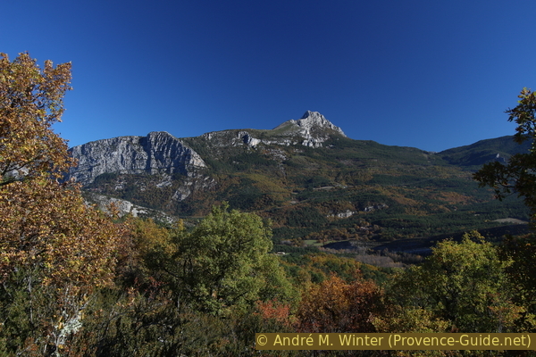
Limestone layers of the Crête de Casseyère
You can now also see the village of Rougon.
The white rock in the middle of the picture is the viewpoint Point Sublime.
No reproduction is permitted without the written consent of the author. (id5335)
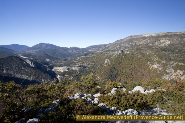
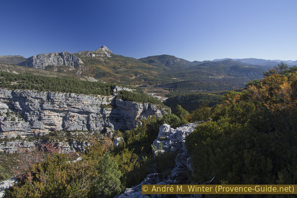
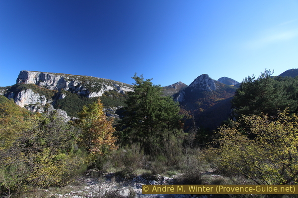
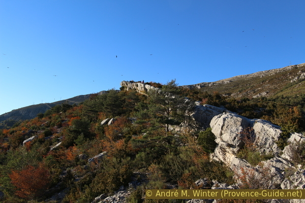
View over the northern part of the Crête de Casseyère
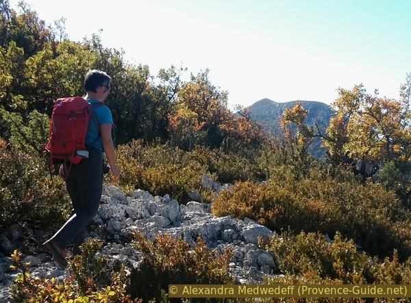
The picture shows our route in the foreground, still in difficult terrain and without a path. In the back left is the Breis mountain. In front of this we reach the marked path and then turn right into the hilly area in front of the peaks.
No reproduction is permitted without the written consent of the author. (id5339)
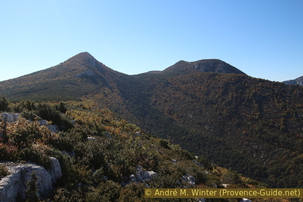
Crête de Casseyere, Sommet de Breis, Crête de l'Arme and Serre Mejan
Section 2: Casseyère - Encastel - Belvédère de Rancoumas
➙ 2,4 km ... 45 min ➚ 30 m ➘ 145 m ↝ average
40% easy trails, few marks
10% easy trails, cairns
10% forest roads, few marks
20% forest roads, without marks
20% hard-to-recognize trails, few cairns
The clues
- Crête de Casseyère, 1040 m, we continue south and turn right before the Sommet de Breis
- Encastel, 990 m, abandoned and overgrown ruins
- Belvédère de Rancoumas, 975 m, impressive view of the Gorges du Verdon
There is few difference in altitude on this connecting route.
We continue south along the bumpy ridge and as we descend slightly into a more densely wooded saddle we come across a yellow marked trail. We continue in the same direction, so still south and without turning left. We slowly come to the right under the ridge and continue comfortably and slightly uphill on a ledge.
No reproduction is permitted without the written consent of the author. (id5340)
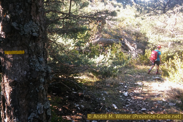
Yellow marker towards Encastel
Below the Sommet de Breis, the path turns in a wide arc to the right. The forest is a little denser on the shady slopes. If we finally go west, we come to a junction, but we keep going straight west (path on the right), now slightly down.
A little later you come to a forest road on which we continue downhill. We are now a few minutes on the red and white marked long-distance hiking trail GR49.
No reproduction is permitted without the written consent of the author. (id5331)
On the GR49 trail towards Encastel
However, we remain on the downhill forest road when the GR49 path branches off to the right. The forest road now becomes steeper and there are no longer any markings.
After a left turn, we come to the upper area of former pastures, which are again taken over by the forest. Ruins lie between the trees, some trees are bearing wild apples. The forest road branches and we now go down to the right to avoid the overgrown terrain counterclockwise.
No reproduction is permitted without the written consent of the author. (id5329)
In the upper part of the pastures of Encastel
At the bottom you are standing on a flat meadow and in front of a flat rock ledge (in the west). A small cairn indicates that you have to climb the rock here. Then you come to a flat ridge of fine gravel, which leads us straight to the Belvédère de Rancoumas.
No reproduction is permitted without the written consent of the author. (id5336)
Flat ridge to Belvédère de Rancoumas
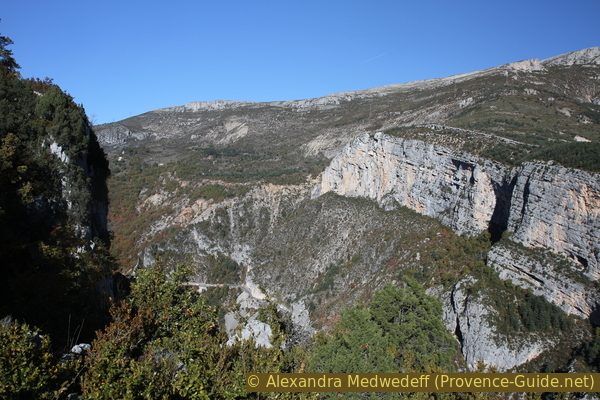
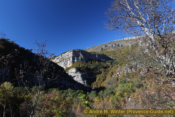
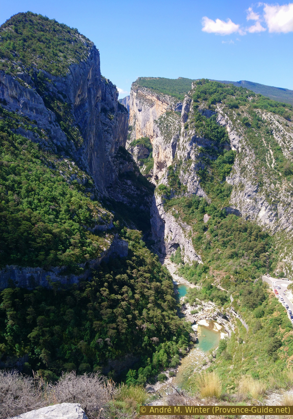
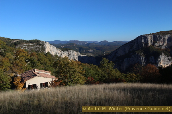
The viewpoint is slightly to the left, a natural wall forms a railing, you don't have to climb any more rocks. You can see perfectly down and over a long stretch south of the Couloir Samson.
No reproduction is permitted without the written consent of the author. (id5341)
View from the Belvédère de Rancoumas 360 metres down to the Verdon
Opposite is the massive rock face Barres de l'Escalès. Vultures circle over climbers and tightrope walkers.
No reproduction is permitted without the written consent of the author. (id5342)
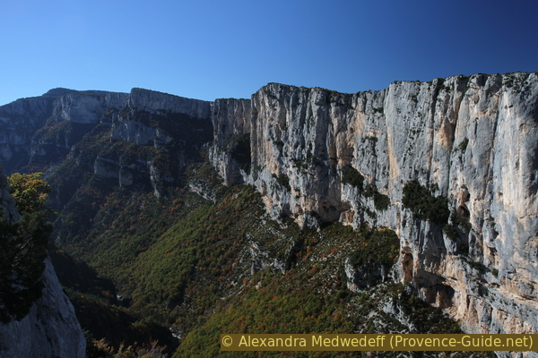
Barres de l'Escales
You could enjoy this view for hours. But we have to realize that we are only at a third of the way through!
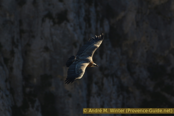
No reproduction is permitted without the written consent of the author. (id5333)
Griffon vultures in the Verdon Gorge
Section 3: Rancoumas - Pont du Tusset - Point Sublime
➙ 3,7 km ... 1 h 45 min ➚ 150 m ➘ 320 m ↝ average
25% hard-to-recognize trails, without marks
75% easy trails, with marks
The clues
- Belvédère de Rancoumas, 975 m, descent across meadows and forest to the Verdon stream
- Pont du Tusset, 625 m, historc bridge
- Point Sublime, 760 m, the most famous viewpoint of the Verdon Canyon
We descend to the valley and begin the arduous ascent opposite.
From the vantage point, we go back along the flat ridge to the sages and from here to the north-west, i.e. to the left.
This section starts out fairly flat and easy, but the trail is barely visible. A small field is sometimes ploughed up, then the path has completely disappeared.
No reproduction is permitted without the written consent of the author. (id5345)
Meadows south of the Belvédère de Rancoumas
We stay about 50 meters to the right of the rock edge and when it rises again we turn right. At the same time we cross a flat valley and thus we come to its eastern slope.
The river bed is dry, but it can still be wet on these northern slopes. In the off-season and after rain, the downhill can be quite slippery.
No reproduction is permitted without the written consent of the author. (id5346)
Path from Encastel to the GR49 long-distance trail
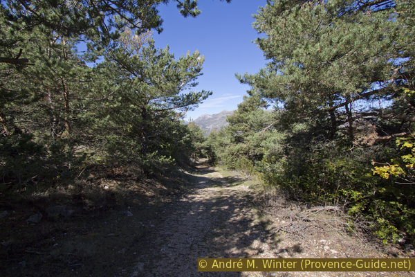
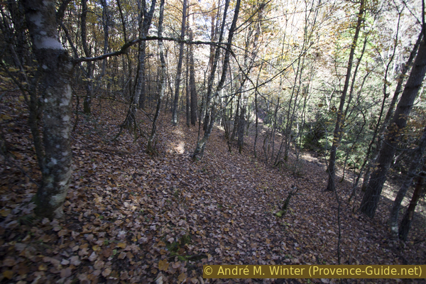
In the higher forest the path is more visible again and it becomes steeper, now it descends progressively. It's quite cool here even in summer, and the beech forest has a northern European feel to it.
At about 900 meters above sea level, we rejoin the GR49 path which, for some inexplicable reason, bypasses the Rancoumas viewpoint. The forest becomes even darker and the path even steeper.
No reproduction is permitted without the written consent of the author. (id5347)
GR49 long-distance hiking trail down to the Pont de Tusset bridge
At times you can see a white and pyramid-shaped rock face on the left. This is the Point Sublime, to which we must climb later. However, our path turns progressively to the right.
No reproduction is permitted without the written consent of the author. (id5348)
Point Sublime seen from the Ravin de la Combe Drèche ditch
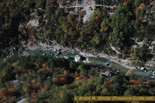
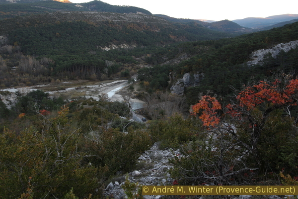
Later we see down to the Verdon, which flows very leisurely here between the Clue de Carajuan and Couloir Samson.
No reproduction is permitted without the written consent of the author. (id5349)
The Verdon flows leisurely here
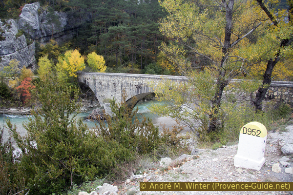
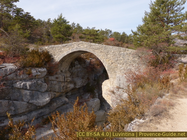
Along the Verdon, the path is very wide and in front we see the Pont du Tusset bridge. Here we cross the stream again. The location of the bridge is a good example of old routes that no longer match the current road network.
No reproduction is permitted without the written consent of the author. (id5350)
GR49 trail, the Verdon, Pont de Tusset and jagged rocks
Opposite, our path leads up with a constant incline.
No reproduction is permitted without the written consent of the author. (id5351)
Pont de Tusset bridge
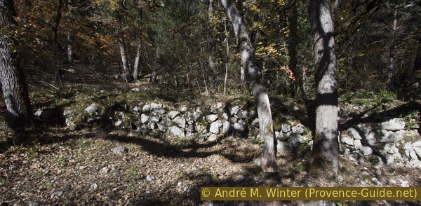
In the past, the path was also used to cultivate small fields away from the settlements. The stone walls bear witness to this. With the ascent we come back into drier areas, pine trees now replace the deciduous trees.
No reproduction is permitted without the written consent of the author. (id5353)
Dry stone walls on the old route to Rougon
The path becomes uncomfortably steep when we cross the road that leads down to Sentier Martel. The forest is getting lighter and lets more and more sun through. Usually you are here in the early afternoon and it can be quite hot.
No reproduction is permitted without the written consent of the author. (id5354)
Ascent of the GR49 path under the road to Sentier Blanc-Martel
After crossing the road, the trail remains steep. At the first crossroads we stay left without going onto the road. We come to a valley that is a little less steep and the path turns to the left. At the crossroads of the GR49 and GR4 paths, we turn right to Point Sublime and shortly afterwards turn left, leaving the road.
We're not at the viewpoint yet, but we're already looking back at the first part of the tour.
No reproduction is permitted without the written consent of the author. (id5355)
Crête de Casseyère, Breis, Serre Méjan, Crête de l'Arme Vieille
You go slightly downhill on a bare area with fine limestone gravel until you reach the lookout point. Here you can see directly into the water that flows through the Couloir Samson. The view is better if you descend before the viewpoint from the trail to the right and pass before under the viewpoint or right of it.
No reproduction is permitted without the written consent of the author. (id5379)
Couloir Samson
View from the ledge to the right of Point Sublime.
Section 4: Point Sublime - Rougon
➙ 1,7 km ... 30 min ➚ 210 m ➘ 5 m ↝ easy
20% easy trails, few marks
10% hard-surfaced quiet side streets, faulty marks
60% easy trails, few marks
10% moderate trails, without marks
The clues
- Point Sublime, 760 m, and a last steep climb to the village
- Rougon, 960 m, water point and another vantage point
The last steep climb offers drinking water at the bottom and at the top.
The Point Sublime was completely renovated in 2021. A new wide path leads from the parking lot to the viewpoint. Anyway, we have to go up the road, to the Auberge du Point Sublime and turn here left first on the road towards Rougon. In the wall under the terrace is a tap with drinking water.
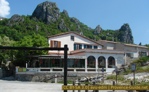
Auberge du Point Sublime
After the first left-hand bend in the road, our path branches off to the right before the next bend. A signpost marks this point. Here we come back to an old connecting path with a fairly constant gradient. There is now little shade and the fatigue of the legs is slowly becoming noticeable.
No reproduction is permitted without the written consent of the author. (id5359)
Ascent to Rougon
As soon as you are above the inn, you should turn around. Now you can see the Point Sublime and the view from there.
No reproduction is permitted without the written consent of the author. (id5358)
Panorama across Point Sublime
We walk along fields, only rarely do old trees offer some shade.
No reproduction is permitted without the written consent of the author. (id5360)
Meadow, mountains around Encastel and the Couloir Samson
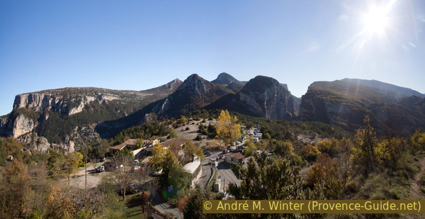
But the village with its rock is already in sight. We come up on a dirt road, at the top we turn left up to a parking lot.
In the picture you can see the rock and the viewing point on it.
No reproduction is permitted without the written consent of the author. (id5362)

The last metres under Rougon
At the parking lot we turn right and are then directly at the old wash house with several water basins that are connected to each other. This washhouse has existed since 1864, before that you had to descend much further to other springs. For us hikers, the toilet and drinking water tap on the left are probably more important at the moment.
No reproduction is permitted without the written consent of the author. (id5364)
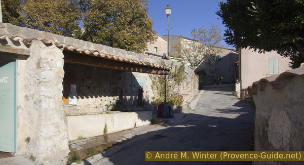
Wash house in Rougon
But there is still more to come. From the wash house we go up to the village center.
Main street in Rougon
We take the second narrow street on the right, this is after the triangular square above the wash house. Through the Rue Riganel, that's the first right, we come to the rock with the castle ruins.
At the last house, the path turns left and winds its way under the rock face up to the old walls and the viewpoint. We now have an ideal view into the Samson couloir.
The Rock of Rougon
Section 5: Rougon - Barre de l'Aigle - Carajuan
➙ 4,8 km ... 1 h 15 min ➚ 55 m ➘ 380 m ↝ easy
5% moderate trails, without marks
5% hard-surfaced city roads, few marks
30% forest roads, few marks
60% easy trails, few marks
The clues
- Rougon, 960 m, further through the village and slightly uphill to the west
- Barre de l'Aigle, around 1000 m, view on the griffon vultures in the afternoon
- Pont de Carajuan 640 m, downhill via hairpin bends to the starting point
It goes up one last time to the view of the vultures. Then sweep down over a long stretch.
We go back from the rock to the main road in the village and then turn right. This is how you get to the central square with the municipal office and we continue in the direction that is to the Barre de l'Aigle ridge and the Pont de Carajuan bridge.
After the last houses, the asphalt stops and we follow the chalk-white gravel road. It rises only slightly, but now you can feel every step in your legs. However, we are already in the last third of the tour.
No reproduction is permitted without the written consent of the author. (id5366)
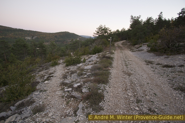
Forest road from Rougon towards Barre de l'Aigle
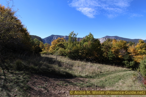
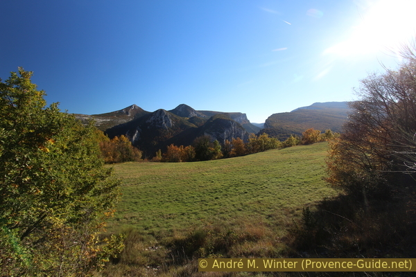
In the foreground are meadows and behind them the rock face of the Clue de Carajuan towers. On the left you can see the Barre de l'Aigle ridge behind which we will then descend. On the right is the Crête de Casseyère wall, where we climbed at the beginning.
No reproduction is permitted without the written consent of the author. (id5365)
Clue de Carajuan seen from Rougon
Looking back, one might think that Rougon is hidden behind its rock.
No reproduction is permitted without the written consent of the author. (id5368)
Looking back to the Rock of Rougon
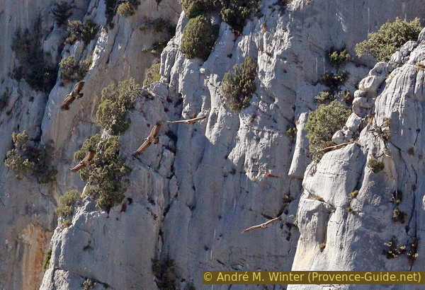
Further ahead we see a wooded hill and you can just make out a metal construction. This is the griffon vulture release site, which has been reintroduced here since 1999. You are not allowed to approach the area, the forest road leads us around to the north. But the vultures come here almost every day in the late afternoon. You can see them from the east side of the hill.
No reproduction is permitted without the written consent of the author. (id5367)
Vultures circle around the Barre de l'Aigle
At the highest point of the forest road, it branches off. The left branch leads to the vulture release site, the area is fenced off several times. The road on the right continues across the slope. Our path leads right in between downhill to the first hairpin bends of the descent path.
No reproduction is permitted without the written consent of the author. (id5369)
Flat back of the Barre de l'Aigle
However, it makes more sense to go to the edge of the rock because here you can see the griffon vultures up close.
No reproduction is permitted without the written consent of the author. (id5370)
Barre de l'Aigle with vultures
You're about at the height of their flight trajectory here.
No reproduction is permitted without the written consent of the author. (id5372)
Griffon vulture in flight
After admiring the flying skills of the vultures, we can go down the cliff edge or further back. In all cases, further down you will find the descent path. Endless hairpin bends lead us slowly downhill. You don't need to look for shortcuts, the prickly maquis prevents any detour. The path leads downhill with a constant gradient, one can console oneself with the fact that at least one protects one's knees.
No reproduction is permitted without the written consent of the author. (id5373)
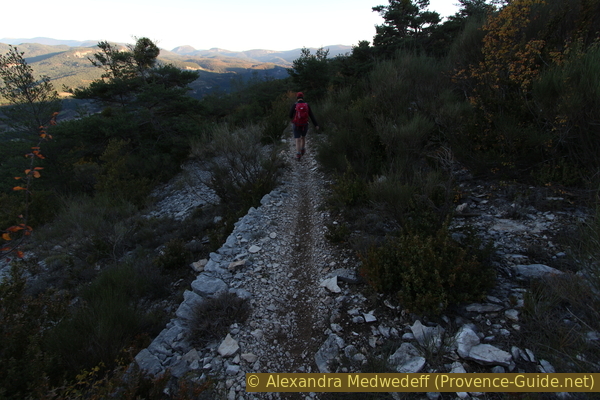
Trail from Rougon to the Pont de Carajuan bridge
Half an hour after the sight of the vultures, we look back down to the Pont de Carajuan. A few minutes later we are already at the starting point.
No reproduction is permitted without the written consent of the author. (id5374)
Pont de Carajuan seen from the Rougon road
Appendix: Trigance - Belvédère de Carajuan
➙ 4,5 km ... 1 h ➚ 115 m ➘ 0 m ↝ average
20% hard-surfaced city alleys, few marks
55% forest roads, old marks
20% easy trails, old marks
The clues
- Trigance, 780 m, start at the southern car park under the village
- Le Sablier, 735 m, north of Trigance
- Belvédère de Carajuan, 895 m, view on Barre de l'Aigle
Alternative starting point in Tringance. We leave the village to the north.
See the orange trail in the map at the top of this page.
There are two car parks in Trigance, one to the south and a second to the north. The description and the route distance refer to the start in the south. You climb up from the parking lot to the village and you always stay on this street without turning off and without going down. This is first the Rue du Four and then the Rue de l'Horloge. Via the latter we also leave the village to the north and thus pass above the northern parking lot. The asphalt road now leads downhill. You come to a bend where it goes up to the castle, but we go straight down. In the hairpin bend that follows, we take the marked path in the direction of Pont de Carajuan. The photo shows this last bend and the path behind it.
No reproduction is permitted without the written consent of the author. (id5324)
Combaou de Breis
crête = ridge
château = castle
beffroi = clock tower
At the junction with the signpost Le Sablier, we take the forest road on the left, even if there is no arrow pointing in this direction. The gravel road later leads into the forest where it becomes more earthy, after rain it can be quite muddy there. In places you will find some yellow markings.
No reproduction is permitted without the written consent of the author. (id5325)
Faint yellow marker at Le Sablier
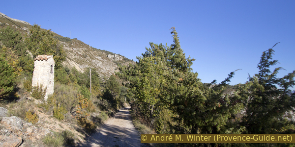
So you climb to the ruins of the Granges de Breis and further ahead, at 800 meters above sea level, there is another fork. The forest road leads downhill to the right, but we continue straight ahead in the original direction. A small cairn marks the spot. The path is now narrower and much less frequented. It takes us straight to the Belvédère de Carajuan viewpoint, which is part of section 1 of the main route.
No reproduction is permitted without the written consent of the author. (id5326)
La Colle and Montagne de Robion
Appendix: Pont de Carajuan - Trigance
➙ 4,5 km ... 1 h ➚ 145 m ➘ 20 m ↝ easy
80% forest roads, few marks
20% hard-surfaced city alleys, few marks
The clues
- Pont de Carajuan 640 m, end of the main tour
- Le Sablier, 735 m, north of Trigance
- Trigance, 780 m, south parking lot
A simple but not very varied forest road takes us back.
This is the way back for those started in Trinace. See the brown trail in the map at the top of this page.
South of the Pont de Carajuan bridge, we now turn left, i.e. to Trigance and quite strictly to the south. The forest road is initially quite coarse gravel, but later it is easier to walk on. It rises steadily towards the Trigance. Finally you come back to the asphalt road, which takes you straight ahead to the village.
In the photo you can also see a path to the bottom left, it leads to the old stone bridge Pont de Sautet. If you still have time, daylight and enough energy, you can make this detour to the Jabron stream. After that, however, you have to climb the 40 metres up to the forest road again.
No reproduction is permitted without the written consent of the author. (id5383)
Road at Les Merlatières
Sources and additional information
A good topographical hiking map is a better guide: this tour is on the IGN "Gorges du Verdon, Moustiers-Sainte-Marie, Lac de Sainte-Croix" map, scale 1:25000, 3442OT.
If you don't want to bother with a paper map, you can also use mapping apps on your cell phone. On the one hand, it is the Cartes IGN app from the official map service. However, it requires access to the data network and this is sometimes difficult in canyons or remote locations.
Alternatively, you can use apps that store data directly on the device. They're generally not free, but they don't cost much. We mainly use OSMAnd, here it is possible to add contour lines, relief shading, markings and others. To store this data on your phone you need a lot of space.
Of course, one needs access to satellites for the GPS signal with any app. In some canyons this is not the case. Therefore, do not rely on the position shown, but read the map on your phone as you would read it on paper. Most apps are available for Android and iPhone. The applications usually allow us to record the route travelled and also view the GPS files offered for each of our hikes.
This page has been seen 2965 times since 20 March 2024.
Pont de Sautet over the Jabron river