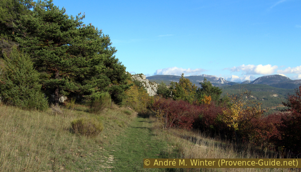
Natural Belvédère de Rancoumas from Trigance
View of the Verdon from the most unspoiled point
hike
average
4 h 30 min
no
yes
no
mountain
Introduction
When we talk about the Verdon viewpoints, we always think of the car parks along the roads around the Gorges du Verdon. But there are also spectacular places that can only be reached on foot. The Belvédère de Rancoumas is difficult to reach in less than 1h30min (one way) from all possible directions. One can start from the north or from Point Sublime (or the road below), but then there is no alternate route back. Or from the south from the Hameau de Saint-Maimes (Sant Maimé), which is also not particularly original and has the same problem. So Trigance stays to the east, which is undoubtedly the longest climb, but you're leaving from a village where you have the advantage of being able to stop for a drink on arrival on the way back. Additionally, it may be more reassuring being able to leave the car in a parking lot in the village rather than somewhere off-road. Unfortunately, none of the starting points can be reached by public transport.
The Belvédère de Rancoumas is a natural prominence just opposite of the viewpoints in the curves of the La Palud crest road. You are in the middle of the only stretch of the canyon between La Mescla and Point Sublime where there is no road along the rim of the gorge. The trail basically follows old paths that were formerly used to connect villages or to bring cattle to pasture. One connects high-altitude hamlets, which are still inhabited during the season, and long-abandoned ruins. On the way back, you have the opportunity to see Rougon from a little-known angle. Although we cover a large part on the GR49 long hiking trail and on marked paths, you don't meet many people here. The other rare hikers who are on the Belvédère de Rancoumas, come normally via Pont du Tusset below Rougon.
From the belvédère, the view glides down to the bottom of the gorge through which the long Sentier Martel runs. Opposite are vertical rocks interspersed with climbing routes where climbers rope down before climbing back up on very technical routes. If you're lucky, you can see climbers and vultures circling overhead at the same time. These animals are curious, scrutinizing the people who are climbing in their territory. This spectacle can be admired from the Belvédère de Rancoumas, especially at lunchtime in the low season.
The facts
13,3 km total distance
4 h 30 min walk time
590 m total elevation
orientation easy, but some junctions are not marked
mark 80% of the total distance
45% easy trails
25% forest roads
15% dirt roads
10% hard-to-recognize trails
5% hard-surfaced city alleys
5% hard-surfaced city roads
<5% Trails with scramble passages
dangers heat in summer, steep drop off at the edge of the gorge
children if they have appropriate walking experience
useful picnic stuff, binoculars
required hiking boots, hiking equipment, water
GPS coordinates (WGS84) of start and end point 43.760388,6.441717
downloads ![]()
![]()
No reproduction is permitted without the written consent of the author. (id3640)
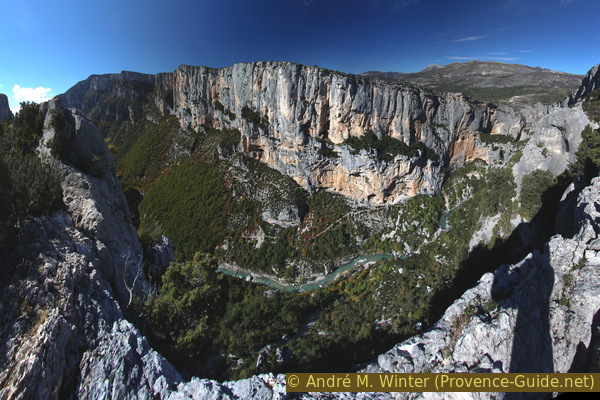
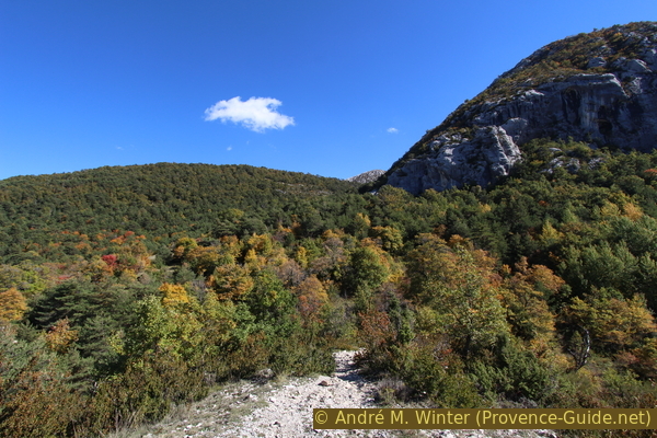
Grand Canyon du Verdon seen from Belvédère de Rancoumas
Opposite you can see the north ridge near the Belvédère du Tilleul up to the level of la Baume aux Pigeons.
Public transport
There are no viable public connections to get to Trigance. You have to take a taxi from Castellane (19 km) or from Draguignan (43 km), which is better connected to the network, see Zou! (only french). The availability of public transport is deplorable around the Verdon, one should not hesitate to complain to the municipalities or the tourist office of the region. It would be time to introduce at least one year-round service for hikers and ingabitants, serving the two banks of the Verdon.
Access by car
Trigance is on the D995 road between Comps-sur-Artuby and Castellane, all north of Draguignan. The starting point of the tour is in the obligatory parking lot at the foot of the village.
Useful parking spaces
There is a car park with an area for campers at the foot of the village and on the D90 (only open in high season). If this car park is full, you have to find a space further down the D90 access road, which you drive up from the bridge over the Jabron.
No reproduction is permitted without the written consent of the author. (id3647)
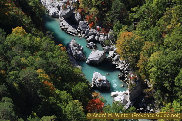
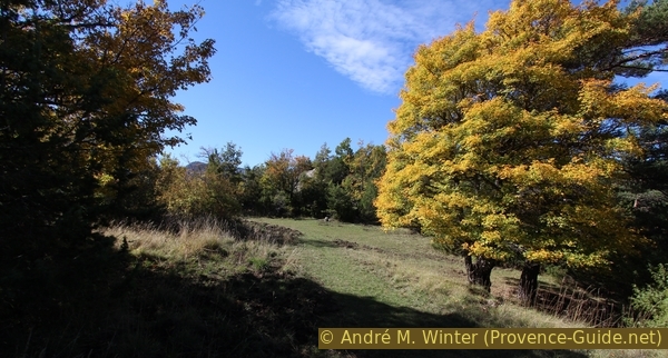
Autumn in the Verdon Gorge
Deep view into the turquoise blue water, surrounded by trees in all autumn colours.
Hints
There is neither a spring nor a river along the way, it is essential to take enough water. The main climb at the beginning can be boring and hot.
The trekking circuit can be undertaken any time of the year, except when snow can be seen walking away from Trigance. On the way out of the village, the ascent is on an eastern slope and without significant shade, you will sweat there even in winter. In midsummer it is advisable to start very early. In autumn one can find wild apple trees with very small but sweet fruits.
The village of Trigance is dominated by its castle and, despite its small size, is inhabited even outside the high season. You will therefore find something there to quench your thirst, to eat or to rest: the castle now houses a hotel.
The Belvédère is formed by a natural ridge, where one should watch out for children, otherwise there are no particular dangers. Orientation is easy, however there are sometimes paths that run parallel and it is easy to walk past signposts. The marking is good on the ascent (GR long-distance hiking trail), not available to the Belvédère and very sparingly on the way back to the village.
The whole region is a zone with a high risk of forest fires. In summer, but also in other seasons when it is very dry or by strong winds, access to the forest areas can be regulated. As a result, the roads may be closed to traffic and/or the trails prohibited to hikers. Current information: Map of access to the forests of the Var (also english). The map shows the colours green, yellow, orange and red which correspond to levels of danger. The affected area is: Plateau de Canjuers (7).
The sections
- Trigance - Entreverges: ascend slowly to the plateau
- Entreverges - Belvédère de Rancoumas: proceed to the gorge rim
- Belvédère de Rancoumas - Crête de Casseyère: back over the north
- Crête de Casseyère - Trigance: further back via La Colle de Breis.
Inns and bars can only be found in the village. There are no shelters along the way.
No reproduction is permitted without the written consent of the author. (id3646)
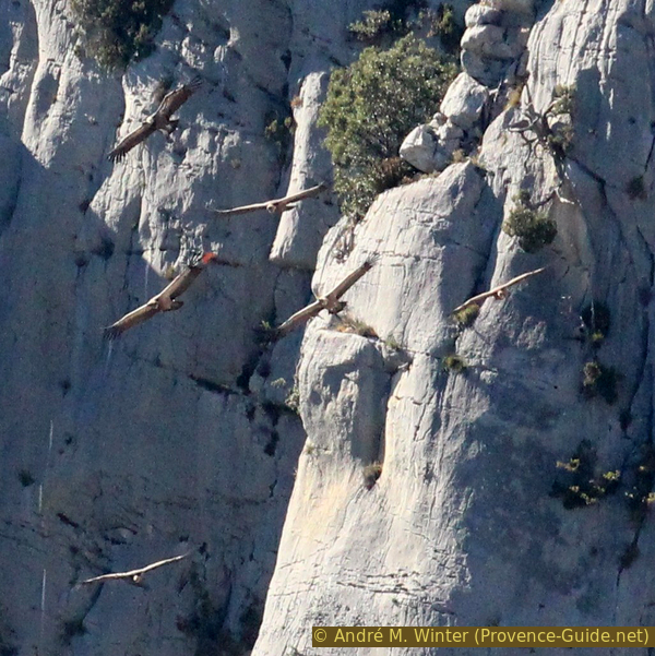
Six vultures in the Gorges du Verdon
The griffon vulture has been reintroduced to Provence since 1999.
Section 1: Trigance - Entreverges
➙ 4 km ... 1 h ➚ 321 m ➘ 0 m ↝ easy
10% hard-surfaced city roads, without marks
35% dirt roads, with marks
50% easy trails, with marks
The clues
- Trigance, 780 m, start at the parking lot
- Ascent under La Serrière du Preil
- Saddle onto the limestone plateau, 1055 m
- Hamlet of Entreverges, 1090 m
Ascent to the barren plateau.
No reproduction is permitted without the written consent of the author. (id3627)
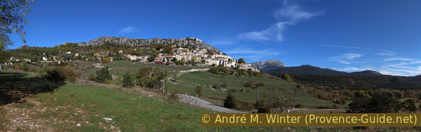
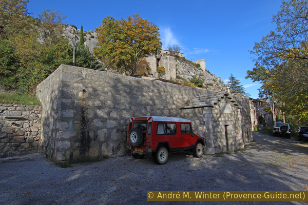
The village of Trigance
crête = ridge
château = castle
beffoi = cloc tower
citerne = water reservoir
Dominating the Jabron valley, the village of Trigance is perched on a hillside at the foot of Mount Breis and its castle. The tour starts with ascending in the village and above its central shaded square. Pass the bar on the right and a little later take the stone steps on the left that lead to the Tour de l'Horloge (clock tower).
No reproduction is permitted without the written consent of the author. (id3628)
Ascent from the main square to Rue du Château
At the clock tower, turn left to head west on Rue du Château. This is the direction in which we will walk during the following hour.
No reproduction is permitted without the written consent of the author. (id3629)
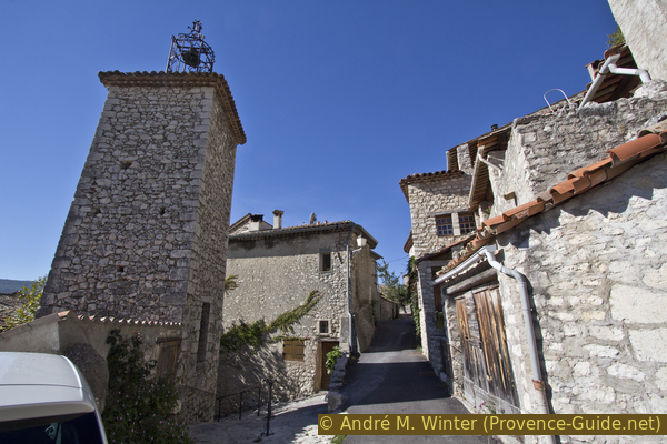
The clock tower of Trigance
When the houses are less narrow, we pass on the right the Citerne Graud, which since 1881 has made it possible to collect surface water. There are no significant springs nearby the village.
No reproduction is permitted without the written consent of the author. (id3630)
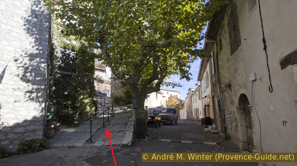
GR49 long-distance trail marker at Citerne Giraud in Trigance
Then we cross another road and shortly afterwards our road becomes a dirt road. It quickly leads out into nature, only a few scattered houses remain. From here the path we follow is signposted as the GR49 long-distance trail, with a sign pointing to Entreverges.
No reproduction is permitted without the written consent of the author. (id3631)
Start of the Chemin d'Entreverges in Trigance
oratoire = shrine
We pass a wayside shrine and end up at a confusing crossroads of forest roads. We follow the main path that climbs in a westerly direction. This forest road becomes steeper and is concreted in some sections. The crest of the Serrière du Preil always remains on our right as we climb. At around 900 metres a wooden arrow points us to the left and we find ourselves on an old path supported in the slopes by dry stone walls.
No reproduction is permitted without the written consent of the author. (id3632)
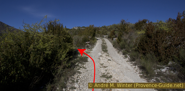
Here the Chemin d'Entreverges leaves the forest road to the left
Little by little we advance into the undergrowth, which gives us a little shade.
No reproduction is permitted without the written consent of the author. (id3633)
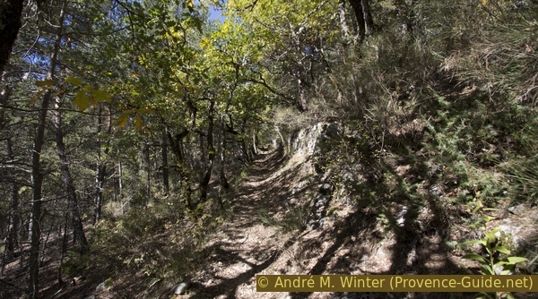
Follow the GR49 trail in the forest under the Serrière du Preil ridge
In Les Soulliès, the path gradually narrows between the bed of the water course and the ridge. A little later we reach a saddle followed by a plateau with greener pastures.
The saddle also marks the departmental boundary between Var and Alpes-de-Haute-Provence. The northern department here represents an enclave south of the Verdon.
No reproduction is permitted without the written consent of the author. (id3634)
Ascent under the Sommet de Breis and Cime de Biach peaks
col = saddle
The path joins a forest road that takes us to the left (south) to the hamlet of Entreverges. We pass it on the right and continue north.
No reproduction is permitted without the written consent of the author. (id3635)
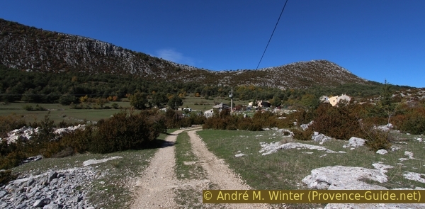
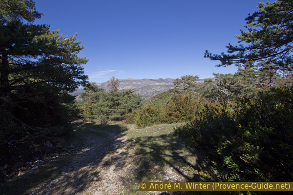
Forest road to Entreverges
Section 2: Entreverges - Belvédère de Rancoumas
➙ 2,5 km ... 40 min ➚ 69 m ➘ 195 m ↝ average
55% forest roads, with marks
<5% easy trails, few marks
15% forest roads, old marks
20% hard-to-recognize trails, cairns
5% Trails with scramble passages, without marks
The clues
- From Entreverges, 1090 m, northwards
- Encastel, 1000 m, ruins of an alpine farm
- Belvédère de Rancoumas, 970 m
Descent to the viewpoint.
col= saddle
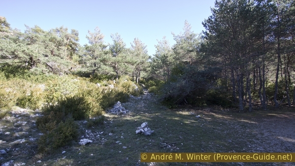
When passing Entreverges there are two parallel paths: the official public path is the rocky one on the right.
No reproduction is permitted without the written consent of the author. (id3636)
Double route north-east of Entreverges
North of the houses and the pastures, the forest road leads up into a flat and sparsely wooded saddle (1161 m), and then descends somewhat steeply into a more densely wooded area. After two hairpin bends, the forest road heads north-west. The long-distance trail branches off to the right in the direction of the Pont de Tusset over the Verdon and Point Sublime. However, we continue straight ahead and without markings.
No reproduction is permitted without the written consent of the author. (id3637)
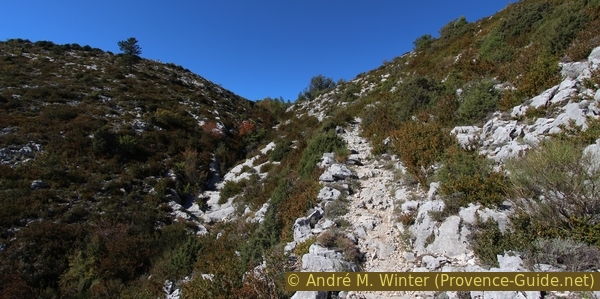
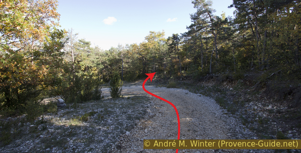
Descent on the GR49 long-distance hiking trail to Encastel
This forest road becomes less pronounced and runs along old pastures. We can go left or right, both variants lead to a flat, forest-free section further down. Don't take the forest road to the left (south) and don't go too far to the right (north), you have to stay in the west direction, that's about the direction you went downhill on the last steep section of the forest road. At the end of the meadow there is a small cairn.
The photo shows the direction to take, the small dot in the middle at the end of the meadow is the cairn. It shows the entrance to the further path to the west. This leads through bushes and behind it it rises briefly on rocks.
No reproduction is permitted without the written consent of the author. (id3638)
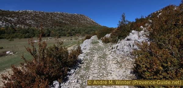
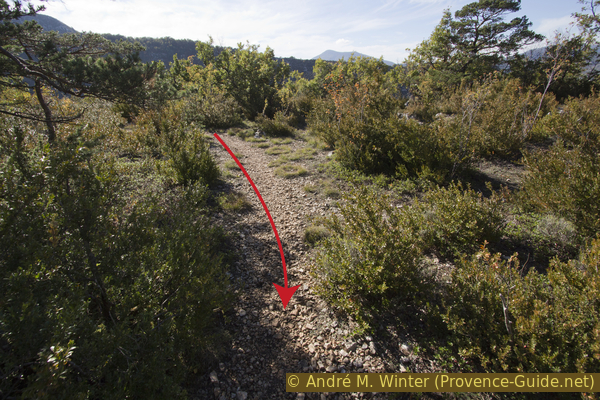
Encastel lower pasture with the cairn to the rear
We are now on the back of a small ridge that leads us directly to the viewpoint. Forward at the rim of the canyon, the best view is on the left. On the right there are meadows that allow for a restful rest.
No reproduction is permitted without the written consent of the author. (id3639)
Just before the Belvédère de Rancoumas
The view makes up for the ascent on foot. A natural barrier protects us from the abyss. In the background of the photo: the Mourre de Chanier mountain.
No reproduction is permitted without the written consent of the author. (id3641)
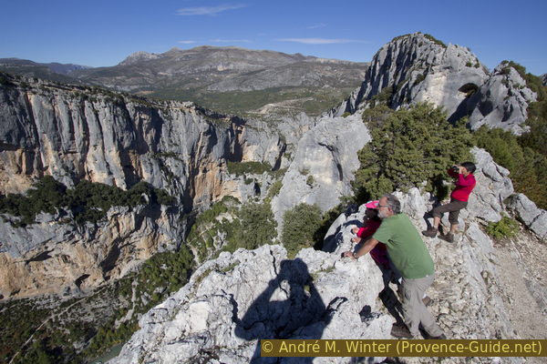
Hikers at Belvédère de Rancoumas
For those who do not want to take a break here, but want to see a little more to the left of the Verdon gorge, there is the possibility of climbing to the end of the ridge in a few minutes. The climb is not difficult, between prickly bushes and some stubborn thujas. Turn left off the lookout and descend on the left side of the ridge, but no lower than five meters from the ridge-line. If you get stuck, go back up the ridge, which is then less sharp.
No reproduction is permitted without the written consent of the author. (id3642)
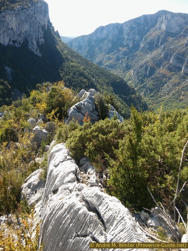
Ridge south of the Belvédère de Rancoumas
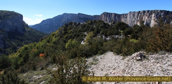
The view opens onto the canyon's largest drop-off.
No reproduction is permitted without the written consent of the author. (id3643)
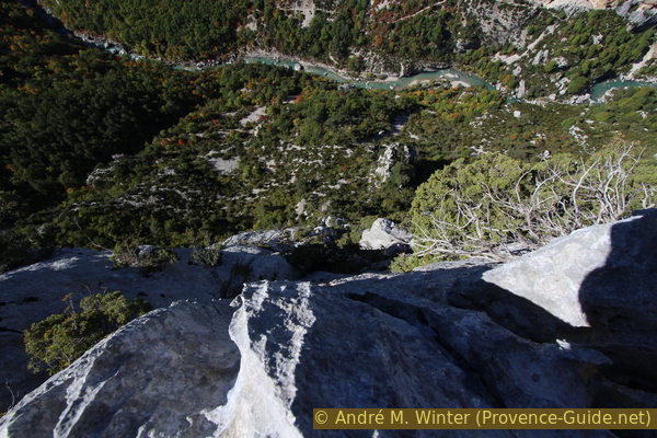
400 metre vertical drop into the Verdon
You can descend a bit further over the stubborn thuja, then to a kind of platform on the right side, i.e. towards the gorge. Return to the viewpoint on the same route.
No reproduction is permitted without the written consent of the author. (id3644)
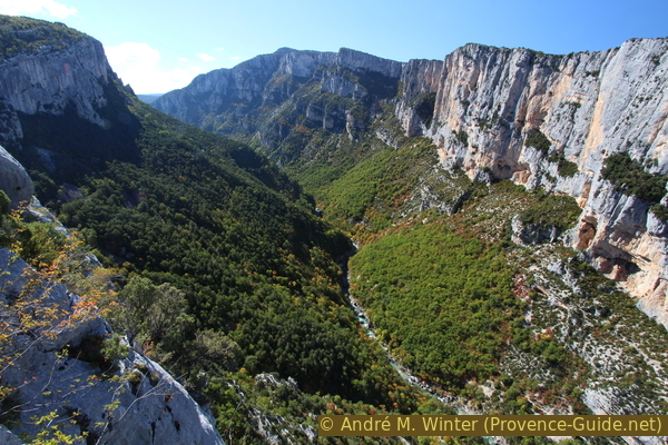
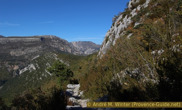
Gorges du Verdon upstream from La Mescla
The highest point opposite is the Collet Barris.
Section 3: Belvédère de Rancoumas - Crête de Casseyère
➙ 2,4 km ... 1 h 30 min ➚ 151 m ➘ 136 m ↝ easy
20% hard-to-recognize trails, cairns
15% forest roads, old marks
10% forest roads, with marks
15% easy trails, cairns
40% easy trails, with marks
The clues
- Belvédère de Rancoumas, 970 m
- Encastel, 1000 m, ruined alp
- Crête de Casseyère, 1040 m
Start the way back first via the same path, then further north back to the village.
From the viewpoint, go back along the ridge along the same path, cross the pastures and go up the forest road to the long distance hiking trail GR49 junction.
No reproduction is permitted without the written consent of the author. (id3648)
Looking back east from the Belvédère de Rancoumas
On the right the north end of the Crête d'Arme Vieille ridge.
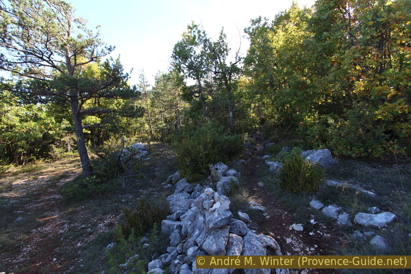
Continue up the way back up, but continue straight ahead after the barrier in the lower hairpin bend. Stone men mark this spot (photo). The path leads over a slight saddle and after 200 meters to the yellow marked path to La Colle de Breis.
No reproduction is permitted without the written consent of the author. (id3649)
Cairns mark the direct route to the east
At the fork in the path, turn left and descend between the Ravin de la Combe Drèche on the left and the ridge on the right, following the old connecting path that offers a nice view to the north and the village of Rougon.
No reproduction is permitted without the written consent of the author. (id3650)
Path south of the Combe Drèche
Section 4: Crête de Casseyère - Colle de Breis - Trigance
➙ 4,4 km ... 1 h 15 min ➚ 21 m ➘ 285 m ↝ easy
<5% easy trails, with marks
25% forest roads, few marks
50% easy trails, few marks
10% dirt roads, faulty marks
10% hard-surfaced city alleys, without marks
The clues
- Crête de Casseyère, 1040 m
- Crête du Preil, 915 m
- Trigance, 780 m
Descent over the gentle slope of La Colle de Breis.
No reproduction is permitted without the written consent of the author. (id3654)
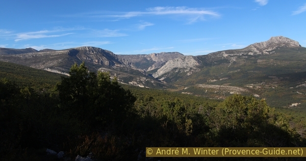
Colle de Breis mountain and Clue de Chasteuil gorge
View to the north: on the first level, the flat and wooded flank of the Colle de Breis, facing east. Center back Clue de Chasteuil, the second bottleneck of the Verdon downstream from Castellane. To the left of the gorge is the Crête des Réglées ridge, to the right the Barre Rousse followed by the Montagne de Robion.
col plat = flat saddle
When the path arrives on a flat section, it turns right. We are here on a saddle south of the Crête de Casseyere. Here the course is not very clear and the markings are sparse. A cairn marks the place where you have to turn right.
No reproduction is permitted without the written consent of the author. (id3651)
The Tour de Breis path passes the Crête de Casseyère ridge
The curve in retrospect.
After the saddle, the path describes a large curve to the left, continues downhill and ends in a forest road. On this down, follow the first bend to the right and continue straight on in the second (yellow marking).
No reproduction is permitted without the written consent of the author. (id3652)
Second bend in the forest road at Colle de Breis
Straight on from here.
The path leads roughly in a south-east direction over old trails between abandoned cultivated terraces, which are now overgrown by forest. The terrain changes between forest, pasture and rocks.
No reproduction is permitted without the written consent of the author. (id3653)
Old walls at Colle de Breis
We pass a slightly higher forest. This is in fact the imperceptible passage of the ridge of the Serrière du Preil, ending on the eastern side with the Château de Trigance.
No reproduction is permitted without the written consent of the author. (id3655)
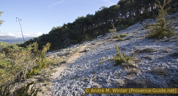
Arid and treeless limestone zone in front of the La Serrière du Preil ridge
crête = ridge
château = castle
beffoi = clock tower
citerne = water reservoir
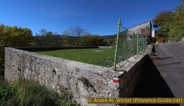
South of the ridge we come back to the area of villas and cottages from the climb, but this time we are higher above. On the right there are fences and isolated houses, on the left some fields under the rocky ridge. It is best to descend along this path, always keeping an eye on the castle below.
No reproduction is permitted without the written consent of the author. (id3656)
Old agricultural path in front of the car park south of the castle
At the end of the car park turn left and the following street to the right, we pass the Citerne Giraud, but this time below. We are now on Rue du Puits, which takes us straight to the village's central square and back to where we started.
Sources and additional information
It's better to have a good topographical hiking map: this tour is on the IGN "Gorges du Verdon, Moustiers-Sainte-Marie, Lac de Sainte-Croix" map, scale 1:25000, 3442OT.
If you don't want to bother with a paper map, you can also use mapping apps on your cell phone. On the one hand, it is the Cartes IGN app from the official map service. However, it requires access to the data network and this is sometimes difficult in canyons or remote locations.
Alternatively, you can use apps that store data directly on the device. They're generally not free, but they don't cost much. We mainly use OSMAnd, here it is possible to add contour lines, relief shading, markings and others. To store this data on your phone you need a lot of space.
Of course, one needs access to satellites for the GPS signal with any app. In some canyons this is not the case. Therefore, do not rely on the position shown, but read the map on your phone as you would read it on paper. Most apps are available for Android and iPhone. The applications usually allow us to record the route travelled and also view the GPS files offered for each of our hikes.
This page has been seen 2825 times since 20 March 2024.
No reproduction is permitted without the written consent of the author. (id3657)
Citerne Giraud in Trigance