Easy hike between Céreste and Carluc
Surprising ruines in the eastern Luberon
walk
easy
3 h
yes
yes
no
walk
Introduction
The eastern part of the Luberon, where we are, has a slightly less marked relief. The hikes are therefore more peaceful and easier. The old Priory of Carluc is well known and frequently visited, however we leave here from the village of Céreste which also has medieval jewels. Too few people bother to stop here.
This tour has long stretches on small, quiet roads. It's a great setting for a family hike or a group to talk. North of Carluc, we include a bit of height difference and a few rocks to approach the site from an unusual side.
The facts
9 km total distance
3 h walk time
220 m total elevation
orientation easy
mark 70% of the total distance
50% hard-surfaced quiet side streets
15% forest roads
10% hard-surfaced city roads
10% easy trails
5% dirt roads
5% cross country
5% hard-surfaced city alleys
<5% moderate trails
dangers ruins
children yes, but it's long
useful picnic stuff
required trekking boots, hiking equipment and water
GPS coordinates (WGS84) of start and end point 43.856443,5.589319
downloads ![]()
![]()
Public transport
Public buses are quite rare here. There is essentially the Forcalquier-Apt connection, where line 62 runs on the network Zou! (only french). The appropriate stop is in the town centre, this is also the starting point of this walk.
Access by car
The D4100 and D900 roads link Forcalquier to Apt in an east-west valley north of the Luberon massif. Céreste is on this connecting road.
Useful parking spaces
It is better to park in the car parks at the eastern entrance to Céreste. The passing through the village takes place at the end of the tour when arriving by car.
Hints
The asphalt roads between Céreste and Carluc are narrow and there is also traffic. We must remain vigilant, even if we are on officially marked hiking trails at the same time.
Of course, you can admire the avenue of plane trees while driving through it. In this case, it is more impressive if you come here early in the morning when the sun is low.
Carluc may also be reached by car.
The whole region is a zone with a high risk of forest fires. In summer, but also in other seasons when it is very dry or by strong winds, access to the forest areas can be regulated. As a result, the roads may be closed to traffic and/or the trails prohibited to hikers. Current information: Access map to the forests of Alpes de Haute Provence (only french). The map shows the colours green, yellow, orange and red which correspond to levels of danger.
No reproduction is permitted without the written consent of the author. (id2323)
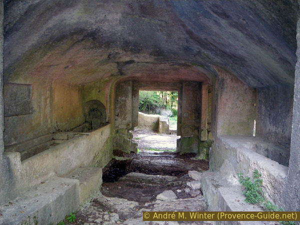
Burial tunnel in Carluc
The sections
Section 1: Céreste - Carluc
➙ 5,3 km ... 1 h 40 min ➚ 165 m ➘ 100 m ↝ average
10% hard-surfaced city roads, faulty marks
5% hard-surfaced city alleys, faulty marks
5% easy trails, without marks
20% hard-surfaced quiet side streets, few marks
10% dirt roads, with marks
5% hard-surfaced quiet side streets, with marks
10% forest roads, without marks
5% hard-surfaced quiet side streets, without marks
15% forest roads, few marks
5% easy trails, without marks
10% cross country, without marks
The clues
- Céreste, 385 m
- Foot bridge on L'Aiguebelle creek, 365 m
- Chemin des Épinettes, 505 m
- Carluc, 450 m
We start with a tour of the old northern part of the village before crossing the plain of fields and groves to climb a little north of Carluc.
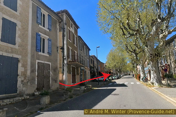
We leave from the center of Céreste. The main road crosses it and cuts it in two. The two bus stops for both directions are right in the middle. We start from the stops down (towards the east and towards Forcalquier) to quick turn left after the underground household waste collection and in front of the Auberge de Carluc.
We immediately plunge into the twisted streets of the old village. The houses are all old, some with exposed stone, some renovated, others not. People live here anyway, it's not a museum.
Rue Marie et Pierre Curie makes us turn right. We continue straight on Rue Gaston Imbert. This makes us turn left and head north. We come across a house, where we take the left lane. This brings us to the Placette de la Rue Pasteur.
The center of Céreste with the bus stop
We then see a house with a simple gable, an ordinary window and a shed entrance without any decor. It is on the right that there is a portal with a marvelous Romanesque arch. We can still recognize other medieval decorations. The portal dates from the 13th century and is undoubtedly the remains of a larger and nobler house originally. The other sides of the building are more recent alterations.
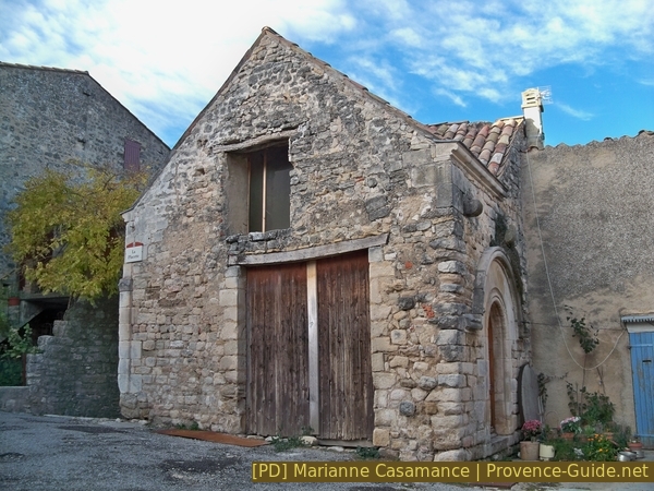
Medieval House of Céreste
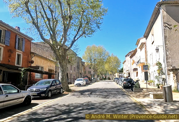
From La Placette, we turn left to take Rue Pasteur westwards to the large Place des Marronniers. Unfortunately, it is mainly used as a car park, but it is the old central square of the village which is still used for the festivities. Here are large old buildings dating back to the 16th century.
Afterwards, we can take one of the two streets towards the north. They both take us through the Notre-Dame Gate in the old village ramparts.
We go down and turn hard right at the bottom to go back to the east of the old village. Before this alley goes back up to the main road, we turn left (as cars should do).
We then pass by houses initially outside the medieval ramparts. Those were mainly stables initially. Further on, this street turns into a parking lot. This is the one we indicate for people coming by car.
Here is the Notre-Dame-de-Pitié chapel. It dates from the 15th century and is currently not in very good condition.
No reproduction is permitted without the written consent of the author. (id7338)
Notre Dame de la Pitié Chapel in Céreste
We continue along this parking lot to arrive at the intersection with the busy departmental road. Despite all the signs towards Carluc, we cross this road to take the sidewalk opposite, turning left.
No reproduction is permitted without the written consent of the author. (id7339)
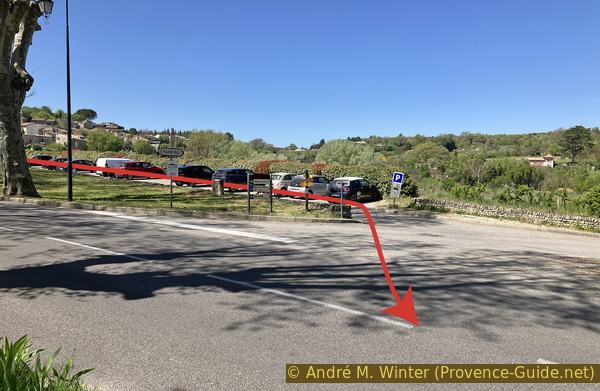
La Chapelle car park to the east of Céreste
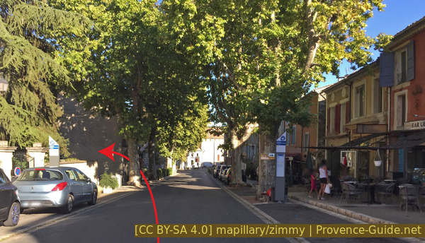
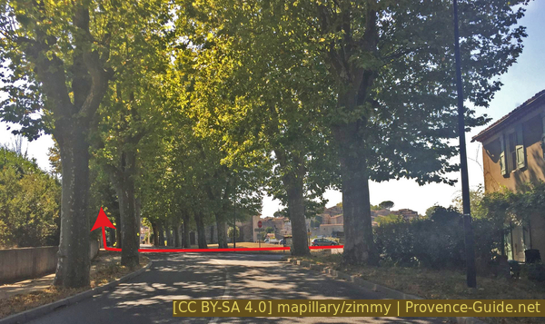
A little further on, this sidewalk turns into a path below the road. The walk may not be pleasant because of the traffic, but for us it is the only place to walk along this wonderful avenue of plane trees. We will also pass a slightly calmer one a little further on.
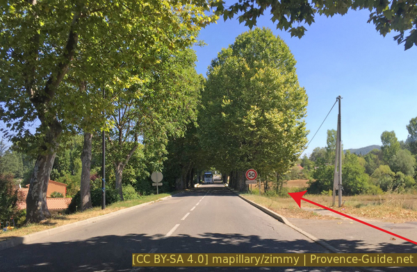
The plane tree avenue in Céreste
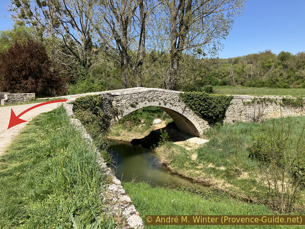
Our path descends a little towards a footbridge next to the road bridge over the Aiguebelle River from 1847. Although we can no longer see anything of it, it is a historic site. Here was the real ancient Roman bridge, unlike the other bridge further to the north which we will see on the way back which is only falsely called Roman.
No reproduction is permitted without the written consent of the author. (id7340)
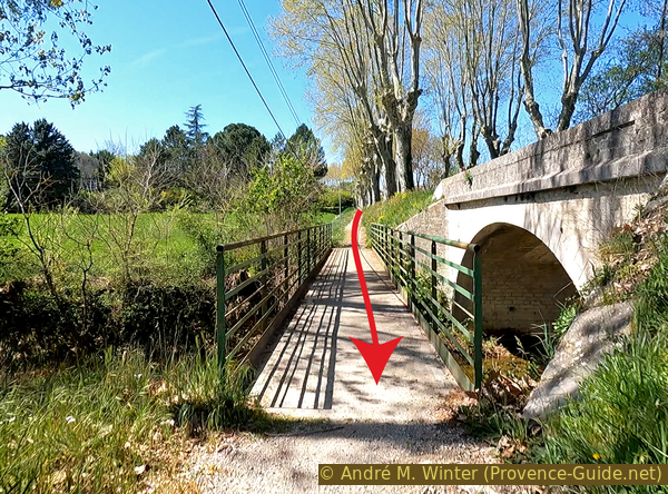
Footbridge and bridge over the Aiguebelle to the east of Céreste
The true Roman bridge was located approximately at the location of the current road bridge. In the 19th century it was not recognized as ancient, especially since it had a central pile made up of quite small cut stones held together by staples sealed with lead. Usually, the Romans used much larger cut stones to make foundations of such importance and subject to flooding. Apparently, ancient builders were in need of large ashlars.
In any case, in 1847, the ancient bridge was destroyed without us knowing today whether the deck structure with irregular parapet was Roman or not. The plans seems to date from 1846. The central pile is in any case Roman. In 1999 it reappeared after a flood north of the road bridge and surveys were carried out to clarify the history of this bridge. The builders of the 1847 bridge could have relied on this foundation for their bridge because the base has not moved since almost 2000 years. The bridge was contemporary with Pont Julien.
It is useless to look for the pile these days, it is once again covered by rubble carried by L'Aiguebelle river.
No reproduction is permitted without the written consent of the author. (id7362)
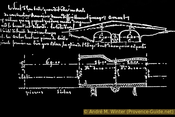
Diagram of the Roman Bridge over the Aiguebelle under the D4100 bridge
Our little path takes us to a roundabout near the shopping center. The path does not continue along the alley. We cross the pedestrian crossing before the roundabout and therefore turn left to find ourselves in another alley.
No reproduction is permitted without the written consent of the author. (id7341)
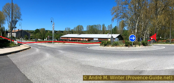
Céreste shopping center roundabout
Here we are in an equally sumptuous tree alley. It seems even more magnificent because the road is narrower. It points straight towards a very classic 19th century house: the Céreste station.
No reproduction is permitted without the written consent of the author. (id7342)
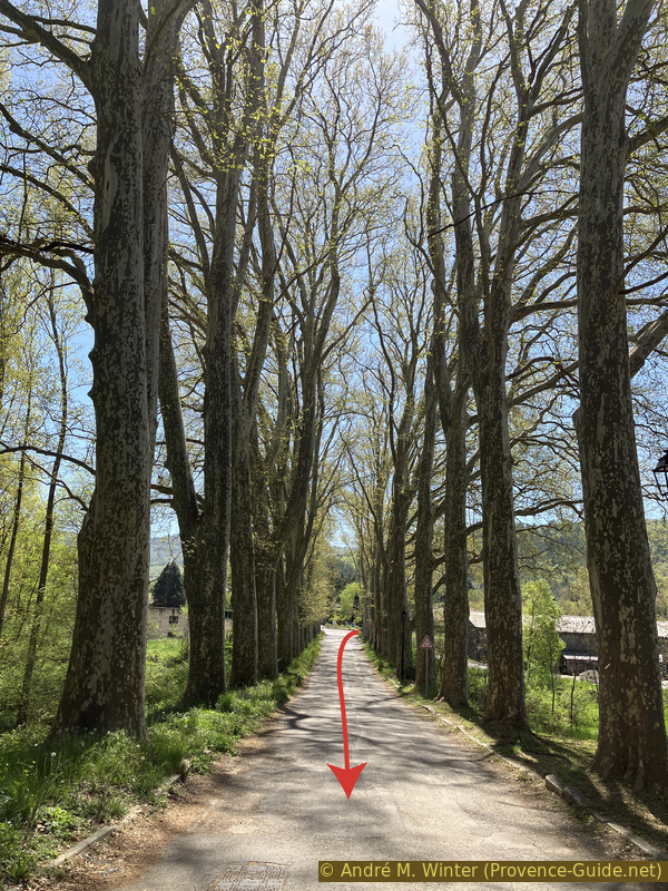
Plane tree avenue south of the old Céreste train station
The Céreste train station is located on the line from Cavaillon to Saint-Maime and Dauphin. It was put into service in 1890 mainly to transport agricultural products from Vaucluse and mining products from eastern Luberon. However, already in 1941, decommissioning and dismantling began with the section between Apt and St. Maime on which Céreste is located. The last stretch between Cavaillon and Apt was dismantled in 1990. There is certainly now a cycle route on this former line, but real rail transport on this line would massively add value to the region today.
No reproduction is permitted without the written consent of the author. (id7344)
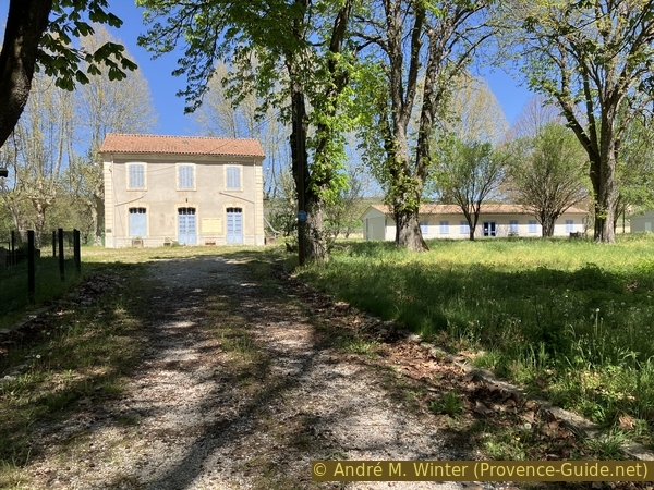
Train station and a dormitory at the railway workers' summer camp in Céreste
Next to the old station building are several other constructions, the most recent dating back to the 1960s. The site is massively fenced and a recent sign indicates the Railway Workers' Holiday Center of the Central Committee of the Public Rail Group (CCGPF). However, the site seems abandoned, it is not found in the list of CCGPF vacation sites either.
No reproduction is permitted without the written consent of the author. (id7343)
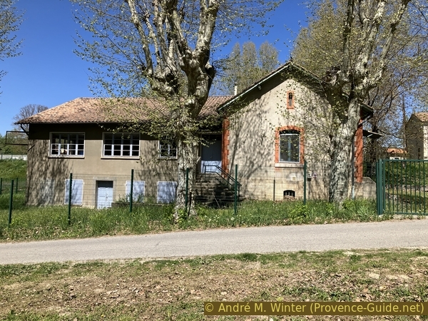
Kitchen at the railway workers' summer camp in Céreste
We turn in front of this inaccessible station on the right. The old railway route passes over an artificial embankment and our road remains in a straight line below. We walk further and along the small craft zone.
No reproduction is permitted without the written consent of the author. (id7345)
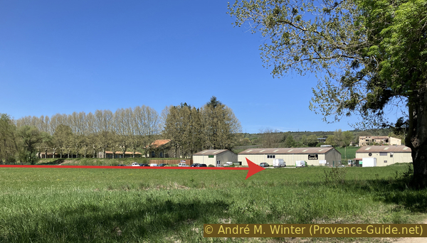
The Céreste train station and industrial zone seen from L'Encrême
At the next crossroads the cycle path begins again, which finds the railway route further on. However, we stay on the road, because we then have to turn left.
No reproduction is permitted without the written consent of the author. (id7346)
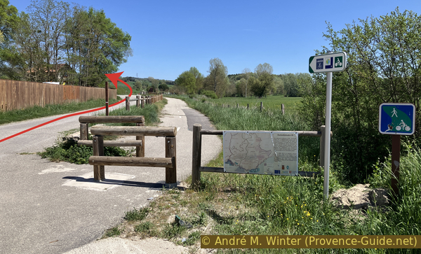
Cycle path at east of Céreste
At the next junctions, we always take the track that points north. Further on, under a power line, it's the same: first on the right, then the unpaved road on the left. This section is marked red and white as the GR4 long distance hiking trail between Nice on the Mediterranean and Royans on the Atlantic.
When our agricultural track comes back to the bend of a small asphalt road, we continue straight on for another 100 metres. You can then take an unmarked path on the right.
150 metres further, we come back on the same road, but we cross it this time. This new forest track takes us up towards the bend of another small asphalt road where we continue in the same direction and uphill.
We arrive at a fork and take the right road downhill. It is no longer paved anymore. 200 metres further, the downhill slope is less steep and we turn right at the next fork, therefore straight on towards the north.
60 metres further, the road makes a small detour and at the next fork, we must turn sharply right onto a narrower forest track. We are again on the GR4 long distance trail and the descent continues, this time in a valley in a south-southeast direction.
250 metres further, we are is shortly before arriving at a confluence of two temporary streams, we take a small unmarked path on the right, it is still downhill and it heads more clearly towards the south.
This junction is not obvious and easily missed, especially since we have been walking on clear roads for a long time. You must at the latest turn right when you cross the Ravin de Carluc stream as in the photo. We then cross an area that is sometimes flooded after heavy rains and after 50 meters we find the path indicated above. Here on the left.
No reproduction is permitted without the written consent of the author. (id7347)
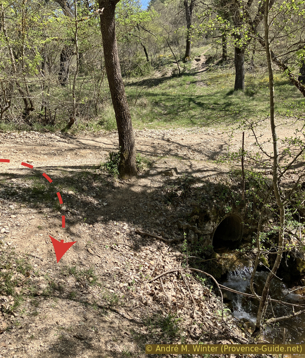
Stream in the Carluc Ravine at the intersection north of the troglodyte site
This narrower path passes a meadow to the south of which are the ruins of the Priory of Carluc.
No reproduction is permitted without the written consent of the author. (id7348)
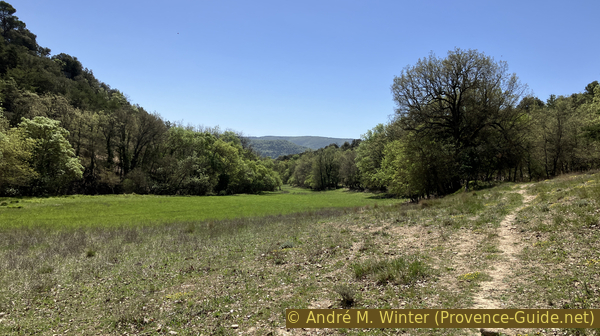
Carluc meadow in spring
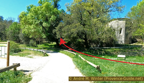
The path returns to a forest of small oaks. About twenty meters after the meadow, we spot an even less visible path on the right. We go up there, keeping roughly the direction indicated by the arrow in the photo.
No reproduction is permitted without the written consent of the author. (id7349)
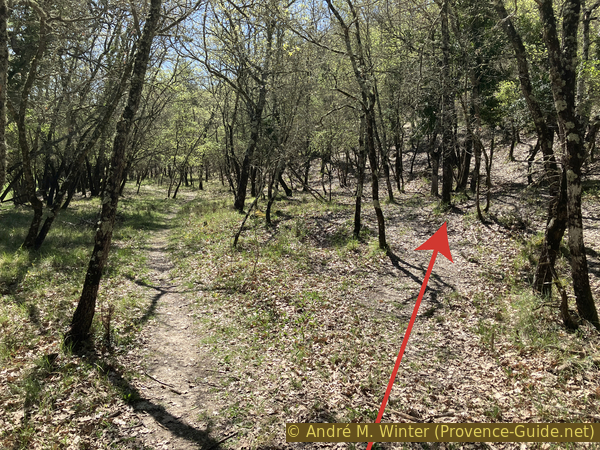
Ascent in the ridge north of Carluc
We come across a low rocky bar, but with an obvious passage.
At the top is another forest on a gentle slope. We descend to the left and parallel to the cliff now on our left side.
No reproduction is permitted without the written consent of the author. (id7350)
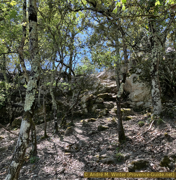
Passage in the ridge north of Carluc
On the way down, we pass near old concrete electrical poles on the ground and we arrive at another meadow gradually regained by the forest. We stay on the left near the forest.
No reproduction is permitted without the written consent of the author. (id7351)
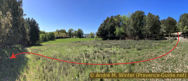
Field west of Carluc
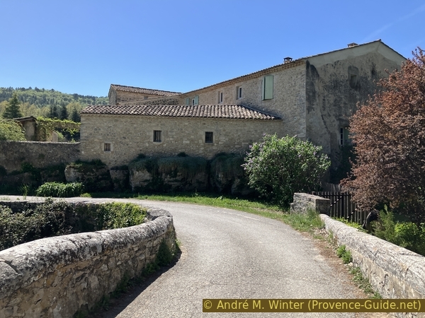
Continuing straight ahead, you arrive at a more visible path going downhill into the forest. When we see ancient walls, we arrive at the Priory of Carluc.
No reproduction is permitted without the written consent of the author. (id7352)
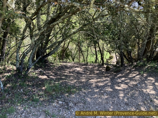
Descent of the ridge to the west towards Carluc
Section 2: Prieuré de Carluc
➙ 3,5 km ... 1 h ➚ 45 m ➘ 100 m ↝ easy
<5% forest roads, few marks
20% hard-surfaced quiet side streets, few marks
5% forest roads, without marks
60% hard-surfaced quiet side streets, few marks
10% hard-surfaced city roads, without marks
10% hard-surfaced quiet side streets, without marks
The clues
- 13th century walls, 450 m
- Chapel, 440 m
- Meadow, 440 m
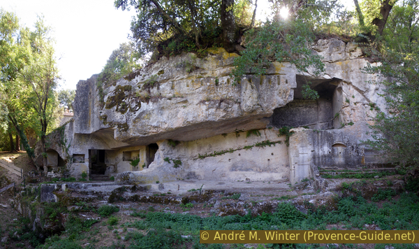
The troglodytic site of the Priory of Carluc is one of the great curiosities of the region. These are rock tombs partly dug into a tunnel, the gallery was interspersed with several chapels, only one truncated of which remains. Near the ancient Via Domitia (between Spain and Briançon), the site has also been on the pilgrimage route to Santiago de Compostela since the Middle Ages.
We arrive from the top and pass large walls, two sides of which are still standing. They are dated from the 13th century and are therefore later than the rock gallery lower down which dates from the 12th century. These large walls are clearly defensive and could have been erected around the unrest created by the Hundred Years' War. Similar defenses from the same period are also visible in the form of the Tourreluque in Aix-en-Provence.
No reproduction is permitted without the written consent of the author. (id7353)
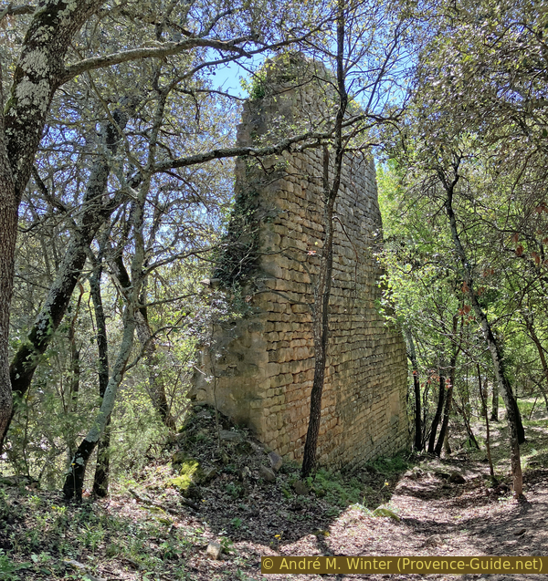
Wall of a 13th-century building at the Carluc Priory
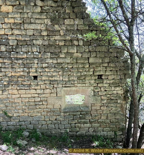
The lower wall has a curious opening which could have served as a parlor between the monks and visitors.
No reproduction is permitted without the written consent of the author. (id7334)
Opening in a wall of a 13th century construction at Carluc priory
Further on we see the north face of the remaining chapel. Barriers prevent you from going down before, but you can see in the gallery of rock tombs. You must therefore go around the chapel. Passing to the west side, we see that a part of the nave is missing. The chapel has a pentagonal apse, in its current state it seems to date from the 15th century. Certain corners of the buildings feature columns with capitals decorated with foliage and birds.
We see numerous holes on all the walls, these are left from fixing the construction scaffolding. Normally, these holes are filled when the construction is completed, especially at a place of worship. This could lead to speculation: was this the last of the three chapels built? Was it not completed because of the fairly rapid and irreversible decline of the priory especially in the 15th century? Is this related to the truncated nave?
No reproduction is permitted without the written consent of the author. (id2325)
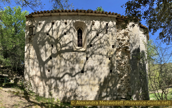
Carluc Chapel 12th century
The interior is not accessible, but the bottom of the door was corroded enough in April 2024 to be able to slide a cell phone in. This short nave is empty and the walls inside have the same holes as the outside.
No reproduction is permitted without the written consent of the author. (id7335)
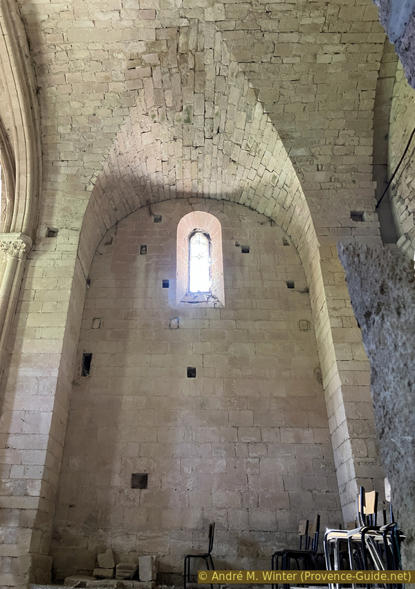
Empty interior of the Carluc Chapel
The cult site is built around a source revered beyond the Gallo-Roman era.
A small abbey had developed at least from 1101 on an ancient cult site and near a tomb of a saint who has not been identified to date. Some tombs date back to the time of the first Christians of Provence (5th century).
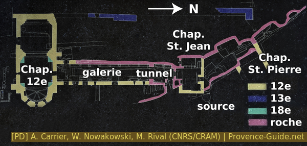
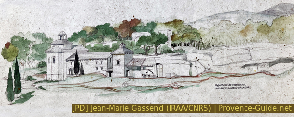
Construction plan of the priory of Carluc
The constructions currently visible do not date back earlier than the 12th century. At this time also took place the attachment to the Montmajour Abbey, which explains the richness and size of the buildings. Three chapels were built, of which only the Notre-Dame chapel partially survives. From this time onwards, several chapels and hermitages in the area will also be looked after by Carluc.
The monastery underwent a revival in the 14th century when it was once again renovated. But the duties linked to dependencies and the duty of hospitality to pilgrims led to impoverishment which was further increased by the plague in 1348. At the end of the 15th century, the rare profits were only used to finance the mother house of Montmajour. The site was in ruins in the 18th century.
It was only in the 1960s that scientific excavations revealed the historical importance of the place. Since 2000, the site belongs to the municipality of Céreste.
Schematic drawing of the priory of Carluc
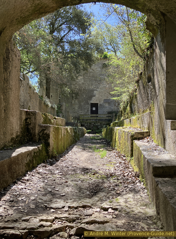
After the chapel, we go up to the gallery to walk it from south to north. We finally pass through the tunnel where there are also tombs. Here are engraved signs such as the Union and a cross.
The beginning of the funerary gallery was attached to the still existing chapel. It was topped with masonry vaults. The west side is dug into the rock and towards the north it continues as a tunnel dug into the rock. Construction on rock is a difficult undertaking in which the Romans excelled in the erection of their temples, their bridges and their aqueducts. This knowledge was lost in the Middle Ages. Here in Carluc, it is precisely all the masonry builton rock which has now collapsed.
No reproduction is permitted without the written consent of the author. (id2322)
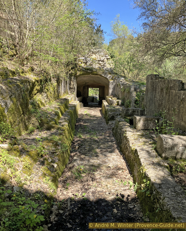
Row of tombs and the breach behind
Rock tombs are also found outside the gallery. These are the oldest ones of the site.
No reproduction is permitted without the written consent of the author. (id2321)
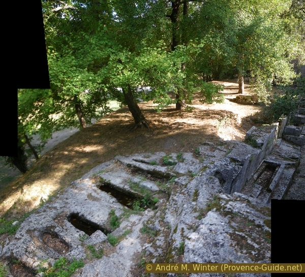
Several stone tombs at Carluc
The tunnel has two openings to the north. We arrive at another area dug into the rock. We recognize a room and troglodytic monastic cells. However, you should be aware that in front of this rock wall there were masonry structures giving these dwellings a slightly more logical shape.
No reproduction is permitted without the written consent of the author. (id2324)
General overview of the rooms carved in stone in Carluc
We continue beyond the historic developments. A barrier indicates that there is nothing more to see. However, we can continue. We are now under the cliff that we followed above on the way here. There are other, more classic troglodyte caves here. In the largest remains a part of a wall and on the ground is a cart with axle, but without wheels. It probably was still in use in the 1950s.
No reproduction is permitted without the written consent of the author. (id7355)
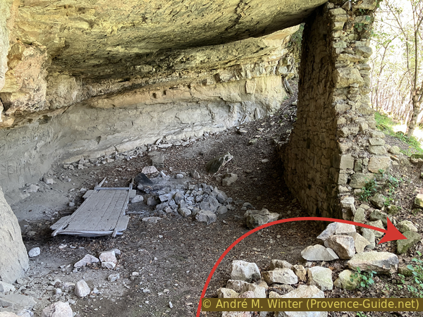
Formerly converted natural cave and remains of a cart in Carluc
Section 3: Carluc - Céreste
➙ 0,3 km ... 20 min ➚ 5 m ➘ 15 m ↝ easy
55% moderate trails, faulty marks
45% easy trails, without marks
The clues
- Carluc, 440 m
- Pont de la Baou bridge, 360 m
- Céreste, 385 m
For the return, we again have to walk along small roads. However, we vary the route a little compared to the outward journey. We will see a bridge that was long believed to be Roman.
After the cave, we go back over the large meadow. Opposite are picnic tables. In front of the remains of the priory are explanatory panels blackened by time.
Arriving via the meadow under the old priory, we can cut the bend in the road by going up to the left of the chapel.
No reproduction is permitted without the written consent of the author. (id7356)
The road to Carluc
After this climb, we return to the road which goes up a little further. Afterwards, we stay on this strip of asphalt without going up any further and we take the following intersections on the left. You can cut the bend passing through the forest as on the way up.
Shortly after, we arrive at the place where we came up from the south towards the road. Here we turn right, following the asphalt road, still going downhill. At times, we have a direct view of Céreste at the foot of the Luberon.
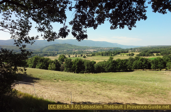
View of Céreste coming down from Carluc
Our road passes through fields and makes a few bends before passing an old bridge. It is called Pont de la Baou, the term Baou meaning flat rock in Provençal, it is also found in the name of Les Baux. Its construction is well documented as are the problems that occurred during its installation when falling on mud hidden under a loose rock. These modifications to the initial plan give it this elongated wavy shape.
No reproduction is permitted without the written consent of the author. (id7357)
Baou Gîte near the so-called Roman bridge in Céreste
It was completed in 1742. However, on site, one quickly forgot this construction history and in the middle of the 19th century, it appears as a Roman Bridge on postcards and official maps. The IGN map still displays it under this name. It is even classified as such by the Historic Monuments which apparently did not have a look on the archives in Digne-les-Bains. This confusion may also be due to the real Roman bridge which disappeared not far away. One knew one existed, and everybody took the one that was available.
No reproduction is permitted without the written consent of the author. (id7358)
The so-called Roman bridge over the Encrême
After the bridge, the road goes back up to the intersection with the main road and the car park on the right. However, you still need to see the southern part of the center of Céreste and return towards the bus station for those travelling by bus. Those who come by car also look at the northern part of the village before returning to the parking lot.
We therefore cross the main road and turn right. We have a continuous sidewalk on this side. It keeps going up. Take a left at the next intersection (direction Vitrolles). We thus pass above the square where the Céreste market takes place and also above the War Memorial.
Return to the center of Céreste
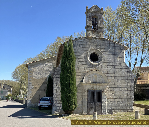
We aim for the bell tower in front of us.
The Saint-Michel church was built in the 18th century, with two bays in the south aisle older from the late 15th century. The bell tower is topped by a Provençal iron campanile.
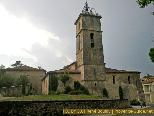
Saint-Michel Church in Céreste
From the church, continue uphill along Boulevard Jean Jaurès. Just before a small house with greenery in front of it, we go down to the right the Traverse d'en Gauche. At the bottom, in Rue de la Bourgade on the left and immediately right via the stairs down in Rue Helia Vigne d'Octon.
At the bottom, we arrive again on the main road. Here on the left for the terraces and the bus stations.
No reproduction is permitted without the written consent of the author. (id7359)
Main road in Céreste
For those returning to the car park, then take the first left and follow the description at the start of section 1.
No reproduction is permitted without the written consent of the author. (id7360)
Bus stops in Céreste
Sources and additional information
It is better to use a good topographic hiking map: this tour is on the IGN map "Apt, Parc naturel régional du Luberon", scale 1:25000, 3242OT.
If you don't want to bother with a paper map, you can also use mapping apps on your cell phone. On the one hand, it is the Cartes IGN app from the official map service. However, it requires access to the data network and this is sometimes difficult in canyons or remote locations.
Alternatively, you can use apps that store data directly on the device. They're generally not free, but they don't cost much. We mainly use OSMAnd, here it is possible to add contour lines, relief shading, markings and others. To store this data on your phone you need a lot of space.
Of course, one needs access to satellites for the GPS signal with any app. In some canyons this is not the case. Therefore, do not rely on the position shown, but read the map on your phone as you would read it on paper. Most apps are available for Android and iPhone. The applications usually allow us to record the route travelled and also view the GPS files offered for each of our hikes.
This page has been seen 1812 times since 20 March 2024.
No reproduction is permitted without the written consent of the author. (id7354)
View from the gallery towards the Carluc Chapel