The Chapel St. Pierre in its canyon by mountain bike
Up from Grands Cléments and back via Clapasson
MTB tour
easy
45 min
no
yes
no
3 % of the distance
Introduction
Villars is a village with various hamlets and various points of interest. Many are easily reachable, but forest tracks can be long. So you might as well take the mountain bike to reach the St. Pierre Chapel at the foot of the eponymous chasm in the otherwise fairly wide valley. The site has been revered at least since the Roman era.
The goal of this mountain bike tour is the site and not only the mountain bike sections themselves.
The facts
4,3 km total distance
45 min movement time.
160 m total elevation
orientation easy
mark 90% of the total distance
65% rutted forest roads
20% hard-surfaced quiet side streets
15% forest roads
5% easy trails
dangers falling on difficult track
children no
useful picnic stuff
required Hardtail mountain bike and water
GPS coordinates (WGS84) of start and end point 43.93524777895568,5.426035429602678
downloads ![]()
![]()
Public transport
The starting point is not reachable by public transport. The regularly accessible point by bus is Apt, see timetables under Zou! (only french). From there by bike, it's at least 10 kilometres towards the north either on the D111 road or with more elevation along the GR9 long distance hiking trail which is everywhere here on road or on forest tracks.
Access by car
Coming from Marseille and the south-east (Var and Alpes-Maritimes), we reach Aix-en-Provence and continue towards Gap on the N296 road and the A51 motorway. Leave the motorway at the Pertuis exit, continue towards Pertuis, then take towards Cadenet at the following roundabouts and intersections. Reach the center of Cadenet and continue along the signs towards Apt. In the town of Apt towards Saint-Saturnin-lès-Apt, then Villars. Do not enter the village and continue towards Rustrel. Three minutes later, turn left towards Les Grands Cléments.
From Vaucluse and the western part of Bouches-du-Rhône, aim for Saint-Saturnin-lès-Apt then continue towards Rustrel. Turn left towards Les Grands Cléments after 4 minutes.
From the two previous departures, drive a hundred metres towards the hamlet to find the car park on the right.
From Manosque and the Durance valley, join Apt, but take towards Rustrel before. Later turn left towards Garde d'Apt, then towards Saint-Saturnin-lès-Apt. Two minutes later, follow the signs to the right towards the Grands Cléments. Turn left at the next intersection and left again 70 metres further to enter the car park.
No reproduction is permitted without the written consent of the author. (id7419)
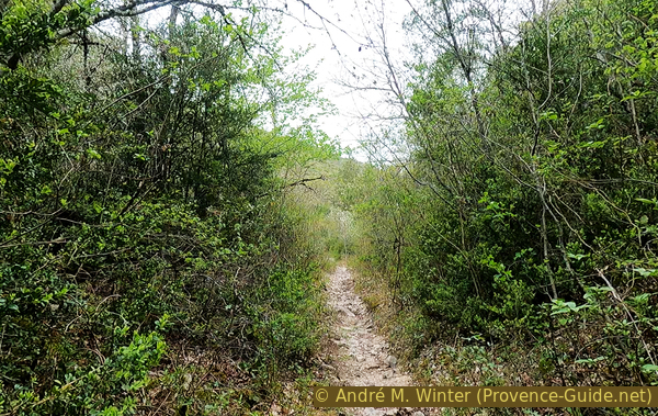
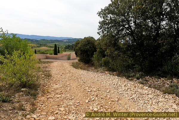
The track north of Les Grands Cléments cemetery
No reproduction is permitted without the written consent of the author. (id7411)
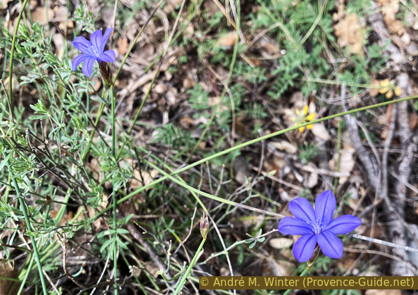
Aphyllanthe de Montpellier
Useful parking spaces
Parking south of the hamlet of Grands Cléments. Here you find a picnic table and map of the region.
Hints
It's a fairly short mountain bike tour, but we are in limestone country and the condition of the trails is very changeable. There are also large stones, ruts and two very steep sections which may require you to get off the bike. We will come out sweating and covered in dust.
The whole region is a zone with a high risk of forest fires. In summer, but also in other seasons when it is very dry or by strong winds, access to the forest areas can be regulated. As a result, the roads may be closed to traffic and/or the trails prohibited to hikers. Current information: Map for access to the forests of the Vaucluse department (also english). The map shows the colours green, yellow, orange and red which correspond to levels of danger. The affected area is: le Massif des Monts de Vaucluse (13).
The sections
- Plan du Miel and ascent to the Combe de St. Pierre valley.
- Descent from St. Pierre and ascent towards Clapasson, descent via the old hamlet of Les Grands Cléments.
Section 1: Grands Cléments - St. Pierre
➙ 2,4 km ... 15 min ➚ 120 m ➘ 0 m ↝ easy
↙ Colours of the sections like MTB rating but without the duration.
10% hard-surfaced quiet side streets, few marks
10% forest roads, without marks
70% rutted forest roads, few marks
5% easy trails, without marks
↖ leave the bike and explore on foot
The clues
- Car park Rue du Plan du Miel, 330 m
- Under Combe de St. Pierre gorge, 350 m
- St. Pierre Chapel, 450 m
The way up is quite direct and gently sloping. Just the ground is at times irregular.
We exit to the right of the parking lot, the climb is moderate. We don't turn for the first few minutes.
No reproduction is permitted without the written consent of the author. (id7388)
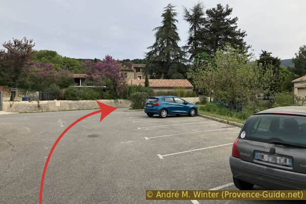
Les Grands Cléments car park
The tar gradually disappears under our wheels. However, it remains a very easy track.
No reproduction is permitted without the written consent of the author. (id7389)
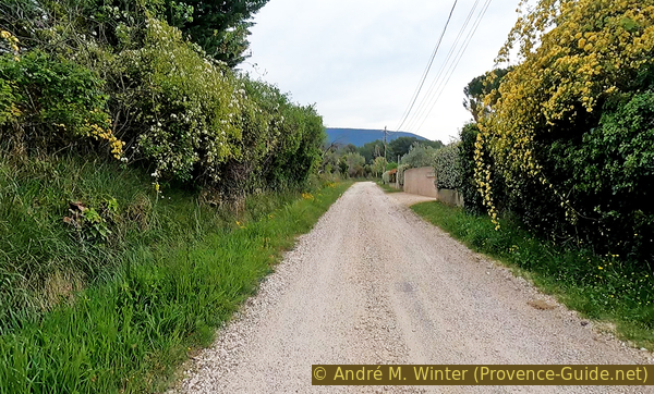
Rue du Plan du Miel gradually becomes tar free
Arriving at a T-junction, turn left in front of a field of vines.
Be careful, there may be soft gravel here.
No reproduction is permitted without the written consent of the author. (id7390)
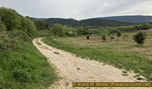
Plan du Miel and the fields under Combe St. Pierre
We are moving in a straight line towards the north. We can't see it, but there is a dry valley on our left and we are already on the axis towards the valley Combe de St. Pierre.
No reproduction is permitted without the written consent of the author. (id7391)
Umwards under Combe St. Pierre
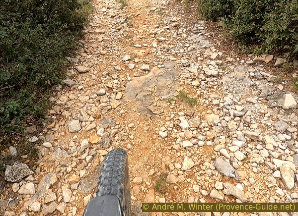
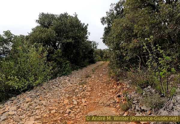
The ground changes, coarse stones cover the agricultural track.
Well-inflated tires prevent punctures, soft tires are gentle on the buttocks. The eternal dilemma. There's no point changing the tires' pression on this round, the stones won't get much sharper and the ground changes every minute.
No reproduction is permitted without the written consent of the author. (id7392)
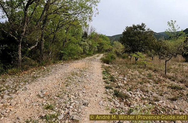
Track with large stones
We arrive on a smoother track which comes from the right and from the hamlet of Fumeirasse. Not even twenty meters further, you have to take the left track uphill and leave this more convenient route again.
No reproduction is permitted without the written consent of the author. (id7393)
Crossings under Combe St. Pierre
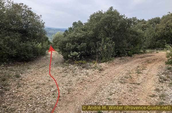
We now continue in a straight line. The fork in the photo will be important for the return journey.
No reproduction is permitted without the written consent of the author. (id7394)
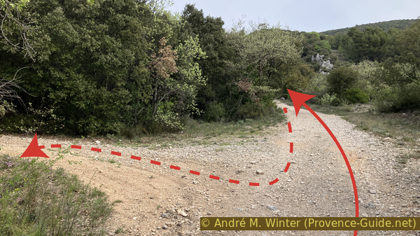
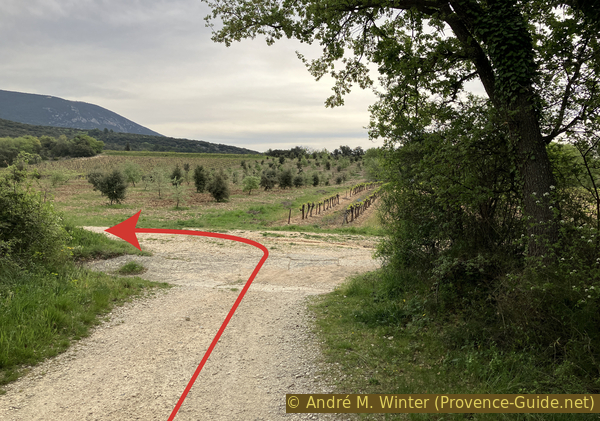
Junction towards Clapasson
We see an isolated pointed rock and we arrive at an open area. A sign identifies it as a parking lot. Perhaps this dates from a time when the forest track was in better condition?
In any case, we pass the barrier at the bottom.
No reproduction is permitted without the written consent of the author. (id7395)
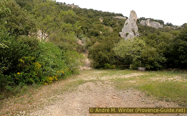
Parking under St. Pierre Chapel
In a few steps, we are in front of the small chapel.
To the right are picnic tables. Let's leave the bikes there and explore the chasm and the chapel on foot.
No reproduction is permitted without the written consent of the author. (id7396)
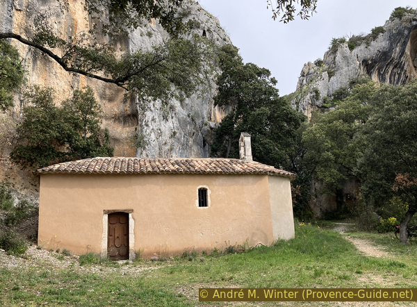
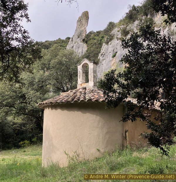
The St. Pierre Chapel at the exit of the valley
Just behind is St. Peter's Gate. It is a chasm which narrows this valley.
It was a place of worship for Silvanus during the Gallo-Roman times. The place was undoubtedly chosen by the dense forest (Sylva) and this was due to the relative abundance of water in the subsoil due to the chasm which also channels groundwater.
No reproduction is permitted without the written consent of the author. (id7397)
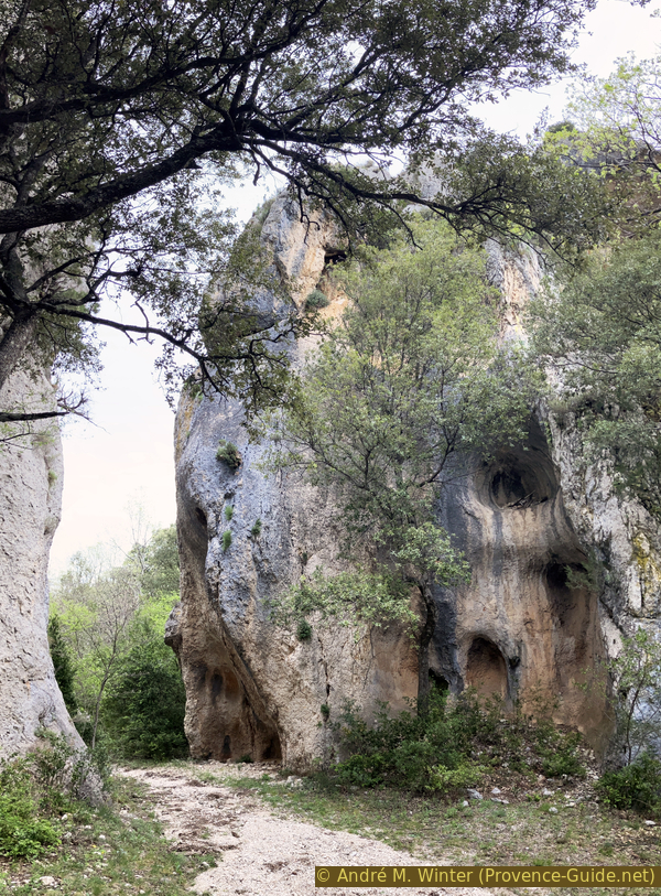
The chasm of St. Pierre in Villars
One might expect gorges further behind, but no, there is only this narrowing. The broad valley continues beyond towards the north.
This terrain is covered with large loose rubble which is very unpleasant for mountain biking. Let's return to the chapel.
No reproduction is permitted without the written consent of the author. (id7398)
Combe de St. Pierre beyond the chasm
The Benedictines of Villeneuve-lez-Avignon in the Gard cleared the forest here and built a first chapel around the 11th century, it was dedicated to a Sancti Petri de Bainiol (Bailleul?).
In the following centuries the region became depopulated and the chapel collapsed. A cross has stood for centuries on the pile of stones.
No reproduction is permitted without the written consent of the author. (id7399)
The Chapel of St. Pierre in Villars
Apparently after a flood, shepherds noticed foundation walls in 1763. Excavations are beginning which proved the location of the old chapel. There were also found burial sites and various stones with inscriptions.
The chapel was rebuilt on the foundations of the old one in the 1760s.
It has been renovated several times since its construction. But the last renovation must date back around fifty years. We can see into the nave through an opening on the west side, it is on the left when arriving. We can see straight onto the choir in Provençal colors. On the left is a small Madonna in an ornamental grotto.
No reproduction is permitted without the written consent of the author. (id7400)
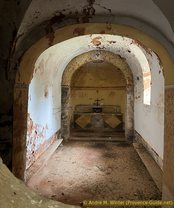
Nave of the St. Pierre Chapel in Villars
The stones with inscriptions are placed in the nave. They are Gallo-Roman, so in a Latin dialect, and in medieval more transformed Latin. The first three stones bear Gallo-Roman inscriptions, we can consider them as ex-votos:
- To Silvanus by the slave of Domitia Severina...
- To Virlontia ...
- To Jupiter ...
The medieval inscription, lower right, is dated to the 11th century. It recalls that the chapel was consecrated the day before the feast of the purification of Saint Mary (therefore on Candlemas).
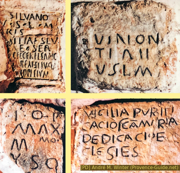
Gallo-Roman and medieval inscriptions of the Chapelle St. Pierre
Section 2: St. Pierre - Clapasson
➙ 1,8 km ... 25 min ➚ 160 m ➘ 40 m ↝ easy
↙ Colours of the sections like MTB rating but without the duration.
15% forest roads, few marks
<5% rutted forest roads, few marks
↖ very steep passages
20% rutted forest roads, few marks
↖ coarse gravel
5% rutted forest roads, few marks
↖ very steep passages
30% rutted forest roads, few marks
30% hard-surfaced quiet side streets, few marks
The clues
- St. Pierre Chapel, 450 m
- Under the Combe de St. Pierre gorge, 425 m
- Clapasson, 465 m
- Grands Cléments, 354 m
- Car park Rue du Plan du Miel, 330 m
The return is planned with an additional climb. We have a view of the Luberon, but otherwise it's more for getting a little more exercise and having a long descent at the end. There are two very steep short sections that potentially need to be pushed.
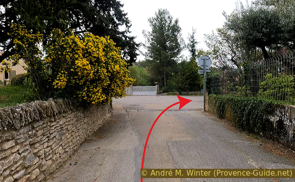
We ride back down to the car park and the first part of the outward journey to return to the first junction. We take a right there. If you have the opportunity to gain momentum, you have to take it because the next slope is at the limit of what is feasible with a mountain bike in hiking mode.
No reproduction is permitted without the written consent of the author. (id7402)
Junction towards Clapasson
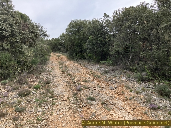
The rest is on a gentle slope but it is again an alternation between good rolling parts and large gravel interspersed with more or less humped rock.
No reproduction is permitted without the written consent of the author. (id7407)
Hard track northeast of Clapasson
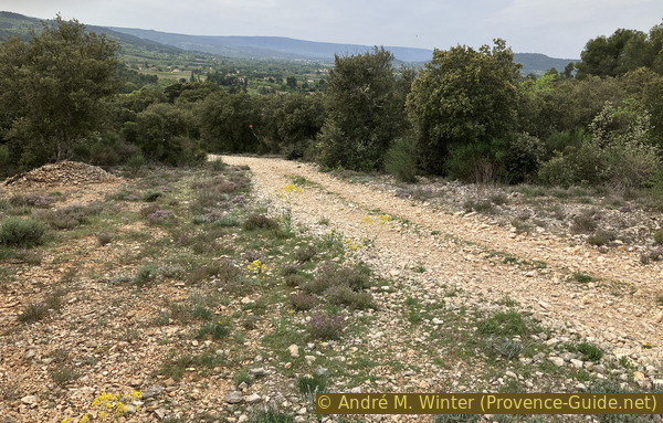
At times, we have a view of the Luberon. In the middle ground shine the ochres of Rustrel.
No reproduction is permitted without the written consent of the author. (id7408)
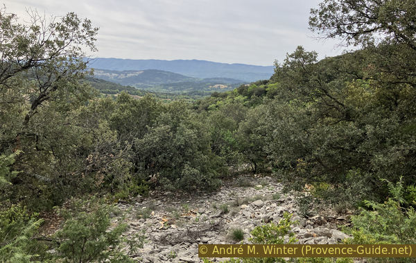
View towards the Luberon
When you pass this ravine, you might think you have crossed the ridge, but that's wrong.
No reproduction is permitted without the written consent of the author. (id7409)
Ravine northeast of Clapasson
After a very chaotic descent that does not allow you to gain momentum, there follows a very pronounced slope which either causes the rear wheel to slip or you involuntarily lift the front wheel. It is best to push from the dip on for about 50 meters in distance before the real descent begins.
No reproduction is permitted without the written consent of the author. (id7416)
Second steep climb northeast of Clapasson
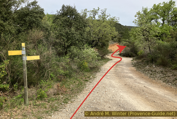
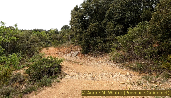
After a few meters of descent, the track seems to turn right, however we must continue straight on a portion in worse condition.
No reproduction is permitted without the written consent of the author. (id7417)
Junction northeast of Clapasson
It remains easy as long as the slope does not steepen. But further on, large gravel also joins in and it forces you into your arms. The terrain is too uneven to ride fast.
No reproduction is permitted without the written consent of the author. (id7418)
Track northeast of Clapasson
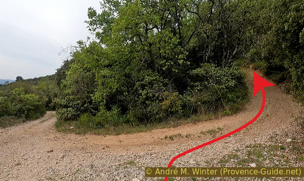
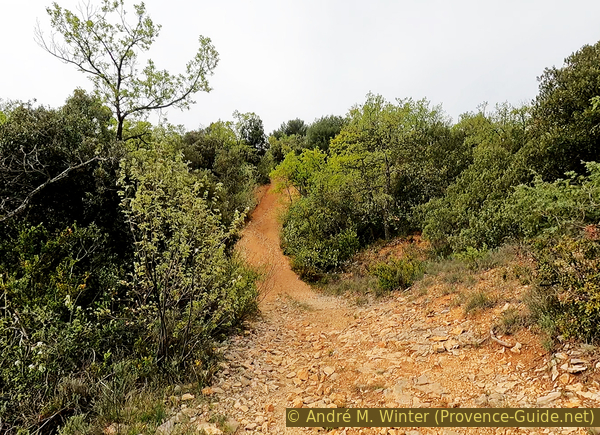
After about eight minutes of steep descent, you arrive at a wider track but it is just as steep and the stones are even coarser.
No reproduction is permitted without the written consent of the author. (id7420)
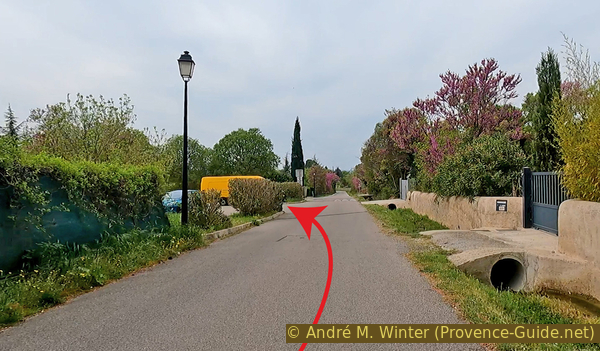
The Aribeau track towards Les Grands Cléments
But it's not for very long. We very quickly arrive at Les Grands Cléments cemetery and with this comes the asphalt.
The descent continues, however, and the slope only slowly eases.
No reproduction is permitted without the written consent of the author. (id7421)
The track goes down to Les Grands Cléments cemetery
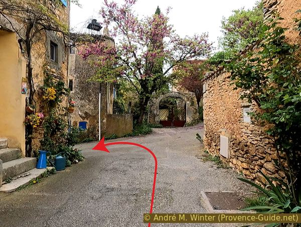
We arrive in the hamlet. Continue straight ahead at this first intersection.
No reproduction is permitted without the written consent of the author. (id7427)
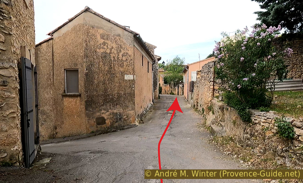
Continue on Rue du Nord
At the T intersection, turn left, still going downhill.
Be careful not to ride too fast, people don't expect bikes here.
No reproduction is permitted without the written consent of the author. (id7428)
From Rue du Nord to Rue Lepic
At the intersection with the large fountain turn right. A lot of water flows here.
No reproduction is permitted without the written consent of the author. (id7429)
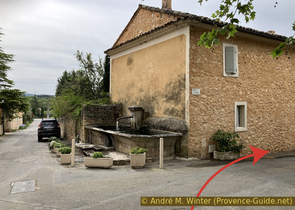
Great fountain of Les Grands Clements
And at the crossroads at the bottom right, we find ourselves again on Rue Plan du Miel from the outbound route.
No reproduction is permitted without the written consent of the author. (id7430)
Descent of Rue de l’Église
The parking lot and starting point is ahead on the left.
No reproduction is permitted without the written consent of the author. (id7431)
Rue du Plan du Miel and Les Grands Cléments car park
Sources and additional information
This tour is inspired by this book: 25 balades sur les chemins de la pierre sèche (25 Hikes on tracks of the dry stone constructions, only french) between Monts de Vaucluse, Montagne de Lure and Lubéron, by Florence Dominique, Le bec en l'air publisher, ISBN 987-0-916073-45-3. If you are more interested in these constructions, this book will also pass on well-founded knowledge. The tours are well explained with pictures and maps.
It is better to use a good topographic hiking map: this tour is on the IGN map "Apt, Parc naturel régional du Luberon", scale 1:25000, 3242OT.
If you don't want to bother with a paper map, you can also use mapping apps on your cell phone. On the one hand, it is the Cartes IGN app from the official map service. However, it requires access to the data network and this is sometimes difficult in canyons or remote locations.
Alternatively, you can use apps that store data directly on the device. They're generally not free, but they don't cost much. We mainly use OSMAnd, here it is possible to add contour lines, relief shading, markings and others. To store this data on your phone you need a lot of space.
Of course, one needs access to satellites for the GPS signal with any app. In some canyons this is not the case. Therefore, do not rely on the position shown, but read the map on your phone as you would read it on paper. Most apps are available for Android and iPhone. The applications usually allow us to record the route travelled and also view the GPS files offered for each of our hikes.
This page has been seen 1651 times since 20 March 2024.
No reproduction is permitted without the written consent of the author. (id7410)
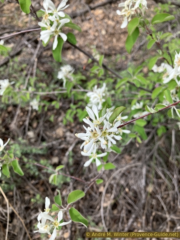
Wild serviceberry in flower