The St. Chamas Heritage Trail by bicycle
Lots of bridges and aqueducts
bycicle
easy
1 h 45 min
yes
yes
no
6 % of the distance
Introduction
The Sentier du Patrimoine (heritage trail) in St. Chamas is a primarily pedestrian loop proposed by the municipality to reach sites of interest. However, it is a very long walk and apart from a few stairs, the tour is completely doable by bike. This avoids long walks, 13 kilometers by bike are easy whereas it can be long on foot. The tour is slightly modified to add other viewpoints and other little-known sites.
Although the Étang de Berre region is quite flat, there is still some elevation gain. It's never very steep for long. We will see a multitude of bridges: a railway bridge, footbridges, a medieval bridge and all the arches of the city's various aqueducts including of course the aqueduct bridge with the clock. We also climb the Baou hill which separates the two parts of the city, here are the major difficulties for cycling and mountain biking, however you can push bicycles everywhere. Finally, we return to the plain on the edge of Étang de Berre, first passing through the Pertuis district, then following the water to Lavoir des Contagieux.
The facts
13,2 km total distance
1 h 45 min movement time.
240 m total elevation
orientation average
mark 60% of the total distance
45% hard-surfaced city alleys
10% easy trails
10% hard-surfaced quiet side streets
10% dirt roads
5% forest roads
5% moderate trails
5% hard-surfaced city roads
<5% difficult trails
<5% stairs
<5% hard-surfaced paths
<5% Trails with scramble passages
<5% rutted dirt roads
<5% cross country
dangers Floods along the river
children yes, but it's long
useful picnic stuff
required normal bike but better with MTB and water
GPS coordinates (WGS84) of start and end point 43.536629968658154,5.034382684703156
downloads ![]()
![]()
Public transport
You can easily reach St. Chamas by train, many connections are under TER PACA (only french) on the line between Marseille and Miramas. We leave the station towards the north, turn right and go up the stairs to avoid a big detour. At the top, turn left and immediately right onto Chemin de la Rabassière for 400 metres and up to its highest point. Turn left here on Chemin du Bion, we are then at the start of section 3 of the tour. The route starting from the station is indicated in burgundy red on the map on this page.
Access by car
Coming from the east (Marseille, Nice, Durance Valley) take the exits from the A7 and A8 motorways towards Berre-l'Étang, then towards Fare-les-Oliviers and then St. Chamas. We pass near the Pont Flavien and turn left towards Gendarmerie at the roundabout at the entrance to St. Chamas.
Coming from the west (Arles), pass St.-Martin-de-Crau, but exit before the A54 motorway and follow the signs towards Miramas. The city is a little complicated to get through, but you have to look for the D10 road towards Aix and Marseille. After a few minutes of green countryside, we arrive at St. Chamas which we cross from north to south on the same D10 road. At the exit roundabout, you can see the Pont Flavien on the left. Here you have to take the second exit towards Gendarmerie on the right.
Coming from the north (Luberon), take the A7 motorway to Salon-de-Provence, change onto the A54 motorway towards Arles and exit very quickly towards Salon, the town centre, then towards Lançon. Along the N113 road leaves the D70 road towards Cornillon-Confloux and here we cut through the hills. Then take towards St. Chamas on the left. Towards St. Chamas at the following junctions. We pass near the Pont Flavien and turn left towards the Gendarmerie at the roundabout at the entrance to St. Chamas.
In any of the cases indicated above, at the next two roundabouts turn right and continue ahead after the right turn and follow edge of the Étang de Berre. Search for parking lots along the road.
Useful parking spaces
On the bend is the Lavoir des Contagieux car park that now counts only a few places. Otherwise, continue towards the port and the center to find other parking lots. We visit the Lavoir des Contagieux at the end of the tour.
No reproduction is permitted without the written consent of the author. (id7242)
The Washhouse of the Contagious
No reproduction is permitted without the written consent of the author. (id7241)
On Pont de l'Horloge
Hints
There is no source of drinking water along the route, so bring enough to drink. Markers are rare but the orientation stays easy.
No section uses dedicated cycle or mountain bike paths. We ride on paths and forest roads where pedestrians always have priority. That is also the case on stairs.
We mention the Poudrerie site several times on this page. It was an important site for the production of gunpowder between 1690 and 1974. This historic industrial site massively influenced the town. It is renatured and can be visited. In the future, we will present a tour between St. Chamas and Miramas-le-Vieux via the Poudrerie site. Please note, opening hours are restricted to Wednesdays and certain Sundays per month out of season.
The whole region is a zone with a high risk of forest fires. In summer, but also in other seasons when it is very dry or by strong winds, access to the forest areas can be regulated. As a result, the roads may be closed to traffic and/or the trails prohibited to hikers. Current information: Map of access to forests and exposed areas in Bouches-du-Rhône (also english). The map shows the colours green, yellow, orange and red which correspond to levels of danger.
The sections
- From the Lavoir des Contagieux to the Pont Flavien bridge.
- Along La Touloubre river to the Pont de la Roquette, to Chapelle St. Léger et an to the arches of the St. Léger Viaduct.
- Through olive groves, oak groves and pine forests back to the city.
- Along Aqueduc du Guéby to Pont de l'Horloge.
- The Baou hill.
- Le Pertuis, the coast and the Lavoir des Contagieux.
Section 1: Pont Flavien
➙ 1,8 km ... 10 min ➚ 25 m ➘ 10 m ↝ with marks
↙ Colours of the sections like MTB rating but without the duration.
30% hard-surfaced city alleys, without marks
10% hard-surfaced paths, without marks
35% hard-surfaced city alleys, without marks
20% hard-surfaced city roads, without marks
10% difficult trails, few marks
The clues
- Lavoir des Contagieux, 3 m
- Pont du Guéby, 18 m
- Pont Flavien, 15 m
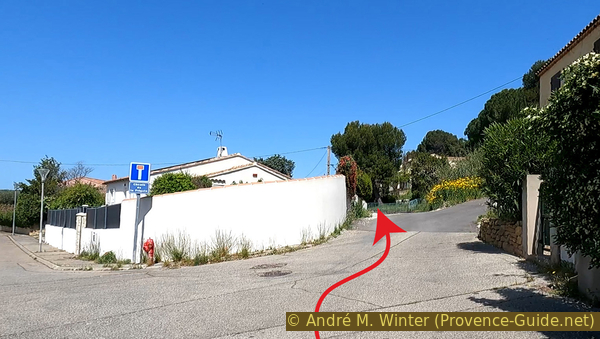
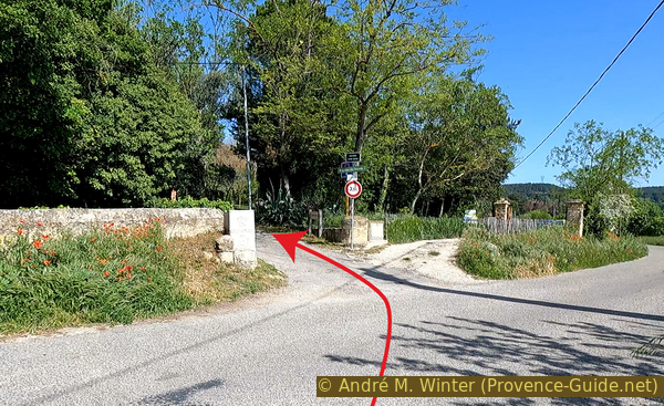
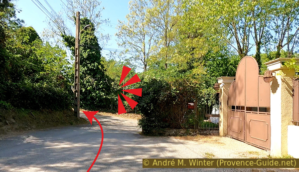
As noted above, there are a lot of linking sections. The longest ones are located before and after the Lavoir des Contagieux car park, which is why we have placed the departure point for those arriving by car here.
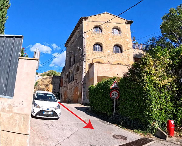
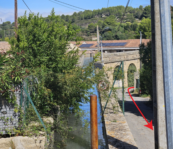
We leave the Lavoir des Contagieux parking lot in the direction from which we came by car. We will have to go back over the hill, but we will take another less monotonous route.
No reproduction is permitted without the written consent of the author. (id7191)
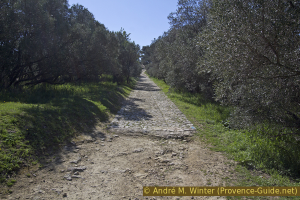
Chemin des Ragues before the wash house
We continue straight on Chemin Cabioch when the main road bends to the right. Chemin Cabioch then turns left.
No reproduction is permitted without the written consent of the author. (id7192)
Chemin Cabioch on the left
At the first intersection, you go straight ahead, to do this you have to go up a little to the right.
No reproduction is permitted without the written consent of the author. (id7193)
Crossing at Chemin Cabioch
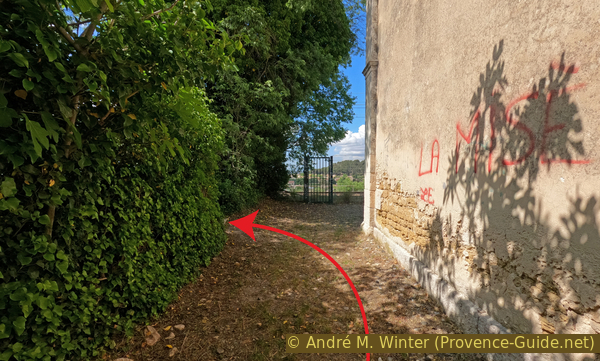
When you arrive in front of several gates of private properties, take upwards to the right and advance to the gate. At the end of the wall a pedestrian path opens on the right which goes up a little before returning in the previous direction.
We pass above a large property with a huge area of lawn that is completely useless for insects and biodiversity, just like the chlorine swimming pool a little further on.
No reproduction is permitted without the written consent of the author. (id7194)
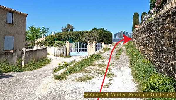
End of the motorable part of Chemin Cabioch
The little-used footpath ends and we have to go up a notch to the right again. This time it takes us a little further up the Allée des Pins. Here on the left. This road goes up a little before going down again.
No reproduction is permitted without the written consent of the author. (id7195)
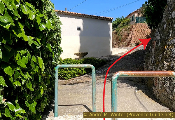
Ascent to Allée des Pins
The advantage of passing through the properties is that we are now on the crest of the hill. Just ride down on the other side along Avenue Seyssaud.
We turn right at the next T-junction.
No reproduction is permitted without the written consent of the author. (id7196)
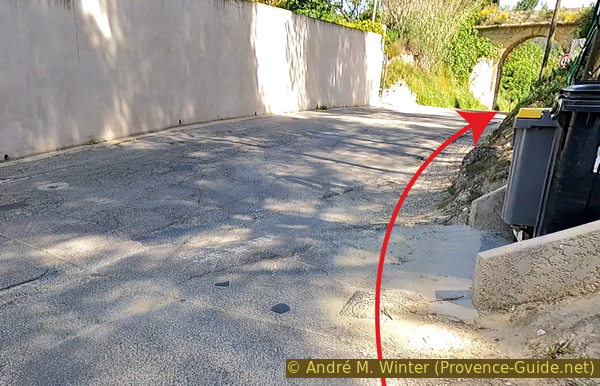
Up under the Pont du Guéby bridge
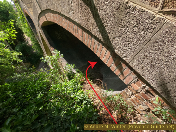
We quickly pass under a bridge carrying the same aqueduct which passes over the Pont de l'Horloge where we will arrive later on this big tour.
No reproduction is permitted without the written consent of the author. (id8124)
The Guéby aqueduct-bridge
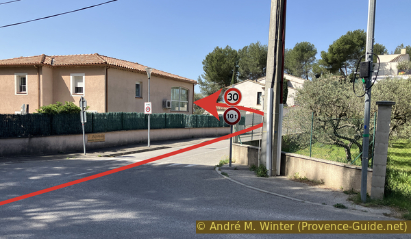
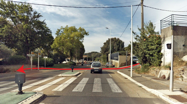
At the bottom, we turn right. Be careful, there is a little more traffic here.
There is a ridiculously narrow cycle lane painted in green.
No reproduction is permitted without the written consent of the author. (id7197)
Avenue Henri Barbusse
We thus arrive at the roundabout to the east of the city which those arrived by car are familiar with. We proceed wisely to take the third exit (no indication). This is the access to the parking lot for the Pont Flavien that we can already see on the right.
We take one of the paths leading to the bridge directly. The closer we get, the more uneven the ground becomes. We ride on the bedrock, the skillful paving of the Romans is now missing.
No reproduction is permitted without the written consent of the author. (id7198)
Roundabout near Pont Flavien
It is the only Roman bridge in the world to have preserved its arches. Its name comes from its promoter, Claudius Donnius Flavius. We know this because the two arches bear this inscription in local Latin: Claudius Donnius Flavius, son of Claudius, flamine of Rome and Augustus, ordered by his will to build this bridge and these arches, under the direction of C. Donnius Vena and C. Attius Rufus.
No reproduction is permitted without the written consent of the author. (id2286)
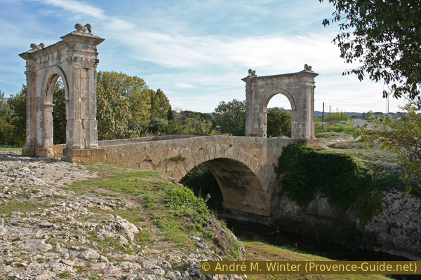
Le Pont Flavien near Saint Chamas
It served as the main bridge until 1944 when an American truck almost brought down the north arch. This was the end of daily use for almost 2000 years. A temporary bridge was then built and it was replaced in 1955 by the current road bridge.
No reproduction is permitted without the written consent of the author. (id2285)
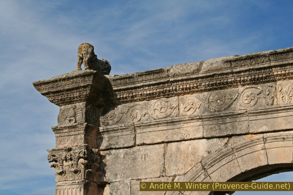
Lion on one of the arches of the Pont Flavien
Section 2: la Touloubre & St. Léger
➙ 1,4 km ... 20 min ➚ 35 m ➘ 15 m ↝ with marks
↙ Colours of the sections like MTB rating but without the duration.
20% easy trails, few marks
<5% stairs, few marks
↖ obligation to push/carry the bike
30% moderate trails, faulty marks
10% Trails with scramble passages, few marks
25% hard-surfaced city alleys, faulty marks
5% forest roads, without marks
5% cross country, without marks
↖ leave the bike and explore on foot
5% forest roads, without marks
The clues
- Pont Flavien, 15 m
- Pont de la Roquette, 15 m
- St. Léger chapel, 35 m
- Under an arch of St. Léger Viaduct, 30 m
We then follow the cause of the existence of the Pont Flavien: La Touloubre river. This small stream has a large watershed and several tributaries. In stormy weather, it can swell considerably, which explains the height of the Pont Flavien. Swimming is prohibited in it because these waters also pass through conventional farming areas polluting soils and rivers.
We therefore cross the Pont Flavien and take the small path before the steps to the left. Above there is a panel with the sites and a map of the heritage trail from which this bike tour is inspired.
No reproduction is permitted without the written consent of the author. (id7199)
South of the Pont Flavien
On the other side of the hill we come immediately down an easy path on the south bank of the Touloubre river.
No reproduction is permitted without the written consent of the author. (id7200)
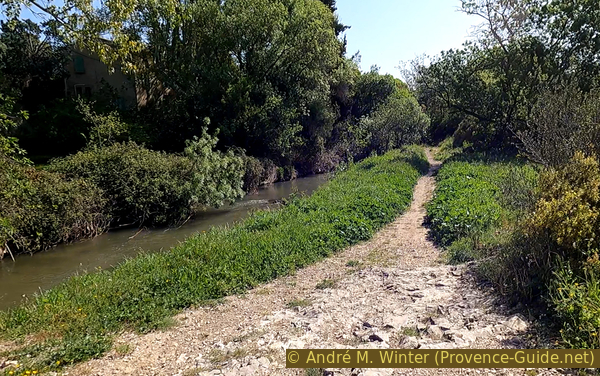
Start of the path on the banks of the Touloubre
Very quickly, rock walls approach. We see that we are in a small canyon dug by the Touloubre river. This is only possible with repeated significant floods.
No reproduction is permitted without the written consent of the author. (id7201)
Path in the Touloubre gorge
A footbridge allows you to change sides because our side no longer leaves room for a path.
No reproduction is permitted without the written consent of the author. (id7202)
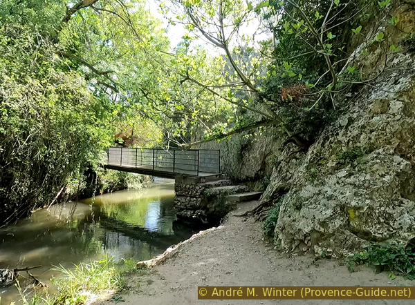
Footbridge in the Touloubre gorge
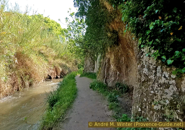
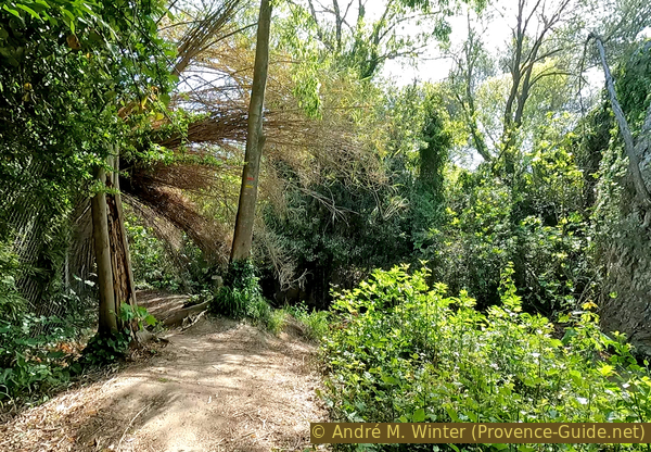
The trail is a little rougher on the other bank. Trees grow irregularly and their roots sometimes create obstacles.
No reproduction is permitted without the written consent of the author. (id7203)
Path along the Touloubre
Further on, there are reeds which make the path quite narrow.
No reproduction is permitted without the written consent of the author. (id7204)
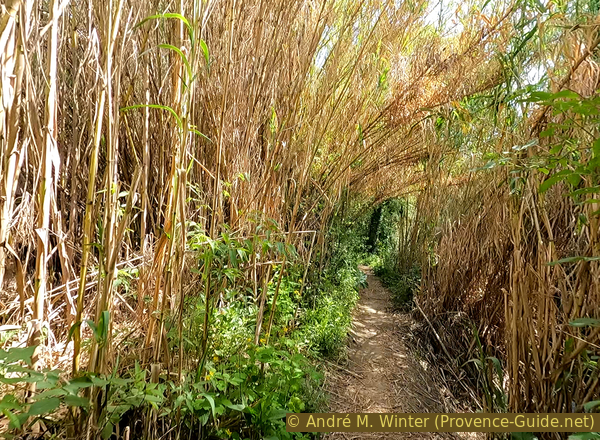
Path lined with reeds along the Touloubre
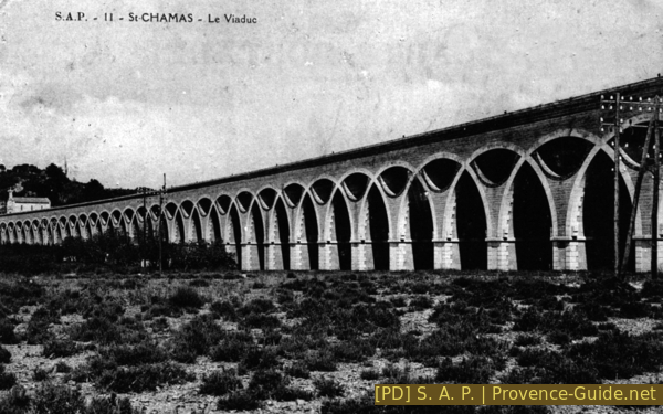
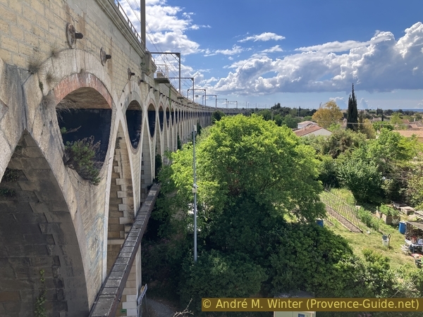
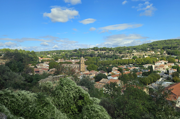
A little further on, we arrive under a large railway bridge. This is the Saint-Léger Viaduc. Since 1847, it crosses the plain created by La Touloubre river over 385 metres.
No reproduction is permitted without the written consent of the author. (id7205)
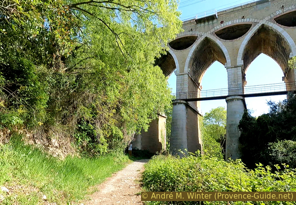
The St. Léger Viaduct passes over the Touloubre
The 49 arches intertwined with each other with hollowed-out spandrels characterize it. This type of construction seems light, but it is not, it is purely artistic and desired as such by Gustave Desplaces. The mass of masonry is almost doubled compared to a conventional brick and stone viaduct. This translates into increased costs for construction and maintenance and this was too much, even in the golden age of the railway in the 19th century. This type of construction will therefore not be continued and this bridge will remain unique in its kind.
We will look at it even more closely at the end of this section. So let's move on below.
The St. Léger Viaduct at the beginning of the 20th century
Just afterwards the path splits into two branches in a reed forest. We stay to the right and near the watercourse. Further on, the path bends to the left. We sometimes bicycle a few centimetres away from the water.
No reproduction is permitted without the written consent of the author. (id7206)
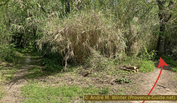
Branching east of the St. Léger Viaduct
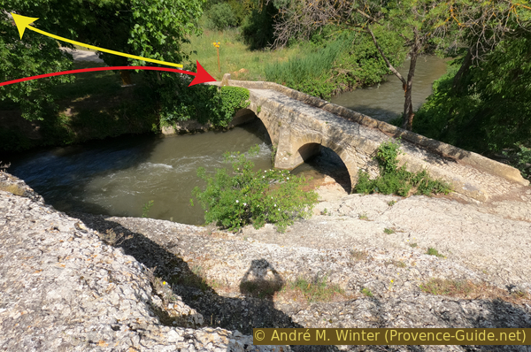
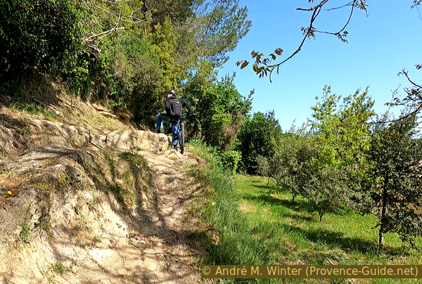
After the bend follows another rock on our path. Pedestrians pass through it by crouching (yellow arrow), but it is not possible to push a bicycle through it. This is the only truly acrobatic passage of the tour. You have to take the bike outside over roots and rocks and then back up the bank. There is enough room for a bike, but not much room for one more person. It's easier with two people when one person holds the bike behind the tree while the other goes in front to take it further.
No reproduction is permitted without the written consent of the author. (id7207)
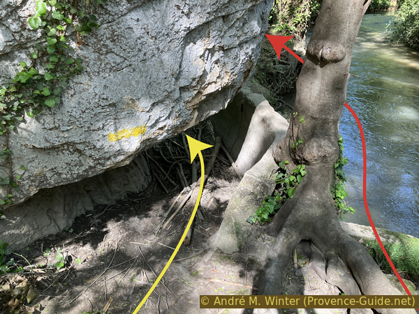
Narrow passage under rock on the banks of the Touloubre
After this very narrow passage, the scenery changes completely. We arrive at a large meadow. Further ahead is another bridge, this one is medieval.
No reproduction is permitted without the written consent of the author. (id7208)
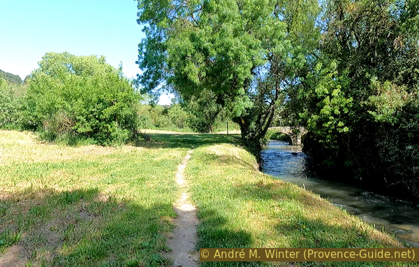
Meadow south of Pont de la Roquette
The current bridge dates from the 18th century because the previous bridge had been swept away by a flood. We recognize here the wisdom of the Romans who built their bridge much higher and which has stood for almost 2000 years.
This bridge, quite close to the Pont Flavien, served as a more direct route for sheep between the farms near the town and the pastures in the Hautes Plaines further to the northeast.
No reproduction is permitted without the written consent of the author. (id7209)
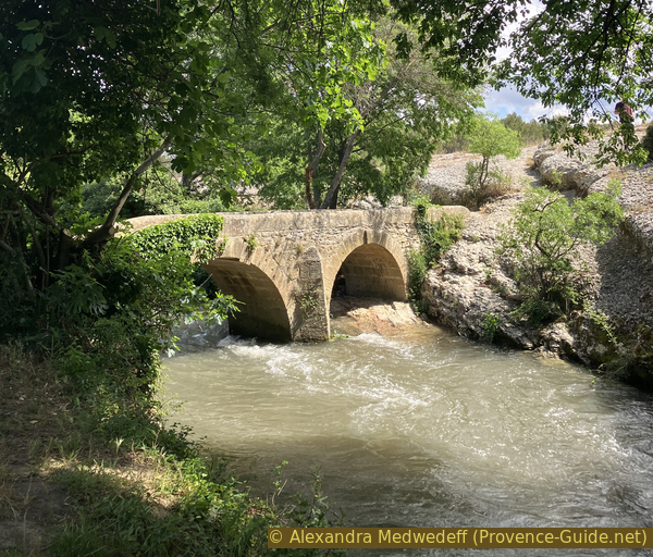
The Roquette Bridge
On the other side of the bridge is a large irregular limestone slab. A trail passes here, but it is almost impossible to ride a mountain bike there. But that's not our direction anyway. We head back in the other direction uphill.
No reproduction is permitted without the written consent of the author. (id7210)
View of the Pont de la Roquette
We come out on a small country road, we turn right.
No reproduction is permitted without the written consent of the author. (id7211)
Crossing of the D70
If you were to turn left beforehand, look back, and surf backwards for 100 years, you would have this view of the viaduct and the chapel.
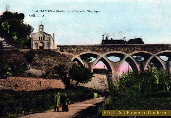
The St. Léger Chapel and Viaduct at the beginning of the 20th century
However, we immediately turn left onto the tarmac climb of Passage Saint-Léger.
No reproduction is permitted without the written consent of the author. (id7212)
Ascent of Passage St. Léger
It goes up and in a particularly dark part our next forest track leaves to the left.
No reproduction is permitted without the written consent of the author. (id7213)
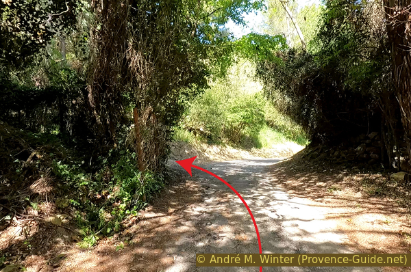
Junction towards Chapel St. Léger and towards the arches of the viaduct
We quickly arrive at a chapel, closed on all sides, located next to the railway line. It is a former priory and a place of pilgrimage where notables were buried.
Only the chapel remains and even this is in poor condition. The masonry stones are dislocated by the vibrations of passing trains.
No reproduction is permitted without the written consent of the author. (id7214)
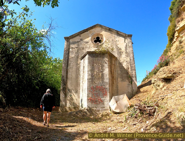
The St. Léger Chapel of St. Chamas
The interior is empty, tagged and blackened by fires. The name of the site, Saint-Léger, was taken over by the current church of Saint-Chamas, without honoring its origins here. The instability is also explained by the fact that the chapel is not in its original location. It was moved here during the construction in 1847 of the viaduct. It served as a place of prayer until the 1930s.
No reproduction is permitted without the written consent of the author. (id7215)
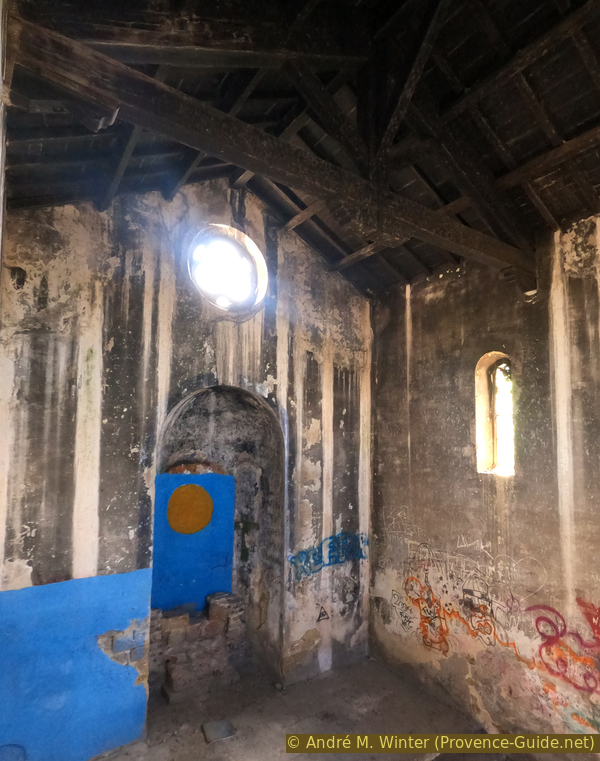
Blackened interior of the St. Léger chapel
To the left of the chapel is a passage through the otherwise dense vegetation. A path passes there, goes down and approaches one of the first arches of the Viaduc Saint-Léger, which also usurps the name of the abandoned site.
You must leave the bike at the chapel.
No reproduction is permitted without the written consent of the author. (id7216)
Access to the intertwined arches of the St. Léger Viaduct
The slope allows you to pass through the first spandrel to the north of the viaduct. Be careful, trains pass regularly on this line, it is noisy and the masonry vibrates.
No reproduction is permitted without the written consent of the author. (id7217)
Arrival at one of the arches of the St. Léger Viaduct
A spandrel is normally the decorated and enclosed upper left and right portion of an arch supporting something. In the case of this very special viaduct, these parts are open and we can pass through one of them.
Not only were we able to enter this spandrel on one side, but we can also exit on a stabilized embankment on the other side.
No reproduction is permitted without the written consent of the author. (id7218)
Under one of the arches of the St. Léger Viaduct
This allows you to have a view of the entire interior curve of the viaduct. This is truly a privileged point of view.
We then go back towards the chapel to ride down to Passage Saint-Léger where we continue to the left in the next section.
No reproduction is permitted without the written consent of the author. (id7219)
The intertwining arches of the St. Léger Viaduct
Section 3: Chemin des Restanques & Aqueducs
➙ 4,3 km ... 25 min ➚ 83 m ➘ 75 m ↝ few marks
↙ Colours of the sections like MTB rating but without the duration.
5% hard-surfaced quiet side streets, with marks
5% easy trails, with marks
↖ natural steps uphill
15% hard-surfaced quiet side streets, with marks
25% dirt roads, few marks
20% hard-surfaced quiet side streets, few marks
20% hard-surfaced city alleys, faulty marks
<5% dirt roads, without marks
<5% easy trails, without marks
10% hard-surfaced city alleys, without marks
The clues
- Chemin des Restanques, 90 m
- Aqueduc de Journet, 40 m
- Hydroelectric power plant, 20 m
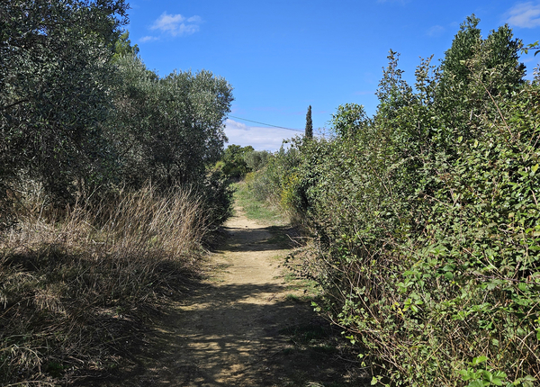
This is the longest and most natural section. We pass through olive groves, oak groves and pine forests. It is a large loop which will then take us back to the city.
The Passage Saint-Léger continues to climb to arrive in front of a house.
No reproduction is permitted without the written consent of the author. (id7220)
End of Passage St. Léger passable for vehicles
To the left continues a simple path with a rocky passage which requires you to push the bikes.
No reproduction is permitted without the written consent of the author. (id7221)
Rocks on Passage St. Léger
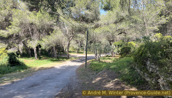
Higher up, you come back to a small tarmac road between a few houses, it always goes up with flatter passages which make the ascent easier.
We arrive at Chemin de la Rabassière where we turn left, but we do not stay there long.
No reproduction is permitted without the written consent of the author. (id7222)
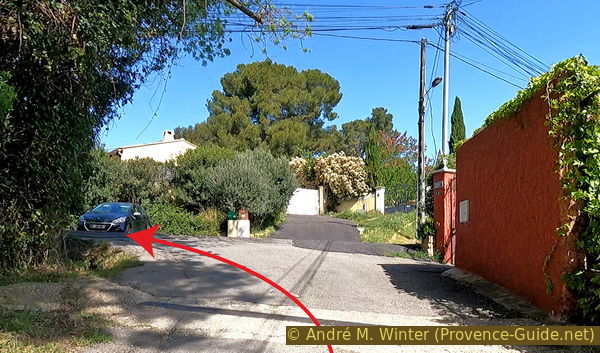
Crossing at Chemin de la Rabassière
The Chemin du Bion goes very quickly to the right and it is where we continue to climb.
Those arriving by train come up from the opposite side and will continue straight on at the end of the tour when returning to the train station.
No reproduction is permitted without the written consent of the author. (id7223)
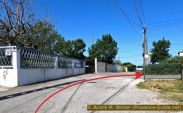
Crossing at Chemin du Bion
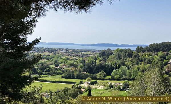
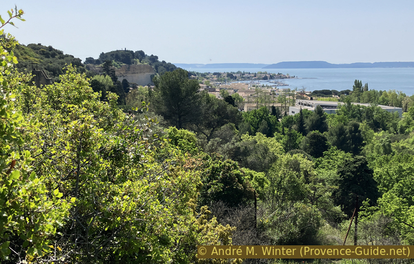
The Chemin du Bion also has its flat parts. Before a left turn, there is a clear view to the right.
No reproduction is permitted without the written consent of the author. (id7224)
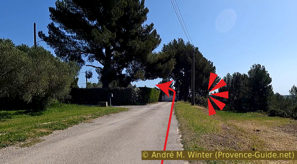
Viewpoint from Chemin du Bion
We see back towards the Saint-Léger Viaduc with the Étang de Berre in the background.
No reproduction is permitted without the written consent of the author. (id7225)
View of Chemin du Bion
When turning, we lose the tarmac under the wheels. We turn left after the last houses and continue to follow this somewhat irregular road. There are many accesses to properties, but the main route is always recognizable. There are also yellow and red markers.
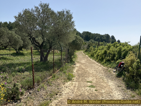
We pass olive fields and oak crops. There are also equestrian centres.
No reproduction is permitted without the written consent of the author. (id7226)
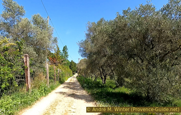
Olive groves of Chemin des Restanques
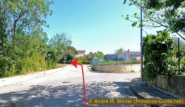
After a few bends, the path becomes straight again and it leads us straight towards the north. When it starts to rise, it takes on a concrete cover and we pass some ruins. We arrive at a crossroads with a signpost in front of a dry stone wall. We turn left there. Subsequently, the marking is only red.
We have been seeing these stone walls for a while. We are also on the Chemin des Restanques. Restanques are cultivation terraces supported by dry stone walls, they are often found in limestone Provence. This terracing with local materials therefore creates flatter land suitable for crops but they also limit erosion by runoff water during frequent storms in the region. These old walls often still fulfill the very important function of soil protection today.
We therefore continue to the left uphill. But it starts to go down very quickly. After 150 metres we turn right.
No reproduction is permitted without the written consent of the author. (id7227)
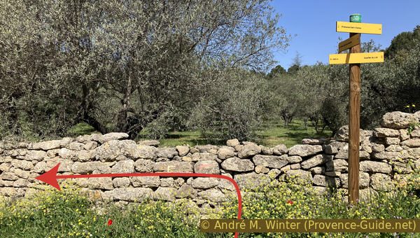
Signpost at the intersection of Chemin des Restanques
We thus descend into a pine forest also very classic in Provence. Pines are not ideal because they are not resistant to forest fires, but they were used to reforest more quickly when there were no more oaks. This is not a recent effect, it started as early as the Greek era. Climate change will also cause them serious problems in the future.
No reproduction is permitted without the written consent of the author. (id7228)
Pine forest of Chemin des Restanques
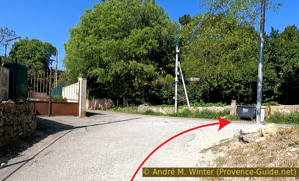
We whiz between the pines because the road continually goes downhill. You must stop at the barely visible stop sign at the intersection of the Route de Grans and cross it. Opposite, Chemin d'Embarben turns left and continues to descend, now between houses.
No reproduction is permitted without the written consent of the author. (id7229)
Crossing the Grans road
We continue in a straight line until a Y junction. The red markings continue to the left, but we turn right.
No reproduction is permitted without the written consent of the author. (id7230)
Junction at Chemin de la Glacière
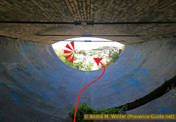
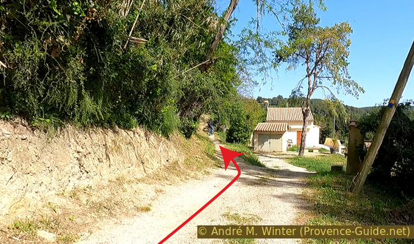
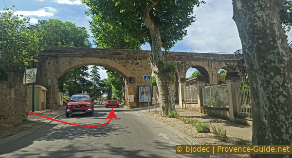
We so quickly arrive at the aqueduct which mainly supplies water to that which passes over the Pont de l'Horloge. We pass under the big arch.
No reproduction is permitted without the written consent of the author. (id7231)
Chemin de la Glacière towards the aqueduct
Just behind is a large brick chimney flue. You can see it even better by turning to the bottom right. The building next door has curious semi-circular windows. It was a thermal electric plant built in 1881 to supplement the hydroelectric plant a little further down (we'll get to that later) in the event of a water shortage in the canal or maintenance. It was the first power station in France apart from hydroelectric plants.
No reproduction is permitted without the written consent of the author. (id7232)
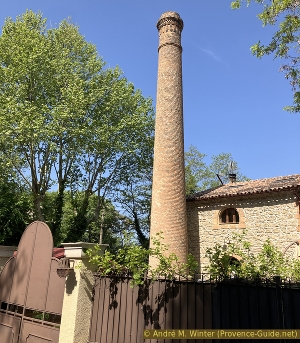
Chimney of the first electrical plant in St. Chamas
However, we turn left at the intersection. It's a very steep climb, but also very short. We ignore the road bridge over the rails and continue straight, downhill again. We see on the other side of the rails another aqueduct. They are definitely everywhere.
No reproduction is permitted without the written consent of the author. (id7233)
Chemin de Journet on the left
We advance uphill on an unpaved road to cross on the pedestrian bridge. It works without getting off the bike. Be careful, on the other side you have to go down to the left, but actually turn right afterwards.
No reproduction is permitted without the written consent of the author. (id7234)
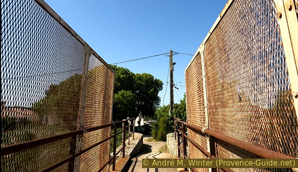
Journet pedestrian crossing on the railway line
We may not have realized it, but we crossed the aqueduct at the same time as the railroad tracks. We can see it a little better in front. The Journet Aqueduct is a secondary water pipe feeding the main canal that we saw earlier and that we will see even more often later.
We continue straight ahead to cross the rails again on the road bridge and to pass again in front of the electrical power plant.
We then turn left to pass this time under the rails. The Chemin de la Glacière descends towards the D10 road which crosses St. Chamas. You should know that the canal seen above runs parallel to it, but it is in a penstock going downhill.
No reproduction is permitted without the written consent of the author. (id7235)
Journet aqueduct along the railway line
Shortly before joining the D10, we see on the left a medieval style building with windows similar to the thermal power plant. It was the hydroelectric power station which had the main responsibility for lighting the city and the Poudrerie plant.
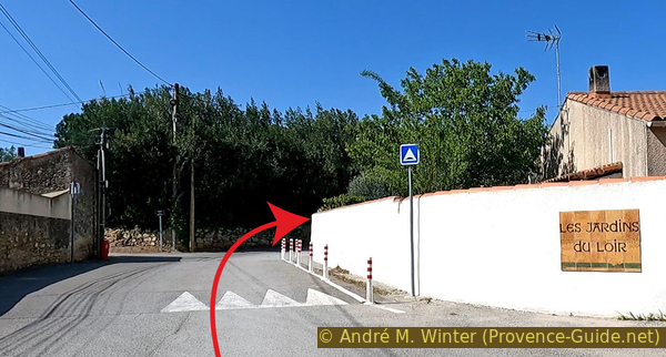
We cross the road below to use a pedestrian way towards the road further down. Here, we turn left.
No reproduction is permitted without the written consent of the author. (id8125)
The former St. Chamas hydroelectric power station
We cross the road below to use a pedestrian way towards the road further down. There, we turn left.
Intersection of the D10 at the aqueduct
Section 4: Auqueduc & Pont de l'Horloge
➙ 1,2 km ... 15 min ➚ 35 m ➘ 60 m ↝ with marks
↙ Colours of the sections like MTB rating but without the duration.
25% hard-surfaced city alleys, without marks
50% forest roads, faulty marks
5% moderate trails, without marks
10% rutted dirt roads, few marks
5% stairs, few marks
↖ obligation to push/carry the bike
5% easy trails, few marks
↖ obligation to push/carry the bike
<5% stairs, few marks
↖ obligation to push/carry the bike
The clues
- Hydroelectric power plant, 20 m
- Aqueduc du Guéby, 20 m
- Plateau de la Moulière, 50 m
- Pont de l'Horloge, 20 m
We have already seen parts of the aqueducts supplying St. Chamas. In this section, we continue their exploration.
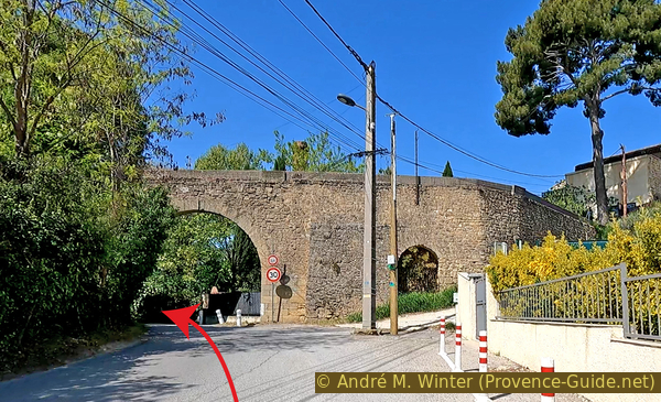
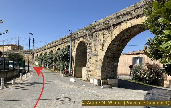
We continue downwards and cross the D10 at the pedestrian crossing.
We see that the aqueduct is interrupted by the road, it passes through a penstock below. The arches apparently obstructed traffic.
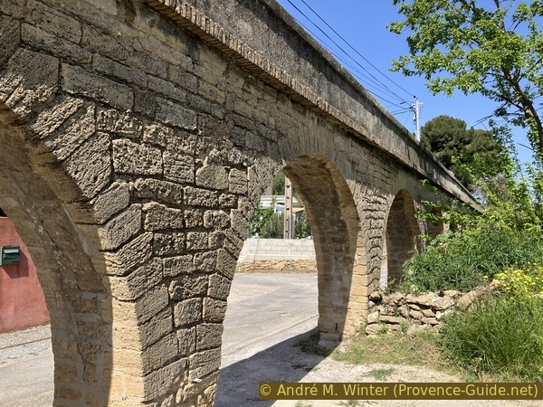
Just to the right of the resuming aqueduct is a passage to Avenue Saint-Exupéry below. In the photo, we ride down to the height of the mirror on the left. Do not continue along the aqueduct, it is a private passage, and turn left to pass under the large arch in the direction visible in the photo.
Proceed to the small roundabout that follows and turn right onto Chemin des Moulières.
No reproduction is permitted without the written consent of the author. The permission of use was kindly given to Provence-Guide.net on 12 May 2024. (id7236)
The Guéby aqueduct in St. Chamas
In a few metres, we find our aqueduct again. It is called Canal du Guéby (a district of Saint-Chamas) or Aqueduct of Boisgelin, it is the name of the ecclesiastic Jean de Dieu-Raymond de Boisgelin who as bishop presides over the states provincial of Provence. In this role, he raised funds for the construction of canals from 1773. Thus was created the Canal des Alpines which passes through St. Rémy de Provence and of which the rest of the waters and the continuation of the installations were found in the aqueduct that we have here before our eyes.
No reproduction is permitted without the written consent of the author. (id7237)
Guéby Canal in St. Chamas
In any case, we continue to the left of the canal. It is almost horizontal and thus we arrive at the height where it turns into an underground canal. It passes in the north-eastern slope of the elevation on which we are currently climbing. Concretely, it passes under our street.
No reproduction is permitted without the written consent of the author. The permission of use was kindly given to Provence-Guide.net on 5 November 2025. (id8187)
The open Guéby aqueduct in St. Chamas
The street continues to climb and runs alongside a wall. At the end of it, we turn right onto a forest track. We continue straight on the first fork.
No reproduction is permitted without the written consent of the author. The permission of use was kindly given to Provence-Guide.net on 5 November 2025. (id8188)
Forest track to proceed towards the edge of the cliff
This track is turning left and it now runs alongside a fence. Behind, we recognize old industrial installations and further on, we see the green area of La Poudrerie reclaimed by nature and actively renatured.
No reproduction is permitted without the written consent of the author. (id7238)
Moulières forest track on the edge of La Poudrière
The map of the Heritage Trail says that you can see the Poudrerie clearly from here, but that must be from a time when the vegetation did not cover everything. We hoped to see the Tour de Safre emerging here, but in fact, this surveillance tower of the explosives production site certainly exceeds the hill seen from below, but not the ridge on which we pass. By twisting the fence and the neck, it is still visible. It's the stepped construction in the top left corner of the photo.
No reproduction is permitted without the written consent of the author. (id7239)
Tour de Safre and Saint-Chamas seen from Moulieres
The track is in changeable condition and we arrive in a wasteland which was an old stone quarry. There are some original sculptures there.
The cyclist must look for a path that passes, the one at the bottom works well in any case.
No reproduction is permitted without the written consent of the author. (id7240)
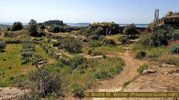
St. Chamas stone quarry
We then fall back onto another forest track and pass next to a barrier. In a short time we are at the viewpoint above the Pont de l'Horloge.
The photo is taken going down to the left of the viewpoint.
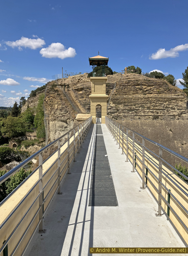
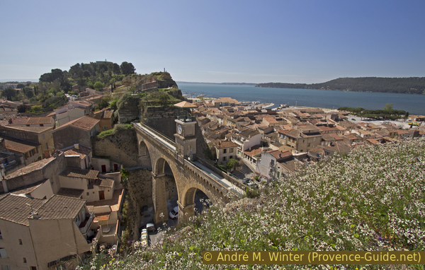
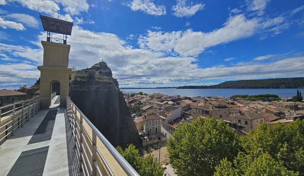
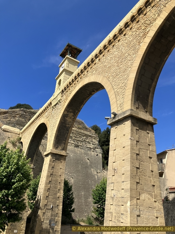
This bridge is a replacement for La Goule. This was the tunnel in the longitudinal hill that separates the two parts of St. Chamas. Above this underground passage also passed the aqueduct. Apparently the stone had been dug too much or the water from the aqueduct had washed out the soft limestone. In any case, on December 18, 1863, La Goule collapsed. The city was both cut in two and deprived of water. The clearing takes long and a temporary wooden canal is being built as quickly as possible for irrigating the crops. The massive pile of rocks is used later to create the flat areas of the port.
At the height of the canal at 23 metres, the breach is 63 metres wide. This is therefore the size of the masonry aqueduct whose construction began in 1868. It did not have a clock at the beginning, hence its banal initial name of Aqueduc du Plan. The 1902 date of the clock installation is only visible from the street.
No reproduction is permitted without the written consent of the author. (id7244)
The aqueduct bridge between the Moulières and Baou hills
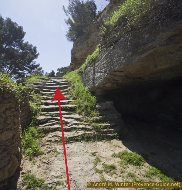
The descent to the Pont de l'Horloge is an irregular and narrow staircase in two parts and there are almost always people on the bridge and on these stairs. You must therefore push the bike (also on the bridge) and let any pedestrian pass with priority.
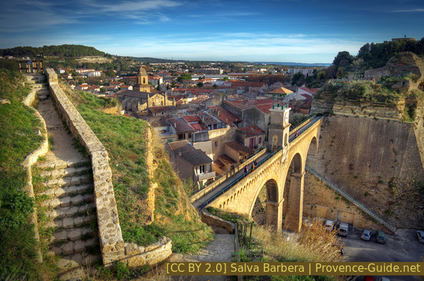
The staircase north of the Pont de l'Horloge
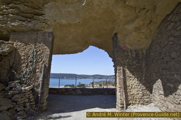
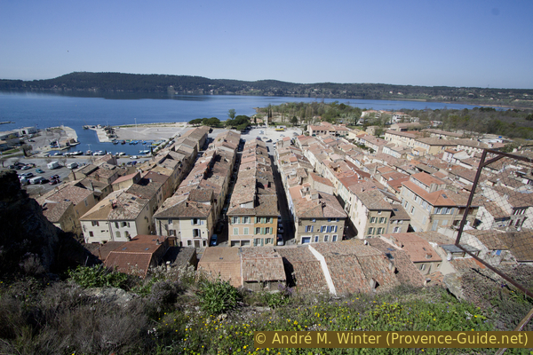
The bridge gives views of both parts of the city.
No reproduction is permitted without the written consent of the author. The permission of use was kindly given to Provence-Guide.net on 5 November 2025. (id8189)
On the Clock Bridge of St. Chamas
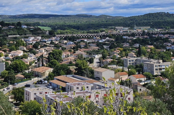
The photo shows Pertuis on the waterside with its regular built 19th century workers' dwellings. On the other side is the Delà district with more irregular streets. Here are the shops and the town hall.
No reproduction is permitted without the written consent of the author. (id5431)
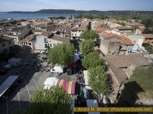
St. Chamas market and Étang de Berre
On the other side of the aqueduct bridge follow other stairs, here also going down. We continue to push the bikes.
Continue straight down the stairs and cross the alley which is in fact a long stair. We can now get back on the bikes to move towards a hairpin bend. Here on the right uphill on Chemin des Baumes.
No reproduction is permitted without the written consent of the author. (id7246)
Escalier de la Goule Charrier after the aqueduct bridge
Section 5: Le Baou & Le Pertuis
➙ 2,3 km ... 20 min ➚ 50 m ➘ 65 m ↝ few marks
↙ Colours of the sections like MTB rating but without the duration.
15% hard-surfaced city alleys, without marks
5% stairs, few marks
↖ obligation to push/carry the bike
30% easy trails, without marks
5% dirt roads, without marks
5% easy trails, without marks
↖ leave the bike and explore on foot
5% easy trails, without marks
5% difficult trails, without marks
↖ natural steps downhill
<5% moderate trails, without marks
↖ passages too narrow and to carry/push
<5% stairs, without marks
25% hard-surfaced city alleys, faulty marks
The clues
- Pont de l'Horloge, 20 m
- Le Baou hill, 50 m
- Le Pertuis, 5 m
The Baou hill is what remains of the long ridge since the collapse of La Goule. The canal still runs underground on the east side. This ridge is perforated on all sides and we try to see certain artificial cavities.
You will often have to push the bike or leave it when going back and forth in this section.
We therefore ride up the Chemin des Baumes and take the first lane which goes up to the right, it is the Montée des Pénitents.
No reproduction is permitted without the written consent of the author. (id7247)
Montée des Pénitents
In front of a yellow house, this road climbs considerably to go around it. Higher up, it is flat and ends in front of a last small house.
No reproduction is permitted without the written consent of the author. (id7248)
Cul de sac of Montée des Pénitents
To the right is a large hole in the cliff. The site appears to be used as a parking lot, but initially these cavities housed hangars. When you move forward, you have a vertical view of the houses of Pertuis.
We bicycle back to Chemin des Baumes where we turn right, again uphill of course.
No reproduction is permitted without the written consent of the author. (id7249)
Breakthrough in the Baou crest
This motorable road turns into a path and a first obstacle arises for cyclists: natural steps on the limestone stratum.
No reproduction is permitted without the written consent of the author. (id7250)
Chemin des Baumes going up to the east of Baou
After a flat area, we pass an old fortification. It was home to the first village of Saint-Chamas in the 7th century. From the 17th century, the medieval ramparts were dismantled to be used for the construction of new districts and the village. The only vestige of this period is the Fort gate whose fortifications date from the 15th century.
No reproduction is permitted without the written consent of the author. The permission of use was kindly given to Provence-Guide.net on 5 November 2025. (id8190)
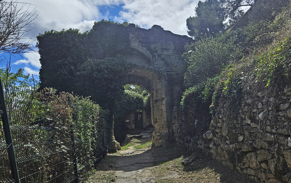
Porte du Fort
Behind the gate there are steps uphill. It's quite a pain to get a bike up here. But the only road going up is on the other side of the hill.
No reproduction is permitted without the written consent of the author. (id7251)
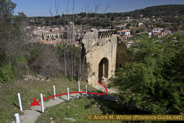
Porte du Fort
We arrive at a road which goes up to the right towards a large water reservoir surrounded by trees and therefore without a view. At the same time you find below a large intersection on the hill. Just after the road towards the reservoir there is a path on the right parallel to the road. We take this one. The path passes near the abyss, the vegetation may be difficult for cycling, if in doubt, it is better to leave the bike at the crossroads and continue on foot.
This path then passes over the ridge and you can see on both sides into the town. You can go quite far until you reach a fence which is at the height of the yellow house on the Montée des Pénitents.
No reproduction is permitted without the written consent of the author. (id7252)
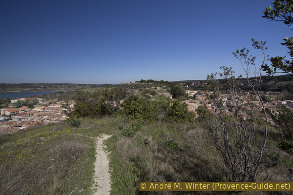
Baou Ridge north of the water tower
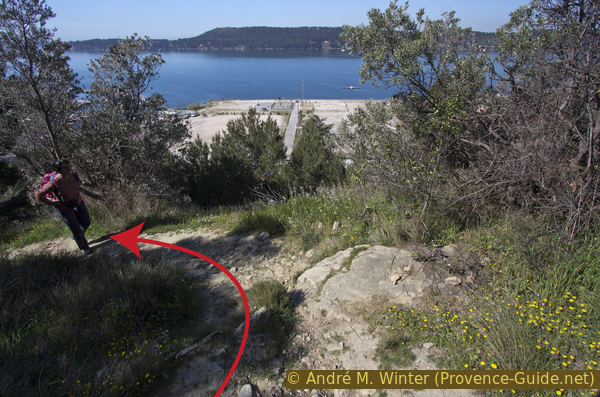
The city views from both sides are magnificent. Here is the very regular Pertuis district on the port side.
No reproduction is permitted without the written consent of the author. (id7253)
Rregular rows of houses in the Pertuis district
On the other side is the more densely populated neighborhood.
No reproduction is permitted without the written consent of the author. The permission of use was kindly given to Provence-Guide.net on 5 November 2025. (id8191)
Quartier du Delà at St. Chamas
Far away in front lays the perched village of Miramas-le-Vieux.
However, we cannot advance far enough to see over the Pont de l'Horloge. The ridge here is too narrow.
We return on the same path towards the junction on the ridge.
No reproduction is permitted without the written consent of the author. (id7254)
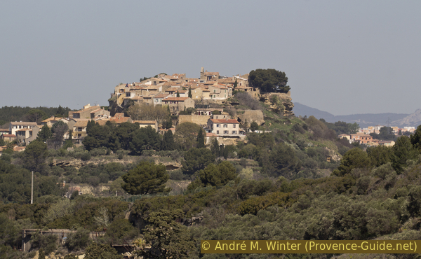
Miramas le Vieux on its rocky mound
Now we move south to see the chapel on the other highest point. We see in front of us an irregular pavement and steps, it's another opportunity to decide if we want to go there by bike or on foot because we have to return to this intersection afterwards anyway.
No reproduction is permitted without the written consent of the author. (id7255)
Paved path going up to the Baou chapel
We quickly reach the Notre-Dame de la Miséricorde Chapel. It is known in Saint-Chamas under the name of Chapelle de la Vierge (Chapel of the Virgin).
It is perhaps the oldest religious centre in the municipality when the village of Saint-Chamas was protected within its ramparts at the top of Le Baou. A chapel has existed here since the 7th century, but it is not the one we see today. Some of his ex-voto and naive paintings have been restored and are in the Paul Lafran municipal museum at the southern stairs of the Pont de l'Horloge.
No reproduction is permitted without the written consent of the author. (id7256)
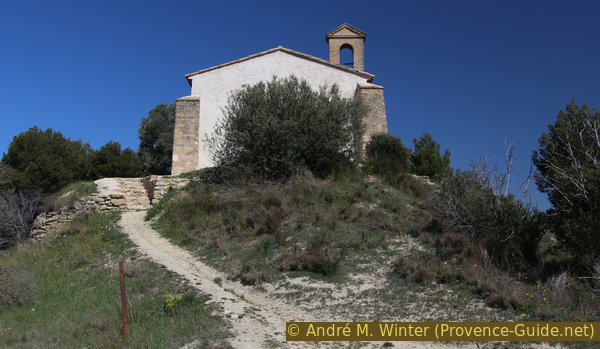
Notre-Dame Chapel on the Baou
Coming back down towards the crossroads, you can deviate through the olive grove for another good view of the Étang de Berre and the port of Saint-Chamas.
No reproduction is permitted without the written consent of the author. The permission of use was kindly given to Provence-Guide.net on 5 November 2025. (id8192)
Viaduc St. Léger as seen from Le Baou
We also see back to one of the monuments from the beginning of the tour.
No reproduction is permitted without the written consent of the author. (id7257)
Olive trees on the Baou
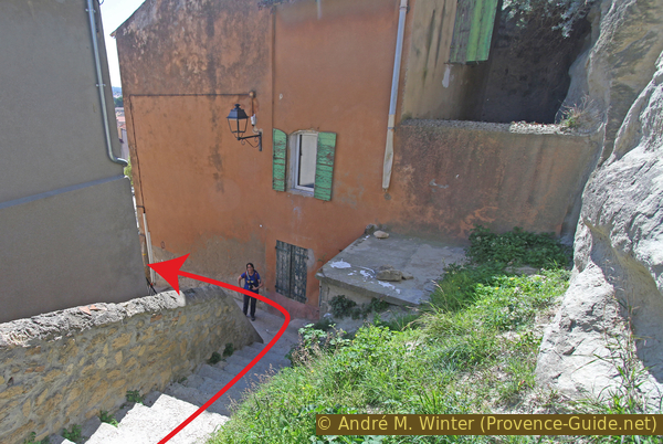
We take another difficult path to descend. It's even difficult when mountain biking, you will probably have to get off the saddle at certain times. This is the downhill path on the left coming from the chapel. The path quickly becomes steep but stays still quite wide. Further down follow two bends, at this point the photo was taken. After the last bend, we pass through a narrow gully filled with stones fallen from higher up and finally follow long steps downhill.
No reproduction is permitted without the written consent of the author. (id7258)
Path to Rue du Baou
Before arriving at the bottom, we have a good view of the west cliff of Baou. The lower part is coated with cement to stabilize the rock, but in the upper part, we see the various openings created including the one through which we looked earlier into the Montée des Pénitents. This cliff is almost scary, but half the city lives peacefully at its foot.
No reproduction is permitted without the written consent of the author. (id7260)
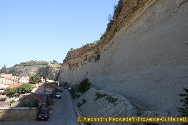
West face of the Baou
We move straight under the cliff to return under the Pont de l'Horloge. It is there in all its splendor. The clock optically raises it beyond 23 metres in height.
We turn our backs on the Pont de l'Horloge and aim for the rows of regular houses in the Pertuis district. When cars have to turn right, we can turn left into Rue de la Fraternité.
No reproduction is permitted without the written consent of the author. (id7268)
Under the arches of the Pont de l'Horloge
Further on, you can take any alley on the right. They are all similar even if they are not identical. These were initially fishermen's homes, subsequently, workers from the nearby Poudrerie lodged here.
If you take Rue Marcel Roustan, you arrive directly at a large square which serves as a parking lot on market days. Backing up a good distance, there is a good view back over the cliff that separates the town from St. Chamas.
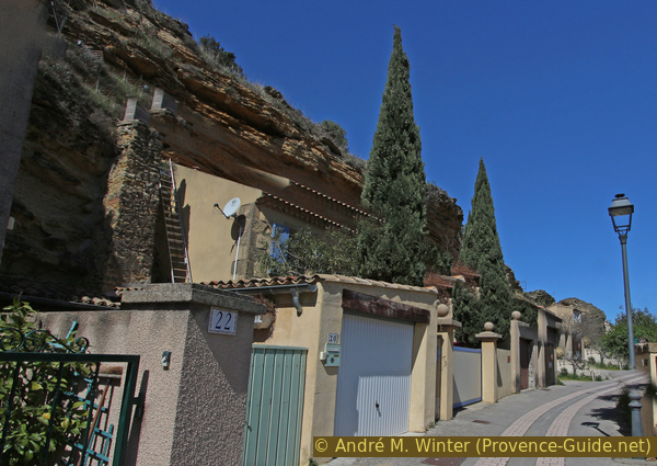
The artificial cavities form an important troglodytic habitat, unique in its characteristics in Europe. Some caves cross Le Baou, one can access the east side to be able to look westwards over the roofs of Pertuis as we did from the ridge, over the port and of course over the Étang de Berre. These caves mainly served as cellars, barns, warehouses and stables. Oil mills and wine presses were also installed there. It is only today that some of these cavities have been transformed into homes.
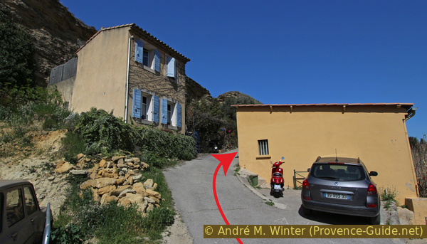
We leave the main square towards the south, therefore with Le Baou on the left. We are forced to go around the fishing port basin and then, in principle, we continue straight along the new developments at the back of the Plage des Cabassons.
No reproduction is permitted without the written consent of the author. (id7261)
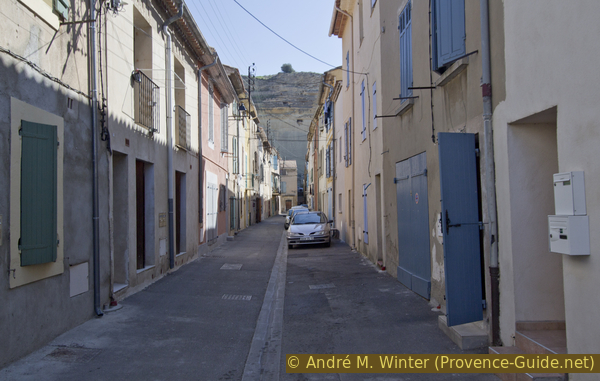
Street in the Pertuis district of Saint-Chamas
Section 6: Étang de Berre & Lavoir
➙ 2,2 km ... 15 min ➚ 12 m ➘ 15 m ↝ with marks
↙ Colours of the sections like MTB rating but without the duration.
70% hard-surfaced city alleys, faulty marks
5% dirt roads, without marks
20% hard-surfaced city alleys, without marks
5% dirt roads, few marks
The clues
- Le Pertuis, 5 m
- La Digue, 2 m
- Lavoir des Contagieux, 3 m
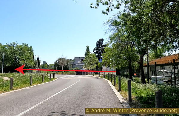
The very flat return to the starting point and the visit to the old wash house.
Further on follows the marina and then you get closer to the shore. There is a rarely used sidewalk here that can be used as a cycle path.
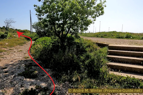
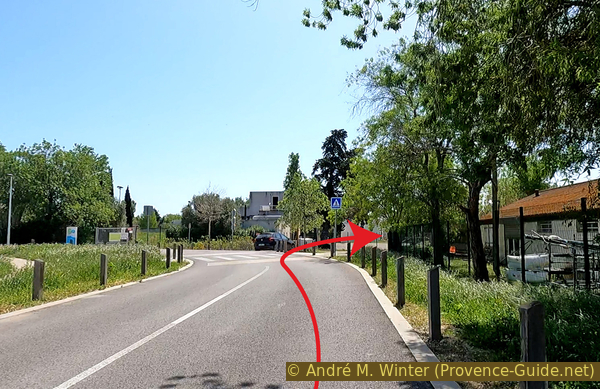
At the height of the photo, the hiking trail deviates towards the coast, but the rocks there are prohibitive for cycling and mountain biking. We continue straight along Chemin des Ragues.
No reproduction is permitted without the written consent of the author. (id7262)
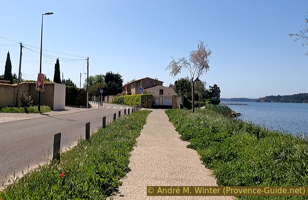
Sidewalk parallel to Chemin des Ragues
It is possible to go back and forth on the flat dyke past a dark red house on the right.
No reproduction is permitted without the written consent of the author. (id7263)
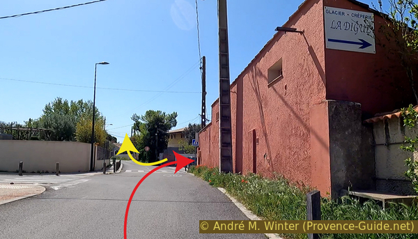
Chemin des Ragues before La Digue
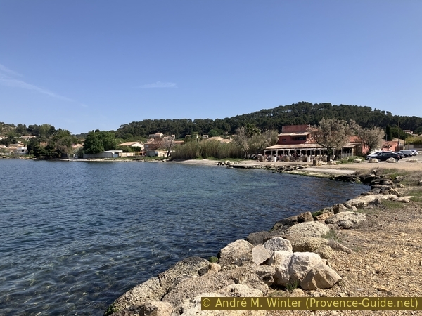
We have a good view back on St. Chamas, on the chapel on Le Baou and Miramas-le-Vieux. There is also a waterside bar here.
We ride back to the Chemin des Ragues for a final flat portion back to the Lavoir des Contagieux parking lot.
No reproduction is permitted without the written consent of the author. (id7243)
La Digue de St. Chamas
Those parked here will find their car, those who came by train take to section 1 until the start of section 3 to return to the SNCF station.
But for both, there remains the visit to the very original wash house.
No reproduction is permitted without the written consent of the author. (id7264)
Chemin des Ragues before the wash house
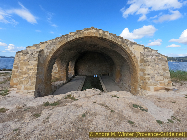
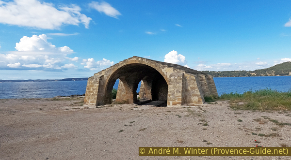
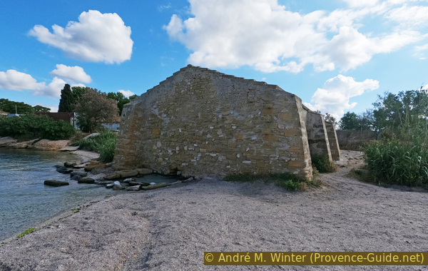
The wash house is located directly on the edge of the Étang de Berre on a source which arises precisely here. The name Lavoir des Contagieux (wash house of the infectious) or Lavoir des Pestiférés (wash house of the lazar) comes from washing the laundry of the sick in 1720 during the Great Plague in Provence. However, the plague did not affect the commune thanks to the strict blockade established by the Marquis Charles de Tubières de Caylus, lieutenant general of the King's armies in Provence. This name therefore does not do justice to the washhouse because it was mainly used by carders for washing sheep's wool.
No reproduction is permitted without the written consent of the author. (id7265)
Washhouse on the edge of the Étang de Berre
It was built in the 18th century on the site of an old fountain. Its other names are Lavoir des Ragues (a rague is a water hole like the source on which the washhouse is located) or Lavoir du Polygone (a shooting polygon existed here in connection with the black powder plant).
No reproduction is permitted without the written consent of the author. (id7266)
Washhouse in St. Chamas
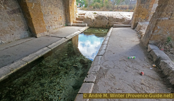
At the back, its water flows directly into the Étang de Berre.
Here ends this big cultural and historical tour around St. Chamas. The historical information is quite meager, if you know more details especially on the power plants presented at the end of section 3, we would be happy to learn about (form at the bottom) and add this information to this page.
No reproduction is permitted without the written consent of the author. (id7267)
The washhouse is closed on the Etang de Berre side
Sources and additional information
It is better to use a good topographic hiking map: this tour is on the IGN maps "Étang de Berre, Istres, Marignene, Martigues", 3144OT for the southern part and "Salon-de-Provence, Miramas", 3143OT for the northern part. Both scale 1:25000.
If you don't want to bother with a paper map, you can also use mapping apps on your cell phone. On the one hand, it is the Cartes IGN app from the official map service. However, it requires access to the data network and this is sometimes difficult in canyons or remote locations.
Alternatively, you can use apps that store data directly on the device. They're generally not free, but they don't cost much. We mainly use OSMAnd, here it is possible to add contour lines, relief shading, markings and others. To store this data on your phone you need a lot of space.
Of course, one needs access to satellites for the GPS signal with any app. In some canyons this is not the case. Therefore, do not rely on the position shown, but read the map on your phone as you would read it on paper. Most apps are available for Android and iPhone. The applications usually allow us to record the route travelled and also view the GPS files offered for each of our hikes.
This page has been seen 2334 times since 20 March 2024.