The Bérigoule caves
Today we explore them easily, but the Waldensians hid and perished here
scramble
difficult
1 h 30 min
no
no
shelter
walk
Introduction
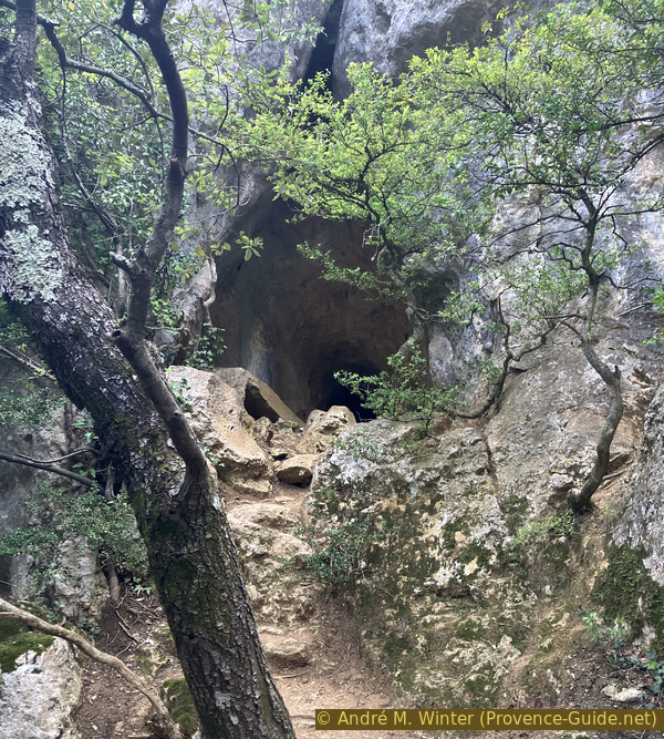
It is rare to be able to explore several caves with very different appearances in the same place, just a few steps from a road and a parking lot. We are here on the eastern slope of the Combe de Bérigoule. It is one of the many dry valleys in the Lubéron plateau. Here, this slope forms a cliff about twenty metres high and the caves are all at the foot of that rock wall.
These caves are also the site of a religiously motivated massacre in the 16th century. The Waldensians are a large group of believers with a Christian base, but renouncing all wealth. They are therefore in strong opposition to the kleptokratic catholic church, which declares the Waldensians heretics and persecutes them. Originally from Lyon in the 12th century, the Waldensians also settled massively in Provence to integrate well and persist until the 16th century. However, since 1540, the lords and bishops of Provence began a war against the Waldensians of the Luberon.
22 villages were burned in April 1545. Fleeing the massacres, 25 Waldensian women and children fled to Murs. This village gave support to the Waldensians for a long time. They took refuge in the Bérigoule caves. Their cache was revealed in the week of April 20 to 27, 1545 to the representative of the Pope's vice-legate in Avignon. In front of the caves, he summons the Waldensians to surrender, but they do not move. The catholics then light fires to suffocate them all. The bones were found in the 20th century to prove this massacre in the name of the catholic church. Although a large part of the Waldensians were murdered during these massacres, they continued attacks against catholics until the end of the wars of religion in Provence in 1595.
The facts
2,5 km total distance
1 h 30 min walk time
110 m total elevation
orientation average
mark 65% of the total distance
65% forest roads
20% moderate trails
10% trail through a cave
dangers dark caves
children only with experience
useful picnic stuff
required trekking boots, headlamp, helmet, hiking equipment and water
GPS coordinates (WGS84) of start and end point 43.974129,5.255555
downloads ![]()
![]()
Public transport
There is no public transport to reach the starting point or nearby villages. The site is 22 kilometres away from Apt. This city can be reached by regional lines, see Zou! (only french)
Access by car
We are in the northwest part of the Luberon.
From the south, we reach Cavaillon on the A7 motorway. First follow the signs towards Apt, then towards Gordes. In the center of the village, take the road uphill towards Murs at the roundabout near the castle. Continue towards Sault for five minutes.
From the Durance Valley, go up via Volx, Saint-Maime and Céreste towards Apt. Here towards Sault, then towards Cavaillon and shortly after towards Murs. Continue towards Sault for five minutes.
From the north, join the D4 road under Venasque and continue towards Murs. At the intersection with the D15A, continue towards Sault and do the same at the next intersection. Continue in this direction for three minutes.
In any case, locate the Chemin de Bérigoule sign on the left.
Useful parking spaces
There is enough space at the start of Chemin de Bérigoule.
No reproduction is permitted without the written consent of the author. (id7386)
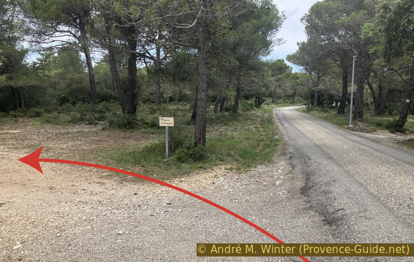
Chemin de Bérigoule starting from Route de Sault D15
Hints
The caves are of different difficulty. Follow the directions in the different sections. In any case, headlamps are needed for everyone. A helmet is recommended at least for the Grotte au Petit Trou. A bicycle helmet does the job.
You can approach the forest trail by bike in five minutes. Bikes can be locked at the electric pole near the final climb.
The whole region is a zone with a high risk of forest fires. In summer, but also in other seasons when it is very dry or by strong winds, access to the forest areas can be regulated. As a result, the roads may be closed to traffic and/or the trails prohibited to hikers. Current information: Map for access to the forests of the Vaucluse department (also english). The map shows the colours green, yellow, orange and red which correspond to levels of danger.
The sections
- Access to the cliff of Bérigoule
- The cave with the oblong section
- The cave with natural arches
- The cave full of soot
- The cave with the little hole
- The cave with parallel galeries
- Return to the starting point
Section 1: Chemin de Bérigoule
➙ 0,9 km ... 20 min ➚ 40 m ➘ 5 m ↝ easy
90% forest roads, few marks
10% moderate trails, cairns
The clues
- Parking at the start of Chemin de Bérigoule, 585 m
- Cairn, 590 m
- Foot of the cliff, 620 m
An easy approach and a short, steep climb.
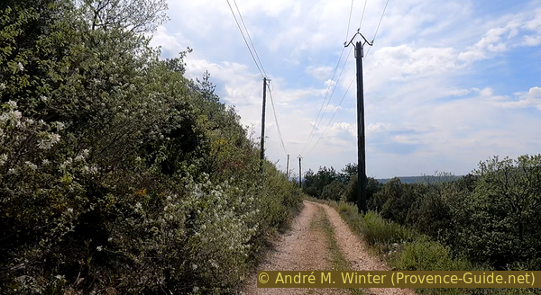
We take the Chemin de Bérigoule, the municipal sign calls it Barigoule. It goes up a little, then we go down towards another forest track. It is bordered by electrical poles on the left and telephone poles on the right. There is yellow marking here. It goes down a little and then rises gently up again.
No reproduction is permitted without the written consent of the author. (id7403)
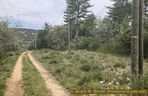
Yellow marker on the Chemin de Bérigoule
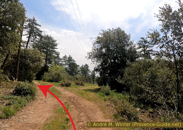
The road makes several small bends and we continue for a few minutes until we find a large cairn on the right. This is the sign for us to go up to the cliff on the right.
No reproduction is permitted without the written consent of the author. (id7404)
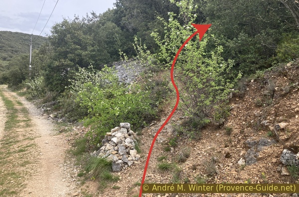
Cairn on the way up to the Bérigoule caves
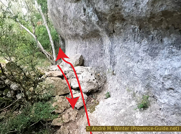
The path goes very directly up the wooded slope. We pass a few more cairns.
No reproduction is permitted without the written consent of the author. (id7405)
Ascent to the Bérigoule caves
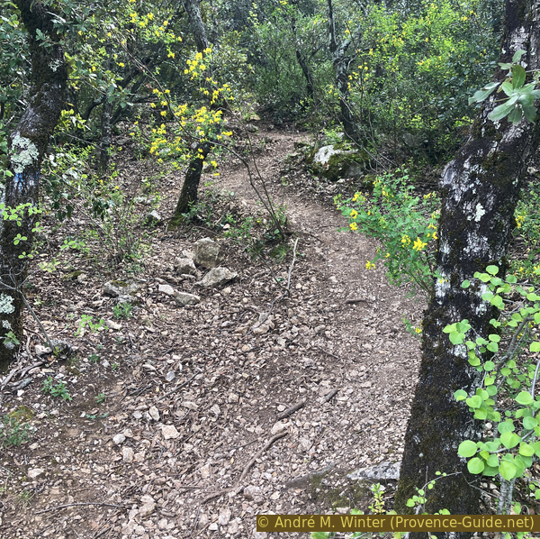
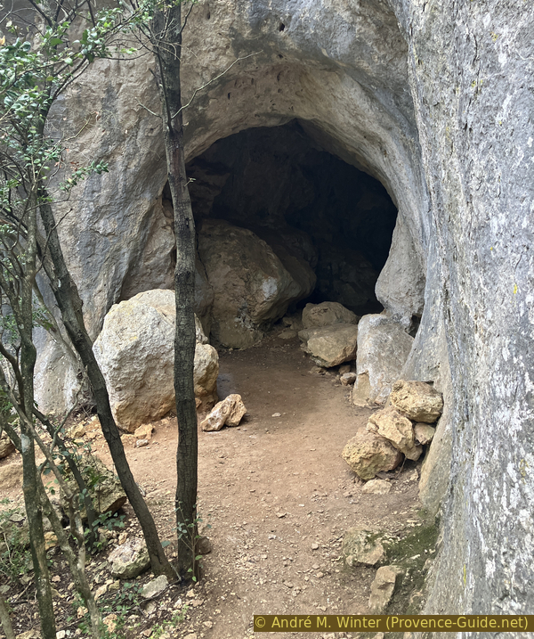
We arrive at the foot of the cliff at two openings too small to access. We take a left here.
No reproduction is permitted without the written consent of the author. (id7406)
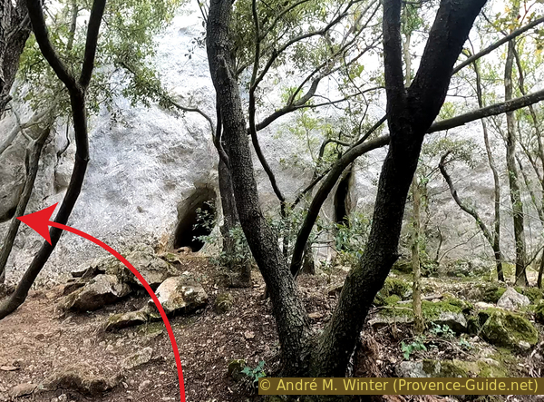
The first caves of Bérigoule are not easily accessible
Section 2: Grotte oblongue
➙ 0,1 km ... 10 min ➚ 5 m ➘ 10 m ↝ average
20% moderate trails, cairns
80% trail through a cave, without marks
The clues
- Foot of the cliff, 620 m
- Rectilinear cave, 625 m
A surprising hole the size of a human being, a little oblique though.
You need a headlamp for the back part of the cave. A helmet is useful. The ground is flat.
We advance at the foot of the cliff to the left for less than twenty meters to find an oval opening a little higher up.
This opening is easily accessible by climbing a little.
No reproduction is permitted without the written consent of the author. (id7412)
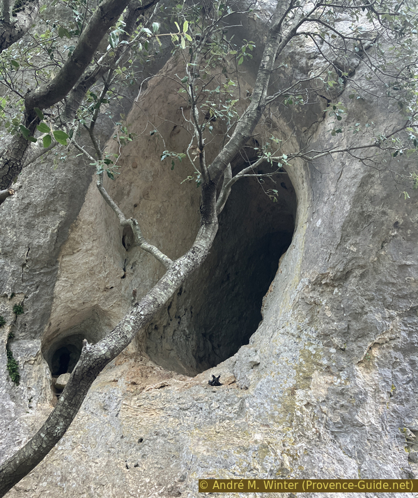
Cave with oblong section
Thereafter, the tunnel is almost straight, the ground is quite flat and the opening is quite high. You have to bend over a bit to accommodate the leaning section all the way through.
After about 15 metres, the cave ends with short sections to the left and right. Here there are limestone concretions on the ceiling.
It is not possible to continue exploring, we must retrace our steps.
No reproduction is permitted without the written consent of the author. (id7413)
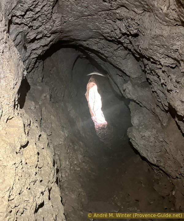
View of the oblong section of a Bérigoule cave
Section 3: Grotte à arches naturelles
➙ 0,1 km ... 10 min ➚ 20 m ➘ 15 m ↝ average
25% moderate trails, without marks
75% trail through a cave, without marks
The clues
- Foot of the cliff, 620 m
- Cave round trip, 615 m
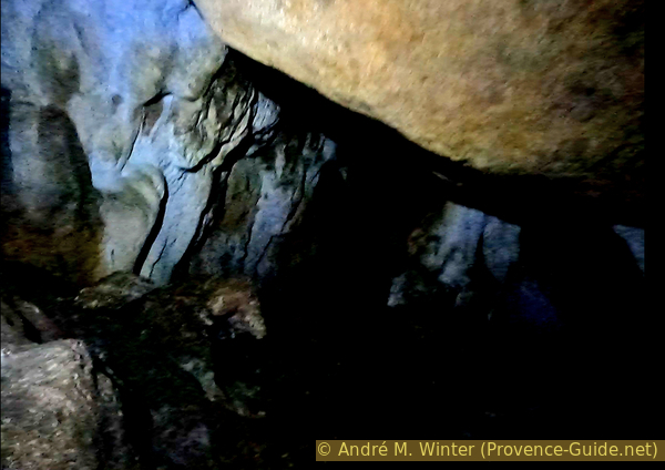
The largest of the caves on this cliff has a sumptuous natural arch at the entrance. Following this are conglomerate arches that look crumbly, but are quite solid.
The entire cave is naturally lit. The passages are high enough to avoid hitting your head.
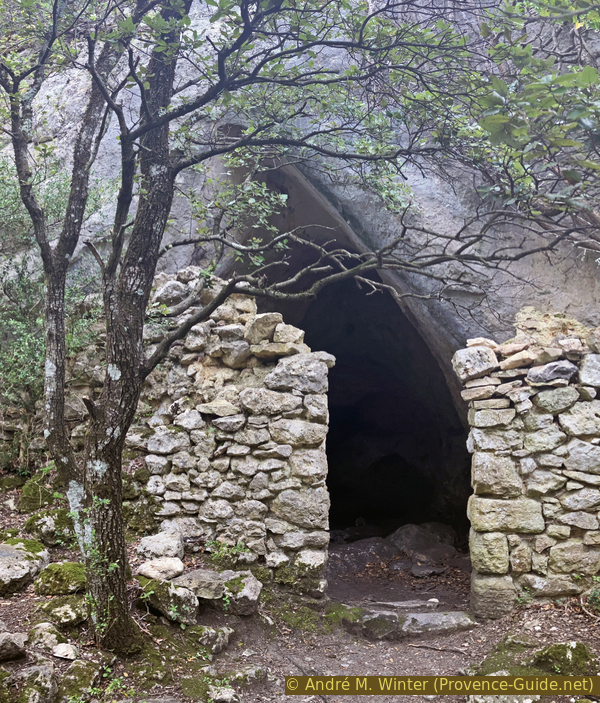
Twenty metres further to the north is another much larger opening. It is partly closed by a dry stone wall. This cave was to be used as an animal enclosure.
No reproduction is permitted without the written consent of the author. (id7414)
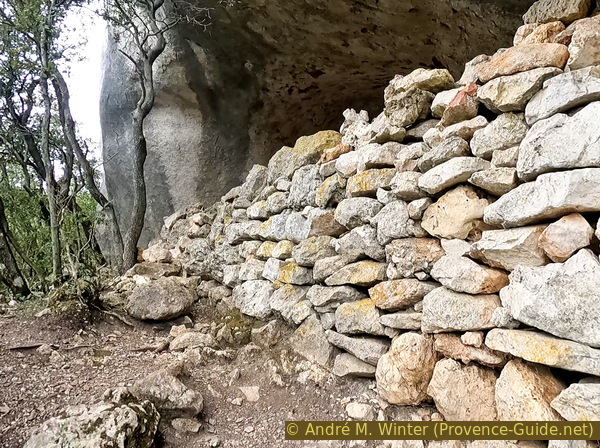
Dry stone wall under the natural arched cave of Bérigoule
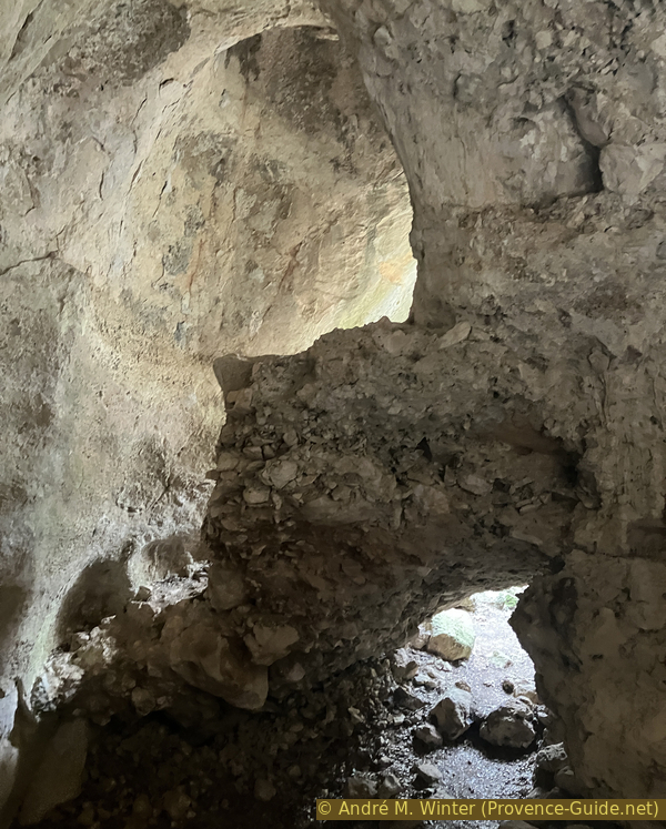
After the first arch, we arrive at a large open-air space.
Ahead is a conglomerate barrier which forms another natural arch. We first go to the right at the top. For the return, you can take the lower central part.
A conglomerate is a rock composed of discernible pieces held together by natural cement. Here, the basic rocks resulting from mechanical degradation are also limestone, just like cement base.
No reproduction is permitted without the written consent of the author. (id7415)
Two passages in the natural arches cave of Bérigoule
At the left is another opening to the sky. It is smaller, taller and more vertical. Fragments of conglomerate limestone stick to the walls. You can go down ahead to the right, but the potential passages are all blocked.
No reproduction is permitted without the written consent of the author. (id7422)
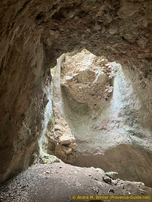
Vertical chimney in the natural arches cave of Bérigoule
We return to the exit by taking below right.
No reproduction is permitted without the written consent of the author. (id7423)
Conglomerate arch in natural arches cave
We are bachon the open central space occupied by a single tree.
No reproduction is permitted without the written consent of the author. (id7424)
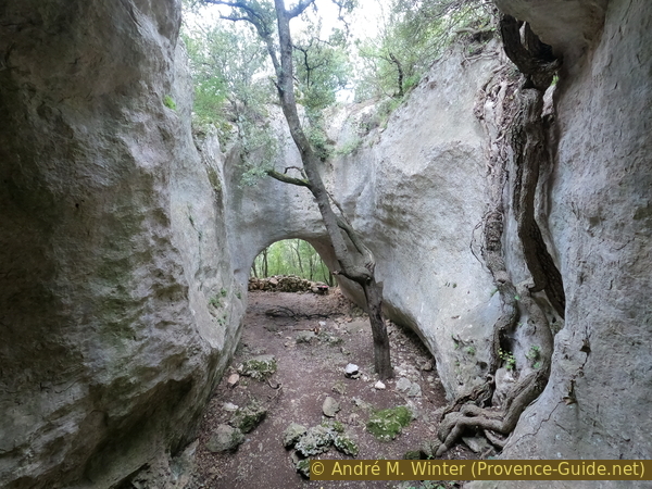
Tree in the natural arches cave of Bérigoule
Section 4: Grotte fumée
➙ 0,1 km ... 10 min ➚ 0 m ➘ 0 m ↝ average
70% moderate trails, without marks
30% trail through a cave, without marks
The clues
- Foot of the cliff, 630 m
- Cave, 630 m
The flat floor of this cave is composed of ground ash and the natural walls are covered in soot. We get dirty everywhere in this cave.
This is probably not the cave where the Waldensians were asphyxiated in the 16th century by the Catholics because it is not large enough for 25 people and the traces of ash as well as the wall in front are too recent. There is a large first room and smaller, shorter spaces follow behind. The small cave had probably been used as a charcoal oven in the early 20th century.
No reproduction is permitted without the written consent of the author. (id7425)
Wall in front of the cave of Bérigoule with soot
Subsequently, we find other small openings in the wall.
No reproduction is permitted without the written consent of the author. (id7426)
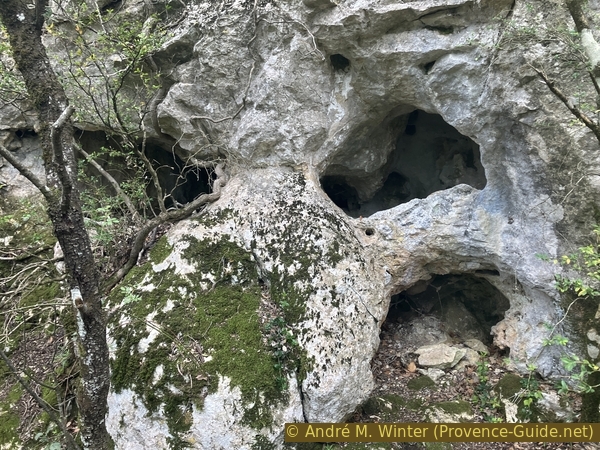
Small cavities in the Bérigoule cliff
Section 5: Petit Trou
➙ 0,1 km ... 10 min ➚ 20 m ➘ 20 m ↝ average
25% moderate trails, without marks
75% trail through a cave, without marks
The clues
- Foot of the cliff, 630 m
- Cave round trip, 625 m
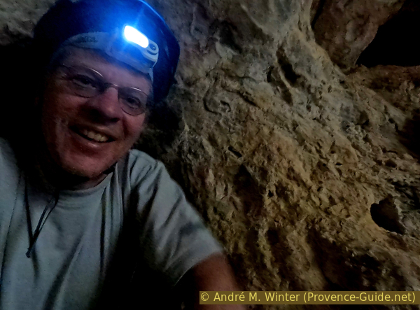
This cave is the most demanding. We enter through a short tube into a cavity entirely devoid of natural lighting. You need at least two lamps and a helmet per person. You can still see quite a bit just after the gut, but afterwards, the rocks are dark and even good lamps don't give off much light. The ground is littered with stones of very different sizes.
This is probably the cave where the Waldensians women and children were murdered by the henchmen of the catholic church. The rear cavity is quite large, the only access is small and it has no other exit. We find black and ocher marks in the access which can refer to the dead.
Access to the first part of the cave is easy. It is a large room with a flat floor, but covered with large rocks.
No reproduction is permitted without the written consent of the author. (id7436)
Cave with the little hole of Bérigoule
On the left, you can climb up and see a small circular opening which narrows into a funnel. The opening remains quite large thereafter. The pipe is approximately two metres long and leads to a flat place at the top of the room that follows. You have to lie on your stomach to pass.
No reproduction is permitted without the written consent of the author. (id7437)
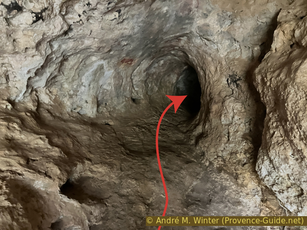
Passage into the cave with the small hole of Bérigoule
You would need very strong lamps to get an impression of the room or any traces of the massacre. A headlamp and a cell phone lamp are not enough to illuminate the room.
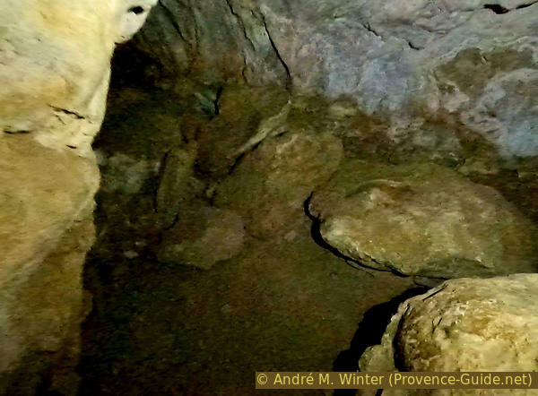
The highest part of the room is just after the small hole. The room floor and ceiling slope to the right and forward. Rocks of different sizes cover the entire ground.
Further ahead, you can advance under a rock to arrive in front of a fault with irregular ground. We did not explore further due to lack of effective lighting. There is no draft in the room, so it is potentially closed everywhere else.
No reproduction is permitted without the written consent of the author. (id7438)
The back of the big room behind the small hole
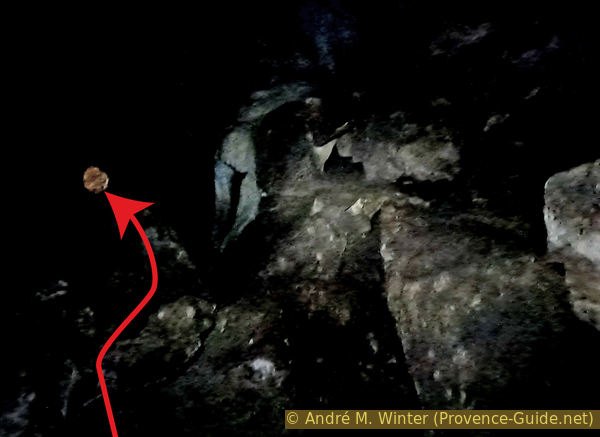
For the return, we have as a marker a sort of reddish moon, it corresponds to the small hole through which we entered and through which we must exit.
On the way back, we have a better impression of the room.
No reproduction is permitted without the written consent of the author. (id7439)
Return in the cave room with the little hole
The exit is just as grueling as the entrance. We are happy to see the light of day again!
No reproduction is permitted without the written consent of the author. (id7440)
Escapung from the cave with the little hole
Section 6: Galeries parallèles
➙ 0,1 km ... 10 min ➚ 5 m ➘ 5 m ↝ average
30% moderate trails, without marks
70% trail through a cave, without marks
The clues
- Foot of the cliff, 630 m
- Cave tour, 635 m
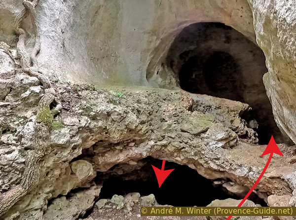
Here is an original cave with two openings opening onto parallel galleries and joined at the end by a passage allowing you to take a real tour.
You need a helmet because the natural ceilings are low. Natural lighting is sufficient, but a headlamp is still useful.
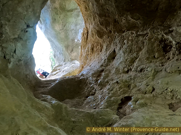
You must first climb a few metres into the first vaulted cavity which is still open to the outside. The bottom of this cavity is blocked.
There is a first tunnel on the right returning to the open air shortly after. The exit is blocked by a large rock, but this opening would lead into a void in any case.
No reproduction is permitted without the written consent of the author. (id7441)
Ascent to the cave with parallel galleries of Bérigoule
On the left are the two parallel galleries. They really look like the photo, apart from the arrows, this photo is not altered.
We enter through the tunnel on the left. People of normal height will have to lower their heads.
No reproduction is permitted without the written consent of the author. (id7442)
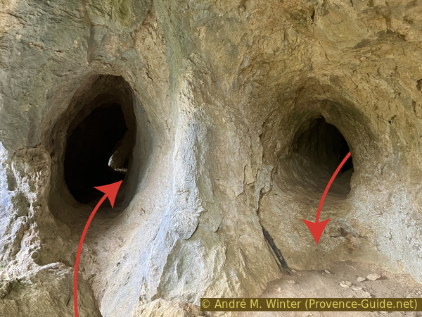
The two parallel galleries of a Bérigoule cave
This exterior gallery is lit by a natural opening in the wall.
No reproduction is permitted without the written consent of the author. (id7443)
Exterior gallery of the cave with parallel galleries
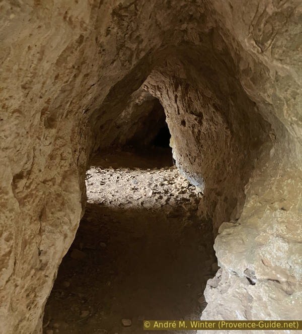
Shortly after opening to the outside, the gallery turns right to arrive at the interior gallery. It would continue towards the left, but this passage is blocked by large rocks.
No reproduction is permitted without the written consent of the author. (id7444)
Interior gallery of the cave with parallel galleries
However, by turning right, we quickly find daylight and the central place of the cave again. The interior gallery has a more irregular floor and a lower ceiling.
No reproduction is permitted without the written consent of the author. (id7445)
Exit from the inner gallery
Section 7: Retour
➙ 1,2 km ... 20 min ➚ 10 m ➘ 55 m ↝ easy
30% moderate trails, cairns
70% forest roads, few marks
The clues
- Foot of the cliff, 630 m
- Overhangs, 625 m
- Foot of the cliff, 630 m
- Cairn, 590 m
- Parking at the start of Chemin de Bérigoule, 585 m
We advance a little along the cliff and then return along the foot of it to resume the outward path.
There are no more notable caves further ahead. However, you can continue the path to arrive in a cirque surrounded by overhanging rocky areas.
It is possible to continue this path until the end of the rocks and climb while always keeping to the right. We come across another path to take again to the right and 70 metres further, we come back to the road Route de Sault D15. Here on the right to return to the starting point.
No reproduction is permitted without the written consent of the author. (id7446)
Low wall and end of the caves northwest of the Bérigoule cliff
We retrace our steps, passing under all the caves that we explored on the way out. We also go back down the same path towards the cairn on the Chemin de Bérigoule.
No reproduction is permitted without the written consent of the author. (id7447)
Return to the track under the Bérigoule caves
Don't forget to turn left at the intersection. We then abandon the power line and only follow the telephone line.
We are back in a few minutes at the starting point.
No reproduction is permitted without the written consent of the author. (id7448)
Turn on Chemin de Bérigoule
Sources and additional information
It is better to use a good topographic hiking map: this tour is on the IGN map "Cavaillon, Fontaine-de-Vaucluse, PNR du Lubéron", scale 1:25000, 3142OT.
If you don't want to bother with a paper map, you can also use mapping apps on your cell phone. On the one hand, it is the Cartes IGN app from the official map service. However, it requires access to the data network and this is sometimes difficult in canyons or remote locations.
Alternatively, you can use apps that store data directly on the device. They're generally not free, but they don't cost much. We mainly use OSMAnd, here it is possible to add contour lines, relief shading, markings and others. To store this data on your phone you need a lot of space.
Of course, one needs access to satellites for the GPS signal with any app. In some canyons this is not the case. Therefore, do not rely on the position shown, but read the map on your phone as you would read it on paper. Most apps are available for Android and iPhone. The applications usually allow us to record the route travelled and also view the GPS files offered for each of our hikes.
This page has been seen 1817 times since 20 March 2024.