Gorges de Régalon
Exit via Mayorques and descent over La Libaude
hike
average
3 h
yes
yes
shelter
mountain
Introduction
The Gorges de Régalon is the deepest canyon in the Luberon Massif. You can't see it from the road and you don't even recognize it when you are in front of it, this crack in the rock is so narrow. The deep part is almost 700 meters long, but you spend almost an hour there during which you go from surprise to surprise.
The proposed tour leaves at the first opportunity towards the west, we arrive at an old farm to go down again by a pass in the cliff. The cross valley La Libaude brings us back to the starting point.
The facts
8,3 km total distance
3 h walk time
290 m total elevation
orientation average
mark 65% of the total distance
30% forest roads
20% Trails with scramble passages
20% easy trails
20% moderate trails
10% hard-surfaced quiet side streets
dangers rocks to climb
children yes, but it's long
useful picnic stuff
required hiking boots, hiking equipment and water
GPS coordinates (WGS84) of start and end point 43.75896956689384,5.156695641090914
downloads ![]()
![]()
Public transport
Access to the Gorges du Régalon is via the road north of the Durance river. Here only bus line 908 runs between Cavaillon, Cadenet, Pertuis and Cucuron about ten times a day. The bus stop closest to the canyon is called Logis Neuf. Get off the bus, cross the Canal de Carpentras and turn right. After less than 400 meters, follow the road that leads to the access to the Gorges de Régalon. You can cut short through a loose pine forest. We come to the parking lot at the beginning of the gorge. This is where the hike described below begins. Information about the bus: Zou! (only french).
Access by car
The access to the Régalon canyon is north of the Durance river between Avignon and Manosque. More precisely, it is located between Cavaillon and Pertuits in the municipality of Cheval-Blanc. From the D973 road, a sign points to Gorges de Régalon.
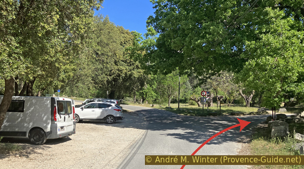
Useful parking spaces
La Tuilère car park is at the end of the access road and at the fork on the right. The places at the beginning and before the crossing are the most shaded during the day and especially in the afternoon. The car park is free, but it can be very quickly full in season and during the weekend.
No reproduction is permitted without the written consent of the author. (id6904)
Gorges de Régalon
No reproduction is permitted without the written consent of the author. (id6890)
First car park at Gorges de Régalon
Hints
This gorge is well known and the enthusiasm for this site is only broken by the long years of forced closure due to rockfalls. These problems can return to the agenda at any time, erosion advances. The verticality of the walls and the roots of vegetation make this passage risky at all times.
There are several passages with rocks to climb. This can cause problems for less experienced people. It's not just a walk. There is no technical help in these delicate passages.
The marking to the gorge and in the gorge is clear and obvious. It is much less present or non-existent on the rest of the tour. The orientation is then sometimes difficult even if one realizes very quickly an error.
At the exit of the gorge, we only made a little more than a quarter of the whole tour. You still need resources for the rest of it!
The gorge faces south. The GPS signal is good enough for the circumstances.
The whole region is a zone with a high risk of forest fires. In summer, but also in other seasons when it is very dry or by strong winds, access to the forest areas can be regulated. As a result, the roads may be closed to traffic and/or the trails prohibited to hikers. Current information: Map for access to the forests of the Vaucluse department (also english). The map shows the colours green, yellow, orange and red which correspond to levels of danger. The affected area is: Massif du Petit Luberon (10).
The sections
- Gorges de Régalon in ascent
- To Ferme des Mayorques
- Down to La Libaude
- Back via La Roquette and Rioufret
Section 1: Gorges de Régalon
➙ 2,5 km ... 1 h 10 min ➚ 125 m ➘ 5 m ↝ easy
5% hard-surfaced quiet side streets, with marks
5% easy trails, with marks
5% forest roads, with marks
5% easy trails, with marks
5% forest roads, with marks
75% Trails with scramble passages, faulty marks
The clues
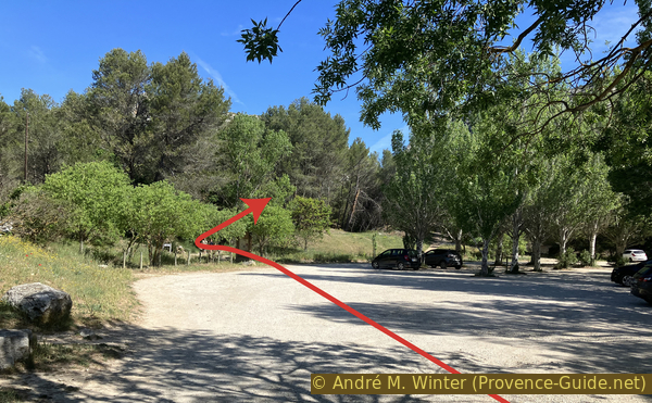
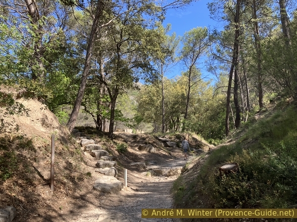
- Régalon car park, 115 m
- Gorges de Régalon
- Upper Gorges de Régalon canyon, 240 m
The heart of the hike at the very beginning
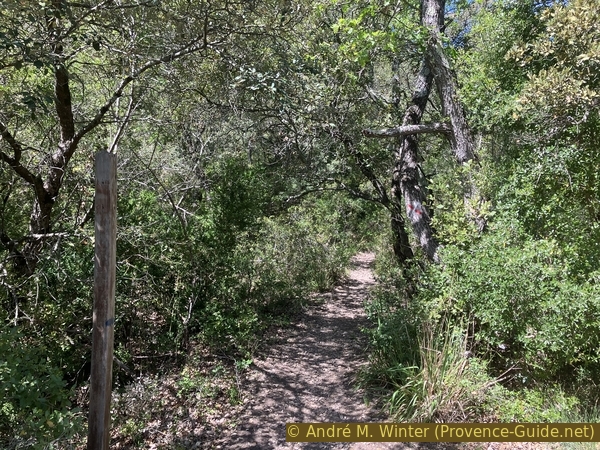
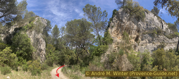
We advance towards the large car park and look for access to the path at the signs on the left. The path itself is clearly visible.
No reproduction is permitted without the written consent of the author. (id6891)
Second Gorges de Régalon car park
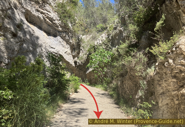
The marked trail is either in the river bed, or to the left of it.
No reproduction is permitted without the written consent of the author. (id6892)
Lower Gorges de Régalon
We arrive further in an olive grove and we see in front the cliffs forming the lower part of the gorge.
Stay here on the track and do not return to the bed of the river, nor pass through the olive groves.
Finally, we are guided by fences towards the access to the gorge. The various positions given below are indicated in walking minutes from this beginning of the gorge. The time count is generous, i.e. with breaks for taking photos.
No reproduction is permitted without the written consent of the author. (id6893)
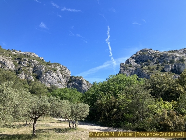
Olive grove at the lower exit of Gorges de Régalon
The cut of the canyon begins immediately. A panel recalls the dangers and the fragility of the place. Then, we simply walk at the bottom of the canyon dug here six million years ago during the rise of the Alps. The side walls are still far away, but their height is immediately impressive.
No reproduction is permitted without the written consent of the author. (id6894)
First tightening of the Gorges de Régalon
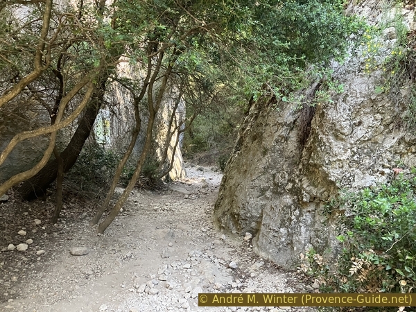
The canyon ist not straight in a line. After a few moments, we are in a much darker environment. It is only after several minutes that a little more light enters a somewhat wider area. Sunlight is also blocked by various trees and ivy growing along the edge of the cliff and in the rock wall.
No reproduction is permitted without the written consent of the author. (id6895)
Inside the first tightening of the Gorges de Régalon
In one of these open areas follows five minutes after the start of the gorge a step of rocks consolidated by limestone concretions. The rock looks smooth, but it's not slippery. The easiest passage is at the bottom center and top left.
No reproduction is permitted without the written consent of the author. (id6896)
Step covered with limestone concretion
At eight minutes, we pass under a large rock wedged two meters above the bottom of the gorge. This is all the more surprising as the canyon is here otherwise wide open.
Soon after follows another neck.
No reproduction is permitted without the written consent of the author. (id6897)
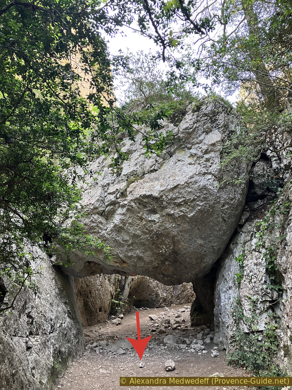
Big rock stuck in the Gorges de Régalon
At ten minutes, you have to climb an inclined plane to the left of a large rock. As before, the rock is not smooth despite its rounded appearance.
At 12 minutes are recently fallen rocks in the gorge, their sides show fresh breaks. This reminds us that erosion is a continuous process. Currently it is no longer the water that actively cuts the gorge. It is caused by the temperature differences and by the roots of the plants that nibble especially the upper part of the cliffs.
No reproduction is permitted without the written consent of the author. (id6898)
Uphill passage next to a large rock
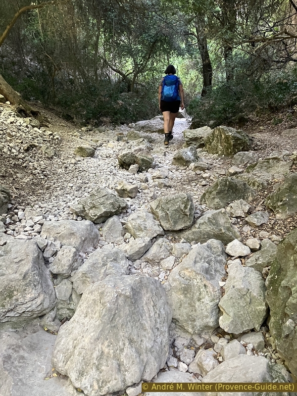
You also have to look down. The ground is strewn with stones of different sizes and the terrain becomes more and more uneven.
No reproduction is permitted without the written consent of the author. (id6899)
The river bed in the Gorges de Régalon
At 15 minutes, we enter a natural tunnel which at first seems very dark, but we quickly reach the upper end.
No reproduction is permitted without the written consent of the author. (id6900)
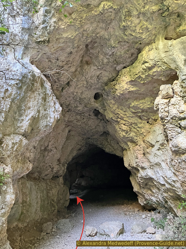
Passage through a natural tunnel in the Gorges de Régalon
The north exit is by advancing straight without taking the climb in the opposite direction.
No reproduction is permitted without the written consent of the author. (id6901)
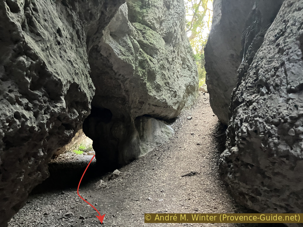
Back view in the tunnel of the Gorges du Régalon
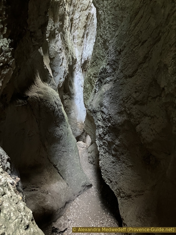
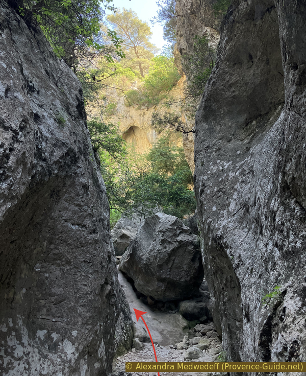
Just after follows the narrowest passage of the gorge. In some places two people cannot stand side by side. Stones that seem no bigger than soccer balls are stuck in various heights between the rock walls that remain tight to the top.
No reproduction is permitted without the written consent of the author. (id6903)
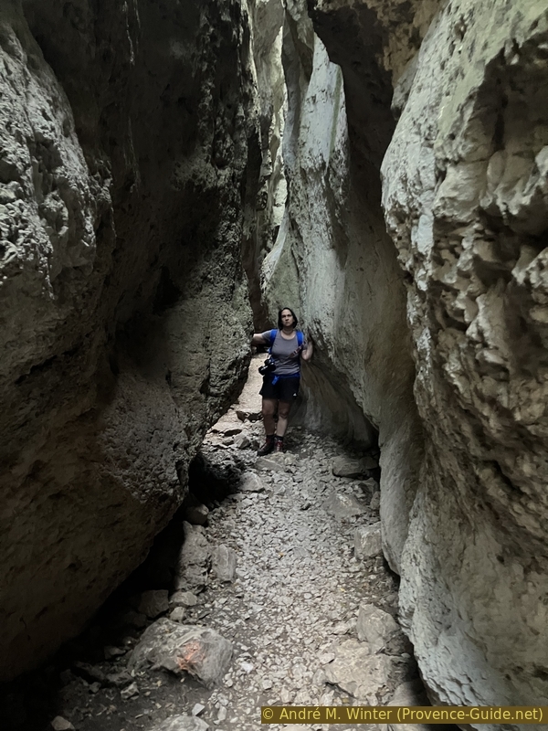
In the narrowest part of the Gorges de Régalon
Narrow parts alternate with wider areas. The visible upper edge of the cliff is also constantly changing. It makes hiking here fun.
No reproduction is permitted without the written consent of the author. (id6905)
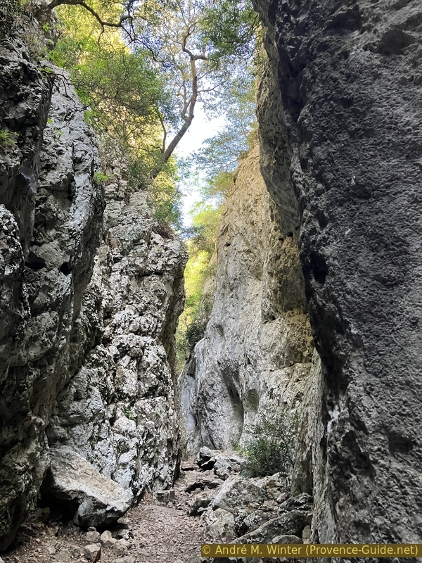
Upper exit of the narrowest part of the Gorges de Régalon
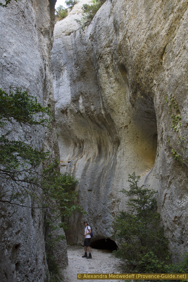
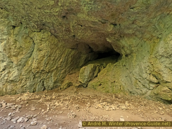
It is rare to see the high edge of the cliffs in the sun. This is only possible in wider areas.
The slightly more complicated things start not far upstream.
No reproduction is permitted without the written consent of the author. (id6906)
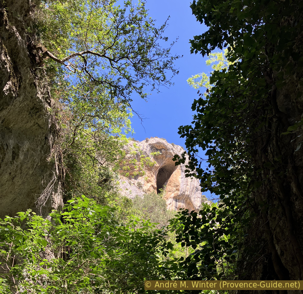
Cave high above
At 29 minutes, you have to climb another pile of stones wedged between the right wall and a larger rock on the left. It's a little vertical, but narrow enough to be able to hold on well aside.
No reproduction is permitted without the written consent of the author. (id6907)
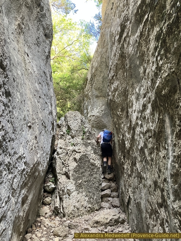
Ascent to the right of a large rock in the Gorges de Régalon
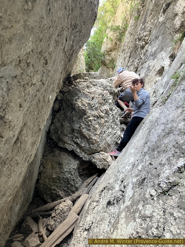
At 31 minutes, you have to climb a cluster stuck in this narrow zone. It's not difficult because you can hold on well.
No reproduction is permitted without the written consent of the author. (id6908)
Rocks to climb in the Gorges de Régalon
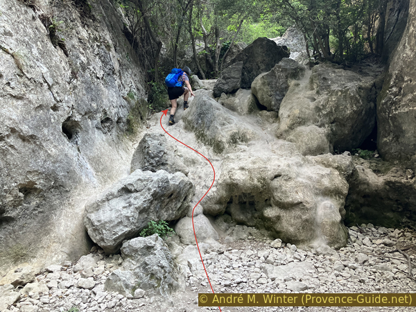
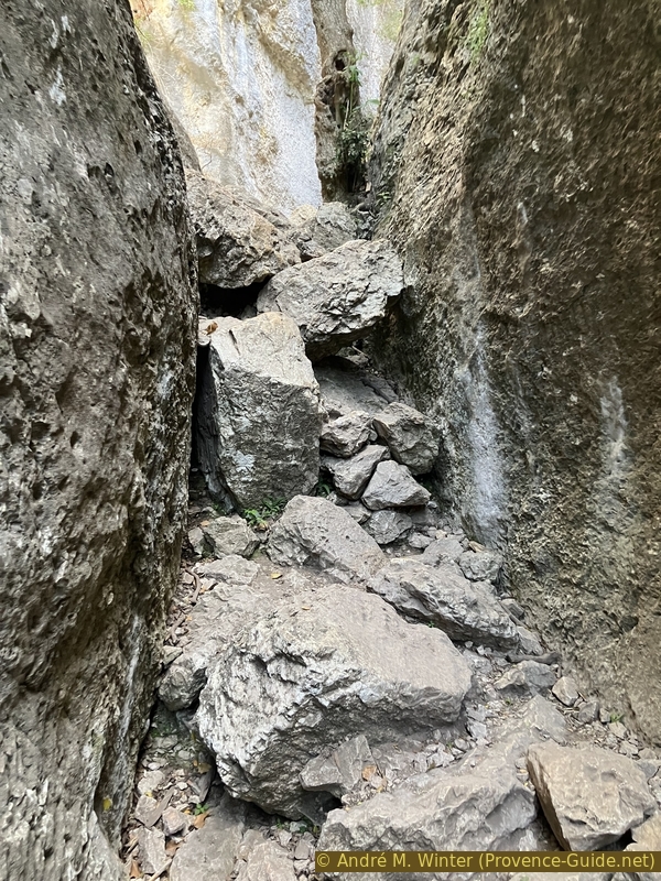
In the next minute the canyon narrows massively while the remaining open crack is inclined. There are other stones stuk here and this is the most difficult part of the tour. Pieces of wood help to climb to the first stone, then you have to loop through and continue climbing by keeping to the right.
No reproduction is permitted without the written consent of the author. (id6909)
Ascent on rocks in the oblique passage
At 35 minutes we arrive in an area widened by caves on both sides. The gorge then remains lower and wider.
No reproduction is permitted without the written consent of the author. (id6910)
Side cave in the Gorges de Régalon
Huge ivies take root at the bottom of the canyon while exposing their leaves much higher in the cliffs.
No reproduction is permitted without the written consent of the author. (id6911)
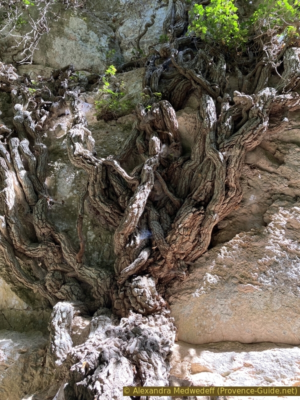
An ivy climbs the rock face of the Gorges de Régalon
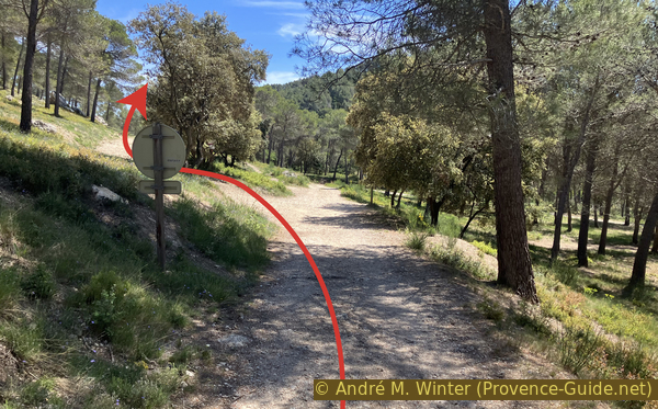
At 40 minutes, we arrive at the first possibility to exit the gorge at 239 meters above sea level. You can exit here towards the east and the Vallon du Canebier. However, it is not a quick return to the starting point because you have to go roughly all the way to Mérindol before you can return to the car park at the foot of the cliffs.
No reproduction is permitted without the written consent of the author. (id6912)
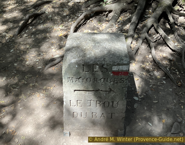
Former indicative marker in the Gorges de Régalon
We therefore continue beyond the old marker and the recent signpost towards the north and towards Agarnier.
No reproduction is permitted without the written consent of the author. (id6913)
The upper part of the Gorges de Régalon
After an hour, you cross a barrier of the national forest office and a little higher is a big crossroads. We turn left here.
No reproduction is permitted without the written consent of the author. (id6914)
Large open area above the Gorges de Régalon
Section 2: Ferme des Mayorques
➙ 1,5 km ... 25 min ➚ 85 m ➘ 10 m ↝ average
40% easy trails, without marks
60% forest roads, without marks
The clues
- Upper Gorges de Régalon canyon, 240 m
- Ferme des Mayorques farm, 315 m
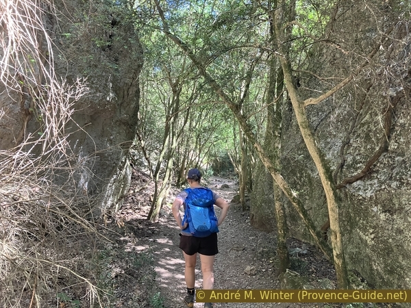
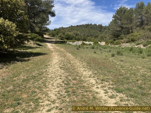
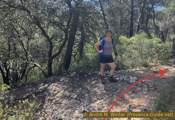
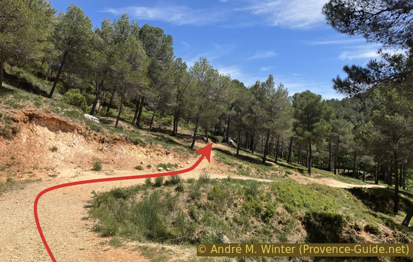
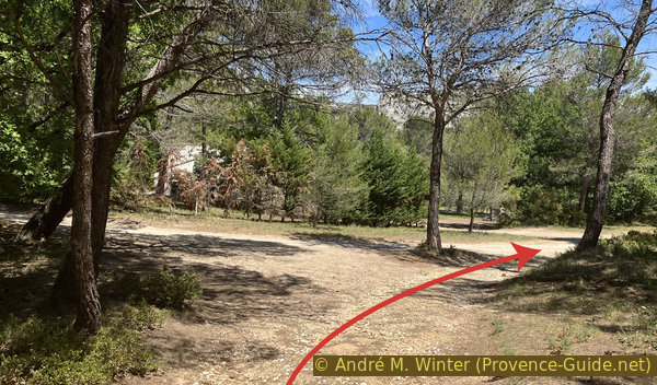
Exit to the plateau to the west.
The section on the plateau east of the Ferme des Mayorques is a protected area. There may be bans on passage to the west along the way. In this case, it is better to look for paths to the left (south) and to advance along the edge of the forest towards the west. You will then have to keep right towards the Ferme des Mayorques.
So we start from the wide area to the left. No sign is here mark anything. A cross marking indicates that the long distance trail GR6 does not pass through here.
Our path has some private green markers. It comes out through a side valley.
No reproduction is permitted without the written consent of the author. (id6915)
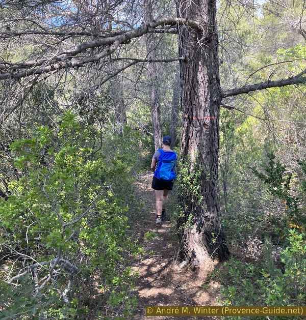
Path to the west from the open area
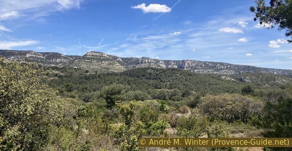
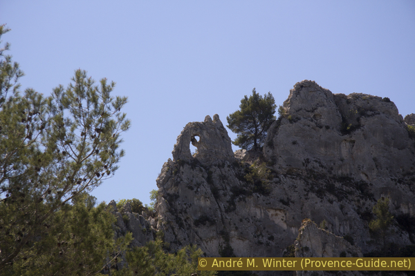
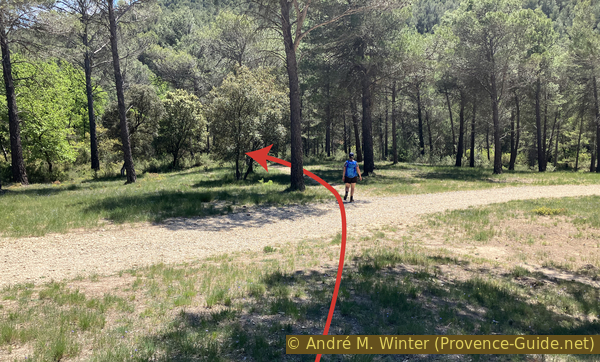
After a little over five minutes, the path turns sharply to the left. A few minutes later, you can turn left again towards a slightly more open natural viewpoint because the forest here is less dense. You can also see towards the upper part of the Gorges de Régalon and the crest of the Massif du Luberon.
However, we return to the path which continues south for another two minutes before turning right and heading west.
No reproduction is permitted without the written consent of the author. (id6916)
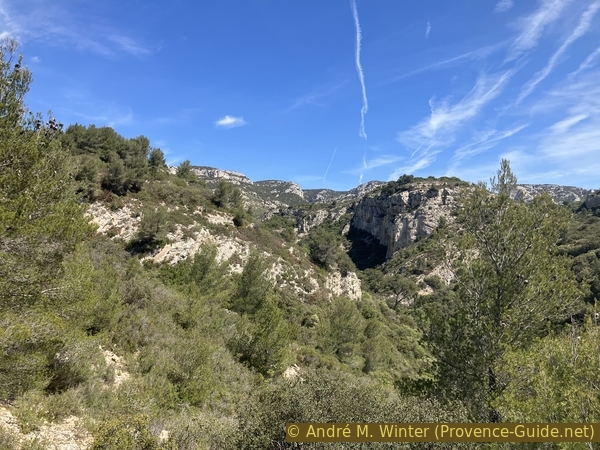
Rocher des Sautes rocks above the Gorges de Régalon
We sometimes see green marks on a white background on the trees. These are not hike markings, but limits of forest estates. Despite this lack of markings, the path is obvious.
Five minutes later, you arrive near dry stone walls and fairly dry fields. There are several parallel paths and tracks here. It is preferable to keep to the right when leaving the path along the edge of the forest estate. A farm track is now our way. It quickly resumes the westward direction.
No reproduction is permitted without the written consent of the author. (id6917)
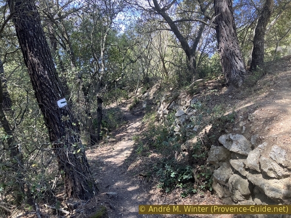
Path along the forest limit of the Lubéron natural park
This agricultural track is not quite straight. We pass a few cedars that have come down from the Luberon ridge.
No reproduction is permitted without the written consent of the author. (id6918)
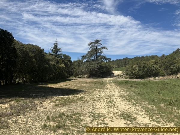
Upper meadow and cypresses east of Les Mayorques farm
Just past these cedars are some curious limestone rocks with knobs on the right.
No reproduction is permitted without the written consent of the author. (id6919)
Structure of the limestone plates east of Les Mayorques
The track ascents a little and goes to the left to then resume heading west.
No reproduction is permitted without the written consent of the author. (id6920)
Meadow and dry stone wall east of Les Mayorques
We arrive on a cattle gate. Straight ahead we see the Mayorques farm which is our next stop. The old sign on the other side of the gate prohibits passage, but there is none on the side we came from. We spoke about it in 2023 to a guard we met below and she said she wants to invest that. If prohibitions are visible while climbing out from the Gorges de Régalon, you must go further south (left) at the latest at the exit of the forest onto the fields.
No reproduction is permitted without the written consent of the author. (id6921)
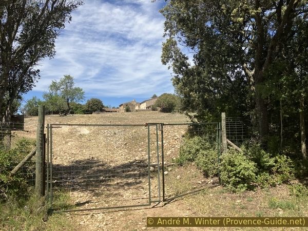
Cattle gate east of Les Mayorques
The farm gate is open.
The farm is located on a barely cultivable arid limestone plateau. The farm has always been very isolated, but the use of this difficult land is explained by the impossibility of cultivating the valley of the Durance because of untimely floods before its regulation with various dams on the Durance and the Verdon in the 1960s.
No reproduction is permitted without the written consent of the author. (id6922)
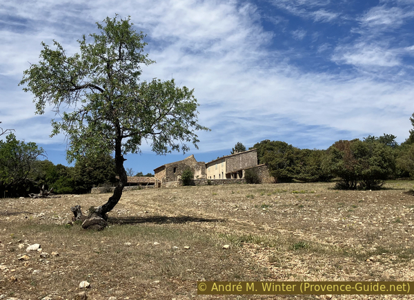
Ferme des Mayorques farm
One tries to bring this farm back to life through associations and with the help of the Luberon regional natural park.
The exposed stone parts are the sheepfold, the more modern part is the shepherd's accommodation.
No reproduction is permitted without the written consent of the author. (id6923)
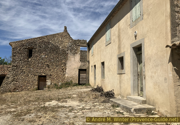
Courtyard of the Mayorques farm
Under the old barn are signs that explain the attempt to revive the activity of this farm. It is all the more difficult with climate change, the lack of water is flagrant on this large limestone plateau to the south under the Luberon ridge.
No reproduction is permitted without the written consent of the author. (id6924)
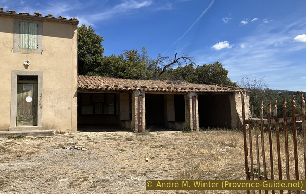
Former stable of Les Mayorques farm
Section 3: Les Mayorques - La Libaude
➙ 1,8 km ... 40 min ➚ 30 m ➘ 180 m ↝ average
50% moderate trails, few marks
50% easy trails, without marks
The clues
- Ferme des Mayorques farm, 315 m
- Crau des Mayorques, 332 m
- Croupatas saddle, 285 m
- Cross valley La Libaude, 155 m
Descent from the plateau to the south.
From the Ferme des Mayorques, we leave the gate and thus we walk first mainly towards the south and towards Barrié. We are again on a marked path, here in yellow.
No reproduction is permitted without the written consent of the author. (id6925)
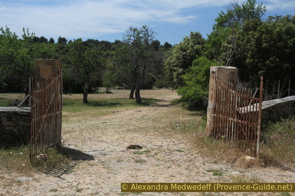
Les Majorques Farm Portal
The marked path is slightly uphill towards a barely perceptible pass marked by a post without a sign and a large cairn.
The term Crau designates in Provençal a flat and stony plain covered with grass which is a more or less abundant grazing ground for herds of sheep and goats.
No reproduction is permitted without the written consent of the author. (id6927)
Highest point of the Crau des Mayorques
Going up, we see back on the main ridge of the western Luberon.
However, we continue straight to the south.
No reproduction is permitted without the written consent of the author. (id6926)
Back view on the Luberon ridge
On the other side of the pass, the slope is more noticeable and you come to a notch.
No reproduction is permitted without the written consent of the author. (id6928)
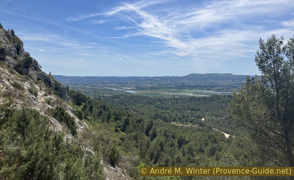
View in the plain of the Durance river
The descent in hairpins ist fast and chaotic. The path goes quite far to the right under the notch.
No reproduction is permitted without the written consent of the author. (id6929)
The passage in the cliff above Croupatas
There is a good view of the plain of the Durance from here.
No reproduction is permitted without the written consent of the author. (id6930)
The passage in the cliff above Croupatas and the plain of the Durance
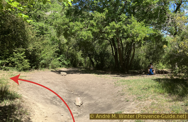
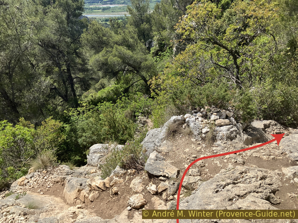
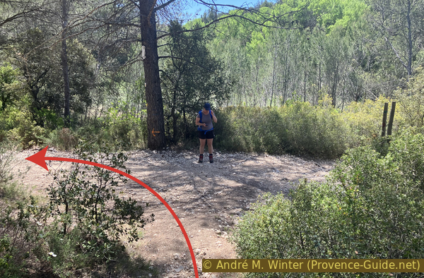
Arriving on a slightly more earthy flat area, we are in front of a fork. We take the direction of the yellow cross marking on the right. So we leave the marked trail again.
No reproduction is permitted without the written consent of the author. (id6931)
The junction of Croupatas
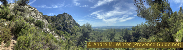
This path is clearly visible and very flat. It undulates between trees and rocks in a westerly direction. Do not descend by rocks on the left.
No reproduction is permitted without the written consent of the author. (id6932)
Path from Croupatas to La Libaude
This hunter's path descends further more frankly towards a forest track. Turn left and further downhill here.
No reproduction is permitted without the written consent of the author. (id6933)
Arrival on the Chemin de la Libaude
This barely passable track makes a wide bend to take us through the cross valley La Libaude.
A current of water has pierced the cliff bar here perpendicularly. On either side of the cross valley rises a high rocky ridge 500 meters long.
No reproduction is permitted without the written consent of the author. (id6934)
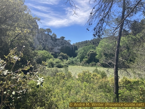
Cross valley north of the Gorges de la Libaude
You can see the natural passage better from the south side.
No reproduction is permitted without the written consent of the author. (id6935)
Cross valley of La Libaude seen from the south
Section 4: La Libaude - Rioufret
➙ 2,5 km ... 40 min ➚ 45 m ➘ 90 m ↝ average
40% forest roads, faulty marks
25% moderate trails, without marks
15% forest roads, few marks
20% hard-surfaced quiet side streets, few marks
The clues
- Cross valley La Libaude, 155 m
- Le Gour
- La Roquette, 165 m
- Les Bastides, 155 m
- Rioufret
- Régalon car park, 115 m
Return to the starting point.
The forest track is concreted shortly after to pass into Le Gour. It is a small portion of canyon formed by the same stream that pierced the cross valley further upstream.
No reproduction is permitted without the written consent of the author. (id6937)
The concrete path in Le Gour under La Libaude
The track takes us slightly downhill towards La Roquette. However, we pass above to take the Piste du Riouffret (or Chemin de la Montagne).
No reproduction is permitted without the written consent of the author. (id6938)
Junction of the Piste du Riouffret and the Chemin de la Montagne towards Barrié
When we are on that higher track, it's time to look right. A hole in the rock and the remaining wall of a medieval tower can be seen in the ridge further south.
No reproduction is permitted without the written consent of the author. (id6944)
Rocky arch in the ridge west of La Roquette
This section of wall is all that remains of the Tour de la Roquette tower.
The territory of Cheval-Blanc, the municipality in which we are located, was part of the possessions of the Counts of Toulouse and then of the Comtat Venaissin. It formed a border with the Kingdom of France, of which there remain the ruins of this watchtower at La Roquette.
No reproduction is permitted without the written consent of the author. (id6945)
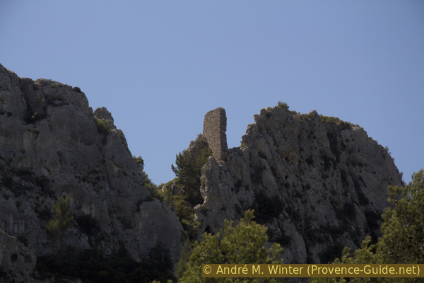
Ruin in the ridge west of La Roquette
We keep to the left on the path when the track descends to the right. This avoids a loss of height.
No reproduction is permitted without the written consent of the author. (id6939)
Path to the left of the forest road
We come back to the forest track a little further, but in order to cross it. This avoids going up to Barrié.
No reproduction is permitted without the written consent of the author. (id6940)
Crossing of the forest road between La Roquette and Barrié
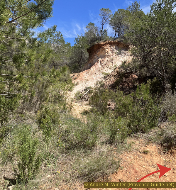
The small path first descends towards a kind of depression which seems to have been an ocher mine. You have to go up here first to the left.
No reproduction is permitted without the written consent of the author. (id6941)

Take on the left towards the Bastides
When the bushes become denser, you have to turn right.
No reproduction is permitted without the written consent of the author. (id6942)
Old quarry or erosion between La Roquette and La Bastide
Here begins a steep slope. This are about thirty meters of positive elevation. It's the last climb of the day!
No reproduction is permitted without the written consent of the author. (id6946)
Junction west of Les Bastides
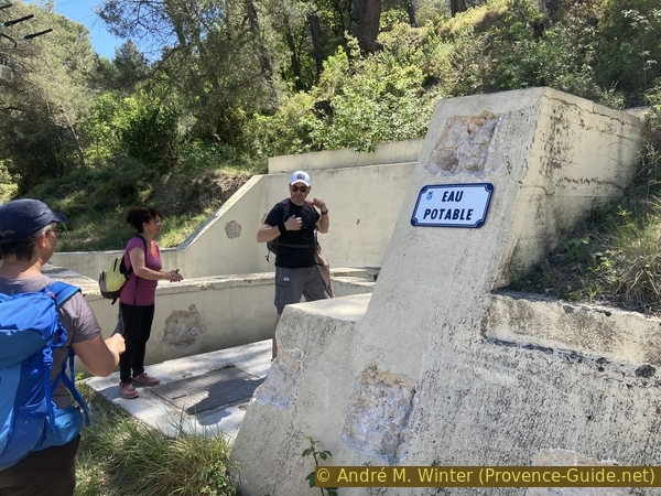
We come back on a forest track to Les Bastides. A few minutes later, we pass the hamlet of Rioufret.
The name means fresh river and there is a source of drinking water here, the only one on this whole tour.
A few minutes later, we are back at the starting point.
No reproduction is permitted without the written consent of the author. (id6947)
Source de Rioufret
Sources and additional information
It is better to use a good topographic hiking map: this tour is on the IGN maps "Cavaillon Fontaine-de-Vaucluse", scale 1:25000, 3142OT and "Salon-de-Provence", scale 1:25000, 3143OT.
If you don't want to bother with a paper map, you can also use mapping apps on your cell phone. On the one hand, it is the Cartes IGN app from the official map service. However, it requires access to the data network and this is sometimes difficult in canyons or remote locations.
Alternatively, you can use apps that store data directly on the device. They're generally not free, but they don't cost much. We mainly use OSMAnd, here it is possible to add contour lines, relief shading, markings and others. To store this data on your phone you need a lot of space.
Of course, one needs access to satellites for the GPS signal with any app. In some canyons this is not the case. Therefore, do not rely on the position shown, but read the map on your phone as you would read it on paper. Most apps are available for Android and iPhone. The applications usually allow us to record the route travelled and also view the GPS files offered for each of our hikes.
This page has been seen 2631 times since 20 March 2024.
No reproduction is permitted without the written consent of the author. (id6936)
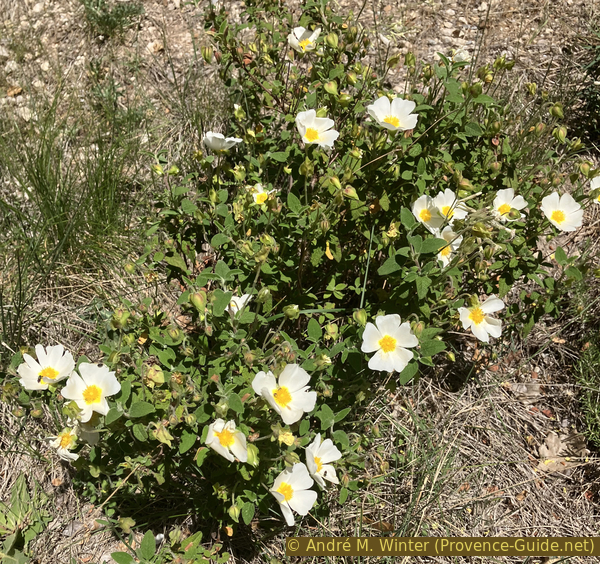
White cistus in bloom