Sentier de l'Imbut and Sentier Vidal in the Verdon Canyon
The full tour with Baou Béni and way back on GR99
via ferrata
difficult
5 h
no
yes
no
mountain
Introduction
Attention! Access to the Sentier de l'Imbut is prohibited from the Descente des Cavaliers due to landslides in an area above the Styx. The ban also concerns the ascent via the Sentier Vidal. This prohibition is still valid and last verified February 2026. The tour described here can therefore not be practiced at the moment.
The Imbut trail is undoubtedly one of the most beautiful ones in the Gorges du Verdon. This hike requires good endurance and experience in mountainous terrain, especially if you join the section to Baou Béni and finish it all by the Sentier Vidal.
It is possible to do only the trip in the gorges, so to do the section 1 and the section 2 of this lap, then retrace your steps. In this case, it takes 4 hours. By doing the Sentier de l'Imbut and the Sentier Vidal without going to Baou Béni , you should count 3h30 of walk.
The facts
10 km total distance
5 h walk time
750 m total elevation
orientation difficult
mark 90% of the total distance
45% easy trails
15% moderate trails
10% exposed trails
10% forest roads
5% difficult trails
5% Trails with scramble passages
5% via ferrata
<5% cross country
<5% hard-surfaced country road
dangers exposed sections
children no
useful picnic stuff
required hiking boots, hiking equipment and water
GPS coordinates (WGS84) of start and end point 43.738165,6.343481
downloads ![]()
![]()
Public transport
There is no public transport to the tour. It's lamentable given the purely tourist traffic on the small roads. It ist useful to complain about at the tourist offices of the region.
Access by car
We are along the D71 road on the south shore of the Gorges du Verdon, between Lac de Sainte-Croix and Aiguines to the west and Comps-sur-Artuby to the east. Access from the west is faster. We are targeting the Auberge des Cavaliers and the Hôtel du Grand Canyon, both are 15 kilometres from Aiguines and 23 kilometres from Comps.
Useful parking spaces
The structurally delimited parking spaces are those of the hotel and the inn. A little further up, near the seasonal lifeguard station, is the Parking des Cavaliers, plus there are a few spaces along the road. However, we recommend parking further down: 100 meters west of the hostel, towards Aiguines, there is an emergency phone where you can park. Not far from there, the long-distance hiking trail GR99 joins, where we will end the tour. In any case, the hike is described from this small parking lot.
No reproduction is permitted without the written consent of the author. (id6458)
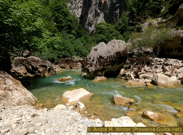
L'Imbut du Verdon
Hints
This is a long, difficult and tiring hike. You often find people out of breath. It is advisable to leave as early as possible in the hot season so that there is still shade on the ascent and the descent remains just as cool. It makes no sense to speculate with the heat for, bathing in the Verdon, the water is cold anyway. There are easier places to splash around.
The state electricity company EDF manages the dams upstream of the Verdon and puts up warning signs everywhere because of the water release without prior notice and without a precise plan. Throughput can be multiplied by 25 in seconds. However, the place is well known and the path leads through the bottom of the gorge close to the water. Water is not drained during the day in summer. The stupidest thing about EDF is that they have an online information page about these artificial floods, but it's reserved for canyoning professionals only. It is difficult to practice a more idiotic policy of misinformation.
The descent from Les Cavalaiers into the canyon includes a rock passage with irons and handrail. The Sentier de l'Imbut contains unprotected passages in the rock face on the river side, some of these sections are narrow. The way to and from Baou Béni is very difficult, you need good orientation and climbing skills, you should not go here alone. The Sentier Vidal climb is an easy via ferrata, but with passages in earthy scree. The latter and the high visitor frequency in the season prohibit the descent via the Sentier Vidal. A sign explains it at the beginning of the difficult passages. However, the descent is technically possible and has been practiced by fishermen for a long time. Nowadays you have to be on trail very early in order not to cross anyone during the descent. The way back via the GR99 is the easiest part.
In the part deep in the gorge, the GPS signal is only random and the telephone signal does not exist. Orientation is therefore only possible by conventional means such as maps or this description with lots of photos.
The whole region is a zone with a high risk of forest fires. In summer, but also in other seasons when it is very dry or by strong winds, access to the forest areas can be regulated. As a result, the roads may be closed to traffic and/or the trails prohibited to hikers. Current information: Map of access to the forests of the Var (also english). The map shows the colours green, yellow, orange and red which correspond to levels of danger.
The sections
- Les Cavaliers - Passerelle de l'Estellier
- Sentier de l'Imbut
- Hike to narrow Baou Béni
- Way back from Baou Béni
- Up Sentier Vidal
- Back on long-distance trail GR99
Section 1: Les Cavaliers - Passerelle de l'Estellier
➙ 1,2 km ... 25 min ➚ 0 m ➘ 245 m ↝ easy
10% hard-surfaced country road, few marks
25% moderate trails, with marks
5% via ferrata, with marks
50% moderate trails, with marks
15% easy trails, with marks
The clues
- Road D71 west of Les Cavaliers, 790 m
- Passerelle de l'Estellier foot bridge, 545 m
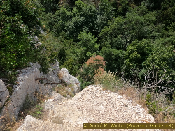
The descent into the gorges is easy, but the polished limestone rock can be slippery.
GR = long distance trail
borne = emergency telephone
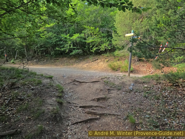
We either exit from the large parking space Les Cavaliers car park or the smaller car park near the emergency telephone. In the first case, you have to walk a hundred meters down the road towards Aiguines. In the second case, as can be seen in the photo, it goes 100 meters to the east. Be careful along the road, there are drivers who see a Formula 1 track here and don't know how else to enjoy the scenery.
No reproduction is permitted without the written consent of the author. (id6369)
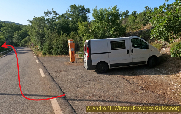
Small car park near Le Cavaliers emergency phone
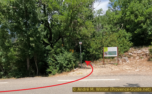
Several signs mark the access to the Descente des Cavaliers, as this is the main access to the Sentier de l'Imbut. There is also a map of the entire area that we will traverse here, but not all trails are marked.
No reproduction is permitted without the written consent of the author. (id6370)
Descent from the D71 road
The descent from Les Cavaliers is easy at first, with good all-round visibility, which is a sign that we are approaching the abyss. Opposite is the Collet Barris mountain, over which the ridge road from La Palud-sur-Verdon runs. You can see sections of this tourist road.
No reproduction is permitted without the written consent of the author. (id6371)
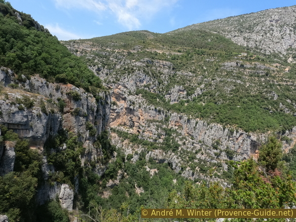
View in the Verdon at the start of Les Cavaliers descent
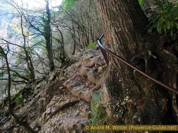
With the best view, we reach a rock step that is secured by a handrail. It's not difficult, but you shouldn't push down stones, because the path goes down to the right. Everyone who descends to the Sentier de l'Imbut takes this path, and a many also go back up here.
Below we come to a dry valley where we can see a waterless waterfall. We turn right.
No reproduction is permitted without the written consent of the author. (id6372)
Descent on a first passage on rock
The further way is steeper downhill. We walk for a long time on a rock strip and over natural steps.
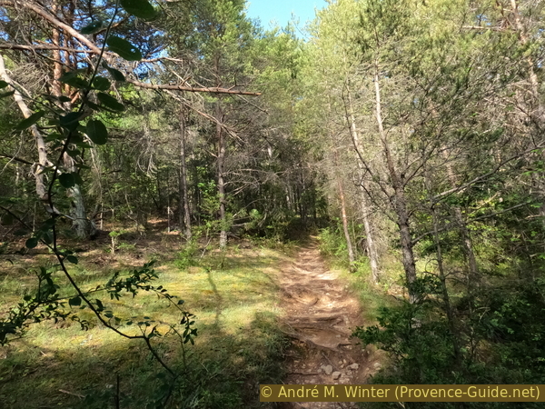
The path makes two big hairpin bends and plunges into a dense and dark forest.
No reproduction is permitted without the written consent of the author. (id6373)
Descente des Cavaliers trail to the Estellier footbridge
The path becomes easier when we are already far down approaching the river bed of the Verdon. However, the forest remains dense.
No reproduction is permitted without the written consent of the author. (id6374)
The Imbut Trail at the bottom of the canyon
We reach the Passerelle de l'Estellier, it is the only pedestrian structure that crosses the river. It allows to reach the Sentier Martel and to climb to the Chalet de la Maline hut.
The current footbridge was built to replace the bridge that was washed away by the heavy floods of 5 November 1994. It forms a steel arch made up of a structure with a V-shaped cross-section.
We are now at the bottom, the Sentier de l'Imbut starts here.
No reproduction is permitted without the written consent of the author. (id6375)
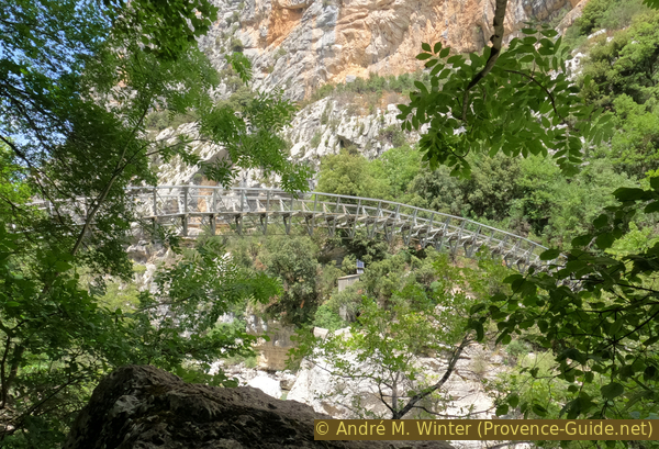
Passerelle de l'Estellier footbridge
Section 2: Sentier de l'Imbut
➙ 2,6 km ... 1 h 45 min ➚ 190 m ➘ 160 m ↝ average
20% easy trails, with marks
5% exposed trails, with marks
15% easy trails, easy trails
10% exposed trails, with marks
20% easy trails, with marks
25% exposed trails, with marks
10% easy trails, with marks
The clues
- Passerelle de l'Estellier foot bridge, 545 m
- Styx, 540 m
- Sentier Vidal fork, 575 m
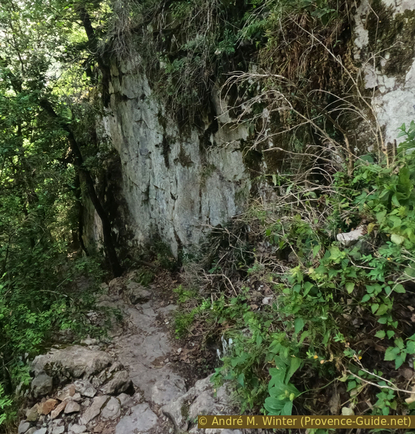
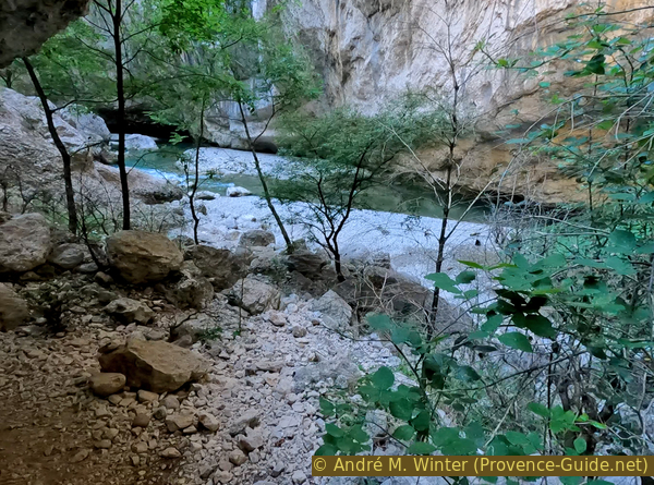
The heart of the hike with footbridges, caves and passages carved into the rock. This path is not difficult, but you should have a head for heights. Although we go downstream, we gain altitude as the last stretch is well above the water.
At the beginning here a commemorative plaque and reminder that you will see umpteen times on this course. The Verdon is dangerous. We pass sections with wide beaches, which, however, converge further downstream in narrow labyrinths of rocks, through which it is not possible to get through alive even without high tide. There are also several siphon passages. Most fatalities here in the Gorges du Verdon happen while canyoning without a guide.
The quality of the trail is very variable. We try to comment on the important points, but it is difficult to give any spatial clues. Instead, the time elapsed from the Passerelle de l'Estellier is given.
No reproduction is permitted without the written consent of the author. (id6376)
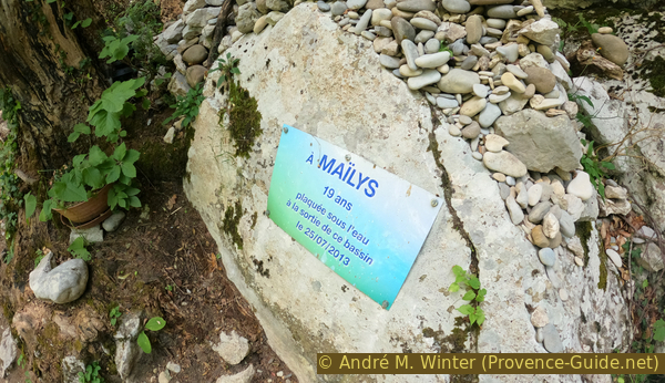
Souvenir plate of sportswoman who died in the Verdon
The first part of the Sentier de l'Imbut allows multiple descents to the river, which is relatively calm here in a fairly wide stream bed. But you see more vertical sections ahead where it's not so easy to leave the trail any more.
Be careful, moss and algae can be slippery! The water pressure is very rnds. The photos were taken in June 2022 at the beginning of the early onset of the drought.
Photo 10 minutes after the Passerelle de l'Estellier
No reproduction is permitted without the written consent of the author. (id6377)
Verdon river downstream from the Estellier footbridge
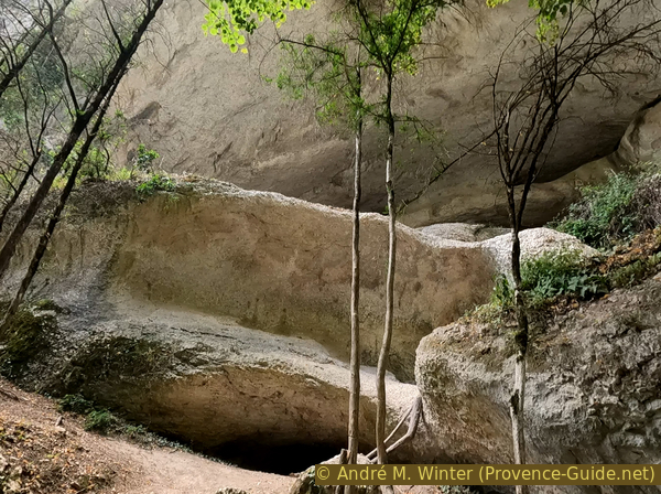
It continues up and down several times on loose ground. The path is stabilized with steps made of tree trunks. Here we pass semi-caves with intermediate levels. They were washed out in an area of soft limestone.
The trail used to be higher in the caves, but it has been moved lower to protect this natural environment.
Photo 15 minutes after the Passerelle de l'Estellier
No reproduction is permitted without the written consent of the author. (id6378)
Caves between the bridge and Falaise de Baucher
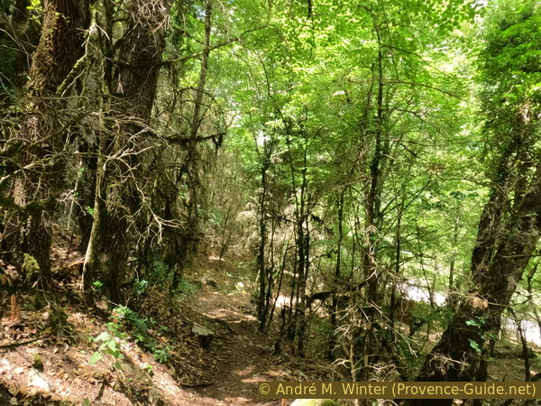
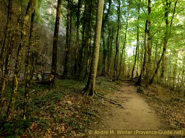
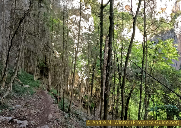
We often come through fairly dense forest sections. In the off-season it is quite cool there, but in summer the hot air stays here.
Photo 20 minutes after the Passerelle de l'Estellier
No reproduction is permitted without the written consent of the author. (id6379)
Forest on Sentier de l'Imbut
One can admire the turquoise colour of the Verdon better as one gains altitude. However, small trees often hide the view.
Photo 25 minutes after the Passerelle de l'Estellier
No reproduction is permitted without the written consent of the author. (id6380)
Sentier de l'Imbut now higher above the river
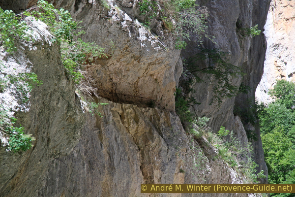
A little further ahead we come to a flat and wide path in a rather monotonous forest. Further up we see a rock face with a hollow base. A long time ago, the Verdon dug this base. You can climb to it from different places, but it's easier on the western end.
Photo 40 minutes after the Passerelle de l'Estellier
No reproduction is permitted without the written consent of the author. (id6381)
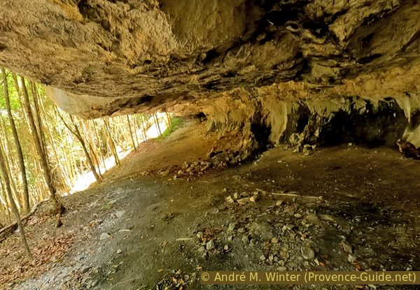
Long and deep overhang before Falaise de Baucher
We are here in the central part of the Sentier de l'Imbut. We go higher and higher and the view gets better and better.
Further on, we pass over more rock and a steel stair.
Photo 45 minutes after the Passerelle de l'Estellier
No reproduction is permitted without the written consent of the author. (id6382)
Verdon river before Falaise de Baucher
We gradually approach the area where the Sentier de l'Imbut runs long in the rock.
Photo 50 minutes after the Passerelle de l'Estellier
No reproduction is permitted without the written consent of the author. (id6383)
Verdon valley under the sun
The natural rock strip is not continuous, you often have to go up and down. This causes the great height difference of this section.
Photo 51 minutes after the Passerelle de l'Estellier
No reproduction is permitted without the written consent of the author. (id6384)
Sentier de l'Imbut below Falaise de Baucher
The climbing aids alternate with passages carved into the rock. These are often quite narrow.
Photo 52 minutes after the Passerelle de l'Estellier
No reproduction is permitted without the written consent of the author. (id6385)
Footbriges on Sentier de l'Imbut below Falaise de Baucher
But there are often very easy sections of the trail. This variety makes hiking here interesting, it never gets boring.
Photo 53 minutes after the Passerelle de l'Estellier
No reproduction is permitted without the written consent of the author. (id6386)
The trail tightens closer to the rock wall
Under an overhang is a juniper which is said to be 3000 years old. It is dead, but this very hard wood endures unchanged for decades. Juniper is called cade in Provence.
Photo 54 minutes after the Passerelle de l'Estellier
No reproduction is permitted without the written consent of the author. (id6387)
The millennial juniper on the Imbut Trail
In a very shaded area are several fissures in the rock above our heads. Signs warn us to be quiet. And indeed, we see tiny grey bats attached to the white rock.
This kind of very small bat weighs only 4 to 7 grams. It is a protected species because its population has dropped to 1% compared to the beginning of the 20th century.
Photo 55 minutes after the Passerelle de l'Estellier
No reproduction is permitted without the written consent of the author. (id6388)
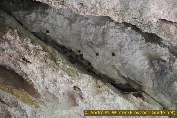
Rhinolophus hipposideros bats
We arrive on a wide beach which is in the sun during the midday hours in summer. It is, however, the last convenience of its kind on the rest of the hike.
Photo 1 hour after the Passerelle de l'Estellier
No reproduction is permitted without the written consent of the author. (id6389)
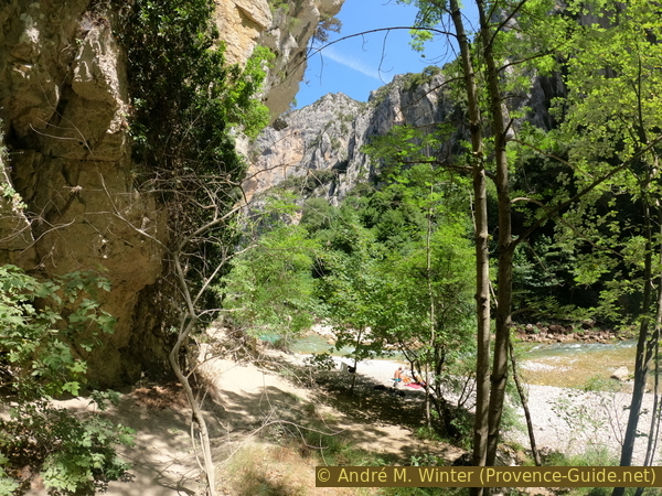
The last sunny beach before the narrow sections
The more serious things begin now. It is still a few times possible to go down to the water, but now only small coves remain.
After the peaceful beach follows another passage in the rock which makes the attraction of the path. On long sections, you can only move forward in single file. That is a reason to leave very early in the morning during the summer season.
Photo 1 hour and 6 minutes after the Passerelle de l'Estellier
No reproduction is permitted without the written consent of the author. (id6391)
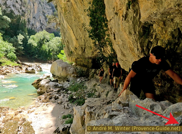
The trail is a manually widened rock strip
The forest is dense, but at times you can see the rock face of the north shore. It is more rugged than that under which we find ourselves. At the foot of this fault is the cave Baume de Maugué at the level of the Verdon. Maugué means bad ford.
Photo 1 hour and 8 minutes after the Passerelle de l'Estellier
No reproduction is permitted without the written consent of the author. (id6392)
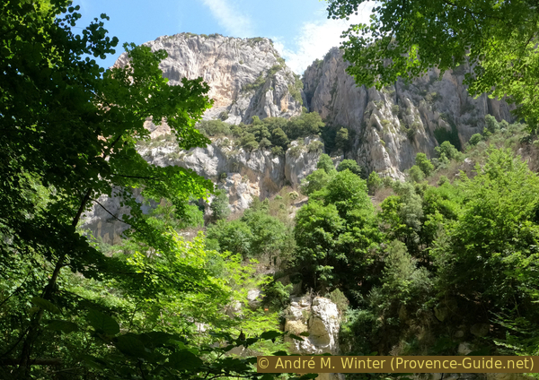
Cliffs above Baume de Maugué cave on the other side
The Verdon seems unchanged the whole time we walk on the south bank. But in front begins one of the especially narrow passages.
Photo 1 hour and 10 minutes after the Passerelle de l'Estellier
No reproduction is permitted without the written consent of the author. (id6393)
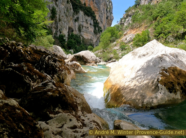
The still calm Verdon upstream of the Styx
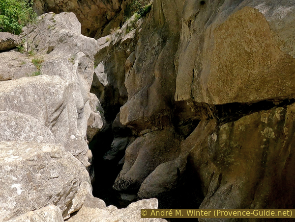
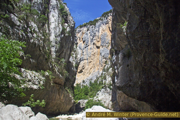
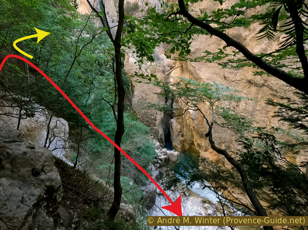
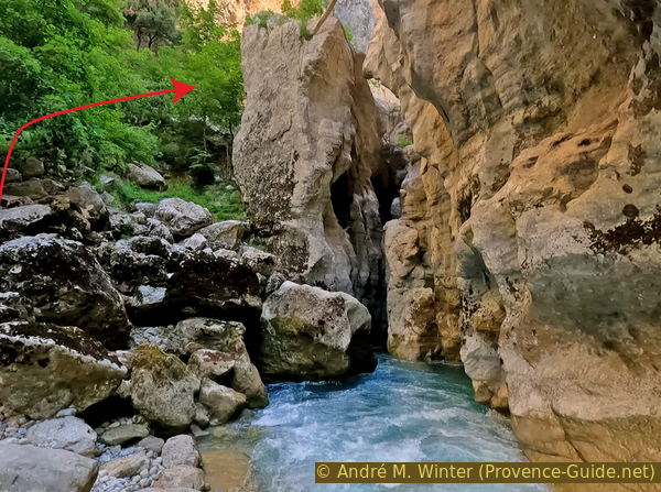
Now, you have to be careful not to miss the attraction of the Styx, this canyon dug at the bottom of the Grand Canyon du Verdon. This narrow passage explains the relative calm upstream, here the water must thread its way through very narrow entrails.
We notice that the path now leads to the other bank. Between the green branches we see a large rock that seems almost on the other side. The Styx is hidden behind it. However, we cannot continue there, we must then return to the main path. We'll have other views of the bottleneck later.
Photo 1 hour and 12 minutes after the Passerelle de l'Estellier
No reproduction is permitted without the written consent of the author. (id6394)
Sentier de l'Imbut just before the Styx
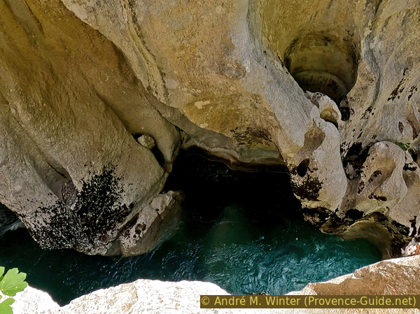
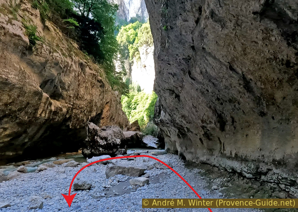
The Styx is one of the potentially deadly stretches because the water not only flows horizontally, but sometimes takes a deeper path for several minutes. This explains the relative calm at the water surface.
In Greek mythology, the Styx is one of the rivers and crossing points of the Underworld. The Styx also aims to prevent the dead from fleeing hell.
Photo 1 hour and 12 minutes after the Passerelle de l'Estellier
No reproduction is permitted without the written consent of the author. (id6395)
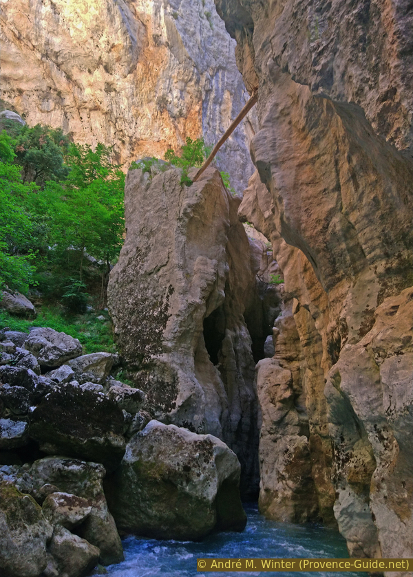
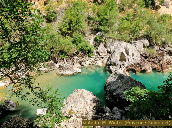
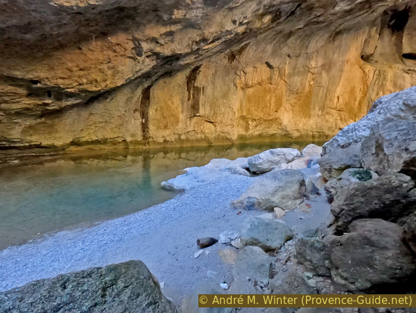
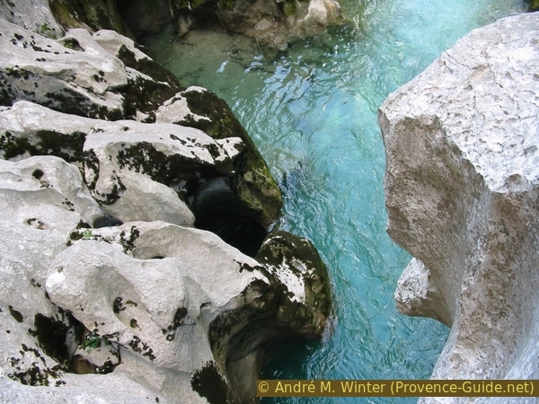
Le Styx in Verdon Canyon
The water seems to flow easily through this area, but the calm on the surface is deceptive. Everywhere we see deformed rocks blocking this passage. We see the rnds whirls better if we observe a certain area for a longer period of time.
Photo 1 hour and 12 minutes after the Passerelle de l'Estellier
No reproduction is permitted without the written consent of the author. (id6396)
Water in the Verdon Styx
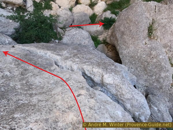
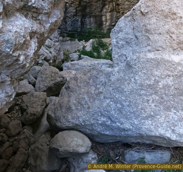
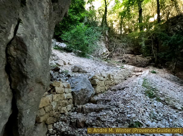
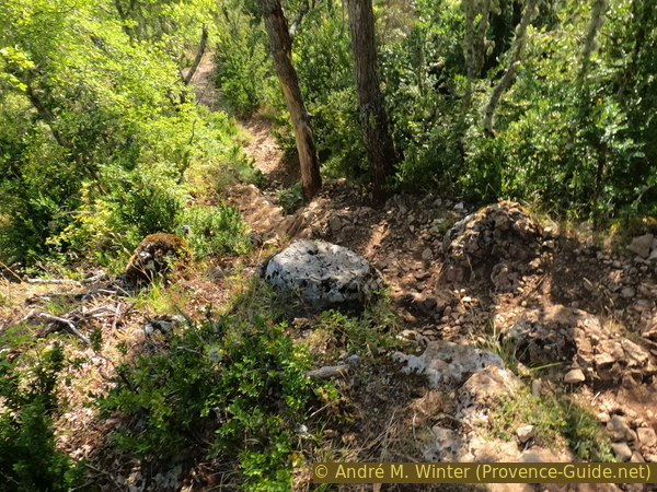
After the Styx follows a passage with a mixture of rocks and earth which threatens to block the path.
It is here that the landslide of July 2022 occurred, so a few days after the survey of this tour on 26 June 2022.
Photo 1 hour and 20 minutes after the Passerelle de l'Estellier
No reproduction is permitted without the written consent of the author. (id6398)
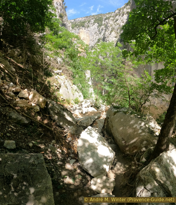
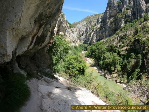
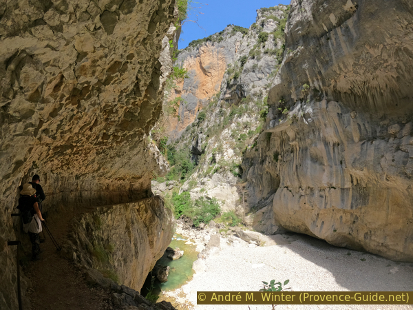
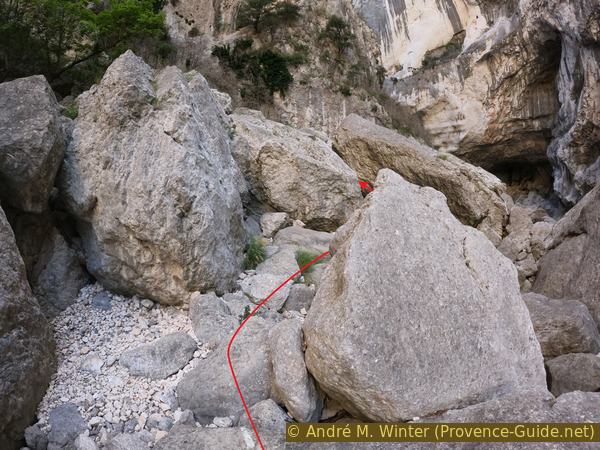
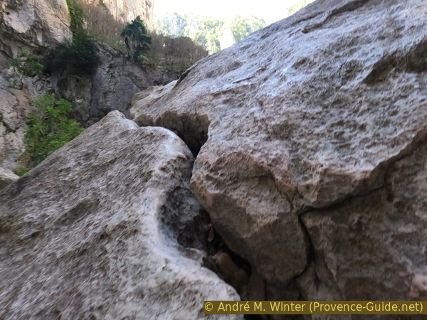
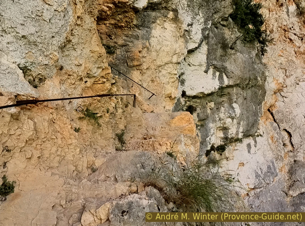
Sentier de l'Imbut between Styx and Sentier Vidal
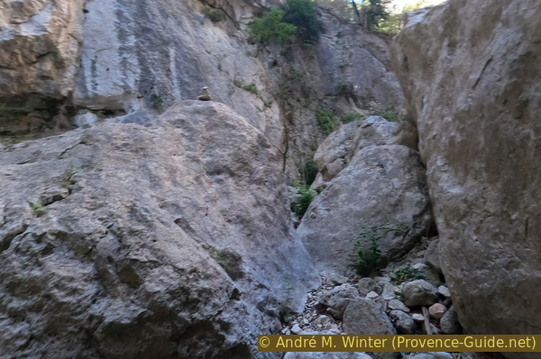
The lower part of the Verdon remains very tight and rocky. The two walls are overhanging. We see on the photo a small dark line in the left wall. This is our Sentier de l'Imbut, below a more detailed photo.
Photo 1 hour and 25 minutes after the Passerelle de l'Estellier
No reproduction is permitted without the written consent of the author. (id6399)
Verdon river bed and Sentier de l'Imbut
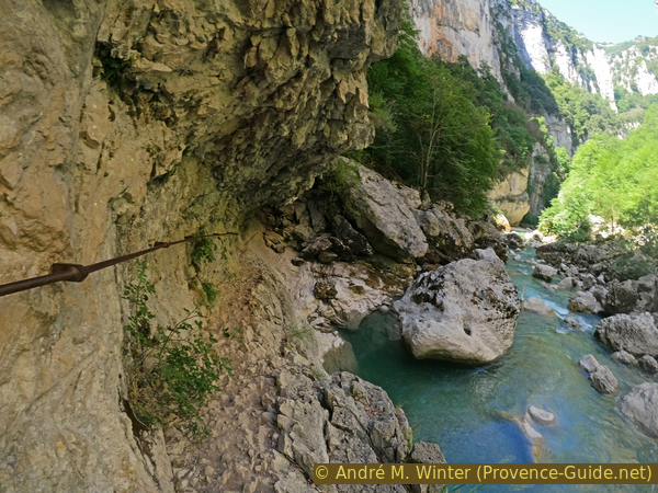
The path still benefits from some natural edge, but it is mostly chiselled in the rock.
Photo 1 hour and 25 minutes after the Passerelle de l'Estellier
No reproduction is permitted without the written consent of the author. (id6400)
Sentier de l'Imbut between Styx and Sentier Vidal
The sections in the rock are not continuous. You can walk down to the riverbed at times. The Verdon flows here further to the right along the north bank.
Photo 1 hour and 30 minutes after the Passerelle de l'Estellier
No reproduction is permitted without the written consent of the author. (id6401)
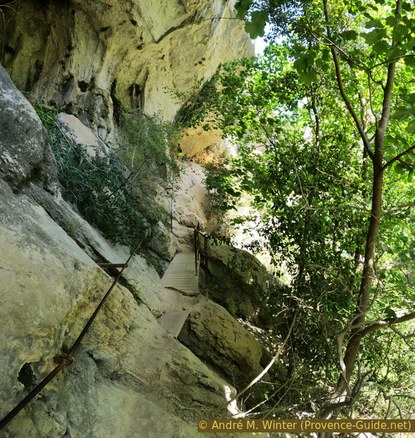
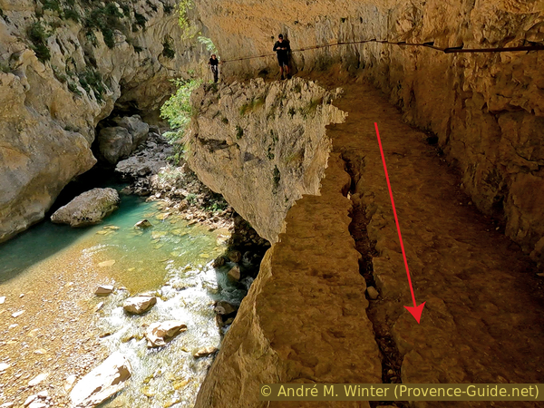
Verdon river bed and Sentier de l'Imbut
The corridor carved into the rock is wider here, but there is only a handrail on the wall side, the void side is unprotected. We are here in one of the most imposing passages of the Sentier de l'Imbut.
Photo 1 hour and 32 minutes after the Passerelle de l'Estellier
No reproduction is permitted without the written consent of the author. (id6402)
Sentier de l'Imbut between Styx and Sentier Vidal
The rock is hard and solid, even if cracks appear in the ledge you are walking on.
Photo 1 hour and 33 minutes after the Passerelle de l'Estellier
No reproduction is permitted without the written consent of the author. (id6406)
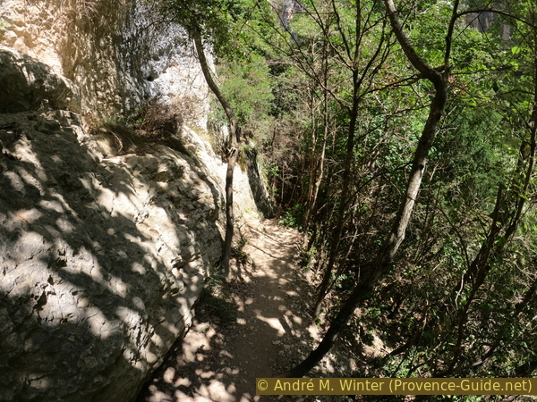
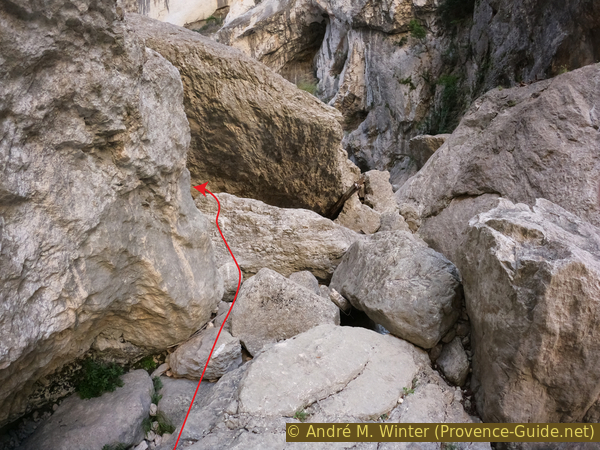
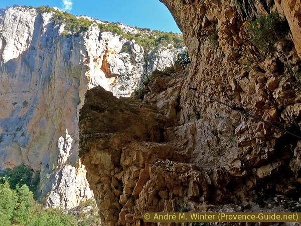
Sentier de l'Imbut before reaching Sentier Vidal
Sometimes the path is very narrow and you wonder where it goes. But there is never any doubt, it always continues on the same bank.
Photo 1 hour and 33 minutes after the Passerelle de l'Estellier
No reproduction is permitted without the written consent of the author. (id6403)
Sentier de l'Imbut before Sentier Vidal
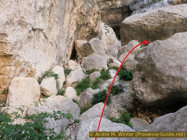
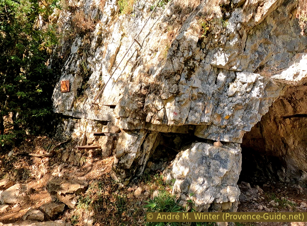
We are now close to the intersection with the Sentier Vidal which climbs further to the left. Before reaching this intersection of paths, you have to pass a earthy part and go up in switchbacks of about twenty meters in altitude until you find yourself in front of the explanatory panels of the Sentier Vidal.
Everything after that (to the Baou Béni and the Sentier Vidal) is more difficult than the Sentier de l'Imbut managed so far. If you realize that it has already been a lot, it is better to turn back and walk the Sentier de l'Imbut in the other direction. It is then useless to climb up to the crossroads with Sentier Vidal since it is in the middle of the forest.
Photo 1 hour and 40 minutes after the Passerelle de l'Estellier
No reproduction is permitted without the written consent of the author. (id6404)
Sentier de l'Imbut rather narrow
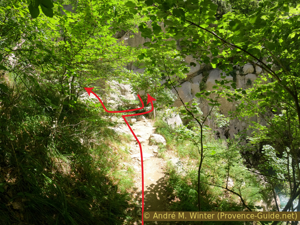
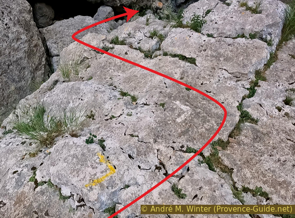
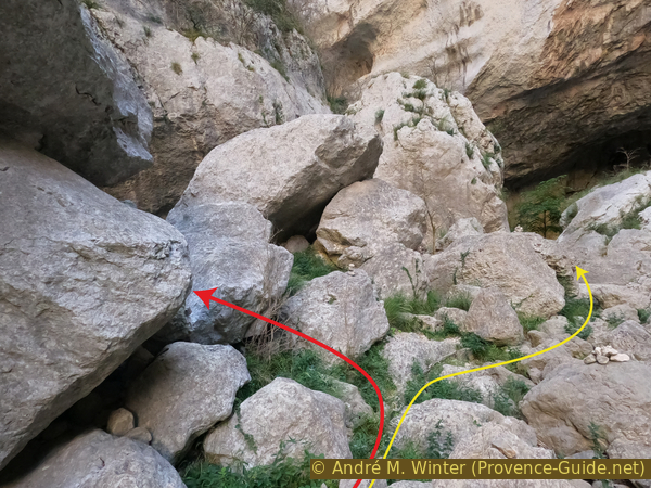
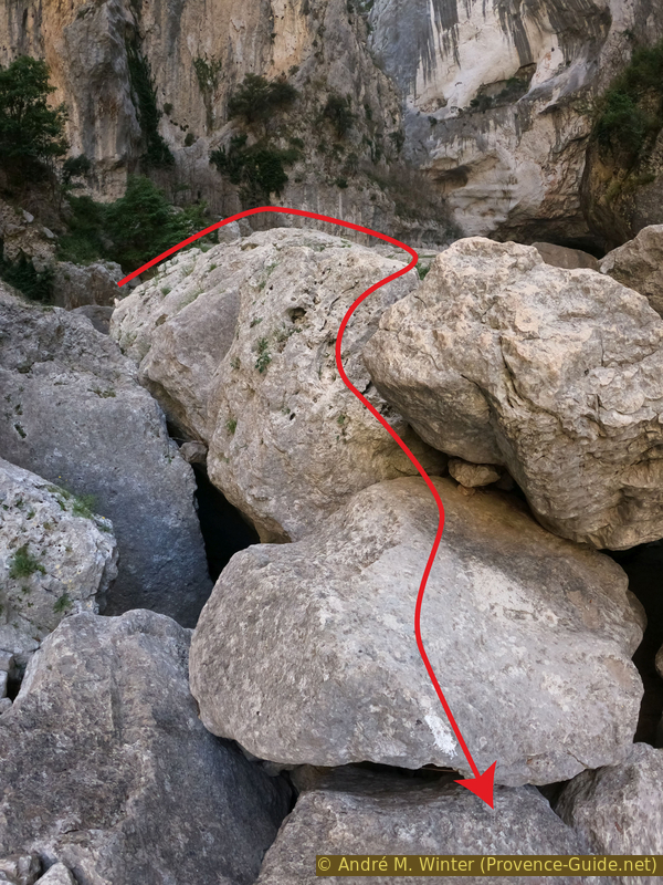
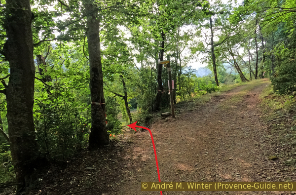
We finally go up to the intersection between the Sentier de l'Imbut and the Sentier Vidal. The red arrow indicates the continuation of the Sentier de l'Imbut towards the Étroit du Baou Béni as described in the following section. The yellow arrow shows the access to the Sentier Vidal via ferrata.
Photo 1 hour and 45 minutes after the Passerelle de l'Estellier
No reproduction is permitted without the written consent of the author. (id6405)
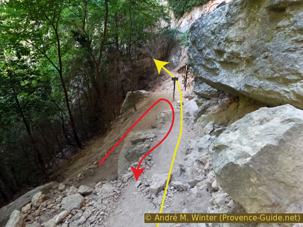
Fork Sentier de l'Imbut and Sentier Vidal
Section 3: Sentier Vidal - Étroit du Baou Béni
➙ 1,2 km ... 50 min ➚ 95 m ➘ 160 m ↝ very challenging
25% moderate trails, few marks
20% cross country, without marks
25% difficult trails, old marks
20% Trails with scramble passages, old marks
10% moderate trails, few cairns
The clues
- Fork with Sentier Vidal, 575 m
- Down to the Verdon river at l'Imbut, 515 m
- Big rocks, 560 m
- Narrow Baou Béni, 510 m
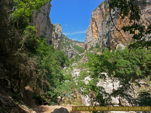
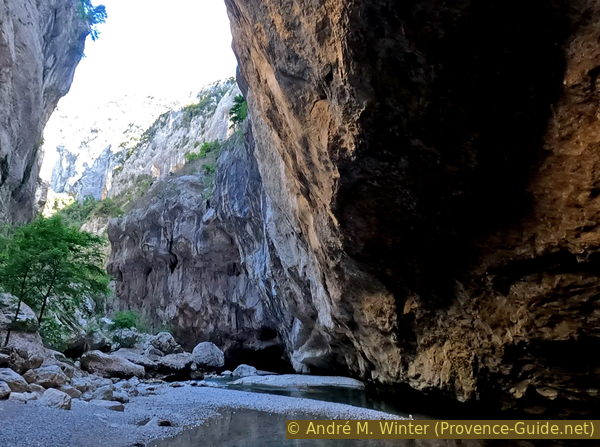
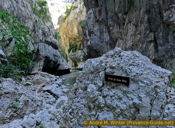
This section describes the end of the Sentier de l'Imbut between the Sentier Vidal and the Étroit du Baou Béni narrow passage. This is the obligatory detour for canyoning around a gorge narrower than the Styx that gives its name to the Sentier de l'Imbut. Imbut appropriately means funnel.
It is not possible to go beyond Baou Beni without going through the water. Let's remember the passages for the way back! However, this last passage is also very difficult, you need climbing skills to go through the big blocks. Don't go here alone, no one falling between big blocks can ever be found. Even without serious injuries, it is usually not possible to get out of the deep holes alone and without equipment.
The small map shows the location of the crossing between the Sentier de l'Imbut coming from the east (right) and ascending to the Sentier Vidal to the south (below). This line is solid and marked. Dashes mark most of this section 3 to Baou Béni. Baou Béni means Blessed Cave.
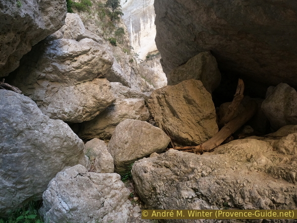
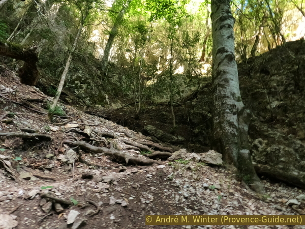
The first part of this trail to Baou Béni is easy. We walk along an earthy slope, higher up is an oblong semi-cave.
No reproduction is permitted without the written consent of the author. (id6407)
Sentier de l'Imbut under trees
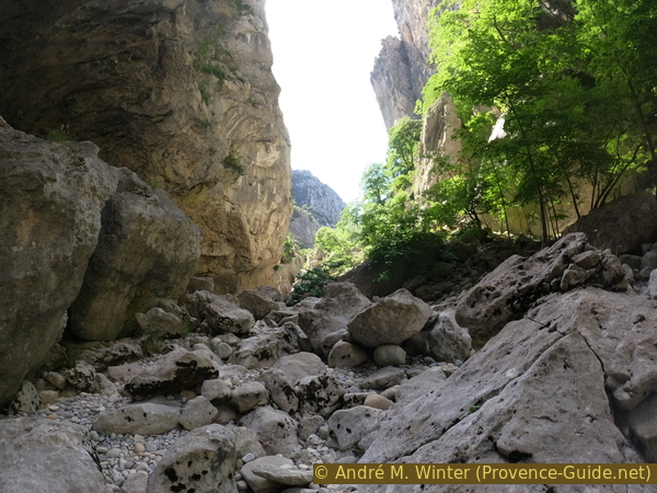
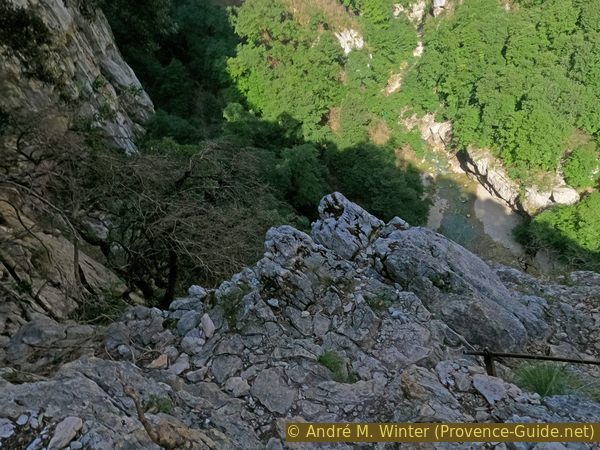
The path approaches the abyss and we see ahead on an extreme narrowing, it is the funnel of the Imbut. We see a coarse beach, we can go down there in the wood in front on the left.
No reproduction is permitted without the written consent of the author. (id6408)
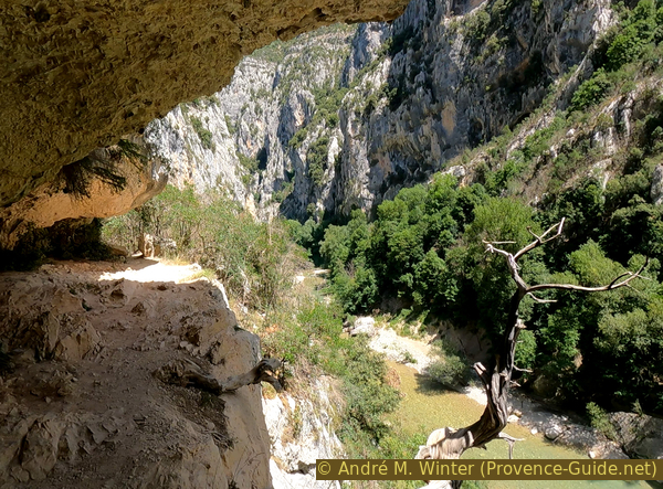
View in the narrow Imbut
Below is a dark beach, the sun is only found further upstream where we passed Sentier Vidal.
No reproduction is permitted without the written consent of the author. (id6409)
View upstream from the narrow
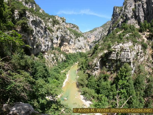
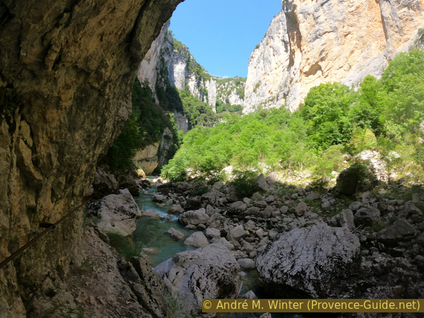
The inner gorge of the Imbut is even more impressive than that of the Styx because here you can clearly see the entrance and the incisions are even deeper. In addition, further down these cuts are covered with large rocks and the water of the Verdon disappears completely from the surface there.
This is the passage that caused the greatest difficulties for the first explorers Edouard-Alfred Martel and Isidore Blanc in 1905.
No reproduction is permitted without the written consent of the author. (id6410)
L'Imbut du Verdon
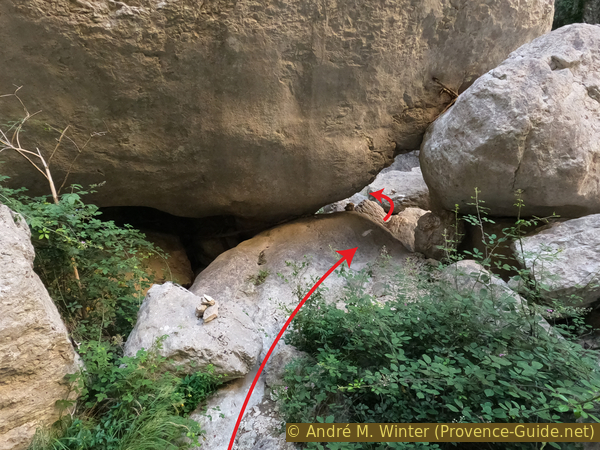
We then climb back up to the path. We pass a memorial plaque for a kayaker who drowned here in 1977. For us, this is the sign of the beginning of the most difficult part of the tour! We come over very large boulders, where the ascent is not always obvious. Below you can sometimes hear the water of the Verdon.
No reproduction is permitted without the written consent of the author. (id6411)
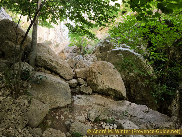
Access to Baou Béni via big rocks
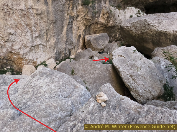
There are some faded yellow and white unofficial markers and a few cairns in the more advanced part. We try to describe in photos the most delicate passages.
No reproduction is permitted without the written consent of the author. (id6412)
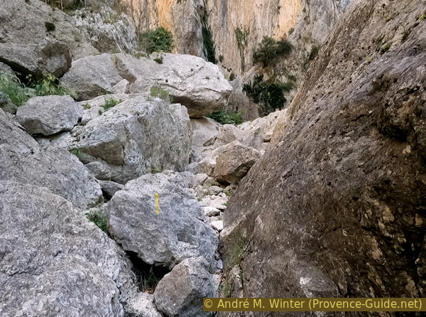
Marks on the way to Baou Béni
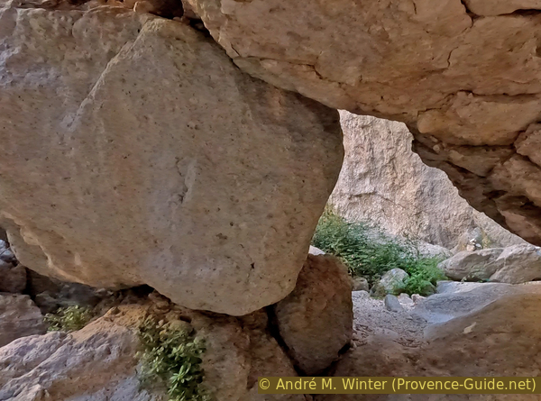
At the beginning, you pass medium-sized rocks with sharp edges. Farther ahead follow even larger, rounded rocks. Here lies the first difficulty. You have to pass in the centre because there are gaping holes on the left and on the right. The problem is the passage to the left of the rock to go to the upper level. There is no room and you have to huddle against the rock in the centre of the photo.
The passage is even more unpleasant in the other direction, we will have to cross it again on the way back.
No reproduction is permitted without the written consent of the author. (id6413)
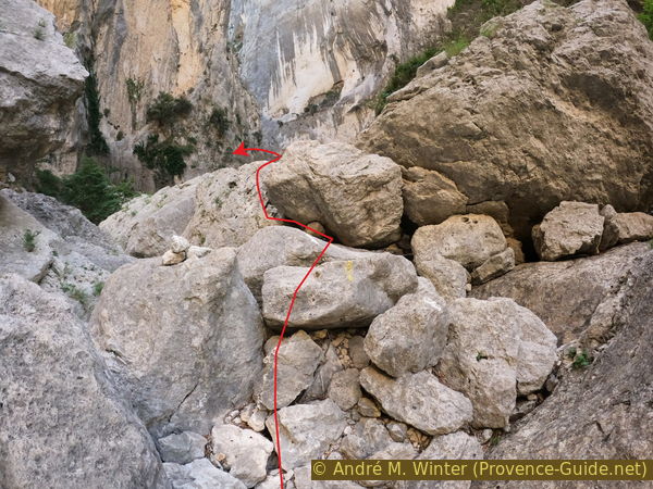
First difficulty
We arrive on a large boulder with a flat surface, but this respite is only short-lived. Markers indicate to turn left.
No reproduction is permitted without the written consent of the author. (id6414)
Left turn on the big flat boulder
This photo is taken from the edge of the block. You have to descend here for several metres. It is especially the first part which is sorely lacking in handles. They will be missed just as much on the return when it is necessary to climb here. At the bottom follow other white marks. Keep right at bottom.
No reproduction is permitted without the written consent of the author. (id6415)
Descent of the block over several metres
The following passage is easier. We pass in the in lowest possible zone.
No reproduction is permitted without the written consent of the author. (id6416)
Passage between rocks
After a large basin, you have to climb again and this in a fairly straight line. The trunk points to a cairn.
No reproduction is permitted without the written consent of the author. (id6417)
Advance along the axis of the tree trunk
Then, you will have to go behind the triangular rock while staying as low as possible.
No reproduction is permitted without the written consent of the author. (id6418)
Pass between the big rocks
Now keep to the left, because on the right rumbles the water of the Verdon which comes out of the Imbut here.
No reproduction is permitted without the written consent of the author. (id6419)
Pass behind on the left
We are now advancing among rocks with better holds. After this steep passage, you keep to the left again.
No reproduction is permitted without the written consent of the author. (id6420)
Maze to pass in downstream direction
We have a situation similar to the previous left descent. It looks easy at first.
No reproduction is permitted without the written consent of the author. (id6421)
Descent towards the southern rock face
In the upper part there is a crack in the rock that we can use to descend. It's great for the feet, but that doesn't mean there's grip for the hands at the same time.
Keep right at the bottom.
No reproduction is permitted without the written consent of the author. (id6422)
Crevice for the feet
It is impossible to continue in a straight line, we must go around the next rock on the right.
No reproduction is permitted without the written consent of the author. (id6423)
Turn right ahead
This takes us under a natural arch formed by huge rocks.
Just after this passage, we turn left because there is already water in front.
No reproduction is permitted without the written consent of the author. (id6424)
Pass under the rock and then to the left
At the next free area we have two options. The left, marked by white markings and the right, marked by small cairns. We take the left variant as it is less exposed and safer by higher water levels.
No reproduction is permitted without the written consent of the author. (id6425)
Last delicate point before Baou Béni beach
We go straight again towards the south wall, it is of course not a flat path, we have to find our way avoiding the big gaping holes between the rocks.
No reproduction is permitted without the written consent of the author. (id6426)
Further descent towards the southern rock face
We pass behind another large rock and stay very close to the rock wall on the left bank.
No reproduction is permitted without the written consent of the author. (id6427)
Way along the south wall
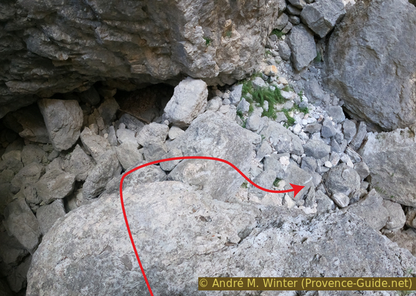
We come to another area that appears to be open, but the rocks on the right are too high. Another very large rock is leaning against the south face, forming a true natural tunnel. The only challenge is going down. On the left is a rope in poor condition. Pieces of wood help down to the right, this is where we went through and this is where the photo was taken.
Even if this passage seems difficult downhill, it poses no problem uphill on the way back.
No reproduction is permitted without the written consent of the author. (id6428)
Natural tunnel just before Baou Béni
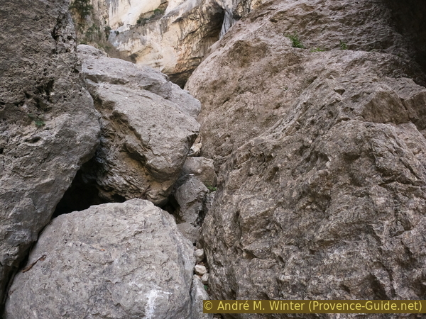
At the exit, a beach awaits us in a very tight part of the Gorges du Verdon.
No reproduction is permitted without the written consent of the author. (id6429)
Easier terrain at the exit of the natural tunnel
Very little sunlight comes in here. The one we see is reflected by the light rocks above. You can only hear running water here, no traffic noise, nothing.
No reproduction is permitted without the written consent of the author. (id6430)
Baou Béni is an overhang through which the Verdon passes
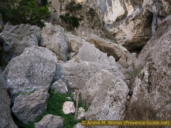
One could believe that the way is open looking in a downstream direction.
No reproduction is permitted without the written consent of the author. (id6431)
View downstream from Baou Béni
That's not true, we're not getting any further in this direction on dry land. This is followed by several bottlenecks that are reserved for canyonists. The path that we have just taken so far is a bypass designed specifically for those who climb the Verdon with canyoning equipment.
We recommend taking a break here as the next hour will be difficult and physical. We must return from Baou Béni to the junction with Sentier Vidal and then climb the latter.
No reproduction is permitted without the written consent of the author. (id6432)
Étroit du Baou Béni
Section 4: Étroit du Baou Béni - Sentier Vidal
➙ 1 km ... 40 min ➚ 100 m ➘ 35 m ↝ very challenging
10% moderate trails, few cairns
25% Trails with scramble passages, old marks
35% difficult trails, old marks
30% moderate trails, few marks
The clues
- Narrow Baou Béni, 510 m
- Big rocks, 560 m
- Fork with Sentier Vidal, 575 m
The return path on the same route through the chaos of rocks.
The marks guide well for the return and we know the way but it stays challenging. After the tunnel follows the passage under the rocks.
No reproduction is permitted without the written consent of the author. (id6434)
Pass under these rocks
One of the delicate passages is the climb in the crack. Here a photo taken during the return.
No reproduction is permitted without the written consent of the author. (id6433)
Crevice to go up
Here we are back at the most difficult passage because of the gaping hole on the left (on the right going down).
Thereafter, we advance on an easier and known path. It is not necessary to descend towards the Verdon, we stay up high until the crossroads.
No reproduction is permitted without the written consent of the author. (id6435)
Difficult way down
Section 5: Sentier Vidal
➙ 1,3 km ... 1 h ➚ 360 m ➘ 0 m ↝ average
5% moderate trails, with marks
10% via ferrata, few marks
15% exposed trails, few marks
10% via ferrata, few marks
15% easy trails, few marks
40% easy trails, old marks
The clues
- Sentier Vidal access, 575 m
- Road D71, 832 m
- Long distance trail GR99, 930 m<
This trail has some via ferrata type passages. It is no more difficult than the Sentier de l'Imbut, but its verticality makes it challenging.<
The start of the Vidal trail is very impressive. The ascent on the first hundred metres is hard since the difference in height is very important.
The Sentier Vidal owes its name to an engineer who created it during works to develop the Verdon access at the beginning of the 20th century. It was then an escape route for the workers. It should only be taken uphill.
It begins with the simple path that advances in a small rocky cirque. But it rises very quickly, you can see it in the top left corner of the photo.
No reproduction is permitted without the written consent of the author. (id6436)
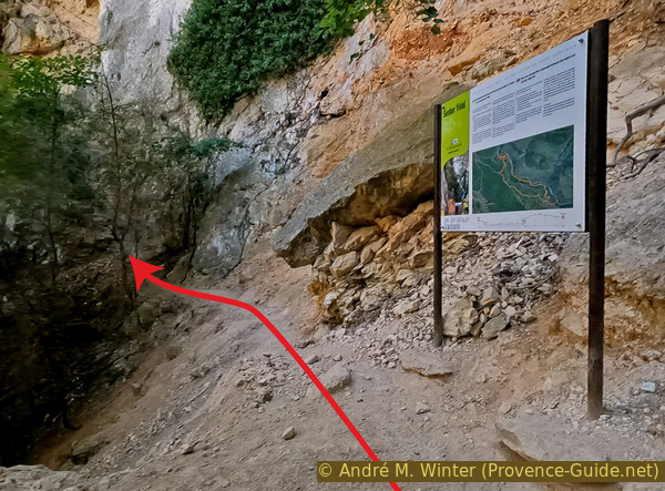
Panel explaining the Sentier Vidal
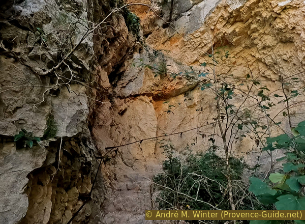
The Sentier Vidal is cut into the rock. It certainly takes advantage of the terrain, but a lot of rock had to be removed.
No reproduction is permitted without the written consent of the author. (id6437)
Ascent of the first rocky part of the Sentier Vidal
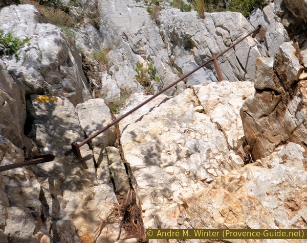
We go up without respite in bends, a handrail accompanies all the parts in the rock.
No reproduction is permitted without the written consent of the author. (id6438)
Handrail and carved steps of the Sentier Vidal
The outlook changes at each bend. The rocks wall in the sun is on the north bank of the Verdon.
No reproduction is permitted without the written consent of the author. (id6439)
Dizzying Sentier Vidal
Looking down takes a bit of courage. We are here in the upper part of the first rocky sector on the Sentier Vidal.
No reproduction is permitted without the written consent of the author. (id6440)
Deep view from Sentier Vidal
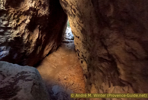
The Sentier Vidal enters a wooded valley and passes over a mixed terrain of rocks, dirt and scree. The climb remains steady, there are no flat passages.
We pass several times near the rock walls of the valley, often we see caves there, sometimes the path passes directly inside as here.
No reproduction is permitted without the written consent of the author. (id6441)
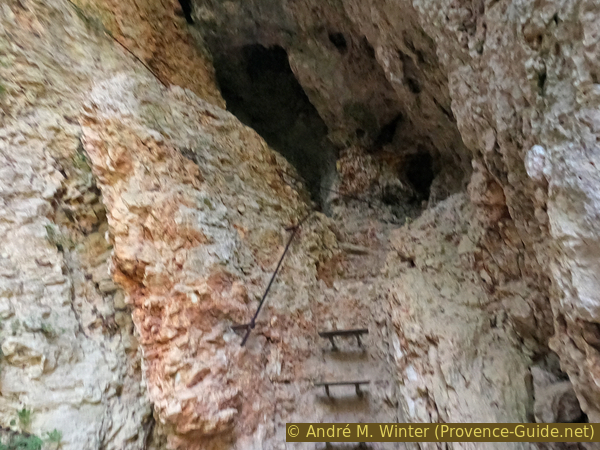
The Sentier Vidal leads through a cave
After the cave, we return in mixed terrain. Sometimes roots form the steps.
No reproduction is permitted without the written consent of the author. (id6442)
Mixed ground
All this steep valley is filled with rubble and rather unstable earth. The path zigzags in it and low walls too rarely stabilize this area.
No reproduction is permitted without the written consent of the author. (id6443)
Stabilized path in the scree
You can see all the roughness of this valley in the upper part. Tree roots hold the ground in place.
No reproduction is permitted without the written consent of the author. (id6444)
Ascent on earth and rubble
Another rocky part awaits us when we reach the top of the valley. It is as straight up as the first, but here we are walking mostly on steel.
No reproduction is permitted without the written consent of the author. (id6445)
Beginning of the second part in the cliff
A long ladder makes it possible to cross an otherwise very difficult area. We make a maximum of height up this way.
No reproduction is permitted without the written consent of the author. (id6446)
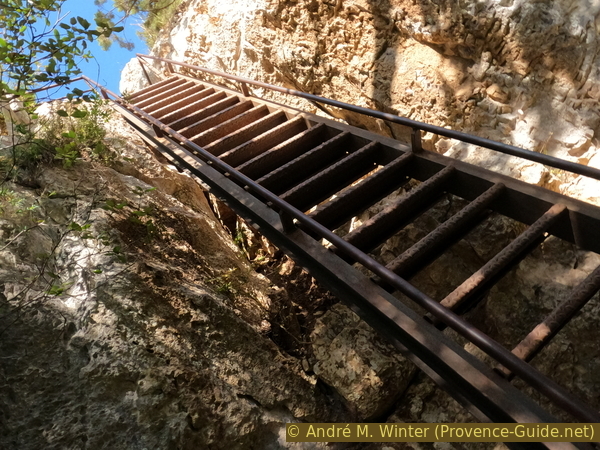
Ladder in the upper part of Sentier Vidal
The last steps are carved into the rock.
No reproduction is permitted without the written consent of the author. (id6447)
The trail takes us back to the sun
The demanding part is over when we see this easier passage. We arrive on a sort of small plateau.
No reproduction is permitted without the written consent of the author. (id6448)

The simpler Vidal trail
The back view: the Imbut du Verdon is the large dark part to the right of the centre of the photo.
The path continues to climb more wisely and it widens little by little to a forest road.
No reproduction is permitted without the written consent of the author. (id6449)
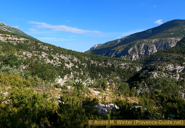
View over the Imbut area
We reach the road. Take left here, pay attention to the cars and look for the signpost on the other side. This is the continuation of Sentier Vidal.
No reproduction is permitted without the written consent of the author. (id6450)
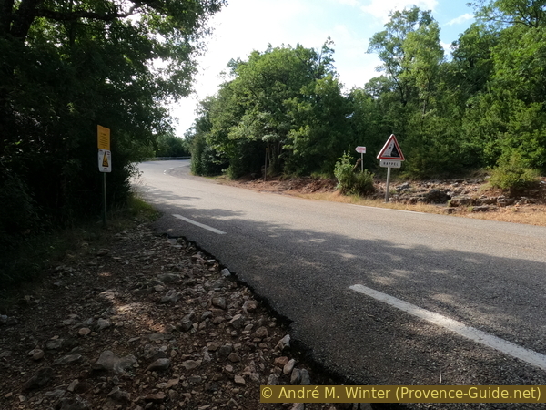
Crossing D17 road
This trail has nothing in common with the earlier passages, it joins the long distance trail GR99 in about ten minutes.
No reproduction is permitted without the written consent of the author. (id6451)
Sentier Vidal above the road
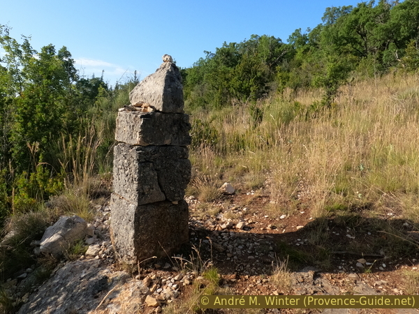
We pass an old stone pillar that undoubtedly demarcated land and we see the forest road in front where the trail GR99 between Aiguines and Trigance passes. We take the direction of Trigance on the left and go more concretely to the Parking des Cavaliers.
No reproduction is permitted without the written consent of the author. (id6452)
Sentier Vidal reaches the GR99 trail
Section 6: GR99
➙ 2,8 km ... 20 min ➚ 5 m ➘ 150 m ↝ easy
30% forest roads, few marks
70% easy trails, few marks
The clues
- Long distance trail GR99, 930 m
- La Grande Forêt, 930 m
- Road D71 east of Les Cavaliers, 790 m
Easy return to the starting point.
We follow this almost flat forest road for about 800 metres. After about 150 metres is the Fontaine de Périer spring above the path. It is a water basin covered by the forest, the water does not seem drinkable.
We arrive at a signpost and a large meadow. Go down here on the left. Do not go straight ahead, this road leads directly to the closed military area of Camp de Canjuers.
No reproduction is permitted without the written consent of the author. (id6453)
Down on GR99 trail to Les Cavaliers
These meadows are protected areas to promote biodiversity.
No reproduction is permitted without the written consent of the author. (id6454)
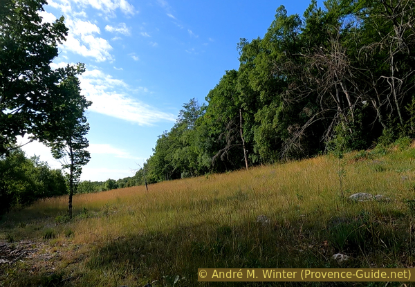
Meadows under La Grande Forêt farm
The GR99 is now mostly downhill, the slope is not great but the karstic terrain is tricky. In winter and after rain, large puddles of water can cover parts of the path.
No reproduction is permitted without the written consent of the author. (id6455)
Trail condition to Les Cavaliers
We pass another pillar which delimited something.
No reproduction is permitted without the written consent of the author. (id6456)
Old boundary stone under the La Grande Foret farm
The forest is not dense, but it can provide some shade.
We are back at the starting point in a few minutes.
No reproduction is permitted without the written consent of the author. (id6457)
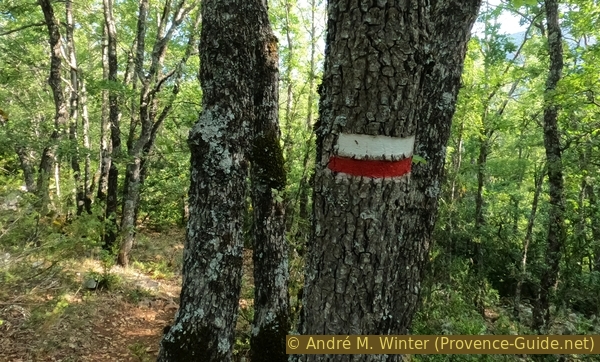
Waymark GR99
Sources and additional information
It is better to use a good topographic hiking map: this tour is on the IGN map "Gorges du Verdon, Moustiers-Sainte-Marie, Lac de Sainte-Croix, PNR Du Verdon", scale 1:25000, 3442OT.
If you don't want to bother with a paper map, you can also use mapping apps on your cell phone. On the one hand, it is the Cartes IGN app from the official map service. However, it requires access to the data network and this is sometimes difficult in canyons or remote locations.
Alternatively, you can use apps that store data directly on the device. They're generally not free, but they don't cost much. We mainly use OSMAnd, here it is possible to add contour lines, relief shading, markings and others. To store this data on your phone you need a lot of space.
Of course, one needs access to satellites for the GPS signal with any app. In some canyons this is not the case. Therefore, do not rely on the position shown, but read the map on your phone as you would read it on paper. Most apps are available for Android and iPhone. The applications usually allow us to record the route travelled and also view the GPS files offered for each of our hikes.
This page has been seen 4919 times since 20 March 2024.
No reproduction is permitted without the written consent of the author. (id6397)
Clear Water in the Styx