Saint-Mandrier peninsula
In search of preserved places
hike
average
3 h 30 min
yes
yes
built-up area
mountain
Introduction
The peninsula of St. Mandrier closes the Bay of Toulon and it is only through this promontory that the location becomes strategically interesting. The large bay and the stretches of coast facing the sea are all equipped with military installations from many centuries. The French Navy is still strong and around a third of the municipal area of St. Mandrier is a military zone. Nevertheless, especially on the south coast, there are wide and untouched sections that can only be reached on foot along the Sentier du Littoral. To close the loop, we cross the island in the middle through an unexpectedly quiet forest. Steep sections, military facilities and settlements force us to make a few detours and so the tour reaches over 300 meters in altitude difference.
The facts
11,8 km total distance
3 h 30 min walk time
320 m total elevation
orientation easy
mark 40% of the total distance
35% easy trails
25% hard-surfaced city alleys
10% moderate trails
5% cross country
5% hard-surfaced city roads
5% hard-surfaced quiet side streets
5% parks
5% on beach
<5% hard-surfaced paths
<5% forest roads
dangers exposed paths, military installations
children yes
useful picnic stuff, swimwear
required trekking shoes, hiking gear and water
GPS coordinates (WGS84) of start and end point 43.080530988332946,5.896552503932196
downloads ![]()
![]()
No reproduction is permitted without the written consent of the author. (id6459)
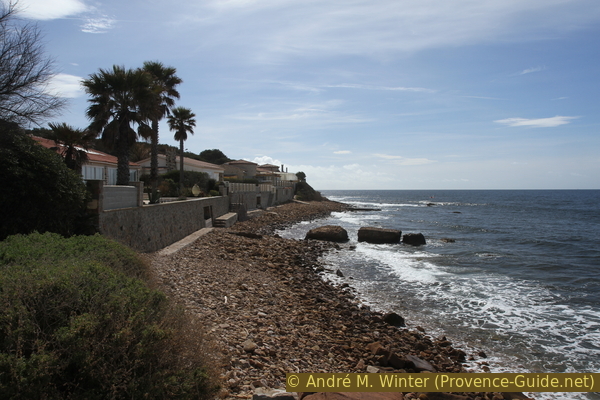
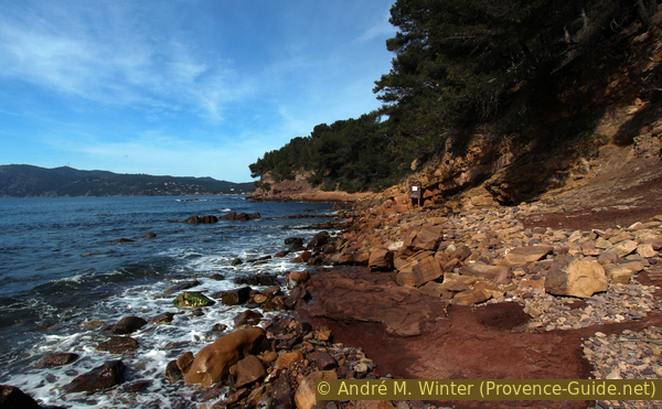
Break in the bay east of Pointe de Marégau cape
Public transport
It is neither easy nor quick to get to the peninsula, you should arrive by public transport, especially in summer, when you can take the 18M ferry from the pontoon Toulon. Many bus lines stop at this quay in Toulon, where it is called Station Maritime. All information can be found under Réseau Mistral (only french).
Attention, the bus service is severely restricted on public holidays. From Toulon train station, only bus line 40 goes to the port terminal: from the train station, walk down Avenue de Vauban opposite and cross Boulevard Général Leclerc. Here on the right, the bus stop is in front of the small supermarket Carrefour.
The ferry is active every day with a dense timetable. The 18M ferry takes you from the Toulon pontoon to Ponton des Sablettes in 30 minutes (a ferry every 30 minutes during the week and every hour on public holidays). This is also where the tour starts.
Access by car
With a car you have to bring a lot of patience, it is really better to travel by ferry.
From Saint-Tropez and basically from the east, take the A57 and A50 motorways to cross Toulon from east to west. We take La Seyne Center exit. At many other roundabouts, keep heading towards La Seyne until you find the sign for Saint-Mandrier/Six-Fours (do not take St Mandrier par Centre-Ville). From the three-lane road you have to turn slightly to the right, but then immediately get into the left lane (direction Centre des Impôts). Continue straight on until a second set of traffic lights, turn left here (direction Maison de la Jeunesse). Keep going on this one-way road, which gets narrower, more winding and steeper at the front. At the next roundabout, turn left towards Saint Mandrier and continue following the indications to Saint Mandrier. When we get to the flat area of Les Sablettes it's time to look for a parking space.
Coming from Marseille, we take La Seyne exit and follow the indications for Saint-Mandrier. At a roundabout with an olive tree in the middle, turn left onto Route des Sablettes. Stay in this direction, regardless of roundabouts and other indications. In Les Sablettes do not continue to Saint-Mandrier, it is better to get rid of the vehicle here.
Useful parking spaces
There are two large car parks in Les Sablettes. They are to the west and east of the large Fernand Braudel park. Coming from the west you go through the park to meet the tour, from the east you go east (monument to Lattre de Tassigny).
Hints
The section around Pointe de Saint Elme cape can only be passed when the sea is calm because you have to walk very close to the water. If the swell is too high, take the way from the beginning back to the starting point!
In the military areas, shooting exercises and manoeuvrers with heavy equipment are possible.
The seaside and inbound routes are almost parallel, with good crossings in the following areas: between Saint-Mandrier and the Plage de la Coudoulière, on the passes in the middle of the peninsula and at the Plage Sainte-Asile.
The whole region is a zone with a high risk of forest fires. In summer, but also in other seasons when it is very dry or by strong winds, access to the forest areas can be regulated. As a result, the roads may be closed to traffic and/or the trails prohibited to hikers. Current information: Map of access to the forests of the Var (also english). The map shows the colours green, yellow, orange and red which correspond to levels of danger. The affected area is: Monts Toulonnais (1).
The sections
- Pass Saint-Elme hill, back to the Plage de Sainte-Asile and via Marégau to the military site of La Renardière
- Descend to Plage de la Coudoulière, continue along the Corniche d'Or and walk via a last saddle to the port of Saint-Mandrier
- From the port of Saint-Mandrier through the Pin Rolland forest and through the urbanization to Plage de Sainte-Asile
- Seaside around Cape St. Elme
In Saint-Mandrier, shops and bars are open all year round, in Les Sablettes only in summer and otherwise on public holidays when the weather is nice.
No reproduction is permitted without the written consent of the author. (id4244)
Military restricted area at Cap Cépet
Section 1: Sablettes - Sainte-Asile - La Renardière
➙ 4 km ... 1 h ➚ 135 m ➘ 55 m ↝ easy
<5% hard-surfaced city roads, without marks
10% parks, without marks
25% hard-surfaced city alleys, without marks
5% forest roads, without marks
10% hard-surfaced city alleys, faulty marks
15% easy trails, few marks
<5% hard-surfaced city alleys, faulty marks
30% moderate trails, faulty marks
The clues
- Les Sablettes, 0 m
- Sainte-Asile beach, 0 m
- Coast near Marégau, 35 m
- Calanque, 0 m
- Batterie du Gros Bau, 65 m
- Batterie de la Renardière saddle, 85 m
First along the road, then across a wild coastal landscape to the east.
station maritime = ferry
stèle = monument
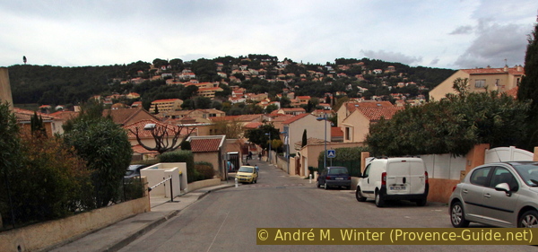
Our starting point is Les Sablettes, which is the stretch of sand between La Seyne to the west and St. Mandrier to the east.
We arrive publicly either on the 18M ferry or on the 8 bus route which stops right in front of the shuttle pontoon. We cross the street and enter Parc Fernand Braudel, then keep left. We arrive on a straight axis called Allée entre deux Terres or Allée Danielle Mitterand. This axis goes east to a roundabout. We turn left, cross the street to the right and pass on the parking lot opposite.
If you arrive by car at the western car park, go in the direction of Parc Fernand Braudel and look for the straight axis as described above. Those who took the parking lot further east are now on the tour described below.
We go to the eastern part of the parking lot overgrown with pine trees. Here is a monument in memory of Marshal Lattre de Tassigny. The Battle of Toulon ended here on 28 August 1944 with the surrender of the last German Nazis.
No reproduction is permitted without the written consent of the author. (id4251)
Fishing boats in the port of Saint-Mandrier
We then go forward on an alley parallel to the busy main road. We'll be seem thrown onto the main road for a short while, but can take a shortcut and soon after we'll be able to take another parallel path. 60 meters ahead we turn right and follow the big curve to the left. We come to tennis courts, which we pass on the right.
No reproduction is permitted without the written consent of the author. (id4252)
Beginning of Chemin piétonnier forestier Ardisonne
So we come to a parking lot and near a soccer field. Here we cross the street to the right and at the next roundabout we also turn right onto Avenue Marie Fliche Bergis. In this way we bypass a large deserted park on the right-hand side.
So we get to a parking lot, where we turn right again. At the end of the asphalt there is a gate and behind it a forest road in the parc that is open to the public.
No reproduction is permitted without the written consent of the author. (id4253)
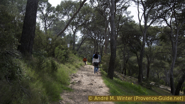
The broad path Chemin piétonnier forestier Ardisonne
This path turns left, passes public toilets and reaches a parking lot. This is where the small market of Pin Rolland takes place.
No reproduction is permitted without the written consent of the author. (id4254)
Way above Avenue du Général Kœnig
We cross the car park towards the road, turn right towards the sea and thus arrive directly at the beach and the promenade of Sainte-Asile.
No reproduction is permitted without the written consent of the author. (id4255)
Continue along Avenue du Général Kœnig
When the road turns left and the promenade ends, the actual coastal footpath begins. We first go under the perimeter walls of the villas. The coast here is sloping and only coarse gravel can be found along the water.
No reproduction is permitted without the written consent of the author. (id4229)
Coast under the villas of Marégau
Some times we have to follow small stairs to avoid boat garages. Sometimes you also have the choice between a path along the wall (the only one that always goes through) or a more exposed path closer to the water.
No reproduction is permitted without the written consent of the author. (id4230)
Coast between Ste. Asile beach and Pointe de Marégau cape
The nature of the coast suggests more serious rocks further ahead. And indeed, just before the Pointe de Marégau cape, the markings lead us from the coast up to the road. Keep left here and then right, also right again at the next crossing and continue uphill.
No reproduction is permitted without the written consent of the author. (id4231)
Transition to Avenue du Languedoc
We now come back to a (small) fenced military area. Right behind it begins a path that first runs between two fences.
No reproduction is permitted without the written consent of the author. (id4232)
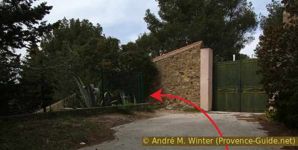
Avenue d'Auvergne and military area at Pointe de Marégau cape
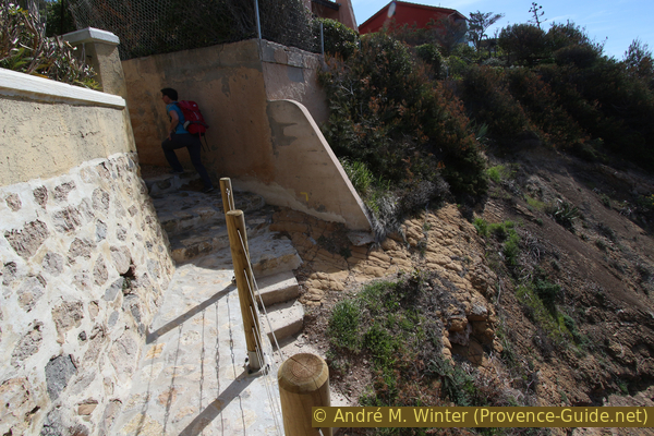
At the top, turn right and you will come to a viewpoint behind the small military area.
There, a bold staircase leads down into a small rocky bay.
No reproduction is permitted without the written consent of the author. (id4234)
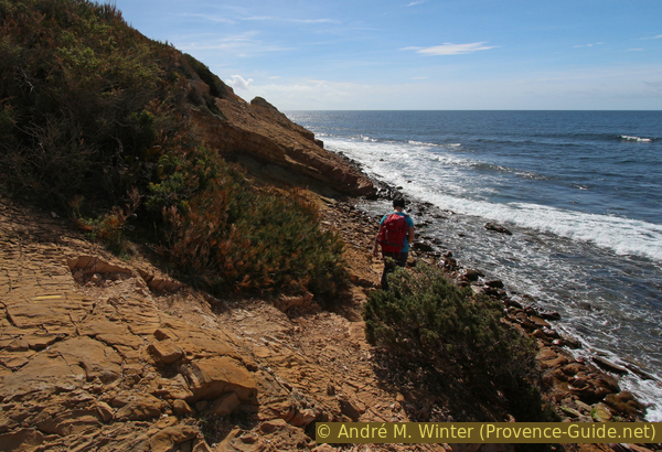
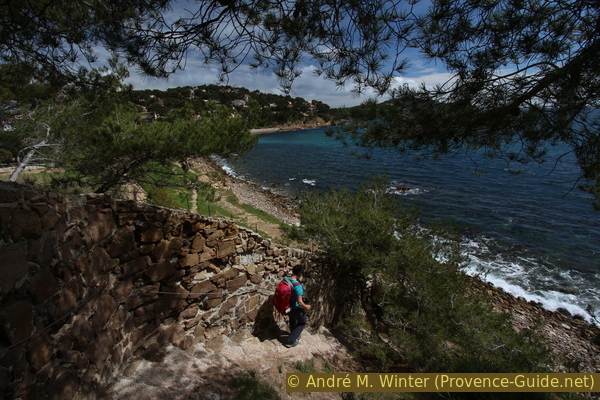
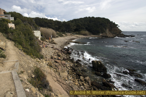
Viewpoint east of Pointe de Marégau cape
Here we can do a few more meters of altitude. The descent pays off because we can see the rocky coast further east. We also see here why the coastal path has to run so high up here.
No reproduction is permitted without the written consent of the author. (id4233)
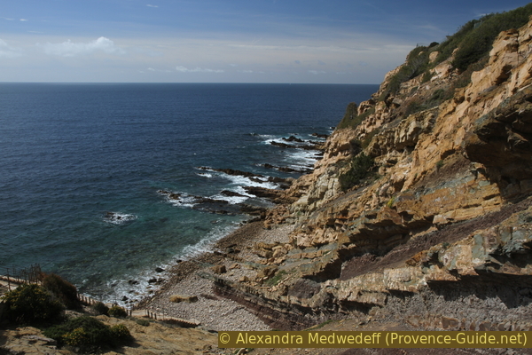
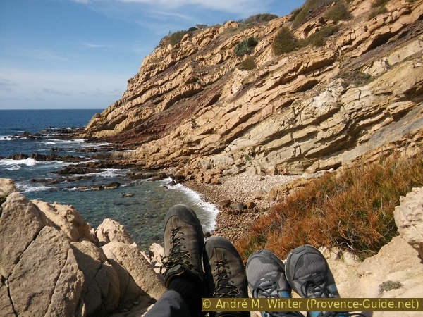
Bay with stair east of Pointe de Marégau cape
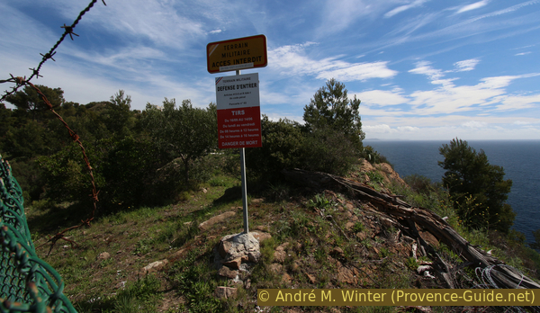
After the bay we have to force the many steps back up, up to the right and on the rock face. After about 100 meters there is another vantage point and a second military area has to be circumnavigated. This one is larger, it is the ruins of the Battery du Gros Bau, behind which we walk around.
The fort has not been used for a long time, but the army conducts shooting exercises here.
Never enter the forbidden zone, even if there are holes in the fence.
No reproduction is permitted without the written consent of the author. (id4235)
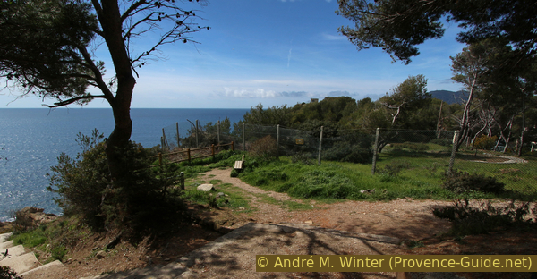
View of the sea east of Batterie du Gros Bau
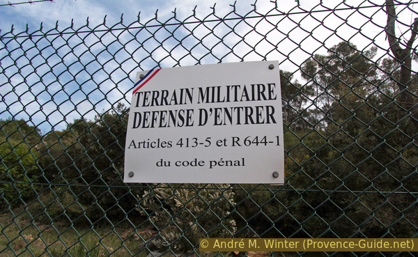
Behind the fort we go back to the cliff edge in the coastal area and after 200 meters we are again in front of a fence. Now we have to bypass the battery de la Renardière and this area is still in constant use. The area is also much larger, it will take some time to get around.
No reproduction is permitted without the written consent of the author. (id4236)
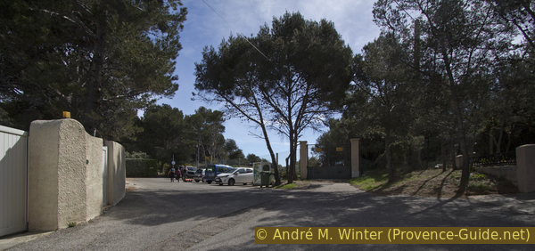
Signs west of the military zone La Renardière
At the top we come to the gate of the military installation. We are now on the main ridge of Saint-Mandier peninsula. Section 1 ends here
No reproduction is permitted without the written consent of the author. (id4237)
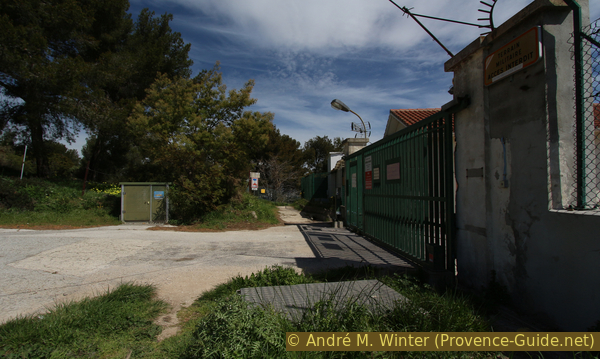
Gateway to La Renardière military area
Section 2: La Renardière - Plage de Grave - St. Mandrier
➙ 3,1 km ... 1 h ➚ 80 m ➘ 165 m ↝ average
25% easy trails, few marks
5% hard-surfaced paths, without marks
40% easy trails, without marks
10% hard-surfaced quiet side streets, without marks
10% easy trails, without marks
10% hard-surfaced city alleys, without marks
The clues
- La Renardière saddle, 85 m
- Plage de la Coudoulière beach, 0 m
- La Corniche d'Or, 10 m
- Plage de Grave beach, 0 m
- Creux de St. Georges saddle, 70 m
- St. Mandrier, 0 m
We advance to the large military area at Cap Cépet and then, via a last saddle, we turn left to the port of Saint Mandrier.
We need to go further around the military area, we just go down along the fence. So we come back to the cliff edge above the sea. Here it goes slowly but surely downhill to Plage de la Coudouliere beach. Just before you get to the beach, the marked path makes strange detours between old fences and walls.
No reproduction is permitted without the written consent of the author. (id4239)
Descent to Plage de la Coudouliere beach
We cross the car park and then take the promenade. Benches invite you to take a break or just relax.
No reproduction is permitted without the written consent of the author. (id4240)
Promenade of La Coudouliere bay
The promenade ends quite abruptly in the east. We don't go further on the rocks here, it's really dangerous and there is nothing to see except rubble. We look further back for stairs upwards.
No reproduction is permitted without the written consent of the author. (id4241)
Stair up to the Corniche d'Or
At the top we come to a wide path, which we easily follow to the right. So we pass under the villas of the Corniche d'Or.
No reproduction is permitted without the written consent of the author. (id4242)
Coastal footpath on the Corniche d'Or
This path leads us to the gravel beach Plage de Grave (also called Plage de Cavalas), this is the last accessible coastal area before the large military area on the cape. Do not take the stairs to the left of the emergency telephone, but continue forward to the fence of the restricted area.
No reproduction is permitted without the written consent of the author. (id4243)
Arrival at Plage de Grave beach
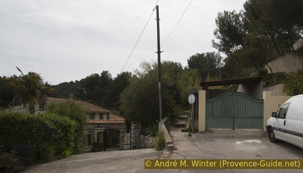
Like the previous times, we walk along the fence. This time, however, things are not going straight uphill. We come through a wetland with reed grass. Further ahead we pass a large car park and then the path turns left uphill. Here you pass abandoned gardens.
No reproduction is permitted without the written consent of the author. (id4245)
Path under the Route du Cap Cépet
This path leads us to a road that we continue to climb in the same direction.
No reproduction is permitted without the written consent of the author. (id4246)
Climbing Route du Cap Cépet
At the wide crossroads, turn right onto Route du Sémaphore and continue uphill.
As soon as possible, we turn left (marking on the curb) and come to a dead end.
No reproduction is permitted without the written consent of the author. (id4247)
Go left here
There, at the gate, our path leads down between a fence and a large wall (Creux de Saint Georges).
No reproduction is permitted without the written consent of the author. (id4248)
Entry into the path down to the Creux de Saint Georges depression
station maritime = ferry
col = Sattel
The descent is quite consequent, you come to a fallow area and so to rue Jean Aicard where we continue downhill. Bottom right to return to the port of St. Mandrier.
You can end the hike here and go back to Toulon by ferry on the line 28M.
No reproduction is permitted without the written consent of the author. (id4249)
Rue Jean Aicard downhill
Section 3: Saint-Mandrier - Plage de Sainte-Asile
➙ 2,8 km ... 45 min ➚ 90 m ➘ 85 m ↝ average
20% hard-surfaced city roads, without marks
15% hard-surfaced city alleys, without marks
40% easy trails, few marks
25% hard-surfaced city alleys, few marks
The clues
- Port de St. Mandrier, 0 m
- Col de la Renardière saddle, 83 m
- Plage Sainte-Asile beach, 0 m
We cross the peninsula from north-east to south-west. In the middle there is a wooded ridge, which we cross under high pines.
No reproduction is permitted without the written consent of the author. (id4251)
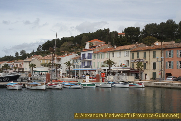
Fishing boats in the port of Saint-Mandrier
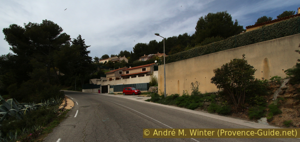
We leave the harbour basin and go to the large square to the fountain. Here turn right in front of bars and the police and go straight over the next crossing and past the bakery. This street leads to Avenue Marc Baron, turn left here and after the sports field, turn right onto Chemin des Aubepines. We see the hill in front of us.
No reproduction is permitted without the written consent of the author. (id4250)
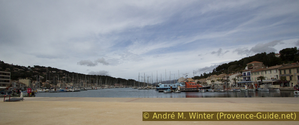
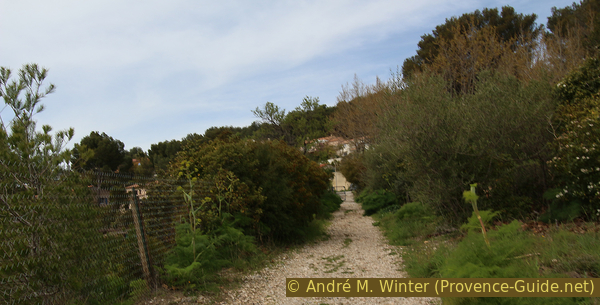
Port of Saint-Mandrier
There is a noticeable uphill climb from the first curve and after the second one the road ends, but continues in the form of a footpath (Chemin Ardisonne). The course of the path is not dissimilar to that of the road, it goes comfortably, now in the shade, uphill over three hairpin bends.
No reproduction is permitted without the written consent of the author. (id4252)
Beginning of Chemin piétonnier forestier Ardisonne
col = saddle
We come to a wooden barrier and behind it to a road that runs along the north-south ridge of the peninsula. We cross this road, opposite is a signpost to Pin Rolland.
No reproduction is permitted without the written consent of the author. (id4253)
The broad path Chemin piétonnier forestier Ardisonne
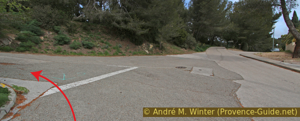
So we take a path downhill, which always leads along the denser forest line a little above a road. It is now consistently going south-west downwards.
No reproduction is permitted without the written consent of the author. (id4254)
Way above Avenue du Général Kœnig
You have to ignore the many signs and other markings (especially those of the fitness course) and always stay about 20 meters to the right of the downhill road. When this Avenue du Général Kœnig makes two hairpin bends, many paths in the forest cross, here straight ahead and slightly to the right as in the picture.
No reproduction is permitted without the written consent of the author. (id4255)
Continue along Avenue du Général Kœnig
col = saddle
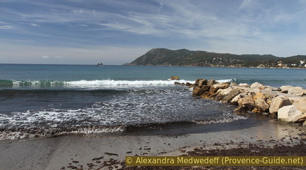
We come to a crossroads, here turn right into the district of Marégau. We go around a playground and at the roundabout turn right onto Avenue de la Mer, here we go west. At the end of the street we see the beach of Sainte-Asile Bay. We go straight onto the beach and keep to the right. You can rest well under the large pines.
No reproduction is permitted without the written consent of the author. (id4228)
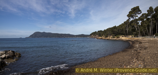
Cap Sicié and Plage de Ste. Asile beach
Section 4: Plage Ste.-Asile - St. Elme - Pointe de Marégau
➙ 1,9 km ... 40 min ➚ 10 m ➘ 10 m ↝ difficult
45% cross country, without marks
15% hard-surfaced quiet side streets, without marks
25% on beach, without marks
10% parks, without marks
5% hard-surfaced city roads, without marks
The clues
- Plage Sainte-Asile beach, 0 m
- Cape and Port Saint-Elme, 2 m
- Les Sablettes, 0 m
Wild rocky coast back to the starting point.
Warning: the following stretch of coast to Port de Saint-Elme is not an official route. In the east it is officially closed, but there are no barriers. Rockfalls can occur here, so don't walk here during or after heavy rains. Strong winds inland (which you can already feel on the Plage Ste.-Asile beach) are just as unfortunate. In these cases we better go to the right on the beach and avoid the westernmost section by walking the same way as on the beginning of the tour.
We circle this hill on which a disused fort is enthroned (cannot be visited).
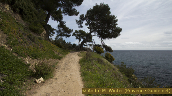
West of the beach we follow a path at the edge of the forest as long as one is still available. But very quickly we land on the shore area, which consists of coarse gravel and more and more solid rock blocks that we have to avoid or climb over. Progressively, the rock wall on the right also gets higher and the ledge along the water on which we walk gets narrower and narrower.
No reproduction is permitted without the written consent of the author. (id4227)
Rocky area at Pointe St. Elme cape
In the rocky areas you always have to keep an eye out for easy transitions. Sometimes it is better to go left directly at the water, then right again further up. Below the fort, which cannot be seen well, we cross the municipal boundary from St. Mandrier to La Seyne, where there is also a sign warning of the further section. This is where it gets a little more difficult.
It is the rocks, some of which are in our way, that make the section so interesting. The rocks are partly so weathered that the surface forms like small cushions, it is also appropriately called wool sack weathering. Wool used to be stuffed into sacks and tied tighter with string. This rock is very grippy as long as there is no algae growing on it.
No reproduction is permitted without the written consent of the author. (id4226)
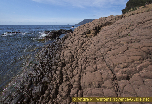
Spheroidal weathering at Pointe Saint Elme cape
At Cap Saint-Elme, which is not very distinctive, a few darker ledges of rock lead down to the water. Sometimes you have to climb over it on the top right, it always depends on how the waves are. Never climb under the trees on the slope, this terrain is very rough and at the top you are quickly faced with an insurmountable fence.
When we already see the stone pier of the port of St-Elme, we have to go around an uncomfortable rock on the water side, which cannot be avoided on the land side. If necessary, you have to wait for a calmer phase in the wave action. When the sea is calm, however, you can easily walk past here.
No reproduction is permitted without the written consent of the author. (id4225)
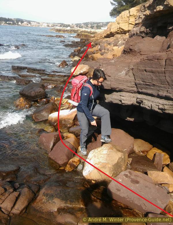
Bottleneck at Pointe St. Elme cape
The person in the picture is walking in the opposite direction.
station maritime = ferry
stèle = monument
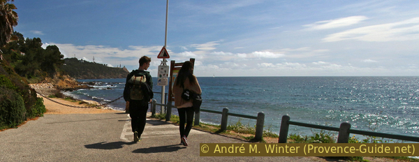
Behind the cape we come directly into the small fishing port. We stay to the right of the wall and cross two fences where there are open areas for pedestrians. As soon as possible, we go down to Plage des Sablettes and enjoy the view of Cap Sicié.
No reproduction is permitted without the written consent of the author. (id4224)
View of Cap Sicié
We pass the sailing school and some restaurants on the beach. Between the two stone moles, a paved beach promenade begins on the right, which we change to. So we go west and further along the beach.
This beach is south of Parc Fernand Braudel, which we know from the start of the tour. We can go through the authorized passages in the direction of the straight axis. Then left to the ferry terminal, the bus stop and the west car park. On the right is the eastern parking lot with the monument.
No reproduction is permitted without the written consent of the author. (id4223)
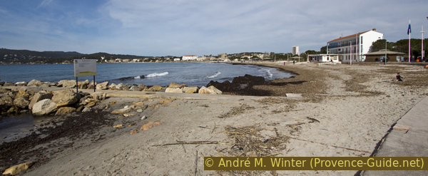
Plage des Sablettes beach with the promenade on the right
Sources and additional information
It is better to use a good topographic hiking map: the tour is on the IGN map "Toulon, Le Gros-Cerveau, Mont-Faron", scale 1:25000, 3346OT.
If you don't want to bother with a paper map, you can also use mapping apps on your cell phone. On the one hand, it is the Cartes IGN app from the official map service. However, it requires access to the data network and this is sometimes difficult in canyons or remote locations.
Alternatively, you can use apps that store data directly on the device. They're generally not free, but they don't cost much. We mainly use OSMAnd, here it is possible to add contour lines, relief shading, markings and others. To store this data on your phone you need a lot of space.
Of course, one needs access to satellites for the GPS signal with any app. In some canyons this is not the case. Therefore, do not rely on the position shown, but read the map on your phone as you would read it on paper. Most apps are available for Android and iPhone. The applications usually allow us to record the route travelled and also view the GPS files offered for each of our hikes.
This page has been seen 2690 times since 20 March 2024.