L'Escalet and the Camarat lighthouse
To Cap Camarat and back via La Quessine
hike
average
4 h 45 min
seasonal
yes
no
mountain
Introduction
You can walk the entire peninsula of Saint-Tropez along the coastal path. This is a particularly beautiful stretch of the Côte d'Azur. However, it is very difficult to plan a circular hike here that also leads back to the starting point on the same day. Most of the private areas between the coast and the ridgeline also prohibit hikers from going through. We are now happy to suggest a hike in the central cape of the peninsula. We start from L'Escalet, towards Cap Camarat and up to the lighthouse, which few people reach on foot. It goes back through the overgrown valley of La Quessine.
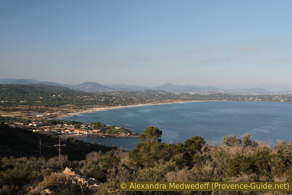
There are no longer any beaches in the section of coast that we walk on, so there are far fewer people here than south of L'Escalet, even in the high season. We look long into the Bay of Bonporteau between Cap Taillat and Cap Camarat. From the ridge we see down several times the beach of Pampelonne.
The facts
10,5 km total distance
4 h 45 min walk time
350 m total elevation
orientation average
mark 65% of the total distance
60% easy trails
15% hard-to-recognize trails
10% hard-surfaced quiet side streets
5% dirt roads
5% stairs
dangers heat in summer, no drinking water on the way
children not too small because of lengthy sections
useful picnic stuff, swimwear
required trekking shoes, hiking gear and water
GPS coordinates (WGS84) of start and end point 43.18734,6.642419
downloads ![]()
![]()
Public transport
The starting point and destination are difficult to reach publicly.
There is no regular bus service to Ramatuelle. In summer only, the beach bus (line 875) runs between St. Tropez bus station and Ramatuelle. Timetables for this line can be found at Zou! (only french). Our stop is called L'Escalet, but this is the saddle of the same name above the bay. You have to add 250 meters and 65 meters in altitude and you can cut off a hairpin bend on a path halfway up.
Access by car
The Plage de l'Escalet beach is located in the south-east of the Saint Tropez peninsula. The fastest access, also from Hyères via Cogolin, is via the large roundabout in La Foux. This is the major crossroads on the roads between St. Tropez and Cogolin and between Sainte-Maxime and Cavalaire. From there we first drive in the direction of St. Tropez. At the second bulky roundabout (in the middle there is a garden centre) we turn off towards Ramatuelle. We drive first between vineyards. At the first roundabout under the village of Ramatuelle, we turn left towards Les Plages. After the steep descent and a long left turn we can take the one-way right to L'Escalet, it is a legal shortcut. Turn right at the stop sign and left at the next crossing to L' Escalet. It goes into a saddle in front and behind it steeply down to the beach. The parking lot is at the bottom right.
Coming from Le Lavandou and Cavalaire you drive through Cavalaire and after the long plain you come to a roundabout where you can turn right to Gigaro. Drive uphill and at the next roundabout turn left towards Ramatuelle. Further up, turn right again and continue to Ramatuelle. This road is narrow and very winding, but also nice to drive on with the many pine trees. We come in a saddle and behind it the curves continue. When we come to a level, at the first crossroads we turn right towards L'Escalet. After another saddle it goes steeply down to the beach. The parking lot is at the bottom right.
Useful parking spaces
Driving down into L'Escalet cove, the car park is immediately on the right. It has a height limit and is subject to a fee in summer. Along the road by the sea there are other marked parking spaces on both sides, these are free of charge all year round. In summer and every other weekend with nice weather, parking spaces can get tight here. However, hikers who come early shouldn't have any problems.
No reproduction is permitted without the written consent of the author. (id5083)
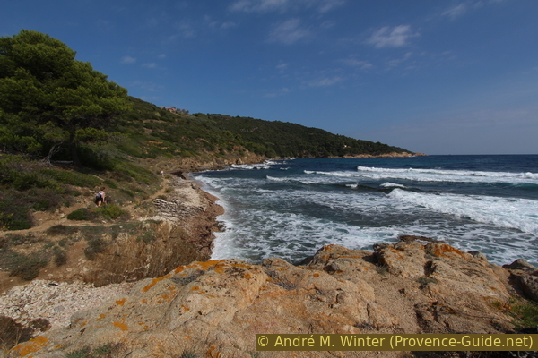
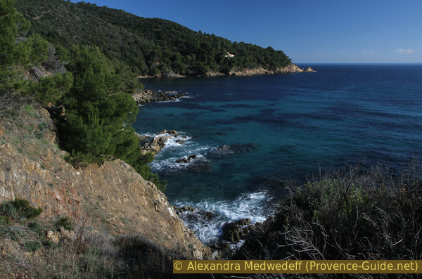
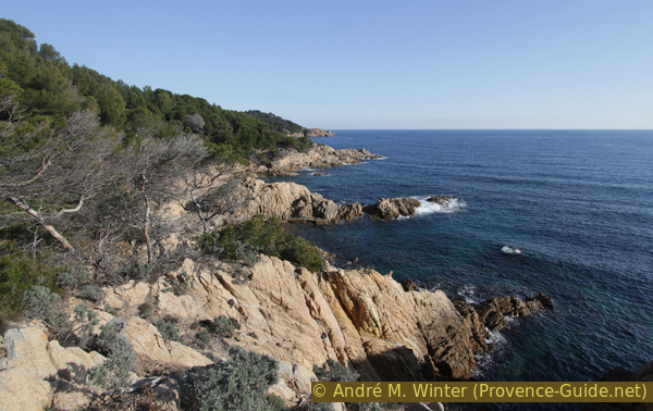
Coastal path between Sèche de Gassin port and Cap Camarat
No reproduction is permitted without the written consent of the author. (id5084)
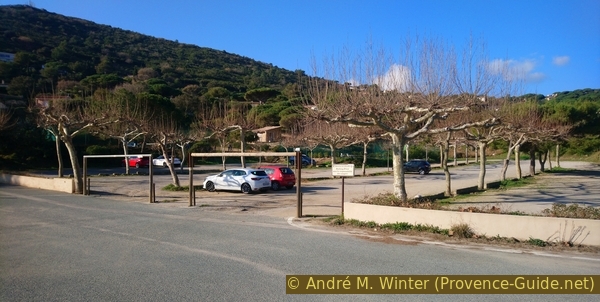
Parking in L'Escalet in winter
Hints
In L'Escalet you will find a snack bar that is also open in the off-season when the weather is nice.
There is no drinking water or other supplies along the way. The sun and the wind can make you thirsty, it is essential to take enough water with you.
In 2017 a local forest fire raged in the La Quessine valley, this is where we want to descend. The fire was quickly subdued, but many fallen trees prevent us from orienting ourselves in this vast and otherwise natural area. At the end of 2019, however, we got through well.
The whole region is a zone with a high risk of forest fires. In summer, but also in other seasons when it is very dry or by strong winds, access to the forest areas can be regulated. As a result, the roads may be closed to traffic and/or the trails prohibited to hikers. Current information: Map of access to the forests of the Var (also english). The map shows the colours green, yellow, orange and red which correspond to levels of danger. The affected area is: Corniche des Maures (4).
The sections
- L'Escalet - Cap Camarat: the classic coastal path with stairs, easier sections and rocky sections
- Cap Camarat - Leuchtturm - La Quessine: a direct climb, a bit along the road and an overgrown descent, but nice viewpoints.
- La Quessine - l'Escalet: return via part of the approach
Section 1: L'Escalet - Cap Camarat
➙ 4,6 km ... 2 h 45 min ➚ 160 m ➘ 160 m ↝ easy
50% easy trails, few marks
<5% stairs, few marks
5% easy trails, few marks
<5% stairs, few marks
40% easy trails, few marks
The clues
- L'Escalet, 5 m
- Sèche de Gassin port, 0 m
- Le Merlier settlement, 15 m
- Pointe Moussure cape, 30 m
- Cap Camarat, 10 m
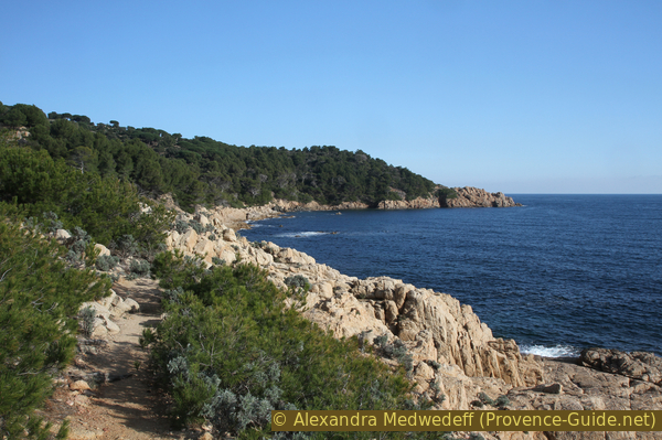
The section is about 4.5 kilometres long and takes almost three hours to complete. This is due to the numerous counter climbs. Several bays offer a good view, invite you to rest and that also takes time. The south-eastern and southern orientation guarantees plenty of sun, but there are also tall pine trees that provide shade.
No reproduction is permitted without the written consent of the author. (id5085)
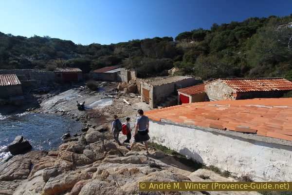
Start of the trail in L'Escalet
From the parking lot we go straight to the sea in front and left in front of the cottages. A dirt road leads to the small fishermen's cottages in the bay. After the boat garages, the coastal path begins, which leads straight over rocks.
No reproduction is permitted without the written consent of the author. (id5086)
L'Escalet fishing port
Coming around the little cape north of L'Escalet we see Cap Camarat and the lighthouse at the top of the ridge. These points are far away, so the tour is still long!
No reproduction is permitted without the written consent of the author. (id5087)
View to Cap Camarat
As long as we pass under houses, several paths lead up to the left. They all go to closed private settlements and are therefore to be ignored.
As is so often the case, one walks between the sea and fences in settlement areas because the villas penetrate quite far to the water. But here you will usually not find an old and rusty fence, often there are beautiful stone walls or fences made of driftwood. That's really nice!
No reproduction is permitted without the written consent of the author. (id5088)
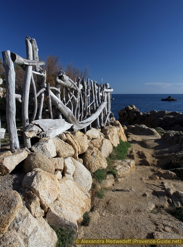
Fencing made of driftwood
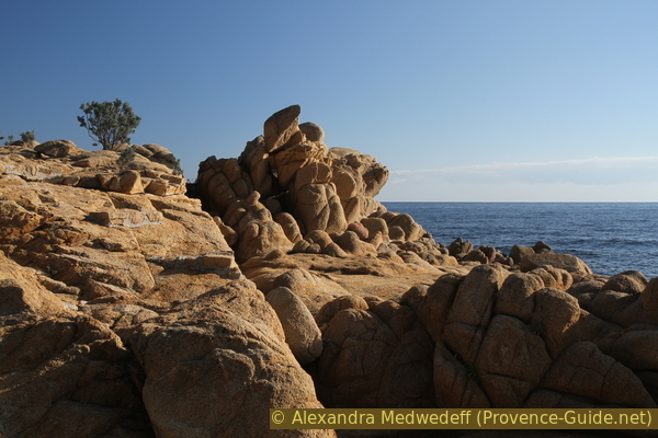
The rocks of the coast are strongly reminiscent of those of Brittany or Sardinia. The granite includes very large quartz inclusions that allow a good grip. Nevertheless, there can be slippery areas where small creeks flow into the sea off-season.
No reproduction is permitted without the written consent of the author. (id5089)
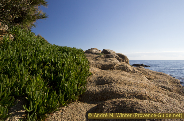
Quartz-rich granite rocks
Still below the houses, we come to a wider rocky area. In front of the sea lies the cliff Rocher Escudelier. A little off the path there is a higher rock with two marble tablets.
Here the Resistance fighters against the Germans in World War II are commemorated, who from 1943 maintained a connection with the free French forces in North Africa via this coast with submarines.
No reproduction is permitted without the written consent of the author. (id5090)
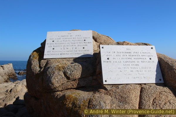
Commemorative plaques to the resistance fighters against the German occupation
We continue along this granite coast and the villas slowly recede. The winter sun emphasizes the bizarre rock formations.
No reproduction is permitted without the written consent of the author. (id5091)
Cliffs on the coast north of L'Escalet
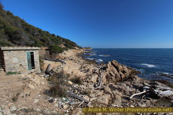
The coastal path comes into a bay that is built up with old boathouses. It is the Sèche de Gassin. Sèche refers to pulling boats onto dry land (sec). There is no driveway to these boat garages, you can walk down the slope like in the old days. However, it is difficult to believe that really the residents of Gassin came down here.
Before heading down into the bay, it's worth looking ahead at the ridge. There is the castle of Château de Volterra. It was built at the beginning of the 20th century, for which extra stones were brought in from the Cap du Dramont in the Esterel massif.
No reproduction is permitted without the written consent of the author. (id5092)
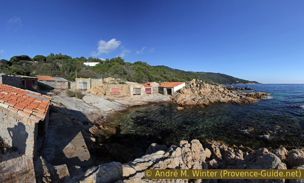
Sèche de Gassin fishing port
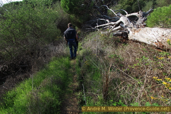
After this small port, we finally come to an area without houses. We enter the less steep and less rocky part of the La Quessine cirque. On the way back we will come down from the left. Here you can see traces of a forest fire, which only caused damage in this wide valley.
A few small streams also flow down the slope here. In the low season, the areas of the crossings with the path are often muddy.
No reproduction is permitted without the written consent of the author. (id5093)
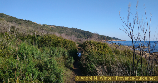
Crossing of La Quessine valley
On the sea side there are some very narrow gravel beaches, but there are also rocks in the water in front of them.
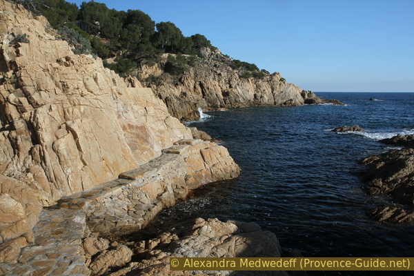
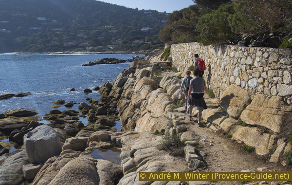
After this easier section we come back in a rockier and steeper area under Château de Volterra.
No reproduction is permitted without the written consent of the author. (id5094)
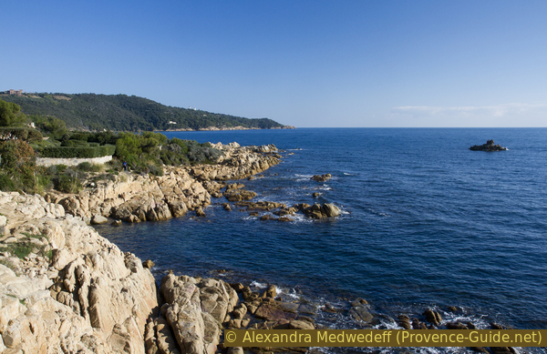
Coastal path between Sèche de Gassin and Cap Camarat
The path climbs to the left to avoid steep and crumbling rocky areas.
No reproduction is permitted without the written consent of the author. (id5095)
Section of rock below the Château de Volterra
After crossing a wet and green valley, the path climbs again to take us up a forest road. After about 100 meters we branch off to the right again.
No reproduction is permitted without the written consent of the author. (id5096)
From the forest road down to the right
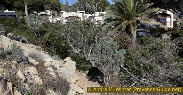
Stairs leads down rapidly. It probably originally belonged to the Château de Volterra. Today we bypass the holiday resort Le Merlier. We will pass under many small cube-shaped houses.
This brutalist architecture was implemented here in 1965.
No reproduction is permitted without the written consent of the author. (id5097)
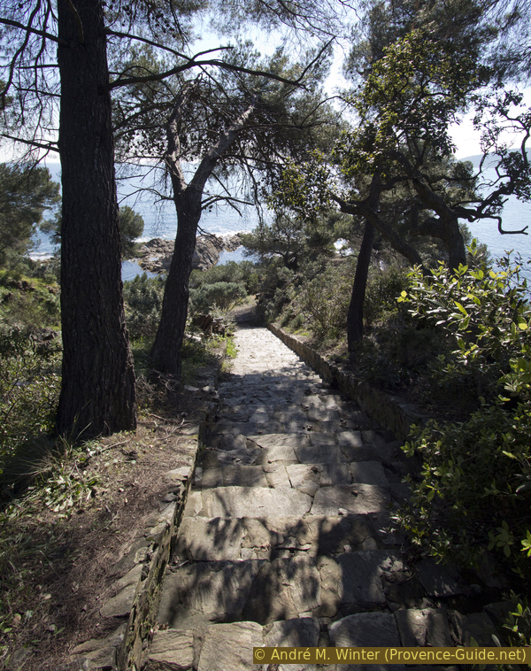
Long stair before Le Merlier
At the bottom of the stairs we turn sharp left in front of a boathouse. For a while the coastal path is quite natural again, even if we pass close to houses. Partly the marked path leads over terraces and between masonry.
No reproduction is permitted without the written consent of the author. (id5098)
Partially stabilized paths under the Le Merlier holiday park
The marking under the settlement is good and clear. The path often climbs a little and you are then referred to the bottom right.
No reproduction is permitted without the written consent of the author. (id5099)
Another turn to the right below
So the path leads down again, this time over concrete paths and terraces close to the sea. We come to a larger bay that is to be exited to the rear.
No reproduction is permitted without the written consent of the author. (id5100)
Paved path over rocks below Le Merlier
The path is briefly back in the natural area, but we come back to a paved section and then back out towards the sea. Above we see the houses of Le Merlier for the last time.
No reproduction is permitted without the written consent of the author. (id5101)
Path and cottage of the Le Merlier village
However, this section under the houses is in poor condition, the path is increasingly slipping at the end of 2019. You can recognize the section by the fact that a pumping station is installed further ahead. If the path has slipped too much here, go back to the last stabilised area and, regardless of the signs, pass straight under the houses. After about 30 meters you will get back to the marked path.
No reproduction is permitted without the written consent of the author. (id5102)
Slipped path in front of the Le Merlier pumping station
After the pumping station, it goes uphill and right again at the top on the normal and very natural path.
No reproduction is permitted without the written consent of the author. (id5103)
The coast east of Le Merlier
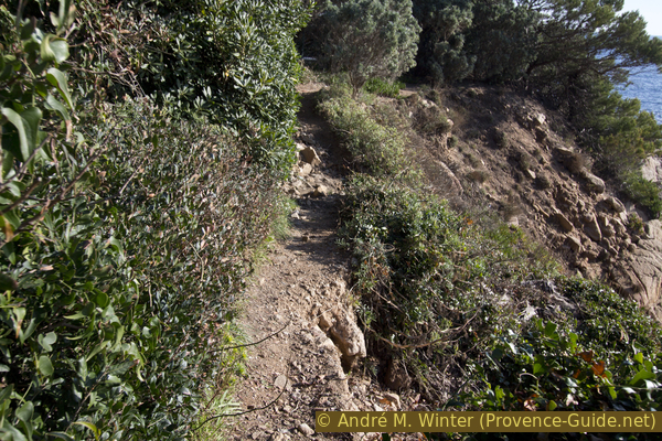
We continue towards Cap Camarat. The path stays higher up and often runs in the forest. On the promontories you can see ahead better.
We ignore all paths to the top left that only lead to private villas. Those to the right below lead down into rocky coves.
No reproduction is permitted without the written consent of the author. (id5104)
Walk across the Baie des Roches Bleues
One of the few clues on this coast is the double boathouse that we pass above. However, you can see it better in retrospect from further ahead.
No reproduction is permitted without the written consent of the author. (id5105)
Boat garage in the Baie des Roches Bleues
We come to Pointe Moussure cape. The path is now a little higher again and it is also narrower than before. The orientation of the coast allows us to see up to Cap Camarat later. Then you can also see the Rocher des Portes rocks in front of the cape. Several rocky cliffs also protrude from the water.
No reproduction is permitted without the written consent of the author. (id5106)
Bay between Cape Pointe Moussure and Cap Camarat
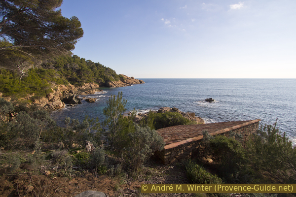
In the middle of the last rocky bay before the cape there is a hut that probably served as a pumping station.
No reproduction is permitted without the written consent of the author. (id5107)
Works hut south of Cape Camarat
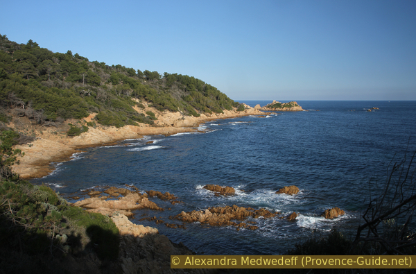
In a few minutes we are at the cape, here follows is an unexpected ascent.
The Cap Camarat is quite flat at the front and this is a good place to take a break. In front of it lies the bird island of Rocher des Portes, which is inaccessible to us. We don't see the lighthouse from here, we first have to hike up the ridge to be able to admire it.
No reproduction is permitted without the written consent of the author. (id5108)
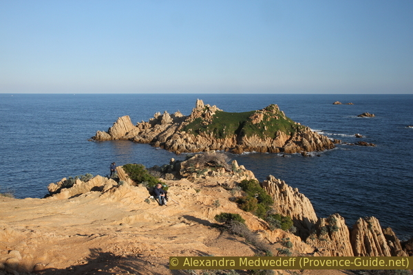
Rocky plain at Cap Camarat and Rocher des Portes island
Section 2: Cap Camarat - Phare - Quessine
➙ 4,5 km ... 1 h 30 min ➚ 170 m ➘ 175 m ↝ average
5% stairs, few marks
10% easy trails, few marks
15% hard-surfaced quiet side streets, without marks
5% hard-to-recognize trails, without marks
<5% hard-surfaced quiet side streets, without marks
<5% hard-to-recognize trails, without marks
10% hard-surfaced quiet side streets, without marks
15% dirt roads, without marks
35% hard-to-recognize trails, without marks
The clues
- Cap Camarat, 10 m
- View point and Phare de Camarat lighthouse, 110 m
- La Pommière high, 85 m
- La Quessine high, 135 m
- La Quessine low, 5m
This section is very different: more tedious and difficult. We first have to climb steeply, then walk along a road and finally we fight our way down through unruly vegetation. The forest fire of 2017 did not improve the situation here.
After a break at the wide cape we go up to the path and it climbs straight up along the ridgeline as the north side of the cape is steep and rugged.
No reproduction is permitted without the written consent of the author. (id5109)
Ascent of the path at Cap Camarat
This trail runs constantly just to the right and north of the ridge line. There are steps in the steep sections. On the right we are accompanied by an old fence and at one point the marked path seems to be blocked by a tree lying across. We have to go either above or below. Trees are free here, even if they complicate the path.
In this ascent, the coastal hiking trail also branches off to the right towards Bonne Terrasse and Pampelonne. But we stay to the left and continue uphill.
From the path you can see to the north in places: in front of us is the rugged north face of Cap Camarat. Here isolated rocks rise above the Mediterranean forest. The flat landmass further back is the Cap de Saint-Tropez, it is much less high than the capes south of it.
No reproduction is permitted without the written consent of the author. (id5110)
North slope of Cap Camarat and Cap de St. Tropez
We dive back into the forest and continue uphill without a break. Between the trees we can finally see the Camarat lighthouse.
No reproduction is permitted without the written consent of the author. (id5111)
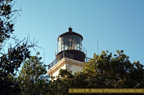
Lantern of the Phare de Camarat lighthouse
Although the lighthouse is an important milestone, we continue west in the direction of ascent and pass it. After 50 meters we come to a natural viewpoint. Here you can see down to Pampelonne and towards Saint-Tropez.
No reproduction is permitted without the written consent of the author. (id5112)
La Bonne Terrasse and Pampelonne beaches
We then go back to the lighthouse.
It was built between 1829 and 1832 on the central cape of the Saint-Tropez peninsula. With its 25 meter high tower, the lens is 130 meters above sea level. This makes it the second tallest lighthouse in France. The light is visible 48 kilometres away. It is automated and controlled from Porquerolles.
Nevertheless, there is a lighthouse keeper and it still he cannot be visited. You would certainly have a great all-round view from the tower, but this hike is specifically designed to provide views in as many directions as possible.
No reproduction is permitted without the written consent of the author. (id5113)

Phare de Camarat lighthouse
piste = forest road
vignes = vineyard
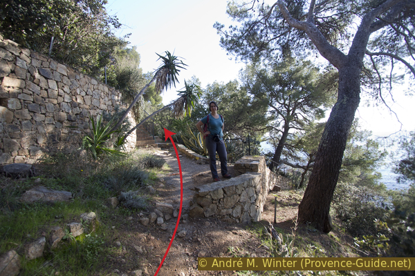
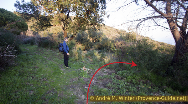
There is now more than a kilometre of asphalt road ahead of us. The route is interrupted by short, somewhat overgrown shortcuts. We'll just go west with the lighthouse behind us. The road remains about 400 meters on the wide crest. There are always driveways to the left, all of which are blocked. At first you can't see beyond the trees in the other direction. Let's stay on the left side of the asphalt road.
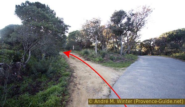
After about 10 minutes we pass two narrow driveways on the left. A third driveway follows (named La Salamandre and La Tarzane). However, we continue along the road for a short while and after the curve, at the second telephone line mast, we climb up the embankment to the left. See also the photo with the red arrow.
No reproduction is permitted without the written consent of the author. (id5114)
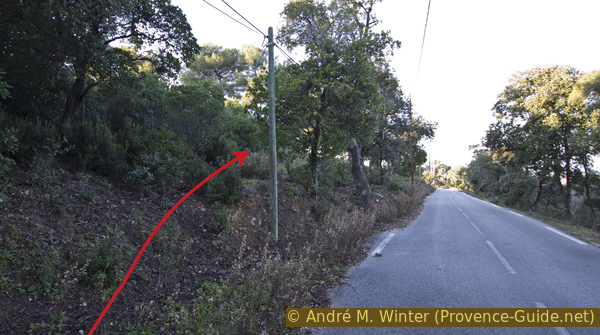
Go up on the left from the Route de Camarat
So we cut off a few curves in the road on a barely recognizable path. At first we follow a fence on the left.
Further ahead we come down again in a right-hand bend in the road. And as before, after the second telephone line pole, go up the embankment on the left. This time the path is more visible.
No reproduction is permitted without the written consent of the author. (id5115)
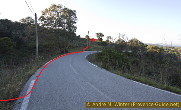
Walk a second time up to the left
At the top we come to another asphalt road, it is the one that leads to the Le Merlier housing estate. But we go to the right.
This road offers an open view on the right. One can see here directly on the beach Pampelonne.
No reproduction is permitted without the written consent of the author. (id5116)
Pampelonne beach
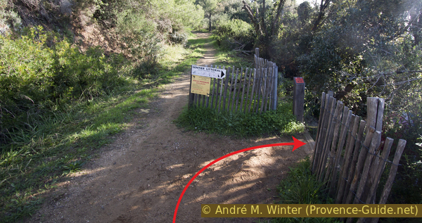
We are guided briefly through a dark pine forest and when we see the sky again we circle a house on this road. Then we turn left onto the dirt road Piste de la Pommière.
No reproduction is permitted without the written consent of the author. (id5117)
Access to the Piste de la Pommière forest road
This path is used to access the large vineyards of the Volterra winery.
No reproduction is permitted without the written consent of the author. (id5118)
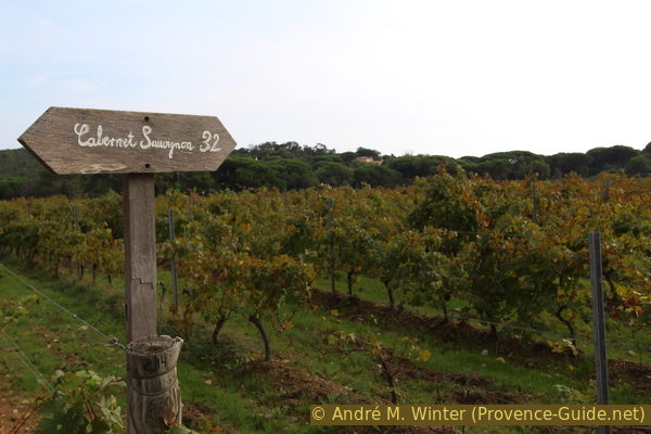
Vines of the Cabernet Sauvignon variety from the Volterra winery
piste = forest road
feu = forest fire
The dirt road climbs gently and after the windyard it leads through a section of forest. We come to an inconspicuous saddle, where a paved road crosses (Chemin de la Pommière).
We cross this street and opposite, a forest path continues to the right of a few houses. Then we come to the top of the La Quessine cirque. It goes downhill in long hairpin bends. In the first turn you can see the sea below. However, the path leads to the right and passes under a house.
No reproduction is permitted without the written consent of the author. (id5119)
Path descending into the La Quessine cirque
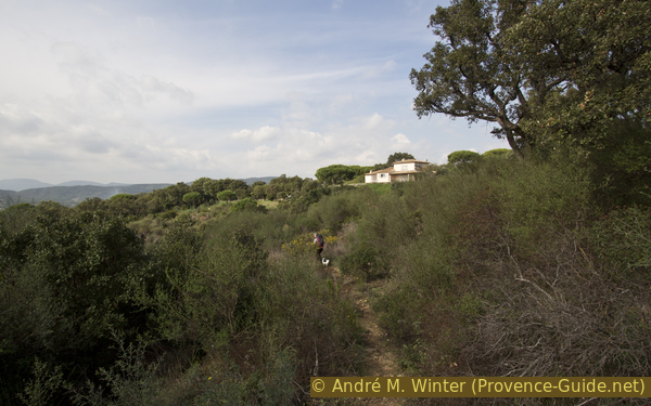
This old forest road is hardly recognizable as such. What remains is a path that repeatedly bypasses bushes that overgrow the road. The terrain is not particularly steep, but you cannot simply descend in the direction of the fall: prickly bushes prevent you from getting through.
No reproduction is permitted without the written consent of the author. (id5120)
Hikers on the trail in La Quessine
After a right turn we come to a slightly more open area. The forest fire raged here and we often cross the affected area. The old forest road takes a long left turn. At the end of 2019, several fallen trees blocked the path and an ideal bypass is not discernible. However, the generally gentle incline and the wide curve radii of the forest road do not change. The GPX and KML files show the original course of the forest road. With this information you should be able to stay on the path or find your way back after bypassing it.
After the long left turn, there is a much tighter one to the right. Underneath we come to a crossroads, we go straight on here. After a few minutes we come back from the burnt zone under living pines. Here we can cut off a long bend on the left. Keep left again at the bottom.
A few minutes later we come to an inconspicuous crossroads with a small cairn. Here we go down to the right.
No reproduction is permitted without the written consent of the author. (id5121)
Junction in the lower part of La Quessine
After the following left turn, the path theoretically leads straight ahead to the sea. It's also much flatter here. But the forest fire of 2017 knocked down many pine trees. The path is blocked in sections and you have to go around these places with bushes. The GPX and KML files still show the original path.
No reproduction is permitted without the written consent of the author. (id5122)
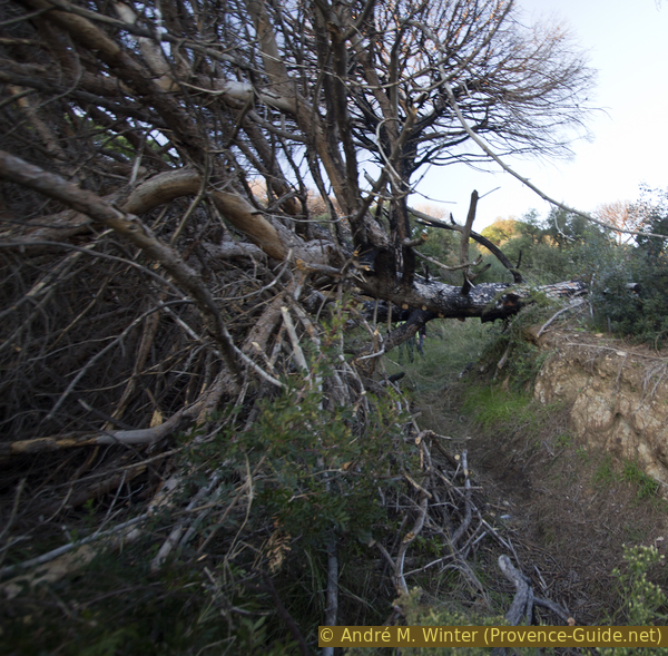
Fallen tree on the path in La Quessine
Shortly before the coast it gets confusing and overgrown. Over time, however, the deadwood is reduced and the passage becomes easier. The pictures of the burned trees are from December 2019.
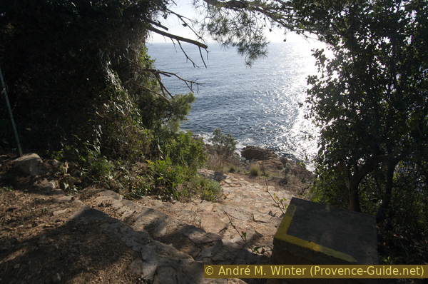
At the very bottom we come back to the coastal path we are familiar with. We naturally go right back to L'Escalet.
No reproduction is permitted without the written consent of the author. (id5123)
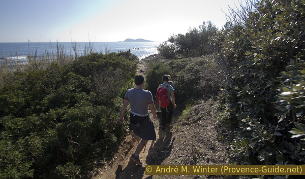
Hikers on the coastal path below La Quessine
Section 3: La Quessine - l'Escalet
➙ 1,4 km ... 30 min ➚ 20 m ➘ 15 m ↝ easy
100% easy trails, few marks
The clues
- La Quessine below, 5m
- Sèche de Gassin port, 0 m
- L'Escalet, 5 m
We already know the way. After the earthy section below La Quessine, the classic coastal path over rocks begins again.
No reproduction is permitted without the written consent of the author. (id5124)
Again through Sèche de Gassin port
The sun is now different than at the start. We'll be back in L'Escalet in a few minutes.
No reproduction is permitted without the written consent of the author. (id5125)
Coastal footpath north of L'Escalet
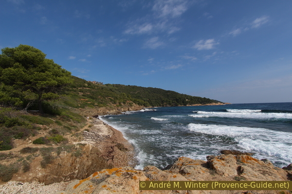
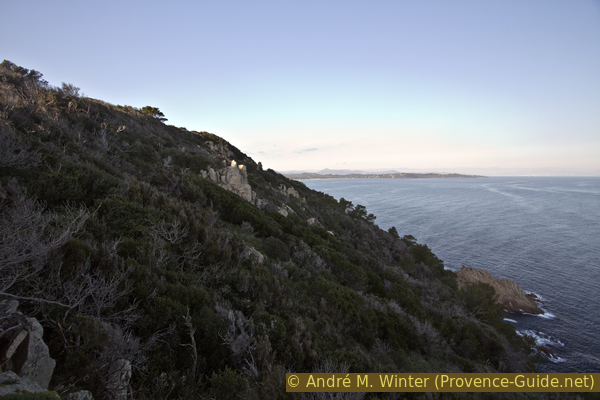
In winter you should not leave too late, because it can get dark quickly.
No reproduction is permitted without the written consent of the author. (id5126)
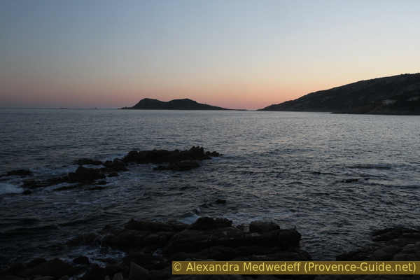
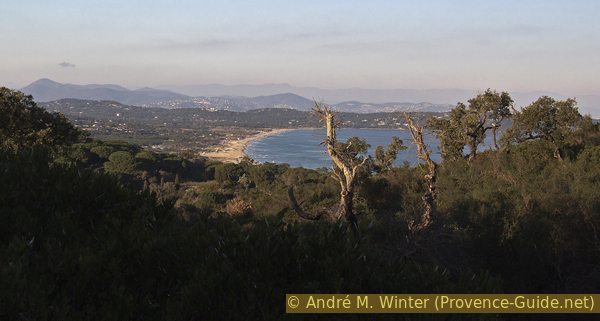
Evening mood around Cap Taillat
Sources and additional information
It is better to use a good topographical hiking map: This tour is on the IGN map "Saint-Tropez, Sainte-Maxime, Massif des Maures", scale 1:25000, 3545OT.
If you don't want to bother with a paper map, you can also use mapping apps on your cell phone. On the one hand, it is the Cartes IGN app from the official map service. However, it requires access to the data network and this is sometimes difficult in canyons or remote locations.
Alternatively, you can use apps that store data directly on the device. They're generally not free, but they don't cost much. We mainly use OSMAnd, here it is possible to add contour lines, relief shading, markings and others. To store this data on your phone you need a lot of space.
Of course, one needs access to satellites for the GPS signal with any app. In some canyons this is not the case. Therefore, do not rely on the position shown, but read the map on your phone as you would read it on paper. Most apps are available for Android and iPhone. The applications usually allow us to record the route travelled and also view the GPS files offered for each of our hikes.
This page has been seen 3574 times since 20 March 2024.
No reproduction is permitted without the written consent of the author. (id5127)
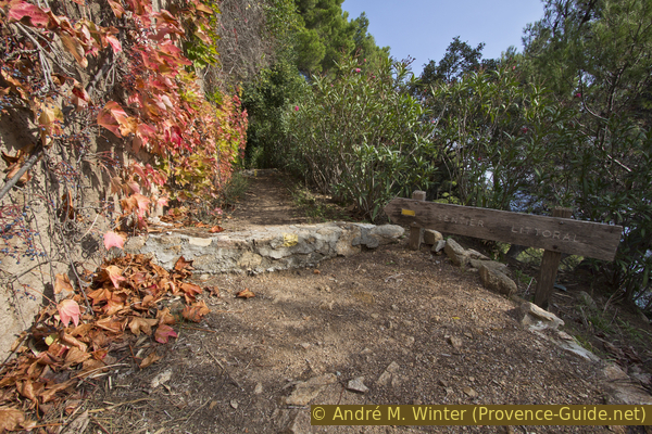
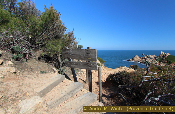
Coastal path sign at Le Merlier