Loop around the Cap Dramont
An easy cape in the Estérel massif
hike
easy
2 h
yes
yes
no
mountain
Introduction
The Cap du Dramont is a miniature Massif de l'Estérel. Of course, the cape is part of the massif, but it's still sort of separate from it as the train and road pass behind it. The walking times are not particularly long and you have wonderful vantage points, especially of the Massif de l'Estérel, because you have the necessary distance and still have a view of the sea.
The facts
6 km total distance
2 h walk time
240 m total elevation
orientation easy but many byways
mark 75% of the total distance
40% easy trails
20% forest roads
10% on beach
10% hard-surfaced quiet side streets
5% cross country
5% hard-surfaced city alleys
5% hard-surfaced city roads
<5% hard-surfaced paths
<5% hard-surfaced country road
dangers wind swell, exposed rocks
children
useful picnic stuff, swimwear
required hiking boots, hiking equipment and water
GPS coordinates (WGS84) of start and end point 43.420054,6.855825
downloads ![]()
![]()
No reproduction is permitted without the written consent of the author. (id3885)
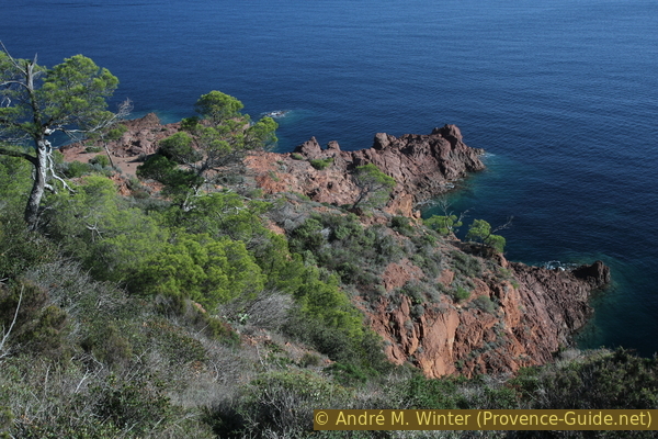
Pointes de Camp Long rock spurs seen from above
Public transport
The line 8 of the Esterel Côte d'Azur Le Bus (only french) serves the route between the bus station of St-Raphaël (north of the tracks at the level of the train station), the Bay of Agay and a little further beyond. There is a connection approximately every hour. Tickets are available on the bus. Get off at Camp Long station. From the station we continue along the provincial road towards the sea, at the Tiki Plage sign we turn right onto Rue Robinson.
The TER PACA (only french) regional train has a station called Le Dramont which serves about 9 times a day. There is an underpass to cross the rails and the road. You come out directly at the memorial stone for the landing of the Allies on the night of 14/15 August 1944. This is how you get to the tour in section 3 and go down to the port of Poussaï.
Access by car
The Cap du Dramont is located east of St. Raphaël, the logical access is via the D559 coastal road. Reaching the region on the A8 highway, you exit at Puget-sur-Argens or Fréjus and drive through Fréjus and St. Raphaël in order to get on the coast.
Useful parking spaces
There is a fairly large parking lot right at the starting point of the hike. It is forbidden to stay there overnight.
A second car park is located to the west and in section 3, but there is a height restriction.
Hints
Access is easy, so here we find here residents from the urban area of Saint-Raphael-Fréjus. As soon as the weather is right, you are rarely alone here. This also applies to the rockier detours. We therefore advise doing this hike during the week and out of season.
The rocky headland does not have bathing areas, but it borders a beach on either side: the Plage de Camp Long beach, which is the starting point of the tour, and the Plage du Débarquement beach, which can be reached by continuing along the coast after the port of Poussaï.
Detours off the marked path to some capes are suggested on this tour. These are easy accesses, but it is sometimes necessary to use your hands for easy climbing sections. In addition to these, there are other descent options to the sea, all of which have in common that they are unsecured.
The whole region is a zone with a high risk of forest fires. In summer, but also in other seasons when it is very dry or by strong winds, access to the forest areas can be regulated. As a result, the roads may be closed to traffic and/or the trails prohibited to hikers. Current information: Map of access to the forests of the Var (also english). The map shows the colours green, yellow, orange and red which correspond to levels of danger. The affected area is: Esterel (8).
No reproduction is permitted without the written consent of the author. (id3889)
Signs on some sections of the trail around the Cap du Dramont
The sections
- Go up on the sea side over the red rocks to the vantage point at the antenna.
- Down again and overlooking the sea to the green rocks in front of the Île d'Or island.
- Learn about the history of mining and the Allied landings, then take a faster route back behind the cape.
Section 1: Plage du Camp Long - Belvédère de la Batterie
➙ 1,9 km ... 40 min ➚ 125 m ➘ 15 m ↝ easy
5% hard-surfaced country road, without marks
10% hard-surfaced city roads, without marks
25% easy trails, few marks
5% cross country, without marks
50% easy trails, few marks
5% cross country, without marks
The clues
- Plage du Camp Long beach, 5 m
- South cape of Cap Long
- Saddle, 88 m
- Belvédère de la Batterie (Antenna), 107 m
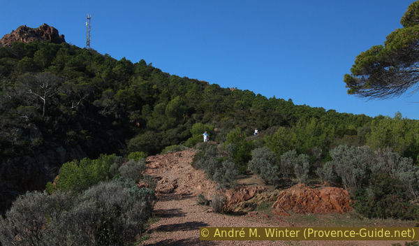
We climb up the east coast to the viewpoint with the antenna.
arrêt de bus = bus stop
Plage = beach
Pointe = cape
fin section 1 = end section 1
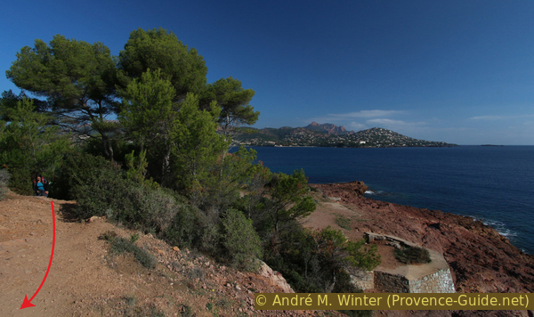
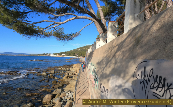
The only public road north of Cap du Dramont leads from road 559 past the beach to the car park. We leave the parking lot with a view of the sea and go towards a barrier. The signs explain all sorts of things and after the barrier a signpost points to the right towards the Belvédère de la Batterie. But this is not our way, we want to stay on the coast.
No reproduction is permitted without the written consent of the author. (id3879)
Crossroads north of the Cap du Dramont
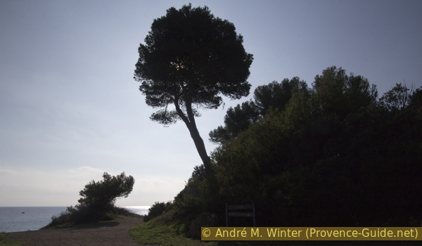
We stay to the left of this tree.
We can descend to two historic coastal defences of which only the foundations remain. From one, the view goes back to the rocks of the Pointes Longues and the beach, on the south coast we see the area that awaits us below.
No reproduction is permitted without the written consent of the author. (id3880)
Rastel d'Agay crest, Pic du Cap Roux mountain and the Colline d'Anthéor hill
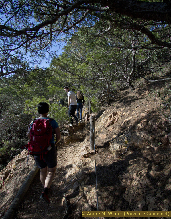
The coastal path always leads through the vegetation at higher altitude, after each detour to the coast or a cape we have to return to the marked path.
No reproduction is permitted without the written consent of the author. (id3881)
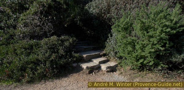
Old stair
The situation is well illustrated in this photo: the coastal promontories below and the coastal footpath runs above.
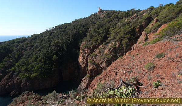
We will therefore remain on the coastal path for a while, which will allow us to bypass one of the indentations of the sea in the rocks of the cape.
In front of us we see rocky and fairly flat ledges rising out of the sea. These are one of the last chances to go out to the coast, as the coast then becomes much steeper and more rugged. The marked path leads almost to the summit and the descents to caps later are difficult to impossible.
No reproduction is permitted without the written consent of the author. (id3882)
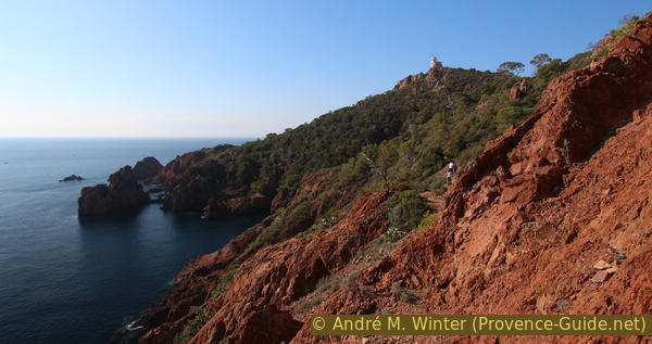
Looking back at a gun emplacement
The southern point of Camp Long is the last on which we make effortless progress. From there we look back to the Massif de l'Esterel but also forward to the south (on the left in the photo). And it is clear that the environment there is becoming more inhospitable. The path will go around these rocks and deep gorges almost to the top.
No reproduction is permitted without the written consent of the author. (id3883)
Panorama of the southern tip at Camp Long
So from the southern point of Camp Long we climb up in a straight line to rejoin the marked coastal path. With a bend we climb a good 20 meters.
There are several parallel paths in the curve and in autumn 2016 the markings and the signs for hikers were in poor condition. You have to go north-east for roughly 100 m, then head south. Don't cut through the undergrowth, the vegetation has enough to suffer here.
No reproduction is permitted without the written consent of the author. (id3884)
From the Pointes de Camp Long, go back on the trail
The path is frequently walked and there are several benches to enjoy the views.
No reproduction is permitted without the written consent of the author. (id3886)
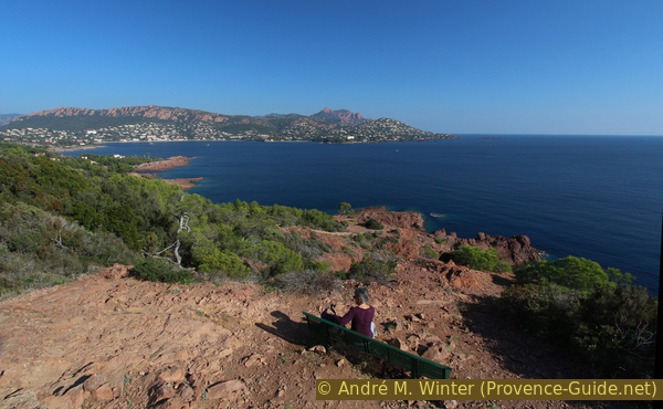
Bench with a view of Cap du Dramont
The photo shows the view further to the rugged rocky outcrops. Even if it seems impossible from here, you can descend towards the rocky and dark island on the left to the middle level (in the course of section 2). Before that, however, one must go up in the saddle between the two peaks of the cape.
No reproduction is permitted without the written consent of the author. (id3887)
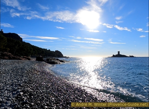
Pointe du Dramont cape and coastguard tower
Not only the coast is rugged here, there are also deep incisions that form dark rocky bays, which you have to circum-hike.
Here you can see the coast watchtower (Sémaphore), located on the top of the left peak, but it is not useful to go there from here, since the vegetation and the fences (military area) block a large part of the view. We will climb to the other peak to the north-east, which is much more open.
No reproduction is permitted without the written consent of the author. (id3888)
Big cuts in Cap Dramont
The ascent to the saddle between the two peaks has an even gradient.
Under the saddle we reach a crossroads of several paths, we continue to climb the flat saddle, where we find an old paved road. Here to the right towards the summit in the north-east.
No reproduction is permitted without the written consent of the author. (id3890)
Way at Cap du Dramont
The road leads up from the parking lot at the back of the hill and connects the two peaks away from the saddle. You are not forced to walk on the road, about 20 meters after the saddle you can turn right onto a path.
No reproduction is permitted without the written consent of the author. (id3891)
Direct route from the saddle to the north-east summit of Cap Dramont
The photo shows the view back to the Estérel massif. Bottom center the Plage de Camp Long, the starting point of the tour.
No reproduction is permitted without the written consent of the author. (id3892)
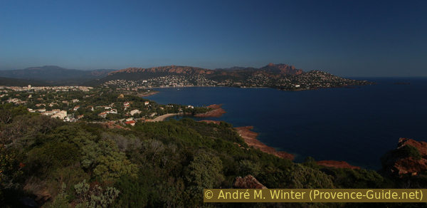
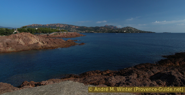
Rade d'Agay bay and the Esterel Massif
Section 2: Belvédère de la Batterie - Port du Poussaï
➙ 1,5 km ... 35 min ➚ 55 m ➘ 150 m ↝ easy
30% easy trails, few marks
10% easy trails, faulty marks
5% cross country, without marks
10% easy trails, with marks
10% cross country, without marks
20% forest roads, with marks
15% easy trails, without marks
The clues
- Belvédère de la Batterie (antenna), 107 m
- Northern cape of Pointe du Dramont, 15 m
- Pointe du Dramont cape, 30 m
- Green rocks, 5 m
- Port du Poussaï, 0 m
Descend on the path below and around the cape.
col = saddle
port = harbour
pointe = cape
We go down again from the top with the antenna towards the saddle and towards the crossroads of the paths to the east. This time we continue south, so to the right. The path leads downhill in several hairpin bends. After a section where we follow the mountainside, we take a path that descends to the left and makes a last big hairpin bend (remains of a yellow, sometimes blue marker). This path leads us to the foot of an inhospitable rock.
On the left, a path in poor condition branches downhill. A mark in the shape of an X shows us that this is not the right trail, but we go down the rock on our right. We pass under hollows in the rock, this is a type of erosion called taffoni. The salt and the humidity nibble here on the shady side of the rock.
No reproduction is permitted without the written consent of the author. (id3893)
Approach to the North Cape of the Pointes du Dramont
We reach a small flat area overlooking a small rugged island. Here we find interesting geological formations in the rock: folds filled with crystals, inclusions of different colours etc.
It is possible to climb into the small saddle visible on the right of the photo. In this way we arrive at a small natural viewpoint where there is enough space to sit down.
No reproduction is permitted without the written consent of the author. (id3894)
Approach to the northern Pointe du Dramont
Be careful, the rock drops off steeply all around, and there are also many loose stones!
No reproduction is permitted without the written consent of the author. (id3895)
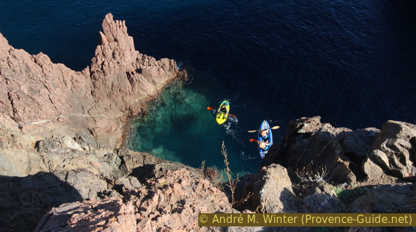
Deep view on canoeists between the Pointes du Dramont
We climb back up to the path along the jagged rocks and turn left. We quickly come to an old road that descends from the saddle between the two peaks and we continue our tour of the cape.
No reproduction is permitted without the written consent of the author. (id3896)
On the way to Cape Pointe du Dramont
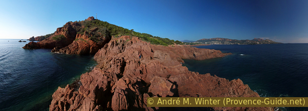
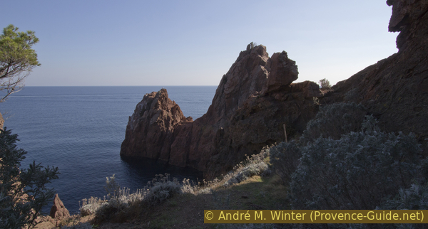
The trail quickly leads to Cap du Dramont. The ridge of the wide cape is high, but it is much more larger than the previous ones, so it is easy to get there to see the further west coast. Many people take a break here with a pick-nick.
In front the cape becomes steeper and as before there is a large offshore island.
No reproduction is permitted without the written consent of the author. (id3897)
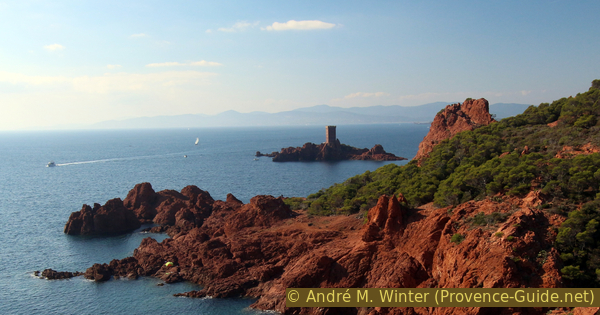
Pointe de l'Esquine de l'Ay cape and the of Île d'Or island
View west from Pointe du Dramont cape.
plage = beach
pointe = cape
île = island
rochers verts = green rocks
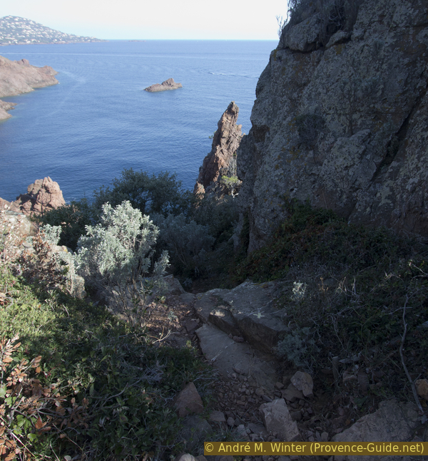
The marked path runs here on a dirt road that leads through the forest behind the coast at this point. We could descend to the next cape, a washed out path hooks up to the Pointe de l'Esquine de l'Ay cape. This point looks like the following ones, we leave it aside and only go down the third possibility. This is at the point where the main trail finally turns north-west and about 300 meters after the Pointe du Dramont cape. Some steps make it easier to descend, otherwise the path is rather chaotic.
No reproduction is permitted without the written consent of the author. (id3898)
Way down from the marked coastal path
We go down along a ravine in hairpin bends, then we follow the rocky and rather flat coast but with staying in the vegetation.
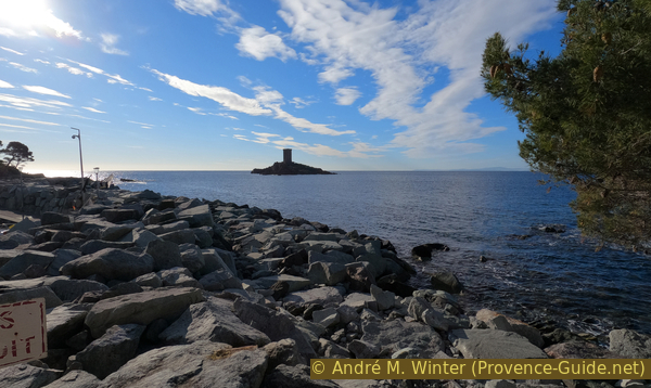
The path approaches the Île d'Or island, surmounted by a medieval-looking tower, which is said to have inspired the comic book artist Hergé for the album The Black Isle of the Tintin series.
No reproduction is permitted without the written consent of the author. (id3899)
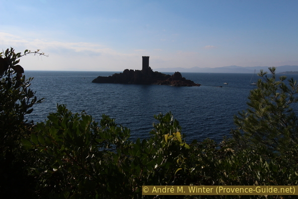
Île d'Or island
We continue towards the west and over stairs we reach a small beach with red pebbles and green rocks.
No reproduction is permitted without the written consent of the author. (id5881)
Red pebble beach, green rocks and Île d'Or
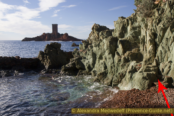
The small cape on the right is now completely green. It is indeed the same rock, but it exists in the colours red-brown, green-blue like here and ochre. In this otherwise only red environment, this draws the eye.
No reproduction is permitted without the written consent of the author. (id3900)
Green cliffs east of Port du Poussaï
Plage du Débarquement in the background.
We climb up the green rocks on the right and circle this small cape. Further ahead, by going around a villa, you quickly reach the quays of Port du Poussaï.
The Port du Poussaï is a leisure port only. In high season the café is open there.
No reproduction is permitted without the written consent of the author. (id3902)
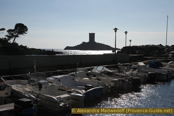
Port du Poussaï and the island of Île d'Or
Section 3: Port du Poussaï - Monument - Plage du Camp Long
➙ 2,7 km ... 45 min ➚ 60 m ➘ 65 m ↝ easy
5% hard-surfaced paths, few marks
10% on beach, without marks
15% hard-surfaced quiet side streets, faulty marks
10% on beach, without marks
5% hard-surfaced paths, few marks
5% easy trails, without marks
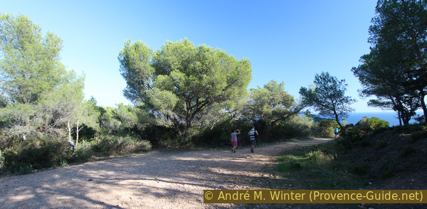
35% forest roads, few marks
15% hard-surfaced city alleys, few marks
The clues
- Port du Poussaï, 0 m
- Plage du Débarquement beach, 0 m
- Lake in an old quarry, 15 m
- Monument du Débarquement, 15 m
- Port du Poussaï, 0 m
- Plage du Camp Long beach, 5 m
Visit of places steeped in history and return to the starting point.
gare = train station
lac = lake
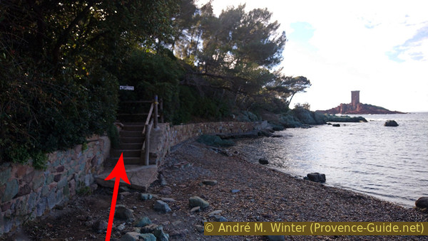
We stay at the harbor quay and continue to the dam. Shortly before that, a few steps lead up and then a concrete path leads along a retaining wall. This is a quick way to get to Plage du Débarquement.
No reproduction is permitted without the written consent of the author. (id5879)
Ascent from the quay towards the coastal path
This place, including the Port du Poussaï, is characterized by porphyry quarries. The Allied landings of August 1944 also took place here and the quarries were directly responsible for the site selection for this part of the Mediterranean landings. Here's why:
No reproduction is permitted without the written consent of the author. (id5877)
The coastal path passes under a wall
The quarries have existed since the late 19th century and grew with the construction of the railway. At that time there was no large beach here, it was a low rocky coast. The whole esplanade with the monument and the whole beach are nothing but rubbish from the quarry, which was useless at the time. We would call it waste rock if ore had been mined here. These deposits were so extensive that local fishermen complained about the loss of their bays and the poor water quality. They are appeased with the construction of a pier that today forms the Port du Poussaï.
No reproduction is permitted without the written consent of the author. (id5878)
Île d'Or seen from the Port du Poussaï breakwater
During the Nazi German occupation, work in the quarries was more extensive than before, and the residents were even forced to work here. The construction of the Atlantic Wall is supplied with porphyre from the Estérel. At the beginning of 1944, all beaches of the Mediterranean Sea and all places where a landing was possible were mined. However, the French manager of the quarry managed to get the Germans to keep the beach open and without mines because the workers worked here every day. This information reaches the command of the Allied Forces and they decide to launch one of the great landings in Provence here. Since all the major harbours were unusable, equipment and men have been brought ashore here for several weeks.
No reproduction is permitted without the written consent of the author. (id5875)
Green gravel on red sand
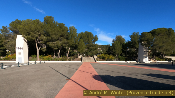
Let's look at one of these quarries first. Arriving at the beach, we go along the wide path that goes up to the esplanade of the monument.
Two towers marked 1944 and 2019 delimit the rear of the square and to the right of the tower marked 2019 is an underground passage under the road and the railway. A plan shows the location of all other explanatory panels.
No reproduction is permitted without the written consent of the author. (id5882)
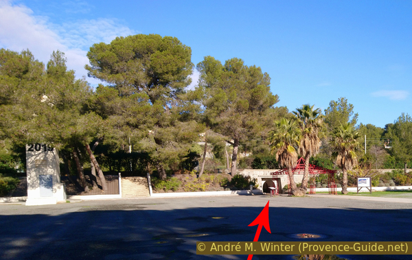
Access to the tunnel
Passing through the pedestrian tunnels, one comes straight to a large lake with completely rocky shores.
The hard porphyry that was used as cobblestones on several streets in France was quarried here. A little further away is another lake that has been converted into an amusement park.
No reproduction is permitted without the written consent of the author. (id5883)
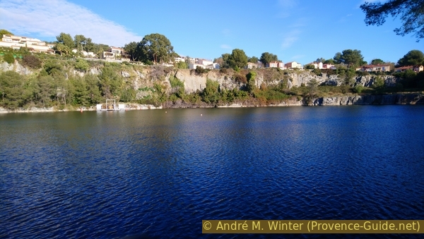
Lake in the eastern quarry of Dramont
We return through the tunnel to inspect the steles of the monument.
This place of remembrance is somewhat unattractive, as it was intended to protect it from development from the end of 1944.
No reproduction is permitted without the written consent of the author. (id5872)
The square around the landing monument
An authentic group barge has been installed on the Esplanade since the 50th anniversary of the successful landing of the Allies. It's closed now, but at the time of its deployment, the soldiers and equipment were out in the open and exposed to enemy bullets.
No reproduction is permitted without the written consent of the author. (id5873)
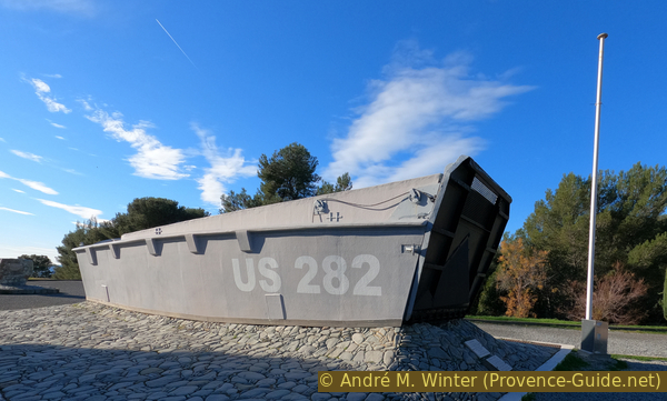
US landing craft
We walk behind the landing craft down one of the many paths down to the beach. You walk first on fine red gravel and progressively is added green ground gravel. There is only green porphyry on the surf.
No reproduction is permitted without the written consent of the author. (id5874)
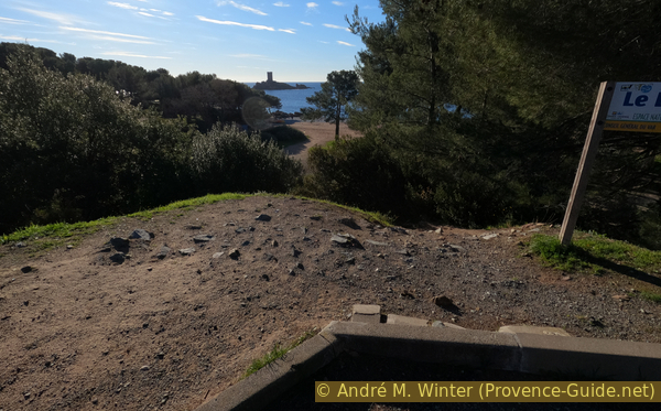
Path down to the beach behind the monument
At the beach turn left again towards Port du Poussaï.
No reproduction is permitted without the written consent of the author. (id5876)
The landing beach, Cap Dramont and Île d'Or
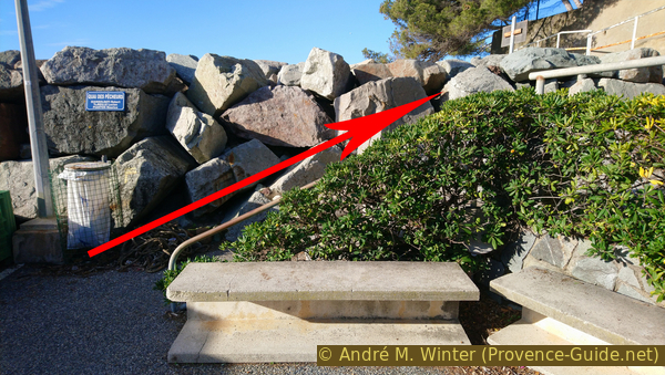
So we walk back to the Port du Poussai and go along the quay towards the green rocks. Shortly before that, however, we take the stairs to the left. It leads to a forest road that circles the cape in the hinterland, so we turn left at the top.
No reproduction is permitted without the written consent of the author. (id5880)
Stair east of Port du Poussaï
After about 500 metres there is a possibility to go down to the parking lot.
No reproduction is permitted without the written consent of the author. (id3903)
Forest road north of Cap du Dramont
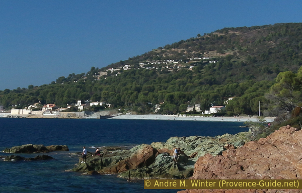
The small beach is located south of the much larger Plage d'Agay beach. You can swim here at least for six months of the year.
No reproduction is permitted without the written consent of the author. (id3904)
Camp Long beach
Sources and additional information
It is better to use a good topographical hiking map: this tour is on the IGN map "Fréjus/Saint-Raphaël/Corniche de l'Estérel", scale 1:25000, 3544ET.
If you don't want to bother with a paper map, you can also use mapping apps on your cell phone. On the one hand, it is the Cartes IGN app from the official map service. However, it requires access to the data network and this is sometimes difficult in canyons or remote locations.
Alternatively, you can use apps that store data directly on the device. They're generally not free, but they don't cost much. We mainly use OSMAnd, here it is possible to add contour lines, relief shading, markings and others. To store this data on your phone you need a lot of space.
Of course, one needs access to satellites for the GPS signal with any app. In some canyons this is not the case. Therefore, do not rely on the position shown, but read the map on your phone as you would read it on paper. Most apps are available for Android and iPhone. The applications usually allow us to record the route travelled and also view the GPS files offered for each of our hikes.
This page has been seen 6478 times since 20 March 2024.