From the village of Ramatuelle to the Paillas mill
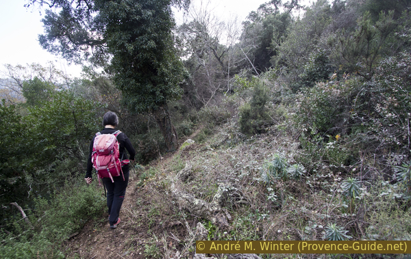
Lonely paths in the cork oak forest
hike
easy
1 h 45 min
seasonal
yes
no
mountain
Introduction
Ramatuelle is a dream destination on the Côte d'Azur, in the municipality lies the most beautiful part of the peninsula of Saint Tropez. Although Ramatuelle includes the unspoilt capes and beach of Pampelonne, there are some hidden gems to be hiked in the hills. You will find windmills, aqueducts and lots of peace and quiet in the cork oak forests.
The facts
5,5 km total distance
1 h 45 min walk time
240 m total elevation
orientation average
mark 0% of the total distance
40% moderate trails
20% forest roads
15% hard-surfaced quiet side streets
15% hard-surfaced city alleys
10% hard-to-recognize trails
5% stairs
<5% hard-surfaced paths
dangers steep sections
children yes
useful picnic stuff
required hiking boots, hiking equipment and water
GPS coordinates (WGS84) of start and end point 43.217571,6.611341
downloads ![]()
![]()
Public transport
There is no regular bus service to Ramatuelle. In summer, the beach bus (line 875) runs between St. Tropez bus station and the roundabout under the village of Ramatuelle, where the tour starts. Timetables for this line can be found at Zou! (only french).
Access by car
Ramatuelle is located in the middle of the Saint-Tropez peninsula. From Ste. Maxime, from Grimaud and from Toulon via Cogolin you come to the big roundabout La Foux with the supermarket Géant Casino in the centre. Here we first drive in the direction of St. Tropez. At the following roundabout, which is just as bulky and large, we turn off towards Ramatuelle. Between vines, first flat and later uphill, we come under the centre of Ramatuelle. We drive straight on at a first roundabout and come to another. A war memorial stands in the shadow here, and this is where the hike begins.
For those who love small roads, we can also recommend the following access routes when coming from Cavalaire and Croix-Valmer: on the D93 road via the Col de Collebasse saddle or past the Croix-Valmer football field on the Route du Brost towards Gassin and then on Route des Moulins de Paillas to Ramatuelle. You can also pass the mill by car.
Useful parking spaces
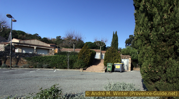
After the second roundabout under the centre of Ramatuelle there is a first car park on the left and further up after the bend there is a second one.
You should avoid the parking lot at the chapel at the beginning of the tour, the entrance and exit is closed when the school is in operation.
Hints
There is no water along the route, it is essential to have enough to drink. We are often in the shade in the forest, but the hot air can really be trapped here. Some sections of the trail run on heavily washed out old forest roads.
Although we are constantly above Ramatuelle, you rarely see the village. There are no signposts or markings. You are usually quite lonely here.
The windmill can also be reached by car, as described under Moulin de Paillas.
The whole region is a zone with a high risk of forest fires. In summer, but also in other seasons when it is very dry or by strong winds, access to the forest areas can be regulated. As a result, the roads may be closed to traffic and/or the trails prohibited to hikers. Current information: Map of access to the forests of the Var (also english). The map shows the colours green, yellow, orange and red which correspond to levels of danger.
The sections
- Go up to the Moulin de Paillas via the Sainte Anne chapel and the Castellas ridge
- To the beacon tower and down to a vantage point on white rocks
- Back across the slope and partly along an old water pipe to Ramatuelle
No reproduction is permitted without the written consent of the author. (id4693)
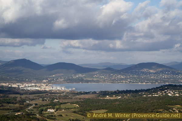
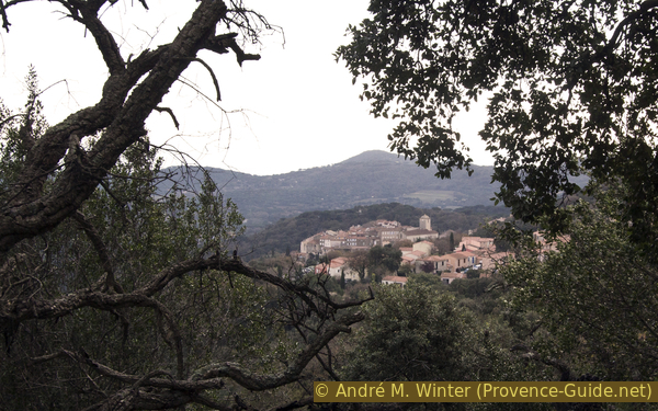
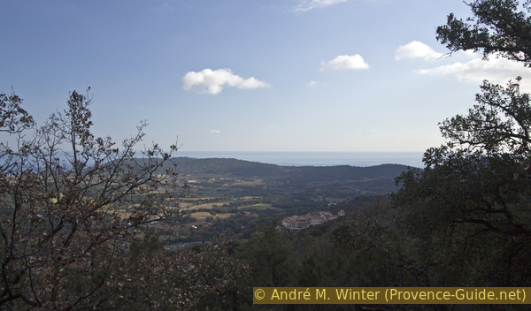
View to Port Grimaud
Section 1: Ramatuelle - Moulins de Paillas
➙ 1,7 km ... 40 min ➚ 150 m ➘ 10 m ↝ average
10% hard-surfaced city alleys, without marks
10% hard-surfaced paths, without marks
10% hard-surfaced city alleys, without marks
15% forest roads, without marks
60% moderate trails, without marks
The clues
- Ramatuelle, 130 m, start at the roundabout with the monument
- Through the settlement of Hameau du Baou and onto the ridge of Castellas
- Ascent to the mill, 265 m
You leave the village via the school and quickly climb up the wooded slope. The mill is not at the highest point of the loop.
écoles = schools
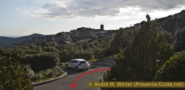
The monument honoring the Special Forces of the French National Defense (Mémorial des Anciens des Services Spéciaux de la Défense Nationale) is located in the shaded area to the south of the roundabout. Just opposite, a road leads up to the school complex and the chapel. We're going up here.
No reproduction is permitted without the written consent of the author. (id4654)
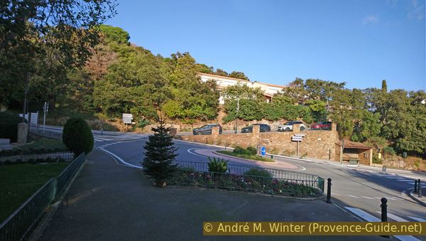
The roundabout and the rise to the school beyond
You can see the bus stop on the right.
In front of us is the chapel of Ste. Anne. It is rarely open.
Behind the chapel is the lower entrance to the cemetery. An actor of the post-war period, well-known in France, is buried here. Gérard Philipe died of rapid liver cancer in 1959 at the age of 37. He was buried in the costume of Don Rodrigue (Le Cid, Corneille). His simple grave lies against the cemetery wall, which continues to the east behind the chapel.
No reproduction is permitted without the written consent of the author. (id4658)
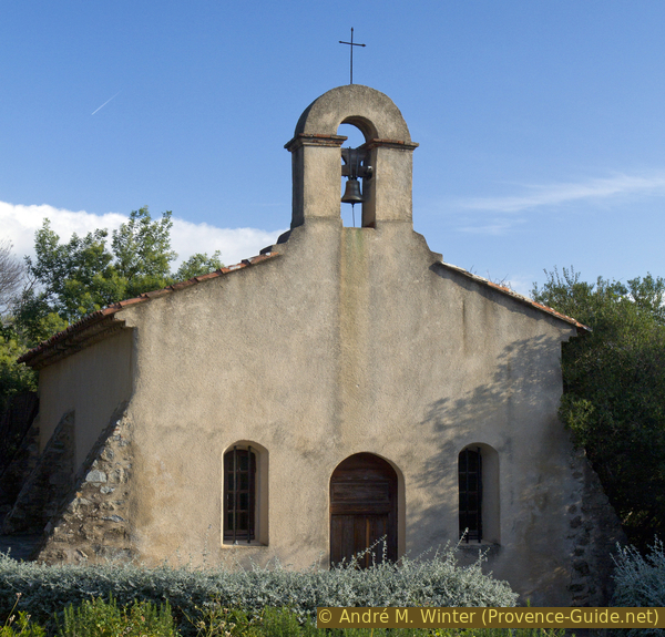
Ste. Anne chapel
To the left of the chapel, a short stairway climbs to the school and cemetery extension.
Here our path continues.
No reproduction is permitted without the written consent of the author. (id4659)
Way to school and cemetery
It pays to look back from the stairs. Especially in the morning you have a good view of the centre of Ramatuelle.
No reproduction is permitted without the written consent of the author. (id4702)
Looking back at the village of Ramatuelle
In front of the upper cemetery gate we turn left.
No reproduction is permitted without the written consent of the author. (id4660)
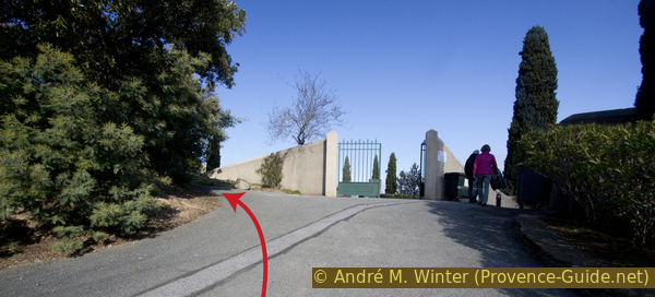
Upper cemetery gate
This concrete walkway takes us towards the settlement of Roques du Castellas.
No reproduction is permitted without the written consent of the author. (id4661)
Way to Rue du Castellas
We cross the street and go opposite into the alley Hameau du Baou. This is a cul-de-sac with houses to the left and right.
No reproduction is permitted without the written consent of the author. (id4662)
We cross the road to the Hameau du Baou
The short lane ends at a passage between a fence on the left and oleanders on the right. Here we climb the forest. Depending on the season, there can also be high grass, but you can see an old forest road which leads to the right after 70 meters.
No reproduction is permitted without the written consent of the author. (id4663)
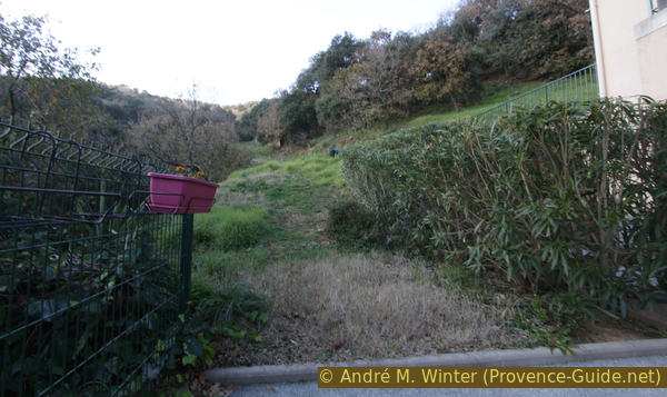
Ascent up the wooded hillside
So we come to a ridge on which another old forest road runs along.
Here left and directly up the ridge.
No reproduction is permitted without the written consent of the author. (id4664)
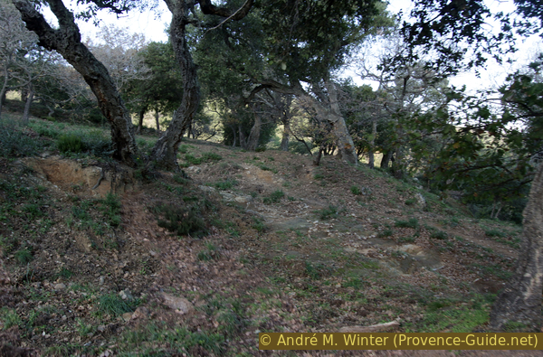
Castellas ridge
The rough forest road is washed out to the rock.
No reproduction is permitted without the written consent of the author. (id4665)
Bumpy forest road at Castellas
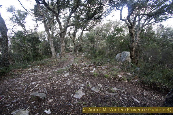
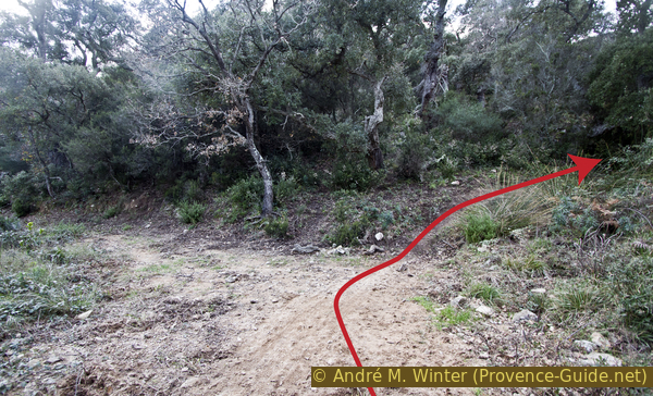
Less than 100 meters ahead, a path crosses on a flatter section. Here we go left, crossing the slope into the forest. The path leads slightly downhill.
No reproduction is permitted without the written consent of the author. (id4666)
Turn left here into the forest slope
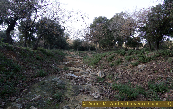
The almost imperceptible incline of the path is due to the aqueduct buried beneath it. It is an old water supply for the village and the fields below.
Water was collected in the various ditches which the aqueduct crosses. It probably dates from the 19th century.
We finally see the aqueduct as it freely crosses a moat over a bridge. This is just after the turn-off onto this trail.
No reproduction is permitted without the written consent of the author. (id4667)
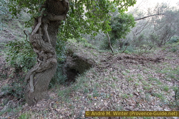
Old aqueduct in the forest
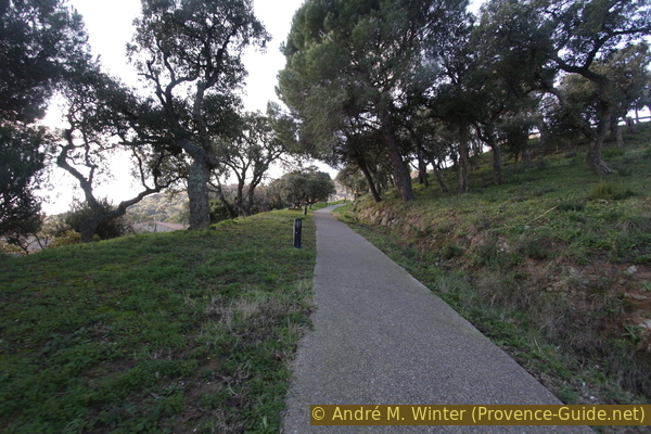
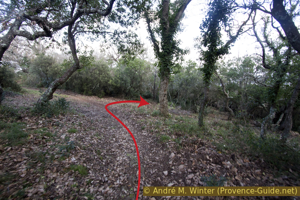
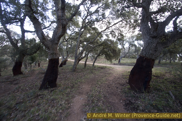
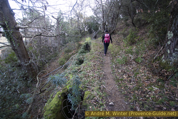
Our path continues south at approximately the same level. Again and again, paths branch off to the left downhill, but we always keep to the right and in any case without descending.
No reproduction is permitted without the written consent of the author. (id4669)
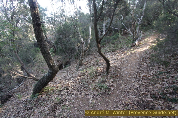
Keep right
moulin = mill
radiophare = radio beacon
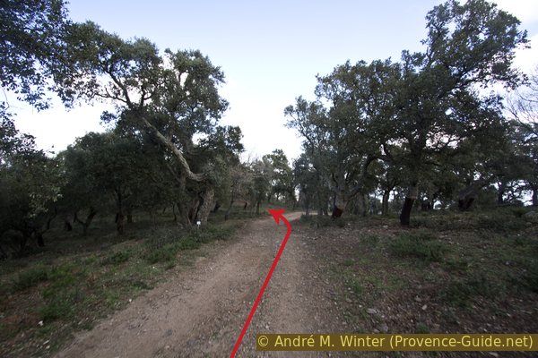
After crossing another ditch, the path turns right and now the last ascent to the mill begins. We are walking here again on an old and washed-out forest road.
After five hairpin bends, it leads more or less in a straight line to the north-west
No reproduction is permitted without the written consent of the author. (id4670)
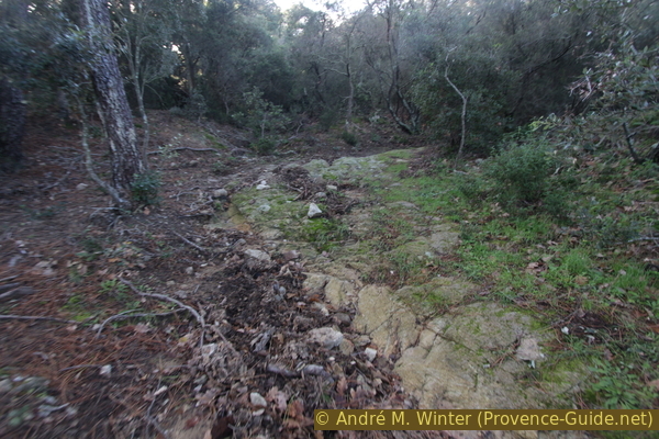
In hairpin bends up on an old forest road
Sometimes the forest road becomes a ravine, but we slowly come up to the ridge and the mill.
No reproduction is permitted without the written consent of the author. (id4671)
Last straight up to the mill
One says mill of Paillas, but one should speak of mills in the plural, because at least four were in operation here. The base of another mill is not far behind the one that was beautifully renovated in 2002. The name comes from the last active miller, Jean Baptiste Paillas.
It is a classic 19th century Provençal windmill. The structure is very similar to that of the Windmills of Régusse. Guided tours are held from April to October on Saturdays and Sundays from 10:30 to 12:30. When the wind is good, the blades are covered on Sundays at the end of May, the end of June and the end of September and then the mill can be seen in operation.
No reproduction is permitted without the written consent of the author. (id4672)
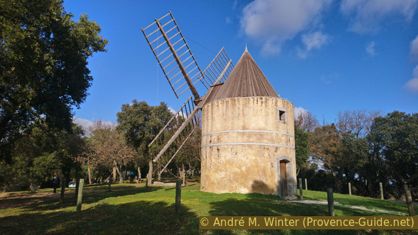
Moulin de Paillas
Section 2: Moulins de Paillas - Rochers blancs
➙ 2 km ... 30 min ➚ 60 m ➘ 115 m ↝ average
35% hard-surfaced quiet side streets, without marks
<5% forest roads, without marks
25% moderate trails, without marks
5% forest roads, without marks
15% moderate trails, without marks
15% forest roads, without marks
The clues
- Mill Moulin de Paillas, 265 m
- Under the radio beacon tower, 315 m, this is the highest point of the tour
- Descent north-east to white rocks, 250 m
- Descent to a junction, 210 m
We advance to the radio beacon on the right of the ridge.
Behind the mill you come to a picnic table and further back you can see the stump of an unrestored mill.
No reproduction is permitted without the written consent of the author. (id4673)
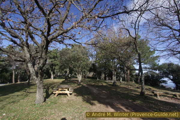
Picnic table by the mill
We continue in this direction and thus come to a road that leads to isolated houses on the ridge. There is also an easy path to the right under the road. One can walk either on the road or on the path, both of which lead in the right direction. Another mill stump can be seen from the road.
No reproduction is permitted without the written consent of the author. (id4674)
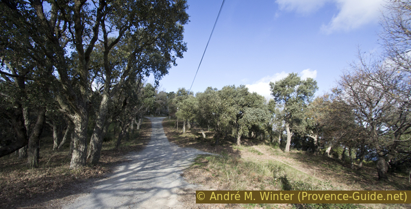
Road and path to the radio beacon tower
radiophare = radio beacon
point de vue = view
rochers blancs = white rocks
vignes = vineyard
moulins = mills
After approx. 700 meters the road ends in front of the gate of the radio beacon tower.
It is a navigational aid that is still in use. Radio waves from the antenna are received by ships in the sea and airplanes in the air. With wavelength and orientation, ships and aircraft can determine their position. The principle is the same as with GPS, except that the antenna is land-based. Today the radio beacons are only used by aviation.
You can't see much of the radio tower and our way is to be found in front of it at the bottom right by the water tank anyway.
No reproduction is permitted without the written consent of the author. (id4704)
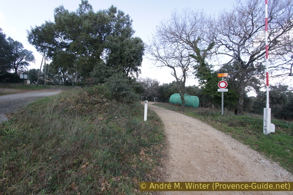
Access to the radio beacon and the water tank
The forest road leads down to the right after the tank, but we go straight on a path in the bend. There are also mountain bikers here, there are a few ramps further down, but we leave the section as soon as it gets steeper. This path leads to a hill at 305 meters above sea level on a hardly perceptible ridge./p>
No reproduction is permitted without the written consent of the author. (id4676)
Path and mountain bike trail
After the wooded elevation, the path turns slightly to the left and leads downhill. You can clearly see the tracks of the bikers.
Less than 100 meters further down we turn right while the mountain bike trail leads to the left.
No reproduction is permitted without the written consent of the author. (id4677)
Leave the mountain bike trail to the right here
We are on an old forest road, which leads to the larger one that we left earlier.
On this now left, but only 50 meters long.
No reproduction is permitted without the written consent of the author. (id4678)
Left onto the forest road under the radio beacon
Before the forest road leads to the right, we turn left on a path on another flat ridge northwards.
No reproduction is permitted without the written consent of the author. (id4691)
Keep left at the beginning of the curve
In a few minutes we come to a small elevation of white rocks. It is quartzite, this rock is harder than the surrounding mica schist and thus such white rocks are often found on the ridges in the Massif des Maures.
No reproduction is permitted without the written consent of the author. (id4692)
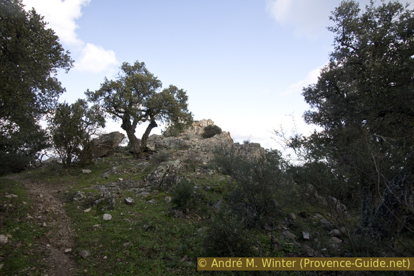
The whitish rocks on the ridge
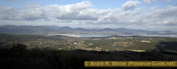
From the rocks there is an atypical view of the Gulf and the peninsula of St. Tropez, in fact you cannot see the village of St. Tropez, it is hidden behind a hill. From left to right you can see the village of Gassin, behind it the village of Grimaud, across the Gulf of Saint Tropez, onto the Esterel massif and weather permitting the scenery is framed by the Alps beyond. On the right the view leads to Cap Camarat.
No reproduction is permitted without the written consent of the author. (id4707)
Gulf of Saint Tropez
The path further down from the white rocks leads in the wrong direction. So we go the same way back to the forest road. There to the left further down. After a curve, the forest road goes straight and in front we see an open space, it is a vineyard.
But before we get down there, we look for a path that branches off to the right.
No reproduction is permitted without the written consent of the author. (id4706)
View from the white rocks to Cap Camarat
Section 3: Vignes - Ramatuelle
➙ 1,7 km ... 40 min ➚ 32 m ➘ 120 m ↝ average
15% forest roads, without marks
40% hard-to-recognize trails, without marks
15% moderate trails, without marks
10% stairs, without marks
20% hard-surfaced city alleys, without marks
The clues
- Junction near the vineyard, 210 m
- Short ascent in a valley, 215 m
- Down through the settlement of Roques du Castellas.
We are at the beginning of the walk back to the village of Ramatuelle.
radiophare = radio beacon
vignes = vineyard
montée = ascent
The photo shows the beginning of the way back on the right.
No reproduction is permitted without the written consent of the author. (id4694)
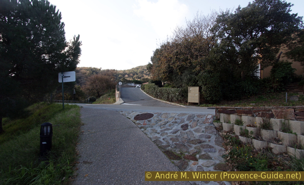
Turn right here
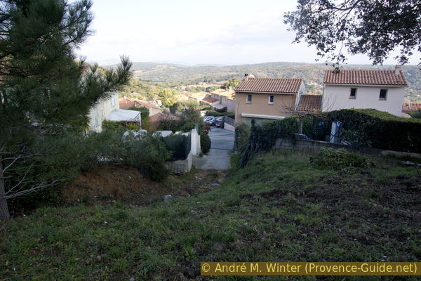
As a forest road, it is a cul-de-sac that becomes an easy path after about 200 meters. Sometimes you can see the old village centre of Ramatuelle through trees.
No reproduction is permitted without the written consent of the author. (id4695)
View to Ramatuelle
Finally, the forest road turns into a path that has slipped in places. We always try to stay at the same level and walk south between small trees.
No reproduction is permitted without the written consent of the author. (id4696)
Little used path in the forest
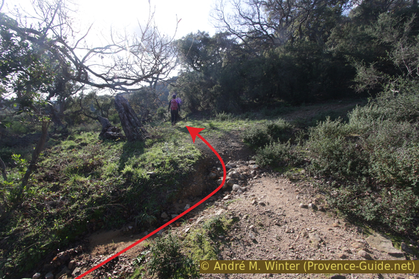
So we come to an open space where you think you can see the forest road again. If this seems to turn to the left, we go a few meters to the right, steeper uphill, because the path in front quickly ends in the thorny thicket!
No reproduction is permitted without the written consent of the author. (id4697)
A short climb to the right here
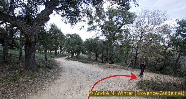
After about 20 meters of ascent (you can see mountain bike tracks), we turn left again to find an easy path between cork oaks. It leads slightly uphill and further ahead crosses some dry ditches.
No reproduction is permitted without the written consent of the author. (id4698)
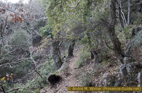
Path between cork oaks
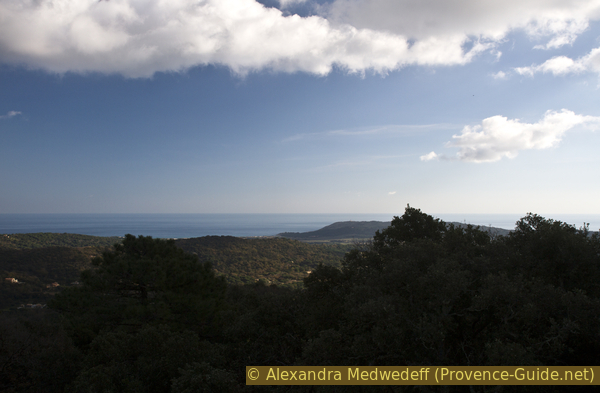
Sometimes you can see the peninsula and Ramatuelle.
No reproduction is permitted without the written consent of the author. (id4699)
Views of Ramatuelle and the peninsula
Further ahead the path shows obvious signs of human engineering, although vegetation is slowly covering everything. This is how you get through a breakthrough in the rock. Shortly afterwards we see why: we walk along a different section of the aqueduct that we know from the ascent.
We follow the water pipe and continue in this direction when it disappears into the ground.
No reproduction is permitted without the written consent of the author. (id4700)
Path along the aqueduct
écoles = schools
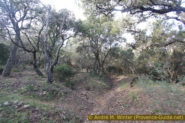
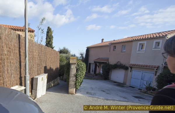
We come back to the crest of the Castella, where we climbed up from the settlement. But this time we go straight down the chaotic forest road. At a different point, it takes us to the settlement of Les Roques du Castellas. We literally stumble into the houses.
No reproduction is permitted without the written consent of the author. (id4703)
Descent to the settlement of Les Roques du Castellas
Paths and stairs that shorten the road lead through the settlement. They aren't posted, but easy to find. When you arrive you turn right after the second house. Further down turn right again and before the curve turn left. The path then leads straight down to the road in several sections. Then keep left there.
To get back to the starting point, either follow the concrete path over the school and the chapel as on the ascent, or stay on the road to the right. The second variant may be better for drivers because it allows you to get to the parking spaces faster.
No reproduction is permitted without the written consent of the author. (id4701)
Shortcuts in the settlement
Sources and additional information
It is better to use a good topographical hiking map: This tour is on the IGN map "Saint-Tropez, Sainte-Maxime, Massif des Maures", scale 1:25000, 3545OT.
If you don't want to bother with a paper map, you can also use mapping apps on your cell phone. On the one hand, it is the Cartes IGN app from the official map service. However, it requires access to the data network and this is sometimes difficult in canyons or remote locations.
Alternatively, you can use apps that store data directly on the device. They're generally not free, but they don't cost much. We mainly use OSMAnd, here it is possible to add contour lines, relief shading, markings and others. To store this data on your phone you need a lot of space.
Of course, one needs access to satellites for the GPS signal with any app. In some canyons this is not the case. Therefore, do not rely on the position shown, but read the map on your phone as you would read it on paper. Most apps are available for Android and iPhone. The applications usually allow us to record the route travelled and also view the GPS files offered for each of our hikes.
This page has been seen 2591 times since 20 March 2024.
No reproduction is permitted without the written consent of the author. (id4705)
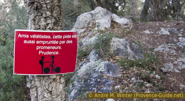
Advice to mountain bikers to share the path with hikers