The old Hyères centre and the castle ruin
A city walk with panoramic views
walk
easy
1 h 15 min
yes
yes
built-up area
walk
Introduction
Cities allowing hikes directly from the centre to quickly reach natural viewpoints are quite rare. This is the case however in the old town of Hyères. We climb passing pleasant squares, dark passages, very narrow streets and flowery parks to the castle, certainly in ruins, but offering a perfect panorama.
The facts
3,7 km total distance
1 h 15 min walk time
180 m total elevation
orientation average
mark 55% of the total distance
45% hard-surfaced city alleys
35% easy trails
15% hard-surfaced city roads
10% parks
dangers slippery sections
children yes
useful picnic stuff
required trekking boots, hiking equipment and water
GPS coordinates (WGS84) of start and end point 43.119339,6.131662
downloads ![]()
![]()
Public transport
Hyères is easily accessible from Toulon with line 103 of Réseau Mistral (only french), get off at the Jean Jaurès stop. Line 878 in the network of Zou! (only french) is also usable. It is also possible to take the TER regional train to Hyères train station and take the 67 bus to the city centre. In the last two cases, the stop to get off is called Hyères Centre Joffre.
Access by car
Hyères is a fairly large town and access by car is not as difficult as in other towns in the region. A large multi-lane road passes south of the centre. Take the Centre-Ville and Parking Forum Casino exit. We thus go up from the D98 in the Avenue Ambroise Thomas.
Useful parking spaces
You arrive at a roundabout and you are already skirting the Versin car park. It is free, but often full. In this later case, there is only the underground paid car park of the casino, one simply continues along Avenue Ambroise Thomas to find it on the right. Otherwise, there are other paid car parks near the centre.
No reproduction is permitted without the written consent of the author. (id6521)
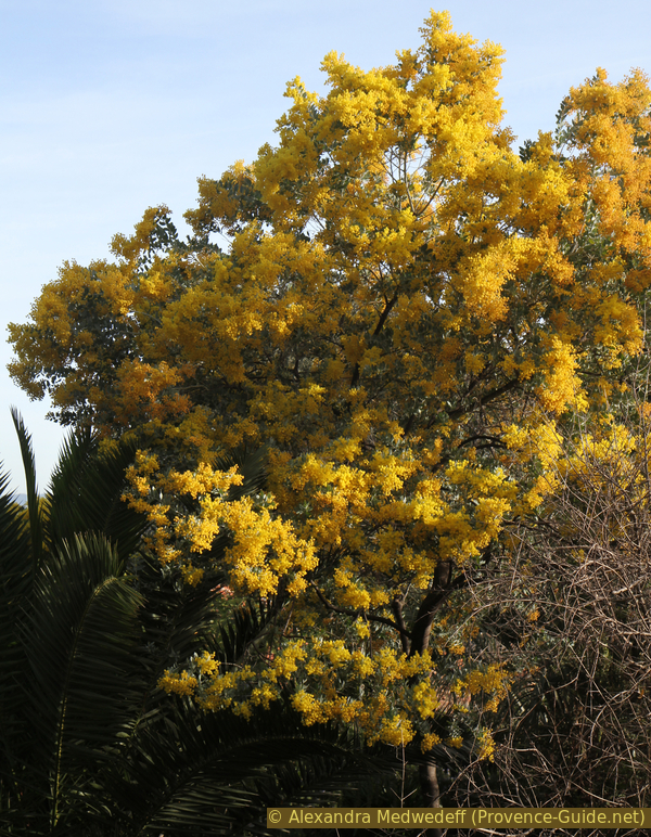
Mimosa in Parc Saint Bernard
Hints
Although this is a city hike, we climb 180 meters to the castle. However, we pass through very peaceful streets and parks.
Parks are only open at daylight.
The whole region is a zone with a high risk of forest fires. In summer, but also in other seasons when it is very dry or by strong winds, access to the forest areas can be regulated. As a result, the roads may be closed to traffic and/or the trails prohibited to hikers. Current information: Map of access to the forests of the Var (also english). The map shows the colours green, yellow, orange and red which correspond to levels of danger. The affected area is: Corniche des Maures (4).
The sections
- Ascent via Parc St. Bernard to the castle and its viewpoints.
- Descent into town via the Rue des Porches.
Section 1: Place Massillon - Château
➙ 2 km ... 45 min ➚ 175 m ➘ 5 m ↝ average
15% hard-surfaced city roads, without marks
40% hard-surfaced city alleys, old marks
15% parks, without marks
10% hard-surfaced city alleys, without marks
25% easy trails, old marks
The clues
- Bus stops Jaurès or Joffre, 30 m
- Place Massillon, 50 m
- Wash house Lavoir du Repos, 65 m
- Porte Barruc, 75 m
- Parc St. Bernard, 100 m
- Castle ruin, 200 m
The ascent via various squares and gardens.
Coming by bus or car, we go north towards the hill with the old centre of Hyères. Above the former Parc Hôtel the avenue Aristide Briand leads us towards the centre.
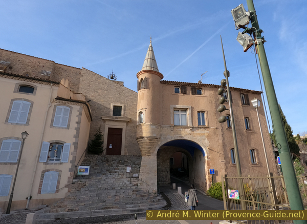
We have the large Place Clemenceau on the right, but we keep to the left to be in front of Porte Massillon. However, do not pass it because we are going up right the Place de la République. At the top is the Saint Louis Church, it dates back to the 13th century Franciscans.
Arriving at the top of the square, we turn left until we come to Rue Massillon where we go up to the right.
No reproduction is permitted without the written consent of the author. (id6512)
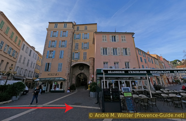
Place de la République and Porte Massillon
This often very lively alley leads us to the last large square under the castle. To the left is the Templar Tower.
The tower is the vestige of the commandery founded outside the city walls by the Templars. This religious and military order is mentioned in Hyères in an act dated 1198. It then owned an important estate surrounded by arable land, but also a hospice, attic, stable, forge and baking oven in the immediate vicinity of the town.
In 1308, during the general arrest of the Templars, their property was donated to the Order of Hospitallers of the Commandery of Beaulieu located in Solliès-Pont. In 1673, the tower was sold to the municipality, which left its occupation to the blue penitents until 1765. It was then transformed into a market hall, then into a town hall until 1913. The tower kept the essential of its medieval appearance. In the Middle Ages, the chapel on the ground floor, whose entrance is located to the south, did not communicate from the inside with the large guard room on the first level. The upper floor is accessed from the outside by retractable stairs. At the top, a defensive terrace is connected to the guard room by a staircase built into the thickness of the wall. We can still observe in different places the loopholes pierced in the facades. Other openings, such as the two twin windows with columns, the large semi-circular arched bays and the roofs show the transformations of the building over the centuries.
No reproduction is permitted without the written consent of the author. (id6513)
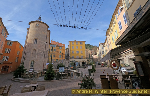
Place Massillon and Tour des Templiers
We climb the stairs at the end of the square to have an ideal view. A statue is under this staircase.
It shows Jean-Baptiste Massillon, born 24 June 1663 in Hyères. A great preacher, he left his home town early and later became bishop of Clermont-Ferrand.
No reproduction is permitted without the written consent of the author. (id6514)
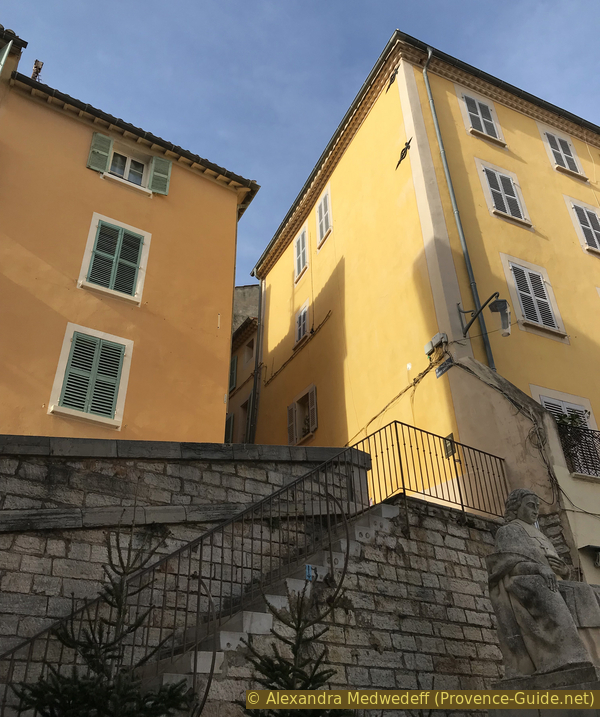
Stair at Rue Sainte Catherine and Jean-Baptiste Massillon statue
This square is perhaps the nicest in Hyères. In this photo from January it is empty of people, but a bar has opened anyway.
At the end of the stairs, we turn left into Rue Sainte Catherine.
No reproduction is permitted without the written consent of the author. (id6515)
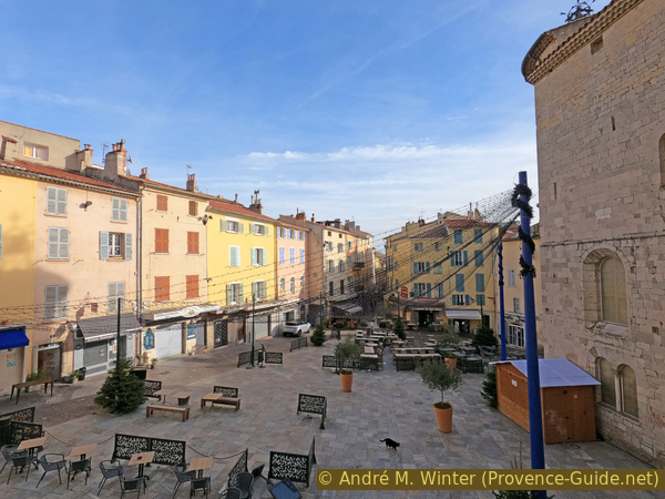
Place Massillon
At the address 8 Rue Sainte Catherine is a stone with Latin words in the wall. It is a tombstone reused here for the construction of the house.
The Latin text reads:
Q(uintus) Atilius Q(uinti) F(ilius) Prepon sibi et suis vivos F(ecit)
That means:
Quintus Atilius, son of Quintus Prepon, built this tomb during his lifetime for himself and his family
No reproduction is permitted without the written consent of the author. (id6516)
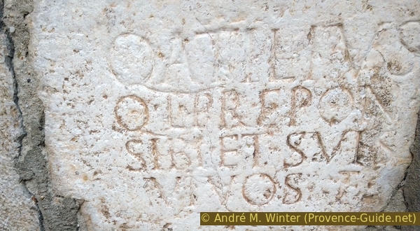
Roman tombstone of Quintus Atilius
We upwards on Rue Sainte Catherine and turn left twice to go down a few meters to pass through the access opened in 2018 towards the Lavoir du Repos garden.
No reproduction is permitted without the written consent of the author. (id6517)
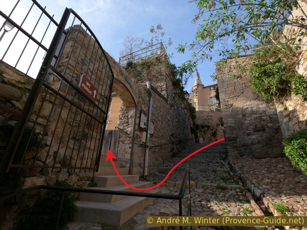
Access to the wash house from Rue du Repos street
The name of the site (Repos = rest) comes from the use of this land until 1782 when the intramural cemetery below the Saint-Paul church was definitively transferred outside the city for reasons of public safety. The plot of the old cemetery remained unused for more than a century. In 1880, several old washhouses were removed and this washhouse was installed here in 1888. The washhouse was built on the second of the three terraces of the plot, which is closed by a wall on the side of the alley. It consists of three hard stone basins fed by a tap at the south-west end. It is sheltered by a large roof. In the north corner is a fire place.
Today, it is a park that also serves as an exhibition space. There are public toilets.
No reproduction is permitted without the written consent of the author. (id6518)
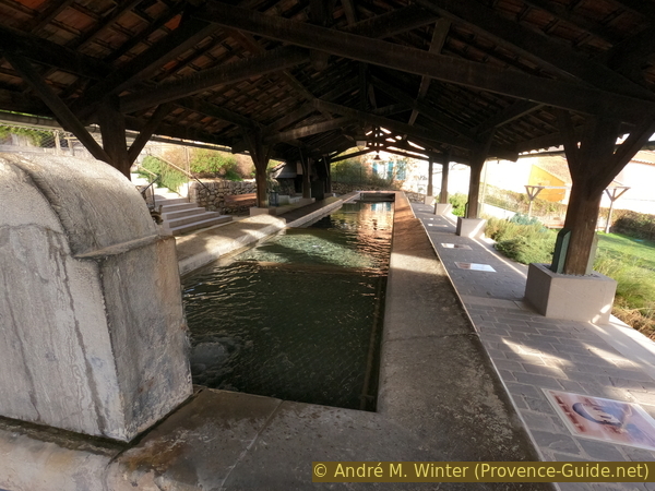
Lavoir du Repos washhouse
We exit the park by the steel staircase.
At the top left is an orientation table, but then we continue to the right.
No reproduction is permitted without the written consent of the author. (id6519)
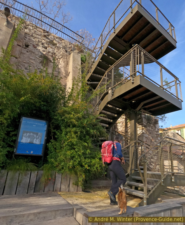
Stair above Lavoir du Repos washhouse
In the 13th century, the Saint-Paul church was protected by a rampart in which the Saint-Paul gate became the main access. The church is behind the door on the left, but we can see it better later from above.
No reproduction is permitted without the written consent of the author. (id6525)
Porte Saint Paul
Under the great vault is a starry sky very typical of medieval decor.
After this door, we take the first lane on the right. This is Rue Paradis.
No reproduction is permitted without the written consent of the author. (id6526)
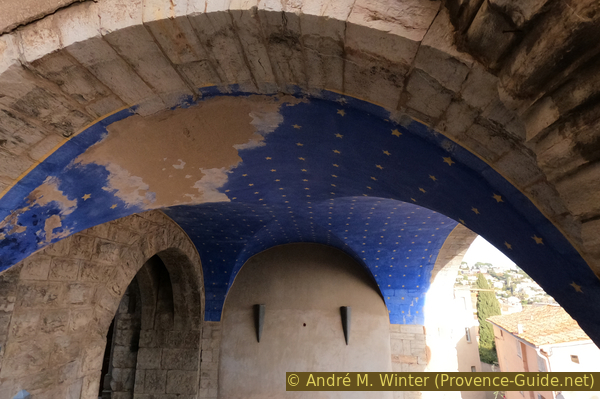
Stars under Porte Saint Paul
Rue Paradis is an alley prohibited and impossible for all motorised traffic.
It delimited the upper part of the old town, higher up were only gardens. It was a cultivated area inside the ramparts (paradeisos in Greek means orchard surrounded by walls) intended for supply in case of siege. Today these gardens are replaced by recent villas.
This alley goes up and down. At the only notable junction is a house that dates from another time.
No reproduction is permitted without the written consent of the author. (id6527)
Rue Paradis
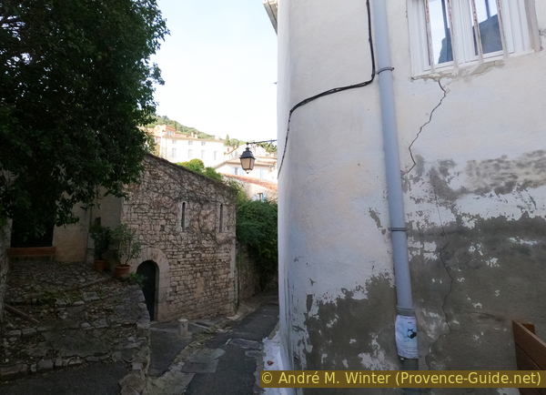
The finest example is a Romanesque house. It was built within the first city walls and is located on the edge of the wall between the Porte Saint-Paul and Porte Barruc gates.
Built directly on the street, it occupies the full width of the property and leaves no room for a garden. It has several floors. In general, the basement and ground floor are dedicated to professional activities, while the upper floors are reserved for domestic life. This versatility explains the different facades.
The ground floor on the Rue Paradis side retains the signs of a large opening to the outside, which gave access to the shed, stable or shop. The floor, accessed through a narrower door across the street, is characterized by two openings. The style of these pillared windows allows the construction of this house to be dated towards the end of the 13th century or during the 14th century.
No reproduction is permitted without the written consent of the author. (id6528)
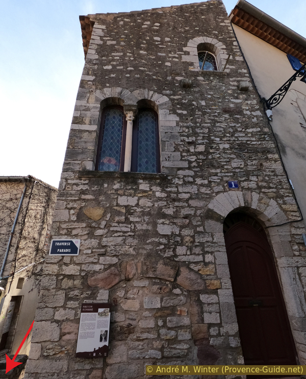
Romanesque house in Hyères
The ramparts, built on either side of the castle in the 13th century, had nine towers and five gates, including Porte Barruc. It protects the densely populated city, whose inhabitants soon settled further down the slope at the end of the Middle Ages. Unlike other entrances to the city, which have a defence system consisting of a portcullis, door and embrasures, this gate also has a defensive bay. You can still see the broken bow and the grooves for the portcullis.
On the first floor, the presence of a double window with a small column decorated with a capital testifies to an enlargement and transformation of the tower into an apartment. In fact, after the construction of the lower city walls that surrounded the lower town in the 14th century, the Porte Barruc was integrated into the urban space, but nevertheless kept functional for a long time.
No reproduction is permitted without the written consent of the author. (id6529)
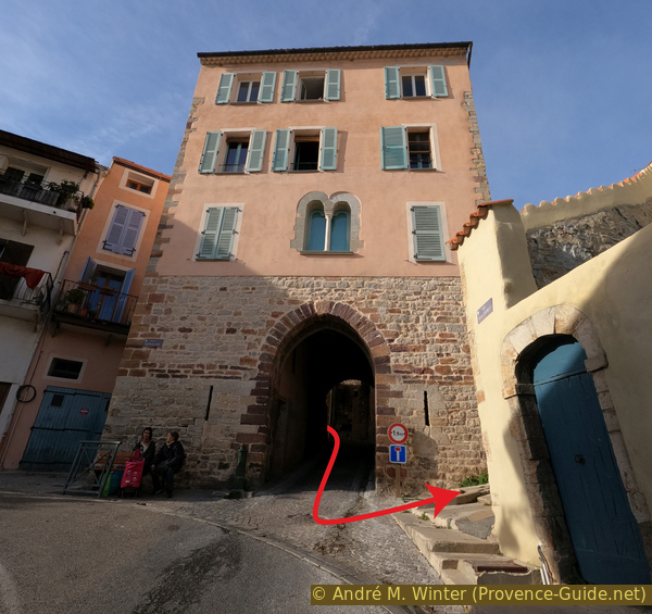
Porte Barruc
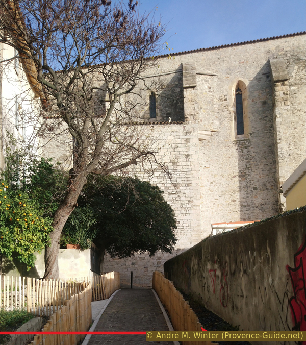
After Porte Barruc, we turn left to go up the steps of Rue Saint Esprit. Higher up, the stairs separate, we stay on the left to enter through the lower door of Parc St. Bernard.
No reproduction is permitted without the written consent of the author. (id6520)
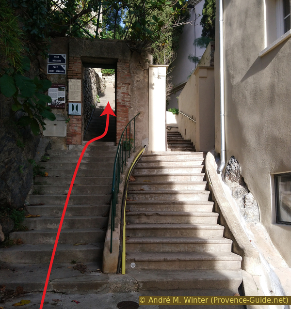
Stair Rue Saint Esprit and access to Parc St. Bernard
Parc Saint-Bernard extends over four hectares at the foot of Villa Noailles, with which it is historically linked. In fact, from 1925, Charles de Noailles, a passionate botanist, planted a Mediterranean maquis to the north of the villa, as well as a terraced garden below, which forms the current park. As the terrain was very steep and the soil poor and dry, the Viscount embarked on a long modelling and levelling project. This lower garden was acquired by the city in 1973.
At the foot of the castle and north of the old town that dominates it, the park is made up of narrow terraces connected by stone steps. Dedicated to the vegetation of the Mediterranean basin, it offers a great botanical diversity. Among the notable rosemary collections, one bears the name of Charles de Noailles. A rock garden brings together certain plants that live in a desert environment: agaves, cacti, acanthus, and yuccas. The garden also houses rare and original plants: the American strawberry tree, the jupiter's beard or the sapodilla tree.
No reproduction is permitted without the written consent of the author. (id6522)
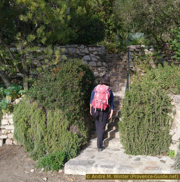
Stair in Parc Saint-Bernard
The garden also houses a small plant labyrinth which is more dense in the spring than in the winter where the photo was taken.
No reproduction is permitted without the written consent of the author. (id6524)
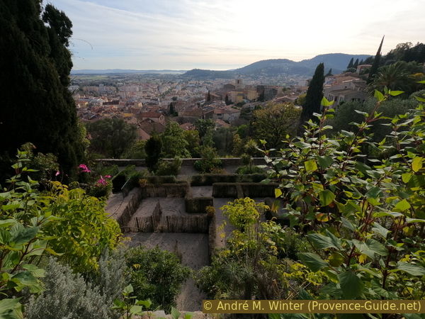
The labyrinth in Parc St. Bernard
After going up the small stairs in the garden, you come to a high wall that you follow to the left. Above is the Villa Noailles.
We climb the staircase from which we enjoy the first good views over the city and the sea.
No reproduction is permitted without the written consent of the author. (id6532)
Upper stair in Parc Saint-Bernard under Villa Noailles
Thus, we have a good view of the city and the islands in the distance. This view will be even better from the top of the castle.
No reproduction is permitted without the written consent of the author. (id6523)
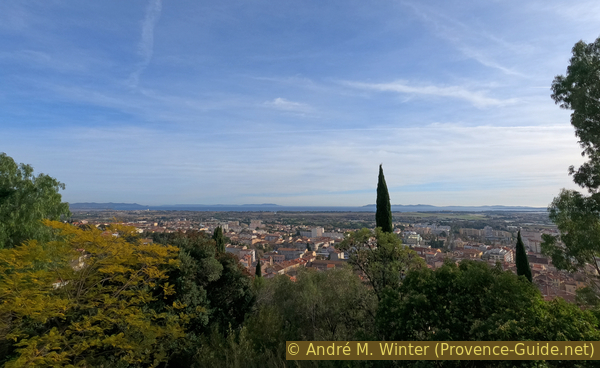
View from the park on Rade d'Hyères bay
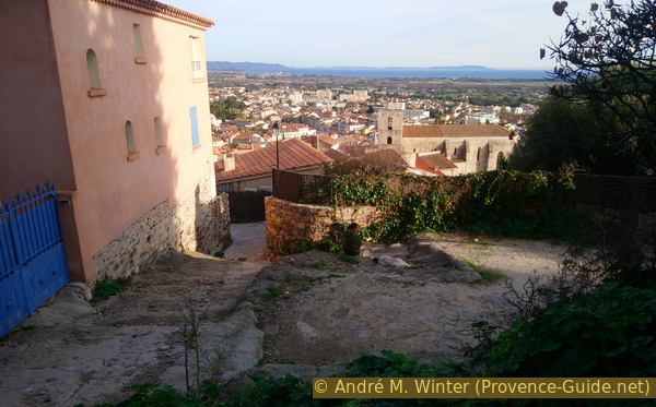
Finally we can see the church better.
Saint Paul's Church, attested since 1182, was mentioned in 1221 as a parish church. In 1572 it became a collegiate church. In 1842 it finally gave up its title of parish church in favour of the Saint-Louis church on the Place de la République. The collegiate church preserves the remains of the first 12th-century building in Provençal Romanesque style, whose western façade has a semi-circular portal. The church was quickly integrated into the medieval town, which was protected by city walls in the 13th century.
Towards the end of the 16th century, a new church was built in Gothic style with an irregular plan. Facing south, it borders the old Romanesque church that becomes its porch, known as the narthex. The choir is built against the old main tower of the city walls, which was once used as a prison and was converted into a sacristy until the time of the last restoration. Already raised in the Baroque period, the bell tower was built even higher in the 18th century. Around 1784 the narthex was partially remodelled to allow access to the church from the lower town via a monumental staircase and a gate facing the bay. After the destruction of the Notre-Dame de Consolation chapel in 1944, the votive offerings housed there were placed in the Saint-Paul collegiate church. This collection is one of the most important votive collections in Provence.
No reproduction is permitted without the written consent of the author. (id6530)
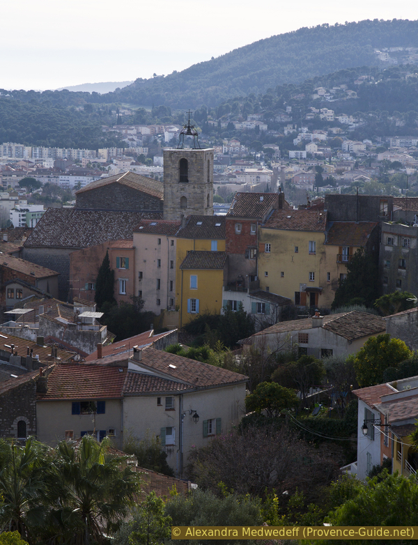
St. Paul church in Hyères
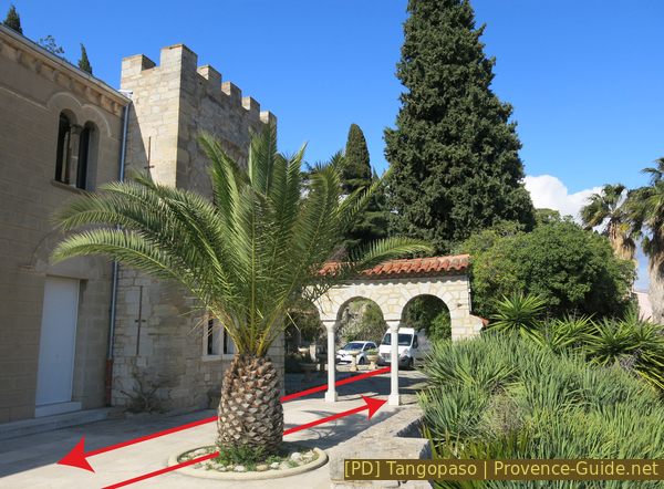
The staircase brings us to the entrance of Villa Noailles.
It was built from 1923 to 1925 for the aristocrat and patron Charles de Noailles (1891-1981). He called upon the architect Robert Mallet-Stevens to build him a villa in a very rational and uncluttered style favouring the entry of sunlight. Sold to the municipality in 1973, it was abandoned before being renovated to be reopened in 1989 to become a centre of art and architecture in 1996.
Access to the villa and its exhibitions is possible from 13 to 19h (14 to 20h in summer). The villa is closed on Mondays, Tuesdays and public holidays. Information under Villa Noailles.
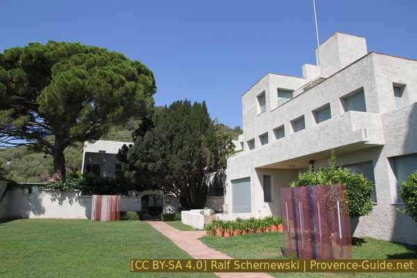
Villa Noailles
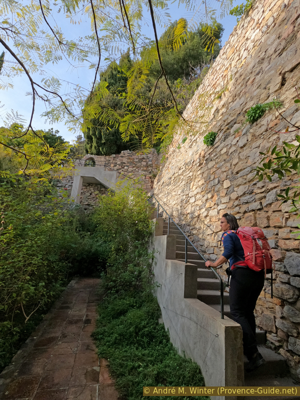
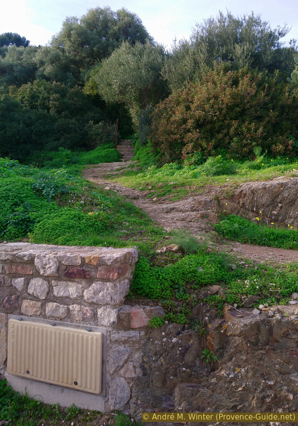
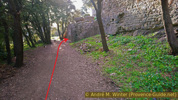
We turn left before entering the villa to climb a bend of the road. The Rue Saint-Pierre is a concrete ramp which is bordered above by a wall. When you see a first house on the left, you also see a path that goes up to the left. This is our access to the castle ruins. We pass several remains from different eras, but we just keep going up.
No reproduction is permitted without the written consent of the author. (id6533)
Access from Rue Saint Pierre to the castle
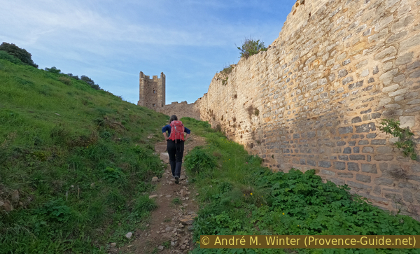
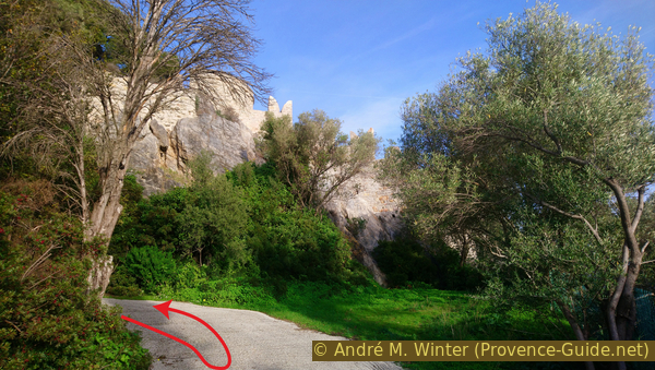
If you deviate to the right of the path, you arrive at the foot of the north-eastern wall which is here again in very good condition. You can also walk up here.
No reproduction is permitted without the written consent of the author. (id6534)
In the castle area of Hyères
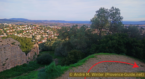
We climb up to a plateau in front of the ruins of the two towers that persist.
The castle is at the highest point, its ruins form the current viewpoints. It dates from the 11th century and was built after the Saracens were driven out of Provence. It often changes ownership and receives visits from different rulers. It was in good condition until the wars of religion at the end of the 16th century. It was finally dismantled in 1620.
No reproduction is permitted without the written consent of the author. (id6535)
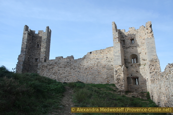
Defence towers of the castle of Hyères
We leave the big towers behind us. Without leaving the enclosure of the castle, we turn left and climb a kind of ramp. We follow this path which makes us make two hairpin bends before returning to the south-west direction.
No reproduction is permitted without the written consent of the author. (id6536)
Under the Hyères castle ruins
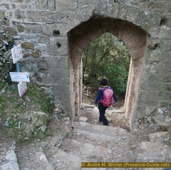
The path, now flat, leads us to two large cylinders which form the base of two twin towers that formed the lower entrance to the castle.
No reproduction is permitted without the written consent of the author. (id6537)
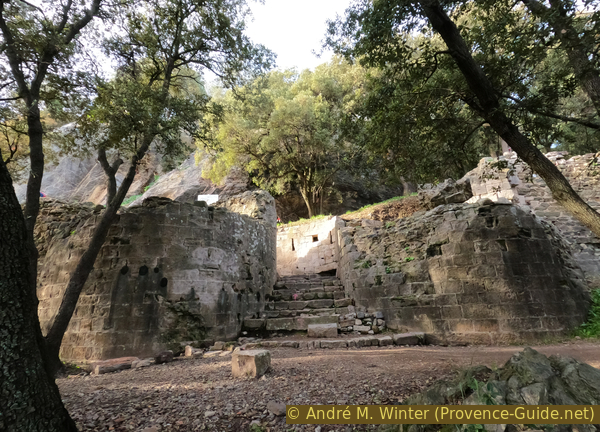
Lower entrance of the castle with the twin towers
The castle's motto, Arearum Castrum (Castle of the Area) is carved into the lower entrance. The city was called by this name in the early Middle Ages.
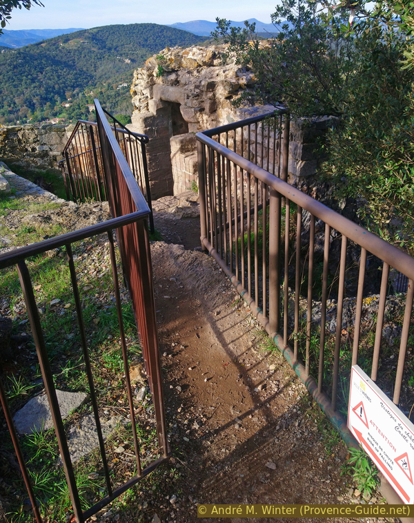
The low door guides us to the left, the rest of the path is guided by stairs and walkways. It makes us pass under and around a first point of view with an orientation table which we therefore access from the north. In the centre of the ruin is a slightly larger terrace with another panoramic orientation table. We have an overview of the whole municipal area of Hyères.
No reproduction is permitted without the written consent of the author. (id6538)
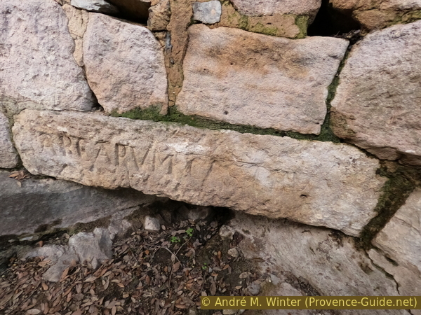
Motto Arearum Castrum engraved on a reused stone
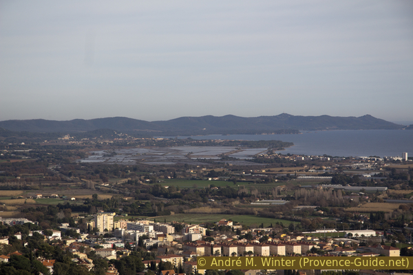
The town of Hyères is at our feet. In the background the islands: Levant and Port-Cros which merge then Porquerolles and the Giens peninsula.
No reproduction is permitted without the written consent of the author. (id6539)
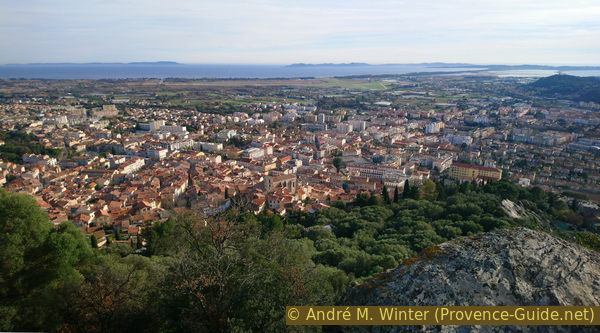
Hyères islands and the city
To the east, towards Londe-les-Maures, are the Old salines of Hyères.
No reproduction is permitted without the written consent of the author. (id6540)
Old salines and Rade d'Hyères bay
To the south is the peninsula of Giens, connected to the mainland by the double tombolo which is also occupied by salines.
To the West you see the mountains Mont Faron, Coudon und Fenouillet.
No reproduction is permitted without the written consent of the author. (id6541)
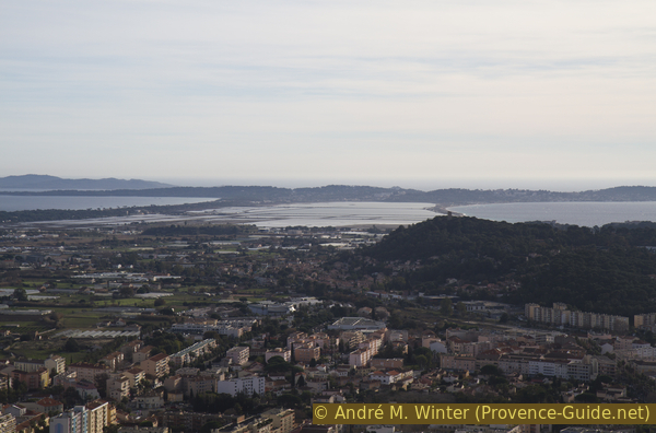
Tombolo and Giens salines
Section 2: Château - Rue des Porches
➙ 1,7 km ... 30 min ➚ 5 m ➘ 175 m ↝ average
40% easy trails, old marks
45% hard-surfaced city alleys, without marks
15% hard-surfaced city roads, without marks
The clues
- Castle, 200 m
- Down via north then south to the city limit, 110 m
- Rue Rabaton, 55 m
- Rue des Porches 40 m
- Bus stops Jaurès or Joffre, 30 m
A slightly faster descent and some nice surprises.
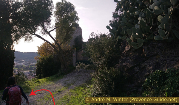
To the east is another viewpoint, but this one is without an orientation table. It is accessible by a well framed path.
No reproduction is permitted without the written consent of the author. (id6542)
Walk on the ruins of the castle of Hyères
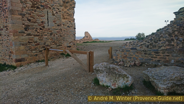
We however return north from all these viewpoints and descend through a door to the north.
No reproduction is permitted without the written consent of the author. (id6543)
Exit through the north gate of the Château d'Hyères
This path descends fairly quickly in two bends and bypassing a small water reservoir. We reach the parking lot north of the hill.
No reproduction is permitted without the written consent of the author. (id6544)
Descent under the north gate of the Château d'Hyères
We return to the flat area under the towers, so we have to enter the enclosure from which we left through the small door before.
No reproduction is permitted without the written consent of the author. (id6545)
North access to the Château d'Hyères
Among the various paths starting from the square to the south-west, we take the lowest without descending along the wall. This dirt road turns quickly to the right, but remains steeply downhill.
No reproduction is permitted without the written consent of the author. (id6546)
Rade d'Hyères bay and the path down
We thus arrive in front of the gate of a house. Here we turn left on a concrete ramp.
No reproduction is permitted without the written consent of the author. (id6547)
Turn left on a concrete ramp
You arrive at a crossroads where a sign clearly indicates that you have to turn left to go down towards Hyères.
However, you can also go to the right down and then back. We can then see then other traces of the medieval walls of the city.
No reproduction is permitted without the written consent of the author. (id6548)
View of the southern part of the enclosure of the castle of Hyères
Having therefore turned left as indicated, we walk on a less steep dirt road. We take the first opportunity to descend to the right.
This brings us back to the city. We arrive near a first house in Rue de la Pastourelle.
We have to turn left at the bottom, but we will go right and steeply downhill at the first opportunity. This takes us down the Rue des Princes. At the very bottom, we pass the rather thin arch of the Porte des Princes.
There under we turn left.
No reproduction is permitted without the written consent of the author. (id6549)
Way down Rue de la Pastourelle
By turning under the Porte des Princes on the right, you can access the garden of Parc Saint-Claire. It is somewhat similar to the Saint-Bernand Garden, but it is only accessible from one entry point. So you have to come back afterwards.
Castel Sainte-Claire
You will come to a crossroads of motorable roads, where you will take the only non motorable passage and descend sharply to the right. This is rue Jules Romains.
No reproduction is permitted without the written consent of the author. (id6550)
Passage Rue Jules Romains
During the descent, we see the Saint-Paul church on the left. You can reach the entrance by advancing here.
The long ramp of Rue Jules Romains leads further down to Rue Lamalgue where we continue to descend until we arrive at a small square which serves as a car park. Here, turn left into Rue Fenouillet. It leads further into Rue Rabaton where you continue in the same direction.
No reproduction is permitted without the written consent of the author. (id6551)
Collégiale Saint-Paul church
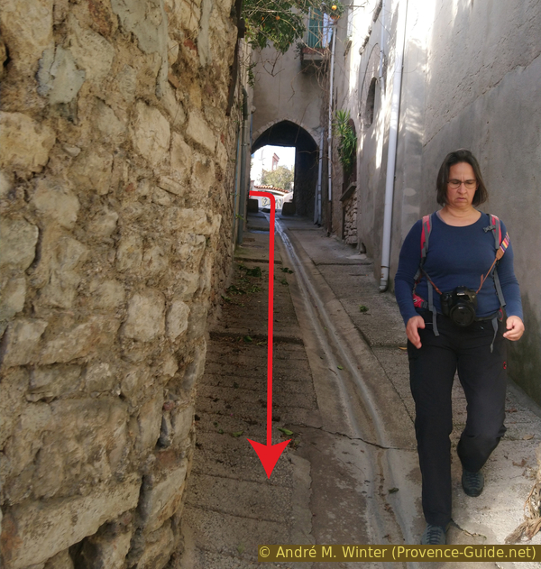
At the end of the street, we pass near the Tour des Templiers and come back to Place Massillon. Either we stop here to sit down at one of the cafes, or we continue: we turn left and go down Rue Portalet.
No reproduction is permitted without the written consent of the author. (id6552)
Place Rabaton
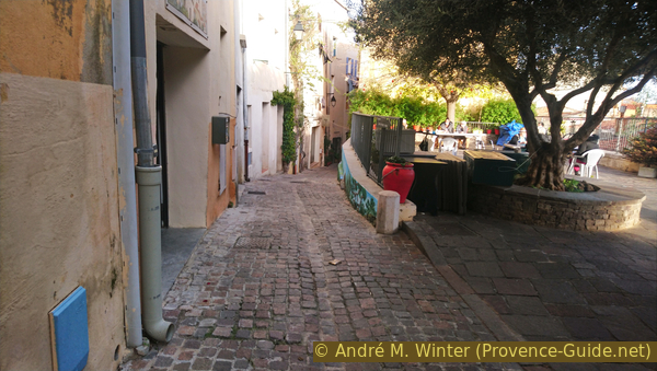
When Rue Portalet becomes less steep and opens onto a square, turn left into the darker street that has no less than five long passages under houses. It's the perfect place to cool off if you're here in the summer season.
Further on, this street leads to Rue Massillon. We continue in the same direction and exit through Porte Massillon on the lower part of Place de la République.
So we find the bottom of the old town and it's time to return to the bus stops or one of the car parks.
Rue des Porches
Sources and additional information
It is better to use a good topographic hiking map: this tour is on the IGN map "Hyères, Île de Porquerolles", scale 1:25000, 3446OT.
If you don't want to bother with a paper map, you can also use mapping apps on your cell phone. On the one hand, it is the Cartes IGN app from the official map service. However, it requires access to the data network and this is sometimes difficult in canyons or remote locations.
Alternatively, you can use apps that store data directly on the device. They're generally not free, but they don't cost much. We mainly use OSMAnd, here it is possible to add contour lines, relief shading, markings and others. To store this data on your phone you need a lot of space.
Of course, one needs access to satellites for the GPS signal with any app. In some canyons this is not the case. Therefore, do not rely on the position shown, but read the map on your phone as you would read it on paper. Most apps are available for Android and iPhone. The applications usually allow us to record the route travelled and also view the GPS files offered for each of our hikes.
This page has been seen 5549 times since 20 March 2024.
No reproduction is permitted without the written consent of the author. (id6531)
Orange flowers