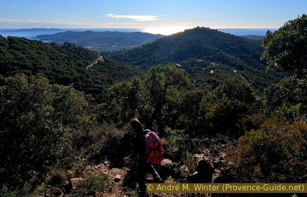
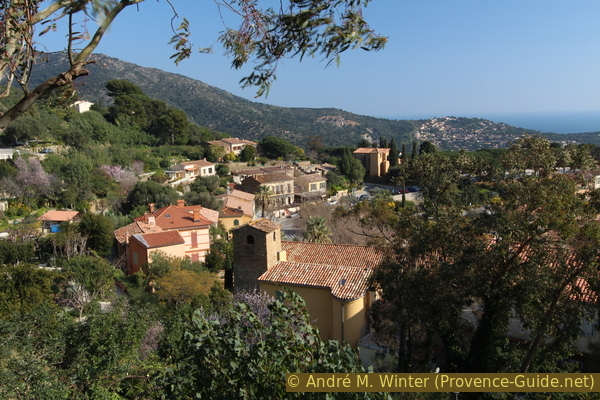
Rock Pierre d'Avenon above Bormes-les-Mimosas
Long way back via Notre Dame de Constance
hike
average
4 h 15 min
yes
yes
no
walk
Introduction
This is a tour far from the bling of the coast, on paths lost in the slopes of the Maures, between twisted cork oaks, heather and strangely shaped rocks. We start from the village of Bormes-les-Mimosas towards the north-east to reach the natural viewpoint of the Pierre d'Avenon. From there, we go for a long loop in the Mediterranean forest to reach the Col de Caguo-Ven. A final climb takes us to the Notre-Dame de Constance chapel and its landscaped viewpoint. We return to the town via the Way of the Cross.
The facts
11,2 km total distance
4 h 15 min walk time
500 m total elevation
orientation average
mark 90% of the total distance
55% forest roads
20% moderate trails
10% easy trails
10% hard-surfaced country road
5% hard-surfaced city alleys
<5% stairs
<5% hard-surfaced quiet side streets
<5% Trails with scramble passages
dangers rocky sections
children yes, but it's long
useful picnic stuff
required hiking boots, hiking equipment and water
GPS coordinates (WGS84) of start and end point 43.151067,6.344579
downloads ![]()
![]()
No reproduction is permitted without the written consent of the author. (id6612)
On the Pierre d'Avenon rock
Public transport
In this part of the coast, the train line is far inland, but there is the bus line 878 between Saint-Tropez and Toulon and the line 873 between Saint-Tropez and Hyères. An inconvenient side effect of these fast bus connections: they do not go up to the old town of Bormes, but only go to the new local area down in the valley. Take bus stop Rond-Point du Grand Bleu. One stop east, called Gare Routière, departs line 886 up to the village and the start of this tour, but only during summer months. Information and timetables at Zou! (only french).
The way to get to the village on foot:
- From down the valley: get out of the bus at the Rond-Point du Grand Bleu sto. Take the first street on the right (Route des Lavandières). Follow the large curve to the left, pass the Chemin des Restanques and take the following road on the right. Be careful, there are two of them, take the one on the left (Impasse des Gazanias). Go up a little, then take the Chemin de Saint-François on the right. Keep the same direction arriving again on roads, we fall back on the Route des Lavandières in a bend in yaw, go up and take the Sentier St. François at the height of a pedestrian crossing. Here we are again on the Route des Lavandières, go up to the bend of the departmental road. Stay here on the right and change up the main road, change sides at the pedestrian crossing then take the path in the woods of the Parc du Cigalou in the centre of the bend. Always turn right in the park to come out under the Salle des Fêtes on the D41, cross it and turn right. Just after take the stairs or the upper part of the Park and continue to climb to reach the town hall and the start of this hike. 130 meters of elevation gain and three quarters of an hour on paved road and concrete paths in addition.
Access by car
The start is at the access to the St. François car park, on the east of the old town.
From the D559, the coast road in the Var department, go up the hairpin bends of the D41 to the village of Bormes and follow the signs for the Parking Saint-François, this is to the east under the large square by the town hall.
Coming from Collobrières, pass the cemetery and then keep left at the Saint François chapel. You are in the east of the village and get directly to the same parking lot.
Useful parking spaces
The free St. François car park is located above the village. In summer, avoid Wednesdays because it's market day in Bormes. More parking possibilities at the right of cemetery on the road to Collobrières, that lays on the fist part of this tour.
No reproduction is permitted without the written consent of the author. (id6649)
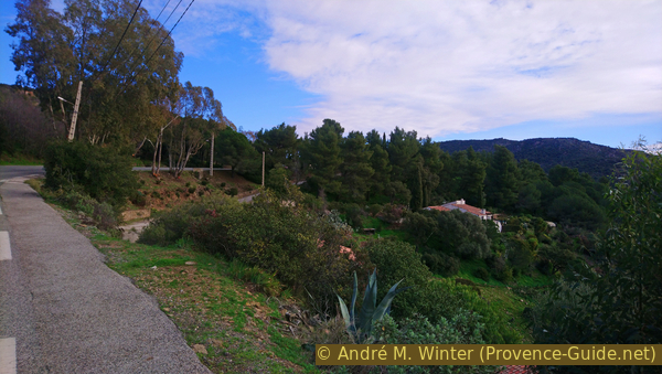
Bormes-les-Mimosas castle
Hints
<This tour has a higher gradient than it appears at first sight. We are on the way about four hours and this not necessarily in the shade, the Mediterranean forest has the defect of being very low and sometimes sparse. It is imperative to leave very early when the weather is hot.
We recommend high shoes for the rocks and the rather steep descents. There are wide enough paths everywhere, you can go in short trousers.
Notre-Dame de Constance Chapel is only open when it is manned by a volunteer, which is usually the case on public holidays and on particularly fine days in winter.
The whole region is a zone with a high risk of forest fires. In summer, but also in other seasons when it is very dry or by strong winds, access to the forest areas can be regulated. As a result, the roads may be closed to traffic and/or the trails prohibited to hikers. Current information: Map of access to the forests of the Var (also english). The map shows the colours green, yellow, orange and red which correspond to levels of danger.
The sections
- Bormes les Mimoas - Landon - Pierre d'Avenon
- Pierre d'Avenon - Col de Landon - Roussel - Col de Caguo-Ven
- Col de Caguo-Ven - ND de Constance - Bormes
No reproduction is permitted without the written consent of the author. (id6641)
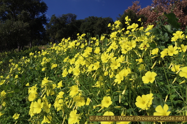
Oxalis flowers
Section 1: Bormes - Pierre d'Avenon
➙ 4 km ... 1 h 20 min ➚ 300 m ➘ 20 m ↝ easy
15% hard-surfaced country road, without marks
65% forest roads, few marks
10% moderate trails, few marks
5% hard-surfaced quiet side streets, few marks
5% forest roads, few marks
5% Trails with scramble passages, faulty marks
The clues
- Bormes St. François, 150 m
- Cimetry, 185 m
- Vallon de Landon, 195 m
- Rock Pierre d'Avenon, 435 m
The climb is slow at first, bypassing a valley. The climb is quite steep to reach the Route des Crêtes, but we then quickly reach the first viewpoint.
We start from the access to the Parking St. François which is under the chapel of the same name,we will visit it on the way back.
This chapel forms a sort of roundabout on the departmental road that goes up from Bormes towards Collobrières. We also leave in this direction. At the beginning, a small footwalk is reserved for hikers and pedestrians.
No reproduction is permitted without the written consent of the author. (id6591)
Route du Baguier and D41 road
Later, there is only a small strip for pedestrians. But let's not despair, we don't even walk for 10 minutes on the edge of this D41 road.
No reproduction is permitted without the written consent of the author. (id6592)
Footpath along the D41 road towards the cemetery
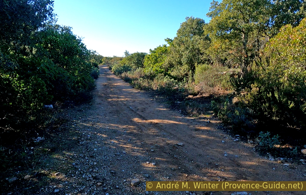
When the road makes a sharp bend to the left, we see a wide wall marking the cemetery. Here we leave the road and pass to the left of the cemetery on the Chemin du Landon.
This is an unsurfaced road which descends a little, but takes us over this valley at a roughly constant height.
No reproduction is permitted without the written consent of the author. (id6593)
Access to Chemin du Landon
This forest road takes us under a quarry and then follows a multitude of accesses to scattered houses. It is not always clear what is the road and what are accesses to houses.
No reproduction is permitted without the written consent of the author. (id6594)
Follow Chemin du Landon
Sometimes blue markers help you to find the right fork in the road. But basically, you have to follow the junction that changes the least amount of slope.
No reproduction is permitted without the written consent of the author. (id6595)
Chemin du Landon to the left
The condition of the road deteriorates after the last houses and we climb a little more steeply when we see a fire tank. It's time to leave this road and go straight on.
No reproduction is permitted without the written consent of the author. (id6596)
Chemin du Landon and the BLM18 fire tank
After the somewhat vague place near the cistern follow more signs.
The road keeps about the same height as before, you pass two fords which can be wet after rain.
No reproduction is permitted without the written consent of the author. (id6597)
Access to the dirt road under Le Landon
The road is now much steeper. We go up into the valley of the Vieille creek.
No reproduction is permitted without the written consent of the author. (id6598)
View bach and slope Coste Drèche
A fork in the road without clear signs, here we turn right and go uphill.
No reproduction is permitted without the written consent of the author. (id6599)
Forest road under Le Landon to the right
The road takes us past the ruins of an old farm. It was probably located here because of the presence of water in these slopes. Today, only a few walls remain with a view on Porquerolles.
No reproduction is permitted without the written consent of the author. (id6600)
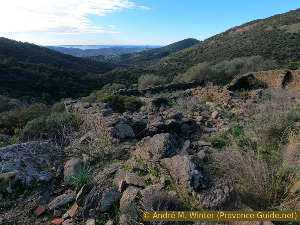
Ruin of a farmhouse in the Vallon du Landon and the Hyères islands behind
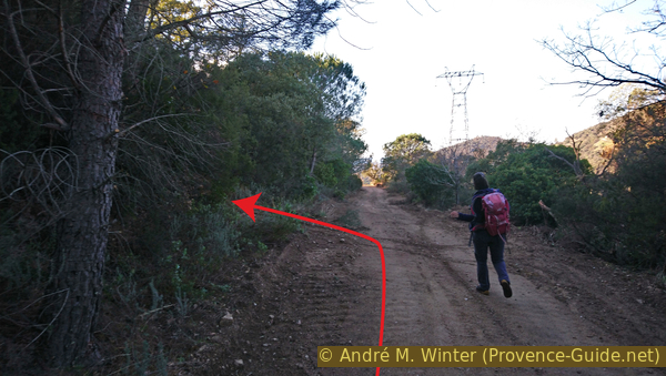
We continue on this road as it turns south.
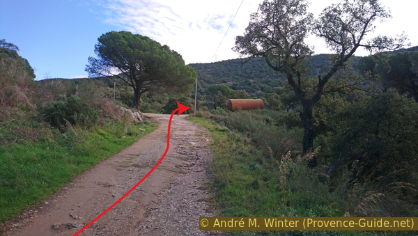
When the road turns right again, we must spot a blue marking on a pine tree to the left of the road. Further on, we see an electricity pylon. Now it is time to look for a path that climbs steeply up the hillside. We find it a few metres after the blue marker.
No reproduction is permitted without the written consent of the author. (id6601)
Track under Le Landon with the path going up to the left
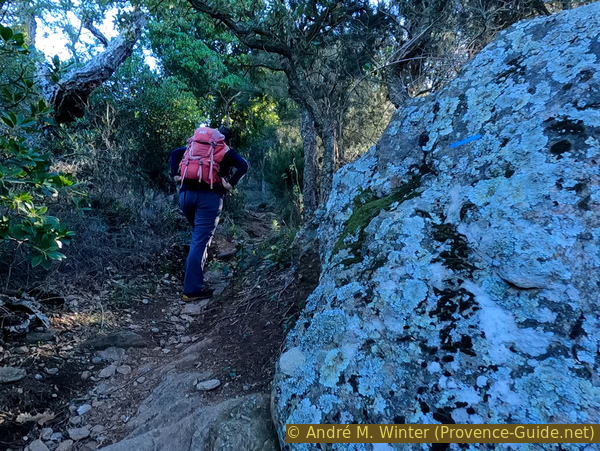
This path climbs the slope in a direct line. It passes between rocks and under some cork oaks. The markings remain blue, but they are very discreet.
No reproduction is permitted without the written consent of the author. (id6602)
Between rocks towards the Route des Crêtes
We see that we are walking along ancestral paths because we are walking along a dry stone wall with a well-mounted crown of large sloping rocks. This stabilises the smaller stones underneath and is also an elegant way of clearing the fields of stones.
No reproduction is permitted without the written consent of the author. (id6603)
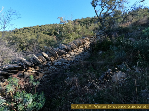
Ancient dry stone wall under the Route des Crêtes
We see that we are walking along ancestral paths because we are hiking along a dry stone wall with a well-mounted crown of large sloping rocks. This stabilizes the smaller stones underneath and it is also an elegant way to clear the fields of stones.
No reproduction is permitted without the written consent of the author. (id6604)
Hill with Notre-Dame de Constance and Hyères in the background
In the background is Hyères with the tombolo of Giens.
No reproduction is permitted without the written consent of the author. (id6605)
Rade d'Hyères and bay Tombolo de Giens
The beautiful sight makes us forget a little that we are in a rather steep ascent and which can be painful in the sun. Leaving rather early, we are in the shade here. The photo is taken at noon in January.
No reproduction is permitted without the written consent of the author. (id6606)
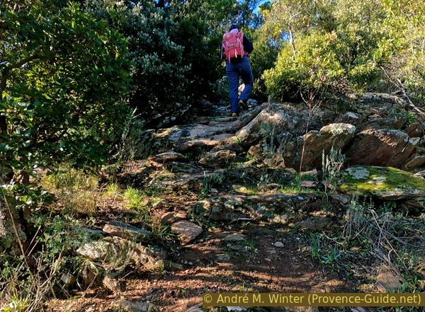
Rocks under the Route des Crêtes
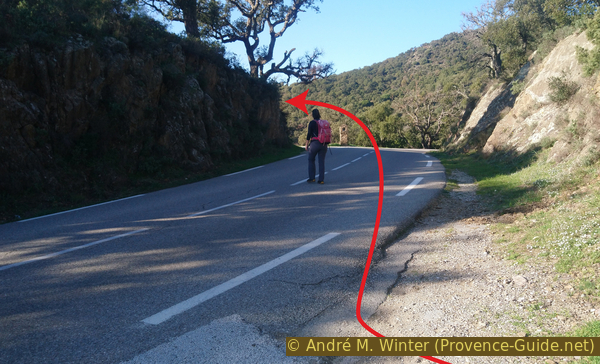
The very steep path takes us back to the tarmac Route des Crêtes des Maures. There may be traffic here. We turn right and take the first opportunity to the left. A blue marker is on a telephone pole.
The chain is only relevant to cars, the footpath passes here.
No reproduction is permitted without the written consent of the author. (id6607)
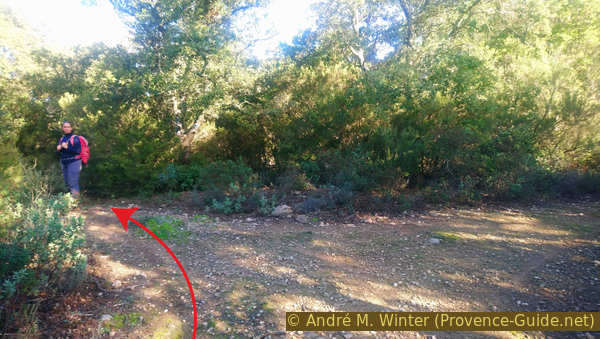
Access to the path to the Pierre d'Avenon rock
The forest road we are following is more of a wide path. It follows a secondary power line.
After a few metres we see a rock with a metal rod at the top. This is the Pierre d'Avenon!
We have to stay on the forest track until we are level with the rock.
No reproduction is permitted without the written consent of the author. (id6608)
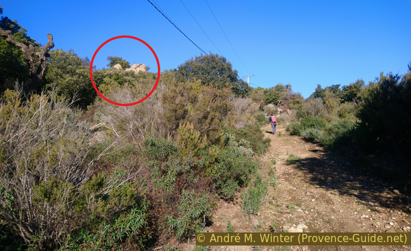
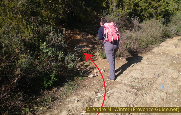
Pierre d'Avenon rock and the dirt road
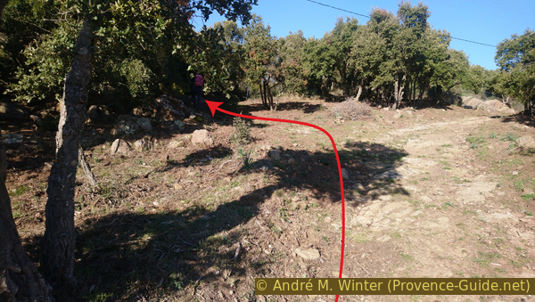
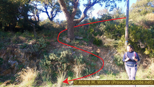
The access to the rock is not marked, as if they wanted to hide it. On the cork oak is a simple blue marker with no indication to turn. We turn left anyway.
We advance towards the grove and cross a first rocky step on which there is a blue cross-shaped marker. Our path continues beyond this. We walk along a patched up fence for a few metres, then keep to the left to climb the rocks.
No reproduction is permitted without the written consent of the author. (id6609)
Access from the track to the Pierre d'Avenon rock
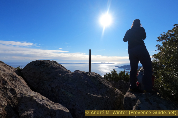
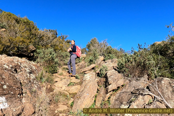
Unlike the woman in the photo, you have to go behind the rock to climb more easily.
No reproduction is permitted without the written consent of the author. (id6610)
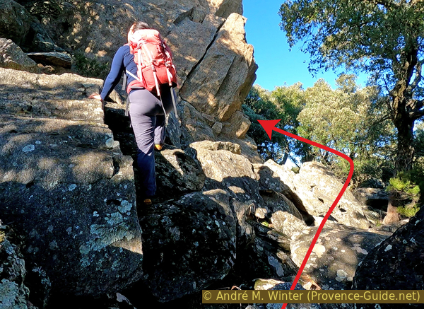
Under the Pierre d'Avenon rock
Behind, we also find some blue markers on trees. The climb through the rocky maze is easy and does not pose any major problems.
No reproduction is permitted without the written consent of the author. (id6611)
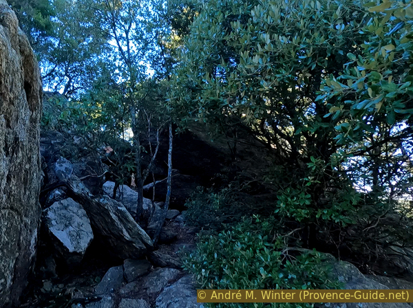
Ascent on the north of the Pierre d'Avenon rock
The Pierre d'Avenon is a chaos of crystalline rocks formed by erosion. It shows the basic geological state of the base of the Massif des Maures.
A cupule at the top gives the place a mythical aspect. However, one should not look for ancestral rites here, erosion by water can create such forms.
No reproduction is permitted without the written consent of the author. (id6614)
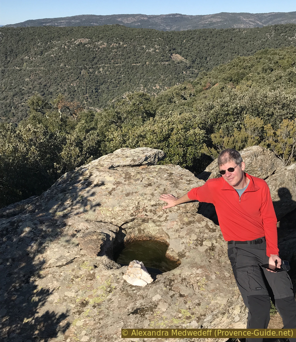
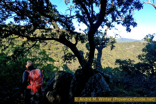
At the water hole on the Pierre d'Avenon
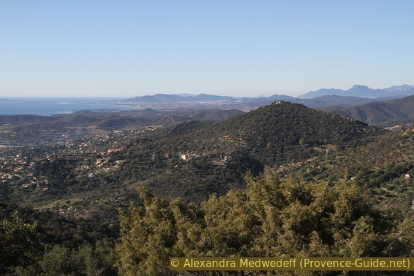
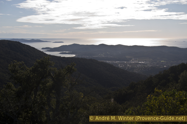
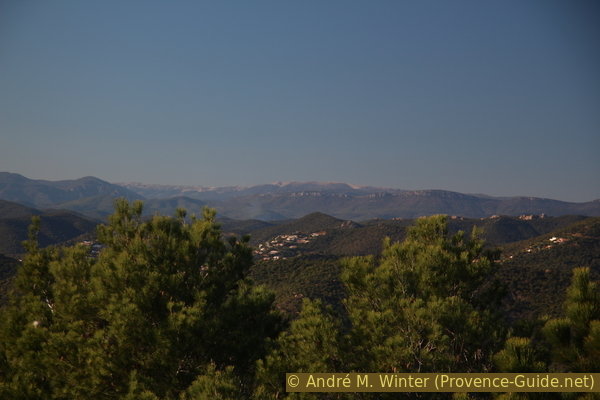
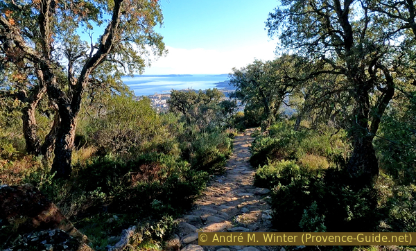
The view from here is of course grand, much of the Côte d'Azur and all the islands of Hyères are below us.
The first section ends here and there is still a long way to go.
No reproduction is permitted without the written consent of the author. (id6613)
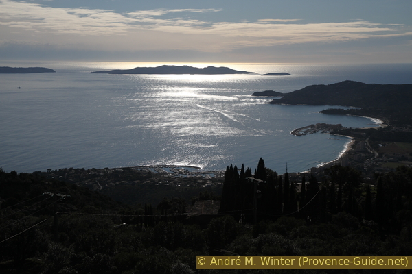
Le Lavandou, Rade de Bormes bay and Port-Cros
Section 2: Col de Landon - Col de Caguo-Ven
➙ 4,8 km ... 1 h 40 min ➚ 115 m ➘ 315 m ↝ average
25% forest roads, few marks
20% easy trails, few marks
40% forest roads, faulty marks
20% moderate trails, faulty marks
The clues
- Rock Pierre d'Avenon, 435 m
- Pré de Roustan, 455 m
- Col de Landon saddle
- Under the hill Mistral, 450 m
- Roussel, 420 m
- Col de Caguo-Ven saddle, 230 m
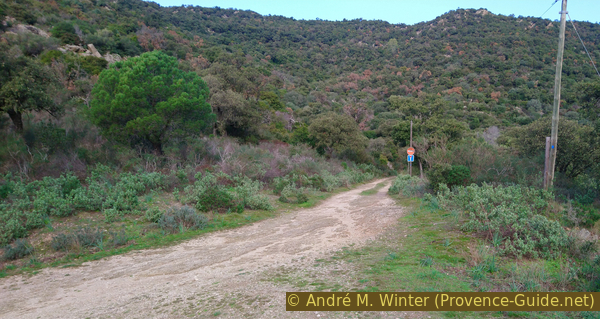
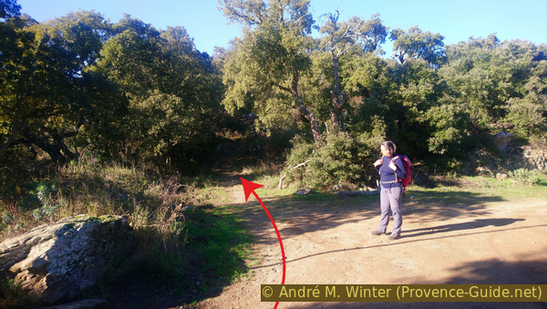
We now walk along the ridge on the north side. It is of course longer, but the view is also better.
We descend from the rock by the same path and continue along the forest road northwards.
No reproduction is permitted without the written consent of the author. (id6615)
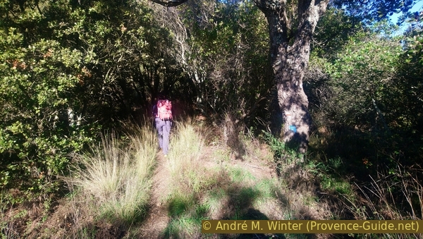
Path north of the Pierre d'Avenon rock
The path is not straight and not all junctions are marked. At times we see a large electricity pylon which we have to pass later.
No reproduction is permitted without the written consent of the author. (id6616)
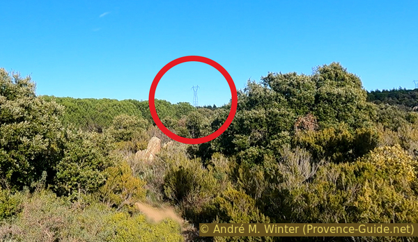
View to the power pole between Vallon and Pré de Roustan
After an initial small right-left zigzag, another left-right loop follows. You take at left at the cairn and a right at the next intersection. One then passes directly by the pylon.
The forest is then a little denser as these are actively planted trees.
We continue north on a forest road that is in principle still passable. We keep to the left at all intersections with other roads as in the photo.
No reproduction is permitted without the written consent of the author. (id6617)
Junction south of point 446
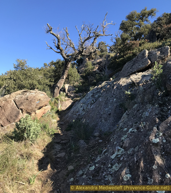
At the last fork, there is only a path on the left, we take it and soon find some blue markers and also some old markers of a long distance trail (red-white) that no longer pass here.
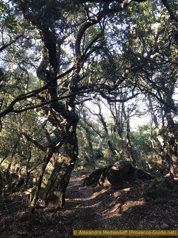
The path is fairly straight downhill between rocks of various sizes and under large twisted cork oaks. This magical place reminds us of the Forest of Carnutes as described in Asterix and Obelix. The real forest of this name, however, is located on the Beauce Plateau between Chartres and Orléans.
No reproduction is permitted without the written consent of the author. (id6618)
Forest of oaks and rocks south of the Col du Landon saddle
We see that we are descending towards a pass. The valley on the right leads to La Môle. The large rocks are still omnipresent.
No reproduction is permitted without the written consent of the author. (id6622)
Descent to the Col du Landon saddle
We continue straight on and in the logic of a pass, we have to climb upwards.
No reproduction is permitted without the written consent of the author. (id6623)
Continuation of the path north of Col du Landon saddle
We go up on other rocks. This is a change from the long forest tracks. There are two known markers and a large white one with a green vertical line, this is a forest boundary.
No reproduction is permitted without the written consent of the author. (id6624)
Climb on the north of Col du Landon saddle
We are here on a section of the GR90 long distance trail which links Le Lavandou to Notre Dame des Anges, a large chapel set further north in the Massif des Maures.
In the middle of the forest, a marker tells us to turn left, but this is the indication to keep to the left on the forest road that emerges further on.
No reproduction is permitted without the written consent of the author. (id6625)
Crossing and markers north of Col du Landon saddle
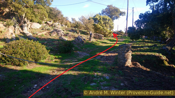
A few metres further on, we turn left again to leave the forest road following the blue marker. Beware the GR90 remains on the forest road although we will find it later again.
No reproduction is permitted without the written consent of the author. (id6626)
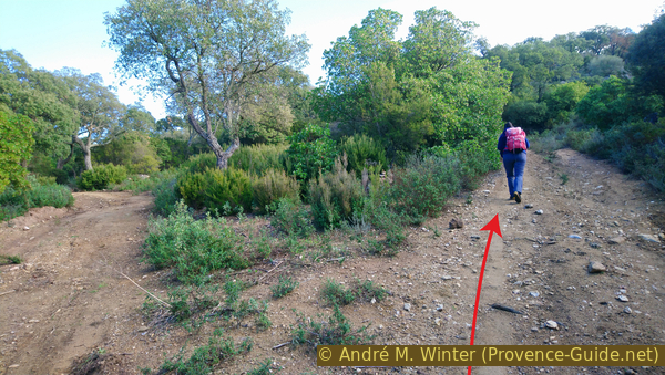
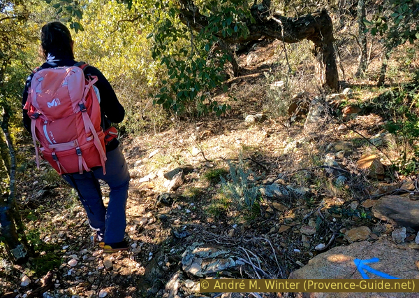
Shortcut under the Col de Labade saddle
All the off-road sections are steep on this tour. Alex is happy that these climbs give us some exercise.
No reproduction is permitted without the written consent of the author. (id6627)
Ascent towards Mistral hill, 458 metres
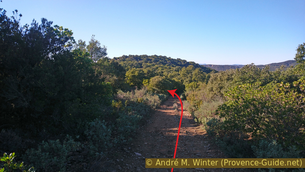
Our uphill path leads unsurprisingly to another forest road. We turn left for over 800 metres and about 25 minutes of walking.
No reproduction is permitted without the written consent of the author. (id6628)
Forest track west of Mistral hill, 458 metres
The forest road is more or less flat and runs under the ridge. The view is clear at times and there are unusual views of the coast.
No reproduction is permitted without the written consent of the author. (id6629)
View on Cap Bénat
Continuing along the forest road, we see at times towards the hill with the Notre-Dame de Constance Chapel. This is a good time to look for the view in this photo. The track goes slightly downhill for a few minutes and there is a hill in front of us. In the middle of a straight line, you should spot a cairn on a wooden pallet. This marks our descent. If you miss this junction, there is another one 50 metres further on marked by a dead-end road on the left. These two paths join a little further down.
Neither path is marked along the forest road.
No reproduction is permitted without the written consent of the author. (id6630)
The forest track at Roussel
There is, however, an unofficial marker where the above mentioned paths meet.
No reproduction is permitted without the written consent of the author. (id6631)
Fork in the ridge between Roussel and Col de Caguo-Ven pass
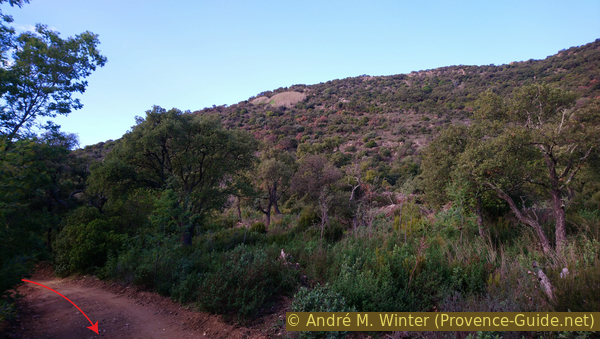
The descent is along a ridge on the north side of the Vallon de Baguier. The path is clear and uncluttered, sometimes passing on one side, then on the other. Here we come across many large cork oaks. Here nobody cuts them, they don't even harvest their cork any more.
No reproduction is permitted without the written consent of the author. (id6619)
Descent to the Caguo-Ven pass and the hill of ND de Constance chapel
The path takes us to a road. This is the start of the Route des Crêtes which continues eastwards to the Col du Canadel and then passes over Cavalaire and down towards Cogolin.
We take the bottom right and in a few metres we find ourselves on the D41 road that we know from Bormes.
We are now on road pass Col de Caguo-Ven. This Provençal name may lead to a smile, but it means Bad Air, in the sense of the air exhaled by a sick person.
No reproduction is permitted without the written consent of the author. (id6620)
Descent to Route des Crêtes near Col de Caguo-Ven pass
Section 3: Chapelle ND de Constance
➙ 2,3 km ... 1 h 10 min ➚ 85 m ➘ 165 m ↝ easy
5% hard-surfaced country road, faulty marks
25% forest roads, with marks
5% easy trails, with marks
5% forest roads, faulty marks
<5% stairs, without marks
30% moderate trails, with marks
5% hard-surfaced city alleys, faulty marks
5% stairs, without marks
5% hard-surfaced city alleys, without marks
10% hard-surfaced country road, without marks
The clues
- Col de Caguo-Ven saddle, 230 m
- Chapel Notre-Dame de Constance, 315 m
- Terrasse du château, 175 m
- Bormes St. François, 150 m
A final climb to a beautiful chapel and another viewpoint.
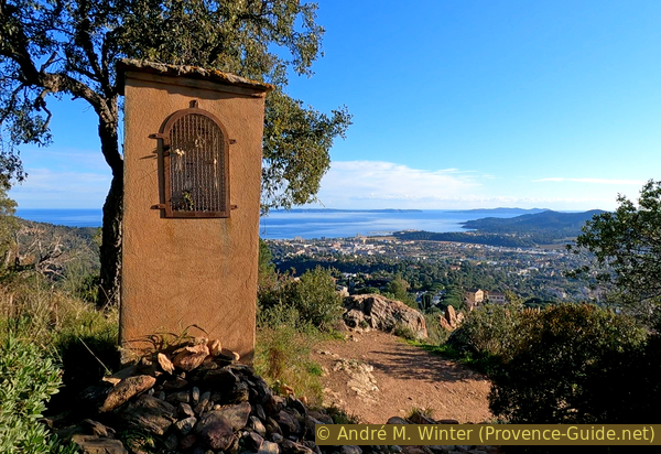
Turn right here and turn left at the first opportunity. You will recognise the first oratory which marks the access to the Notre-Dame de Constance Chapel.
Beware on this road, some nouveau riche and other fools take it for a Formula 1 track.
No reproduction is permitted without the written consent of the author. (id6621)
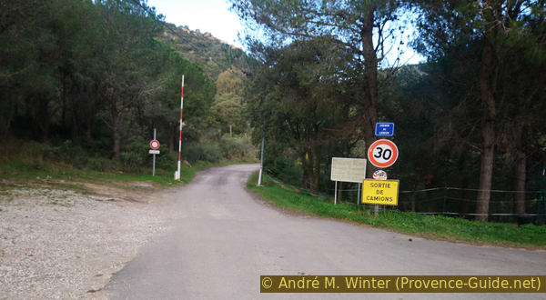
Cross the D41 road
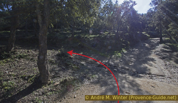
After the road, we find ourselves again on a forest road. At the next junction we turn left to pass by a water tank. We ignore the junction under the high voltage line and continue to climb into a fairly dense forest.
Not even ten minutes after leaving the tarmac road, you take the road to the left and then an even rougher path to the left again. The long distance marker (red-white) also indicates to pass here.
No reproduction is permitted without the written consent of the author. (id6632)
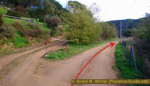
Crossing between the track and the old path to ND de Constance chapel
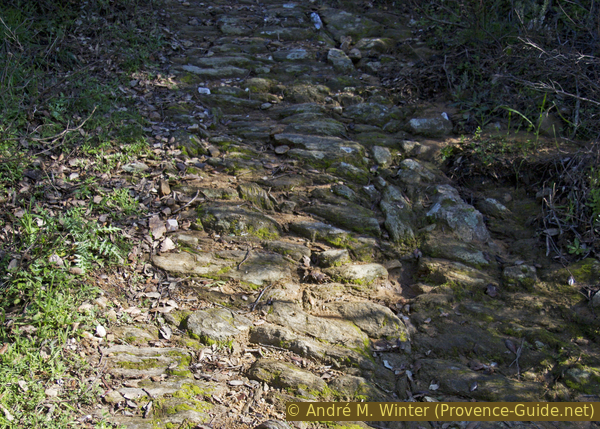
We go up on an old calade path. These are cobblestones laid vertically to better fix the stones and solidify the surface. It also allowed the animals to have a better support. The term calade is Provençal and is normally limited to the predominantly limestone Provence. The Massif des Maures is a crystalline inclusion composed essentially of very friable schists and more robust gneiss. It is the latter that we are dealing with here. The local schist would not have lasted so long.
After about twenty metres of climbing, we turn right onto another section of calade.
No reproduction is permitted without the written consent of the author. (id6633)
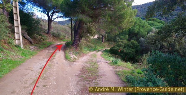
Old calade path to the chapel ND de Constance from the north
The calade takes us back to the forest track we left below. At the next bend in the road, we continue straight on for a few metres.
We see on the left some buildings with steps without recognising what they might have been used for. We climb up these steps and then onto the rocks.
No reproduction is permitted without the written consent of the author. (id6640)
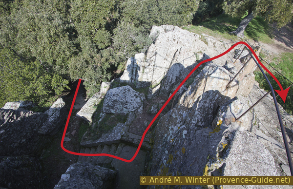
Steps under the viewpoint
We arrive at the viewpoint with an orientation table.
No reproduction is permitted without the written consent of the author. (id6637)
View point near Our Lady of Constance chapel
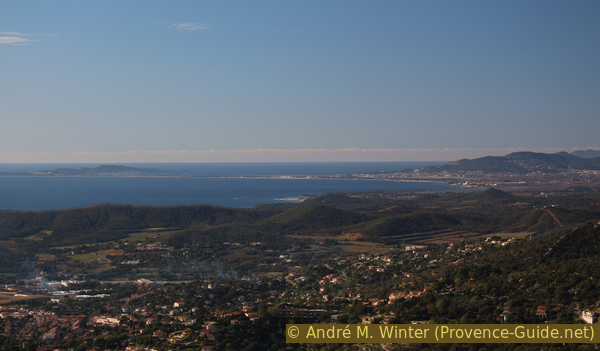
We can see here of course over Bormes and the east coast of Cap Bénat. The winter backlight is unfortunately very strong with the low winter sun.
No reproduction is permitted without the written consent of the author. (id6638)
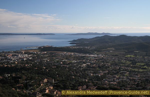
La Favière, Le Levant and Port-Cros islands
You can also see very well to the south-west, west and even north-west. Here are some other interesting mountain ridges, these ones are of limestone.
The view is, however, is a little hidden to the east.
No reproduction is permitted without the written consent of the author. (id6639)
Les Hauts de Valcros, Barre de Cuers and Sainte-Baume ridges
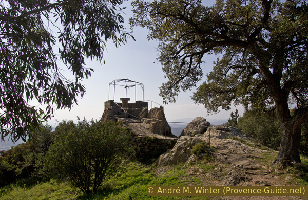
Descending from the viewpoint you can see the chapel that covers the top of the hill and gives it its name.
No reproduction is permitted without the written consent of the author. (id6634)
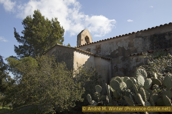
North side of Our Lady of Constance chapel
As is often the case in Provence, it has an open porch with benches, this can serve as a shelter.
The chapel was built in the 12th century on the remains of a temple to Diana.
It is only open when it is manned by a volunteer, which is usually on public holidays and on particularly fine days in winter. The tourist office down in Bormes will provide information.
No reproduction is permitted without the written consent of the author. (id6635)
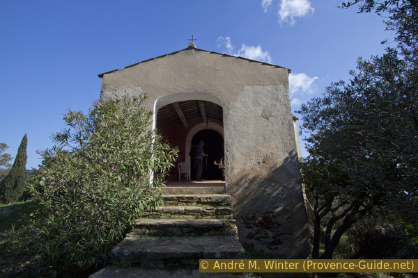
Steps and porch of Our Lady of Constance chapel
The base of the chapel is very irregular, so the nave is offset from the entrance.
The small windows had been walled up and were reopened during the renovation in 1987.
No reproduction is permitted without the written consent of the author. (id6636)
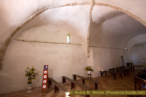
Offset nave of the Our Lady of Constance chapel
You can't stay forever on this peaceful place, you still have to mobilize some energy for the descent because it happens again on a calade. It's much more tiring and nerve-wracking on the way down!
No reproduction is permitted without the written consent of the author. (id6645)
The calade path from Notre-Dame de Constance chapel towards Bormes
Oratories punctuate the descent. They are all of slightly different construction and some are missing.
No reproduction is permitted without the written consent of the author. (id6646)
Station of the Cross of Our Lady of Constance chapel
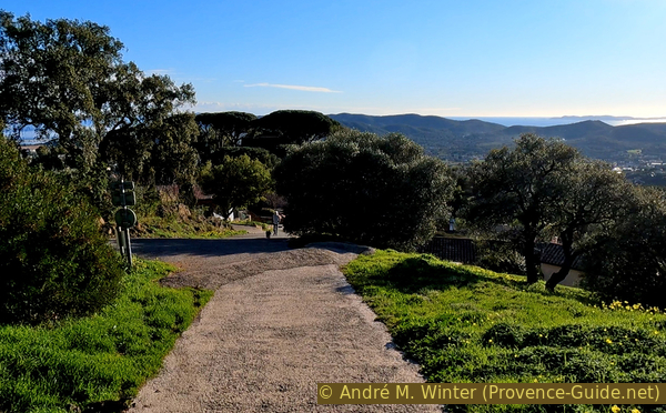
At the end, this winding path of the cross takes us back to a concrete road where we descend to the left.
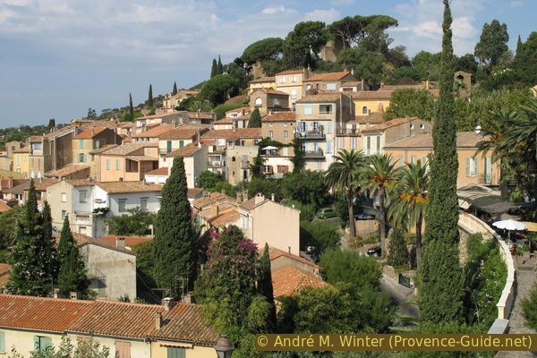
Below, under the tall pines, is the castle of the Lords of Fos which cannot be visited, but a panoramic terrace is accessible to the left of the old building.
No reproduction is permitted without the written consent of the author. (id6647)
Concrete ramp down to Bormes
We can see exotic plants at the bottom, a staircase allows us to pass down there afterwards.
No reproduction is permitted without the written consent of the author. (id6648)
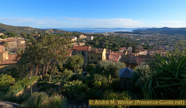
View from the castle terrace
Looking a little to the left, we see the church tower still ahead on our path.
No reproduction is permitted without the written consent of the author. (id6642)
Église Sainte Trophyme church and Chapelle Saint François de Paule
We walk back down from the terrace keeping to the left, we come to a staircase which serves as a shortcut. In the south-facing part, there is a small park on the right, it is planted with succulents and other heat-loving plants.
Under the park, we take a left to go down and then the first possibility to the right.
No reproduction is permitted without the written consent of the author. (id6643)
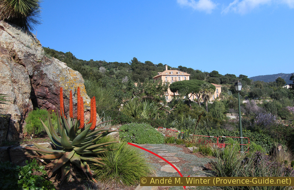
Aloe vera flower
This leads along the nave of the church built into the hillside. At the end, turn left to arrive in front of the entrance to the central religious building of the village.
The church of Saint Trophyme dates from the late 18th century, although it is Romanesque in inspiration.
No reproduction is permitted without the written consent of the author. (id6644)
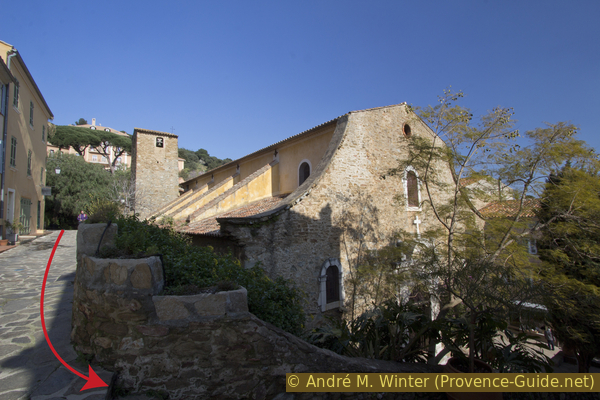
Église Sainte-Trophyme church
We leave the church and go left, still downhill. This takes us along the tourist office on Place Gambetta. Ahead is a hairpin bend of the D41 road along which we keep left an in a few minutes we come to the Chapel of St. Francis of Paola and the starting point.
St. Francis of Paola, born Calabria, was a pilgrim, hermit and founder of the Minims order in the 15th century. He is venerated here because he is believed to have delivered the village of Bormes from the plague in 1481.
The park around the chapel can be used as a rest area after the tour.
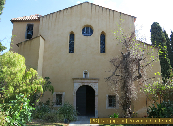
St. François de Paule chapel in Bormes
Sources and additional information
It is better to have a good topographic hiking map: this tour is on the IGN map "Le Lavandou, Corniche des Maures, Parc National de Port-Cros", scale 1:25000, 3446ET.
If you don't want to bother with a paper map, you can also use mapping apps on your cell phone. On the one hand, it is the Cartes IGN app from the official map service. However, it requires access to the data network and this is sometimes difficult in canyons or remote locations.
Alternatively, you can use apps that store data directly on the device. They're generally not free, but they don't cost much. We mainly use OSMAnd, here it is possible to add contour lines, relief shading, markings and others. To store this data on your phone you need a lot of space.
Of course, one needs access to satellites for the GPS signal with any app. In some canyons this is not the case. Therefore, do not rely on the position shown, but read the map on your phone as you would read it on paper. Most apps are available for Android and iPhone. The applications usually allow us to record the route travelled and also view the GPS files offered for each of our hikes.
This page has been seen 2127 times since 20 March 2024.