La Quilho above Le Puy-Sainte-Réparade
A small mountain with a chapel, a ruin and a good view
hike
average
2 h 15 min
yes
yes
no
mountain
Introduction
Between the Luberon to the north and the Montagne Sainte-Victoire to the south, flows the Durance. Little known villages are lined up along this river, but some places had a strategic position such Puy Sainte-Réparade and its hill La Quiho. This elevation sheltered the village itself, protected by a large 10th century castle which commanded a passage on the Durance by ferry. The castle was destroyed in 1612. The upper village then descended gradually over 200 years to its actual position.
Quilho means keel in Provençal, this name perhaps refers to the remaining wall of the castle on the summit plateau.
Today remain a lot of ruins, the source of the old village, a beautiful chapel and a 360 degree view. We leave directly from the village.
The facts
7,4 km total distance
2 h 15 min walk time
290 m total elevation
orientation average
mark 40% of the total distance
25% easy trails
20% hard-surfaced quiet side streets
20% hard-surfaced city alleys
15% forest roads
15% moderate trails
5% hard-surfaced paths
dangers slippery gravel sections
children yes
useful picnic stuff
required trekking boots, hiking equipment and water
GPS coordinates (WGS84) of start and end point 43.663343157522995,5.43612675441436
downloads ![]()
![]()
Public transport
Fairly regular bus lines connect the village of Puy-Sainte-Réparade from Aix-en-Provence, Pertuis and La Roque d'Anthéron. The stop is called Parking Cézanne. This is the start of this tour. Look for lines 252 and 260 under La Métropole Mobilité (only french).
Access by car
Le Puy-Sainte-Réparade is accessible from the south and from the north by the A51 motorway, take the Pertuis exit, then drive to Le Puy-Sainte-Réparade further to the west.
Useful parking spaces
Coming from the A51 from the east, you arrive in the center of Puy-Sainte-Réparade. Turn right at the central intersection, then at the next roundabout slightly right. The next road on the right is called Rue Cézanne and this is the dedicated car park for the tour. It is also possible to turn a few meters before the central crossing on the left, drive up the Chemin de la Taillade and cross the canal. Park on the large crossing just after the canal. We continue to climb on foot in the same direction for this tour.
No reproduction is permitted without the written consent of the author. (id6849)
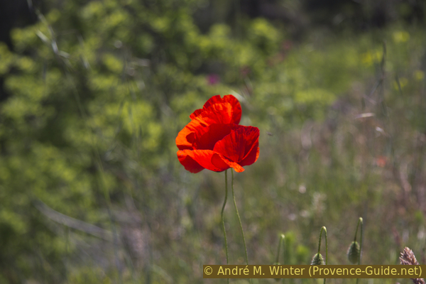
Poppy flower
No reproduction is permitted without the written consent of the author. (id6844)
East face of the Sainte-Réparade chapel
Hints
The tour presents a long ascent on a paved road and the return takes place on a path that is first very steep, then very flat along the EDF canal.
The summit plateau can be overgrown in spring.
The orientation is a little demanding because the existing marks describe a round tour of the hill, but not its ascent and not the descent chosen here.
The whole region is a zone with a high risk of forest fires. In summer, but also in other seasons when it is very dry or by strong winds, access to the forest areas can be regulated. As a result, the roads may be closed to traffic and/or the trails prohibited to hikers. Current information: Map of access to forests and exposed areas in Bouches-du-Rhône (also english). The map shows the colours green, yellow, orange and red which correspond to levels of danger. The affected area is: Trevaresse.
The sections
- Le Puy-Sainte-Réparade, the chapel and the summit with La Quilho.
- La Quilho, descent in direction north-west and back along the channel.
Section 1: Le Puy-Sainte-Réparade - La Quilho
➙ 3,2 km ... 45 min ➚ 255 m ➘ 0 m ↝ easy
25% hard-surfaced city alleys, without marks
45% hard-surfaced quiet side streets, few marks
20% easy trails, faulty marks
10% hard-surfaced paths, faulty marks
<5% easy trails, without marks
The clues
- Cézanne car park, 200 m
- Place Louis Philibert
- Rue du Canal
- Chemin de la Taillade
- Bridge over the channel, 230 m
- Chemin de la Chapelle
- Sainte-Réparade chapel, 365 m
- Château de la Quilho ruin, 455 m
A quick climb with a beautiful chapel on the way.
We come out of Parking Cézanne on the west side to turn left. We arrive at a roundabout to arrive on Place Louis Philibert where takes place the sunday market.
No reproduction is permitted without the written consent of the author. (id6836)
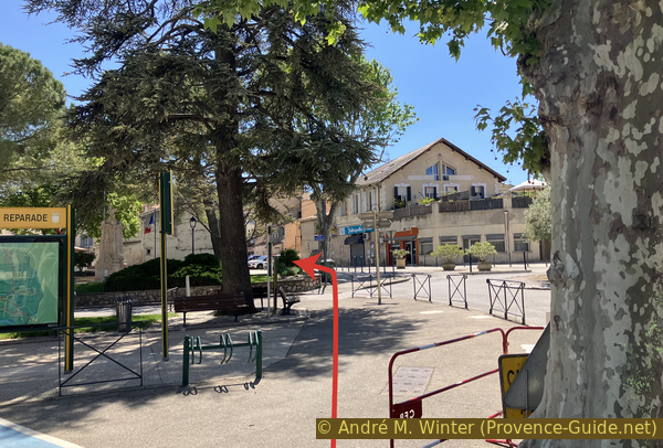
The park near the town hall of Puy-Sainte-Réparade
Our route, however, continues straight to the south and the central crossing of the village. On the left is an artisan baker renowned for his sourdough bread.
No reproduction is permitted without the written consent of the author. (id6837)
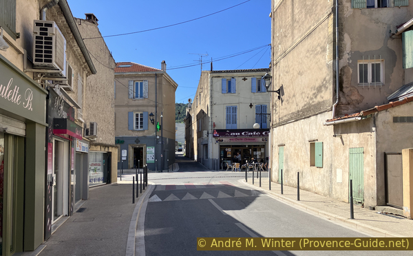
Avenue de la République in Puy-Sainte-Réparade
We cross the intersection in a straight line to go up Rue du Canal. Turn left at the first opportunity.
No reproduction is permitted without the written consent of the author. (id6838)
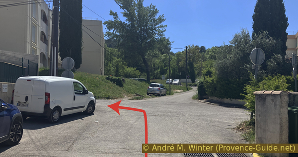
Ascent on Rue du Canal
Then right onto Chemin de la Taillade where we continue to ascent.
No reproduction is permitted without the written consent of the author. (id6839)
Ascent on Chemin de la Taillade
This leads us straight to the bridge over the Canal EDF de la Durance. It is a set of canals, dams and hydraulic power stations fed by water from the Durance from Serre-Ponçon to the Étang de Berre.
No reproduction is permitted without the written consent of the author. (id6840)
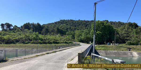
Pont des Pontiers bridge
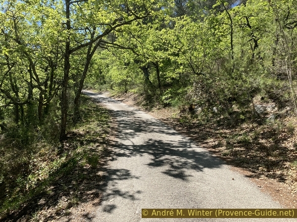
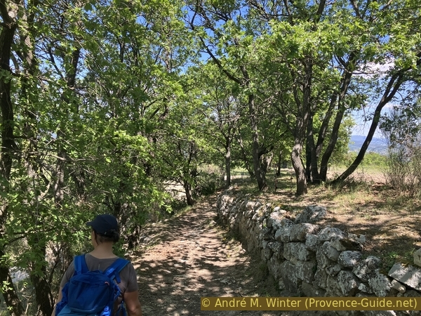
We continue in a straight line on Chemin de la Chapelle. The ascent begins immediately and we keep this direction as difficult as it is. You can get some shade here if you leave early in the morning. Stay on this road uphill without deviating from it.
We pass newly built villas, one of which has several chapels and portals of various styles.
No reproduction is permitted without the written consent of the author. (id6841)
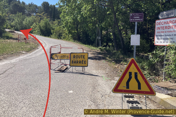
Ascent on Chemin de la Chapelle
Higher up, this road passes through a more virgin Mediterranean forest. It remains paved until the car park of the chapel.
No reproduction is permitted without the written consent of the author. (id6842)
Ascent on Chemin de la Chapelle
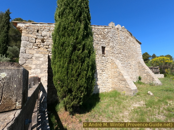
The chapel is built on a cliff and you can't see much of the panorama from the side you come to.
No reproduction is permitted without the written consent of the author. (id6843)
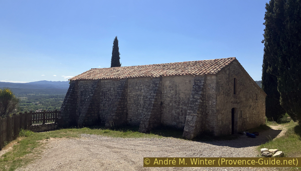
North face of the Sainte-Réparade chapel
The small chapel is closed. On the lintel above the door is engraved the date 20 June 1577. It is that of a restoration because the primitive chapel dates from the 10th century like the castle above.
No reproduction is permitted without the written consent of the author. (id6845)
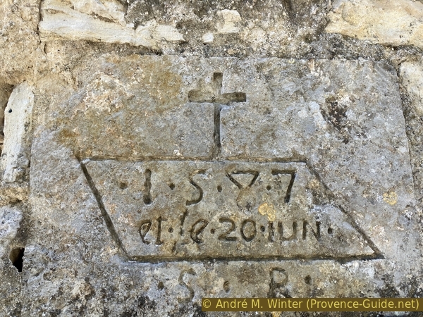
Date 20 June 1587 on a stone of the Sainte-Réparade chapel
It is better to pass to the right, arrive in a pretty olive grove and advance here along the church for a view of the eastern part of the Luberon and the Durance valley and its crops.
No reproduction is permitted without the written consent of the author. (id6846)
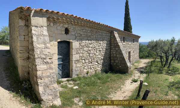
South face of the Sainte-Réparade chapel
The Sainte-Victoire is the large dark mass on the right. We see here its northern slope.
No reproduction is permitted without the written consent of the author. (id6847)
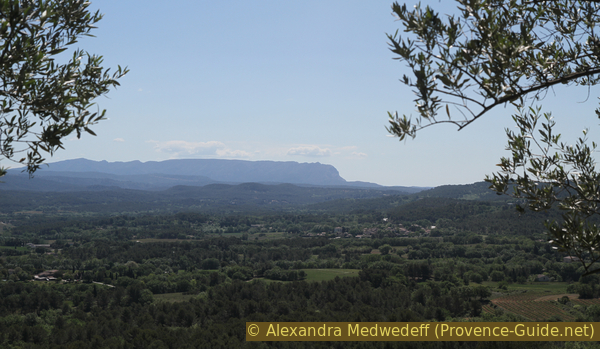
Sainte Victoire mountain seen from the Sainte-Réparade chapel
The chapel invites you to take a break, however you should know that picnic benches are located a little higher. We return to the square north of the chapel to find a junction ignored earlier. We take the road that continues above the chapel to pass this first picnic area. There is a second one along the descent from the summit.
On this path, you can also see over the roof of the chapel.
No reproduction is permitted without the written consent of the author. (id6848)
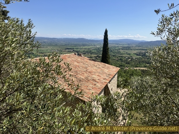
View over the roof of the Sainte-Réparade chapel
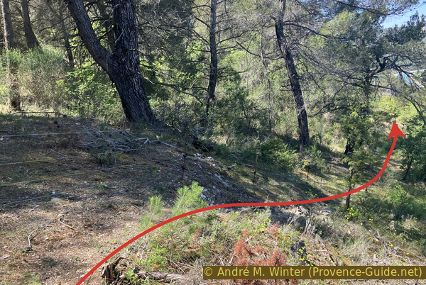
The road turns into a path, however we remain more or less at the same height. You arrive after a few minutes on a crossing with a outwashed and vertical path upwards that we ignore.
No reproduction is permitted without the written consent of the author. (id6887)
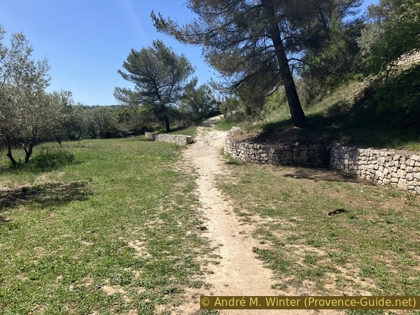
Meadow and path above the chapel
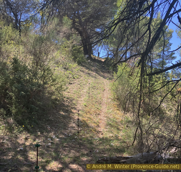
A hundred meters further, we come across a rather wildly shoveled track on the slope. We follow the switchbacks uphill to the right.
No reproduction is permitted without the written consent of the author. (id6888)
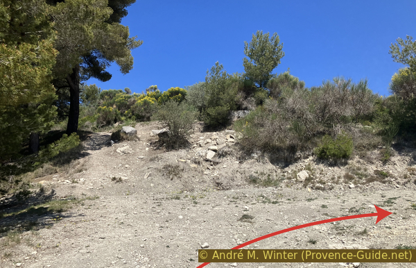
Switchback climb
You thus arrive on a meadow with an inconspicuous path which always remains uphill. We see here the first time towards the goal of the day.
No reproduction is permitted without the written consent of the author. (id6851)
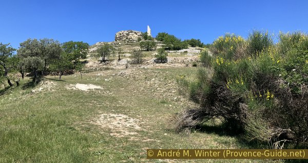
View upwards to La Quilho
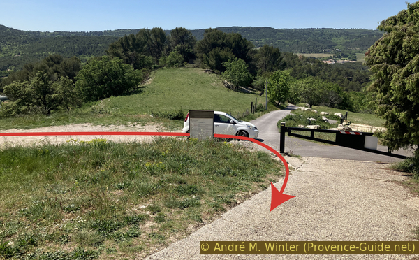
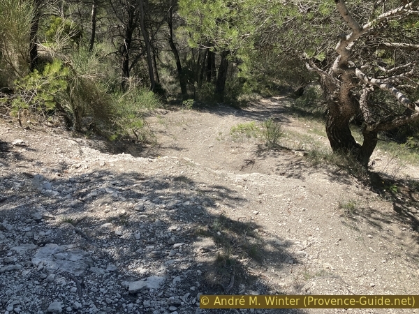
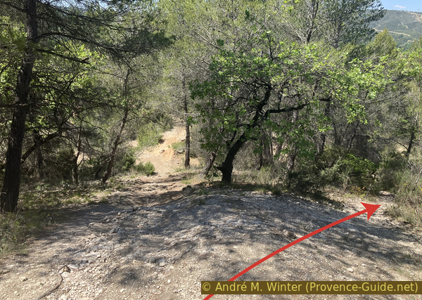
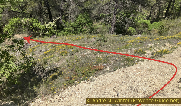
The next landmark is a parking lot from which three tracks start. We do not take the marked one that turns around the hill to the right, nor the one to the left that leads to houses. We walk up the concrete one in the center.
No reproduction is permitted without the written consent of the author. (id6852)
Back view on the car park south of La Quiho
The climb is steep. It leads us through other switchbacks and bends on the flat top of La Quilho.
No reproduction is permitted without the written consent of the author. (id6853)
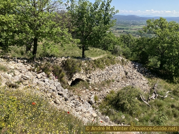
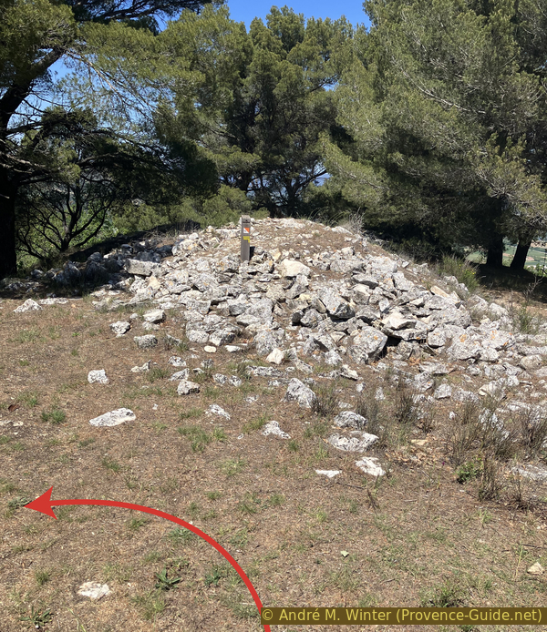
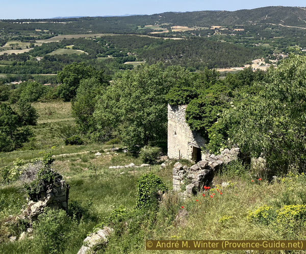
Old constructions under La Quiho
We see a watchtower and the remaining ruin of Château du Puy. The ground is strewn with stones which come from the castle. Most of it, however, was taken away to be reused for the construction of houses in the lower village. We see very clearly the voluntary dismantling of the castle in the 17th century.
In spring, these ruins are covered with the dark pink flowers of centranthus.
No reproduction is permitted without the written consent of the author. (id6854)
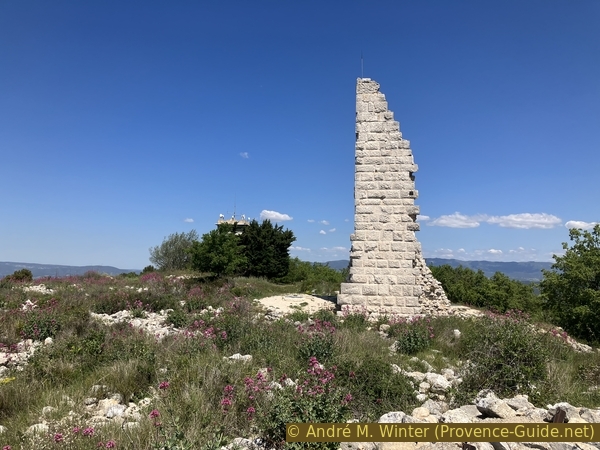
La Quiho ruin and the watchtower
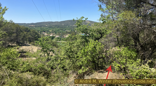
Advancing towards the south of the summit plateau, we see back on a part of the way of the climb. Further to the far right is the Villa La Coste, a modern exhibition venue.
No reproduction is permitted without the written consent of the author. (id6889)
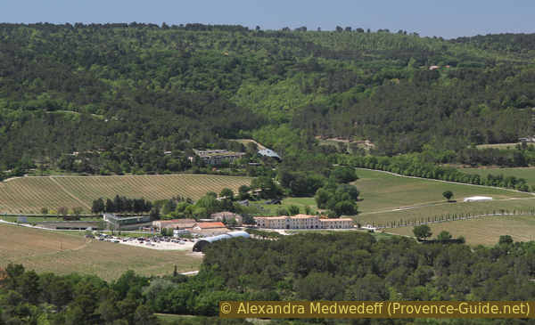
Château de la Coste
Section 2: La Quilho - Le Puy-Sainte-Réparade
➙ 4,2 km ... 1 h 25 min ➚ 35 m ➘ 290 m ↝ average
15% easy trails, faulty marks
10% easy trails, without marks
20% moderate trails, without marks
<5% forest roads, without marks
5% moderate trails, without marks
30% forest roads, without marks
15% hard-surfaced city alleys, without marks
The clues
- Château de la Quilho ruin, 455 m
- La Quilho view point
- Gacharelle source, 430 m
- Le Puy former village ruins
- Descent towards Les Viaux and Église Vieille, 395 m
- Follow the channel, 225 m
- Back to Le Puy-Sainte-Réparade, 200 m
An unusual descent on little-known paths.
We return to the north and the lookout tower, largely hidden by tall cypress trees.
Just after, turn right and continue slightly downhill towards a viewpoint with an orientation table explaining a panorama similar to that of the chapel. Under the table is an orienteering checkpoint. There is a small bench. It is one of the nicest places of the summit.
No reproduction is permitted without the written consent of the author. (id6856)
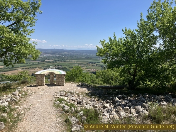
Orientation table east of La Quiho ruin
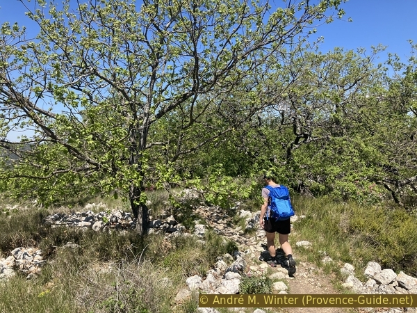
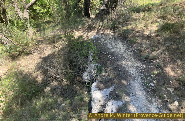
However, you have to come back to the lookout tower and take in front of the path to the right. A damaged panel indicates the Source de Gacharelle. This path leads us along the gentle ridge of this hill. We pass again through a maze of barely recognizable ruins. These were houses from the protective time of the castle.
No reproduction is permitted without the written consent of the author. (id6857)
Path on La Quiho plateau
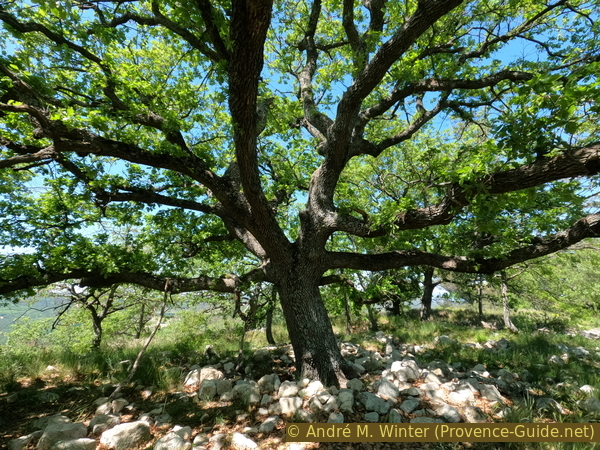
Today, huge oak trees grow in the ruins, indicating lower water veins.
No reproduction is permitted without the written consent of the author. (id6858)
Big oak tree
The path continues 300 metres to the north. It goes around various rock piles, holes and of course tall trees. We arrive in front of another large pile of stones that does not seem to be of natural origin. An orienteering post also carries a marking that tells us to turn left.
No reproduction is permitted without the written consent of the author. (id6859)
Orienteering post with marking
We then descend to another picnic area well shaded by oaks. It is arranged in terraces. Higher up is a cliff with some caves at the base. They all threaten to collapse, you must not go in there.
No reproduction is permitted without the written consent of the author. (id6860)
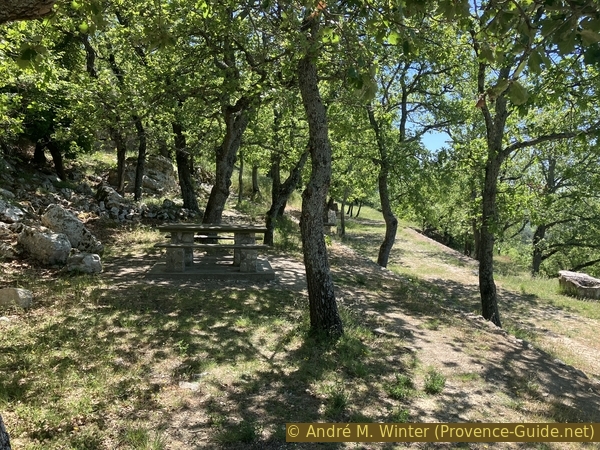
Picnic table at the Source de la Gacherelle
Continuing along the cliff, we arrive at a grated grotto which is the Source of Gacharelle which supplied the various villages and also the castle with water. We recognize chiseled basins and an enlargement of the original natural cavity. There is very little rock mass above this source, it only flows during heavy rains.
No reproduction is permitted without the written consent of the author. (id6861)
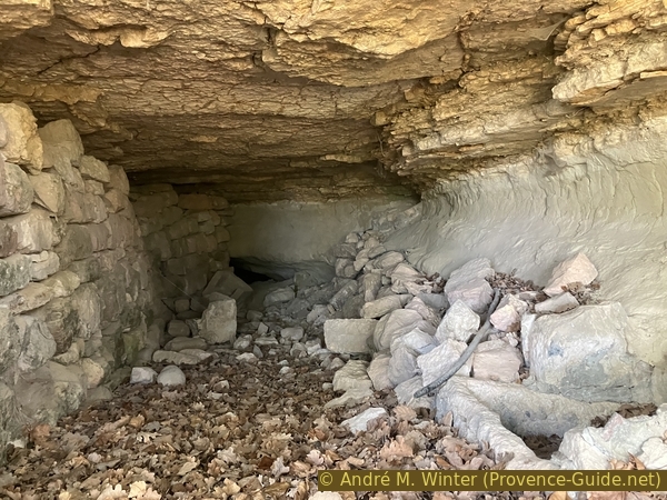
Source de la Gacherelle
After the source and the somewhat neglected picnic area, we return to the north. The path is slightly downhill and runs along a fence.
No reproduction is permitted without the written consent of the author. (id6862)
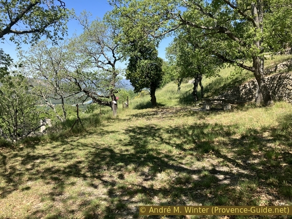
Path north beyond the source
On the lower meadows are the ruins of the last upper village of Le Puy. Access to the old houses is completely overgrown and all these buildings are in danger of collapsing at any moment. Stay on the path!
No reproduction is permitted without the written consent of the author. (id6863)
Ruins of the old village of Le Puy
We pass other terraces and we take the path on the one below, without changing direction to the north.
No reproduction is permitted without the written consent of the author. (id6864)
Descent to the north on the left
This path turns little by little to the right to find the line of the north-south ridge. Our next trail descends here to the left in short switchbacks.
No reproduction is permitted without the written consent of the author. (id6865)
Descent to the left
We then pass several sheep gates. They must be closed after each pass. They are often change in position and therefore cannot serve as landmarks.
No reproduction is permitted without the written consent of the author. (id6866)
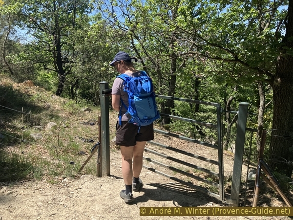
Cattle gate on the descent north of La Quiho
After the descent, the path turns again towards the north. It leads to the ring forest track that goes around La Quilho hill.
No reproduction is permitted without the written consent of the author. (id6867)
Descent to the north of the Quiho
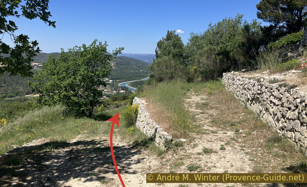
Now there are two possibilities. Either the path descending to the north-northeast in a hollow trail (red arrow). You can recognize old calades surrounded by low walls. It is obviously the old path between the upper and lower villages. We describe this route here.
The other path goes through the meadows to the left and in a northwesterly direction (yellow arrow). The path is not very visible in the spring unless the sheep have already grazed on everything. The sheep can be quite pushy here.
No reproduction is permitted without the written consent of the author. (id6868)
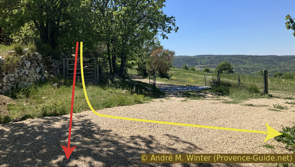
Two variants at the crossimg of the road
This well-shaded path could bring us to the starting point in the village if there weren't newly built villas and the canal.
No reproduction is permitted without the written consent of the author. (id6869)
On the beginning of the old path north of La Quiho
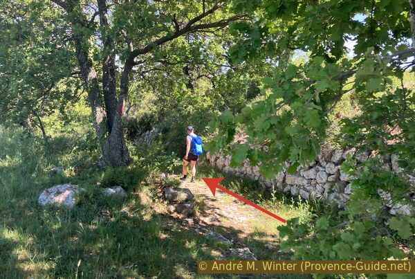
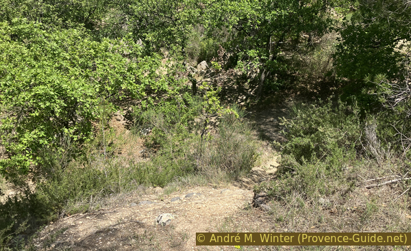
After 200 metres, this path gets lost somewhat in the pine forest. We try to keep the direction and above all not to turn too much to the right when we see the canal. On the contrary, you have to turn left on a path that is not too visible.
No reproduction is permitted without the written consent of the author. (id6870)
Bifurcation before the high voltage line
We see below a high voltage line, we follow it first in height, then closer, to the left.
No reproduction is permitted without the written consent of the author. (id6871)
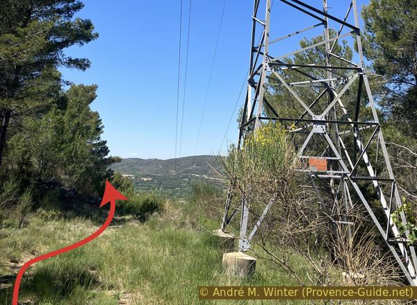
Walk along the high voltage line
Later, an electric fence on the left joins it, which we now follow.
No reproduction is permitted without the written consent of the author. (id6872)
Now along the electric fence
This path is not flat, it is marked by a few steep climbs, the last of which leads us below a gate.
Through the gate you would arrive by going straight down through the meadow.
No reproduction is permitted without the written consent of the author. (id6873)
Go up along the electric fence
The next part is a wasteland and an El Dorado for mountain bikers. Our goal is to descend towards the west. There are several variants and also several paths cross all these possible descents. It's really up to you. The steepest and slippery part is just below the gate.
No reproduction is permitted without the written consent of the author. (id6874)
Descent under the gate to the northwest of the departmental domain
The GPS track on the map shows our route, but it's not necessarily the best one. We tried to avoid mountain biking descents.
No reproduction is permitted without the written consent of the author. (id6875)
Downhill trail on the left and foot path on the right
The easiest path often takes us back to the left, but we must try to stay to the right of the mountain bike descent.
No reproduction is permitted without the written consent of the author. (id6876)
Continuation of the path in sloping wasteland
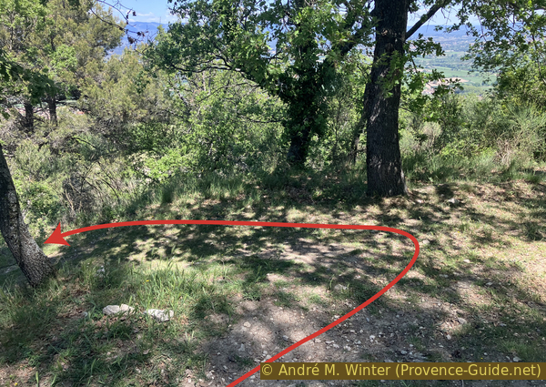
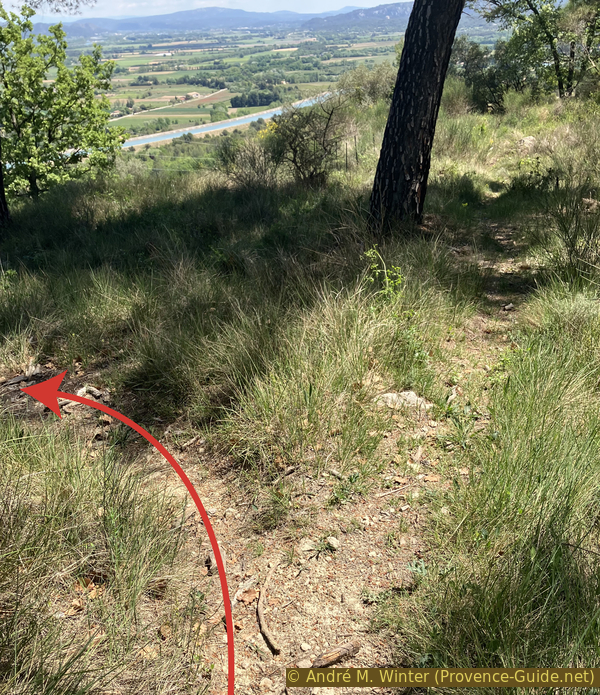
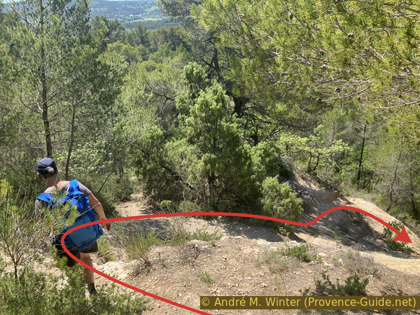
Finally, we move away radically to the right and the path then passes through a less steep forest.
No reproduction is permitted without the written consent of the author. (id6877)
Take right here to leave the downhill track
We must fall back on a forest track white of limestone after about fifteen minutes. We turn right here, but we don't go further than the high voltage line.
No reproduction is permitted without the written consent of the author. (id6878)
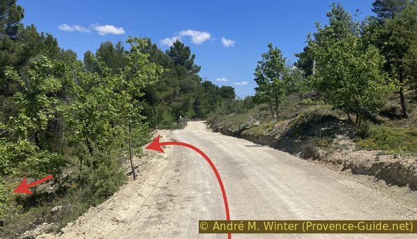
Descent from the forest road before the first houses
We turn left downhill. The path is not very used, but clearly visible.
No reproduction is permitted without the written consent of the author. (id6879)
Descent from the forest road north of Collet Blanc
We stay mainly to the right of the power line and the pylons.
No reproduction is permitted without the written consent of the author. (id6880)
Descent to the right of the high voltage line
A hook to the right allows you to pass a steep section exposed to the sun.
No reproduction is permitted without the written consent of the author. (id6881)
Crossing of rocks naturally arranged
However, we then return to the route under the electric cables. We then pass two large cairns which mark this path for those coming from below.
No reproduction is permitted without the written consent of the author. (id6882)
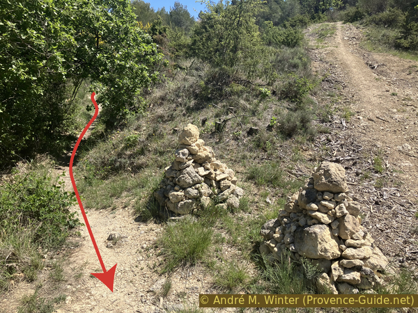
Pass two large cairns
Lower on, you come to a field to be bypassed on the right.
No reproduction is permitted without the written consent of the author. (id6883)
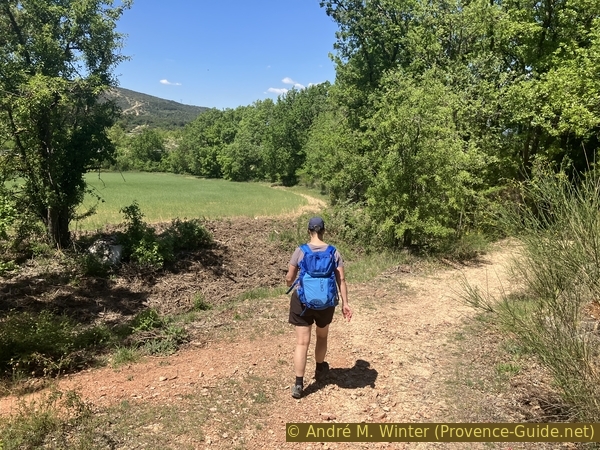
Turn right when you reach a field
The agricultural track leads us very quickly onto the D15 road towards Puy-Sainte-Réparade.
No reproduction is permitted without the written consent of the author. (id6884)
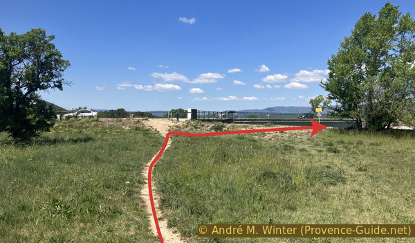
Path to the D15 road and the bridge over the Canal de l'EDF
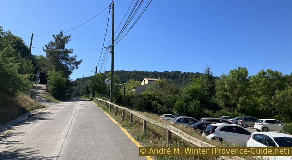
We now have to go on the right along the EDF canal, both sides have wide paths. In summer neither is really shaded.
No reproduction is permitted without the written consent of the author. (id6885)
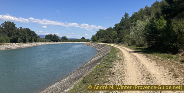
On the south bank of the EDF canal
We then return to the other bridge that we know from the outward journey.
The return to the starting point in the village takes place on the same path.
No reproduction is permitted without the written consent of the author. (id6886)
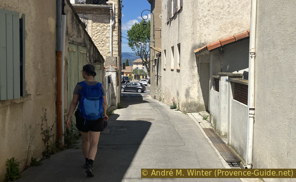
Descent on Rue du Canal
Sources and additional information
It is better to use a good topographic hiking map: this tour is on the IGN maps "Pertuis Lourmarin", scale 1:25000, 3243OT and "Aix-en-Provence", scale 1:25000, 3143ET.
If you don't want to bother with a paper map, you can also use mapping apps on your cell phone. On the one hand, it is the Cartes IGN app from the official map service. However, it requires access to the data network and this is sometimes difficult in canyons or remote locations.
Alternatively, you can use apps that store data directly on the device. They're generally not free, but they don't cost much. We mainly use OSMAnd, here it is possible to add contour lines, relief shading, markings and others. To store this data on your phone you need a lot of space.
Of course, one needs access to satellites for the GPS signal with any app. In some canyons this is not the case. Therefore, do not rely on the position shown, but read the map on your phone as you would read it on paper. Most apps are available for Android and iPhone. The applications usually allow us to record the route travelled and also view the GPS files offered for each of our hikes.
This page has been seen 2348 times since 20 March 2024.
No reproduction is permitted without the written consent of the author. (id6850)
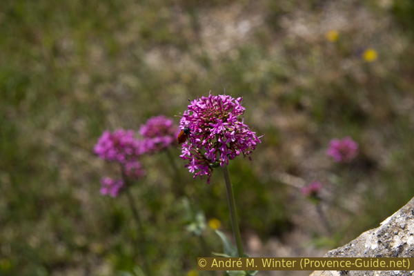
Red valerian