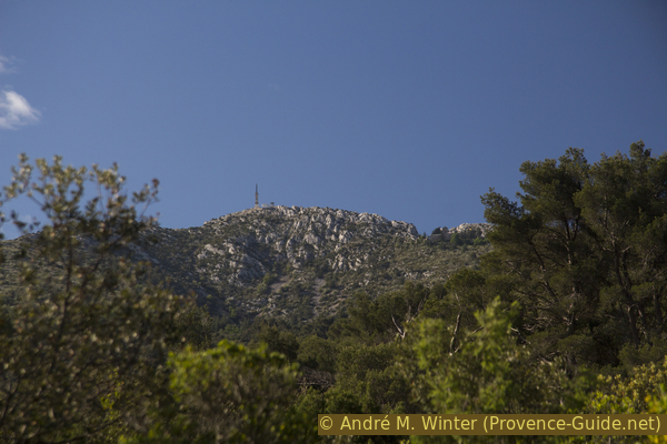
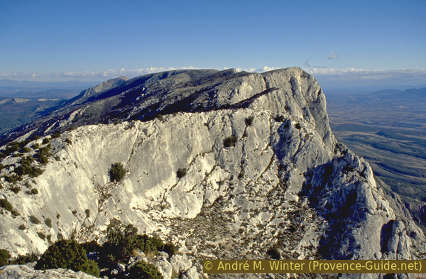
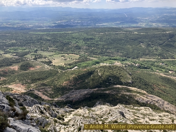
Montagne Sainte Victoire from the north
Up the Chemin des Venturiers and back over the ridge between Delubre and Vallon des Gendres
hike
average
5 h
yes
yes
shelter
mountain
Introduction
This mountain is the very emblem of Provence. His priory is a reference. There are always people, Provençal locals and tourists going up the various paths, which all present some difficulties. We have already presented the most direct access but still feasible by everyone under Sainte Victoire from the south. Here is described a similar access from the north starting from Vauvenargues. The Chemin des Venturiers is not very charming, but it allows a quick climb in any season. We then follow part of the ridge towards the east and we descend by a less known path which crosses the Vallon des Gendres.
The facts
11 km total distance
5 h walk time
680 m total elevation
orientation average
mark 70% of the total distance
55% forest roads
30% easy trails
10% moderate trails
5% Trails with scramble passages
dangers exposed sections
children yes, but it's long
useful picnic stuff
required hiking boots, hiking equipment and water
GPS coordinates (WGS84) of start and end point 43.55371156197697,5.579018409283446
downloads ![]()
![]()
Public transport
There are regular bus connections between Aix-en-Provence and Vauvenargues on line 140 once an hour on weekdays and six times a day on Sundays and public holidays. The stop to get off is called Vauvenargues Chemin St. François. Go a little further east to descend towards the Venturiers car park where the hike begins. The stop for the return to Aix is a little further to the west. Information under La Métropole Mobilité (only french).
Access by car
Vauvenargues is the only notable village north of the Montagne Sainte-Victoire. It is reached by the D10 road from Aix-en-Provence or by Pourrières or Rians coming from the east and the Var departement.
Useful parking spaces
The Venturiers car park is dedicated to the Chemin des Venturiers. It is not particularly large and quickly full on weekends in good weather. Other car parks can be found in the village more eastwards.
You find car parks on Boulevard du Moraliste at the entrance to the village of Vauvenargues and behind the castle. In these cases, the start of the hike is different: leave the car and walk down to the stadium (stade). Continue to descend beyond the stadium and follow the path that turns west following the often dry bed of La Cause stream. After a little over a kilometre, we arrive at a crossroads where we turn left to find ourselves on the lower part of the Chemin des Venturiers. Follow the signs to the priory (prieuré). This approach is indicated with a red line on the map.
No reproduction is permitted without the written consent of the author. (id6810)
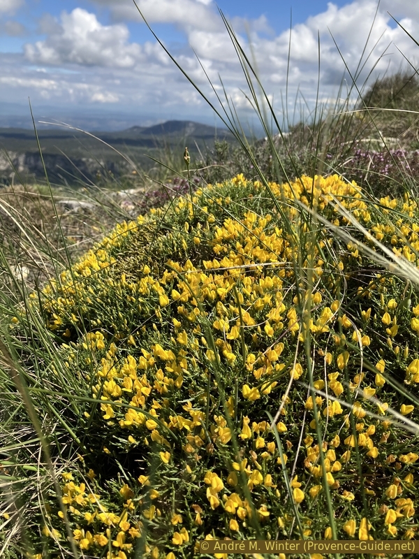
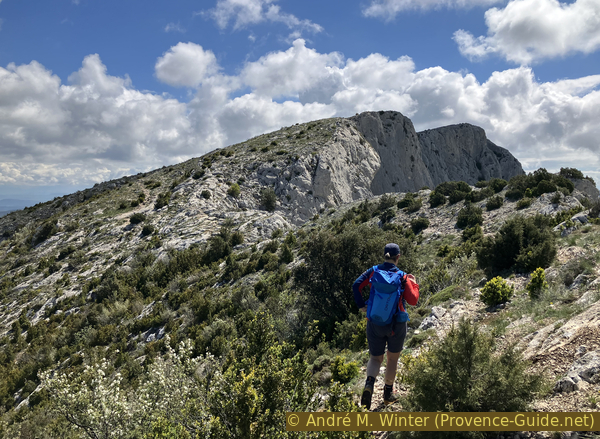
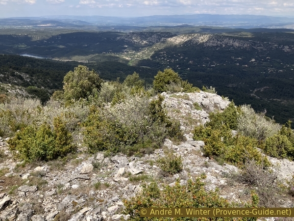
Flowering chunky broom on the ridge near Le Signal
No reproduction is permitted without the written consent of the author. (id6779)
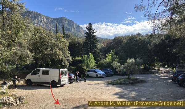
Les Venturiers car park
The rocky ridge in the backgrund is La Barre with Tête du Marquis mountain north of Vauvenargues.
Hints
The ascent to the former monastery and to the cross is easy, but on the edge definitely problematic for people who are not free from giddiness. These points are particularly important with children. Some passages have smooth limestone. Be sure to bring warm clothing, even if it is pleasantly warm down below, we are climbing just under 1000 m above sea level. Climate and path conditions correspond to those of the high mountains! In winter the temperatures are negative very quickly, parts of the path are also on the shady side behind the ridge and therefore possibly icy.
At the top of the former monastery, there is a shelter that has recently been renovated. You can make a fire here, but you would have to carry wood upstairs.
The descent requires a good sense of direction as it is marked only by a few cairns not necessarily placed in a useful way.
No source of drinking water on the way
The whole region is a zone with a high risk of forest fires. In summer, but also in other seasons when it is very dry or by strong winds, access to the forest areas can be regulated. As a result, the roads may be closed to traffic and/or the trails prohibited to hikers. Current information: Map of access to forests and exposed areas in Bouches-du-Rhône (only french). The map shows the colours green, yellow, orange and red which correspond to levels of danger.
The sections
- Chemin des Venturiers and Prieuré Sainte-Victoire
- Croix de Provence and Le Signal
- Ridge between Le Delubre and Vallon des Gendres
Section 1: Chemin des Venturiers
➙ 4,9 km ... 2 h ➚ 540 m ➘ 15 m ↝ easy
10% forest roads, with marks
5% easy trails, with marks
60% forest roads, with marks
25% easy trails, with marks
The clues
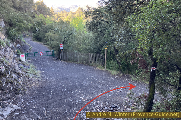
- Les Venturiers car park in Vauvenargues, 365 m
- Cabassols fields, 350 m
- Bridge over La Cause creek, 355 m
- Forest road Les Venturiers, 370 m
- Path Chemin des Venturiers, 725 m
- Prieuré Sainte-Victoire, 890 m
A quick ascent.
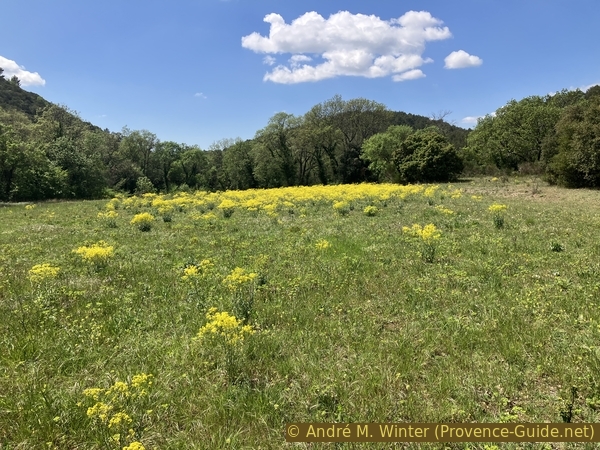
From the Venturiers car park, you must first descend towards the wide valley north of the Montagne Sainte-Victoire. We arrive near market garden fields where we turn left.
The signs to follow are those of the long distance trail GR9 towards the priory (prieuré).
No reproduction is permitted without the written consent of the author. (id6780)
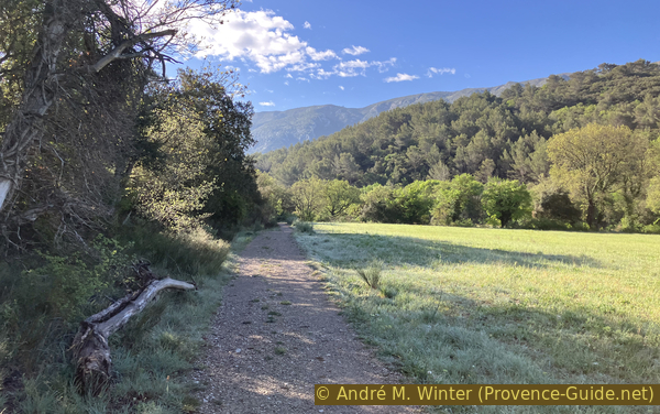
Les Cabassols fields
This path takes us back into the forest where it goes up a little before descending in the form of a forest road towards the bridge over La Cause creek.
No reproduction is permitted without the written consent of the author. (id6781)
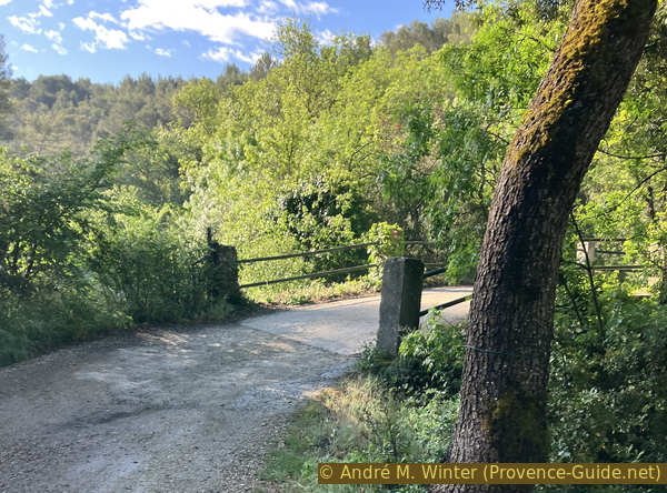
Bridge over La Cause river
We stay on the main trail after the bridge.
No reproduction is permitted without the written consent of the author. (id6782)
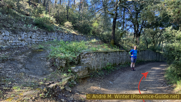
Forest road under dry stone walls
300 meters after the bridge, turn right.
No reproduction is permitted without the written consent of the author. (id6783)
Junction of the GR9 long-distance hike and the Vallon Délubre valley trail
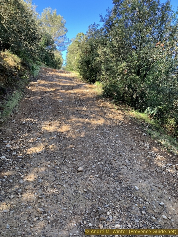
Then take the uphill forest track. This is our program for the next hour. We go up about 350 meters on a steady slope. The children will surely not like it. We are here in the shade if we leave early in the morning. The shade will remain almost permanent in winter.
The track first makes a wide double bend and then follows a direction southwest, then south. Later follows a turn to the right and another to the left to find a fairly obvious southerly direction for a longer time.
No reproduction is permitted without the written consent of the author. (id6784)
Steep climb on the Chemin des Venturiers
Around 470 metres above sea level, it is possible to deviate towards a clearing on the left for a first view of the Croix de Provence and the priory.
No reproduction is permitted without the written consent of the author. (id6785)
View towards the Croix de Provence and the priory
We return to the forest track and continue to climb. After another right-left hook, it resumes the tireless southern direction and the tireless climb.
In winter, wood can be found here to heat the refuge.
No reproduction is permitted without the written consent of the author. (id6786)
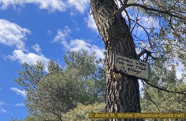
Place of dry wood for the refuge in winter only
At 725 metres above sea level, the motorable track finally ends. A more pleasant path starts here near an area with cedars of Lebanon. You can still see towards the cross and the priory.
This makes a more pleasant progress in the Vallon de Cherbourgue. As soon as you cross the valley, long switchbacks begin.
No reproduction is permitted without the written consent of the author. (id6787)
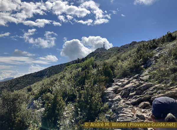
In a straight line under the Croix de Provence cross
You comme to dry stone walls that bounded the lands of the priory with the Pré des Moines a little higher up. It was the meager land that the monks present between the 14th and 17th centuries cultivated. This was surely not enough to feed them because there is no water source and the slope is oriented towards the north.
No reproduction is permitted without the written consent of the author. (id6788)
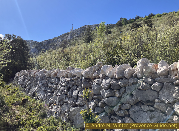
Lower enclosure of the grounds of the priory
To the west, we see a rocky ridge called the Costes Chaudes, we pass there on another tour on this mountain: Sainte Victoire from the south.
No reproduction is permitted without the written consent of the author. (id6789)
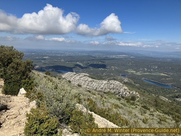
Les Costes Chaudes and Lac de Bimont lake
Other tight bends bring us to the wider Chemin Imoucha which bounds together all the paths going up from the west towards the priory. We will meet other hikers at the latest here. We gradually climb towards the ridge and towards the priory. You can feel lucky if you don't have a cold wind here.
No reproduction is permitted without the written consent of the author. (id6790)
On the main path to the Croix de Provence cross
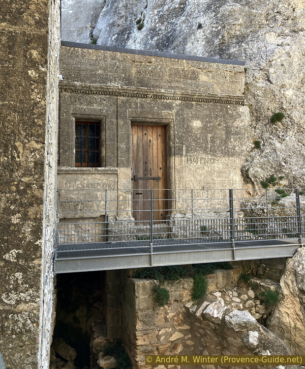
The entrance porch of the priory from 1670 is reached in a short time.
For this view with the porch and the bell tower of the chapel, you have to climb in the rocks about ten meters before crossing the porch.
The chapel is open when the Provençal flag floats above. In season it is on Thursdays and Sundays depending on the availability of volunteers.
No reproduction is permitted without the written consent of the author. (id6791)
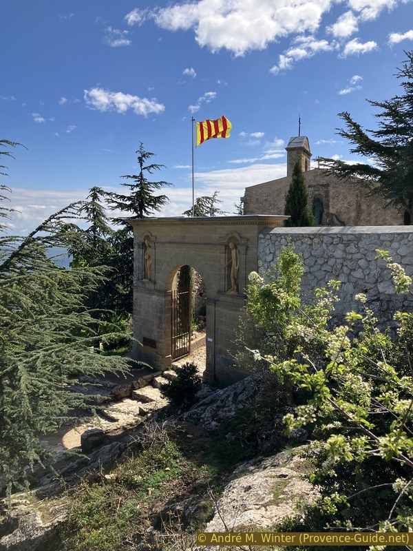
Provençal flag on the gate of the Sainte Victoire priory
The 1661 chapel is classically Provençal with its bell tower facing north. It is the only building that had kept its roof in 1955 when the reconstruction of the site began.
No reproduction is permitted without the written consent of the author. (id6792)
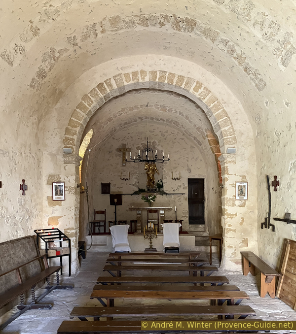
Sainte Victoire chapel nave
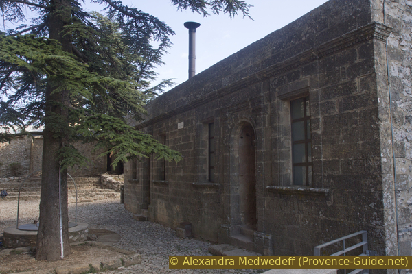
The rectangular building is the current refuge. It has large benches that can be used as a bed when you bring mattresses and sleeping bags. The open hearth can heat up as long as there is wood, but this shelter will remain cool or even very cold all the rest of the time because the sun's rays do not often reach it.
The refuge and the corridor behind it house a small exhibition retracing the turbulent history of the priory and especially its restoration during the 1950s.
No reproduction is permitted without the written consent of the author. (id6793)
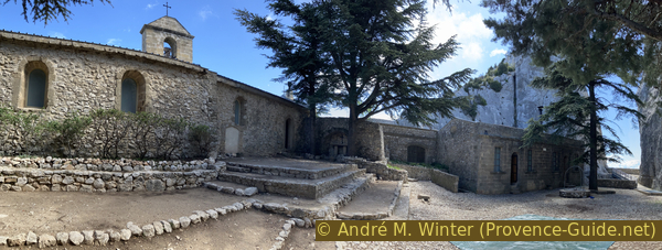
Chapel and refuge of the Sainte Victoire priory
The refuge was before the building of the monks, it was built in 1670 and remodeled several times thereafter.
The esplanade is a filled rock crevice. It houses a cistern 3 meters in diameter and 9 meters deep since 1662. It was filled with water collected from the roofs and that mounted on the backs of donkeys in skins and jars.
No reproduction is permitted without the written consent of the author. (id6798)
The refuge in the Sainte Victoire priory
We see that the opening to the south is worked by the hands of men in 1663. Indeed, the monks widened it to bring in more sunlight.
No reproduction is permitted without the written consent of the author. (id6794)
View of the Brèche des Moines cut at the Sainte Victoire priory
On the south side, the esplanade does not advance for two reasons.
On the one hand, a staircase dating from 1670 allows to descend into the crevice and exit under the current belvedere. Here you can access the said Jardin des Moines, cultivation terraces supported laid out at the end of the 17th century. Currently, the dry stone walls are difficult to distinguish, as they are invaded by brambles. It's the green bar on the left side of the photo.
Today fig trees still bear witness to cultures. However, you can no longer descend there.
No reproduction is permitted without the written consent of the author. (id6795)
View from above of the Brèche des Moines towards the Jardin des Moines on the left
On the other hand, there below is a primitive chapel from the 13th century, surmounted by the Logis d'Elzéar, whereinn lived a hermit from on Sainte-Victoire.
No reproduction is permitted without the written consent of the author. (id6796)
The esplanade seen from the belvédère
The Logis d'Elzéar is covered with engraved names of visitors from past centuries.
No reproduction is permitted without the written consent of the author. (id6797)
Logis d'Elzéar with old graffiti and old chapel below
When the site is guarded, the rear gate between the sacristy and the refuge is open. It is a direct exit to the path to the Croix de Provence that we take thereafter.
No reproduction is permitted without the written consent of the author. (id6799)
Arch between the sacristy of the chapel and the refuge
On the north side, under the chapel, there are dry toilets.
No reproduction is permitted without the written consent of the author. (id6800)
The dry toilets north of the priory and the Barre with Tête du Marquis
Section 2: Croix de Provence - Le Signal
➙ 1,6 km ... 1 h ➚ 115 m ➘ 40 m ↝ average
100% easy trails, with marks
The clues
- Prieuré Sainte-Victoire, 890 m
- Croix de Provence, 950 m
- Brèche du Garagaï saddle, 915 m
- Le Signal, 970 m
- Ridge east of Le Signal, 970 m
A little more solitary on the Montagne Sainte Victoire ridge.
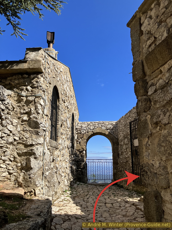
The priory is only a stop for us. It is possible to exit through a portal between the chapel and the refuge towards the Croix de Provence. If this small gate is closed, you have to go back through the main porch and turn right.
No reproduction is permitted without the written consent of the author. (id6802)
Back view of the bell tower of Sainte Victoire chapel
The path to the cross is easy, although rockier than what we have seen so far.
No reproduction is permitted without the written consent of the author. (id6801)
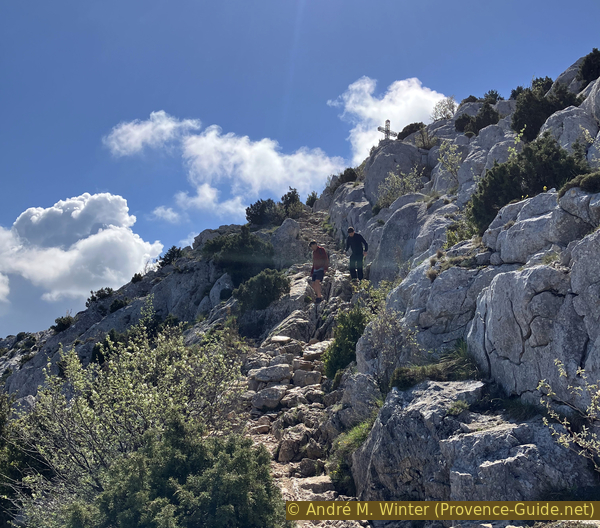
Ascent path to the Croix de Provence cross
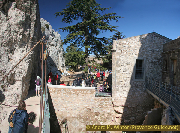
Under the cross is a closed shelter, it was used by firefighters watching for fires from the cubic lookout above. This lookout still exists, but all the windows are destroyed. These constructions somewhat disfigure the summit.
No reproduction is permitted without the written consent of the author. (id6803)
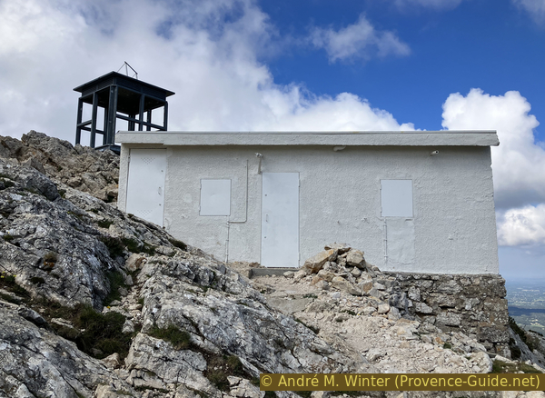
Old shelter and watchtower without windows
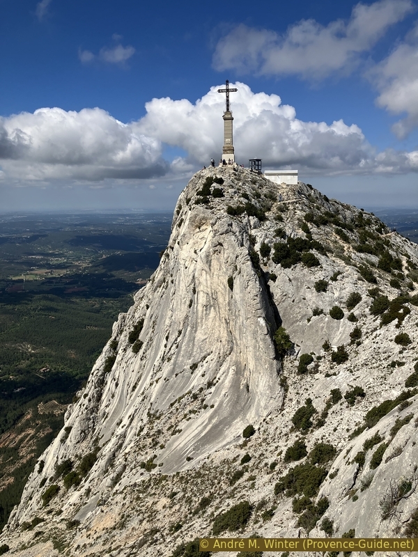
The cross is built far from the main summit to be well seen from Aix-en-Provence. This is the fourth cross after the first erected by a sailor in the 17th century. But also this one, from 1875, sufferes seriously from the Mistral on the ridge and from the lightning which strikes it regularly.
The cross itself is monstrous when you're up close. The four sides have plates in Latin, French, Greek and Provençal.
No reproduction is permitted without the written consent of the author. (id6805)
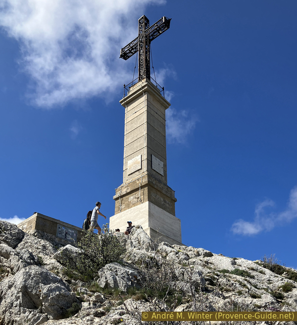
Under the Croix de Provence cross
You can barely make out the terrace of the belvedere of the Prieuré Sainte-Victoire. Looking closer, we can also see very well that the crevice has been widened.
No reproduction is permitted without the written consent of the author. (id6804)
View of the Croix de Provence looking west
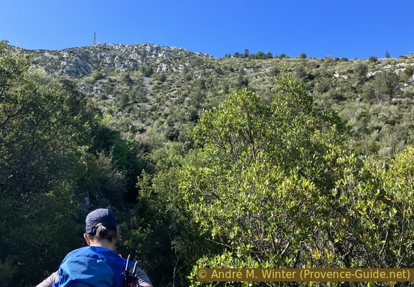
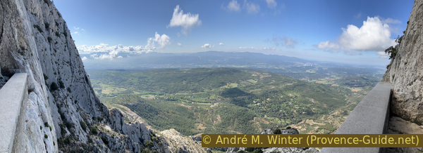
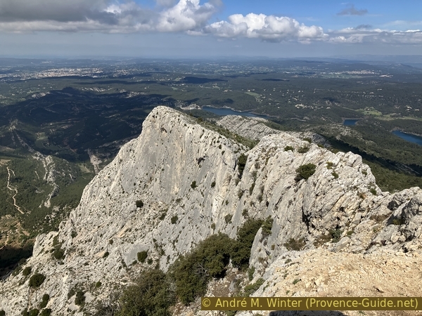
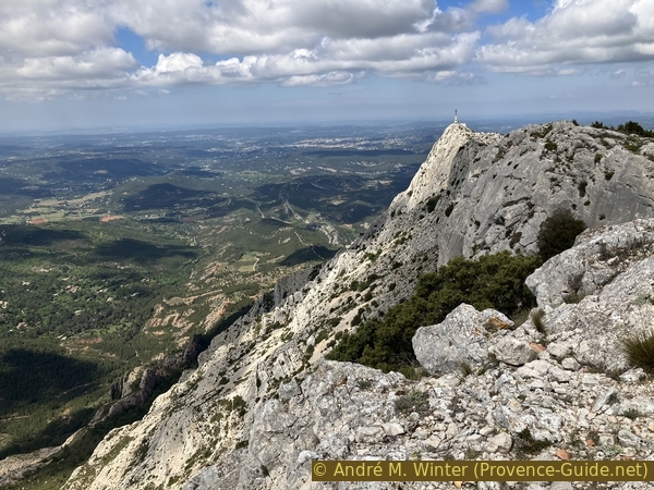
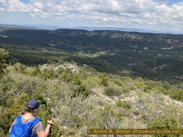
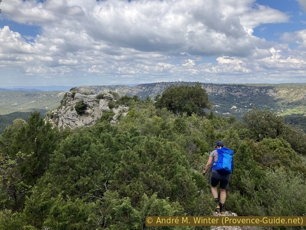
You can see especially well to the east with Le Signal and the other peaks of the ridge.
No reproduction is permitted without the written consent of the author. (id6815)
Le Garagaï, Le Signal and Bau des Vespres
The further hike runs along the crest of Sainte-Victoire. We are going east. We first descend on the main path which passes under the cross and then cross a small pass.
The marked path always passes a few meters below the ridge. This is wise because if there is wind it usually blows from north to south. However, you can go back to the ridge at any time. It is worth from the first hill after the cross precisely to see back towards the cross Croix de Provence.
No reproduction is permitted without the written consent of the author. (id6806)
La Croix de Provence seen from the Col du Garagaï saddle
The land is dry and monotonous, except in spring when some plants bear small colorful flowers such as pink thyme, tiny narcissus and very stocky broom in yellow. We also see various orchids of white or purple color.
No reproduction is permitted without the written consent of the author. (id6814)
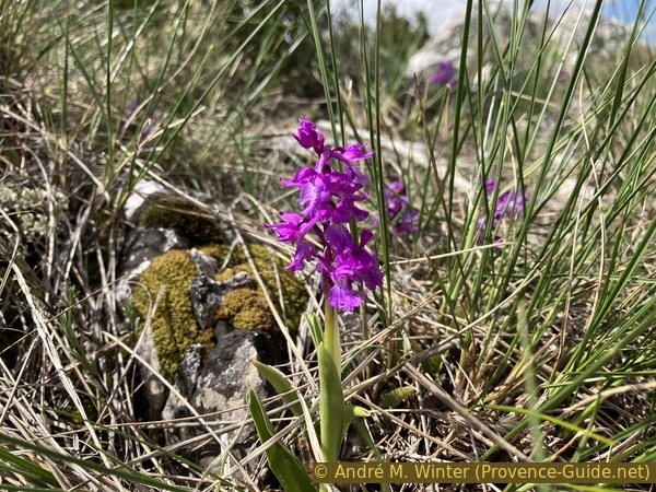
Orchid
The path descends and then rises again above Garagaï.
No reproduction is permitted without the written consent of the author. (id6807)
Under point 942 east of Garagaï
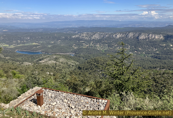
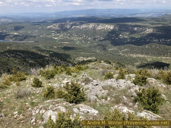
We have plunging views towards the south from the various passes.
No reproduction is permitted without the written consent of the author. (id6808)
View to the south on the Oppidum Untinos and the Sainte Victoire ecomuseum
Here we are on the path up to Le Signal.
No reproduction is permitted without the written consent of the author. (id6809)
On the way to Le Signal de la Sainte Victoire
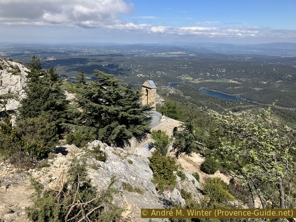
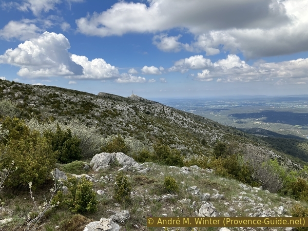
Le Signal is the highest point of the tour and another peak from which you can see well in 360 degrees.
No reproduction is permitted without the written consent of the author. (id6812)
View from Le Signal towards the Croix de Provence
The path stays at about the same height after Le Signal. Ten minutes and 400 metres after the summit, we should spot a medium sized cairn on a fairly flat portion of the hiking trail.
No reproduction is permitted without the written consent of the author. (id6813)
Cairn marking the north ridge east of Le Signal
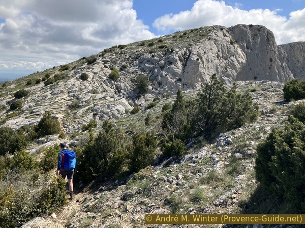
Section 3: Vallon des Gendres
➙ 4,5 km ... 2 h ➚ 20 m ➘ 620 m ↝ difficult
30% moderate trails, cairns
10% Trails with scramble passages, without marks
35% forest roads, without marks
10% forest roads, with marks
5% easy trails, with marks
10% forest roads, with marks
The clues
- Ridge east of Le Signal, 970 m
- Bifurcation between Delubre et Vallon des Gendres, 620 m
- Vallon des Gendres valley, 500 m
- Piste des Venturiers, 370 m
- Bridge on La Cause creek, 355 m
- Cabassols fields, 350 m
- Les Venturiers car park in Vauvenargues, 365 m
A return by old and little known paths.
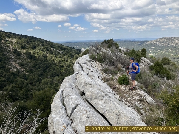
Our descent from the ridge begins at the cairn at about 970 metres above sea level. The ridge lays between the tributaries of the Vallon des Gendres to the east (left) and the Delubre to the west. There are not many markers, but when you are at the cairn indicated, you can see more along the wide ridge. Let's look at the time, it can be useful later.
No reproduction is permitted without the written consent of the author. (id6816)
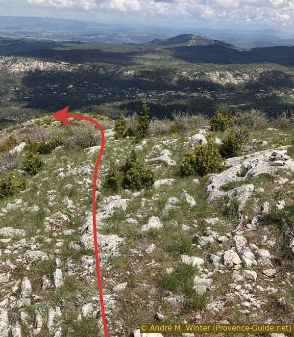
North ridge to the east of Le Signal
This ridge is quite flat at the beginning, we stay high enough to continue to see the Croix de Provence. We don't really see a path, but there are many cairns at the beginning. We advance towards the north with a slight inclination towards the west.
No reproduction is permitted without the written consent of the author. (id6817)
View back to the Croix de Provence from the ridge to the east of Le Signal
Later, around 910 metres above sea level, we pass a little further to the left before returning to the right at the latest at 875 metres to circumvent a rocky terrain. We are then about ten minutes from the ridge path.
No reproduction is permitted without the written consent of the author. (id6811)
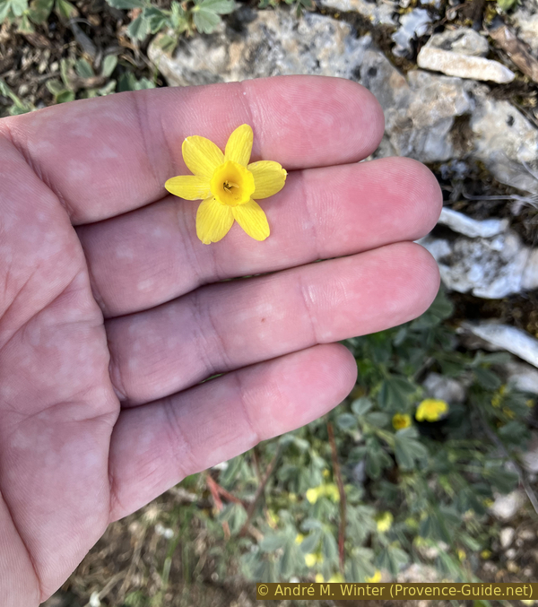
Tiny narcissus flower
Below this first obstacle, the path resumes its northerly direction with the slight inclination to the left. The ridge is then more pronounced, ravines rise from right and left.
No reproduction is permitted without the written consent of the author. (id6818)
250 metres below the main ridge
Around 730 metres above sea level and 20 minutes from the ridge path, higher pines begin to gradually obstruct the view.
No reproduction is permitted without the written consent of the author. (id6819)
Go left 400 metres below the main ridge
The terrain remains uneven.
No reproduction is permitted without the written consent of the author. (id6820)
Path at an altitude of 800 metres on the north ridge
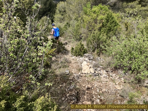
Now you have to go between some bushes.
No reproduction is permitted without the written consent of the author. (id6821)
Path at an altitude of 660 metres on the north ridge
At 615 meters and 25 minutes, we come across another cairn a little bigger than the others. It marks a fork, where we take the left path. We are thus approaching the rocks that we have seen from above.
No reproduction is permitted without the written consent of the author. (id6822)
Left path under the fork at an altitude of 620 metres
It is a cliff oriented southeast to northwest.
No reproduction is permitted without the written consent of the author. (id6823)
Towards the ridge between Vallon des Gendres and Le Delubre
We have to reach the cliff and first stay on the high part of it. These are limestone strata positioned at 45 degrees and the terrain is difficult to walk. The progression is made complicated by bushes which obstruct the rare easy passages.
No reproduction is permitted without the written consent of the author. (id6824)
On the ridge between Vallon des Gendres and Le Delubre
130 meters after reaching the cliff, we descend on some rocks.
No reproduction is permitted without the written consent of the author. (id6825)
First descent on the ridge
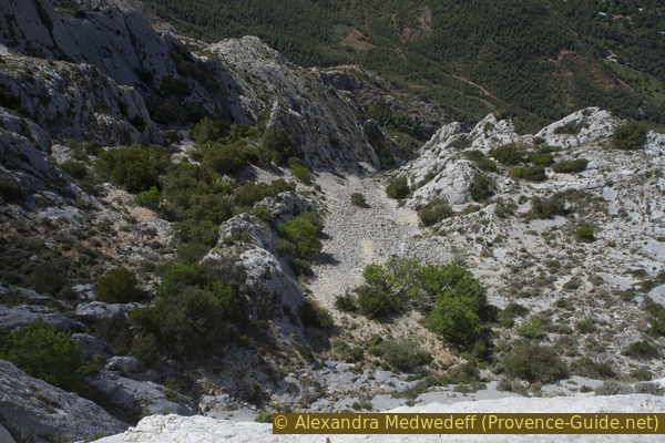
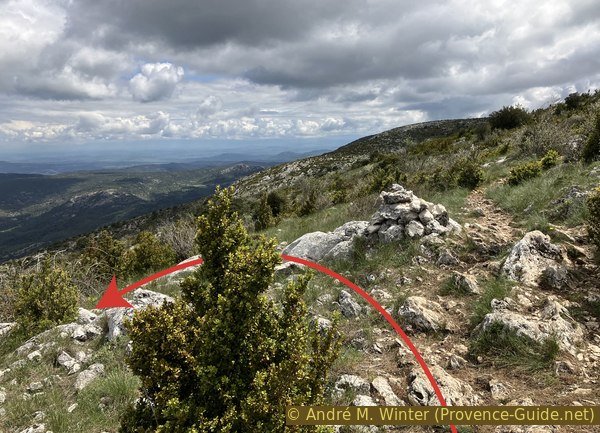
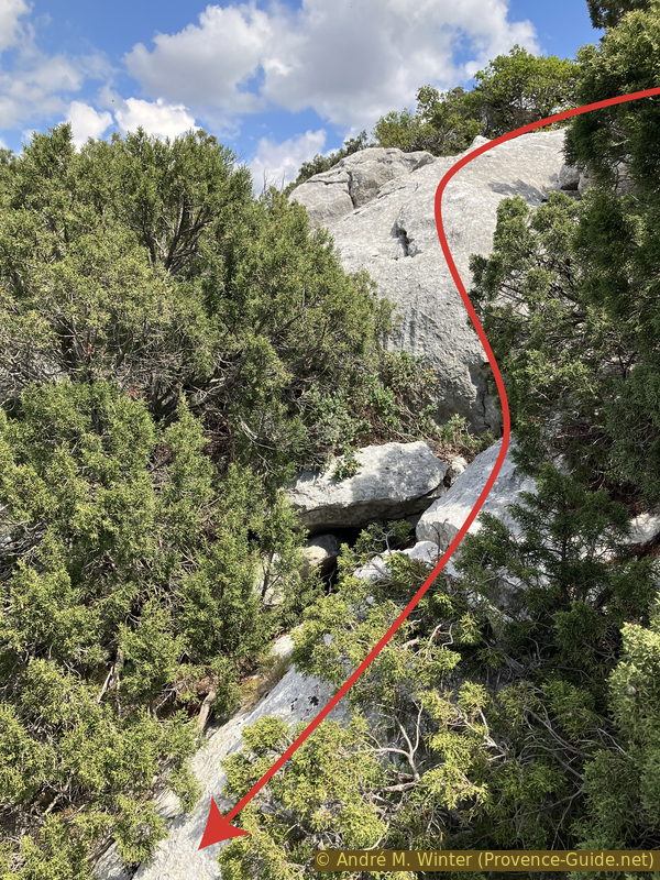
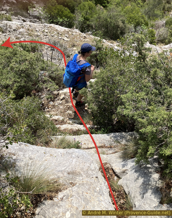
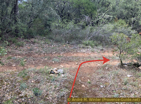
150 meters after climbing the cliff, it lowers more generally to form a kind of funnel to the left. The rocks here are covered with rubble and red earth.
You must first descend into this small cirque and turn to the left. We arrive then on the flat area visible at the base of the arrow in the photo. We then move to the right until the small cairn to go down to the left between the bushes.
The following photo shows the vertical passage.
No reproduction is permitted without the written consent of the author. (id6826)
Second descent to the Vallon des Gendres
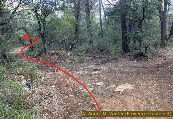
View on the vertical passage under the small cairn.
No reproduction is permitted without the written consent of the author. (id6827)
Detail of the second descent
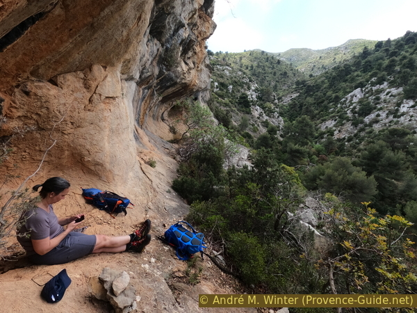
We can then move forward under the cliff and under a cave, we are here in the remainings of a small canyon.
No reproduction is permitted without the written consent of the author. (id6828)
Pause under the ridge of the Vallon des Gendres
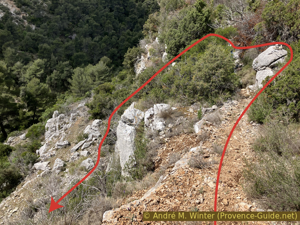
You first descend directly in the axis of the last descent, but you follow the rocky step to the right for about a hundred meters.
When the path seems very easy, a small cairn indicates to turn left and continue to descend into the valley because the passage further on is overgrown.
No reproduction is permitted without the written consent of the author. (id6829)
Left in the descent to the Vallon des Gendres
There are still a few steep passages without a clearly visible path. The descent is quite direct with a slight inclination to the right.
No reproduction is permitted without the written consent of the author. (id6830)
Back view on the faster descent into Vallon des Gendres
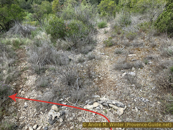
We turn right again at the bottom of the dry valley and continue the now better visible path in a northwesterly direction.
12 minutes and 800 meters further, you come to a poorly visible forest track where you turn right.
No reproduction is permitted without the written consent of the author. (id6831)
Forest road to the west of the Vallon des Gendres
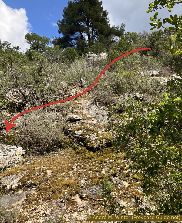
Shortly after, there is a junction with a sunken road where you turn left and downhill. This one makes laces and then folds again to the left and to the west to arrive in a valley.
No reproduction is permitted without the written consent of the author. (id6832)
Left on the lower forest road
The rutted forest track turns right to follow a dry stream.
This brings us back to a junction with the Chemin des Venturiers that we probably didn't notice on the way up. It is a little south of the bridge over La Cause creek.
No reproduction is permitted without the written consent of the author. (id6833)
Descent into the valley to the west of the Vallon des Gendres
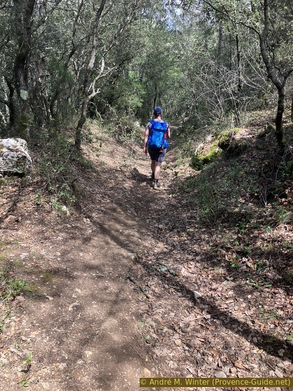
So we're back on the path we already know, along which we return to the starting point.
No reproduction is permitted without the written consent of the author. (id6834)
Cabassols fields
Sources and additional information
It is better to use a good topographic hiking map: this tour is on the IGN map "Montagne Sainte-Victoire, Aix-en-Provence, Gardanne, Trets", scale 1:25000, 3244ET.
If you don't want to bother with a paper map, you can also use mapping apps on your cell phone. On the one hand, it is the Cartes IGN app from the official map service. However, it requires access to the data network and this is sometimes difficult in canyons or remote locations.
Alternatively, you can use apps that store data directly on the device. They're generally not free, but they don't cost much. We mainly use OSMAnd, here it is possible to add contour lines, relief shading, markings and others. To store this data on your phone you need a lot of space.
Of course, one needs access to satellites for the GPS signal with any app. In some canyons this is not the case. Therefore, do not rely on the position shown, but read the map on your phone as you would read it on paper. Most apps are available for Android and iPhone. The applications usually allow us to record the route travelled and also view the GPS files offered for each of our hikes.
This page has been seen 6481 times since 20 March 2024.