All viewpoints on Les Baux-de-Provence
Avoid the crowds and see much more of the castle and the village on the iconic rock
hike
average
3 h 45 min
no
yes
shelter
mountain
Introduction
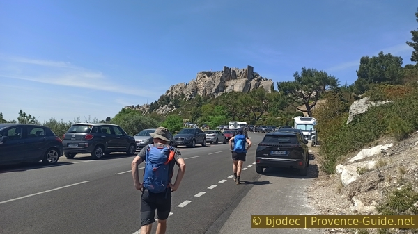
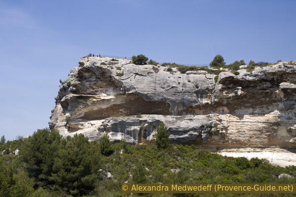
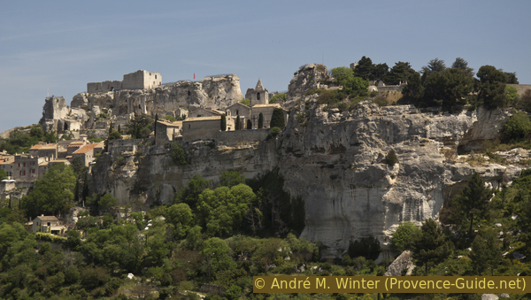
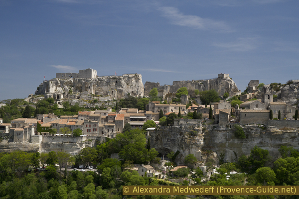
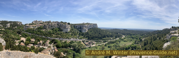
Les Baux is this rock on the southern slope of the Alpilles range which attracts thousands of people per day. The access roads have been transformed into paid park areas, also the entrance to the village and to the ruins of the castle so coveted in the Middle Ages needs a fee to be paid. It's true that the view is very good, it's true that all this is very beautiful. But isn't it better to see all this and more by going around the rock? We pass to around ten direct viewpoints on the rock of Les Baux, part of which is even above the later. The major advantage is also to avoid crowds and large paid parking lots.
The facts
8 km total distance
3 h 45 min walk time
290 m total elevation
orientation average
mark 50% of the total distance
45% forest roads
15% moderate trails
10% hard-surfaced quiet side streets
10% easy trails
5% cross country
5% hard-surfaced country road
5% hard-to-recognize trails
<5% trail through a cave
<5% stairs
<5% via ferrata
dangers exposed sections
children yes, but it's long
useful picnic stuff
required hiking boots, hiking equipment and water
GPS coordinates (WGS84) of start and end point 43.752257,4.793593
downloads ![]()
![]()
Public transport
Only in July and August: line 707 from Avignon via St. Rémy is extended to reach Les Baux-de-Provence. This is quite limited and it is useful to complain to the tourist offices in the region because it is the municipalities which normally contribute to maintaining the lines. Look for the line 707 under timetables under Zou! (only french)
When this busline is active, we get off at the Les Baux stop and continue to go down the main road for 50 metres to continue straight at the follong hair pin bend. We then begin the tour in section 3.
Access by car
We are in the Alpilles Massif, in the center of the Arles, Avignon and Salon-de-Provence triangle. Only small roads lead there. We are precisely between St.-Rémy-de-Provence to the north, Fontvieille to the southwest and Maussane to the southeast.
The southwest (D27) and southeast (D27a) access roads are the village car parks, but these are not our starting points.
Coming from the north, therefore from St.-Rémy, you go up a winding road towards the south. Just before the pass there is a very wide junction where we turn left.
Coming from the south, you climb on both sides of the rock along the parking lots to take the winding road which passes through the Val d'Enfer and climbs to the Col de Sarragan. The pass is marked by an artificial notch in the rock. Just after, we turn right onto a dead-end ridge road for motorized vehicles.
Useful parking spaces
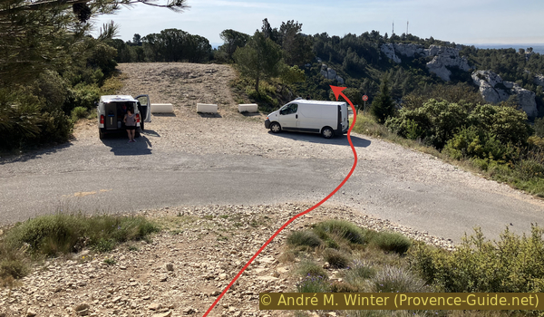
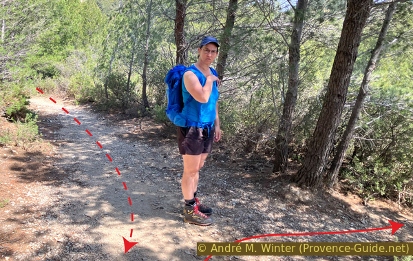
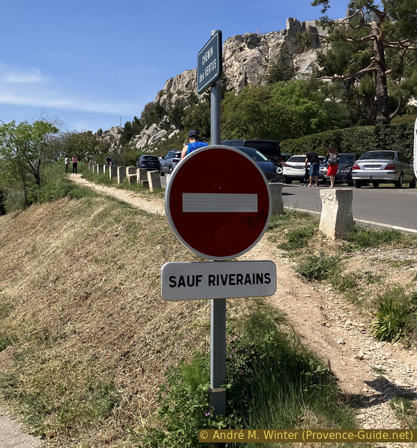
150 metres further east of the pass are vacant spaces which serve as parking lots. The one at the right below the road even offer shade all day long. There are other similar places for another few hundred metres which can all be used as starting points for the tour. We generally find space here because we are too far from the village of Les Baux for a simple visit. The start is in any case near the pierced rock near the first parking lot.
No reproduction is permitted without the written consent of the author. (id6110)
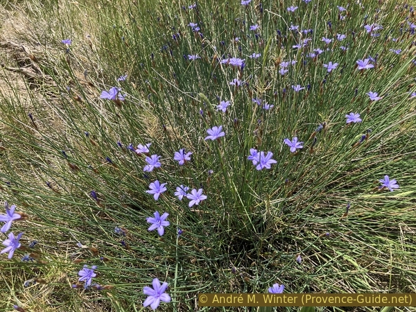
Aphyllanthes monspeliensis
No reproduction is permitted without the written consent of the author. (id6072)
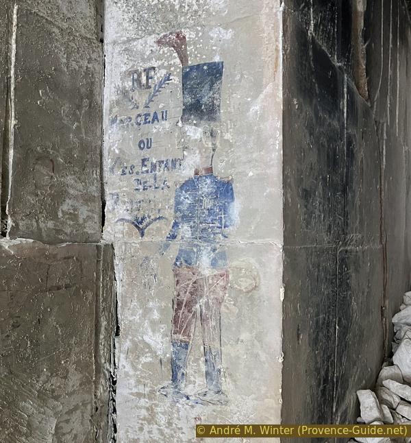
Drawing of General François Séverin Marceau-Desgraviers at the Mireille quarry near Les Baux
Hints
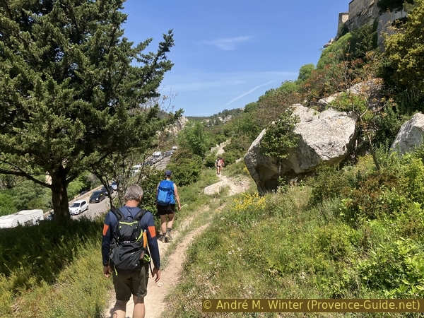
This tour has several climbs and descents and we start from the highest point to which we must return at the end. The path is, however, varied enough that it is not boring.
The visit to the Mireille Quarry is described in section 2. We can ignore this one if we do not want to take this officially prohibited access.
There is no drinking water along the tour.
The whole region is a zone with a high risk of forest fires. In summer, but also in other seasons when it is very dry or by strong winds, access to the forest areas can be regulated. As a result, the roads may be closed to traffic and/or the trails prohibited to hikers. Current information: Map of access to forests and exposed areas in Bouches-du-Rhône (also english). The map shows the colours green, yellow, orange and red which correspond to levels of danger. The affected area is: Massif des Alpilles.
The sections
- Pierced rock - Bringasses Oppidum - Falaise de Baumanières
- Falaise de Baubesse - Carrière Mireille quarry - Route des Oliviers D27a
- Route des Oliviers D27a - Trémaïé - Pavillon de la Reine Jeanne
- Pavillon de la Reine Jeanne - Deffend - Col de Sarragan saddle - Pierced rock
Section 1: Oppidum des Bringasses - Baumanières
➙ 1,3 km ... 1 h ➚ 35 m ➘ 125 m ↝ average
<5% hard-to-recognize trails, without marks
20% forest roads, faulty marks
15% moderate trails, without marks
15% forest roads, officially blocked
10% trail through a cave, officially blocked
15% forest roads, officially blocked
25% moderate trails, without marks
The clues
- Pierced rock, 250 m
- Former orientation table, 280 m
- Baumanières Antennas, 265 m
- Bringasses Oppidum, 250 m
- Falaise de Baumanières cliff, 225 m
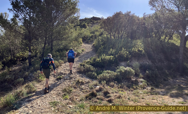
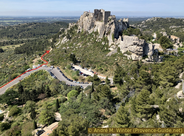
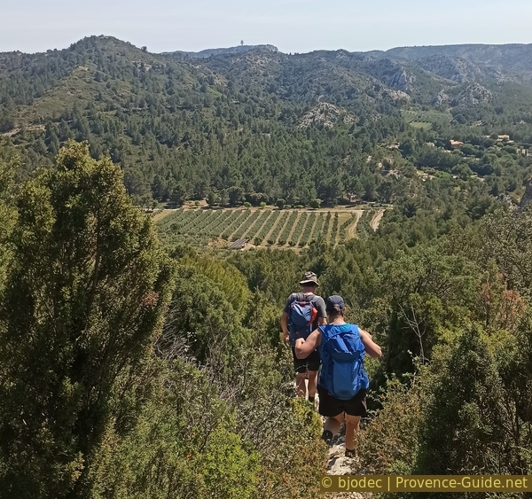
We pass high above the village of Les Baux.
We therefore leave the parking lot towards the east. You find panels with maps and and tour colors on the upper park area. These colors do not represent the color of the trail marking in the nature. We will partly follow the green route and the orange one.
The fortress was built from the 11th to the 13th century. The princes of Les Baux then controlled a large part of Provence. The castle was razed by its own inhabitants starting 1633 and following the wars of religion in which Les Baux chose the losing Protestant side.
No reproduction is permitted without the written consent of the author. The permission of use was kindly given to Provence-Guide.net on 29 August 2023. (id6053)
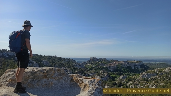
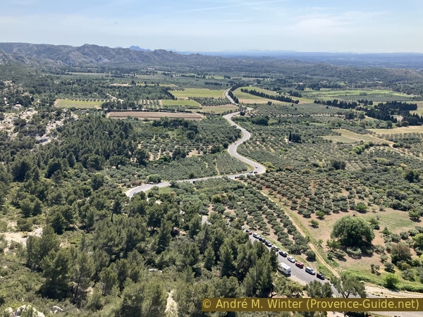
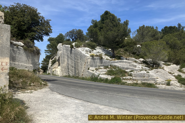
Look at Les Baux from the ridge road east of the Col de Sarragan saddle
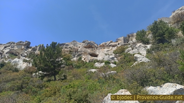
Our first stop is the Roche Percée. You can easily climb into the lower cavity. Apart from the originality of the shape created by natural erosion, the place also offers a good first view of the Baux rock. We are here very precisely to the north of the village.
No reproduction is permitted without the written consent of the author. (id6052)
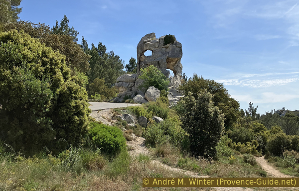
Holey rock on the ridge road east of the Col de Sarragan saddle
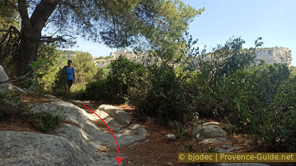
We continue for another 50 metres on this small road, in the next bend and we climb a path on the hill to the left of the road.
No reproduction is permitted without the written consent of the author. (id6054)
Ascent to the viewpoint east of the Col de Sarragan saddle
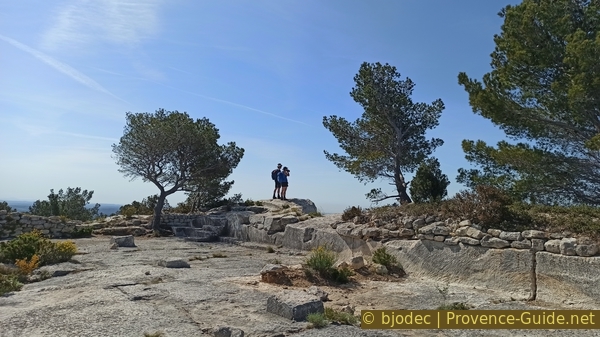
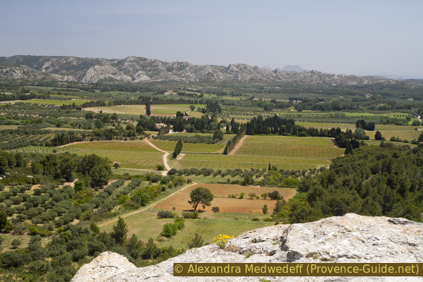
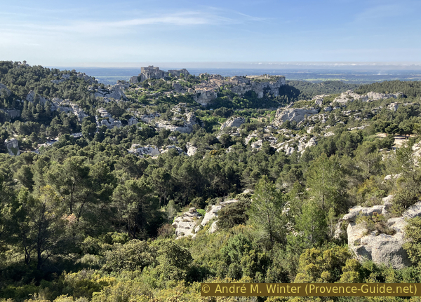
Various maps mark an orientation table on the highest point, but it has been destroyed for a long time. We still go up there for two reasons. On the one hand it will be the highest point of the tour. On the other hand, we really have a good overview over a large part of the Alpilles Massif.
No reproduction is permitted without the written consent of the author. (id6055)
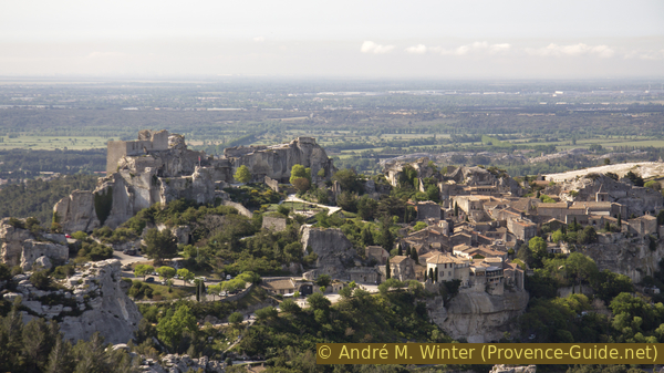
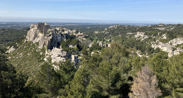
Les Baux and the ruined castle
From here we can also see the Val d'Enfer and the still active quarry of Sarragan.
No reproduction is permitted without the written consent of the author. (id6056)
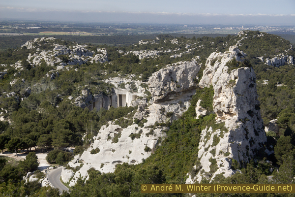
Val d'Enfer stone quarries
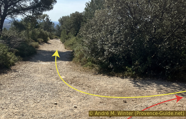
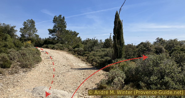
This high point marks a long descent. We continue roughly in the direction of the climb. It is initially quick to brings us back down to the road. We cross the road and take the forest track opposite and to the right of the stones placed as a barrier against cars.
No reproduction is permitted without the written consent of the author. (id6057)
Penultimate car park on the Route des Crêtes east of the Col de Sarragan saddle
This track is slightly downhill, it passes under the crest road and it crosses the wooded ramifications of the upper Val d'Enfer. It's a leisurely stroll and a liaison stage. In the darkest part, we cross the Val d'Enfer at the bottom of which another forest track crosses.
We keep to the right at the two forks that follow. The road is flat and then goes up a little.
Also stay right at the next intersection. In a few moments we are at the Baumanières antennas.
No reproduction is permitted without the written consent of the author. (id6058)
Junction north of the Baumanières antenna
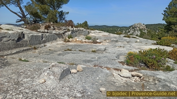
Pass these technical installations and also the bases of old antennas and an old technical room. We advance along the ridge on large rock slabs until we have a good view on Les Baux.
No reproduction is permitted without the written consent of the author. (id6059)
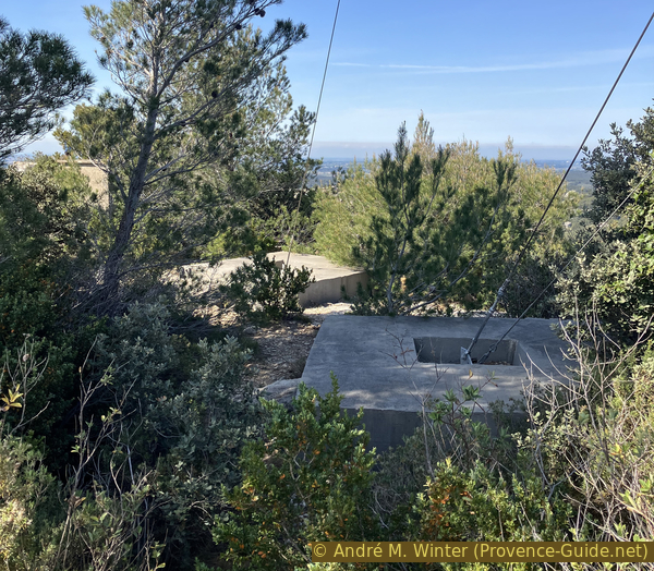
Old antenna bases on the summit of Baumanières
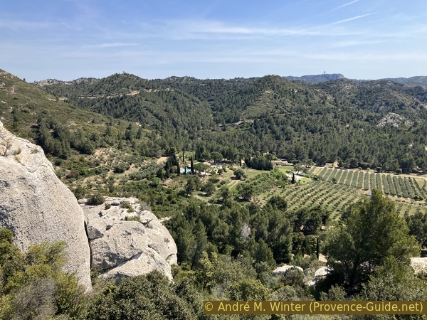
This viewpoint also offers good views of the Val d'Enfer to the right, the olive grove plains and the south-eastern slopes of the Alpilles.
No reproduction is permitted without the written consent of the author. The permission of use was kindly given to Provence-Guide.net on 29 August 2023. (id6060)
On the summit of Baumanières
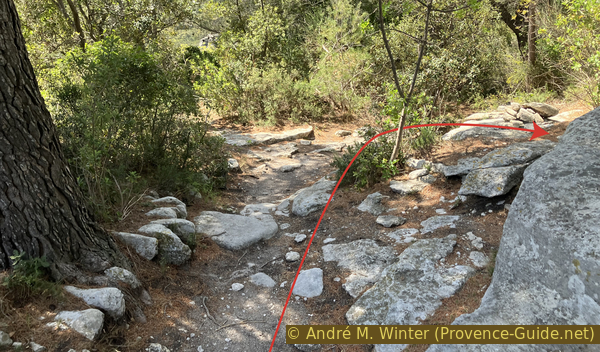
We then retrace our steps and reach the junction where we left the main track. We head again on the right. The track passes over a fairly flat plateau and the forest gets less dense. 200 metres further follows another junction. We turn right again here.
No reproduction is permitted without the written consent of the author. (id6061)
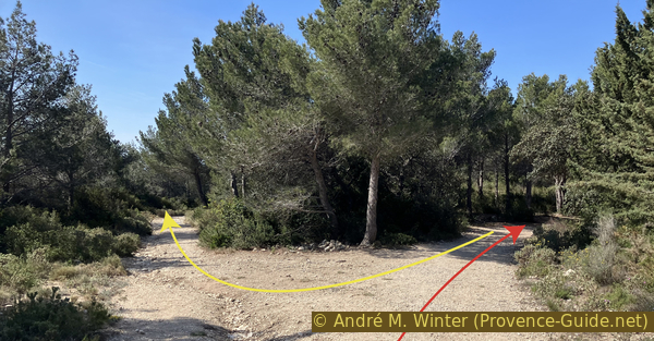
Junction north of the Oppidum des Bringasses
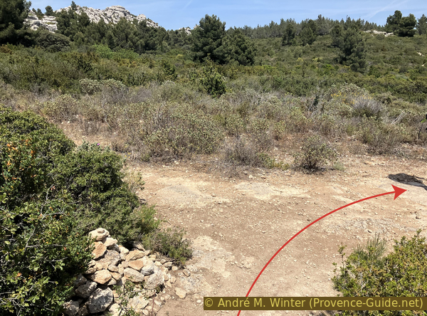
About twenty metres further, we leave this forest track to the left. There are several parallel paths but above all rocks and low walls visible further on. We move in this direction to search for worked walls and stones. This is the Oppidum des Bringnasses. The easiest access is to the right following the outline of the red arrow in the photo.
No reproduction is permitted without the written consent of the author. (id6062)
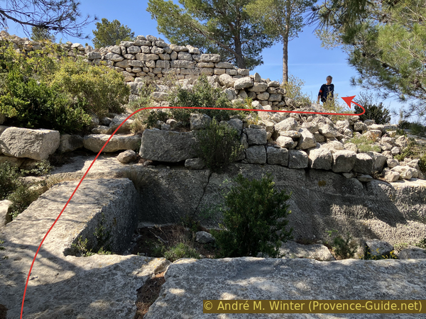
Walls and hollowed out cavities at the Oppidum des Bringasses
The term oppidum is perhaps misplaced, it is either an advanced post of Les Baux, or a competing medieval position. The work of flattening, collecting water and rock tombs is impressive. You can imagine an entire castle on the large flat central square.
No reproduction is permitted without the written consent of the author. The permission of use was kindly given to Provence-Guide.net on 29 August 2023. (id6065)
Flattened rock slab of the Bringasses oppidum
However, it is also a panoramic site on Les Baux, of course. We are now considerably closer.
No reproduction is permitted without the written consent of the author. The permission of use was kindly given to Provence-Guide.net on 29 August 2023. (id6063)
Flattened rock slab and the viewpoint of the Oppidum des Bringasses
We can clearly see here the advanced position of the rock in the plain.
No reproduction is permitted without the written consent of the author. (id6064)
Les Baux seen from the Oppidum des Bringasses
We return by the same path to the main track and continue on the right. In a few minutes, we are on the edge of the Falaise de Baumanières. We are even closer to Les Baux, but we now also see the ugly side with the huge parking lots.
No reproduction is permitted without the written consent of the author. (id6066)
Olive trees east of Les Baux
The red arrow in the photo shows that we must follow these parking lots for a few metres. This happens in section 3.
No reproduction is permitted without the written consent of the author. (id6067)
Les Baux seen from the cliff of Baumanières
Section 2: Carrière de Mireille
➙ 2,8 km ... 1 h 10 min ➚ 80 m ➘ 95 m ↝ average
10% hard-surfaced quiet side streets, with marks
10% moderate trails, without marks
45% forest roads, faulty marks
10% cross country, without marks
15% forest roads, faulty marks
10% hard-to-recognize trails, without marks
5% forest roads, faulty marks
<5% hard-to-recognize trails, without marks
The clues
- Falaise de Baumanières cliff, 225 m
- Carrière Mireille quarry, 210 m
- Route des Oliviers (D27a) road, 145 m
Descend the cliff and visit quarries with graffiti spanning over a century.
It is not possible to go directly down from the rock towards the rest of the tour. So we retrace our steps. We pass the access to the oppidum, it goes up a little. In the following left turn, we spot a stunted cypress on the right. It marks our fairly direct descent path.
No reproduction is permitted without the written consent of the author. (id6068)
Baumanières track and cypress marking the descent to Baubesse
In principle, you walk for 4 minutes towards the south-east and the next 5 minutes towards the east. We thus go around the rocks in order to take the only easy passage. The path is not always obvious between boxwood and scattered rocks. There is no signage. However, the GPX track provided at the top of the page is very precise.
A minute after the cypress, we are tempted to turn left. You can advance on a rock with a good view, but it's a dead end.
No reproduction is permitted without the written consent of the author. (id6069)
View to the antenna on the Plateau de la Caume
Less than two minutes later, the thing repeats itself, it is better to stay downhill without turning left.
One further minute later, the path turns slightly to the left with an even steeper descent. Three minutes later, you pass through rocks, but you must not deviate from the direction and continue to descend.
No reproduction is permitted without the written consent of the author. The permission of use was kindly given to Provence-Guide.net on 29 August 2023. (id6070)
Descent into a valley to the northeast
We then come to a narrow forest track called Chemin de la Cabane. Here we turn right, the path also turns right and continues uphill. It is not often used, the vegetation is gradually taking over.
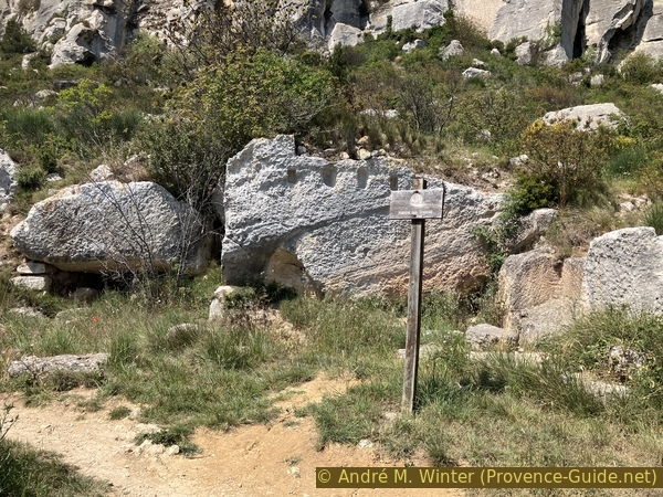
We come across a prohibition sign with a very clear message. We are here on the path towards a quarry abandoned in the 1910s. The site is in no way secure and erosion continues the former work of men. Large rocks have broken away to partly block the openings to the west, however, we are approaching the quarry from the east side. It is up to each and every person to decide whether to move forward here or not. The quarry is very similar to those open to the public in Val d'Enfer, but it is home to other gems: political graffiti from the 1930s.
No reproduction is permitted without the written consent of the author. (id6071)
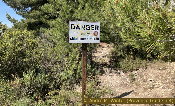
Sign at the entrance to the Mireille quarry
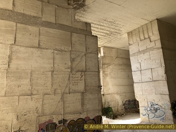
There are two main openings to the east and the collapsed slope to the west. Entry is through the first two artificial openings. Rectangular blocks were cut out and these cuts can be seen on all the walls and ceiling.
No reproduction is permitted without the written consent of the author. (id6077)
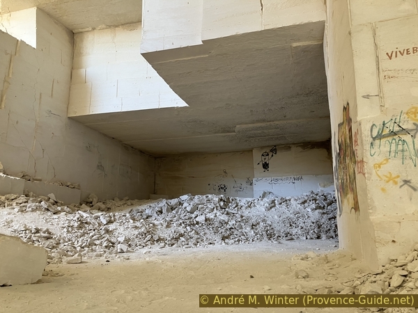
Dug hall of the Mireille quarry in Les Baux
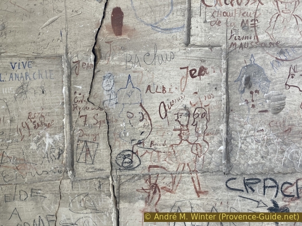
We see graffiti everywhere. They span from World War I to the present. It is a true book of political and social history which mainly covers the first half of the 20th century. There are schematic portraits with helmets from the German Empire, but also full portraits of politicians from the Bourbon Restoration.
No reproduction is permitted without the written consent of the author. (id6075)
Drawings of German soldiers from the WW1 at the Carrière Mireille in Les Baux
The most impressive series are commented portraits of presidents of the French Republic from the 1930s. Here we plunge back into a bygone time, but where politics were apparently discussed with passion.
No reproduction is permitted without the written consent of the author. (id6078)
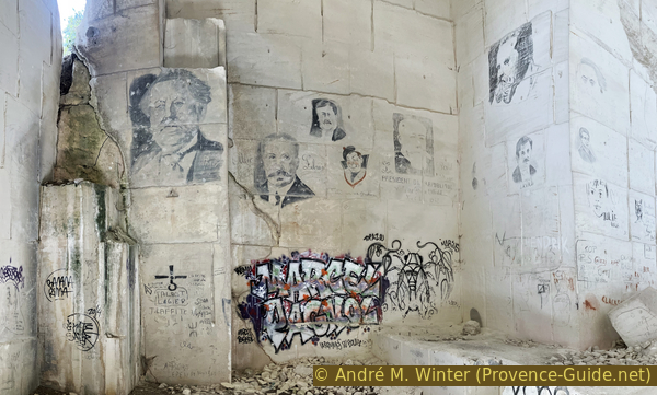
Drawings of Albert Lebrun, Paul Doumer, Pierre Laval and other politicians at the Carrière Mireille in Les Baux
It is not always easy to untangle these superimposed graffiti. Alongside the political messages are also marks from the quarry operators and job search notes (chieusse means quarry worker).
No reproduction is permitted without the written consent of the author. (id6074)
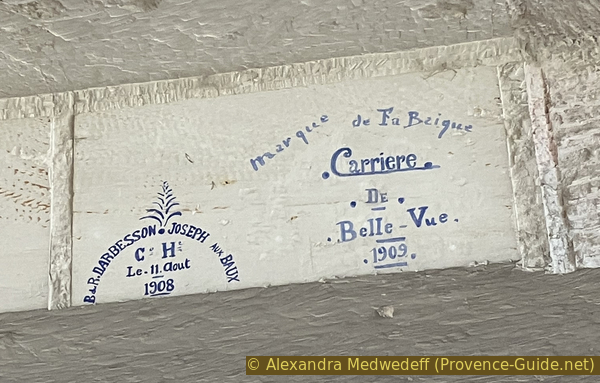
Brand names of Mireille quarry operators in Les Baux
Of course there is also simple graffiti. They also range from the 1910s to the present. People complain about the school, people praise or denigrate women in the region, and people complain about various grievances. Poverty is also discussed in text graffiti. There are also dreams drawn: on the upper part of some walls are drawings of racing cars from the 1920s.
No reproduction is permitted without the written consent of the author. (id6076)
Recent graffiti in the Mireille quarry in Les Baux
Generally speaking, walls are to be read from top to bottom, but this is not generalized. We spend about twenty minutes in this cathedral of 20th century history which is worth a real history lesson.
No reproduction is permitted without the written consent of the author. (id6073)
The Mireille quarry in Les Baux and a hundred years of graffiti
After this captivating visit, we return the same path to pass the prohibition sign again.
No reproduction is permitted without the written consent of the author. (id6079)

Recently collapsed opening of the Carrière Mireille
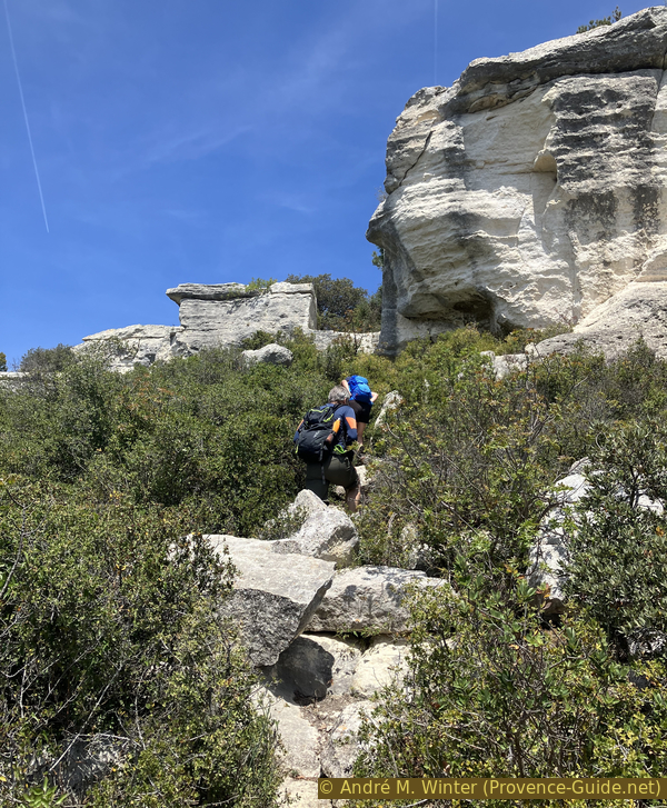
When the Chemin de la Cabane turns left, we spot a path on the right. The trail initially leads east, but very quickly turns right towards the south, then towards the south-east. The descent is almost as steep as the one down from the plateau.
No reproduction is permitted without the written consent of the author. (id6080)
Descent of the Chemin de Baubesse
The terrain is bare and we pass over eroded rocks which prohibit any form of vegetation.
No reproduction is permitted without the written consent of the author. (id6081)
Descent to Baubesse
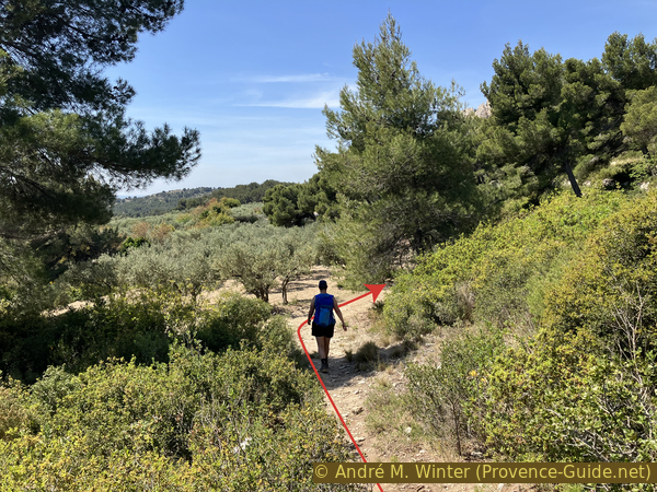
We finally go down into a valley to arrive at an olive grove. We take right here to follow the latter at the edge of the field or a little higher up in the forest.
We then arrive on the Route des Oliviers transformed into a long paid parking lot. We turn right.
No reproduction is permitted without the written consent of the author. (id6082)
Descent to the olive grove of Baubesse
Section 3: Trémaïé - Pavillon de la Reine Jeanne
➙ 1,7 km ... 40 min ➚ 45 m ➘ 65 m ↝ easy
20% hard-surfaced country road, faulty marks
30% forest roads, few marks
10% cross country, without marks
20% easy trails, few marks
<5% stairs, few marks
15% hard-surfaced quiet side streets, without marks
The clues
- Route des Oliviers (D27a) road, 145 m
- Chapelle des Trémaïé, 155 m
- Southern circumnhike of Les Baux rock, 175 m
- Pavillon de la Reine Jeanne, 125 m
The easiest section of this tour.
So we take this road uphill for 350 metres until the road bends.
No reproduction is permitted without the written consent of the author. The permission of use was kindly given to Provence-Guide.net on 29 August 2023. (id6083)
The D27a road uphill from the east towards Les Baux
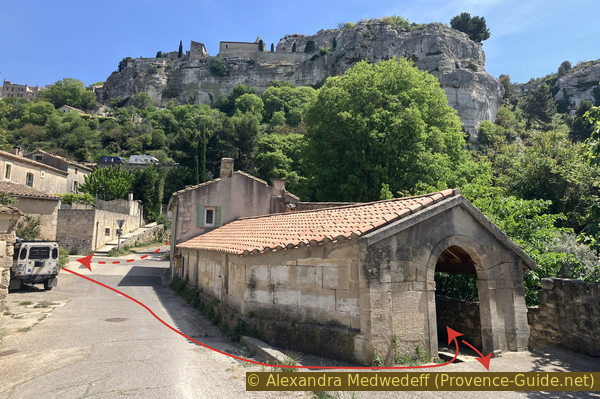
Halfway of the road and the parking lot, it is possible to climb along a small path behind the guardrail. Les Baux does really nothing for pedestrians, not even for those who pay for parking here.
When the road turns sharply to the right, we exit to the left onto a wide track.
Those who came by bus go down the road and turn right to start the tour here.
No reproduction is permitted without the written consent of the author. (id6084)
Path next to the road towards Les Baux
On the right, at the very beginning of the track, there is a sign indicating troglodyte dwellings. Nothing is explained here, they are probably shepherds' shelters.
No reproduction is permitted without the written consent of the author. (id6085)
Housing of the Tremaïé
We continue along this track in full sun. It passes directly under the rock of Les Baux, we clearly recognize the natural defenses of the site, but also the ruins of the castle which are located mainly on this side.
No reproduction is permitted without the written consent of the author. The permission of use was kindly given to Provence-Guide.net on 29 August 2023. (id6086)
Les Baux cliff and castle ruins
In a few minutes, we arrive at a small chapel which would not be worth mentioning if it was not attached to a rock with a bas-relief from the Roman period. It is even said that the chapel was built to prevent the rock from overturning further.
The chapel has a widened square. The cut rocks are obviously a reuse from another source.
No reproduction is permitted without the written consent of the author. (id6087)
Chapel and rock of Trémaïé
It is unknown if this rock fell off the plateau or if it was ever here. The three characters represented have long been interpreted as being three women and associated with the Three Marys (Trémaïé): Mary of Bethany, Mary Salome and Mary mother of James who are said to left by boat from Palestine to arrive in Provence. Several sites compete for the landing place and the place of withdrawal. Sainte-Baume is another of these places.
In reality, the relief represents two women and a man. A heavily eroded text lies below, but it does not aid in the identification of those depicted. The woman in the center is clearly highlighted, she may be a personified deity or a person recommended to a deity.
No reproduction is permitted without the written consent of the author. (id6088)
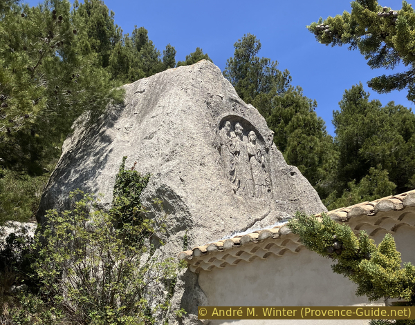
Rocher des Trémaïé et de Gaïé
Beyond the chapel is a rock in the shape of a bench which can be used for a break. However, it is the section most exposed to the sun, it is difficult to find shade here.
No reproduction is permitted without the written consent of the author. The permission of use was kindly given to Provence-Guide.net on 29 August 2023. (id6089)
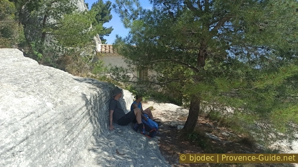
Break at the Rocher des Trémaïé et de Gaïé
A little further on is an eroded taffoni rock. Higher up, the entire cliff shows this type of erosion by air humidity.
No reproduction is permitted without the written consent of the author. (id6090)
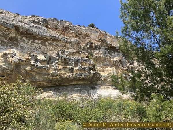
Southeast face of the Baux cliff
We continue our sunny path under the southern tip of the Rocher des Baux. Here you can deviate to the left to approach the edge of another cliff.
No reproduction is permitted without the written consent of the author. (id6091)
Junction to reach a viewpoint south of Les Baux
From the edge of the rock slab, you have a better view of the rock above.
No reproduction is permitted without the written consent of the author. (id6092)
South platform of Château des Baux
Looking east, we see the large antenna on the Plateau de Caume and Les Orpies, the later is a small massif south of the Alpilles.
No reproduction is permitted without the written consent of the author. (id6093)
Les Orpies south of Les Alpilles
We return to the ring trail and continue to go around the rock. We then arrive towards the north and in a slightly more shaded area. Before returning to a road, we pass a statue of the Black Madonna and a natural gap on this side of the rock. This was undoubtedly a difficult point to defend in the Middle Ages. Nowadays are maintained brambles there to prevent people from going up without paying.
No reproduction is permitted without the written consent of the author. (id6094)
Continuation of the tour south of Les Baux
The trail takes us on a cobbled path which leads up to the village. However, we turn left to go down towards another road transformed into a longitudinal parking lot. Here also to the left and downhill, but we take the first right. This is the Chemin des Jardins, reserved for local residents. It doesn't seem to lead anywhere, but later goes down left to a crossroads.
No reproduction is permitted without the written consent of the author. The permission of use was kindly given to Provence-Guide.net on 29 August 2023. (id6095)
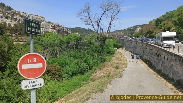
Access on Chemin des Jardins
We first turn right to go up towards a sort of abandoned park.
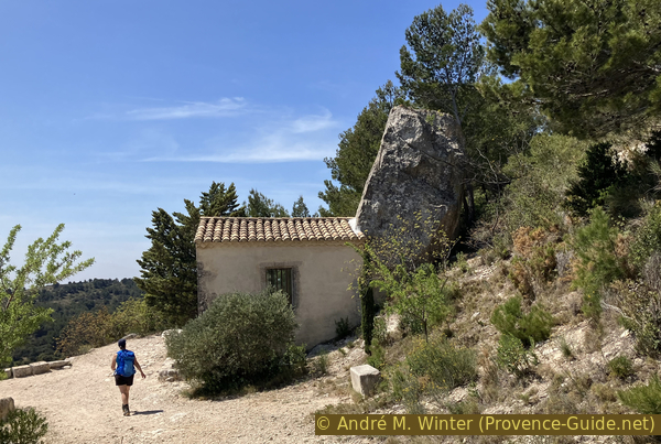
Here is the Pavillon de la Reine Jeanne in the Renaissance style. The elegant corner pavillion was built by Jeanne de Quiqueran, wife of Honoré des Martins, Baron des Baux from 1568 to 1581. It served as a setting for the garden called Jardin du Comte or Verger du Roi. Frédéric Mistral, master of Provençal language and literature, had a copy made for his tomb in Maillane.
It is sad that this monument is so neglected, like the park, without any development.
No reproduction is permitted without the written consent of the author. (id6096)
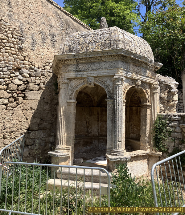
Pavillon de la Reine Jeanne
Section 4: Deffend - Sarragan
➙ 2,2 km ... 1 h ➚ 130 m ➘ 5 m ↝ average
5% hard-surfaced quiet side streets, without marks
15% easy trails, few marks
10% moderate trails, without marks
<5% via ferrata, without marks
5% easy trails, without marks
10% moderate trails, without marks
5% easy trails, without marks
5% hard-to-recognize trails, without marks
35% forest roads, without marks
10% hard-surfaced quiet side streets, few marks
The clues
- Pavillon de la Reine Jeanne, 125 m
- Les Baux old washhouse, 125 m
- Trail Chemin du Deffend, 160 m
- Via ferrata du Deffend, 200 m
- Plateau du Deffend
- Col de Sarragan saddle, 225 m
- Roche percée, 250 m
We are at the lowest point of the tour, we have to go back up. We do it with views to the western side of Les Baux, therefore to the current village.
We retrace our steps and reach the crossroads to turn right onto Chemin du Deffend. There we find another site hidden from tourists in Les Baux: the old wash house. It's the building a little further down on the left. Water ist no longer wasted here since no one comes here, the site is not indicated anywhere. This valley is green, you can see huge trees in the gardens.
The washhouse is the lowest point of the tour. The entire last section is about getting back up to the starting point. This is the most natural section of the tour. There is also a short via ferrata. We of course also pass other viewpoints on Les Baux.
No reproduction is permitted without the written consent of the author. (id6097)
Old wash house of Les Baux
We leave the washhouse and climb towards the west. Turn left at the first intersection, then keep right all the time and go uphill. The road quickly turns into a track and even faster into a simple path.
No reproduction is permitted without the written consent of the author. (id6098)
Chemin du Deffend
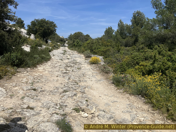
However, it is an old path leading both to the Deffend and to the meadows of Mas d'Auge. We recognize old calades.
No reproduction is permitted without the written consent of the author. (id6099)
Old calade on the Chemin du Deffend
This climb allows views of the west face of the village of Les Baux and its nestled church. These are views that few people know about.
No reproduction is permitted without the written consent of the author. (id6100)
Les Baux seen from the west
Higher up there are longitudinal marks that look like wear and tear from frequent use, but it appears to be more a form of natural erosion.
No reproduction is permitted without the written consent of the author. The permission of use was kindly given to Provence-Guide.net on 29 August 2023. (id6101)
Traces of passage on the Chemin du Deffend
This passage, however, serves as a guide for us. Shortly after, you must turn right and stay on the ridge line.
There is no point looking for a viewpoint on the left, the scrubland is too dense to pass through.
No reproduction is permitted without the written consent of the author. (id6102)
Crossing on the Chemin du Deffend
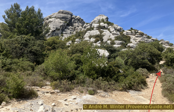
There are no markings, but the route is obvious. Higher up, we approach a rocky ledge that is far too high to be easily stepped over. We recognize an artificial cut and even steps. However, the entire lower part is missing.
No reproduction is permitted without the written consent of the author. (id6103)
Artificial notch in the rocks of the Deffend ridge
Today, we pass there by climbing on a few iron steps. It's not very difficult, but quite vertical on a few metres.
No reproduction is permitted without the written consent of the author. (id6104)
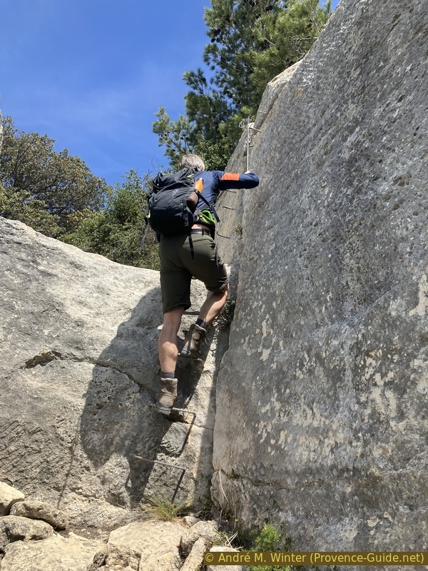
The small via ferrata in the rocks of the Deffend ridge
We are on a plateau after this somewhat aerial passage. At the next intersection on the right.
No reproduction is permitted without the written consent of the author. (id6105)
Crossroads south of the Deffend plateau
Not even 100 metres further to the right again.
The yellow arrow indicates that we will have to come out of this cul-de-sac afterwards, but the detour is worth it for the view!
No reproduction is permitted without the written consent of the author. (id6106)
Crossing to the south-east of the Deffend plateau
We follow the rocky bar for another ideal viewpoint over Les Baux, this time from the west. Here we mainly see the village built after the demolition of the castle.
No reproduction is permitted without the written consent of the author. (id6108)
Les Baux seen from the Deffend in the west
From here we can also see the elevations at the start of the tour as well as the antennas and the Oppidum des Bringasses.
It is not possible to continue along this rocky strip, too many brambles prevent the passage. We must retrace our steps and turn right at the last intersection.
No reproduction is permitted without the written consent of the author. (id6109)
Baumanières, les Baux and the Vallon de Carita seen from the Deffend
We stay on the main path without changing direction significantly. Three minutes later, we pass dry stone walls, but we also see carefully carved bases. This is another historic site without explanation. It seems to have been used as a stable for some time.
No reproduction is permitted without the written consent of the author. (id6111)
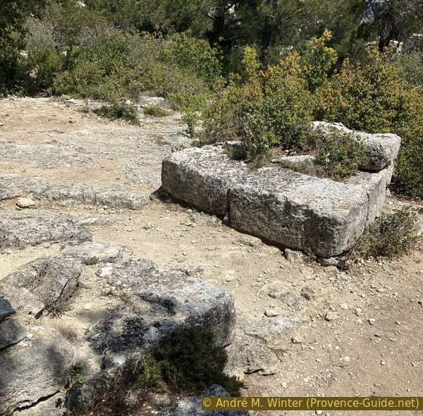
Remains of constructions on the Deffend des Baux
We return to the main path to continue heading north. A path comes from the left, but we continue straight ahead.
At the rocks in the photo and 80 metres after the intersection there is a faint passage between the bushes on the right. This path leads to the Grotte des Fées which we were unable to inspect in 2023 due to lack of headlamps necessary for the exploration, the cave is around sixty metres long. We will try to take a look at it during our next visit.
No reproduction is permitted without the written consent of the author. (id6112)
Rocks on the Deffend des Baux
The road passes the rock maze and continues towards the north. We pass to the left of the still active Sarragan quarry, signs and fences prohibit descending to the right. The road is partly cut into the rock, but the walking is difficult at the end of the tour.
No reproduction is permitted without the written consent of the author. (id6113)
The path above the Sarragan quarry
The track takes us directly to the Col de Sarragan saddle. We must pass the section cut into the rock and take the first road on the left to return to the starting point. There are also paths in the forest on both sides of the road, but this passage is short and there is not much traffic here.
No reproduction is permitted without the written consent of the author. (id6114)
The road on the Col de Sarragan saddle
Sources and additional information
It is better to use a good topographic hiking map: this tour is on the IGN map "St-Martin-de-Crau, Les Baux-de-Provence & Les Alpilles", scale 1:25000, 3043OT.
If you don't want to bother with a paper map, you can also use mapping apps on your cell phone. On the one hand, it is the Cartes IGN app from the official map service. However, it requires access to the data network and this is sometimes difficult in canyons or remote locations.
Alternatively, you can use apps that store data directly on the device. They're generally not free, but they don't cost much. We mainly use OSMAnd, here it is possible to add contour lines, relief shading, markings and others. To store this data on your phone you need a lot of space.
Of course, one needs access to satellites for the GPS signal with any app. In some canyons this is not the case. Therefore, do not rely on the position shown, but read the map on your phone as you would read it on paper. Most apps are available for Android and iPhone. The applications usually allow us to record the route travelled and also view the GPS files offered for each of our hikes.
This page has been seen 2944 times since 20 March 2024.
No reproduction is permitted without the written consent of the author. The permission of use was kindly given to Provence-Guide.net on 29 August 2023. (id437)
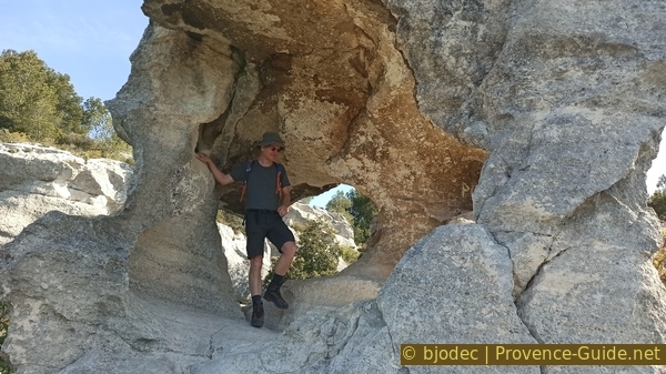
In the holed rock east of the Col de Sarragan
No reproduction is permitted without the written consent of the author. (id1786)
Les Baux seen from the crest road east of the Col de Sarragan