The mountain villages of Peille and Peillon
On old mule tracks
hike
average
6 h
yes
yes
built-up area
mountain
Introduction
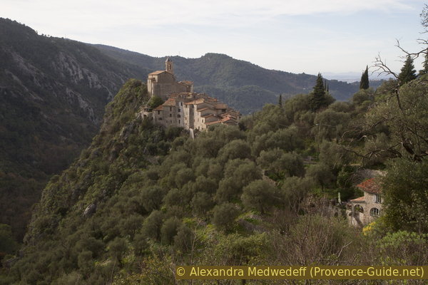
If you want to hike in the hinterland of Nice, you often have to go up from the coast. You are also in a heavily populated area for a long time, with its suffocating traffic. However, behind Mont Agel hide the two villages of Peillon and Peille along a ridge that is off the beaten track. Today the hilltop villages are beautifully renovated, in the 12th century Peille was an important courthouse that stretched its influence as far as Monaco.
A great advantage of this tour is that it starts and ends at the Peillon-Sainte-Thècle train station. It is on the regional train line from Nice to Breil-sur-Roya and on to Tende or Cuneo. There are separate ascent and descent routes. Orientation is not always easy, although we use old connection routes. It is not a simple tour of villages: the paths are not always easy, there are 800 meters of up and down to be conquered and you will not be back at the starting point in less than five hours.
The names in the area may be confusing. The river Paillon flows down in the main valley. We go via the village of Peillon to the slightly larger Peille. All terms go back to the pre-Latin Pelia, which means height.
The facts
14,7 km total distance
6 h walk time
800 m total elevation
orientation average
mark 95% of the total distance
45% moderate trails
30% easy trails
15% hard-surfaced quiet side streets
5% hard-surfaced city alleys
5% hard-surfaced country road
<5% stairs
dangers slippery sections and falling rocks after thunderstorms
children yes
useful picnic stuff
required hiking boots, hiking equipment and water
GPS coordinates (WGS84) of start and end point 43.767888,7.366655
downloads ![]()
![]()
Public transport
The line between Nice and Tende of the regional train TER PACA (only french) offers around 10 direct connections between Nice and the Peillon-Sainte-Thècle station. Trains depart from Nice-Ville central station and take 25 minutes to reach the destination station and our starting point.
Access by car
The quickest way to get to the hike start is via the A8 motorway and the Nice-Est exit. From there, take the arterial road in the direction of Contes and la Trinité. After passing the towns of La Trinité and Drap, we leave the expressway and turn towards Sainte-Thècle at the large roundabout. After the bridge over the Paillon stream, turn left and at the two following roundabouts follow Autres directions (all other directions). At the third roundabout we turn right towards Peillon. After a few bends, we turn off towards the centre of Sainte-Thècle. You come to the village and pass a one-way street on the right. The next right we can drive up to the train station (Gare SNCF) via hairpin bends.
Useful parking spaces
There are only a few parking spaces at the train station, some are also explicitly marked as private. Another public car park is further ahead in town, so straight ahead and without going up to the train station.
No reproduction is permitted without the written consent of the author. (id4877)
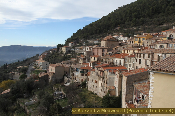
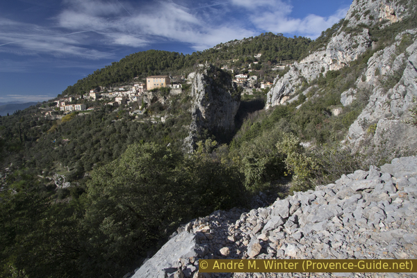
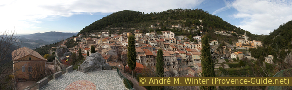
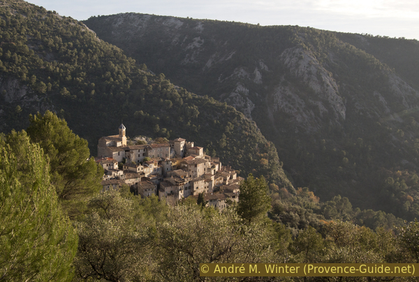
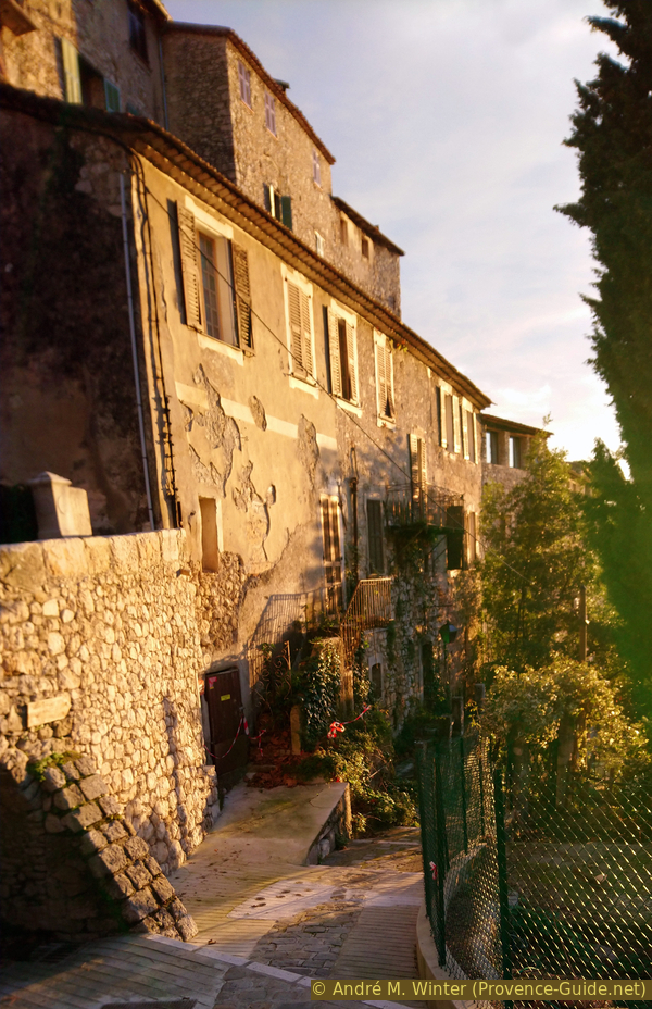
Peille seen from the rock
No reproduction is permitted without the written consent of the author. (id4846)
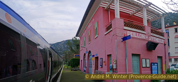
A train stops at Peillon-Sainte-Thècle station
Hints
The round is longer than it looks on the map. There are no long, easy sections where you can make fast progress. You often have to orientate yourself and of course you have to enjoy the great view again and again.
We advise starting early in the morning in both summer and winter because the sun can get quite uncomfortable between Peillon and the Chapel of St. Pancrace.
In the villages are wells with drinking water. Only in Peille are some shops and bars open in the low season.
In the Alpes-Maritimes department, all the signposts have numbers, here you can find numbers between 550 and 600, we mention them in the description and on the maps. The order is arbitrary and has no meaning for this or other tours.
The whole region is a zone with a high risk of forest fires. In summer, but also in other seasons when it is very dry or by strong winds, access to the forest areas can be regulated. As a result, the roads may be closed to traffic and/or the trails prohibited to hikers. Current information: Access map to the Alpes-Marimes forests (also english). The map shows the colours green, yellow, orange and red which correspond to levels of danger. The affected area is: Littoral est.
The sections
- Sainte Thècle - Peillon north: after the last houses of Sainte Thècle, the ascent begins, we pass under the cliffs of the Pointe de Lourquière and then turn towards Peillon
- Peillon north - Peille south: after the valley of La Launa, we reach the highest point of the tour at a chapel ruin and progress across the slope to Peille
- Peille south - Peillon: the descent to Peillon also includes a counter ascent of 150 meters, it is the longest section of the tour
- Peillon - Sainte Thècle: the last meters of altitude are unwound and we cross the Ruisseau de la Launa creek one last time to get back to the starting point
Section 1: Sainte Thècle - Le Pueï - Peillon Nord
➙ 3 km ... 1 h 20 min ➚ 225 m ➘ 22 m ↝ average
<5% stairs, faulty marks
35% hard-surfaced quiet side streets, faulty marks
65% moderate trails, few marks
The clues
- Sainte Thècle train station, 180 m
- Le Pueï, 220 m
- Peillon north, 285 m
We leave the newer settlement area and quickly get into nature.
If you leave the platform and go straight ahead, you will come to another building and a stair to the right of it. This leads us up to the Route des Preisses. Go left at the top and walk in that direction about a kilometre.
No reproduction is permitted without the written consent of the author. (id4847)
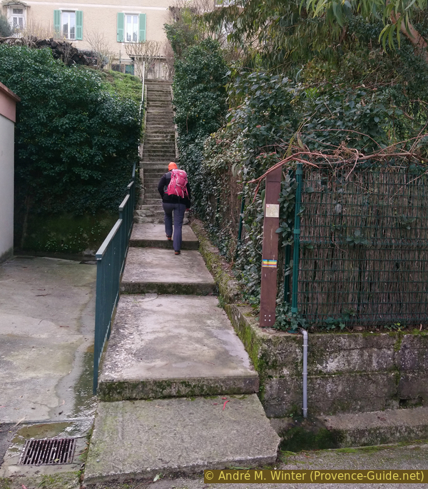
Stair from the train station to the Route des Preisses
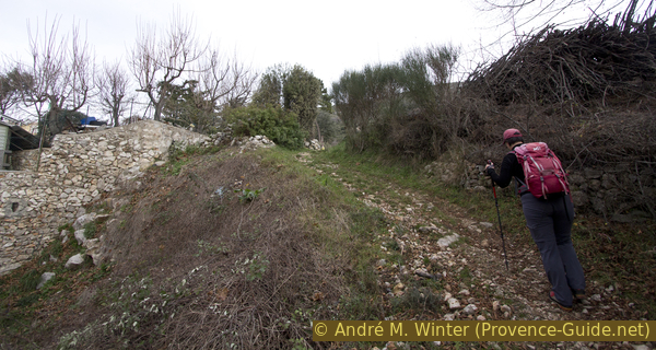
This road turns right after a kilometre, but we go straight ahead, slightly downhill and into the settlement of le Pueï. When this lane turns left continue straight ahead between gardens. This path begins to the left of a blue garden gate.
The course on the official IGN map is wrong here.
No reproduction is permitted without the written consent of the author. (id4848)
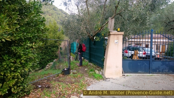
Path between gardens and houses in Le Pueï
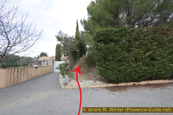
The path circles the gardens further down and then comes up to its starting level. The municipality has apparently sacrificed an old path here for some new citizens who have built their swimming pools along the old path. In winter, the section can be slippery.
No reproduction is permitted without the written consent of the author. (id4849)
Pass under the gardens of Le Pueï
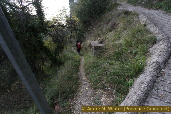
Behind the settlement, we continue through a sparse and somewhat chaotic forest to signpost 592. On the way back, we pass here again. This time, of course, we go right and up. The ground remains earthy and possibly slippery.
No reproduction is permitted without the written consent of the author. (id4850)
The way to Peillon north-east of signpost #592
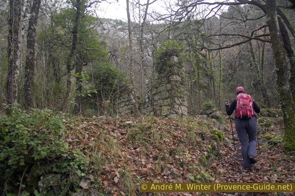
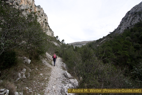
We climb under the western slopes of the Pointe de Lourquière. Rocky ridges jut down and we pass them narrowly.
In places, the path runs directly under the rock wall.
No reproduction is permitted without the written consent of the author. (id4851)
Rock wall below the ridge high 444 metres
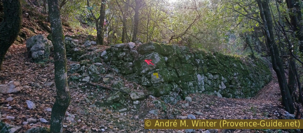
We are on a historic connecting route. Its characteristic is the regular increase in height and in places you can still see some paved sections. In Provence this is called Calade.
No reproduction is permitted without the written consent of the author. (id4852)
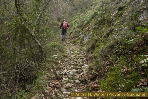
Old laid path between markers #592 and #584
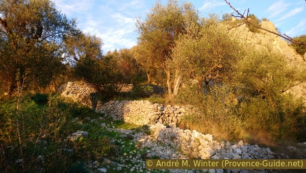
Further up we pass ruins. These are probably farms that were active until the beginning of the 20th century. Today, the old cultural terraces are overgrown with forest.
No reproduction is permitted without the written consent of the author. (id4853)
Ruined house west of point 366
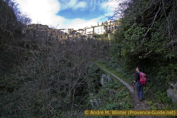
After crossing a side valley and after the ruins, we see up to the town of Peillon for the first time. This is not the usual angle, this one is reserved for people on foot.
No reproduction is permitted without the written consent of the author. (id4854)
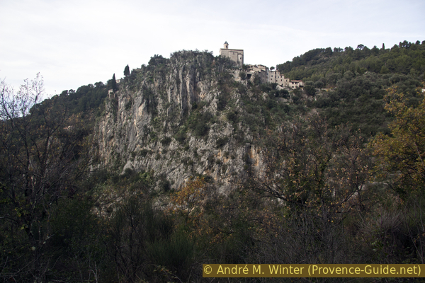
Peillon and the church on the ridge
As we get closer to the village, the signs of civilization increase again. At first, the path is wider and accompanied by dry stone walls.
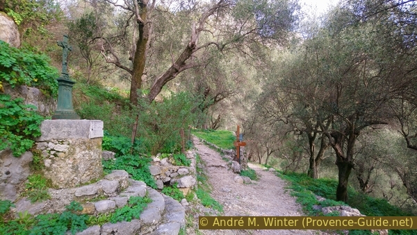
We come to signpost #584, at this crossroads there is also an iron cross. A path comes from the left of St. Martin de Peille and on this better connection we continue to Paillon, so straight ahead.
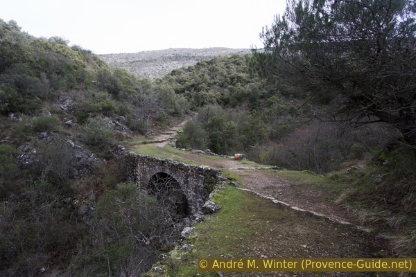
A little later we cross the Ruisseau de la Launa creek for the first time on an old and wide stone bridge. Further on, the path is paved and becomes flatter as we approach the village of Peillon.
No reproduction is permitted without the written consent of the author. (id4855)
Old stone bridge over the Ruisseau de la Launa creek
We come to a detached house in the north of the village and a little later we are at signpost #585.
No reproduction is permitted without the written consent of the author. (id4856)
House near marker #585
To the left you come to a cross, an old washing place and a fountain. Of course, further down is the village of Peillon. However, our path leads uphill to the right. We pass the village on the way back.
No reproduction is permitted without the written consent of the author. (id4857)
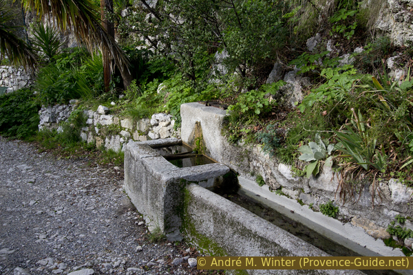
Fountain north of the village of Peillon
Section 2: Peillon Nord - St. Pancrace - Peille Sud
➙ 5,1 km ... 2 h ➚ 380 m ➘ 128 m ↝ average
65% easy trails, faulty marks
10% hard-surfaced country road, few marks
10% easy trails, few marks
10% hard-surfaced city alleys, without marks
The clues
- Peillon north, 285 m
- Under Bompin, 615 m
- St. Pancrace chapel, 715 m
- Peille south, 620 m
We save the visit of Peillon for the descent and continue up the valley of the Ruisseau de Launa creek. The Chapel of St. Pancrace is the highest point of the tour.
We follow the indications to Peille-Village. The path is also called Camin dau Merdanson locally. Merdanson is a pre-Latin term meaning small water course. And indeed, a little further up, a brook crosses the path, at least that's how it is after some rain.
No reproduction is permitted without the written consent of the author. (id4858)
Cross and bifurcation at marker #585
At this crossroads with signpost #580, we turn right onto the wider Camin de Galambert path. The Chapel of St. Pancrace is also indicated here, but it's not just around the corner.
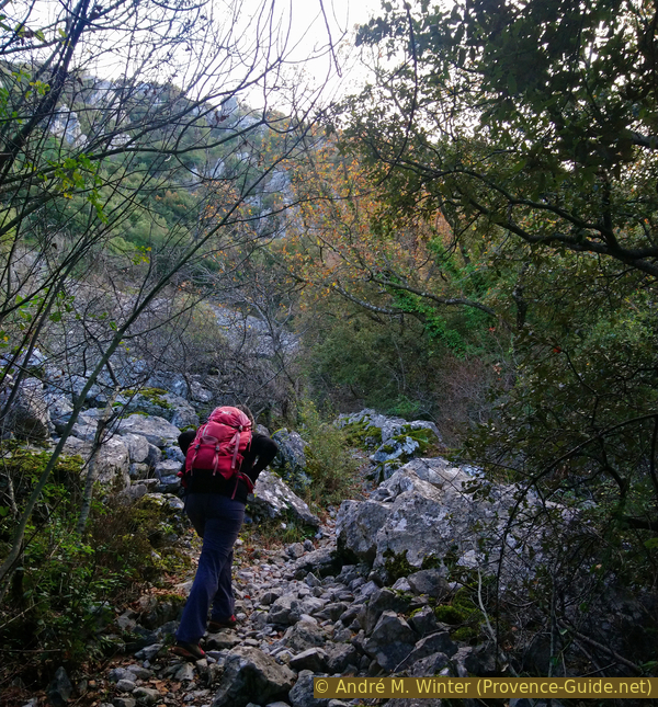
We are still on the old connecting path, you can still see steps and the former paving. We are here in La Launa valley, east of the Cime de Rastel mountain. Here we are in a section that seems quite alpine, but it does not present any particular difficulties. Some paths branch off to the left up to the rocks, these are access trails to climbing routes, which we ignore.
No reproduction is permitted without the written consent of the author. (id4859)
Crossroads at marker #580
Not far after the village, the path makes a short double bend. Before and after you should turn back towards the village. You can see the village in the axis of the ridge on which it is enthroned.
No reproduction is permitted without the written consent of the author. (id4860)
Looking back to Peillon
With the ascent, the rock walls also approach from the left and right. Along the way, we slowly come to the La Launa creek. But here too is another wide and strong stone bridge.
No reproduction is permitted without the written consent of the author. (id4863)
Straight path in the Launa valley
A third and last bridge over this stream follows a little later after signpost #581. We cross it as well and continue to climb.
No reproduction is permitted without the written consent of the author. (id4864)
Another stone bridge over the Launa creek
col = saddle
A double hairpin follows and later we come to the scattered houses of the hamlet of Bompin.
Our path leads to a street through the houses (called Chemin de Buampin). We walk up this winding asphalt road, ignoring driveways.
No reproduction is permitted without the written consent of the author. (id4865)
Arriving under the Bompin hamlet
At the only crossroads, we continue straight ahead. It is a dead end, but only for vehicles.
No reproduction is permitted without the written consent of the author. (id4866)
Chemin de Bompin up to the street
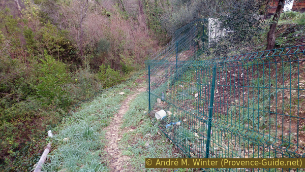
At the end of the road, we continue straight on a path and along a fence.
No reproduction is permitted without the written consent of the author. (id4867)
Connection path from the Chemin de Bompin to the D53 road
This is how we come to the larger road to Peille (D53) and to signpost #564. However, you can't see any other way to the St. Pancrace chapel. You really have to climb up the street opposite and then walk along the wall to the right. We realize that we haven't really changed direction since the lower part of Bompin, so we're still on the historical connection route. The street crosses it and the new houses crowd it from all sides.
No reproduction is permitted without the written consent of the author. (id4868)
Climb in the road embankment
After the section between the wall and the grove, we cross another road. Opposite you can see the path better now, it is also wider and was formerly paved.
No reproduction is permitted without the written consent of the author. (id4869)
Crossing the road to the Col de la Madone saddle
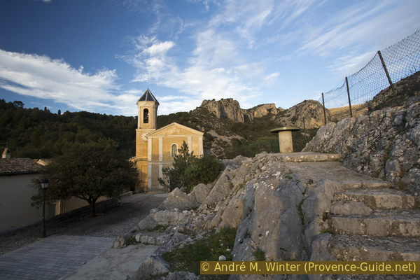
We are now quickly at the chapel Saint Pancrace, or at its ruins. The structural condition is modest. We are now at the top of the loop, but not at the end of this section.
No reproduction is permitted without the written consent of the author. (id4870)
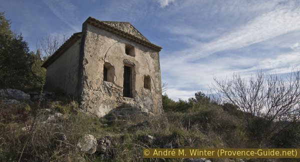
St. Pancrace chapel ruin
You can take a break on the steps of the chapel. Beyond the first mountain range, the peaks jut out from the Mercantour National Park.
No reproduction is permitted without the written consent of the author. (id4871)
St. Pancrace chapel and mountains in Mercantour national park
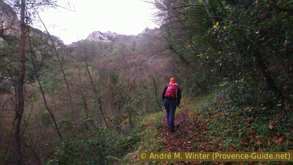
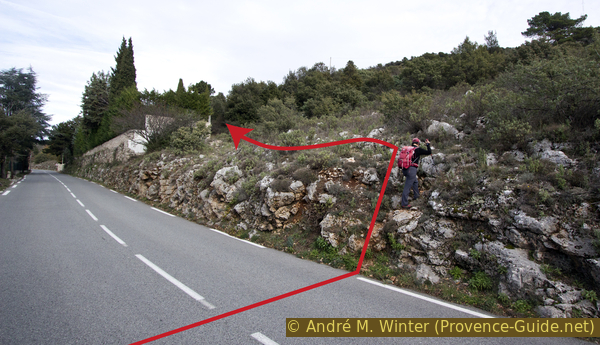
We continue north behind the chapel. The path now leads through a dark forest just above the road to Peille. The descent onto the road soon follows and unfortunately we have to walk about 500 meters further here. As before, the road replaces the old path, but here the terrain is too steep to create a new hiking trail. We stay on the left side of the road, also to be able to warn motorists.
Between the trees, you can see the village of Peille for the first time. Further ahead we come to the descent to the path under the road. But if we go a little further behind the rocky pinnacles aside the road, we get an even better view of the village.
No reproduction is permitted without the written consent of the author. (id4872)
View from the D53 road to Peille
We then return to the descent where the crash barrier is interrupted. Below you walk through between the rock pinnacles. The path now continues under the road, but you don't lose many meters in altitude.
No reproduction is permitted without the written consent of the author. (id4873)
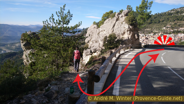
The path branches off under the road in front of the rock pinnacles
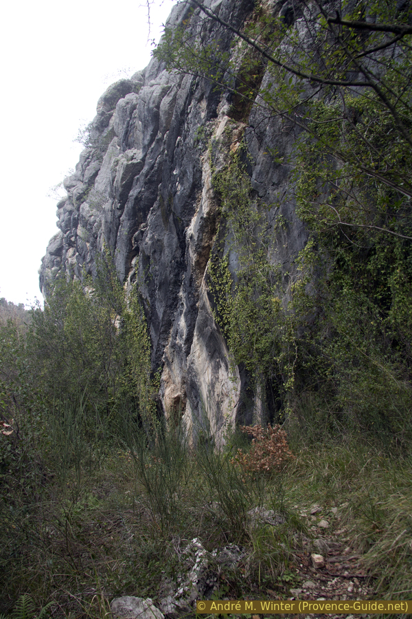
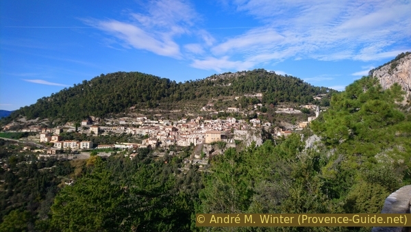
Crossing a scree slope gives you another good view of Peille. From here you can also see the rock that stands in front of the village.
On the photo, you can also see a ravine between the rock and the cliff on the right. Our path goes through here, climbs to the village and so we can climb the rock.
When you go through the narrowest part of the gorge, you may see a rope bridge at the top. It is part of a via ferrata, which has been closed since 2017.
No reproduction is permitted without the written consent of the author. (id4874)
Peille and the rock in front of it
rocher = rock
We arrive in a cirque delimited by the houses of Peille. We climb up into the village and always keep to the left. First it goes up over steps and you pass terraces with benches.
No reproduction is permitted without the written consent of the author. (id4875)
The route arrives through the gorge under Peille
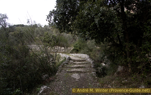
Built-over stairs lead to the village centre. There is a Gothic fountain in the square.
No reproduction is permitted without the written consent of the author. (id4876)
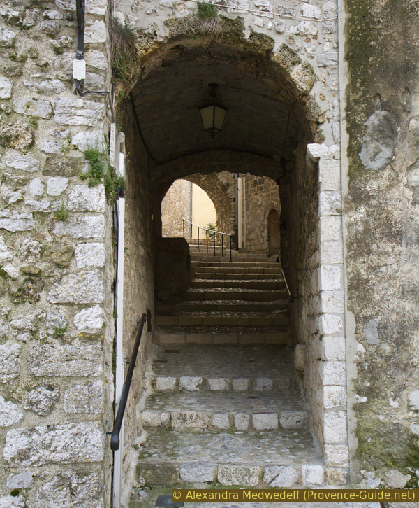
Ascent in the passage to the Mont Agel square
We turn immediately to the left here and pass under the arches (Portiques des Lascaris).
No reproduction is permitted without the written consent of the author. (id4879)
Place du Mont Agel, gothic fountain and passage to the Rock
The path now leads upwards to the top of the rock. There is a peace monument at the top.
At the approach, there are various terraces with benches where you can take a break.
No reproduction is permitted without the written consent of the author. (id4878)
Palace of Lascaris and Peille
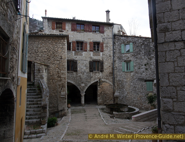
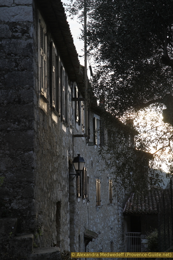
We go back to the square with the fountain and go to the upper and northern corner of the square. Here you can see a Gothic building from the 13th century on the left. The consuls of Peille met here, at the time when even Monaco was administered from here.
At the crossroads, we continue along Rue Saint Sébastien, the one with several short covered passages.
No reproduction is permitted without the written consent of the author. (id4880)
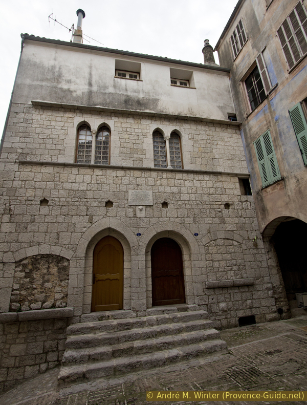
Palais des Consuls
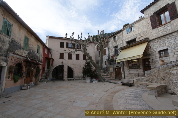
This is how you get to the municipal office and further up the Place Carnot square. Here is a bakery and other shops.
No reproduction is permitted without the written consent of the author. (id4881)
Place Carnot in Peille
We go back to the municipal office and keep to the right and down behind it. You get through more small passages.
No reproduction is permitted without the written consent of the author. (id4882)
Passage Carouge de Sant Bastian
Below we end up on the Rue des Moulins. It is the lowest crossing street of the village, we turn right and so west out of the lower part of the village.
No reproduction is permitted without the written consent of the author. (id4883)
Rue des Moulins leading down
Section 3: Peille Sud - Faquin - Peillon
➙ 4,5 km ... 1 h 50 min ➚ 175 m ➘ 445 m ↝ average
5% easy trails, without marks
<5% hard-surfaced country road, few marks
85% moderate trails, faulty marks
5% hard-surfaced city alleys, without marks
The clues
- Peille south, 620 m
- Faquin creek, 410 m
- Wooded ridge, 550 m
- Church of Peillon, 375 m
- Lower Peillon car park, 365 m
The longest section of the tour also includes an unexpected counter climb and a long flat part.
At an apparently abandoned chapel, we come to a road. But we continue straight ahead down an old paved path.
No reproduction is permitted without the written consent of the author. (id4884)
Way down to the D53 road
We come across a bend in the road and then cross the road.
Opposite is an unpaved driveway to a house. This is also our way, it leads down to the street again.
But this time, we have to turn sharp left and walk about 20 meters up the road.
No reproduction is permitted without the written consent of the author. (id4885)
The D53 road bends
We now find the signpost #570 on the right. There, before the start of the crash barrier, our path goes down to Peillon-Village par le Farquin. The Faquin (without R) river is named on the official map.
No reproduction is permitted without the written consent of the author. (id4886)
Descent from the D53 road at the signpost #570
It is now steeper downhill, first over two hairpin bends on a concrete path.
No reproduction is permitted without the written consent of the author. (id4887)
Concrete path in the Faquin valley
When the path flattens out and we stand by a telephone pole, we turn sharp right onto a narrow path.
No reproduction is permitted without the written consent of the author. (id4888)
Leave the concrete path below to the right
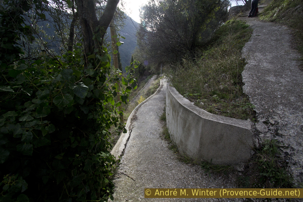
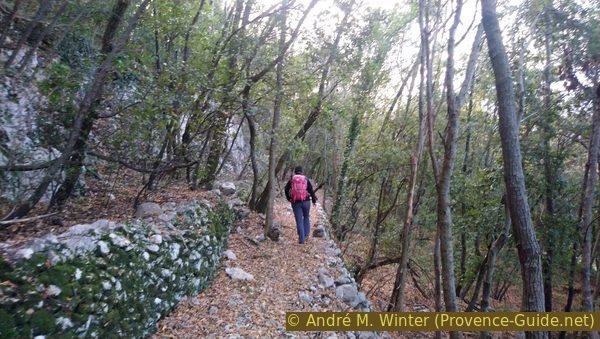
The trail now follows a retaining wall.
Later, but still along the wall, you go down stairs and you come to another bend in the road.
No reproduction is permitted without the written consent of the author. (id4889)
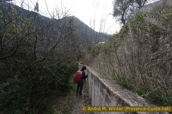
Walk along a retaining wall
However, we continue downhill alongside the road. After a few steps, the path becomes more natural again and leads through old cultural terraces.
No reproduction is permitted without the written consent of the author. (id4890)
Old way down into the valley
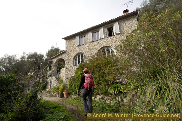
You pass a last house without a driveway and the path continues steeply downhill into the valley. After the last olive trees, a typical Mediterranean forest begins that provides some shade.
No reproduction is permitted without the written consent of the author. (id4891)
Lonely house in the valley slope
Le Faquin creek needs to be forded. A fairly flat section is planned for this, but this has the disadvantage that the creek becomes wider here and often changes its creek bed. The ideal transition is not always easy to identify.
When you come to the river, you should not cross it immediately because the opposite bank is quite steep. It is better to stay on the right bank and go downstream, even if it leads over stones and bushes.
The picture shows the situation from the path on the other bank in retrospect.
No reproduction is permitted without the written consent of the author. (id4893)
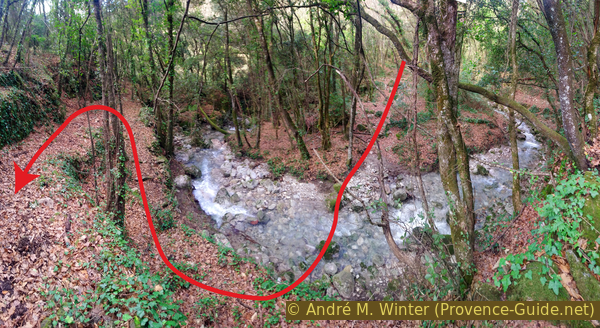
Looking back to the creek crossing
Opposite you can see a path that leads up in a hairpin bend. So we cross the creek roughly where you can see the path opposite. Normally, you can just walk through the water if you wear high mountain boots, as recommended in the introduction.
The photo shows the path vis-à-vis.
No reproduction is permitted without the written consent of the author. (id4892)
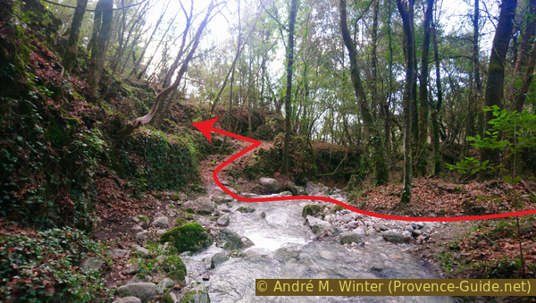
Path on the other bank of the creek
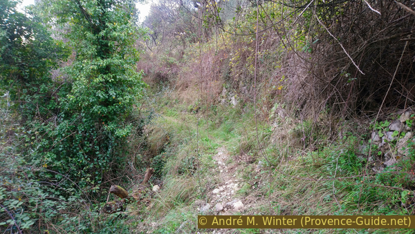
On the other bank, we go up a bit, but the path soon becomes straight and flat. There are good yellow markers here.
No reproduction is permitted without the written consent of the author. (id4894)
Forest on the north slope of Col de St. Pancrace saddle
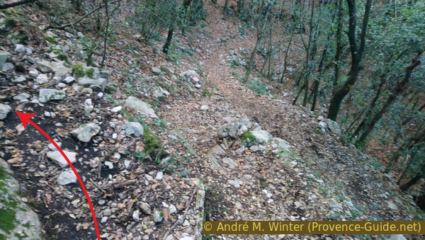
After a few minutes, the path leads down again. We come across a cairn with a rectangular base.
Two minutes later, we are at a barely recognizable fork in the path. Here we have to climb left, even if the other way looks better. But left is the only way we can get back to Peillon. It's now 150 meters uphill.
No reproduction is permitted without the written consent of the author. (id4895)
Fork under the Col de St. Pancrace saddle
In front of the foundation of a house that no longer stands, a yellow marker and a pink arrow point to the left. Now follow an ascent in the fall line at about 100 metres (40 metres in altitude).
No reproduction is permitted without the written consent of the author. (id4896)
Further up in front of a ruined house
However, this somewhat tedious section has the advantage that you have a clear view back to Peille from the scree field.
No reproduction is permitted without the written consent of the author. (id4897)
Ascent along scree
About halfway up the scree field, the path suddenly branches off to the right and becomes flat again.
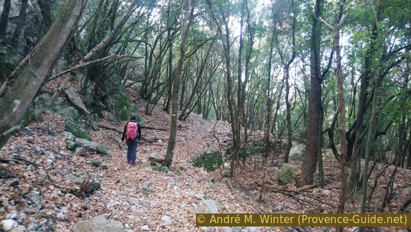
For more than a kilometre we now cross a northern slope, mostly in the forest. The trail is almost flat, there are short climbs when crossing side ridges. The path turns progressively to the left and at any moment you expect to stumble across Peillon village again.
No reproduction is permitted without the written consent of the author. (id4898)
Path between stone walls under the Cime du Rastel mountain
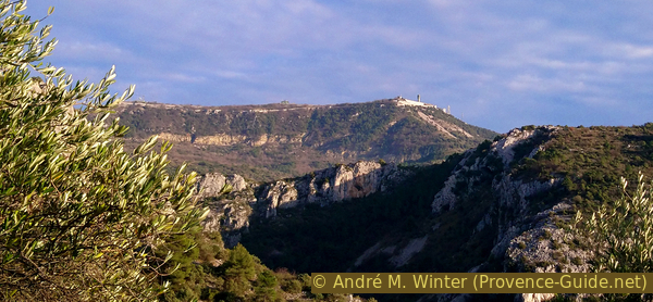
This last descent to the village starts quite late. But we should stop here. First, you can now see the summit of Mont Agel with the massive military installations on the left.
No reproduction is permitted without the written consent of the author. (id4899)
Mont Agel to the east
But you can also see down to the village of Peillon. You can only see it partly directly from the path, but if you leave it at the edge and go up the slippery slope to the right, you can see the whole village including the church. So it looks like an ideal Provencal village.
No reproduction is permitted without the written consent of the author. (id4900)
Deep view of Peillon
The descent that follows is very steep. We pass between cultural terraces from the last and the penultimate century. This is how we come to signpost #579, from there we go straight on towards Peillon. The path here leads along a small stream, in winter you may have to walk through the water.
Further down, at signpost #580, we come back briefly to the ascent path, but now we are going into the town of Peillon. We pass the cast iron cross, the washing place and the small fountain. The path leads to a long row of houses and here we look for the first passage on the left.
No reproduction is permitted without the written consent of the author. (id4901)
Peillon houses
We continue straight on Carriera Centrala street and through more underpasses under houses. We are looking for stairs up to the church, but it comes late because we can only get to the highest point from the south.
So we always take the uphill lane and that's how we get to the large forecourt of the church.
On the eastern side, you can still see the remains of the natural rock ridge. There is an orientation board on it. From here you have a good view of a large part of the ascent.
No reproduction is permitted without the written consent of the author. (id4902)
Peillon church and the viewpoint
We leave the cozy square back down into the village, but tend to keep left to get to the lower parking lot.
No reproduction is permitted without the written consent of the author. (id4903)
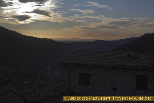
View from Peillon on a winter afternoon
Section 4: Peillon - Le Pueï - Sainte Thècle
➙ 2,2 km ... 50 min ➚ 20 m ➘ 205 m ↝ average
20% moderate trails, few marks
10% hard-surfaced city alleys, with marks
5% hard-surfaced quiet side streets, few marks
15% moderate trails, faulty marks
45% hard-surfaced quiet side streets, faulty marks
<5% stairs, faulty marks
The clues
- Lower Peillon car park, 365 m
- Ruisseau de la Launa creek, 180 m
- Le Pueï, 220 m
- Sainte Thècle train station, 180 m
This last section includes a small secured area in the rock.
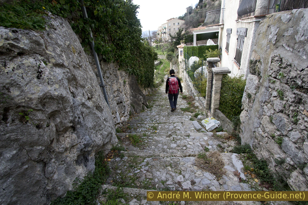
The village of Peillon extends over a ridge of rocks. We came from the northeast and leave the village via the south-west. We walk down stone stairs (Sentier de Portissuola) along the front of the houses.
No reproduction is permitted without the written consent of the author. (id4904)
Sentier de Portissuola in Peillon
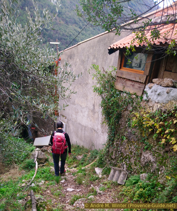
At the last houses, the path becomes completely natural again and descends between olive trees and terraces.
No reproduction is permitted without the written consent of the author. (id4905)
Old stone walls and olive trees
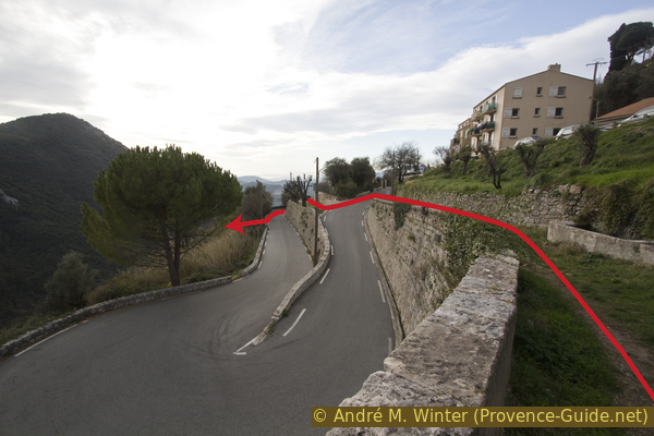
The path now progressively curves forward on a ridge and suddenly turns right into a shadier valley. This descent is secured with a railing and cables.
In the forest, the path turns south-west again and between two houses, it comes to a bend in the D121 road to Peillon.
No reproduction is permitted without the written consent of the author. (id4906)
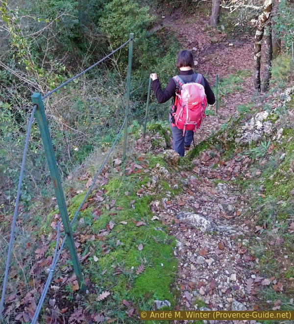
Insured section under Peillon
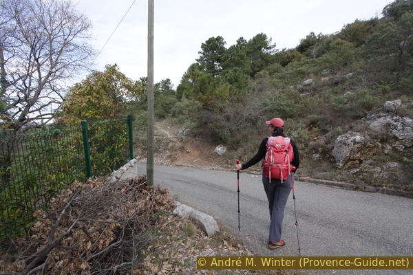
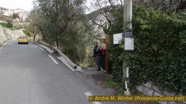
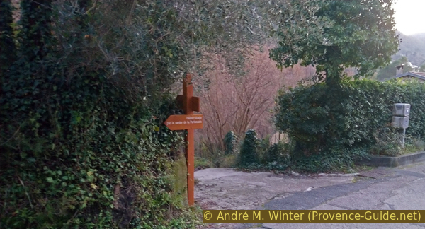
We must go down the road a hundred meters. At signpost #588 we can finally branch off to the left. A wooden arrow points to the hamlet of le Pueï, which we know from the ascent. So it's a last steep descent into the valley of the Ruisseau de Launa creek. Below we cross the water and opposite we have to climb up a bit and turn right at signpost #592. It can be quite slippery here in winter and after rain.
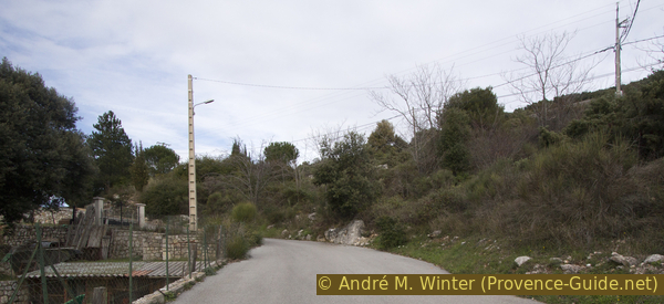
After the hamlet, the paved road takes us back to the starting point at the train station.
Sources and additional information
It is better to use a good topographical hiking map: This tour is on the IGN map "Nice, Menton, Côte d'Azur", scale 1:25000, 3742OT.
If you don't want to bother with a paper map, you can also use mapping apps on your cell phone. On the one hand, it is the Cartes IGN app from the official map service. However, it requires access to the data network and this is sometimes difficult in canyons or remote locations.
Alternatively, you can use apps that store data directly on the device. They're generally not free, but they don't cost much. We mainly use OSMAnd, here it is possible to add contour lines, relief shading, markings and others. To store this data on your phone you need a lot of space.
Of course, one needs access to satellites for the GPS signal with any app. In some canyons this is not the case. Therefore, do not rely on the position shown, but read the map on your phone as you would read it on paper. Most apps are available for Android and iPhone. The applications usually allow us to record the route travelled and also view the GPS files offered for each of our hikes.
This page has been seen 4084 times since 20 March 2024.
No reproduction is permitted without the written consent of the author. (id4907)
Descent at signpost #588