Big tour around the Cape of Antibes
From Plage de la Salis to the big lighthouse, to the cape and to Villa Eilenroc, back via the garden of Villa Thuret
hike
easy
2 h 45 min
yes
yes
built-up area
walk
Introduction
The Cap d'Antibes is a much appreciated peninsula of the Côte d'Azur, one can find numerous castles, large estates and villas with gardens large enough to hide from the gaze of hikers. But it is also the largest cape of the Alpes Maritimes and the most populated. There is almost no originally preserved nature here. This tour tries to connect the remains of nature that are the Bois de la Garoupe, the tour of the cape and the Jardin de la Villa Thuret. All three places are also under protection. In order to connect them, you have to plan for walking distances on roads. We chose the quieter ones for this.
One is rewarded with viewpoints, particularly from the Église de la Garoupe church to Antibes with the Alps as a backdrop. The various beaches that face the Baie des Anges are also well presented. The cape with its karst formations resembling a lunar landscape is simply worth the trip!
The facts
10,1 km total distance
2 h 45 min walk time
220 m total elevation
orientation easy on the coast, in the urban area, follow the instructions in the text
mark 45% of the total distance
45% hard-surfaced city alleys
40% easy trails
10% hard-surfaced city roads
5% moderate trails
<5% on beach
dangers coastal path closed at high seas
children yes
useful picnic stuff, swimwear
required trekking shoes, hiking gear and water
GPS coordinates (WGS84) of start and end point 43.569245,7.130288
downloads ![]()
![]()
No reproduction is permitted without the written consent of the author. (id3854)
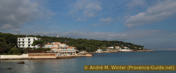
Looking back to Cap Gros
Public transport
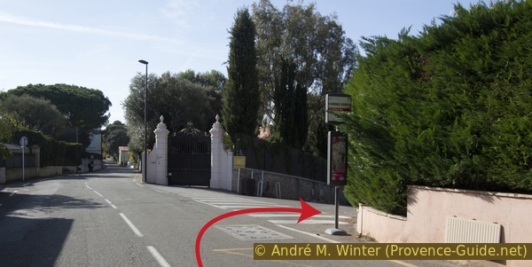
The railway line runs along the coast here, the main lines and the regional lines TER serve the city of Antibes very well. For the main lines and the TGV look under SNCF Connect, for the regional trains under TER PACA (only french), search there for the line between Nice and Cannes. Get off at Antibes train station in the north of the city. Our starting point is in the south, so you have to take line 14 of the Envibus.
Line 14 is organized in loops, but it takes us well from the train station (sea side) to Port de la Salis, which is the starting point of the hike. Connections every 30 minutes from Monday to Saturday, only every hour on Sundays and public holidays. A ticket machine is located across the tracks on Boulevard Vautrin, as most of the company's buses stop vis-à-vis. There is a pedestrian crossing north of the station building. You can also buy single tickets on the bus.
After the tour around the cape it is possible to cut off the last section and skip the Jardin Thuret. Walk down Avenue Mrs. Beaumont towards the boulevard and there is a number 2 bus stop on the right, but services only run approximately once an hour.
Access by car
The traffic situation in the coastal strip of the Alpes Maritimes is extremely difficult, it is better to travel by public transport. Otherwise the best way is via the A8 motorway:
- Coming from Marseille: take exit 44 Antibes Juan-les-Pins and follow these indications, later Antibes Centre-Ville and Cap d'Antibes. Continue along the beach to La Salis Port.
- Coming from Genoa, Menton or Nice: take exit 47 Villeneuve-Loubet. At the roundabout after the tollbooth, take the first exit and then turn left towards Antibes. The D6007 road follows the big Baie des Anges for a long time, but behind the railway line. Turn left at Antibes and follow signs for Centre-Ville and Cap d'Antibes.
South of the centre further along the beach to the port of La Salis.
Useful parking spaces
In the centre, traffic jams are guaranteed almost around the clock. In summer also along the beaches in the south of the city. Nevertheless, you have to get rid of your vehicle here. Fee along the beach in summer. Free in the side streets, but not for campers.
Parking along Boulevard James Wyllie and Avenue de la Salis.
Hints
The cape tour is a very well paved trail. Between La Garoupe chapel and the Plage de la Garoupe as also between Villa Eilenroc and Jardin Thuret garden, there is a large part of quiet streets to walk through. We are on a heavily developed cape with large private estates.
The cape is fully south facing, there is almost no shade. Swimming is only possible on the beaches in the city area and at Plage de la Garoupe, but nowhere between the rocks further on, except in Baie des Milliardaires cove.
There are snack bars and bars on Plage de la Salis and Plage de la Garoupe, which are also open out of season when the weather is nice.
The whole region is a zone with a high risk of forest fires. In summer, but also in other seasons when it is very dry or by strong winds, access to the forest areas can be regulated. As a result, the roads may be closed to traffic and/or the trails prohibited to hikers. Current information: Access map to the Alpes-Marimes forests (only french). The map shows the colours green, yellow, orange and red which correspond to levels of danger.
The sections
- From La Salis beach up to the church and lighthouse of La Garoupe
- Descent to La Garoupe bay
- Around the Cap d'Antibes to the entrance of Villa Eilenroc
- Through quiet alleys to the garden of Villa Thuret
- Jardin Thuret and back to La Salis beach
No reproduction is permitted without the written consent of the author. (id213)
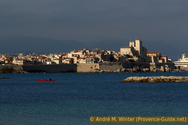
Antibes on an autumn evening
Section 1: Salis - Phare de la Garoupe
➙ 0,8 km ... 15 min ➚ 80 m ➘ 0 m ↝ easy
20% hard-surfaced city roads, few marks
35% moderate trails, faulty marks
45% easy trails, few marks
The clues
- La Salis beach, 0 m
- Bois de la Garoupe forest
- Way of the cross
- Notre-Dame de la Garoupe chapel, 78 m
- La Garoupe lighthouse, 78 m
The beginning of the hike in the shade under trees. Above a church and a lighthouse.
plage = beach
bois (here) = forest
clôture = fence
calvaire = way of the cross
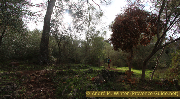
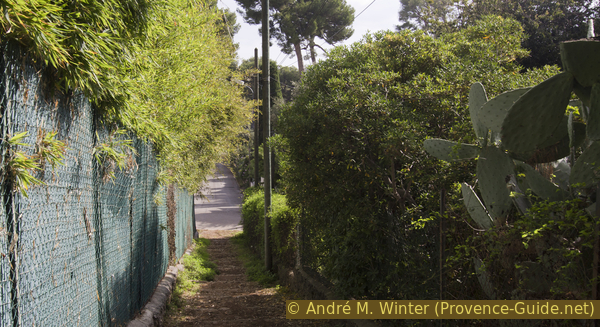
Coming from the north and from Antibes, one reaches the end of Boulevard James Wyllie at the port of Salis. On the right is the Avenue de la Salis, but we need to take the next right where we take the path in the Bois de la Garoupe.
Enter this street without a name, a path in the forest begins on the left.
Immediately it gets lonely here and we leave the hustle and bustle of the coast behind. The path seems rarely used, we first pass between reeds, then we climb the hill more directly.
No reproduction is permitted without the written consent of the author. (id3833)
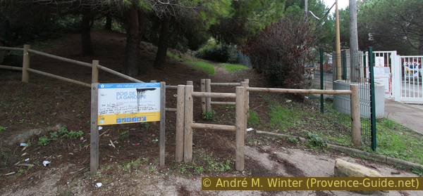
Access to the Bois de la Garoupe
Exactly in the middle there is an old fence (photo), you have to pass it at the opening.
No reproduction is permitted without the written consent of the author. (id3834)
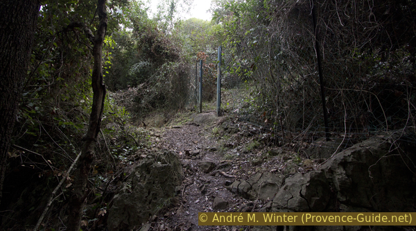
Old fence in the Bois de la Garoupe
Afterwards we climb between rocks before arriving on a flatter section. First shortly right then turn left and continue in the direction of an open area.
No reproduction is permitted without the written consent of the author. (id3835)
Above the old fence in the Bois de la Garoupe
First keep to the right for a few meters, then towards the flat area.
In the 1930s, a railway company built a holiday resort here. Since 1980, the forest belongs to the Conservatoire du Littoral and is protected.
No reproduction is permitted without the written consent of the author. (id3836)
Cobbled old lane in the Bois de la Garoupe
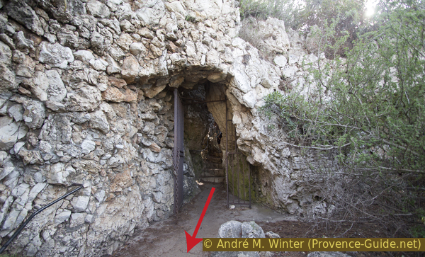
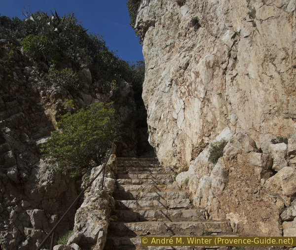
This forest is surrounded by a wall and there is no exit at the top. It is therefore necessary to go out on the left along the old cobbled path, here you will find the Way of the Cross, which leads directly to the chapel. The path is arduous, it leads us up in a straight line, becoming increasingly steeper and the stones that serve as paving are arranged in a very chaotic manner.
No reproduction is permitted without the written consent of the author. (id3837)
Top of the Way of the Cross
At the top of the large forecourt of the chapel made of tamped earth is a panoramic table. It is from 1924 and contains some geographic errors. The best views of Antibes and the Pre-Alps are seen in winter when it's cold and clear.
No reproduction is permitted without the written consent of the author. (id3838)
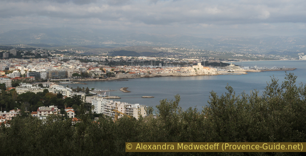
Looking back to Antibes
The chapel is open during the day. It consists of two unequal naves from the 13th and 17th centuries.
No reproduction is permitted without the written consent of the author. (id3312)
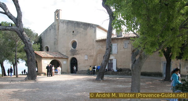
Notre-Dame de la Garoupe church
The church is covered with votive offerings and model ships hang from the ceiling.
No reproduction is permitted without the written consent of the author. (id3839)
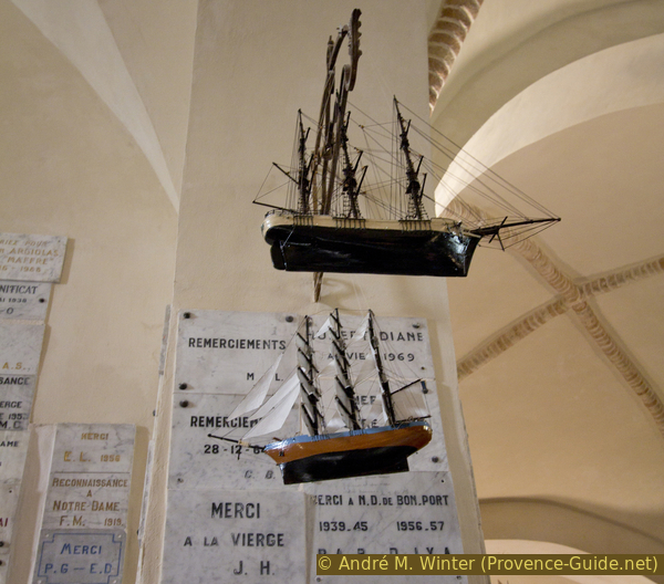
Votive offerings in the Church of Notre-Dame de la Garoupe
Section 2: Phare de la Garoupe - Plage de la Garoupe
➙ 1,8 km ... 20 min ➚ 0 m ➘ 75 m ↝ easy
5% hard-surfaced city alleys, few marks
5% moderate trails, few marks
90% hard-surfaced city alleys, without marks
The clues
- Path to Avenue Bourreau, 78 m
- Avenue Guide
- Boulevard Gardiole Bacon, 35 m
- Avenue des Maréchaux
- Avenue Marc Pugnaire
- Avenue des Fleurs, 10 m
- Boulevard de la Garoupe, 5 m
- Chemin de la Garoupe
- La Garoupe beach, 0 m
A connecting stage on quiet streets between extravagant villas.
phare = lighthouse
plage = beach
If you continue south on the paving of the church you will end up in the parking lot. This also explains why the footpaths are so little used here. Turn left here and proceed to the lighthouse gate. If you go a little further, the hedge has been trimmed and you can admire the lighthouse in all its glory.
No reproduction is permitted without the written consent of the author. (id3840)
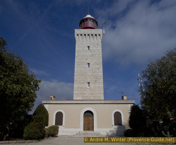
Phare de la Garoupe lighthouse
Opposite, a sign indicates the descent to Avenue Bourreau. This is the last passage in the green before we have to cover a stretch on asphalt.
No reproduction is permitted without the written consent of the author. (id3841)
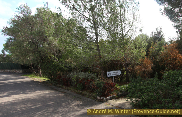
Path to Avenue Bourreau
At the bottom of the stair, we continue straight ahead, also at the next crossroads we go straight on.
No reproduction is permitted without the written consent of the author. (id3842)
Way from the lighthouse down south
On Boulevard Gardiole Bacon, we turn right and continue flat to the south-west.
We could also go down to Boulevard de Bacon, which follows the coast, but there is a lot more motorized traffic there and the pavement is not in the best condition.
No reproduction is permitted without the written consent of the author. (id3843)
Boulevard Gardiole Bacon
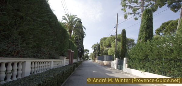
The quarter south of the lighthouse consists of luxury villas and wide streets. Most properties are hidden behind large hedges and walls, often with surveillance cameras. A part of the facade can be seen of a few only.
No reproduction is permitted without the written consent of the author. (id3844)
Villa on Boulevard Gardiole Bacon
When the road winds to the right, we must turn left onto Avenue des Maréchaux. Then you have to go a little zigzag: turn left onto Avenue Marc Pugnaire, turn right onto Avenue des Fleurs, go down left onto Boulevard de la Garoupe, then turn right.
No reproduction is permitted without the written consent of the author. (id3845)
Crossing Bvd. Gardiole Bacon - Ave. des Maréchaux
It seems that you are moving away from the coast, but we thread the first street on the left, Chemin de la Garoupe, which takes us to the beach.
A small park at the level of the zebra crossing allows a view of the entire Baie de la Garoupe.
No reproduction is permitted without the written consent of the author. (id3846)
La Garoupe beach
Section 3: Plage de la Garoupe - Villa Eilenroc
➙ 3,6 km ... 1 h 15 min ➚ 100 m ➘ 85 m ↝ easy
5% on beach
95% easy trails, with marks
The clues
- La Garoupe beach, 0 m
- Cap Gros
- La Croé
- Villa Eilenroc, 25 m
This section includes the developed coastal path on Cape d'Antibes, locally it is also called Sentier de Tire-Poil.
Warning: in rough seas, the path is closed off by an impassable fence between Plage de la Garoupe and Cap Gros. As the cape is very flat, the wind forces the waves onto the shore and large areas of the coastal path are submerged. For 2,5 km there is no possible exit from the path between the Plage des la Garoupe and the Château de la Croé.
The entire stretch of coast is rocky and very rugged, the landscape is karstic. There are some ramps to descend to the sea, but none are really suitable for swimming. The only options are the Plage de la Garoupe, a stairway below Villa Eilenroc, and the Plage des Milliadaires at the end of the section, below the entrance to Villa Eilenroc.
No reproduction is permitted without the written consent of the author. (id3847)
Bay of La Garoupe and district of La Gardiole
View back.
The path does not go around all of Cap d'Antibes as the properties here are built too close to the coast to allow for a public footpath. It's sad because the money here locks people out of a place that's public by coastal law. However, the municipality of Antibes has very well paved the section between Cap Gros and the entrance to Villa Eilenroc, it is undoubtedly the best prepared section of the coastal path on the entire French coast.
Between the Plage de la Garoupe and the Cap Gros there are several taps with drinking water.
No reproduction is permitted without the written consent of the author. (id3848)
Start of the trail south of La Garoupe beach
At the beginning the path is quite pleasant, there are benches to sit down. But these amenities only last as far as Cap Gros, after which there are only facilities necessary for the trail itself.
No reproduction is permitted without the written consent of the author. (id3849)
North tip of Cap Gros
This gate is closed by strong winds and rough seas. It is not possible to bypass this without risking your life. If the gate is closed, you can't get out either. The next exit is 2,5 km after the Château de la Croé.
If the weather is bad, it is better to turn around and go back the same way, even if the gate is still open. This is especially true when strong winds are blowing from all directions except north (if you're in front of the gate, north is on your left). Less than 100 meters after the gate the coast turns west at Cap Gros and then faces full south. If you can already feel the spray from the sea there, the same applies: you should better turn around.
No reproduction is permitted without the written consent of the author. (id3850)
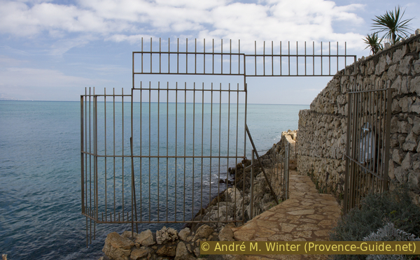
Gate on the coastal path in front of Cap Gros
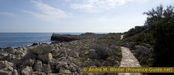
You go from north to south towards Cap Gros, which is actually formed by a large rock. The path is still far enough away from the coastline here. The sea often seems calm here.
No reproduction is permitted without the written consent of the author. (id3851)
Coastal path at Cap Gros
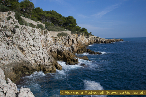
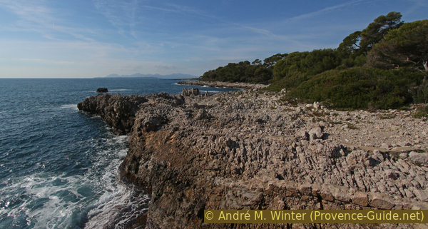
The south coast just after the passage at Cap Gros shows a much more turbulent sea. The path is often higher and runs close to a wall, but the coast is steep and the waves break recklessly when it's windy (which isn't the case in the photo, here show up just currents).
No reproduction is permitted without the written consent of the author. (id3852)
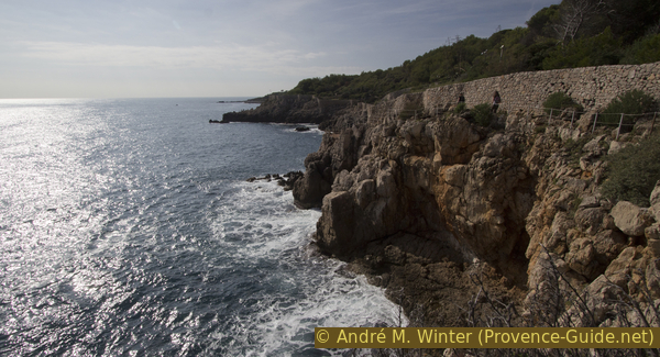
Limestone coast of the Cap d'Antibes
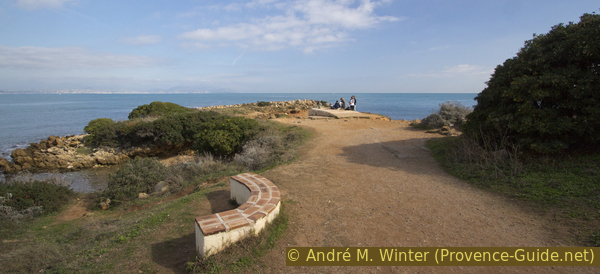
The small platforms allows you to admire the coast or let other people pass by, the tour around the cape is done by locals as well as tourists.
Aside from the gate at Cap Gros, there is no compelling reason to do the tour one way or the other.
No reproduction is permitted without the written consent of the author. (id3853)
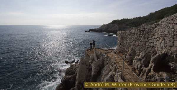
Path and viewpoint at Cap d'Antibes
If it's windy, it's definitely a well sprayed passage and that's why it's secured.
No reproduction is permitted without the written consent of the author. (id3855)
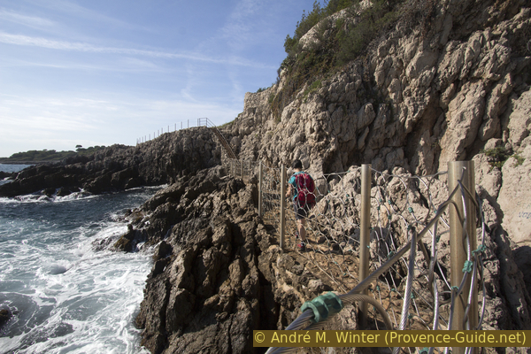
Heavily secured coastal path at Cap d'Antibes
Between the steep and exposed parts there are flatter passages, but they are also karstic. The path is concrete and tiled almost everywhere to ease the walk between the rocks which would otherwise be very breakneck.
No reproduction is permitted without the written consent of the author. (id3856)
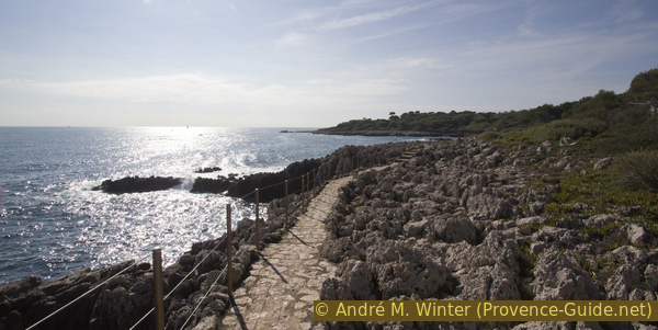
Well secured coastal path at Cap d'Antibes
The wall that accompanies us on the right hand side encloses several large luxury properties. But you can't see anything from the coast and the surveillance cameras are a deterrent. At the level of a real castle, the path leads twice under terraces as if the rich people had not enough space in its properties.
No reproduction is permitted without the written consent of the author. (id3857)
The coastal path under a terrace
Another vantage point of the water horizon! We are here under the Château de la Croé, a little later there is another viewpoint from which you can leave the coast on a path between high walls.
The photo shows the view from the second viewpoint near the Pointe de la Croé. There are three options here:
No reproduction is permitted without the written consent of the author. (id3858)
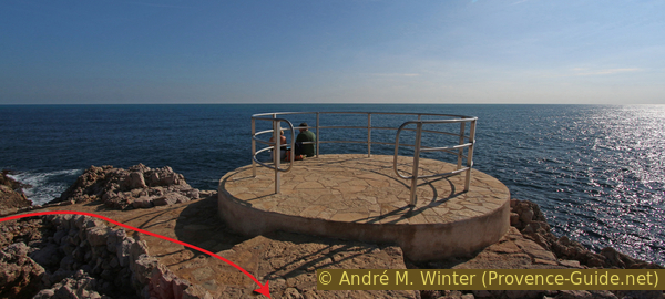
Viewing platform under the Castle of Croé
- Leaving the coast by going north is recommended in unfavourable weather conditions.
- Stay by the sea and there on an old path, which, however, gets lost a bit between the rocks.
- There is another easier path, also shaded, that follows the southern fence of Villa Eilenroc: take the path that leads to the interior of the peninsula and we quickly find a passage in the wall on the left. A sign indicates the direction to Anse de l'Argent Faux bay.
No reproduction is permitted without the written consent of the author. (id3859)
Limestone coast west of the Pointe de la Croé cape
This shady path offers several approaches to the small caps, but to advance you stay close to the fence.
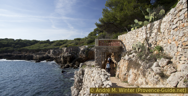
Continuing, we turn progressively to the right and north to reach Anse de l'Argent Faux. The coast is steeper here and the path leads much higher. It was built right next to the Villa Eilenroc property. We pass several old gates, which are nevertheless always open.
The gate in the photo leads to a small bay that was previously fortified, only a concrete footbridge and stairs remain. A ladder takes you into the water and you can take a bath.
No reproduction is permitted without the written consent of the author. (id3860)
Iron gate on the path under Villa Eilenroc
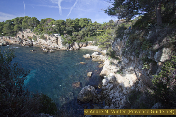
The photo shows the view at Anse de l'Argent Faux, in the background is the real Cap d'Antibes with a lighthouse, but it is not accessible along the coast.
No reproduction is permitted without the written consent of the author. (id3861)
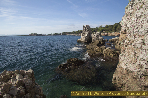
Rocky cove below Villa Eilenroc
Along the Anse de l'Argent Faux, the path covers more elevation gain than on the rest of the cape. Here we are halfway through the tour, there is still work to be done!
No reproduction is permitted without the written consent of the author. (id3862)
Stair under Villa Eilenroc
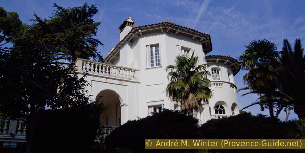
Villa Eilenroc is a neoclassical style building and is located on eleven hectares of parkland directly on the sea. This historic and imposing building is one of the few famous French Riviera villas open to the public. Eilenroc is an anagram of Cornélie, the wife of the rich Dutchman Hugh-Hope Loudon who erected this villa in 1867. Frequently closed without notice.
The entrance is at the end of this section on Avenue Miss Beaumont, opening hours are Wednesdays and Saturdays from 10am to 4pm, fee EUR2,- (as of 2022).
No reproduction is permitted without the written consent of the author. (id3863)
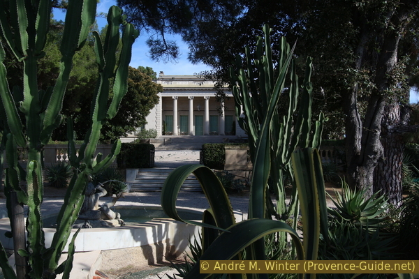
Villa Eilenroc at Cap d'Antibes
View directly from the coastal path.
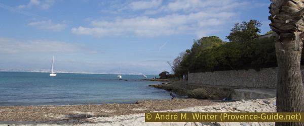
In the north-east corner of Anse de l'Argent Faux (meaning: counterfeit money bay) there is a beach that is called the beach of the billionaires. These names seem consciously chosen. The path passes here, it is the last piece of sea and the last opportunity to swim before the end of the tour.
At the end of the beach, the path leads up to Avenue Mrs. Beaumont and to the entrance of Villa Eilenroc.
No reproduction is permitted without the written consent of the author. (id3864)
Billionaires Beach and Bay
Section 4: Villa Eilenroc - Villa Thuret
➙ 2,3 km ... 25 min ➚ 30 m ➘ 10 m ↝ easy
20% hard-surfaced city alleys, without marks
5% hard-surfaced city roads, without marks
60% hard-surfaced city alleys, without marks
10% hard-surfaced city roads, without marks
5% hard-surfaced city alleys, without marks
The clues
- Villa Eilenroc, 25 m
- Avenue Mrs. Beaumont
- Boulevard John Fitzgerald Kennedy, 30 m
- Chemin des Nielles, 10 m
- Boulevard du Cap, 40 m
- Chemin Gustave Raymond
- Villa Thuret garden
Now follows the second stretch of roads to reach a botanical park with Mediterranean vegetation. It's not the most direct connection, but we're again trying to avoid busy roads. Additionally we see on the Chemin de Nielles that there are also normal houses and agriculture on the Cap d'Antibes.
It is possible to cut off the last section and ignore the Jardin Thuret. To do this, go down Avenue Mrs. Beaumont towards the boulevard and on the right there is a bus stop of line 2, services approximately once an hour.
When we arrive at the street, we continue straight on Avenue Mrs. Beaumont. In this way we reach the larger boulevard John Fitzgerald Kennedy, turn left and since it is not particularly pleasant to walk here, we turn right at the next opportunity (see photo). It is the Chemin des Nielles, which we can follow from one end to the other.
No reproduction is permitted without the written consent of the author. (id3865)
Crossing Bvd. Kennedy - Chemin des Nielles
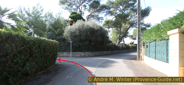
At the end, the Chemin des Nielles turns a little to the right and joins the Boulevard du Cap, follow the direction here but turn left at the crossroads (photo).
No reproduction is permitted without the written consent of the author. (id3866)
Junction Chemin des Nielles - Bvd. du Cap
Take the next option on the left, but you have to pass in front of three entrances to villas beforehand and the footpath only continues right hand. When the boulevard slopes down again, we can walk into the narrow Chemin Gustave Raymon on the left.
The entrance to the park is the first gate on the right (see photo).
No reproduction is permitted without the written consent of the author. (id3867)
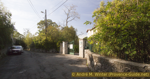
The only entrance to the garden of Villa Thuret
Section 5: Villa Thuret - Plage de la Salis
➙ 1,6 km ... 30 min ➚ 10 m ➘ 50 m ↝ easy
30% easy trails
5% hard-surfaced city alleys, without marks
20% hard-surfaced city roads, without marks
45% hard-surfaced city alleys, without marks
The clues
- Villa Thuret garden tour
- Chemin Gustave Raymond
- Boulevard du Cap, 40 m
- Avenue de la Salis
- La Salis beach, 0 m
No reproduction is permitted without the written consent of the author. (id3868)
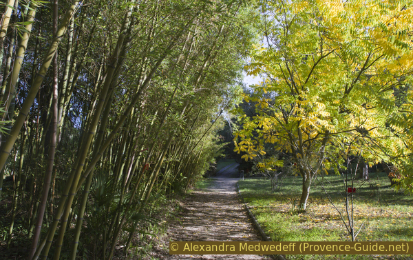
Bamboo in Thuret garden
The Villa Thuret has been a place of scientific research since 1857, today under the leadership of the Institut national de la recherche agronomique (roughly: University of Agricultural Sciences). You can find all kinds of plants that are native to the Mediterranean area, but also exotic plants that have been introduced to the region.
Opening hours: only Monday to Friday, 8am to 6pm in summer, 8.30am to 5.30pm in winter (as of 2022). Admission is free, a guided tour is only available after reservation and is subject to a fee.
The maps shows the diffrent sectors of the park, dark zones are renovates ones, lighter ones are original.
- Cycads and Zamiaceae, palms including Nannorrhops ritchienna and Junbaea chilensis, tree peonies, boldo Peumus boldus, Eucalyptus benthamii, Agathis robusta, Arbutus andrachne
- Cinnamomum camphorea and Malaleuca linariifolia
- collection of Australian species of the genus Acacia
- Arbustus canariensis, Cupressus macrocarpa, Umbellularia californica
- trees for the urban landscape, Mediterranean oaks, pistachio trees, plane trees
- century-old eucalyptus trees, temporary pond with Taxodium mucronatum
- three main families: Myrtaceae, Prteaceae, Fabaceae
- Araucaria spp. Palms and Yuccas
- palms
- collection of Podocarpus and Cupressus spp. of which Cupressus dupreziana
- cedars, a eucalyptus hybrid dedicated to the city of Antibes, Eucalyptus x antipolitensis
No reproduction is permitted without the written consent of the author. (id211)
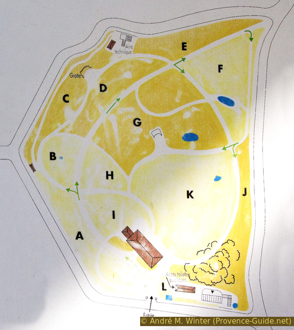
Jardin Thuret map
The way back to the starting point of the tour is again on the road. The lower exit of the garden is locked, you have to go out at the top on Boulevard du Cap, turn left there and continue down. Take the first street on the right, it is Avenue de la Salis. It first curves to the left, then takes us straight back to the starting point near the Port de la Salis.
Sources and additional information
It is better to use a good topographical hiking map: This tour is on the IGN "Cannes, Grasse, Côte d'Azur" map, scale 1:25000, 3643ET.
If you don't want to bother with a paper map, you can also use mapping apps on your cell phone. On the one hand, it is the Cartes IGN app from the official map service. However, it requires access to the data network and this is sometimes difficult in canyons or remote locations.
Alternatively, you can use apps that store data directly on the device. They're generally not free, but they don't cost much. We mainly use OSMAnd, here it is possible to add contour lines, relief shading, markings and others. To store this data on your phone you need a lot of space.
Of course, one needs access to satellites for the GPS signal with any app. In some canyons this is not the case. Therefore, do not rely on the position shown, but read the map on your phone as you would read it on paper. Most apps are available for Android and iPhone. The applications usually allow us to record the route travelled and also view the GPS files offered for each of our hikes.
This page has been seen 3209 times since 20 March 2024.
No reproduction is permitted without the written consent of the author. (id3869)
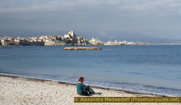
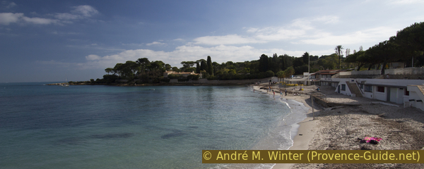
Woman on La Salis beach in autumn